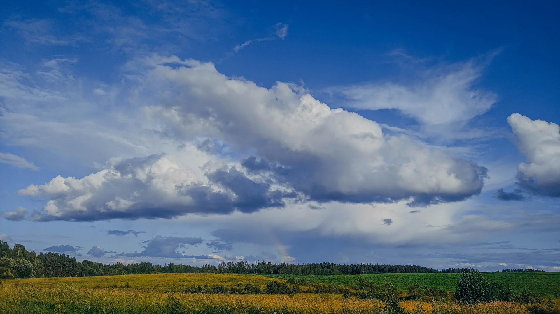
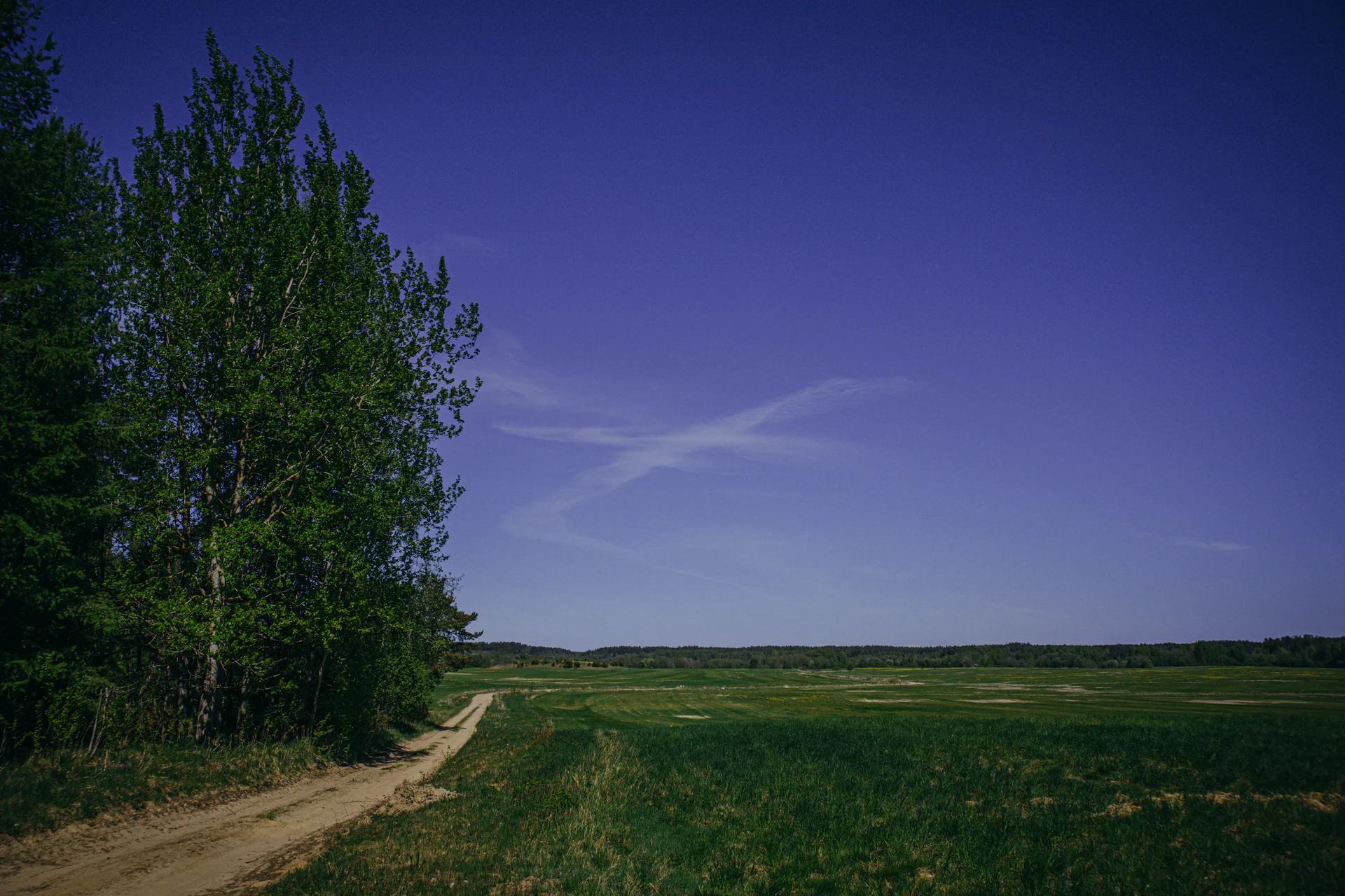
Грунты, песок, озёра, рельеф!
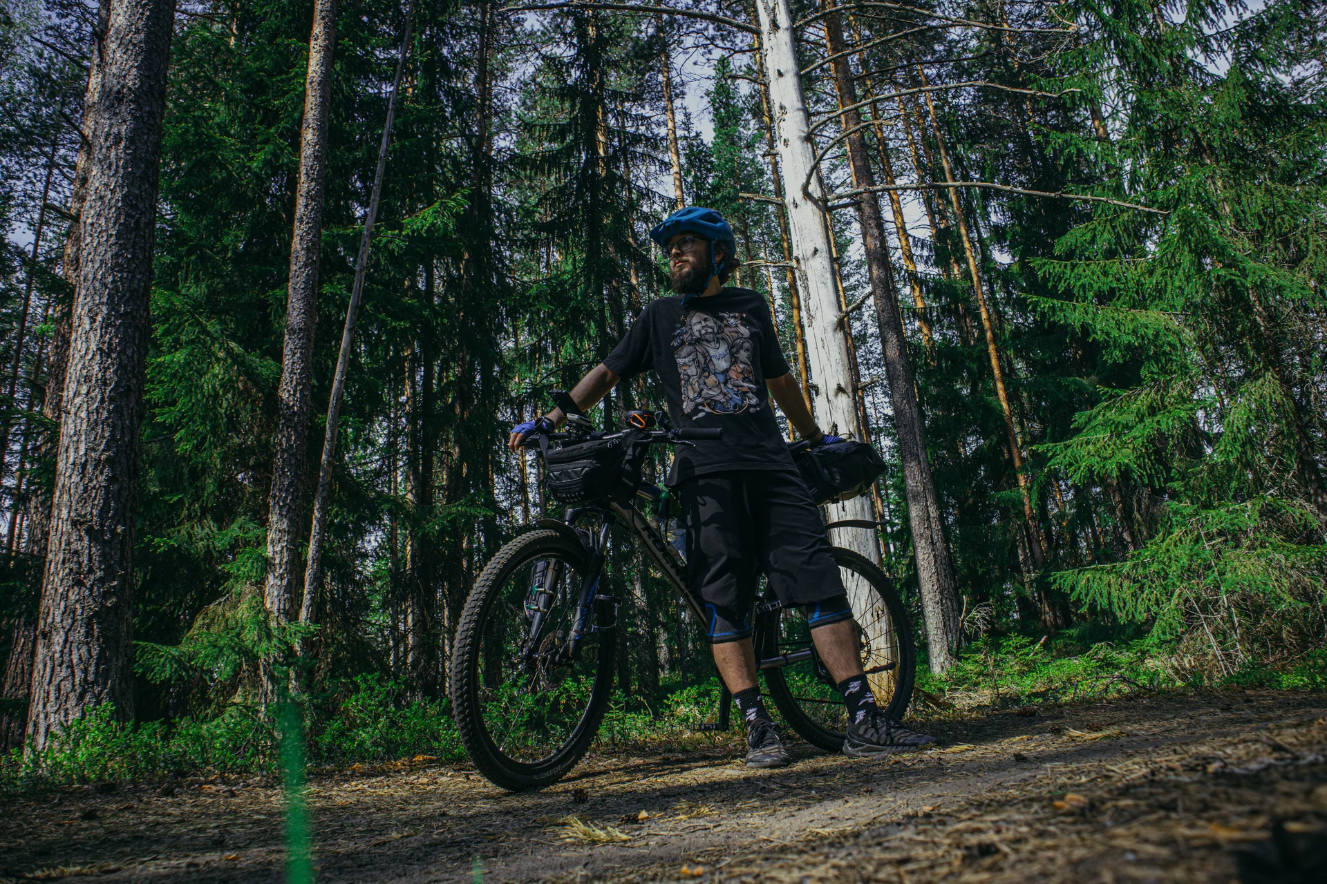
Маршрут можно проехать за день, или (мой совет) поехать в лайтовый поход 40 км + 40 км с отдыхом у Ладоги.
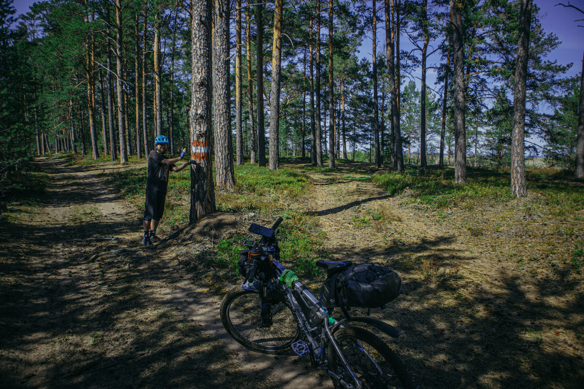
Маршрут почти полностью проходит по маркированным тропам, с небольшими моими ответвлениями.
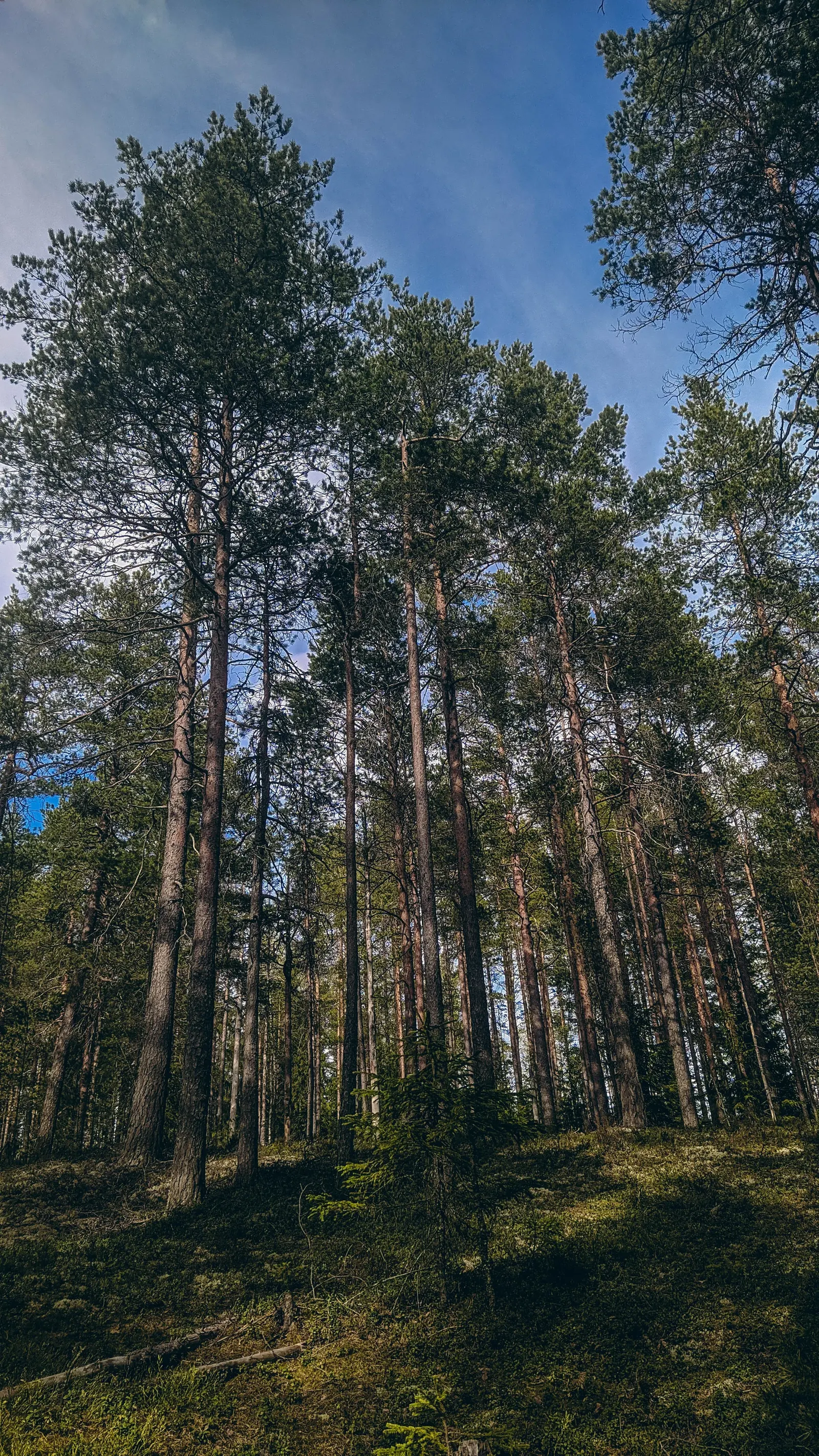
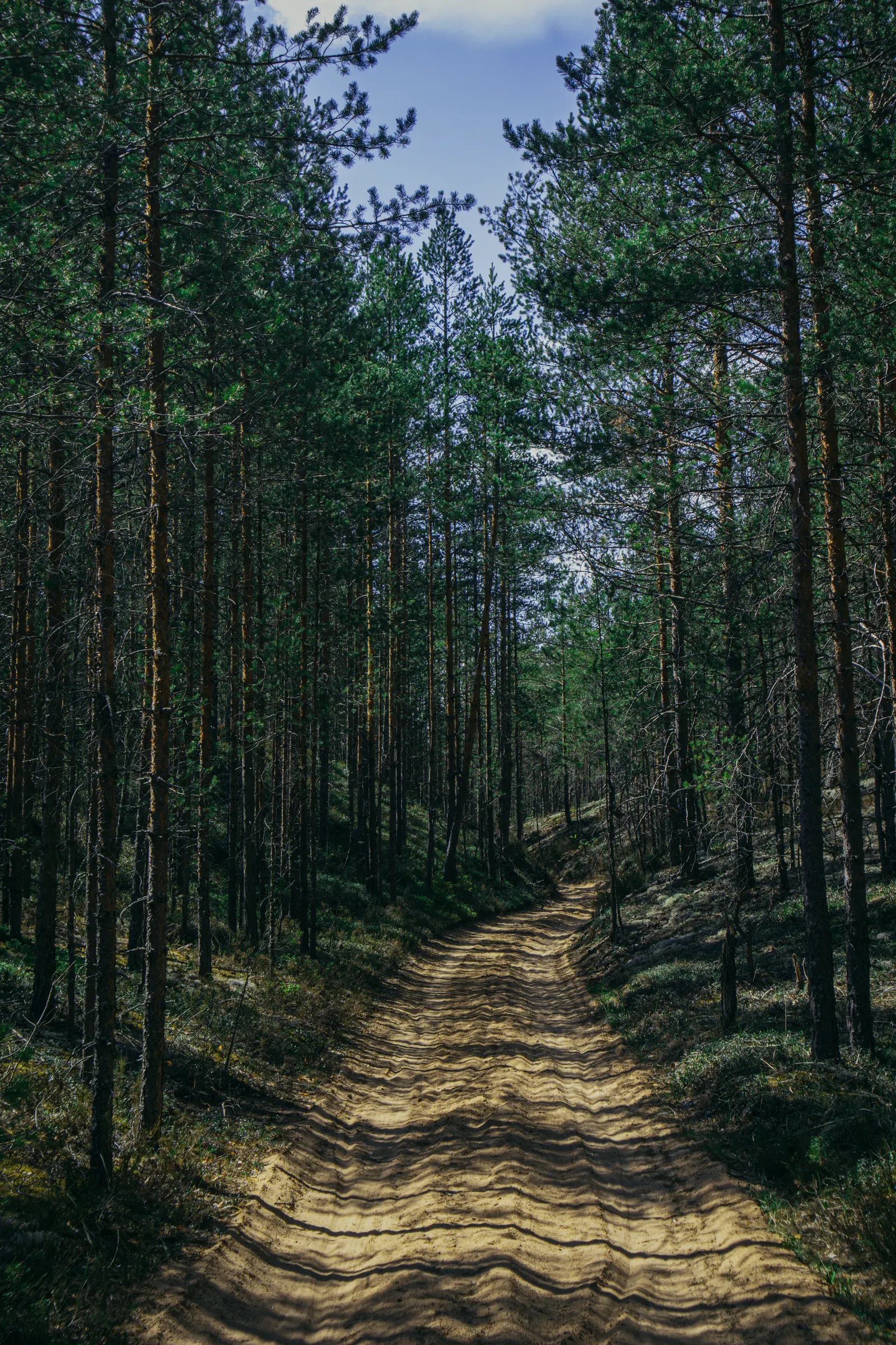
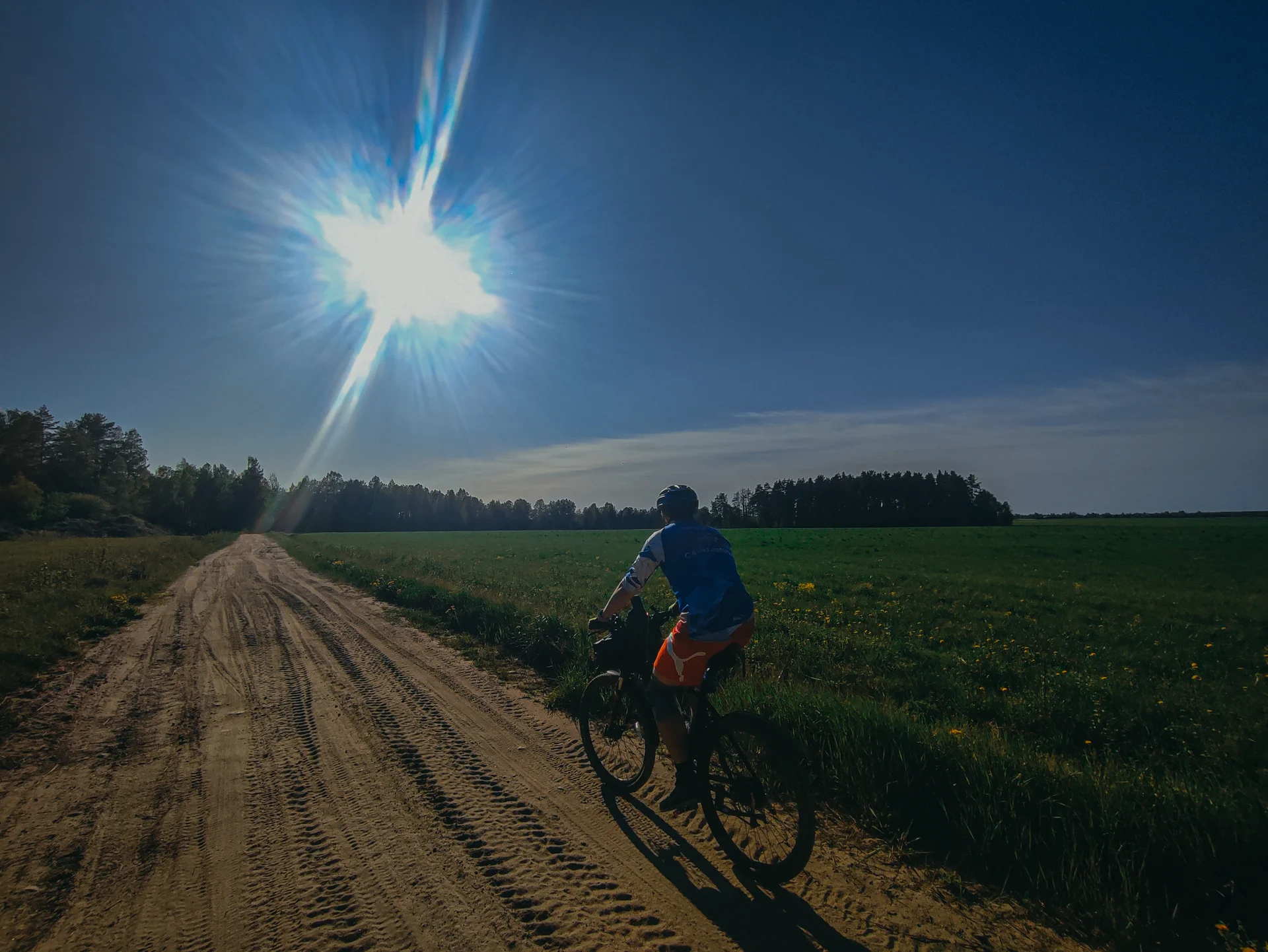
Начинаем маршрут двигаясь по участку Ореховской тропы, прекрасно в любое время года (велик, пешком, на лыжах!)
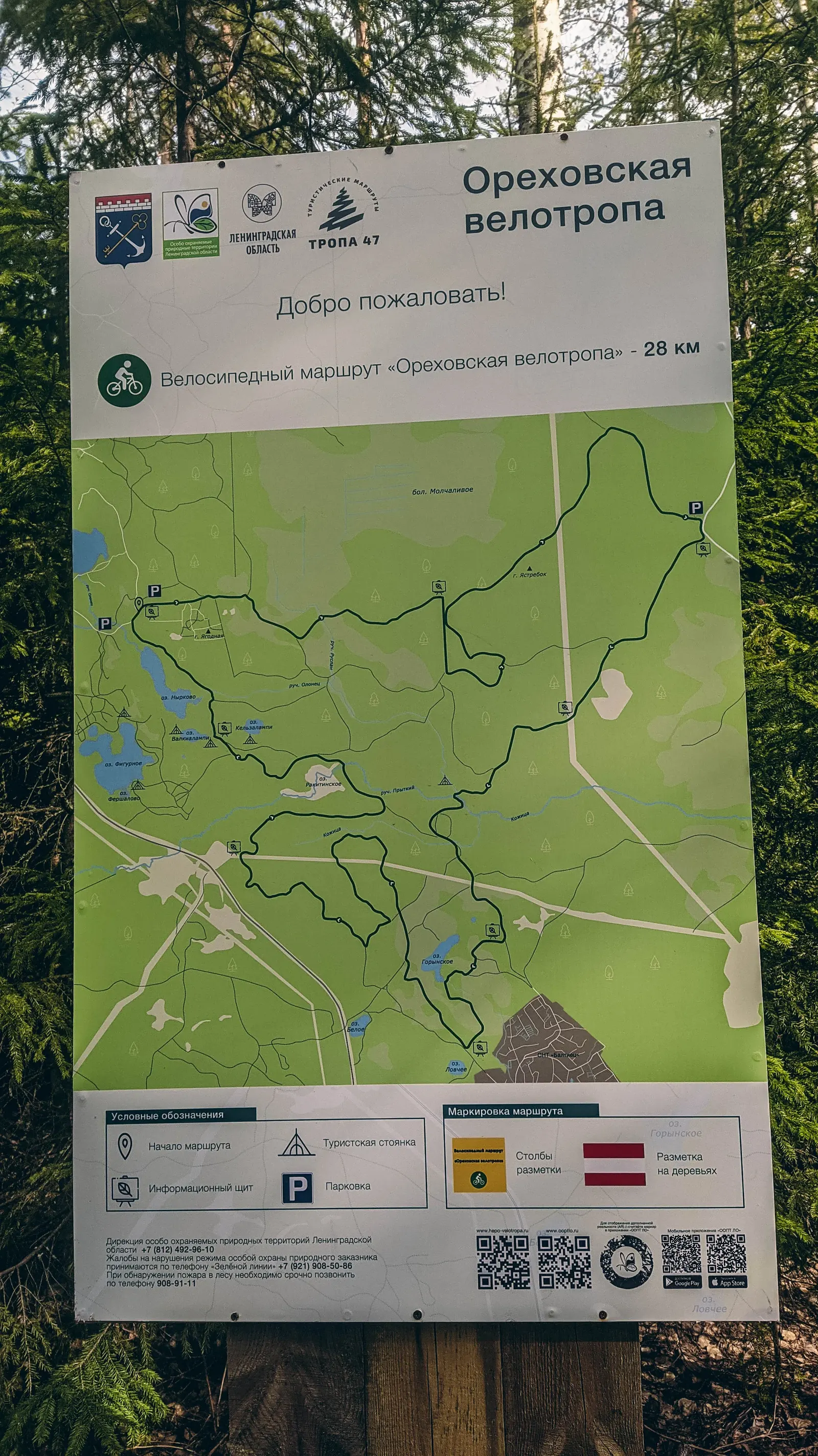
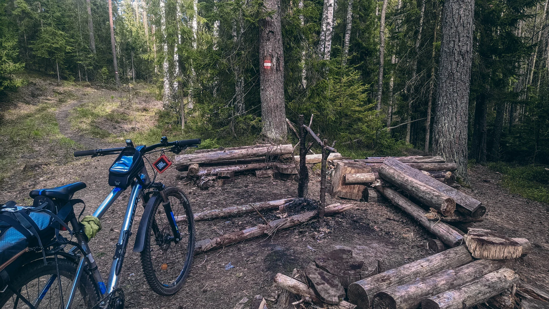
По треке будет странная петля, советую её пройти. Живописная и хорошим рельефом.
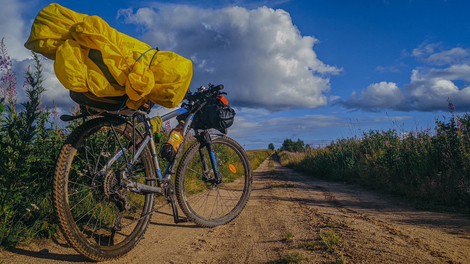
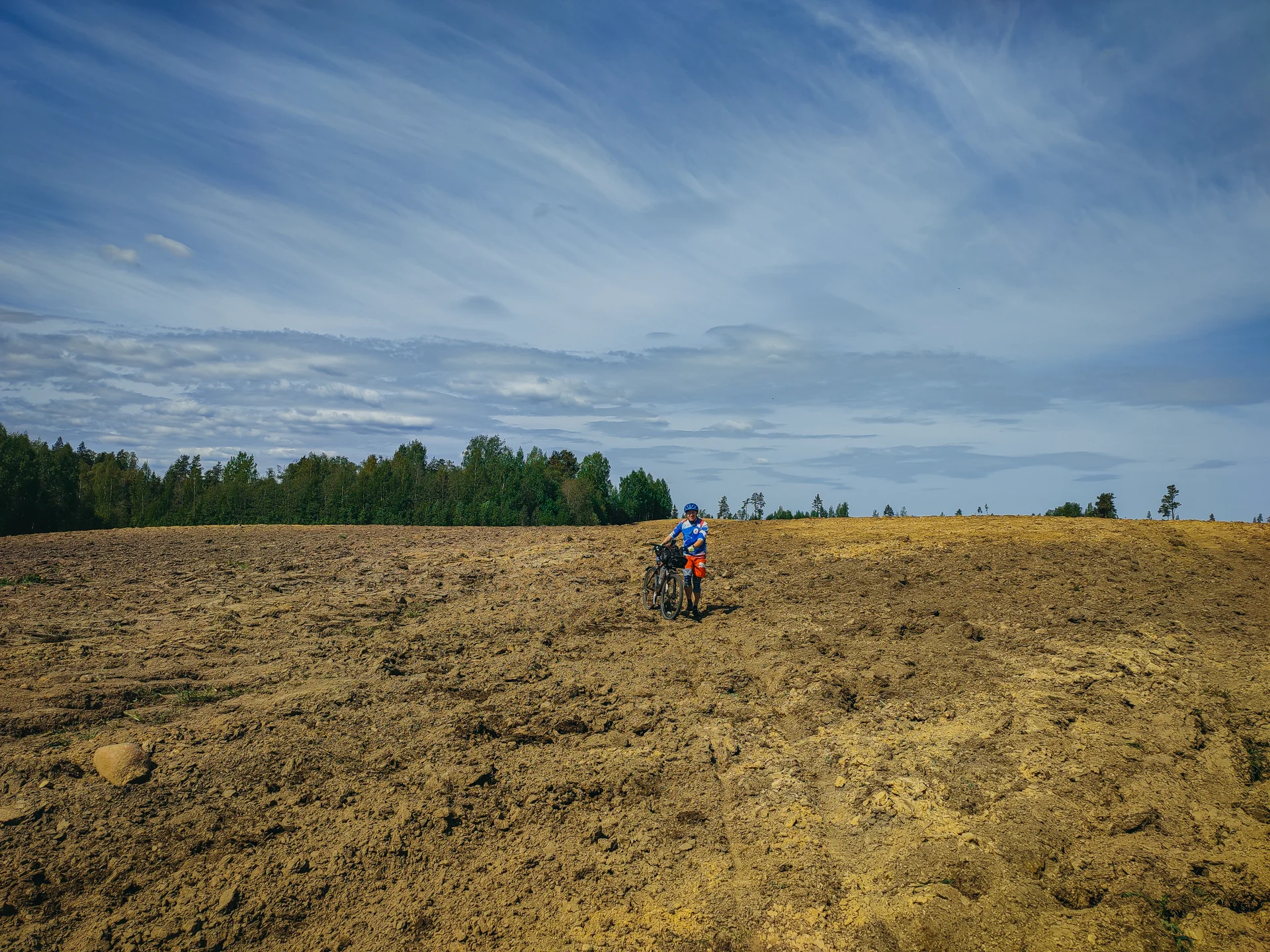
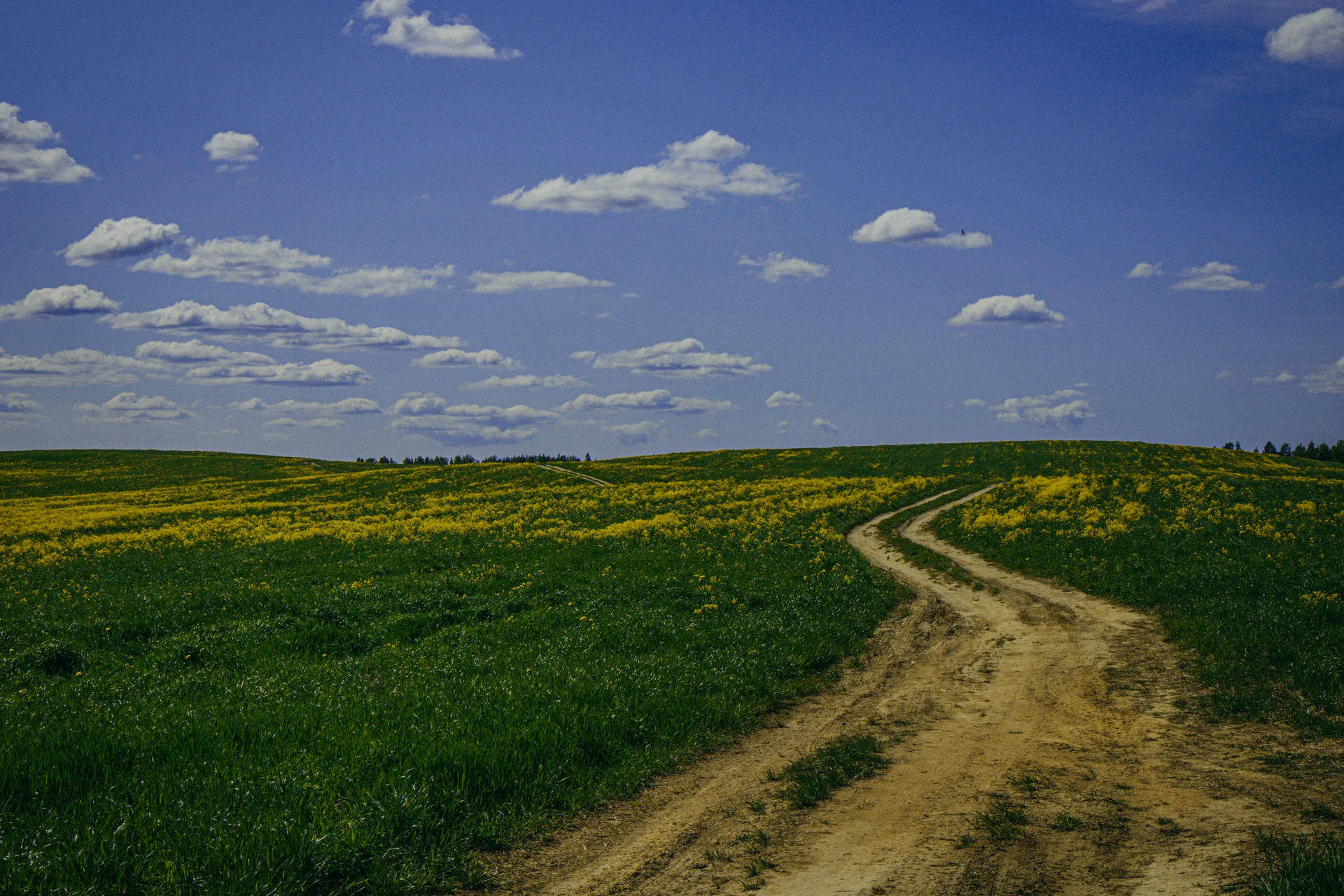
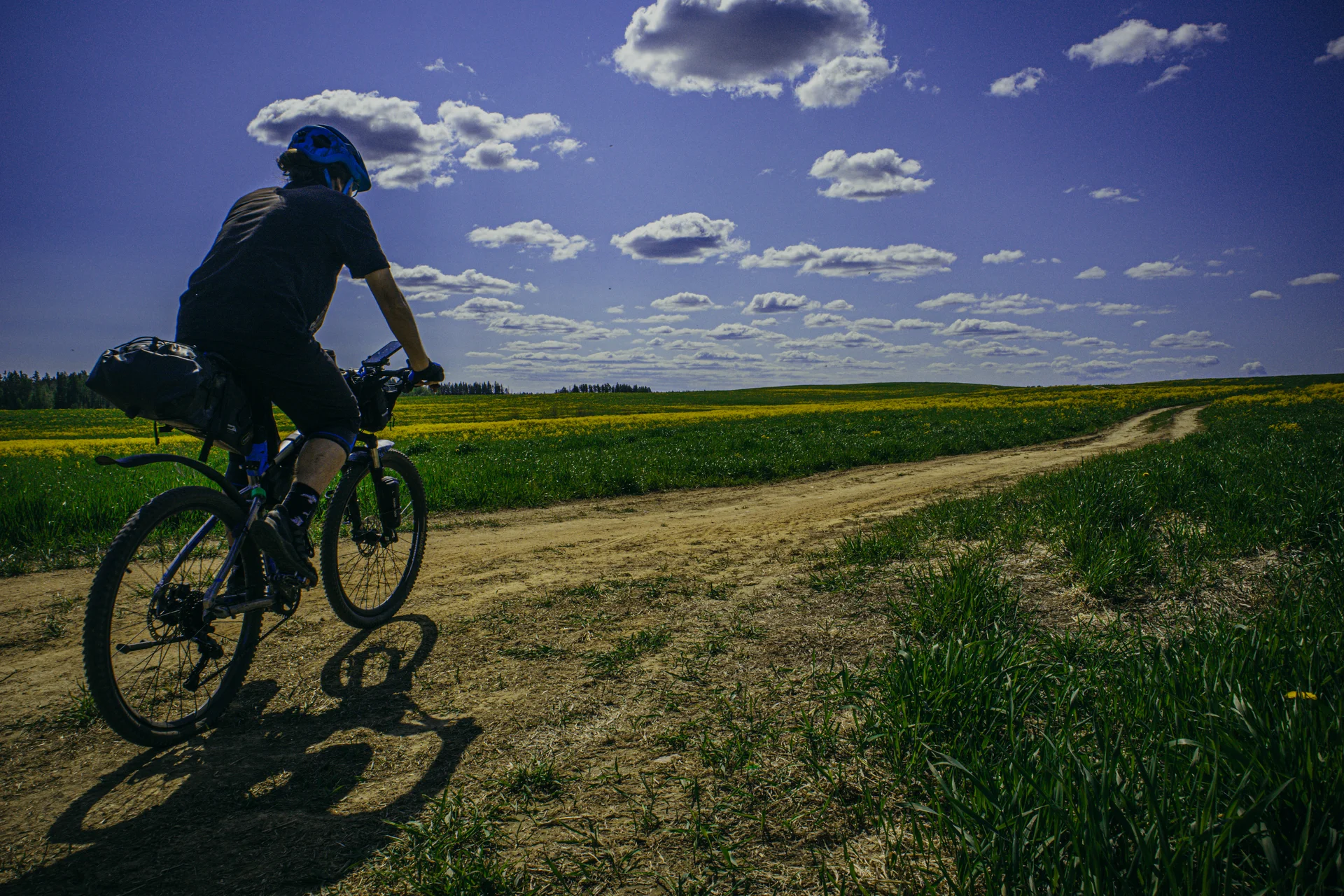
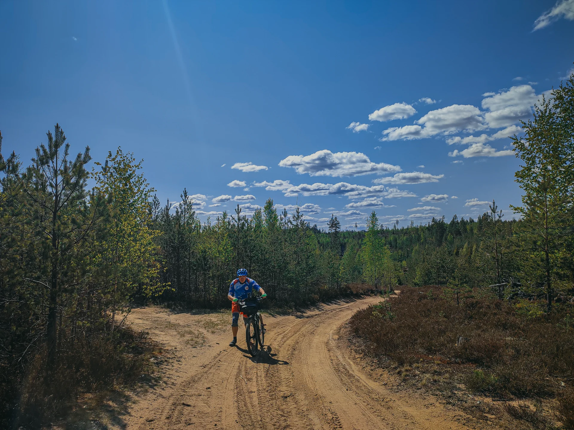
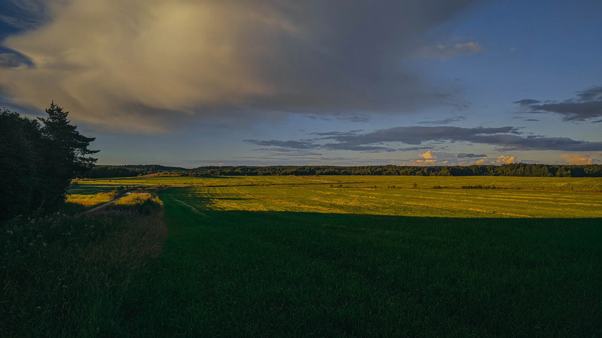
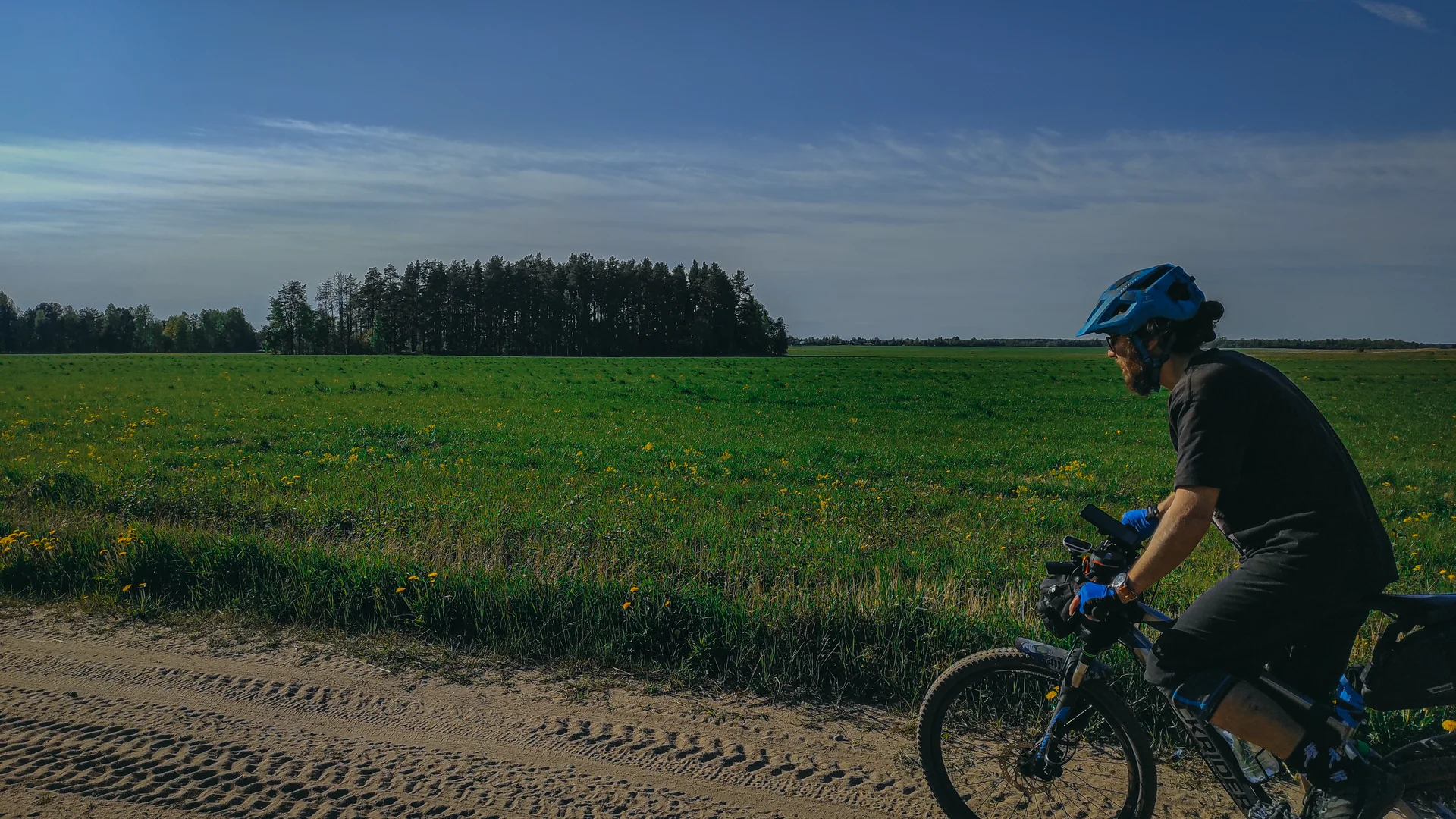
Затем выходим на поля, иногда они могут быть вспахана и придётся тащить вел по земле.
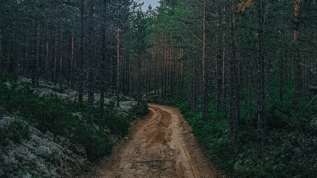
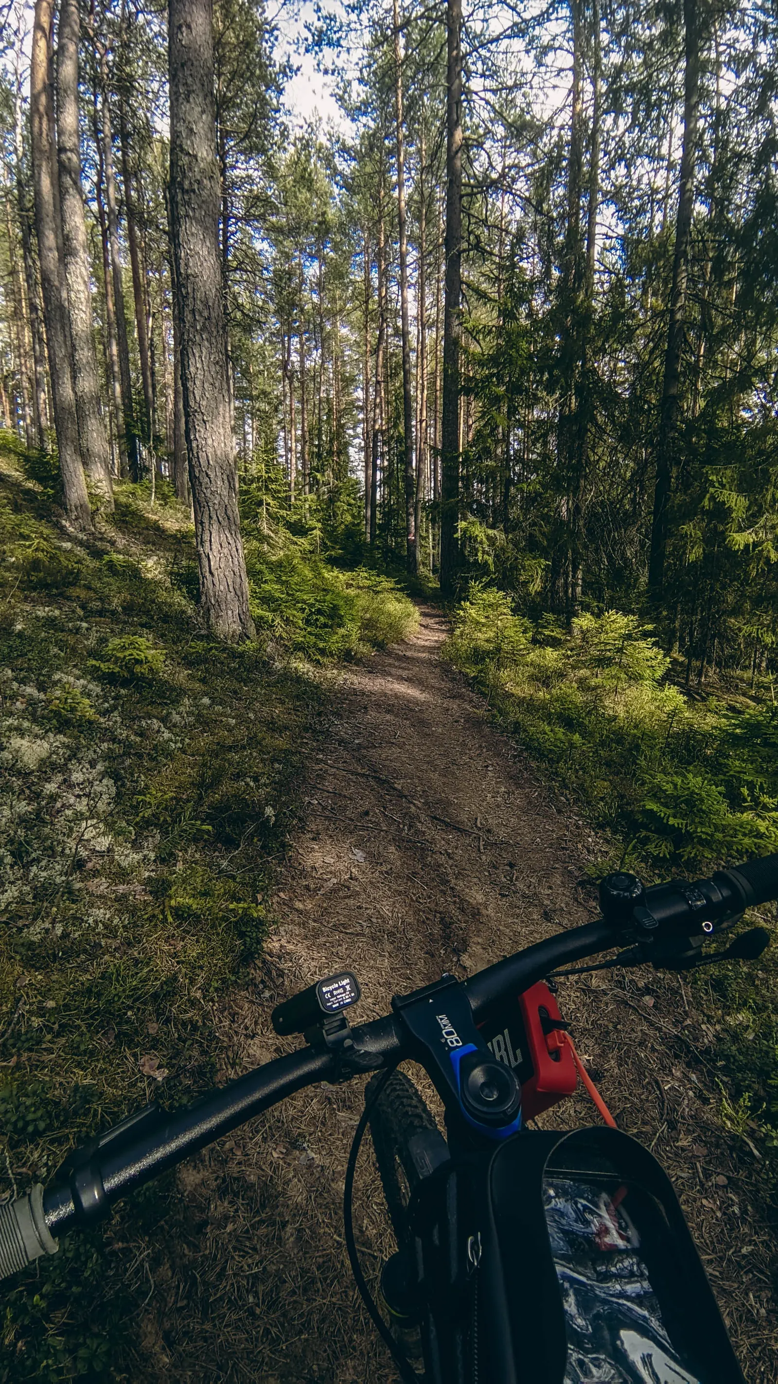
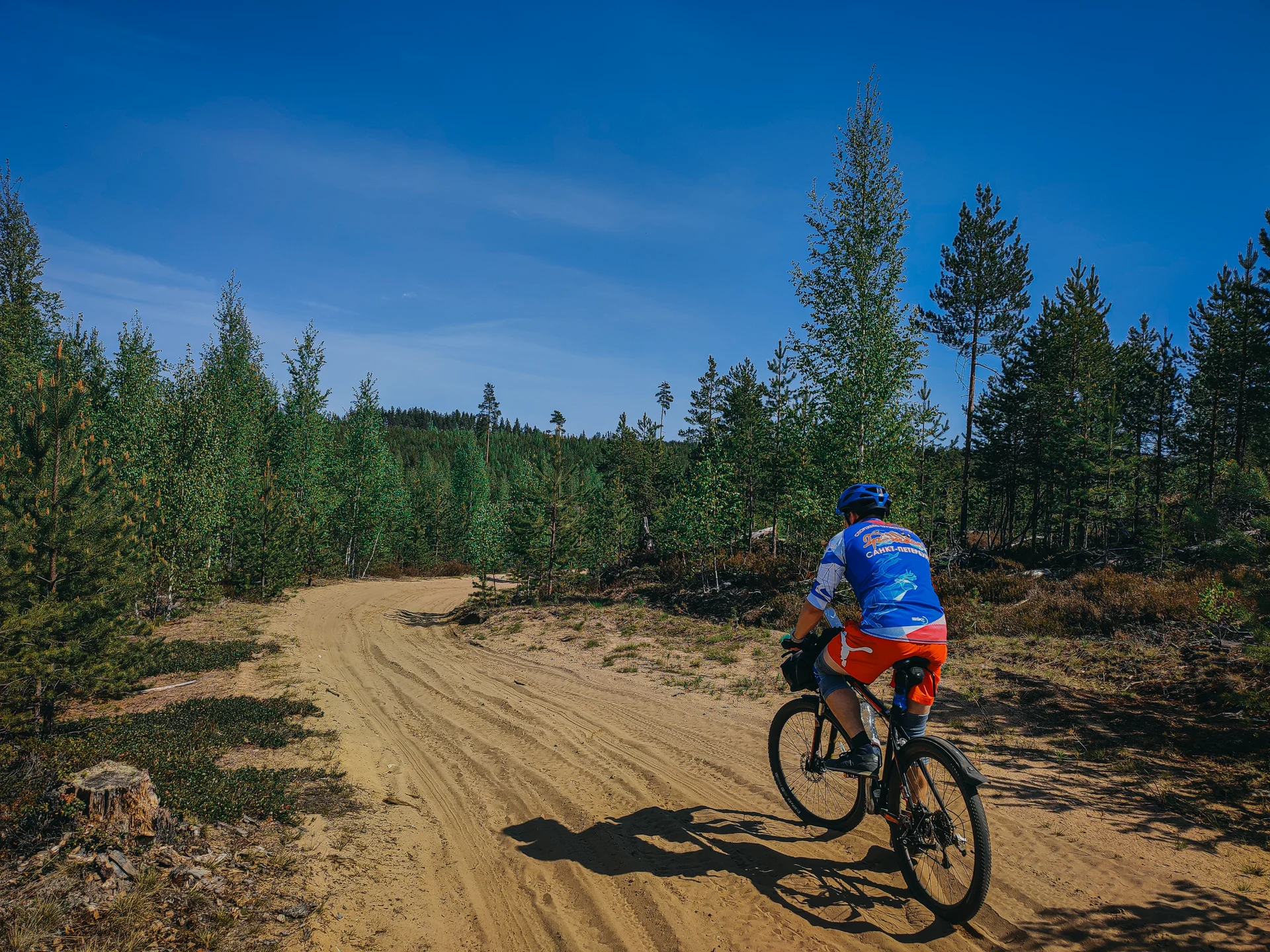
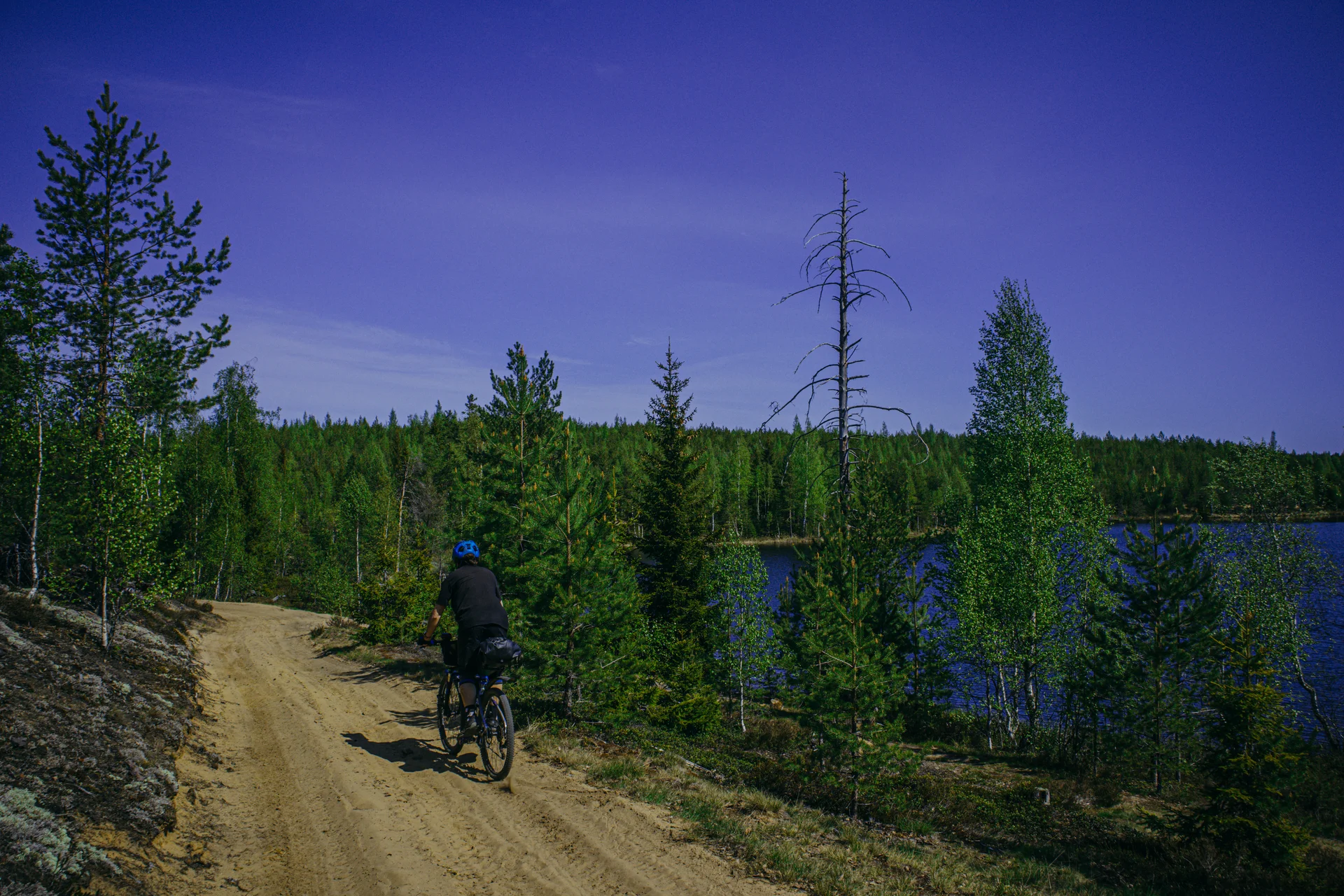
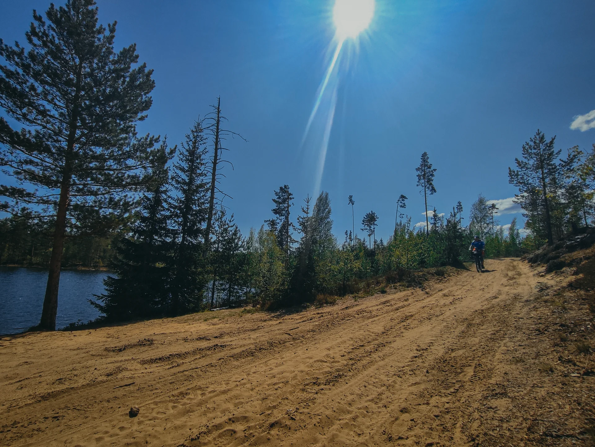
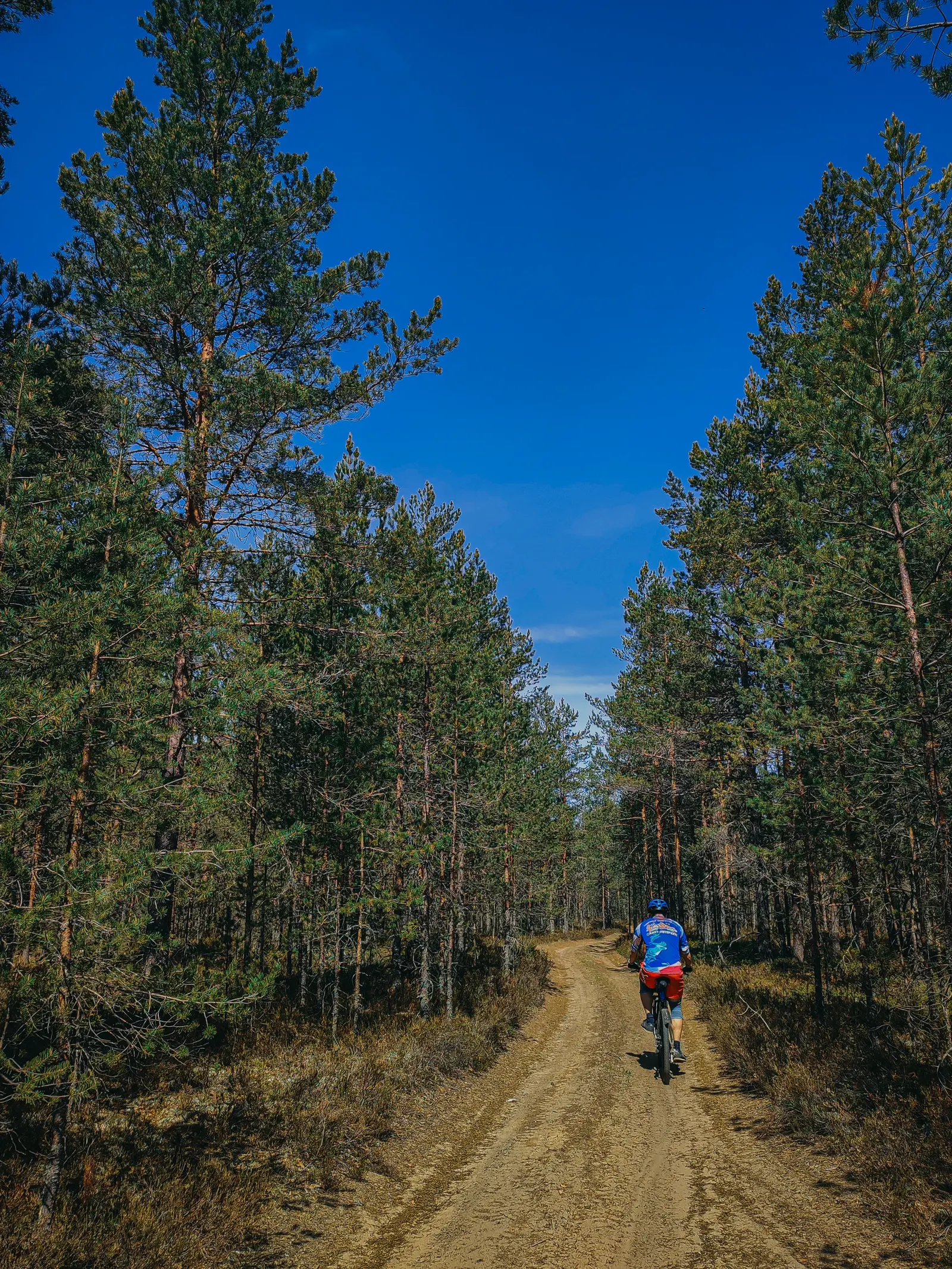
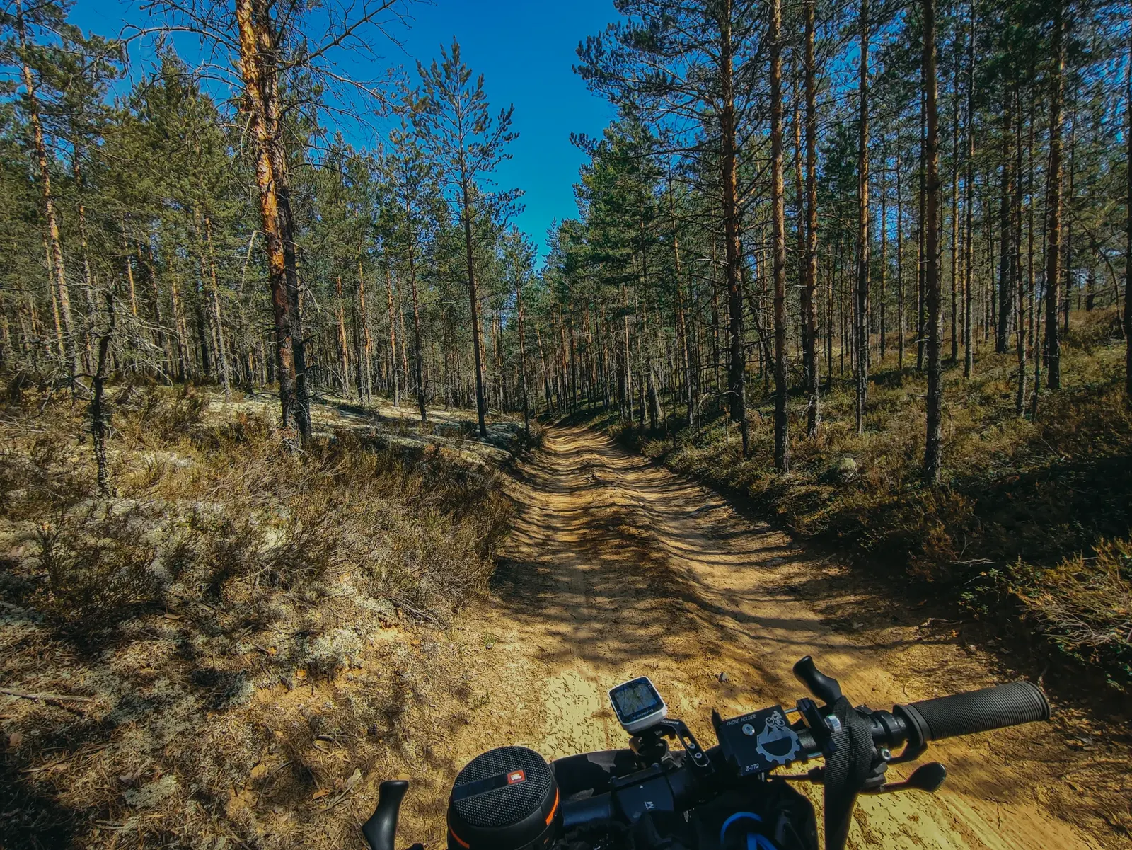
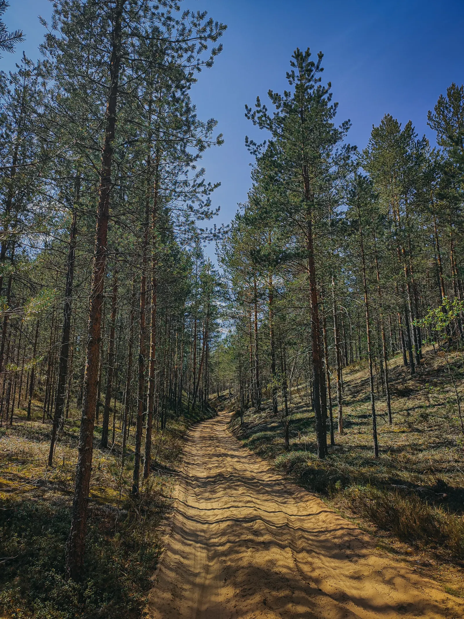
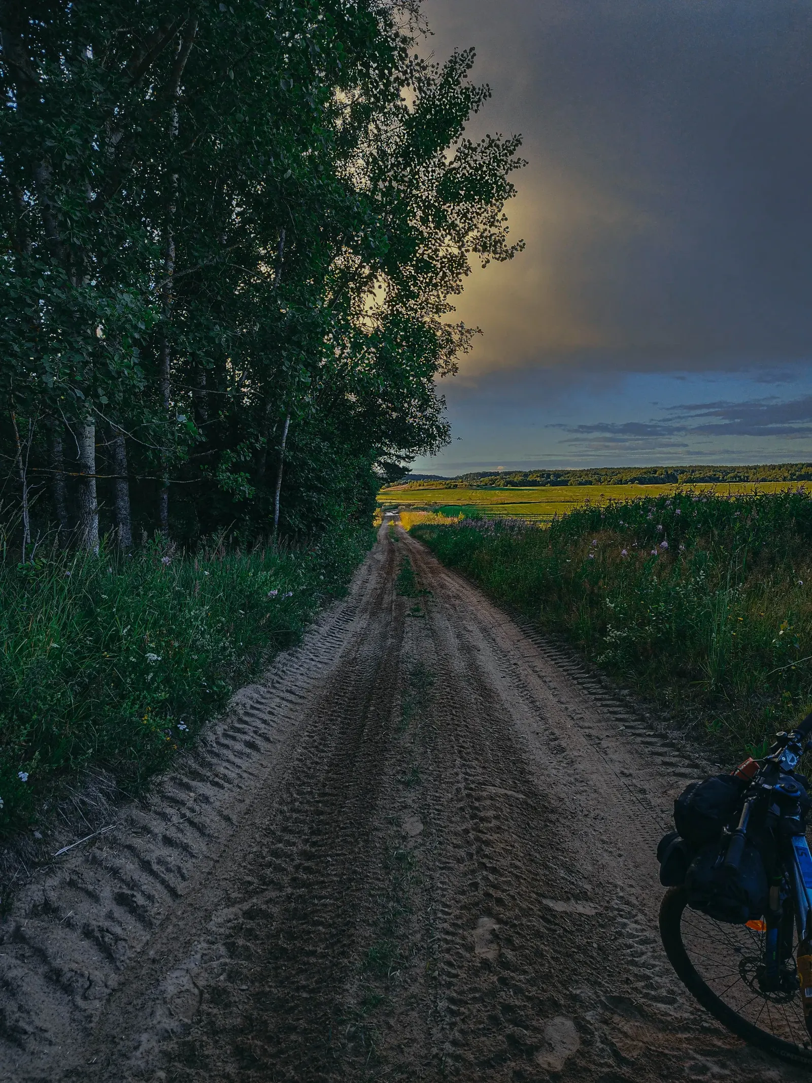
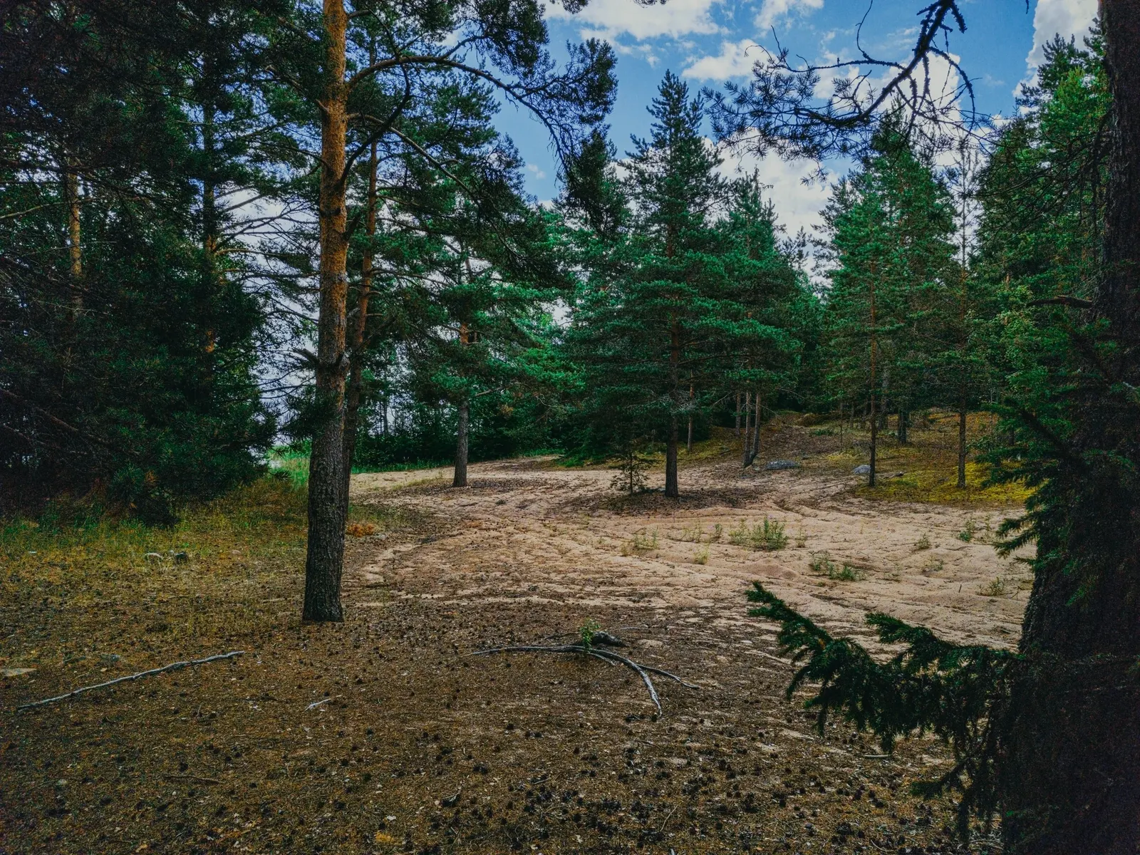
Немного асфальта и снова ныряем в леса. Начинается песок, необычные пейзажи, оставшиеся от ветровала и вырубок, лесные озёра и даже небольшой участок с настоящими серпантинами!)
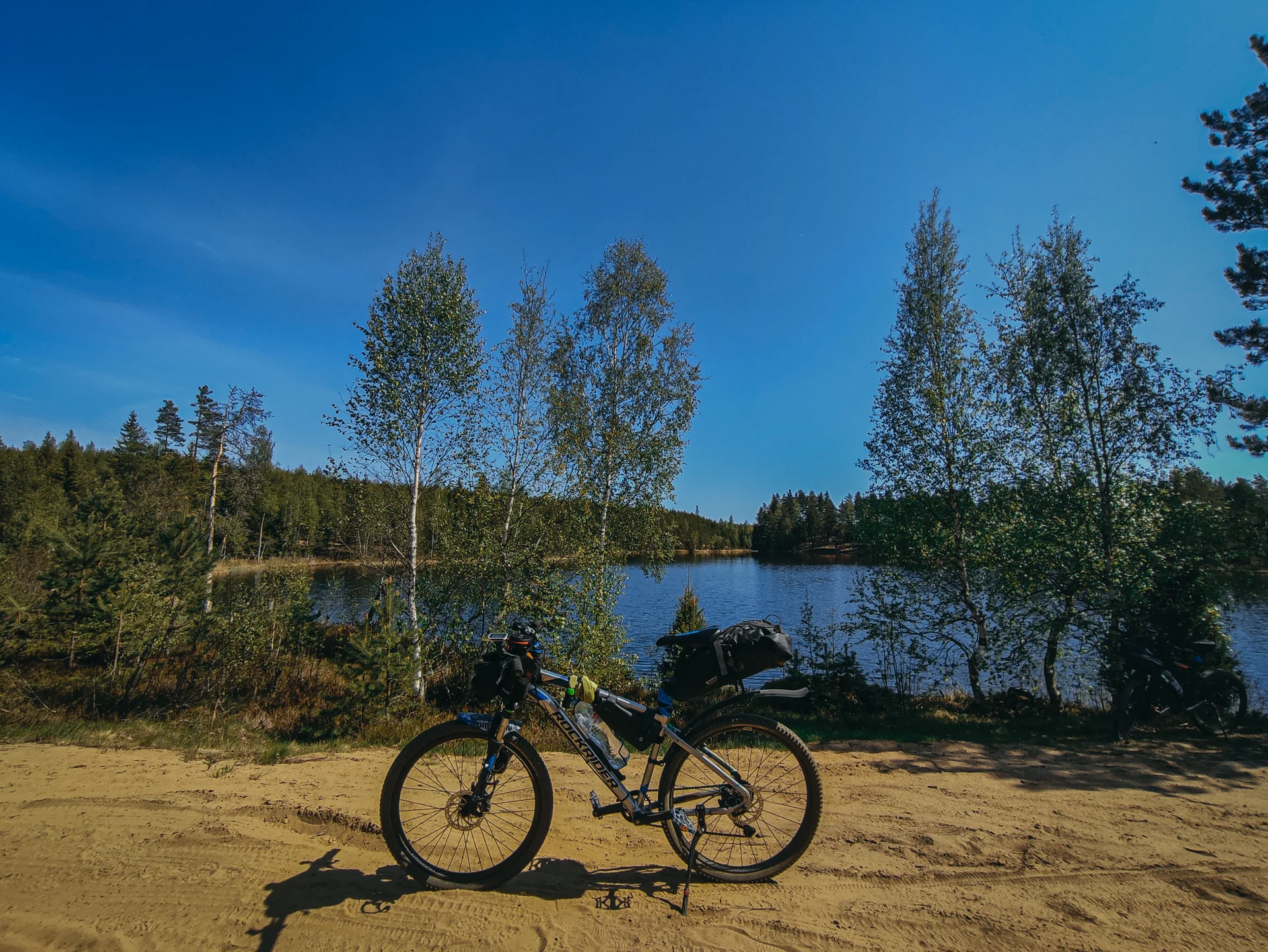
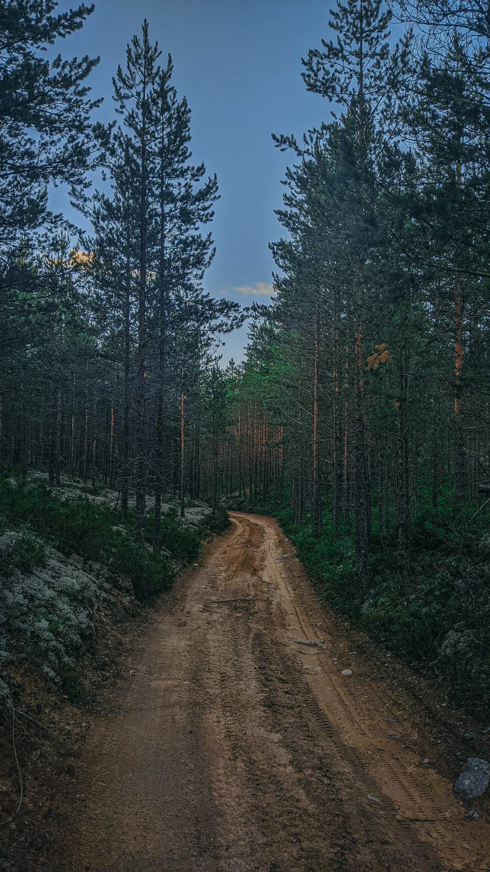
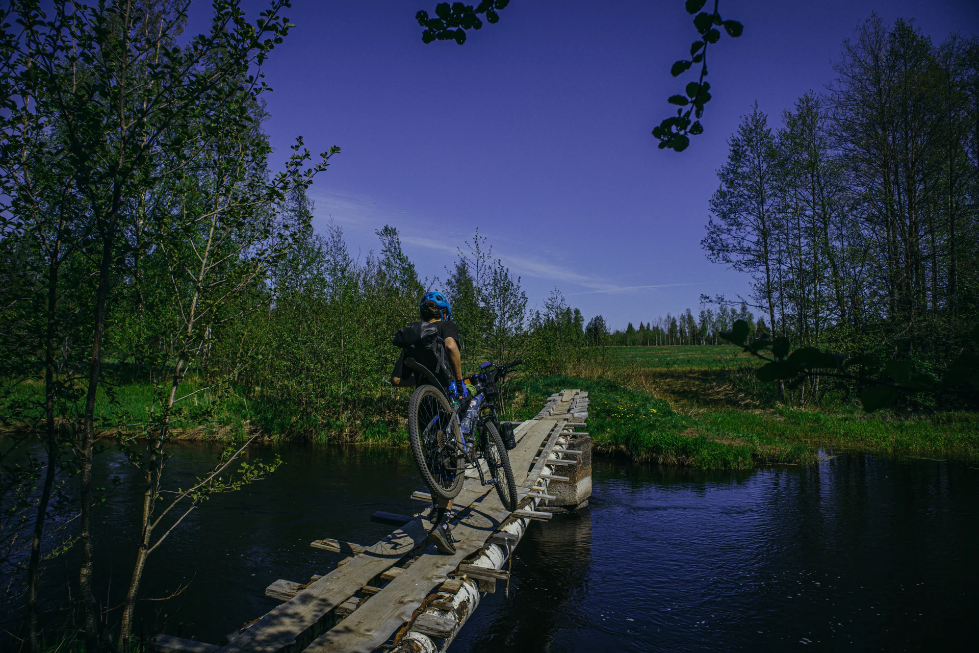
Движемся через Алиски и попадает на ужасный грейдер, мучаемся пару км и, через живописный мостик, снова уходим на поля.
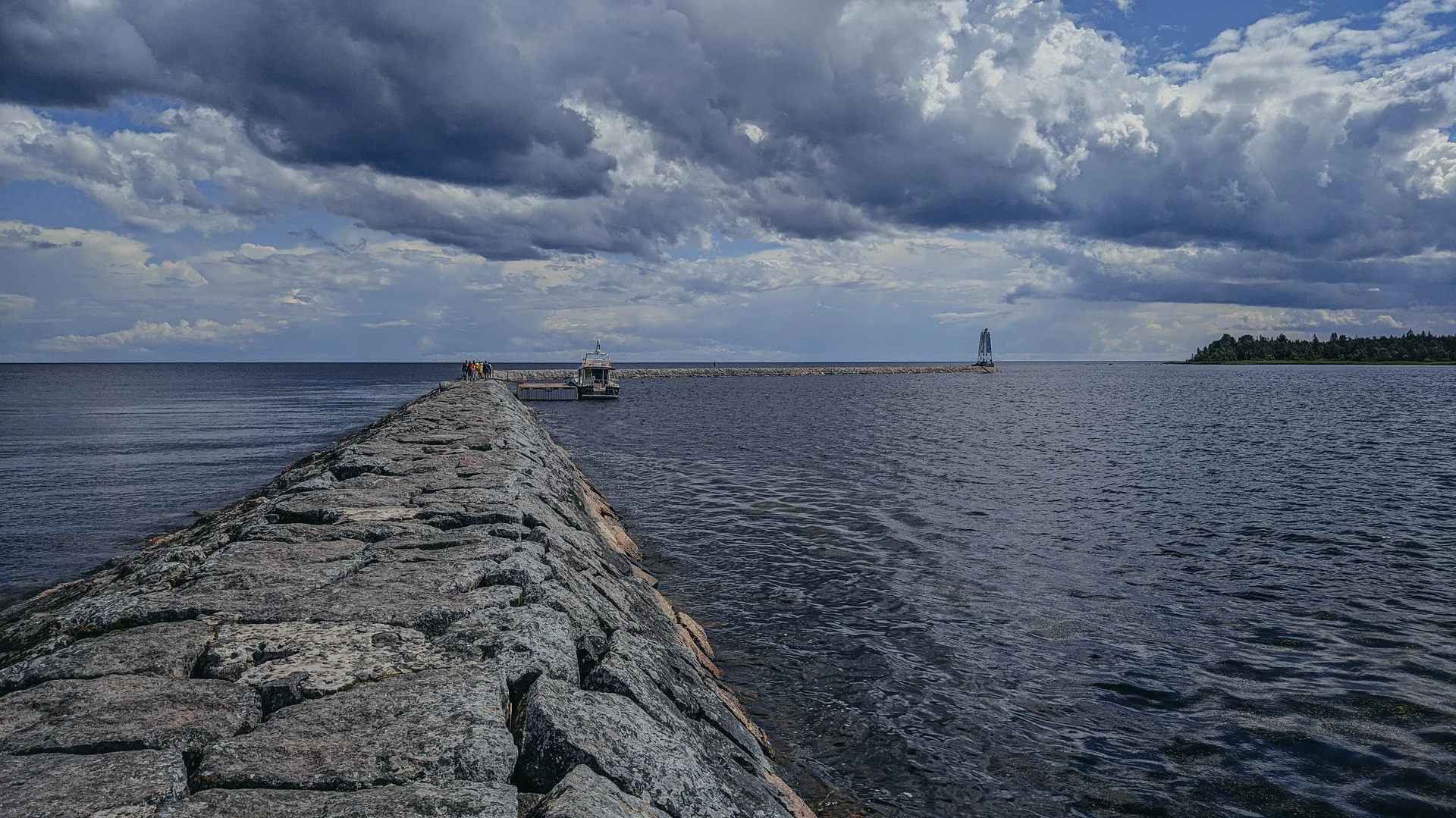
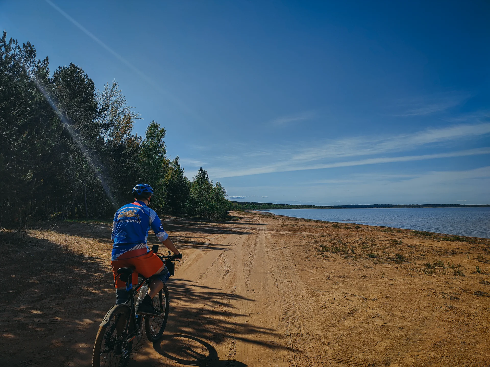
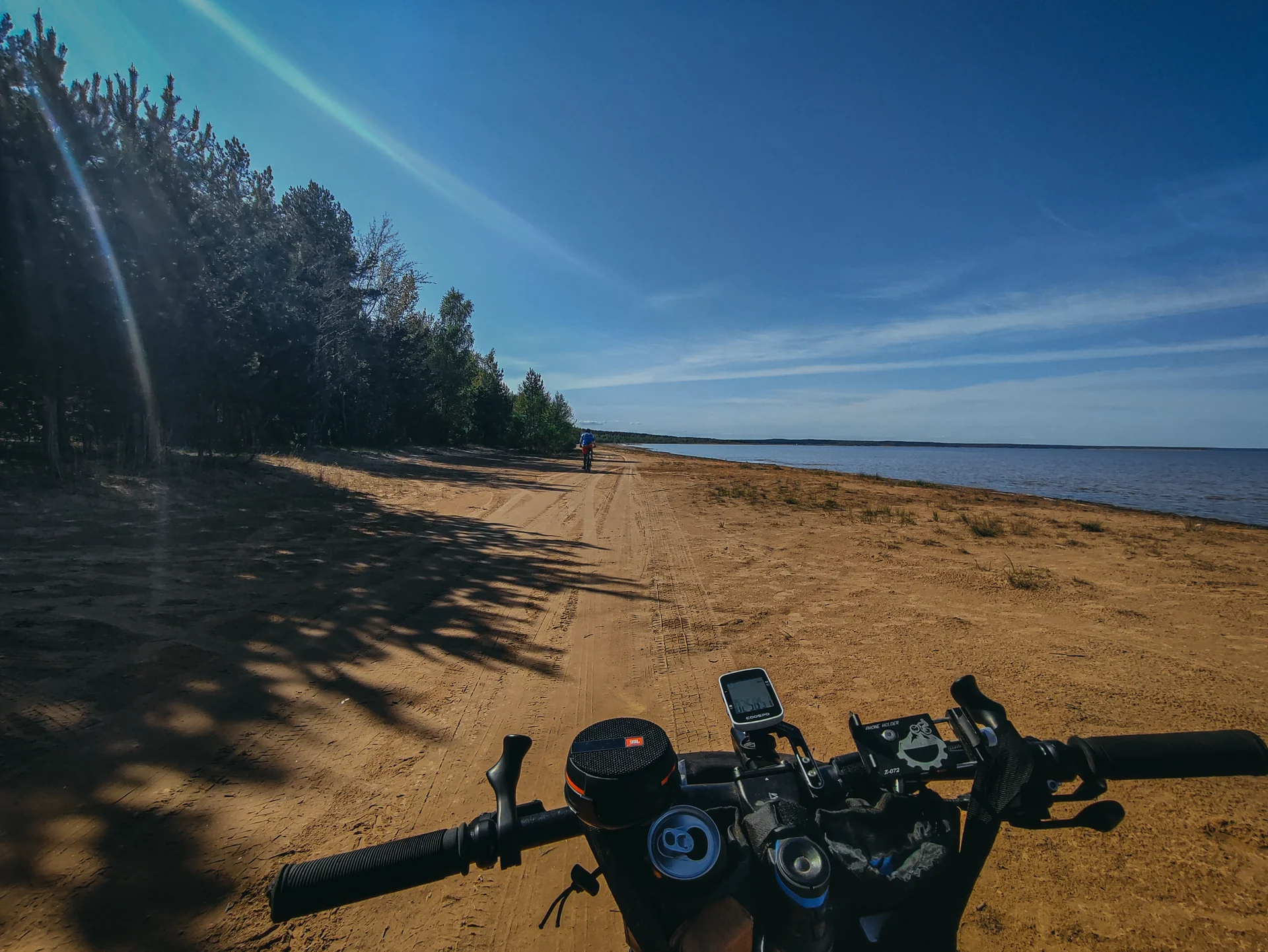
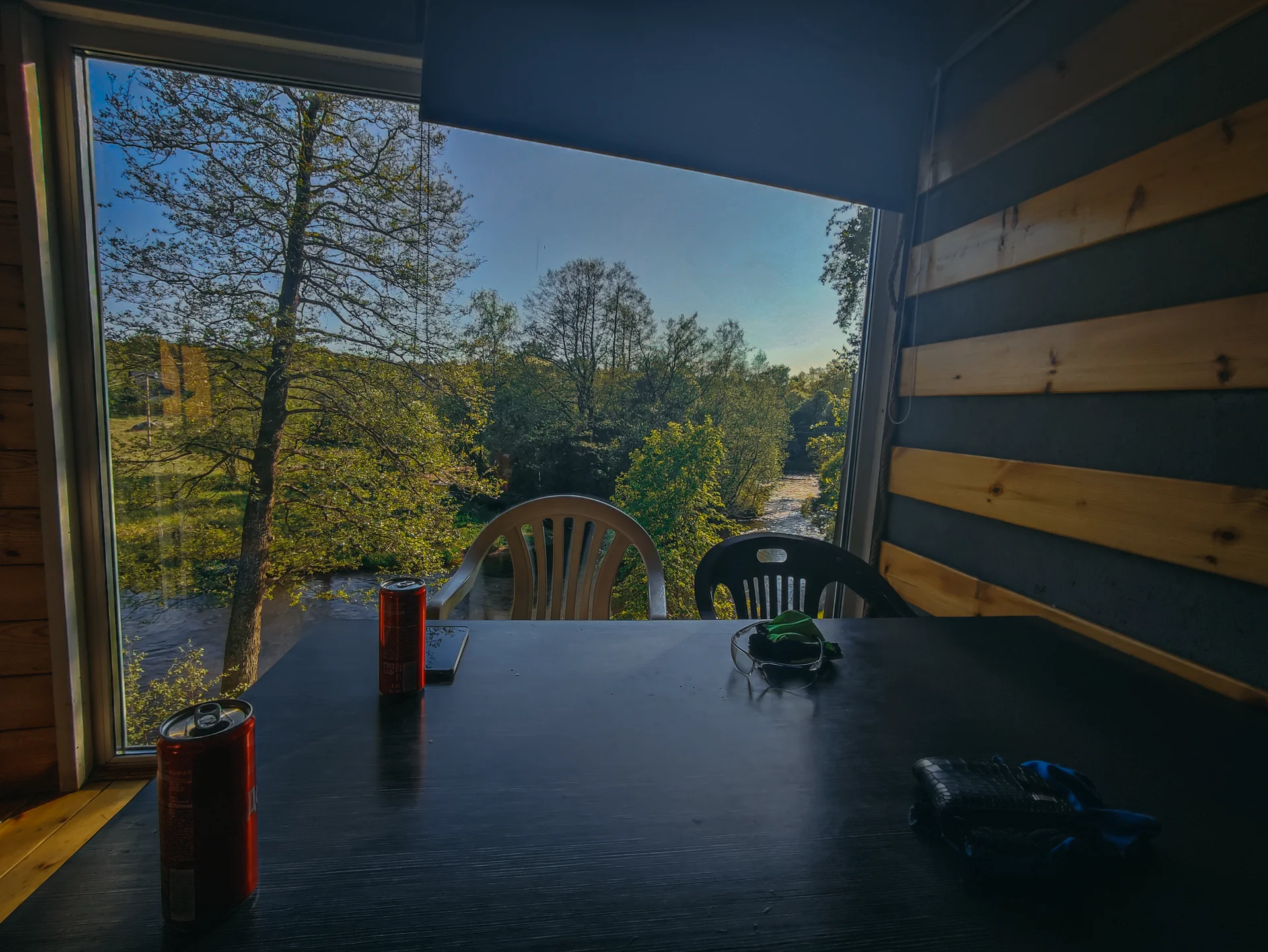
Далее приезжаем в посёлок, закупаемся в магазине, и едем к Ладоге, к Банному молу.
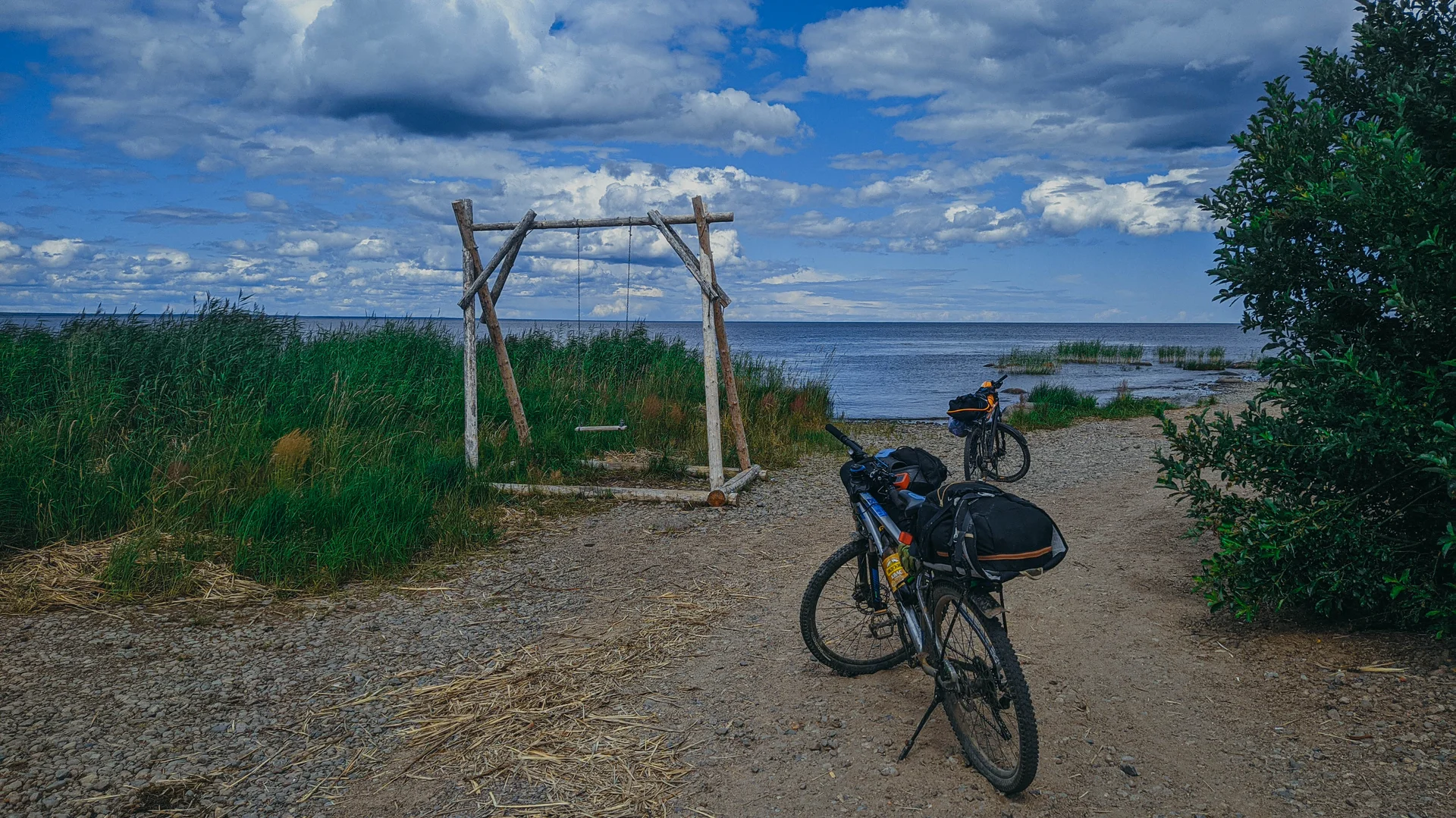
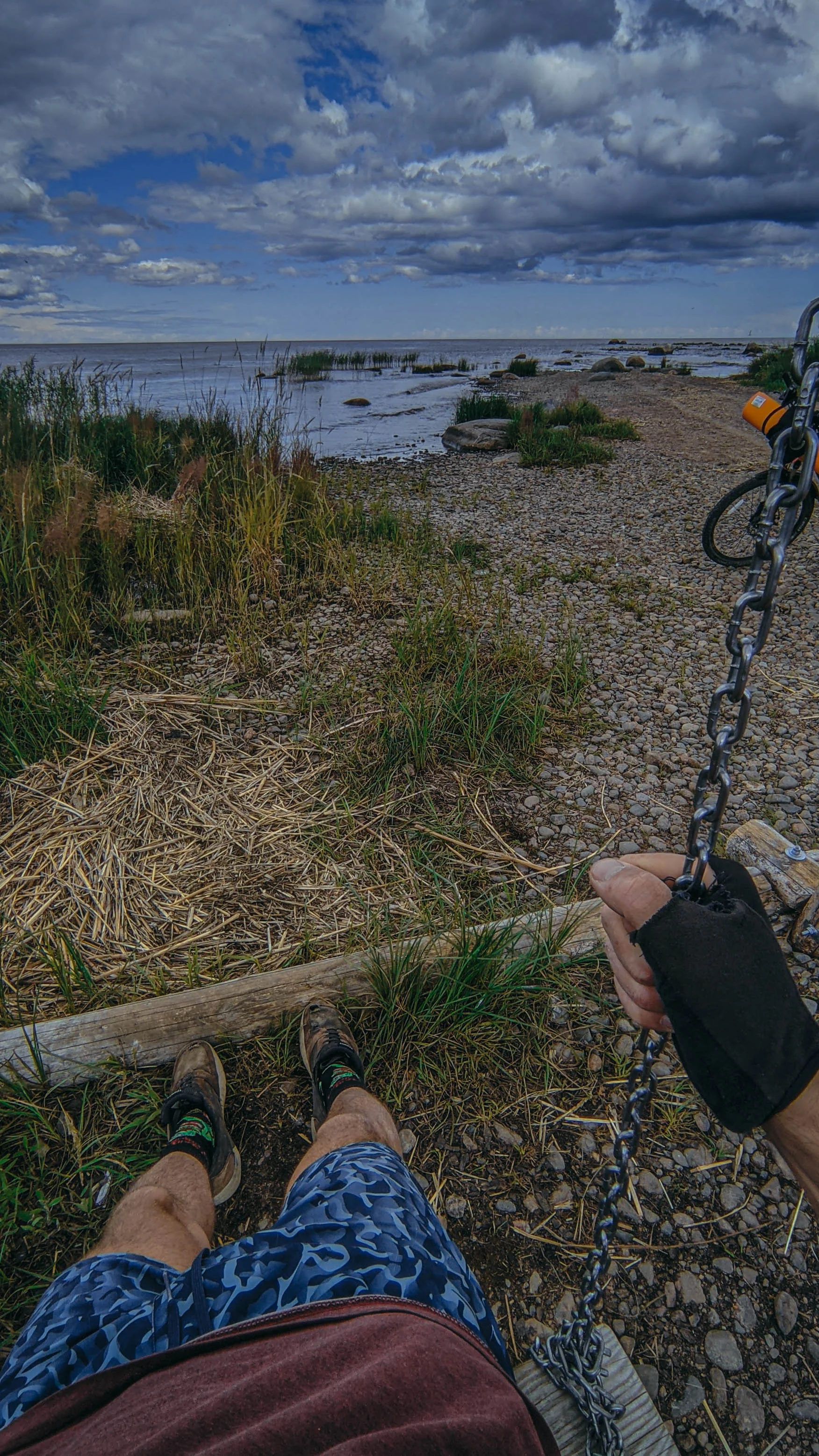
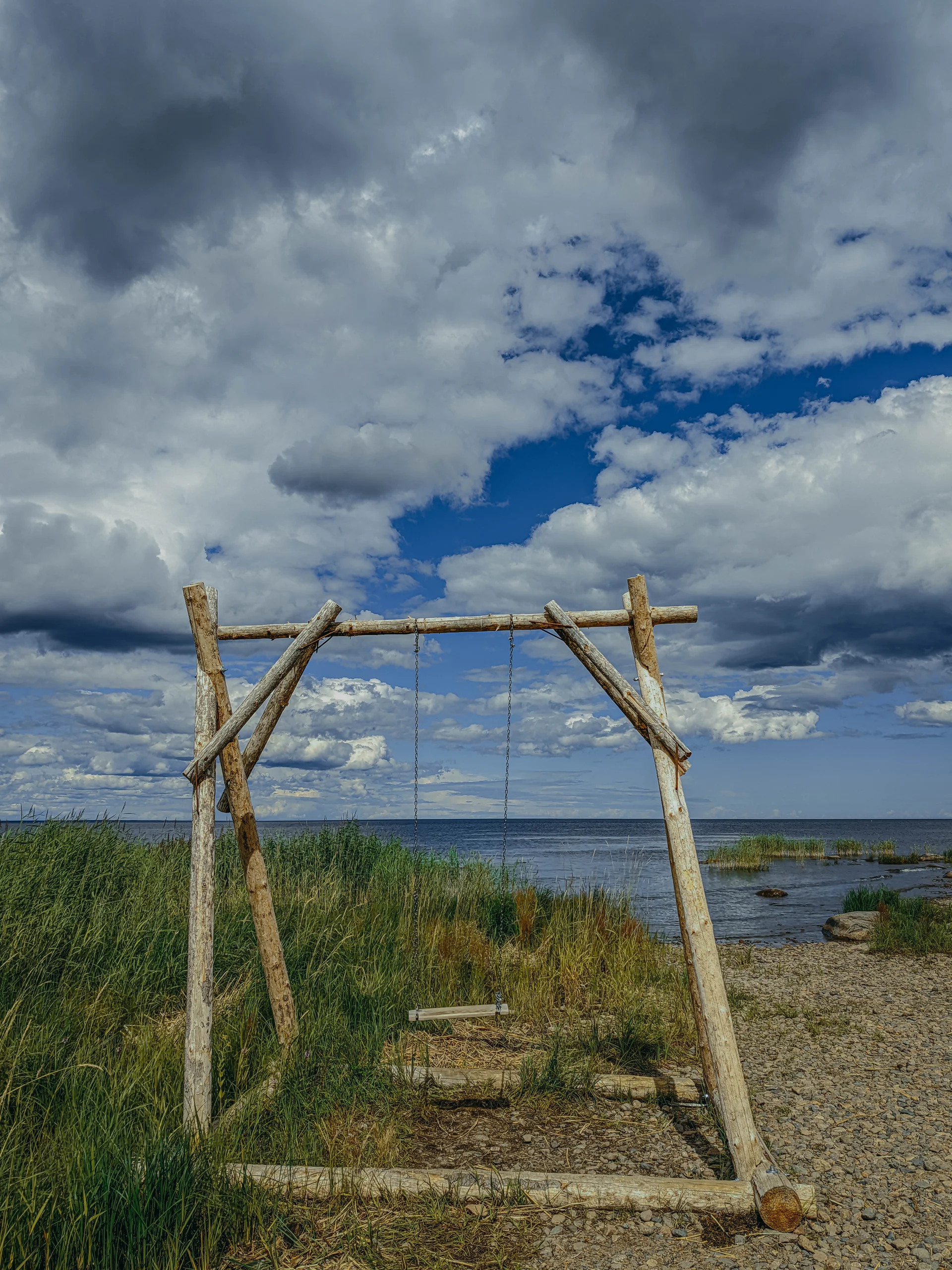
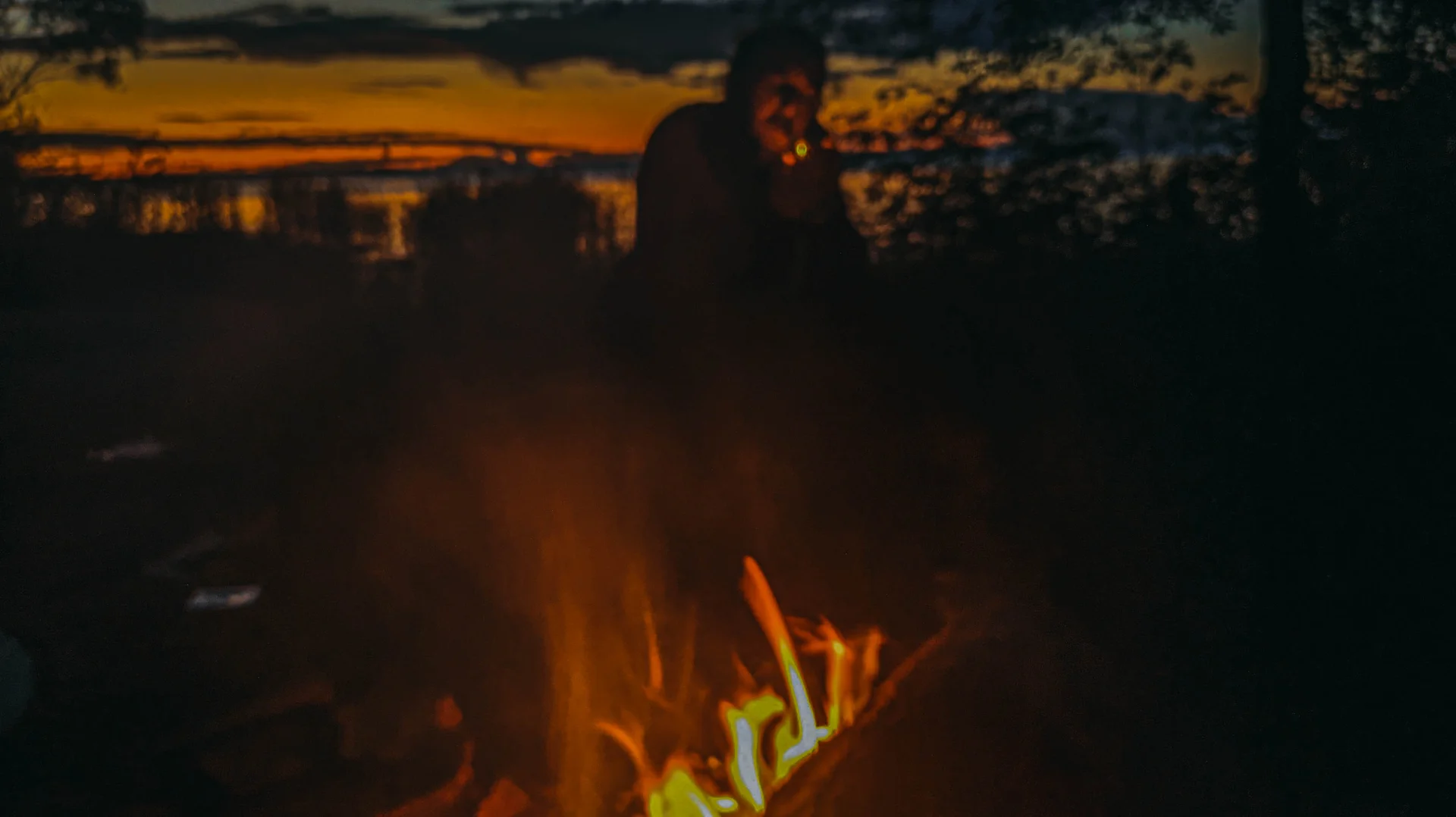
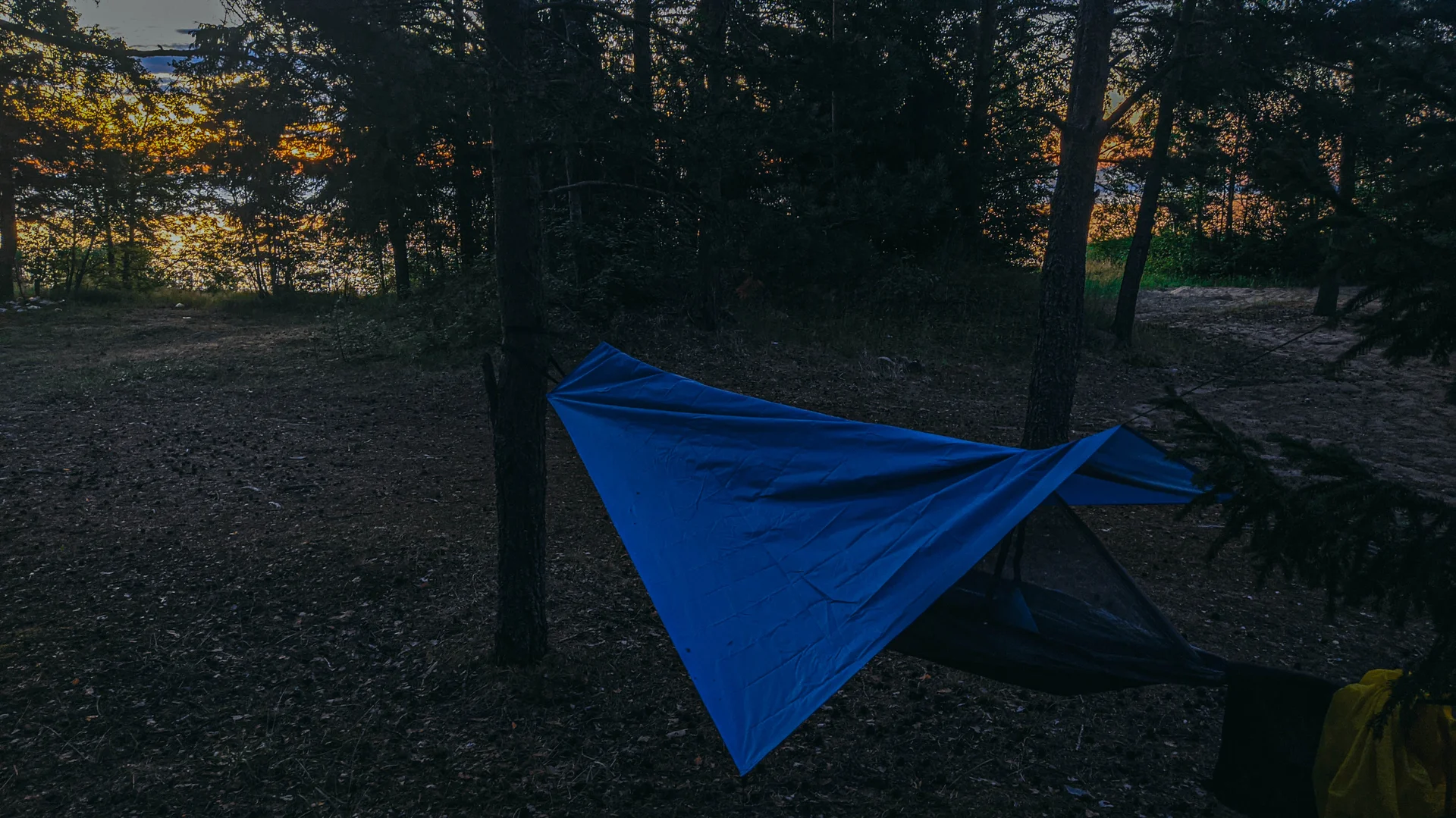
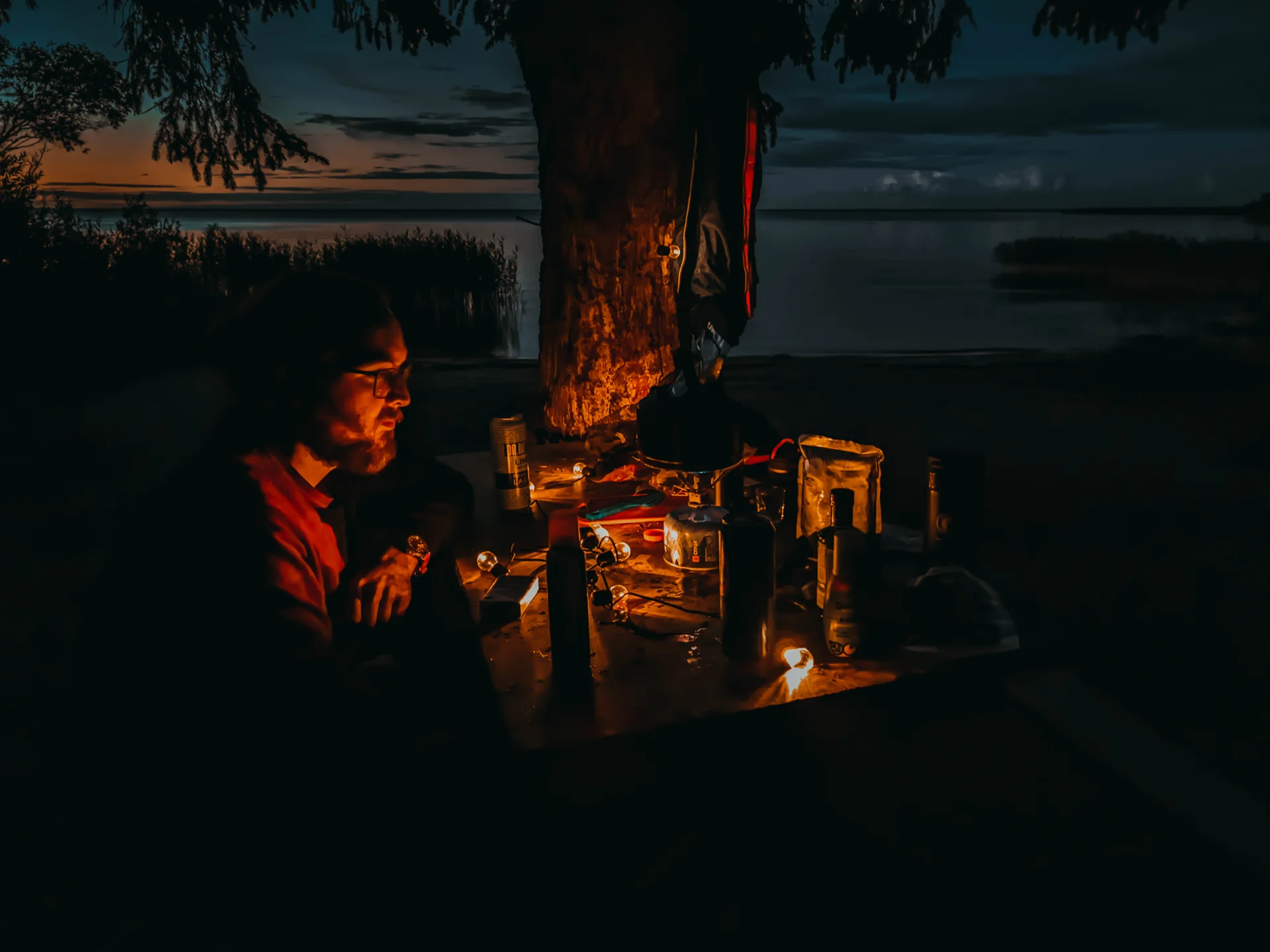
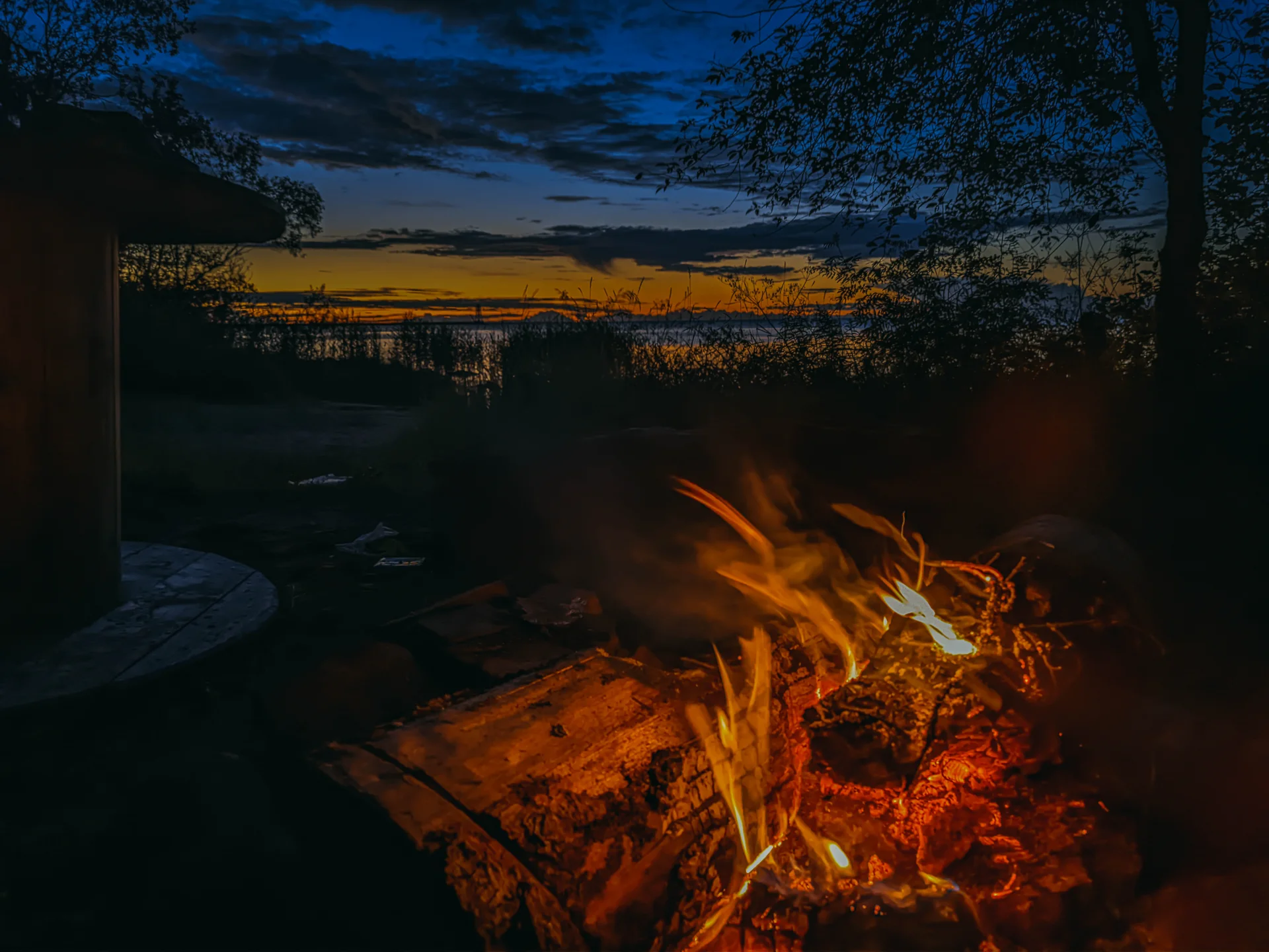
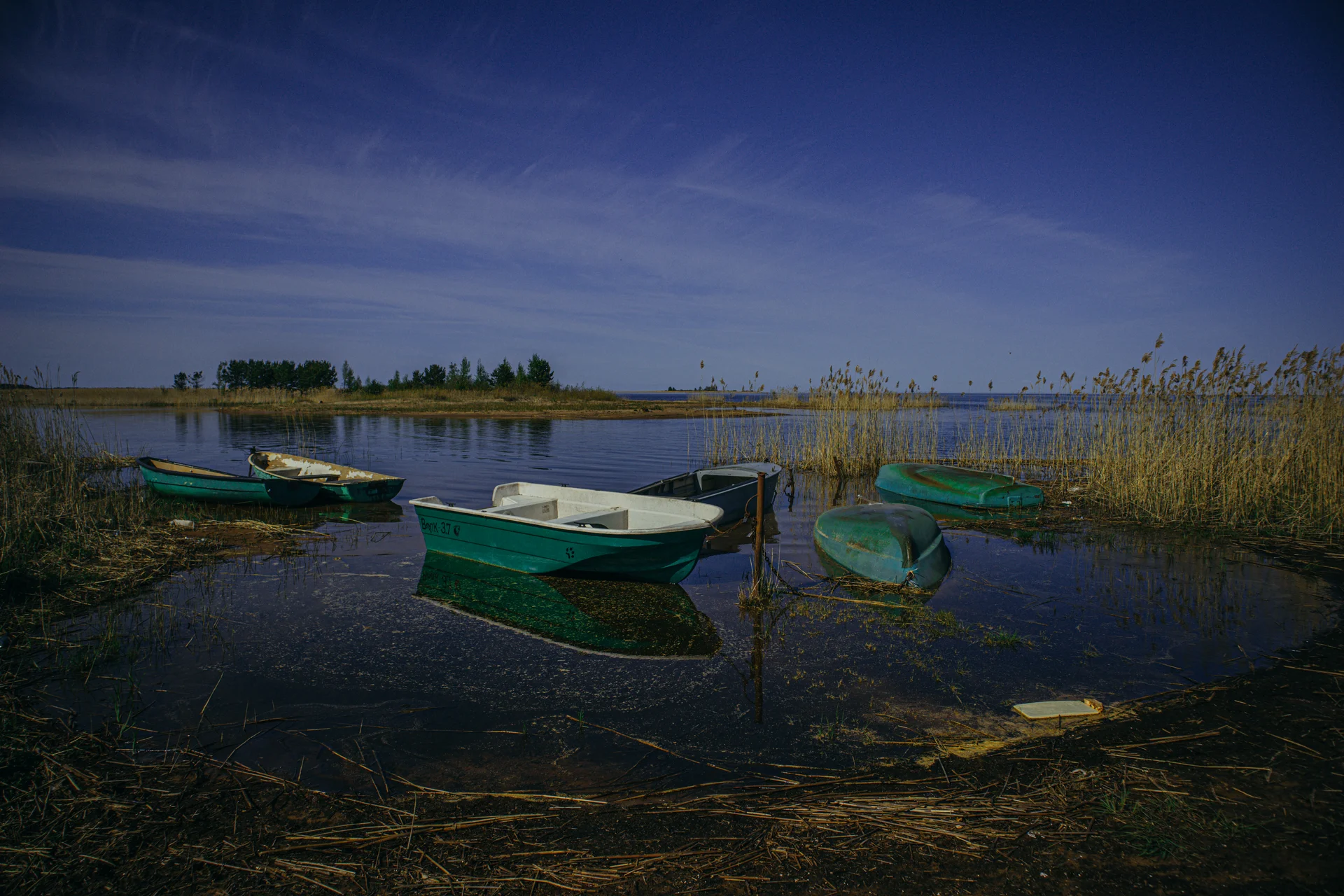
Если поехали с ночёвкой, то у самого мола - полно народу. Но если обойти забор (при въезде) по тропинке справа, попадаем на безлюдные стоянки (так как нет подъезда на машине)
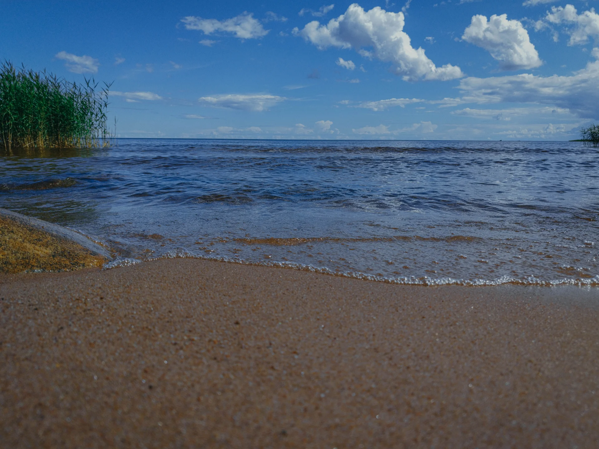
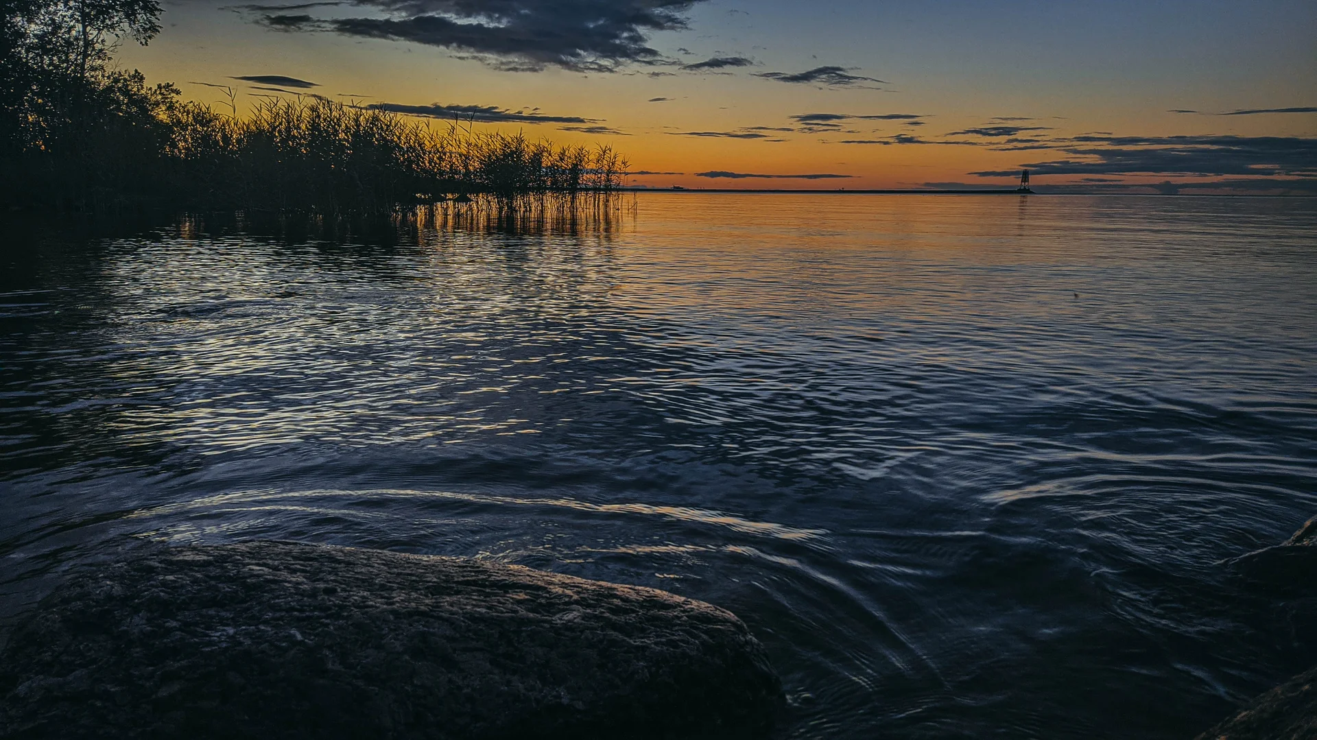
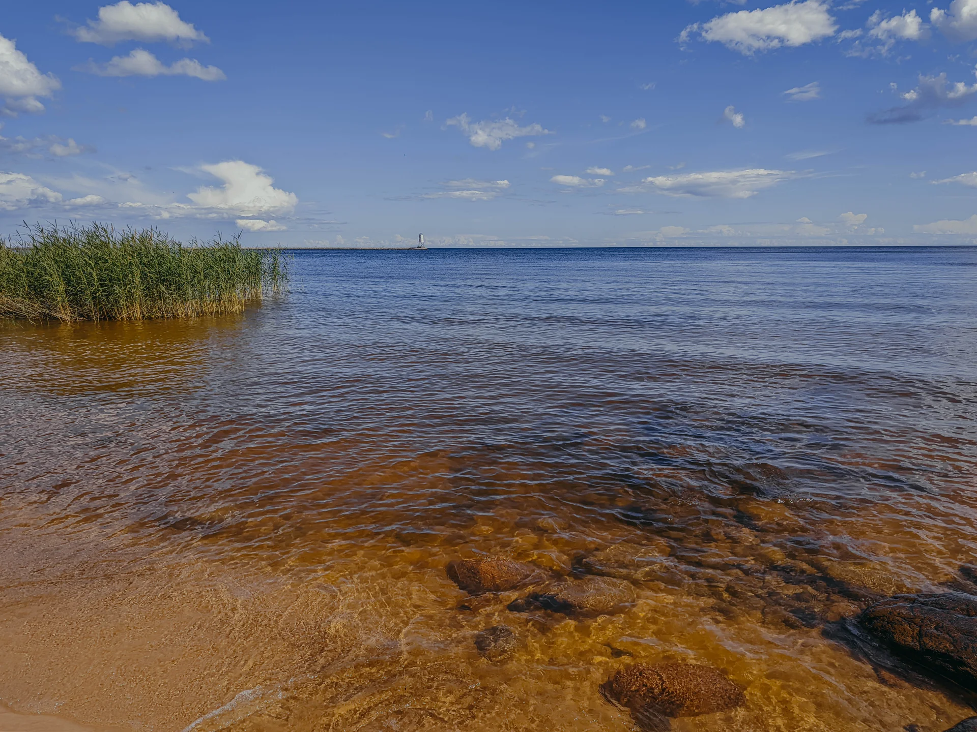
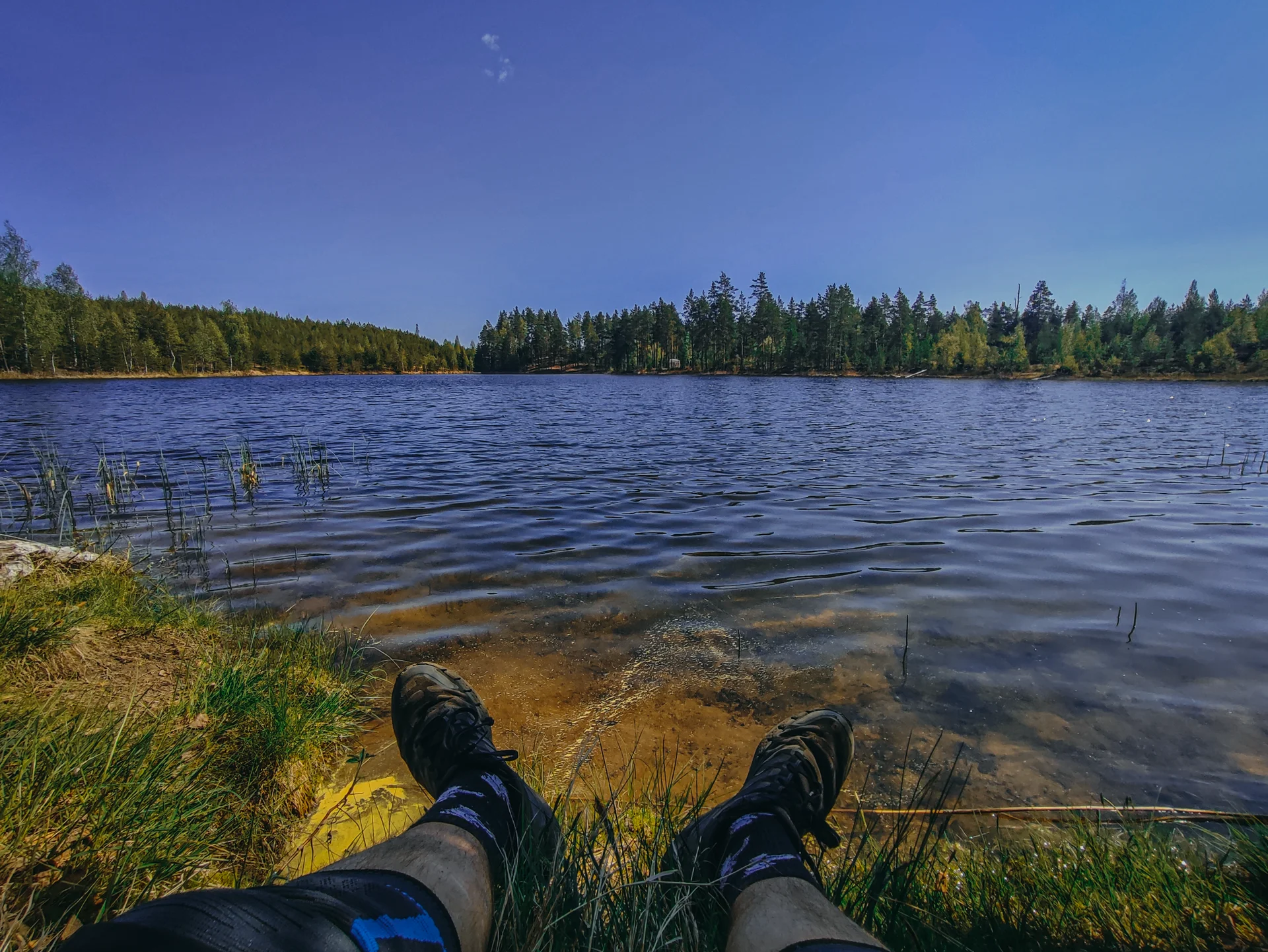
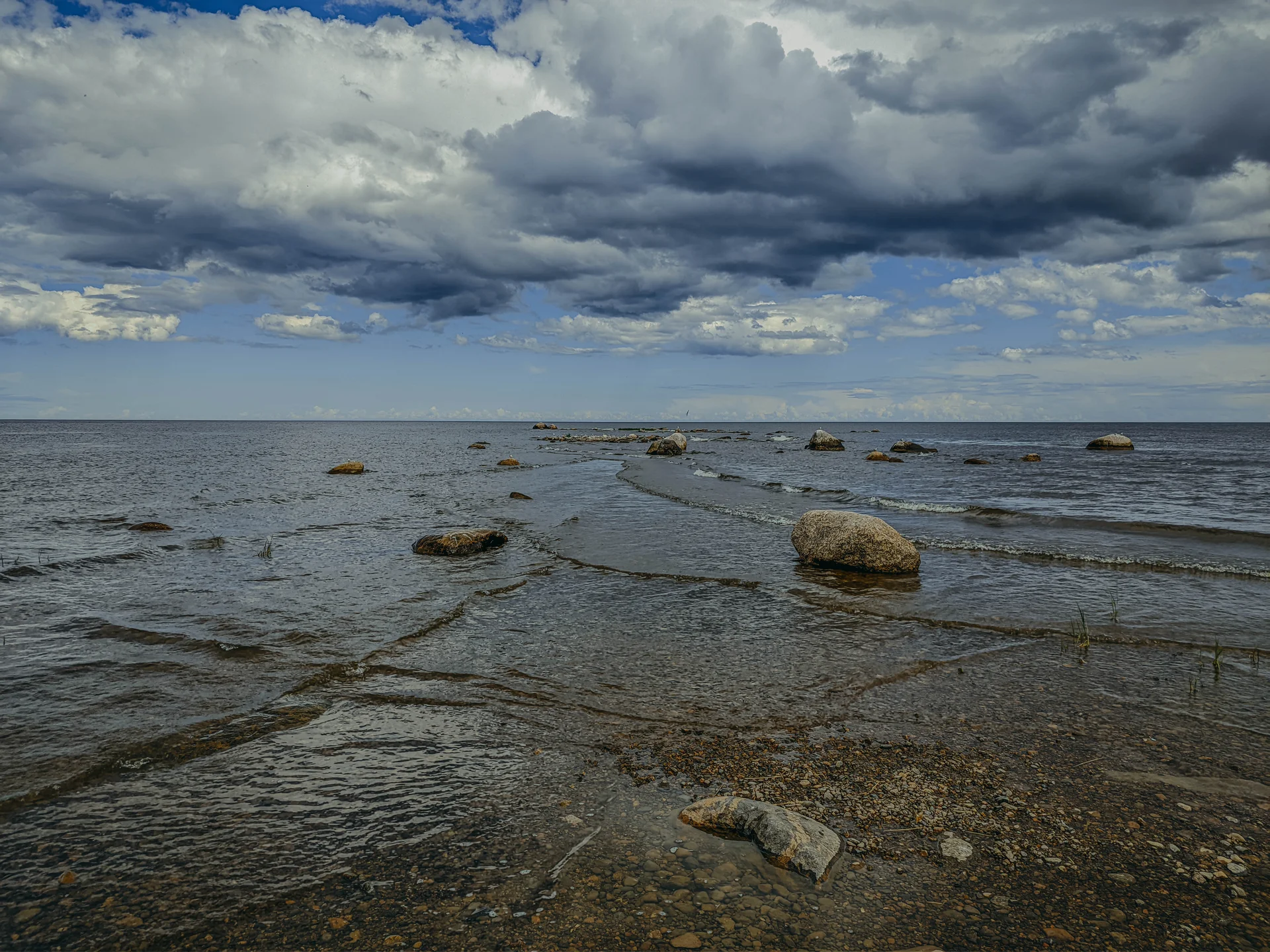
Неподалеку есть также пляжная зона. Песок, красота, но всегда полно народу. Но уютный уголок всегда найти можно.
Выезжаем в посёлок. Есть магазины и неплохая шавуха (была по крайней мере).
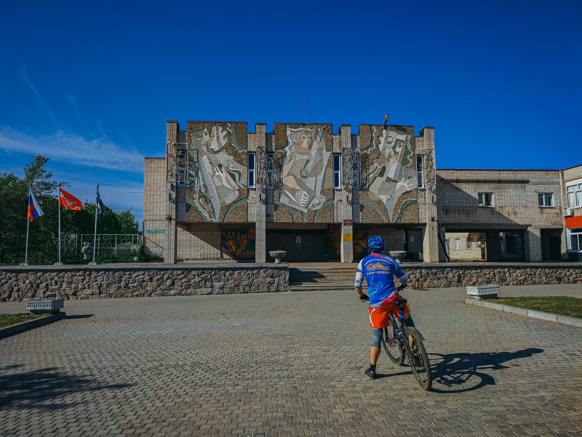
Далее можно втопить по асфальту до Сосново (если устали) или же закончить маршрут грунтами до Никитино. Сложных участок не будет, маркирован. Проходит, частично, по одном из самых первых официальных веломаршрутов ЛО.
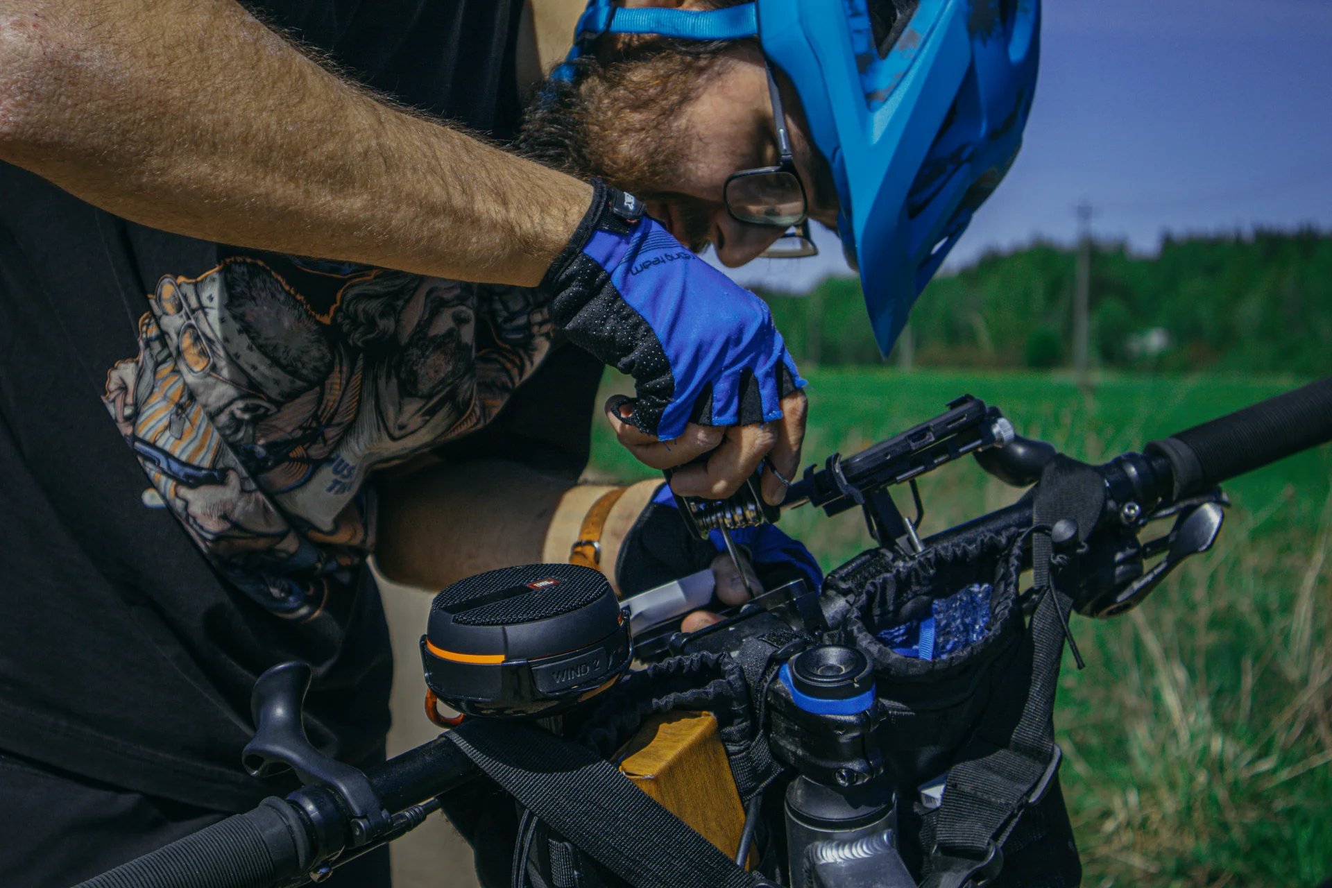
Особо не фоткал, так как устал)) Перед жд Никитино есть несколько магазинов.
{"type": "FeatureCollection", "features": [{"type": "Feature", "properties": {"color": "#4CAF50", "lineStyle": "solid", "segmentId": 2, "isActive": true, "isOffgrid": false, "isFallback": false, "isManual": false, "isImported": false, "isSelected": false, "source": "graphhopper", "buildStatus": "ready", "reused": true, "routeFeatureId": "chunk_0", "pointIds": "[\"pt_1775724474286\",\"pt_1775724475546\"]", "warnings": "[]", "surfaceId": "200", "dominantSurface": "200"}, "geometry": {"type": "LineString", "coordinates": [[30.261041, 60.464594, 0], [30.261217, 60.464331, 0], [30.261647, 60.463818, 0], [30.261776, 60.46384, 0], [30.262018, 60.463683, 0], [30.262187, 60.463555, 0], [30.262331, 60.463523, 0]]}}, {"type": "Feature", "properties": {"color": "#4CAF50", "lineStyle": "solid", "segmentId": 2, "isActive": true, "isOffgrid": false, "isFallback": false, "isManual": false, "isImported": false, "isSelected": false, "source": "graphhopper", "buildStatus": "ready", "reused": true, "routeFeatureId": "chunk_0", "pointIds": "[\"pt_1775724474286\",\"pt_1775724475546\"]", "warnings": "[]", "surfaceId": "12", "dominantSurface": "12"}, "geometry": {"type": "LineString", "coordinates": [[30.262331, 60.463523, 0], [30.262673, 60.463146, 0], [30.262786, 60.462986, 0], [30.262934, 60.462929, 0], [30.263191, 60.462919, 0]]}}, {"type": "Feature", "properties": {"color": "#4CAF50", "lineStyle": "solid", "segmentId": 2, "isActive": true, "isOffgrid": false, "isFallback": false, "isManual": false, "isImported": false, "isSelected": false, "source": "graphhopper", "buildStatus": "ready", "reused": true, "routeFeatureId": "chunk_0", "pointIds": "[\"pt_1775724474286\",\"pt_1775724475546\"]", "warnings": "[]", "surfaceId": "10", "dominantSurface": "10"}, "geometry": {"type": "LineString", "coordinates": [[30.263191, 60.462919, 0], [30.263339, 60.462931, 0], [30.263542, 60.463014, 0], [30.264067, 60.463057, 0], [30.265596, 60.463052, 0], [30.266994, 60.463006, 0], [30.268602, 60.463034, 0], [30.269428, 60.463012, 0], [30.269813, 60.463187, 0], [30.269969, 60.463221, 0]]}}, {"type": "Feature", "properties": {"color": "#4CAF50", "lineStyle": "solid", "segmentId": 2, "isActive": true, "isOffgrid": false, "isFallback": false, "isManual": false, "isImported": false, "isSelected": false, "source": "graphhopper", "buildStatus": "ready", "reused": true, "routeFeatureId": "chunk_1", "pointIds": "[\"pt_1775724475546\",\"pt_1775724477623\"]", "warnings": "[]", "surfaceId": "10", "dominantSurface": "10"}, "geometry": {"type": "LineString", "coordinates": [[30.269969, 60.463221, 0], [30.270124, 60.463254, 0], [30.27031, 60.463262, 0], [30.270563, 60.463252, 0], [30.2708, 60.463216, 0], [30.271026, 60.463157, 0], [30.272894, 60.462484, 0], [30.273209, 60.462386, 0], [30.274245, 60.462134, 0], [30.274486, 60.46206, 0], [30.274772, 60.461954, 0], [30.275405, 60.461753, 0], [30.275727, 60.461668, 0], [30.275958, 60.461625, 0], [30.276249, 60.461584, 0]]}}, {"type": "Feature", "properties": {"color": "#4CAF50", "lineStyle": "solid", "segmentId": 2, "isActive": true, "isOffgrid": false, "isFallback": false, "isManual": false, "isImported": false, "isSelected": false, "source": "graphhopper", "buildStatus": "ready", "reused": true, "routeFeatureId": "chunk_2", "pointIds": "[\"pt_1775724477623\",\"pt_1780057343355\"]", "warnings": "[]", "surfaceId": "10", "dominantSurface": "10"}, "geometry": {"type": "LineString", "coordinates": [[30.276249, 60.461584, 0], [30.277341, 60.461432, 0], [30.277645, 60.461374, 0], [30.278249, 60.461215, 0], [30.278605, 60.461141, 0], [30.279036, 60.461082, 0], [30.280456, 60.460919, 0], [30.280715, 60.460916, 0], [30.280994, 60.460943, 0], [30.28178, 60.461049, 0], [30.282206, 60.46108, 0]]}}, {"type": "Feature", "properties": {"color": "#4CAF50", "lineStyle": "solid", "segmentId": 2, "isActive": true, "isOffgrid": false, "isFallback": false, "isManual": false, "isImported": false, "isSelected": false, "source": "graphhopper", "buildStatus": "ready", "reused": true, "routeFeatureId": "chunk_3", "pointIds": "[\"pt_1780057343355\",\"pt_1775724481058\"]", "warnings": "[]", "surfaceId": "10", "dominantSurface": "10"}, "geometry": {"type": "LineString", "coordinates": [[30.282206, 60.46108, 0], [30.282744, 60.461118, 0], [30.283876, 60.461287, 0], [30.284068, 60.461271, 0], [30.284309, 60.461235, 0], [30.284393, 60.461203, 0]]}}, {"type": "Feature", "properties": {"color": "#4CAF50", "lineStyle": "solid", "segmentId": 2, "isActive": true, "isOffgrid": false, "isFallback": false, "isManual": false, "isImported": false, "isSelected": false, "source": "graphhopper", "buildStatus": "ready", "reused": true, "routeFeatureId": "chunk_3", "pointIds": "[\"pt_1780057343355\",\"pt_1775724481058\"]", "warnings": "[]", "surfaceId": "8", "dominantSurface": "8"}, "geometry": {"type": "LineString", "coordinates": [[30.284393, 60.461203, 0], [30.287274, 60.460134, 0], [30.287905, 60.459871, 0], [30.28862, 60.459555, 0], [30.288832, 60.459439, 0], [30.288927, 60.45937, 0]]}}, {"type": "Feature", "properties": {"color": "#4CAF50", "lineStyle": "solid", "segmentId": 2, "isActive": true, "isOffgrid": false, "isFallback": false, "isManual": false, "isImported": false, "isSelected": false, "source": "graphhopper", "buildStatus": "ready", "reused": true, "routeFeatureId": "chunk_4", "pointIds": "[\"pt_1775724481058\",\"pt_1780057368484\"]", "warnings": "[]", "surfaceId": "8", "dominantSurface": "8"}, "geometry": {"type": "LineString", "coordinates": [[30.288927, 60.45937, 0], [30.28945, 60.459054, 0]]}}, {"type": "Feature", "properties": {"color": "#4CAF50", "lineStyle": "solid", "segmentId": 2, "isActive": true, "isOffgrid": false, "isFallback": false, "isManual": false, "isImported": false, "isSelected": false, "source": "graphhopper", "buildStatus": "ready", "reused": true, "routeFeatureId": "chunk_4", "pointIds": "[\"pt_1775724481058\",\"pt_1780057368484\"]", "warnings": "[]", "surfaceId": "200", "dominantSurface": "200"}, "geometry": {"type": "LineString", "coordinates": [[30.28945, 60.459054, 0], [30.289478, 60.459036, 0]]}}, {"type": "Feature", "properties": {"color": "#4CAF50", "lineStyle": "solid", "segmentId": 2, "isActive": true, "isOffgrid": false, "isFallback": false, "isManual": false, "isImported": false, "isSelected": false, "source": "graphhopper", "buildStatus": "ready", "reused": true, "routeFeatureId": "chunk_4", "pointIds": "[\"pt_1775724481058\",\"pt_1780057368484\"]", "warnings": "[]", "surfaceId": "3", "dominantSurface": "3"}, "geometry": {"type": "LineString", "coordinates": [[30.289478, 60.459036, 0], [30.289754, 60.458894, 0], [30.290214, 60.458714, 0], [30.290616, 60.458601, 0], [30.290882, 60.458542, 0]]}}, {"type": "Feature", "properties": {"color": "#4CAF50", "lineStyle": "solid", "segmentId": 2, "isActive": true, "isOffgrid": false, "isFallback": false, "isManual": false, "isImported": false, "isSelected": false, "source": "graphhopper", "buildStatus": "ready", "reused": true, "routeFeatureId": "chunk_5", "pointIds": "[\"pt_1780057368484\",\"pt_1780057357316\"]", "warnings": "[]", "surfaceId": "3", "dominantSurface": "3"}, "geometry": {"type": "LineString", "coordinates": [[30.290882, 60.458542, 0], [30.291533, 60.45842, 0], [30.292122, 60.458332, 0], [30.292388, 60.45831, 0], [30.292575, 60.458313, 0], [30.292823, 60.458327, 0], [30.293021, 60.458371, 0], [30.293088, 60.458394, 0]]}}, {"type": "Feature", "properties": {"color": "#4CAF50", "lineStyle": "solid", "segmentId": 2, "isActive": true, "isOffgrid": false, "isFallback": false, "isManual": false, "isImported": false, "isSelected": false, "source": "graphhopper", "buildStatus": "ready", "reused": true, "routeFeatureId": "chunk_6", "pointIds": "[\"pt_1780057357316\",\"pt_1775724483534\"]", "warnings": "[]", "surfaceId": "3", "dominantSurface": "3"}, "geometry": {"type": "LineString", "coordinates": [[30.293088, 60.458394, 0], [30.293549, 60.458549, 0], [30.294611, 60.458885, 0], [30.295243, 60.459068, 0], [30.295658, 60.459156, 0], [30.296025, 60.459206, 0], [30.296324, 60.459273, 0], [30.296497, 60.459321, 0]]}}, {"type": "Feature", "properties": {"color": "#4CAF50", "lineStyle": "solid", "segmentId": 2, "isActive": true, "isOffgrid": false, "isFallback": false, "isManual": false, "isImported": false, "isSelected": false, "source": "graphhopper", "buildStatus": "ready", "reused": true, "routeFeatureId": "chunk_6", "pointIds": "[\"pt_1780057357316\",\"pt_1775724483534\"]", "warnings": "[]", "surfaceId": "10", "dominantSurface": "10"}, "geometry": {"type": "LineString", "coordinates": [[30.296497, 60.459321, 0], [30.296629, 60.459366, 0], [30.296742, 60.459422, 0], [30.296913, 60.459521, 0], [30.297187, 60.459707, 0], [30.297915, 60.460137, 0], [30.298515, 60.460499, 0], [30.299118, 60.4606, 0], [30.301315, 60.460673, 0], [30.303696, 60.460689, 0], [30.305473, 60.46068, 0], [30.306339, 60.460698, 0], [30.307258, 60.460744, 0], [30.307772, 60.460796, 0], [30.308788, 60.460909, 0], [30.309353, 60.46098, 0], [30.310004, 60.461089, 0], [30.310287, 60.461101, 0], [30.310534, 60.461097, 0], [30.310801, 60.461072, 0], [30.311368, 60.460968, 0], [30.312017, 60.460992, 0], [30.313327, 60.460891, 0], [30.314114, 60.460873, 0], [30.314406, 60.460875, 0], [30.31516, 60.460949, 0], [30.315761, 60.460969, 0]]}}, {"type": "Feature", "properties": {"color": "#4CAF50", "lineStyle": "solid", "segmentId": 2, "isActive": true, "isOffgrid": false, "isFallback": false, "isManual": false, "isImported": false, "isSelected": false, "source": "graphhopper", "buildStatus": "ready", "reused": true, "routeFeatureId": "chunk_6", "pointIds": "[\"pt_1780057357316\",\"pt_1775724483534\"]", "warnings": "[]", "surfaceId": "11", "dominantSurface": "11"}, "geometry": {"type": "LineString", "coordinates": [[30.315761, 60.460969, 0], [30.316114, 60.46099, 0], [30.31656, 60.461047, 0]]}}, {"type": "Feature", "properties": {"color": "#4CAF50", "lineStyle": "solid", "segmentId": 2, "isActive": true, "isOffgrid": false, "isFallback": false, "isManual": false, "isImported": false, "isSelected": false, "source": "graphhopper", "buildStatus": "ready", "reused": true, "routeFeatureId": "chunk_6", "pointIds": "[\"pt_1780057357316\",\"pt_1775724483534\"]", "warnings": "[]", "surfaceId": "12", "dominantSurface": "12"}, "geometry": {"type": "LineString", "coordinates": [[30.31656, 60.461047, 0], [30.316753, 60.461072, 0]]}}, {"type": "Feature", "properties": {"color": "#4CAF50", "lineStyle": "solid", "segmentId": 2, "isActive": true, "isOffgrid": false, "isFallback": false, "isManual": false, "isImported": false, "isSelected": false, "source": "graphhopper", "buildStatus": "ready", "reused": true, "routeFeatureId": "chunk_7", "pointIds": "[\"pt_1775724483534\",\"pt_1775724484757\"]", "warnings": "[]", "surfaceId": "12", "dominantSurface": "12"}, "geometry": {"type": "LineString", "coordinates": [[30.316753, 60.461072, 0], [30.316902, 60.461091, 0], [30.317132, 60.461017, 0], [30.317217, 60.46087, 0], [30.31744, 60.460735, 0], [30.317875, 60.46065, 0], [30.318067, 60.460622, 0], [30.318243, 60.46056, 0], [30.318268, 60.460449, 0], [30.318119, 60.460247, 0], [30.318106, 60.460046, 0], [30.318138, 60.459836, 0], [30.318239, 60.459791, 0], [30.318586, 60.459676, 0], [30.318737, 60.459597, 0], [30.318785, 60.459434, 0], [30.318798, 60.459256, 0], [30.319079, 60.45902, 0], [30.319401, 60.458915, 0], [30.320356, 60.458798, 0], [30.321107, 60.458634, 0], [30.321791, 60.458424, 0], [30.322705, 60.458248, 0], [30.324444, 60.457825, 0], [30.325805, 60.457172, 0], [30.326334, 60.457283, 0], [30.326892, 60.457498, 0]]}}, {"type": "Feature", "properties": {"color": "#4CAF50", "lineStyle": "solid", "segmentId": 2, "isActive": true, "isOffgrid": false, "isFallback": false, "isManual": false, "isImported": false, "isSelected": false, "source": "graphhopper", "buildStatus": "ready", "reused": true, "routeFeatureId": "chunk_8", "pointIds": "[\"pt_1775724484757\",\"pt_1775724486105\"]", "warnings": "[]", "surfaceId": "12", "dominantSurface": "12"}, "geometry": {"type": "LineString", "coordinates": [[30.326892, 60.457498, 0], [30.327019, 60.457547, 0], [30.328637, 60.458482, 0], [30.32965, 60.458869, 0], [30.330449, 60.458976, 0], [30.330606, 60.458997, 0], [30.331343, 60.458974, 0], [30.331407, 60.458972, 0], [30.331944, 60.45905, 0], [30.333397, 60.459329, 0], [30.334158, 60.459495, 0], [30.33467, 60.459491, 0], [30.33528, 60.459255, 0], [30.336256, 60.459043, 0], [30.336608, 60.45883, 0], [30.336865, 60.458674, 0], [30.337957, 60.458356, 0], [30.338337, 60.458326, 0]]}}, {"type": "Feature", "properties": {"color": "#4CAF50", "lineStyle": "solid", "segmentId": 2, "isActive": true, "isOffgrid": false, "isFallback": false, "isManual": false, "isImported": false, "isSelected": false, "source": "graphhopper", "buildStatus": "ready", "reused": true, "routeFeatureId": "chunk_9", "pointIds": "[\"pt_1775724486105\",\"pt_1775724487651\"]", "warnings": "[]", "surfaceId": "12", "dominantSurface": "12"}, "geometry": {"type": "LineString", "coordinates": [[30.338337, 60.458326, 0], [30.33938, 60.458243, 0], [30.340287, 60.458156, 0], [30.341017, 60.45817, 0], [30.342476, 60.458403, 0], [30.343087, 60.458524, 0], [30.34443, 60.45891, 0], [30.345243, 60.459209, 0], [30.347052, 60.459442, 0], [30.348327, 60.459904, 0], [30.34883, 60.460058, 0], [30.34933, 60.460228, 0], [30.349998, 60.460326, 0], [30.350578, 60.460311, 0], [30.350974, 60.460292, 0], [30.350976, 60.46022, 0]]}}, {"type": "Feature", "properties": {"color": "#4CAF50", "lineStyle": "solid", "segmentId": 2, "isActive": true, "isOffgrid": false, "isFallback": false, "isManual": false, "isImported": false, "isSelected": false, "source": "graphhopper", "buildStatus": "ready", "reused": true, "routeFeatureId": "chunk_10", "pointIds": "[\"pt_1775724487651\",\"pt_1775724488731\"]", "warnings": "[]", "surfaceId": "12", "dominantSurface": "12"}, "geometry": {"type": "LineString", "coordinates": [[30.350976, 60.46022, 0], [30.351029, 60.45869, 0], [30.351058, 60.458255, 0], [30.351168, 60.454839, 0]]}}, {"type": "Feature", "properties": {"color": "#4CAF50", "lineStyle": "solid", "segmentId": 2, "isActive": true, "isOffgrid": false, "isFallback": false, "isManual": false, "isImported": false, "isSelected": false, "source": "graphhopper", "buildStatus": "ready", "reused": true, "routeFeatureId": "chunk_11", "pointIds": "[\"pt_1775724488731\",\"pt_1780057425769\"]", "warnings": "[]", "surfaceId": "12", "dominantSurface": "12"}, "geometry": {"type": "LineString", "coordinates": [[30.351168, 60.454839, 0], [30.351183, 60.454378, 0], [30.351247, 60.453825, 0], [30.351407, 60.453676, 0], [30.351619, 60.453655, 0], [30.352038, 60.453743, 0], [30.352241, 60.453799, 0], [30.352419, 60.453869, 0], [30.35266, 60.453917, 0], [30.352998, 60.453999, 0], [30.353208, 60.454036, 0], [30.353766, 60.454083, 0], [30.354039, 60.454094, 0], [30.354232, 60.454062, 0], [30.355659, 60.453713, 0], [30.355777, 60.453672, 0]]}}, {"type": "Feature", "properties": {"color": "#4CAF50", "lineStyle": "solid", "segmentId": 2, "isActive": true, "isOffgrid": false, "isFallback": false, "isManual": false, "isImported": false, "isSelected": false, "source": "graphhopper", "buildStatus": "ready", "reused": true, "routeFeatureId": "chunk_12", "pointIds": "[\"pt_1780057425769\",\"pt_1775724490712\"]", "warnings": "[]", "surfaceId": "12", "dominantSurface": "12"}, "geometry": {"type": "LineString", "coordinates": [[30.355777, 60.453672, 0], [30.356078, 60.453567, 0], [30.356485, 60.453314, 0], [30.35677, 60.45312, 0], [30.357172, 60.452959, 0], [30.357859, 60.452647, 0], [30.358239, 60.45256, 0], [30.358374, 60.45256, 0], [30.358813, 60.45261, 0], [30.359253, 60.4527, 0], [30.359404, 60.452753, 0], [30.359804, 60.452951, 0], [30.360091, 60.453262, 0], [30.360276, 60.453561, 0], [30.360353, 60.453763, 0], [30.360517, 60.454435, 0], [30.3606, 60.454606, 0], [30.360723, 60.454663, 0]]}}, {"type": "Feature", "properties": {"color": "#4CAF50", "lineStyle": "solid", "segmentId": 2, "isActive": true, "isOffgrid": false, "isFallback": false, "isManual": false, "isImported": false, "isSelected": false, "source": "graphhopper", "buildStatus": "ready", "reused": true, "routeFeatureId": "chunk_13", "pointIds": "[\"pt_1775724490712\",\"pt_1775724492293\"]", "warnings": "[]", "surfaceId": "12", "dominantSurface": "12"}, "geometry": {"type": "LineString", "coordinates": [[30.360723, 60.454663, 0], [30.360768, 60.454684, 0], [30.360998, 60.454908, 0], [30.360676, 60.455004, 0], [30.359828, 60.455157, 0], [30.358969, 60.455302, 0], [30.357796, 60.455292, 0], [30.356866, 60.455402, 0], [30.356228, 60.455362, 0], [30.355837, 60.455267, 0]]}}, {"type": "Feature", "properties": {"color": "#4CAF50", "lineStyle": "solid", "segmentId": 2, "isActive": true, "isOffgrid": false, "isFallback": false, "isManual": false, "isImported": false, "isSelected": false, "source": "graphhopper", "buildStatus": "ready", "reused": true, "routeFeatureId": "chunk_14", "pointIds": "[\"pt_1775724492293\",\"pt_1775724493561\"]", "warnings": "[]", "surfaceId": "12", "dominantSurface": "12"}, "geometry": {"type": "LineString", "coordinates": [[30.355837, 60.455267, 0], [30.355735, 60.455242, 0], [30.355368, 60.455071, 0], [30.354257, 60.456078, 0], [30.353729, 60.456753, 0], [30.353172, 60.457185, 0], [30.352441, 60.457415, 0], [30.351513, 60.457984, 0], [30.351405, 60.458591, 0], [30.351613, 60.459187, 0], [30.352231, 60.459659, 0], [30.352839, 60.459891, 0]]}}, {"type": "Feature", "properties": {"color": "#4CAF50", "lineStyle": "solid", "segmentId": 2, "isActive": true, "isOffgrid": false, "isFallback": false, "isManual": false, "isImported": false, "isSelected": false, "source": "graphhopper", "buildStatus": "ready", "reused": true, "routeFeatureId": "chunk_15", "pointIds": "[\"pt_1775724493561\",\"pt_1775724494738\"]", "warnings": "[]", "surfaceId": "12", "dominantSurface": "12"}, "geometry": {"type": "LineString", "coordinates": [[30.352839, 60.459891, 0], [30.354689, 60.460607, 0], [30.35591, 60.460827, 0], [30.357149, 60.460893, 0], [30.358217, 60.460831, 0], [30.358859, 60.46093, 0], [30.359647, 60.461163, 0], [30.360686, 60.461546, 0], [30.361472, 60.461926, 0], [30.362205, 60.462241, 0], [30.362781, 60.462535, 0], [30.363272, 60.462848, 0]]}}, {"type": "Feature", "properties": {"color": "#4CAF50", "lineStyle": "solid", "segmentId": 2, "isActive": true, "isOffgrid": false, "isFallback": false, "isManual": false, "isImported": false, "isSelected": false, "source": "graphhopper", "buildStatus": "ready", "reused": true, "routeFeatureId": "chunk_16", "pointIds": "[\"pt_1775724494738\",\"pt_1775724497071\"]", "warnings": "[]", "surfaceId": "12", "dominantSurface": "12"}, "geometry": {"type": "LineString", "coordinates": [[30.363272, 60.462848, 0], [30.363946, 60.463201, 0], [30.364469, 60.463455, 0], [30.365402, 60.463788, 0], [30.366385, 60.464091, 0], [30.367139, 60.464282, 0], [30.367745, 60.464527, 0], [30.368312, 60.464805, 0], [30.368847, 60.464953, 0], [30.369324, 60.465061, 0], [30.369864, 60.465206, 0], [30.370309, 60.465486, 0], [30.370733, 60.465971, 0], [30.371131, 60.466392, 0], [30.371622, 60.466701, 0], [30.372133, 60.466979, 0], [30.37264, 60.467155, 0], [30.373206, 60.467375, 0], [30.374364, 60.467962, 0], [30.374546, 60.468154, 0], [30.374652, 60.468425, 0], [30.374825, 60.468637, 0], [30.375509, 60.469011, 0], [30.375996, 60.469321, 0], [30.376293, 60.469578, 0], [30.376343, 60.469832, 0], [30.376204, 60.470131, 0], [30.376035, 60.470913, 0], [30.37607, 60.471385, 0], [30.376214, 60.471613, 0], [30.376386, 60.472199, 0], [30.37669, 60.472445, 0], [30.377336, 60.472783, 0], [30.378, 60.473109, 0], [30.378694, 60.473317, 0], [30.379189, 60.473563, 0], [30.379867, 60.47394, 0], [30.380158, 60.474152, 0], [30.380281, 60.474125, 0]]}}, {"type": "Feature", "properties": {"color": "#4CAF50", "lineStyle": "solid", "segmentId": 2, "isActive": true, "isOffgrid": false, "isFallback": false, "isManual": false, "isImported": false, "isSelected": false, "source": "graphhopper", "buildStatus": "ready", "reused": true, "routeFeatureId": "chunk_17", "pointIds": "[\"pt_1775724497071\",\"pt_1775724498053\"]", "warnings": "[]", "surfaceId": "12", "dominantSurface": "12"}, "geometry": {"type": "LineString", "coordinates": [[30.380281, 60.474125, 0], [30.382486, 60.473625, 0], [30.383195, 60.473513, 0], [30.383989, 60.473195, 0], [30.384337, 60.472889, 0], [30.385225, 60.472209, 0], [30.385512, 60.47152, 0], [30.385727, 60.470367, 0], [30.386134, 60.468379, 0], [30.386435, 60.467723, 0], [30.386728, 60.467278, 0], [30.387035, 60.467046, 0], [30.387765, 60.466687, 0], [30.388393, 60.466598, 0]]}}, {"type": "Feature", "properties": {"color": "#4CAF50", "lineStyle": "solid", "segmentId": 2, "isActive": true, "isOffgrid": false, "isFallback": false, "isManual": false, "isImported": false, "isSelected": false, "source": "graphhopper", "buildStatus": "ready", "reused": true, "routeFeatureId": "chunk_18", "pointIds": "[\"pt_1775724498053\",\"pt_1775724499164\"]", "warnings": "[]", "surfaceId": "12", "dominantSurface": "12"}, "geometry": {"type": "LineString", "coordinates": [[30.388393, 60.466598, 0], [30.388516, 60.466581, 0], [30.389632, 60.466634, 0], [30.39049, 60.46657, 0], [30.394803, 60.465872, 0], [30.395833, 60.465862, 0], [30.396507, 60.465892, 0]]}}, {"type": "Feature", "properties": {"color": "#4CAF50", "lineStyle": "solid", "segmentId": 2, "isActive": true, "isOffgrid": false, "isFallback": false, "isManual": false, "isImported": false, "isSelected": false, "source": "graphhopper", "buildStatus": "ready", "reused": true, "routeFeatureId": "chunk_18", "pointIds": "[\"pt_1775724498053\",\"pt_1775724499164\"]", "warnings": "[]", "surfaceId": "10", "dominantSurface": "10"}, "geometry": {"type": "LineString", "coordinates": [[30.396507, 60.465892, 0], [30.397003, 60.466425, 0], [30.399056, 60.467624, 0], [30.399536, 60.467985, 0], [30.400098, 60.468562, 0], [30.401624, 60.470235, 0], [30.402018, 60.470648, 0], [30.402329, 60.47111, 0]]}}, {"type": "Feature", "properties": {"color": "#4CAF50", "lineStyle": "solid", "segmentId": 2, "isActive": true, "isOffgrid": false, "isFallback": false, "isManual": false, "isImported": false, "isSelected": false, "source": "graphhopper", "buildStatus": "ready", "reused": true, "routeFeatureId": "chunk_18", "pointIds": "[\"pt_1775724498053\",\"pt_1775724499164\"]", "warnings": "[]", "surfaceId": "14", "dominantSurface": "14"}, "geometry": {"type": "LineString", "coordinates": [[30.402329, 60.47111, 0], [30.402951, 60.471506, 0], [30.404567, 60.47307, 0], [30.404691, 60.473146, 0]]}}, {"type": "Feature", "properties": {"color": "#4CAF50", "lineStyle": "solid", "segmentId": 2, "isActive": true, "isOffgrid": false, "isFallback": false, "isManual": false, "isImported": false, "isSelected": false, "source": "graphhopper", "buildStatus": "ready", "reused": true, "routeFeatureId": "chunk_19", "pointIds": "[\"pt_1775724499164\",\"pt_1775724507909\"]", "warnings": "[]", "surfaceId": "14", "dominantSurface": "14"}, "geometry": {"type": "LineString", "coordinates": [[30.404691, 60.473146, 0], [30.405105, 60.473401, 0], [30.406217, 60.473684, 0], [30.406453, 60.473788, 0], [30.406829, 60.473955, 0], [30.407515, 60.474179, 0], [30.40905, 60.474576, 0], [30.410358, 60.474842, 0], [30.411222, 60.47487, 0], [30.411769, 60.474814, 0], [30.412585, 60.474575, 0], [30.414837, 60.474406, 0], [30.415397, 60.474384, 0], [30.415985, 60.474295, 0], [30.417044, 60.474322, 0], [30.417866, 60.474227, 0], [30.419838, 60.473872, 0], [30.420972, 60.473842, 0], [30.421258, 60.473819, 0], [30.42155, 60.473783, 0], [30.421794, 60.473822, 0], [30.421902, 60.473858, 0], [30.422273, 60.474094, 0], [30.422378, 60.474152, 0], [30.423073, 60.474356, 0], [30.423256, 60.474445, 0], [30.423403, 60.474492, 0], [30.423869, 60.474608, 0], [30.424223, 60.474736, 0], [30.424433, 60.47488, 0], [30.424721, 60.474947, 0], [30.424784, 60.474948, 0]]}}, {"type": "Feature", "properties": {"color": "#4CAF50", "lineStyle": "solid", "segmentId": 2, "isActive": true, "isOffgrid": false, "isFallback": false, "isManual": false, "isImported": false, "isSelected": false, "source": "graphhopper", "buildStatus": "ready", "reused": true, "routeFeatureId": "chunk_20", "pointIds": "[\"pt_1775724507909\",\"pt_1780057444608\"]", "warnings": "[]", "surfaceId": "14", "dominantSurface": "14"}, "geometry": {"type": "LineString", "coordinates": [[30.424784, 60.474948, 0], [30.4249, 60.474949, 0], [30.42554, 60.474898, 0], [30.425865, 60.474975, 0], [30.426009, 60.475117, 0], [30.425735, 60.475354, 0], [30.42554, 60.475566, 0], [30.425501, 60.475688, 0], [30.425579, 60.475836, 0], [30.425823, 60.475968, 0], [30.426037, 60.476395, 0], [30.425648, 60.476713, 0], [30.425362, 60.476842, 0], [30.425363, 60.476965, 0]]}}, {"type": "Feature", "properties": {"color": "#4CAF50", "lineStyle": "solid", "segmentId": 2, "isActive": true, "isOffgrid": false, "isFallback": false, "isManual": false, "isImported": false, "isSelected": false, "source": "graphhopper", "buildStatus": "ready", "reused": true, "routeFeatureId": "chunk_21", "pointIds": "[\"pt_1780057444608\",\"pt_1775724508779\"]", "warnings": "[]", "surfaceId": "14", "dominantSurface": "14"}, "geometry": {"type": "LineString", "coordinates": [[30.425363, 60.476965, 0], [30.425444, 60.47706, 0], [30.425551, 60.477141, 0], [30.425797, 60.477186, 0], [30.426021, 60.477203, 0], [30.426194, 60.477255, 0], [30.426269, 60.477324, 0], [30.42625, 60.477666, 0], [30.426165, 60.478017, 0], [30.426218, 60.478088, 0], [30.426597, 60.478308, 0], [30.426631, 60.478369, 0], [30.426584, 60.478575, 0], [30.426586, 60.478659, 0], [30.426645, 60.478698, 0], [30.426833, 60.478906, 0], [30.426933, 60.479051, 0], [30.426933, 60.479091, 0]]}}, {"type": "Feature", "properties": {"color": "#4CAF50", "lineStyle": "solid", "segmentId": 2, "isActive": true, "isOffgrid": false, "isFallback": false, "isManual": false, "isImported": false, "isSelected": false, "source": "graphhopper", "buildStatus": "ready", "reused": true, "routeFeatureId": "chunk_22", "pointIds": "[\"pt_1775724508779\",\"pt_1775724510879\"]", "warnings": "[]", "surfaceId": "14", "dominantSurface": "14"}, "geometry": {"type": "LineString", "coordinates": [[30.426933, 60.479091, 0], [30.426933, 60.479169, 0], [30.426861, 60.479318, 0], [30.426722, 60.479432, 0], [30.426511, 60.47981, 0], [30.426522, 60.479894, 0], [30.426321, 60.479959, 0], [30.426111, 60.479995, 0], [30.425823, 60.480012, 0], [30.425699, 60.479989, 0], [30.425402, 60.479912, 0], [30.425133, 60.479888, 0], [30.424845, 60.479907, 0], [30.42459, 60.479954, 0], [30.424139, 60.480151, 0], [30.423733, 60.48023, 0], [30.423649, 60.48024, 0]]}}, {"type": "Feature", "properties": {"color": "#4CAF50", "lineStyle": "solid", "segmentId": 2, "isActive": true, "isOffgrid": false, "isFallback": false, "isManual": false, "isImported": false, "isSelected": false, "source": "graphhopper", "buildStatus": "ready", "reused": true, "routeFeatureId": "chunk_22", "pointIds": "[\"pt_1775724508779\",\"pt_1775724510879\"]", "warnings": "[]", "surfaceId": "12", "dominantSurface": "12"}, "geometry": {"type": "LineString", "coordinates": [[30.423649, 60.48024, 0], [30.423629, 60.480341, 0], [30.422992, 60.481062, 0], [30.422665, 60.481174, 0], [30.422385, 60.481369, 0], [30.421861, 60.481496, 0], [30.421626, 60.481604, 0], [30.421619, 60.481802, 0], [30.421393, 60.481949, 0]]}}, {"type": "Feature", "properties": {"color": "#4CAF50", "lineStyle": "solid", "segmentId": 2, "isActive": true, "isOffgrid": false, "isFallback": false, "isManual": false, "isImported": false, "isSelected": false, "source": "graphhopper", "buildStatus": "ready", "reused": true, "routeFeatureId": "chunk_22", "pointIds": "[\"pt_1775724508779\",\"pt_1775724510879\"]", "warnings": "[]", "surfaceId": "14", "dominantSurface": "14"}, "geometry": {"type": "LineString", "coordinates": [[30.421393, 60.481949, 0], [30.421685, 60.482087, 0], [30.42213, 60.482539, 0], [30.422297, 60.48292, 0], [30.422411, 60.483011, 0]]}}, {"type": "Feature", "properties": {"color": "#4CAF50", "lineStyle": "solid", "segmentId": 2, "isActive": true, "isOffgrid": false, "isFallback": false, "isManual": false, "isImported": false, "isSelected": false, "source": "graphhopper", "buildStatus": "ready", "reused": true, "routeFeatureId": "chunk_23", "pointIds": "[\"pt_1775724510879\",\"pt_1775724511846\"]", "warnings": "[]", "surfaceId": "14", "dominantSurface": "14"}, "geometry": {"type": "LineString", "coordinates": [[30.422411, 60.483011, 0], [30.422525, 60.483101, 0], [30.422761, 60.48322, 0], [30.422904, 60.483406, 0], [30.42298, 60.483615, 0], [30.423207, 60.483877, 0], [30.423481, 60.484004, 0], [30.423738, 60.484258, 0], [30.424087, 60.484662, 0], [30.424362, 60.485079, 0]]}}, {"type": "Feature", "properties": {"color": "#4CAF50", "lineStyle": "solid", "segmentId": 2, "isActive": true, "isOffgrid": false, "isFallback": false, "isManual": false, "isImported": false, "isSelected": false, "source": "graphhopper", "buildStatus": "ready", "reused": true, "routeFeatureId": "chunk_23", "pointIds": "[\"pt_1775724510879\",\"pt_1775724511846\"]", "warnings": "[]", "surfaceId": "12", "dominantSurface": "12"}, "geometry": {"type": "LineString", "coordinates": [[30.424362, 60.485079, 0], [30.42486, 60.485386, 0], [30.425136, 60.485534, 0], [30.425346, 60.485674, 0], [30.425449, 60.485759, 0]]}}, {"type": "Feature", "properties": {"color": "#4CAF50", "lineStyle": "solid", "segmentId": 2, "isActive": true, "isOffgrid": false, "isFallback": false, "isManual": false, "isImported": false, "isSelected": false, "source": "graphhopper", "buildStatus": "ready", "reused": true, "routeFeatureId": "chunk_24", "pointIds": "[\"pt_1775724511846\",\"pt_1775724513354\"]", "warnings": "[]", "surfaceId": "12", "dominantSurface": "12"}, "geometry": {"type": "LineString", "coordinates": [[30.425449, 60.485759, 0], [30.425496, 60.485798, 0], [30.425889, 60.486046, 0], [30.426073, 60.486246, 0], [30.426165, 60.486446, 0], [30.426321, 60.486937, 0], [30.426331, 60.487074, 0], [30.426272, 60.48728, 0], [30.426276, 60.487648, 0], [30.426296, 60.487782, 0], [30.426284, 60.487906, 0], [30.4262, 60.488083, 0], [30.4262, 60.488326, 0], [30.426152, 60.488461, 0], [30.426116, 60.488668, 0], [30.425937, 60.48881, 0], [30.425745, 60.488922, 0], [30.425625, 60.489052, 0], [30.425601, 60.489152, 0], [30.425505, 60.4893, 0], [30.425493, 60.489412, 0], [30.425439, 60.489484, 0], [30.425689, 60.489893, 0], [30.427258, 60.491256, 0], [30.428164, 60.491836, 0], [30.429554, 60.492396, 0], [30.430443, 60.493005, 0], [30.431576, 60.493661, 0], [30.431632, 60.493716, 0]]}}, {"type": "Feature", "properties": {"color": "#4CAF50", "lineStyle": "solid", "segmentId": 2, "isActive": true, "isOffgrid": false, "isFallback": false, "isManual": false, "isImported": false, "isSelected": false, "source": "graphhopper", "buildStatus": "ready", "reused": true, "routeFeatureId": "chunk_25", "pointIds": "[\"pt_1775724513354\",\"pt_1775724515027\"]", "warnings": "[]", "surfaceId": "12", "dominantSurface": "12"}, "geometry": {"type": "LineString", "coordinates": [[30.431632, 60.493716, 0], [30.432375, 60.494449, 0], [30.433361, 60.49525, 0], [30.433744, 60.495432, 0]]}}, {"type": "Feature", "properties": {"color": "#4CAF50", "lineStyle": "solid", "segmentId": 2, "isActive": true, "isOffgrid": false, "isFallback": false, "isManual": false, "isImported": false, "isSelected": false, "source": "graphhopper", "buildStatus": "ready", "reused": true, "routeFeatureId": "chunk_25", "pointIds": "[\"pt_1775724513354\",\"pt_1775724515027\"]", "warnings": "[]", "surfaceId": "14", "dominantSurface": "14"}, "geometry": {"type": "LineString", "coordinates": [[30.433744, 60.495432, 0], [30.434041, 60.495518, 0], [30.434395, 60.495739, 0], [30.434725, 60.495917, 0], [30.435259, 60.496136, 0], [30.435549, 60.496242, 0], [30.435854, 60.496334, 0], [30.436035, 60.496372, 0], [30.436276, 60.496513, 0], [30.437004, 60.496786, 0], [30.438941, 60.497106, 0]]}}, {"type": "Feature", "properties": {"color": "#4CAF50", "lineStyle": "solid", "segmentId": 2, "isActive": true, "isOffgrid": false, "isFallback": false, "isManual": false, "isImported": false, "isSelected": false, "source": "graphhopper", "buildStatus": "ready", "reused": true, "routeFeatureId": "chunk_25", "pointIds": "[\"pt_1775724513354\",\"pt_1775724515027\"]", "warnings": "[]", "surfaceId": "12", "dominantSurface": "12"}, "geometry": {"type": "LineString", "coordinates": [[30.438941, 60.497106, 0], [30.439111, 60.497056, 0], [30.43983, 60.496741, 0]]}}, {"type": "Feature", "properties": {"color": "#4CAF50", "lineStyle": "solid", "segmentId": 2, "isActive": true, "isOffgrid": false, "isFallback": false, "isManual": false, "isImported": false, "isSelected": false, "source": "graphhopper", "buildStatus": "ready", "reused": true, "routeFeatureId": "chunk_25", "pointIds": "[\"pt_1775724513354\",\"pt_1775724515027\"]", "warnings": "[]", "surfaceId": "12", "dominantSurface": "12"}, "geometry": {"type": "LineString", "coordinates": [[30.43983, 60.496741, 0], [30.440063, 60.496626, 0]]}}, {"type": "Feature", "properties": {"color": "#4CAF50", "lineStyle": "solid", "segmentId": 2, "isActive": true, "isOffgrid": false, "isFallback": false, "isManual": false, "isImported": false, "isSelected": false, "source": "graphhopper", "buildStatus": "ready", "reused": true, "routeFeatureId": "chunk_25", "pointIds": "[\"pt_1775724513354\",\"pt_1775724515027\"]", "warnings": "[]", "surfaceId": "11", "dominantSurface": "11"}, "geometry": {"type": "LineString", "coordinates": [[30.440063, 60.496626, 0], [30.440165, 60.496523, 0], [30.440216, 60.496276, 0], [30.440161, 60.496017, 0], [30.440197, 60.495849, 0], [30.440323, 60.49557, 0], [30.440556, 60.495336, 0]]}}, {"type": "Feature", "properties": {"color": "#4CAF50", "lineStyle": "solid", "segmentId": 2, "isActive": true, "isOffgrid": false, "isFallback": false, "isManual": false, "isImported": false, "isSelected": false, "source": "graphhopper", "buildStatus": "ready", "reused": true, "routeFeatureId": "chunk_25", "pointIds": "[\"pt_1775724513354\",\"pt_1775724515027\"]", "warnings": "[]", "surfaceId": "11", "dominantSurface": "11"}, "geometry": {"type": "LineString", "coordinates": [[30.440556, 60.495336, 0], [30.442237, 60.494663, 0], [30.443357, 60.494524, 0], [30.444247, 60.494582, 0], [30.444407, 60.494605, 0]]}}, {"type": "Feature", "properties": {"color": "#4CAF50", "lineStyle": "solid", "segmentId": 2, "isActive": true, "isOffgrid": false, "isFallback": false, "isManual": false, "isImported": false, "isSelected": false, "source": "graphhopper", "buildStatus": "ready", "reused": true, "routeFeatureId": "chunk_26", "pointIds": "[\"pt_1775724515027\",\"pt_1775724516564\"]", "warnings": "[]", "surfaceId": "11", "dominantSurface": "11"}, "geometry": {"type": "LineString", "coordinates": [[30.444407, 60.494605, 0], [30.444503, 60.494619, 0], [30.445177, 60.494859, 0]]}}, {"type": "Feature", "properties": {"color": "#4CAF50", "lineStyle": "solid", "segmentId": 2, "isActive": true, "isOffgrid": false, "isFallback": false, "isManual": false, "isImported": false, "isSelected": false, "source": "graphhopper", "buildStatus": "ready", "reused": true, "routeFeatureId": "chunk_26", "pointIds": "[\"pt_1775724515027\",\"pt_1775724516564\"]", "warnings": "[]", "surfaceId": "10", "dominantSurface": "10"}, "geometry": {"type": "LineString", "coordinates": [[30.445177, 60.494859, 0], [30.445338, 60.495028, 0], [30.445572, 60.495208, 0], [30.446515, 60.495627, 0], [30.44738, 60.496243, 0], [30.44791, 60.496652, 0], [30.44975, 60.497384, 0], [30.450327, 60.497654, 0], [30.452911, 60.498911, 0], [30.453329, 60.499046, 0], [30.453696, 60.499148, 0], [30.455856, 60.499586, 0], [30.457105, 60.499758, 0]]}}, {"type": "Feature", "properties": {"color": "#4CAF50", "lineStyle": "solid", "segmentId": 2, "isActive": true, "isOffgrid": false, "isFallback": false, "isManual": false, "isImported": false, "isSelected": false, "source": "graphhopper", "buildStatus": "ready", "reused": true, "routeFeatureId": "chunk_27", "pointIds": "[\"pt_1775724516564\",\"pt_1775724518536\"]", "warnings": "[]", "surfaceId": "10", "dominantSurface": "10"}, "geometry": {"type": "LineString", "coordinates": [[30.457105, 60.499758, 0], [30.458338, 60.499911, 0], [30.458555, 60.499909, 0], [30.46048, 60.499817, 0], [30.46218, 60.499634, 0], [30.464105, 60.499537, 0], [30.465136, 60.499527, 0], [30.466579, 60.499691, 0], [30.466876, 60.499705, 0], [30.468871, 60.499305, 0], [30.470353, 60.498764, 0], [30.470683, 60.498723, 0], [30.471931, 60.498785, 0], [30.47274, 60.498756, 0], [30.473976, 60.498628, 0], [30.475061, 60.498801, 0], [30.476158, 60.498916, 0], [30.476952, 60.499081, 0], [30.478891, 60.49935, 0], [30.479735, 60.49934, 0], [30.482061, 60.499443, 0], [30.483259, 60.49936, 0], [30.484678, 60.499405, 0], [30.485738, 60.499519, 0], [30.487317, 60.49986, 0], [30.4877, 60.499982, 0], [30.488878, 60.50018, 0], [30.489884, 60.500189, 0], [30.49077, 60.500261, 0], [30.492493, 60.500209, 0], [30.492887, 60.500268, 0]]}}, {"type": "Feature", "properties": {"color": "#4CAF50", "lineStyle": "solid", "segmentId": 2, "isActive": true, "isOffgrid": false, "isFallback": false, "isManual": false, "isImported": false, "isSelected": false, "source": "graphhopper", "buildStatus": "ready", "reused": true, "routeFeatureId": "chunk_28", "pointIds": "[\"pt_1775724518536\",\"pt_1775724539701\"]", "warnings": "[]", "surfaceId": "10", "dominantSurface": "10"}, "geometry": {"type": "LineString", "coordinates": [[30.492887, 60.500268, 0], [30.493503, 60.500361, 0]]}}, {"type": "Feature", "properties": {"color": "#4CAF50", "lineStyle": "solid", "segmentId": 2, "isActive": true, "isOffgrid": false, "isFallback": false, "isManual": false, "isImported": false, "isSelected": false, "source": "graphhopper", "buildStatus": "ready", "reused": true, "routeFeatureId": "chunk_28", "pointIds": "[\"pt_1775724518536\",\"pt_1775724539701\"]", "warnings": "[]", "surfaceId": "8", "dominantSurface": "8"}, "geometry": {"type": "LineString", "coordinates": [[30.493503, 60.500361, 0], [30.494965, 60.49928, 0], [30.495861, 60.498651, 0], [30.49613, 60.49841, 0], [30.496256, 60.498199, 0], [30.496291, 60.497979, 0], [30.496241, 60.497767, 0], [30.49615, 60.497544, 0], [30.495952, 60.497146, 0], [30.495707, 60.496713, 0], [30.495535, 60.496506, 0], [30.493794, 60.49489, 0], [30.493422, 60.494517, 0], [30.491999, 60.492767, 0], [30.491889, 60.492548, 0], [30.491829, 60.492381, 0], [30.491816, 60.492184, 0], [30.492133, 60.490307, 0], [30.492223, 60.490112, 0], [30.492398, 60.489938, 0], [30.492609, 60.489807, 0], [30.492813, 60.4897, 0], [30.493062, 60.489613, 0], [30.493405, 60.489536, 0], [30.493858, 60.489479, 0], [30.494592, 60.489432, 0], [30.494946, 60.489389, 0], [30.495248, 60.489318, 0], [30.495504, 60.489232, 0], [30.495743, 60.489128, 0], [30.495925, 60.489009, 0], [30.496351, 60.488565, 0], [30.496522, 60.488437, 0], [30.496685, 60.488333, 0], [30.498163, 60.487644, 0], [30.498657, 60.487379, 0], [30.498945, 60.487194, 0], [30.49915, 60.487011, 0], [30.499336, 60.486818, 0], [30.499501, 60.486616, 0], [30.499677, 60.486336, 0], [30.500112, 60.485519, 0], [30.500176, 60.48531, 0], [30.500188, 60.484324, 0], [30.500141, 60.484166, 0], [30.500063, 60.483994, 0], [30.49948, 60.483514, 0], [30.499298, 60.483315, 0], [30.499212, 60.483171, 0], [30.4992, 60.48307, 0], [30.499222, 60.483, 0], [30.499342, 60.482826, 0], [30.499494, 60.48268, 0], [30.4996, 60.482604, 0], [30.499781, 60.482534, 0], [30.500068, 60.482456, 0], [30.500429, 60.482381, 0], [30.500779, 60.482332, 0], [30.502429, 60.482058, 0], [30.504279, 60.481696, 0]]}}, {"type": "Feature", "properties": {"color": "#4CAF50", "lineStyle": "solid", "segmentId": 2, "isActive": true, "isOffgrid": false, "isFallback": false, "isManual": false, "isImported": false, "isSelected": false, "source": "graphhopper", "buildStatus": "ready", "reused": true, "routeFeatureId": "chunk_28", "pointIds": "[\"pt_1775724518536\",\"pt_1775724539701\"]", "warnings": "[]", "surfaceId": "10", "dominantSurface": "10"}, "geometry": {"type": "LineString", "coordinates": [[30.504279, 60.481696, 0], [30.504228, 60.481859, 0], [30.504045, 60.482163, 0], [30.50393, 60.482271, 0], [30.503956, 60.482329, 0], [30.504075, 60.482374, 0]]}}, {"type": "Feature", "properties": {"color": "#4CAF50", "lineStyle": "solid", "segmentId": 2, "isActive": true, "isOffgrid": false, "isFallback": false, "isManual": false, "isImported": false, "isSelected": false, "source": "graphhopper", "buildStatus": "ready", "reused": true, "routeFeatureId": "chunk_28", "pointIds": "[\"pt_1775724518536\",\"pt_1775724539701\"]", "warnings": "[]", "surfaceId": "12", "dominantSurface": "12"}, "geometry": {"type": "LineString", "coordinates": [[30.504075, 60.482374, 0], [30.504369, 60.482498, 0]]}}, {"type": "Feature", "properties": {"color": "#4CAF50", "lineStyle": "solid", "segmentId": 2, "isActive": true, "isOffgrid": false, "isFallback": false, "isManual": false, "isImported": false, "isSelected": false, "source": "graphhopper", "buildStatus": "ready", "reused": true, "routeFeatureId": "chunk_28", "pointIds": "[\"pt_1775724518536\",\"pt_1775724539701\"]", "warnings": "[]", "surfaceId": "12", "dominantSurface": "12"}, "geometry": {"type": "LineString", "coordinates": [[30.504369, 60.482498, 0], [30.504696, 60.482619, 0], [30.505282, 60.482534, 0], [30.505732, 60.48246, 0], [30.506543, 60.482404, 0], [30.506809, 60.482335, 0], [30.507769, 60.481935, 0]]}}, {"type": "Feature", "properties": {"color": "#4CAF50", "lineStyle": "solid", "segmentId": 2, "isActive": true, "isOffgrid": false, "isFallback": false, "isManual": false, "isImported": false, "isSelected": false, "source": "graphhopper", "buildStatus": "ready", "reused": true, "routeFeatureId": "chunk_29", "pointIds": "[\"pt_1775724539701\",\"pt_1775724541097\"]", "warnings": "[]", "surfaceId": "12", "dominantSurface": "12"}, "geometry": {"type": "LineString", "coordinates": [[30.507769, 60.481935, 0], [30.508051, 60.481815, 0], [30.509451, 60.481388, 0], [30.509999, 60.481075, 0], [30.510218, 60.480993, 0], [30.511039, 60.481968, 0], [30.511332, 60.482203, 0], [30.511532, 60.482309, 0], [30.511675, 60.482401, 0], [30.511871, 60.482434, 0], [30.512916, 60.482705, 0], [30.513549, 60.482899, 0], [30.513926, 60.483, 0], [30.514913, 60.483161, 0], [30.515645, 60.48336, 0], [30.515972, 60.48348, 0], [30.516744, 60.483693, 0], [30.517361, 60.483761, 0], [30.517896, 60.483787, 0], [30.519527, 60.483816, 0], [30.520085, 60.483927, 0], [30.521784, 60.484658, 0], [30.522061, 60.484808, 0], [30.522444, 60.48506, 0]]}}, {"type": "Feature", "properties": {"color": "#4CAF50", "lineStyle": "solid", "segmentId": 2, "isActive": true, "isOffgrid": false, "isFallback": false, "isManual": false, "isImported": false, "isSelected": false, "source": "graphhopper", "buildStatus": "ready", "reused": true, "routeFeatureId": "chunk_30", "pointIds": "[\"pt_1775724541097\",\"pt_1775724546571\"]", "warnings": "[]", "surfaceId": "12", "dominantSurface": "12"}, "geometry": {"type": "LineString", "coordinates": [[30.522444, 60.48506, 0], [30.52325, 60.485627, 0], [30.52369, 60.485965, 0], [30.52501, 60.487165, 0], [30.525053, 60.487535, 0], [30.524999, 60.488058, 0], [30.525031, 60.488349, 0], [30.52501, 60.48856, 0], [30.525149, 60.488882, 0], [30.525353, 60.489242, 0], [30.526083, 60.489975, 0], [30.52648, 60.490357, 0], [30.527284, 60.491187, 0], [30.527631, 60.492065, 0], [30.528452, 60.492986, 0], [30.529076, 60.49403, 0], [30.529923, 60.495546, 0], [30.530299, 60.495979, 0], [30.530889, 60.496386, 0], [30.531941, 60.497517, 0], [30.53259, 60.497989, 0], [30.532906, 60.498479, 0], [30.533335, 60.499673, 0], [30.533422, 60.500057, 0], [30.533605, 60.500542, 0], [30.534086, 60.500803, 0], [30.534805, 60.500993, 0], [30.535363, 60.501247, 0], [30.536071, 60.501923, 0], [30.536243, 60.502039, 0], [30.536854, 60.502256, 0], [30.537155, 60.502568, 0], [30.537916, 60.503899, 0], [30.538228, 60.504205, 0], [30.53856, 60.504432, 0], [30.5387, 60.504638, 0], [30.538786, 60.505066, 0], [30.538957, 60.505388, 0], [30.539451, 60.50598, 0], [30.541196, 60.507643, 0], [30.54165, 60.508029, 0], [30.542176, 60.508383, 0], [30.542455, 60.508653, 0], [30.542874, 60.509026, 0], [30.544251, 60.510518, 0]]}}, {"type": "Feature", "properties": {"color": "#4CAF50", "lineStyle": "solid", "segmentId": 2, "isActive": true, "isOffgrid": false, "isFallback": false, "isManual": false, "isImported": false, "isSelected": false, "source": "graphhopper", "buildStatus": "ready", "reused": true, "routeFeatureId": "chunk_31", "pointIds": "[\"pt_1775724546571\",\"pt_1775724548318\"]", "warnings": "[]", "surfaceId": "12", "dominantSurface": "12"}, "geometry": {"type": "LineString", "coordinates": [[30.544251, 60.510518, 0], [30.54448, 60.510766, 0], [30.546104, 60.512678, 0], [30.546382, 60.512881, 0], [30.546685, 60.513002, 0], [30.547724, 60.513149, 0], [30.549301, 60.513262, 0], [30.549762, 60.513365, 0], [30.550182, 60.513558, 0], [30.550813, 60.5142, 0], [30.551883, 60.515017, 0], [30.552391, 60.515607, 0], [30.552716, 60.515802, 0], [30.553635, 60.515924, 0], [30.555256, 60.516086, 0], [30.561746, 60.516853, 0], [30.564952, 60.517876, 0], [30.565358, 60.518053, 0], [30.566408, 60.51859, 0], [30.567532, 60.519242, 0], [30.568213, 60.519724, 0], [30.568323, 60.519852, 0], [30.568393, 60.519982, 0], [30.568377, 60.520184, 0], [30.568261, 60.520515, 0], [30.567977, 60.521089, 0], [30.567025, 60.522352, 0], [30.566966, 60.522478, 0], [30.566948, 60.522602, 0], [30.567012, 60.522894, 0], [30.567229, 60.523128, 0], [30.567537, 60.523408, 0], [30.570544, 60.526525, 0], [30.570887, 60.527454, 0], [30.570458, 60.528426, 0], [30.5696, 60.529312, 0], [30.567583, 60.530157, 0]]}}, {"type": "Feature", "properties": {"color": "#4CAF50", "lineStyle": "solid", "segmentId": 2, "isActive": true, "isOffgrid": false, "isFallback": false, "isManual": false, "isImported": false, "isSelected": false, "source": "graphhopper", "buildStatus": "ready", "reused": true, "routeFeatureId": "chunk_31", "pointIds": "[\"pt_1775724546571\",\"pt_1775724548318\"]", "warnings": "[]", "surfaceId": "2", "dominantSurface": "2"}, "geometry": {"type": "LineString", "coordinates": [[30.567583, 60.530157, 0], [30.567325, 60.530474, 0], [30.567411, 60.530748, 0], [30.568406, 60.531674, 0]]}}, {"type": "Feature", "properties": {"color": "#4CAF50", "lineStyle": "solid", "segmentId": 2, "isActive": true, "isOffgrid": false, "isFallback": false, "isManual": false, "isImported": false, "isSelected": false, "source": "graphhopper", "buildStatus": "ready", "reused": true, "routeFeatureId": "chunk_32", "pointIds": "[\"pt_1775724548318\",\"pt_1775724550352\"]", "warnings": "[]", "surfaceId": "2", "dominantSurface": "2"}, "geometry": {"type": "LineString", "coordinates": [[30.568406, 60.531674, 0], [30.57041, 60.53354, 0], [30.573371, 60.535144, 0], [30.573946, 60.535485, 0], [30.574015, 60.537276, 0], [30.57423, 60.537656, 0], [30.578049, 60.539387, 0], [30.58204, 60.541624, 0], [30.58307, 60.542046, 0], [30.587362, 60.542743, 0], [30.588209, 60.542848, 0], [30.588727, 60.542994, 0], [30.589121, 60.543186, 0], [30.589765, 60.543753, 0], [30.589923, 60.543941, 0], [30.590084, 60.544094, 0], [30.590304, 60.54425, 0], [30.590556, 60.544377, 0], [30.591165, 60.544639, 0], [30.591935, 60.544931, 0], [30.592504, 60.545042, 0], [30.593544, 60.545192, 0], [30.594242, 60.545324, 0], [30.594912, 60.545472, 0], [30.598372, 60.546457, 0], [30.598868, 60.546557, 0], [30.600983, 60.547105, 0], [30.605256, 60.548342, 0]]}}, {"type": "Feature", "properties": {"color": "#4CAF50", "lineStyle": "solid", "segmentId": 2, "isActive": true, "isOffgrid": false, "isFallback": false, "isManual": false, "isImported": false, "isSelected": false, "source": "graphhopper", "buildStatus": "ready", "reused": true, "routeFeatureId": "chunk_32", "pointIds": "[\"pt_1775724548318\",\"pt_1775724550352\"]", "warnings": "[]", "surfaceId": "8", "dominantSurface": "8"}, "geometry": {"type": "LineString", "coordinates": [[30.605256, 60.548342, 0], [30.60636, 60.548525, 0], [30.606599, 60.548576, 0], [30.606843, 60.548641, 0], [30.608262, 60.549064, 0], [30.608532, 60.549159, 0], [30.608781, 60.549266, 0], [30.611276, 60.550635, 0], [30.61138, 60.550703, 0]]}}, {"type": "Feature", "properties": {"color": "#4CAF50", "lineStyle": "solid", "segmentId": 2, "isActive": true, "isOffgrid": false, "isFallback": false, "isManual": false, "isImported": false, "isSelected": false, "source": "graphhopper", "buildStatus": "ready", "reused": true, "routeFeatureId": "chunk_33", "pointIds": "[\"pt_1775724550352\",\"pt_1775724554077\"]", "warnings": "[]", "surfaceId": "8", "dominantSurface": "8"}, "geometry": {"type": "LineString", "coordinates": [[30.61138, 60.550703, 0], [30.612111, 60.551179, 0], [30.612261, 60.551338, 0], [30.612467, 60.552143, 0], [30.612638, 60.552951, 0]]}}, {"type": "Feature", "properties": {"color": "#4CAF50", "lineStyle": "solid", "segmentId": 2, "isActive": true, "isOffgrid": false, "isFallback": false, "isManual": false, "isImported": false, "isSelected": false, "source": "graphhopper", "buildStatus": "ready", "reused": true, "routeFeatureId": "chunk_33", "pointIds": "[\"pt_1775724550352\",\"pt_1775724554077\"]", "warnings": "[]", "surfaceId": "3", "dominantSurface": "3"}, "geometry": {"type": "LineString", "coordinates": [[30.612638, 60.552951, 0], [30.612655, 60.553089, 0], [30.612634, 60.55324, 0], [30.612523, 60.553434, 0], [30.612497, 60.553535, 0]]}}, {"type": "Feature", "properties": {"color": "#4CAF50", "lineStyle": "solid", "segmentId": 2, "isActive": true, "isOffgrid": false, "isFallback": false, "isManual": false, "isImported": false, "isSelected": false, "source": "graphhopper", "buildStatus": "ready", "reused": true, "routeFeatureId": "chunk_33", "pointIds": "[\"pt_1775724550352\",\"pt_1775724554077\"]", "warnings": "[]", "surfaceId": "8", "dominantSurface": "8"}, "geometry": {"type": "LineString", "coordinates": [[30.612497, 60.553535, 0], [30.61219, 60.553658, 0]]}}, {"type": "Feature", "properties": {"color": "#4CAF50", "lineStyle": "solid", "segmentId": 2, "isActive": true, "isOffgrid": false, "isFallback": false, "isManual": false, "isImported": false, "isSelected": false, "source": "graphhopper", "buildStatus": "ready", "reused": true, "routeFeatureId": "chunk_33", "pointIds": "[\"pt_1775724550352\",\"pt_1775724554077\"]", "warnings": "[]", "surfaceId": "3", "dominantSurface": "3"}, "geometry": {"type": "LineString", "coordinates": [[30.61219, 60.553658, 0], [30.611819, 60.553774, 0], [30.61144, 60.553842, 0], [30.608945, 60.554186, 0], [30.608274, 60.55427, 0], [30.607604, 60.554345, 0], [30.607132, 60.554386, 0], [30.606629, 60.554407, 0]]}}, {"type": "Feature", "properties": {"color": "#4CAF50", "lineStyle": "solid", "segmentId": 2, "isActive": true, "isOffgrid": false, "isFallback": false, "isManual": false, "isImported": false, "isSelected": false, "source": "graphhopper", "buildStatus": "ready", "reused": true, "routeFeatureId": "chunk_33", "pointIds": "[\"pt_1775724550352\",\"pt_1775724554077\"]", "warnings": "[]", "surfaceId": "5", "dominantSurface": "5"}, "geometry": {"type": "LineString", "coordinates": [[30.606629, 60.554407, 0], [30.606713, 60.5546, 0]]}}, {"type": "Feature", "properties": {"color": "#4CAF50", "lineStyle": "solid", "segmentId": 2, "isActive": true, "isOffgrid": false, "isFallback": false, "isManual": false, "isImported": false, "isSelected": false, "source": "graphhopper", "buildStatus": "ready", "reused": true, "routeFeatureId": "chunk_34", "pointIds": "[\"pt_1775724554077\",\"pt_1775724557108\"]", "warnings": "[]", "surfaceId": "5", "dominantSurface": "5"}, "geometry": {"type": "LineString", "coordinates": [[30.606713, 60.5546, 0], [30.606629, 60.554407, 0]]}}, {"type": "Feature", "properties": {"color": "#4CAF50", "lineStyle": "solid", "segmentId": 2, "isActive": true, "isOffgrid": false, "isFallback": false, "isManual": false, "isImported": false, "isSelected": false, "source": "graphhopper", "buildStatus": "ready", "reused": true, "routeFeatureId": "chunk_34", "pointIds": "[\"pt_1775724554077\",\"pt_1775724557108\"]", "warnings": "[]", "surfaceId": "3", "dominantSurface": "3"}, "geometry": {"type": "LineString", "coordinates": [[30.606629, 60.554407, 0], [30.607132, 60.554386, 0], [30.607604, 60.554345, 0], [30.608274, 60.55427, 0], [30.608945, 60.554186, 0], [30.61144, 60.553842, 0], [30.611819, 60.553774, 0], [30.61219, 60.553658, 0]]}}, {"type": "Feature", "properties": {"color": "#4CAF50", "lineStyle": "solid", "segmentId": 2, "isActive": true, "isOffgrid": false, "isFallback": false, "isManual": false, "isImported": false, "isSelected": false, "source": "graphhopper", "buildStatus": "ready", "reused": true, "routeFeatureId": "chunk_34", "pointIds": "[\"pt_1775724554077\",\"pt_1775724557108\"]", "warnings": "[]", "surfaceId": "8", "dominantSurface": "8"}, "geometry": {"type": "LineString", "coordinates": [[30.61219, 60.553658, 0], [30.612732, 60.553433, 0], [30.612943, 60.553364, 0], [30.613177, 60.553316, 0], [30.613377, 60.553296, 0], [30.613647, 60.553293, 0], [30.61391, 60.553326, 0], [30.614381, 60.553462, 0], [30.615612, 60.553842, 0], [30.615677, 60.553853, 0]]}}, {"type": "Feature", "properties": {"color": "#4CAF50", "lineStyle": "solid", "segmentId": 2, "isActive": true, "isOffgrid": false, "isFallback": false, "isManual": false, "isImported": false, "isSelected": false, "source": "graphhopper", "buildStatus": "ready", "reused": true, "routeFeatureId": "chunk_35", "pointIds": "[\"pt_1775724557108\",\"pt_1775724566026\"]", "warnings": "[]", "surfaceId": "8", "dominantSurface": "8"}, "geometry": {"type": "LineString", "coordinates": [[30.615677, 60.553853, 0], [30.615823, 60.55388, 0], [30.616016, 60.55389, 0], [30.616188, 60.553879, 0], [30.617038, 60.553722, 0], [30.617443, 60.553665, 0], [30.618609, 60.553556, 0], [30.618776, 60.553512, 0], [30.618975, 60.553414, 0], [30.61917, 60.553203, 0], [30.619291, 60.553142, 0], [30.619744, 60.552952, 0], [30.620197, 60.552878, 0], [30.621186, 60.552829, 0], [30.621471, 60.552788, 0], [30.621739, 60.55268, 0], [30.62236, 60.552483, 0], [30.622829, 60.552392, 0], [30.623181, 60.552342, 0], [30.623667, 60.552309, 0], [30.625189, 60.552307, 0], [30.626635, 60.552186, 0], [30.629972, 60.552202, 0], [30.630743, 60.552178, 0], [30.631179, 60.552079, 0], [30.632604, 60.551658, 0], [30.633409, 60.551485, 0], [30.634046, 60.55137, 0], [30.634868, 60.551271, 0], [30.635304, 60.551262, 0], [30.636008, 60.551419, 0], [30.636945, 60.551678, 0], [30.637383, 60.551768, 0], [30.637682, 60.55181, 0], [30.638012, 60.551832, 0], [30.63829, 60.551803, 0], [30.638882, 60.551682, 0], [30.639224, 60.551637, 0], [30.639457, 60.55162, 0], [30.63968, 60.551615, 0], [30.64018, 60.551633, 0], [30.640456, 60.551651, 0], [30.642409, 60.551806, 0], [30.643034, 60.551807, 0], [30.643912, 60.551779, 0]]}}, {"type": "Feature", "properties": {"color": "#4CAF50", "lineStyle": "solid", "segmentId": 2, "isActive": true, "isOffgrid": false, "isFallback": false, "isManual": false, "isImported": false, "isSelected": false, "source": "graphhopper", "buildStatus": "ready", "reused": true, "routeFeatureId": "chunk_35", "pointIds": "[\"pt_1775724557108\",\"pt_1775724566026\"]", "warnings": "[]", "surfaceId": "200", "dominantSurface": "200"}, "geometry": {"type": "LineString", "coordinates": [[30.643912, 60.551779, 0], [30.644157, 60.552252, 0], [30.644342, 60.552713, 0], [30.64456, 60.553027, 0], [30.644576, 60.553266, 0], [30.644426, 60.553505, 0], [30.644241, 60.553686, 0], [30.644191, 60.554008, 0], [30.644057, 60.554321, 0], [30.644057, 60.554683, 0], [30.644275, 60.555104, 0], [30.6445, 60.555732, 0], [30.644919, 60.556763, 0], [30.645566, 60.558079, 0], [30.645831, 60.558476, 0], [30.64622, 60.558846, 0], [30.647393, 60.559703, 0], [30.647892, 60.559974, 0], [30.649313, 60.56029, 0], [30.649657, 60.560478, 0], [30.649976, 60.560774, 0], [30.650294, 60.561252, 0], [30.650764, 60.561598, 0], [30.651418, 60.562052, 0], [30.65187, 60.562398, 0], [30.652021, 60.56267, 0], [30.651988, 60.56295, 0], [30.651887, 60.563255, 0], [30.651921, 60.563518, 0], [30.652675, 60.564277, 0], [30.653161, 60.564532, 0], [30.656062, 60.565463, 0], [30.656666, 60.565595, 0], [30.657622, 60.565785, 0], [30.658326, 60.566015, 0], [30.659164, 60.566271, 0], [30.66017, 60.566427, 0], [30.661009, 60.566526, 0], [30.661931, 60.566526, 0], [30.663021, 60.566576, 0], [30.663926, 60.5666, 0], [30.664714, 60.5666, 0], [30.666311, 60.566441, 0], [30.667481, 60.566345, 0], [30.668068, 60.566419, 0], [30.668772, 60.566576, 0], [30.669409, 60.566856, 0], [30.669996, 60.567095, 0], [30.670189, 60.567192, 0]]}}, {"type": "Feature", "properties": {"color": "#4CAF50", "lineStyle": "solid", "segmentId": 2, "isActive": true, "isOffgrid": false, "isFallback": false, "isManual": false, "isImported": false, "isSelected": false, "source": "graphhopper", "buildStatus": "ready", "reused": true, "routeFeatureId": "chunk_35", "pointIds": "[\"pt_1775724557108\",\"pt_1775724566026\"]", "warnings": "[]", "surfaceId": "4", "dominantSurface": "4"}, "geometry": {"type": "LineString", "coordinates": [[30.670189, 60.567192, 0], [30.670257, 60.567398, 0], [30.670047, 60.568527, 0], [30.669856, 60.56913, 0], [30.669646, 60.570832, 0], [30.669632, 60.572004, 0], [30.670726, 60.572461, 0], [30.67196, 60.572955, 0], [30.676364, 60.572948, 0], [30.677439, 60.572968, 0]]}}, {"type": "Feature", "properties": {"color": "#4CAF50", "lineStyle": "solid", "segmentId": 2, "isActive": true, "isOffgrid": false, "isFallback": false, "isManual": false, "isImported": false, "isSelected": false, "source": "graphhopper", "buildStatus": "ready", "reused": true, "routeFeatureId": "chunk_35", "pointIds": "[\"pt_1775724557108\",\"pt_1775724566026\"]", "warnings": "[]", "surfaceId": "12", "dominantSurface": "12"}, "geometry": {"type": "LineString", "coordinates": [[30.677439, 60.572968, 0], [30.677539, 60.573019, 0], [30.677684, 60.573284, 0], [30.677557, 60.573393, 0]]}}, {"type": "Feature", "properties": {"color": "#4CAF50", "lineStyle": "solid", "segmentId": 2, "isActive": true, "isOffgrid": false, "isFallback": false, "isManual": false, "isImported": false, "isSelected": false, "source": "graphhopper", "buildStatus": "ready", "reused": true, "routeFeatureId": "chunk_35", "pointIds": "[\"pt_1775724557108\",\"pt_1775724566026\"]", "warnings": "[]", "surfaceId": "200", "dominantSurface": "200"}, "geometry": {"type": "LineString", "coordinates": [[30.677557, 60.573393, 0], [30.67769, 60.57341, 0]]}}, {"type": "Feature", "properties": {"color": "#4CAF50", "lineStyle": "solid", "segmentId": 2, "isActive": true, "isOffgrid": false, "isFallback": false, "isManual": false, "isImported": false, "isSelected": false, "source": "graphhopper", "buildStatus": "ready", "reused": true, "routeFeatureId": "chunk_36", "pointIds": "[\"pt_1775724566026\",\"pt_1775724572033\"]", "warnings": "[]", "surfaceId": "200", "dominantSurface": "200"}, "geometry": {"type": "LineString", "coordinates": [[30.67769, 60.57341, 0], [30.678527, 60.573516, 0], [30.684761, 60.572472, 0], [30.684948, 60.57235, 0], [30.68567, 60.570987, 0]]}}, {"type": "Feature", "properties": {"color": "#4CAF50", "lineStyle": "solid", "segmentId": 2, "isActive": true, "isOffgrid": false, "isFallback": false, "isManual": false, "isImported": false, "isSelected": false, "source": "graphhopper", "buildStatus": "ready", "reused": true, "routeFeatureId": "chunk_37", "pointIds": "[\"pt_1775724572033\",\"pt_1775724584243\"]", "warnings": "[]", "surfaceId": "200", "dominantSurface": "200"}, "geometry": {"type": "LineString", "coordinates": [[30.68567, 60.570987, 0], [30.684948, 60.57235, 0], [30.684761, 60.572472, 0], [30.678527, 60.573516, 0], [30.677557, 60.573393, 0]]}}, {"type": "Feature", "properties": {"color": "#4CAF50", "lineStyle": "solid", "segmentId": 2, "isActive": true, "isOffgrid": false, "isFallback": false, "isManual": false, "isImported": false, "isSelected": false, "source": "graphhopper", "buildStatus": "ready", "reused": true, "routeFeatureId": "chunk_37", "pointIds": "[\"pt_1775724572033\",\"pt_1775724584243\"]", "warnings": "[]", "surfaceId": "12", "dominantSurface": "12"}, "geometry": {"type": "LineString", "coordinates": [[30.677557, 60.573393, 0], [30.677684, 60.573284, 0], [30.677539, 60.573019, 0], [30.677439, 60.572968, 0]]}}, {"type": "Feature", "properties": {"color": "#4CAF50", "lineStyle": "solid", "segmentId": 2, "isActive": true, "isOffgrid": false, "isFallback": false, "isManual": false, "isImported": false, "isSelected": false, "source": "graphhopper", "buildStatus": "ready", "reused": true, "routeFeatureId": "chunk_37", "pointIds": "[\"pt_1775724572033\",\"pt_1775724584243\"]", "warnings": "[]", "surfaceId": "4", "dominantSurface": "4"}, "geometry": {"type": "LineString", "coordinates": [[30.677439, 60.572968, 0], [30.676364, 60.572948, 0], [30.67196, 60.572955, 0], [30.670726, 60.572461, 0], [30.669632, 60.572004, 0], [30.669646, 60.570832, 0], [30.669856, 60.56913, 0], [30.670047, 60.568527, 0], [30.670257, 60.567398, 0], [30.670189, 60.567192, 0]]}}, {"type": "Feature", "properties": {"color": "#4CAF50", "lineStyle": "solid", "segmentId": 2, "isActive": true, "isOffgrid": false, "isFallback": false, "isManual": false, "isImported": false, "isSelected": false, "source": "graphhopper", "buildStatus": "ready", "reused": true, "routeFeatureId": "chunk_37", "pointIds": "[\"pt_1775724572033\",\"pt_1775724584243\"]", "warnings": "[]", "surfaceId": "200", "dominantSurface": "200"}, "geometry": {"type": "LineString", "coordinates": [[30.670189, 60.567192, 0], [30.669996, 60.567095, 0], [30.669409, 60.566856, 0], [30.668772, 60.566576, 0], [30.668068, 60.566419, 0], [30.667481, 60.566345, 0], [30.666311, 60.566441, 0], [30.664714, 60.5666, 0], [30.663926, 60.5666, 0], [30.663021, 60.566576, 0], [30.661931, 60.566526, 0], [30.661009, 60.566526, 0], [30.66017, 60.566427, 0], [30.659164, 60.566271, 0], [30.658326, 60.566015, 0], [30.657622, 60.565785, 0], [30.656666, 60.565595, 0], [30.656062, 60.565463, 0], [30.653521, 60.564647, 0]]}}, {"type": "Feature", "properties": {"color": "#4CAF50", "lineStyle": "solid", "segmentId": 2, "isActive": true, "isOffgrid": false, "isFallback": false, "isManual": false, "isImported": false, "isSelected": false, "source": "graphhopper", "buildStatus": "ready", "reused": true, "routeFeatureId": "chunk_37", "pointIds": "[\"pt_1775724572033\",\"pt_1775724584243\"]", "warnings": "[]", "surfaceId": "12", "dominantSurface": "12"}, "geometry": {"type": "LineString", "coordinates": [[30.653521, 60.564647, 0], [30.653362, 60.564802, 0], [30.652815, 60.564979, 0], [30.65238, 60.565095, 0], [30.651897, 60.565168, 0], [30.651409, 60.565232, 0], [30.651027, 60.565259, 0], [30.650685, 60.565298, 0], [30.65005, 60.565354, 0], [30.649085, 60.565464, 0], [30.6484, 60.565464, 0], [30.648153, 60.565472, 0], [30.647413, 60.565398, 0], [30.646345, 60.565387, 0], [30.645642, 60.565327, 0], [30.644461, 60.565333, 0], [30.64362, 60.565437, 0], [30.642635, 60.565475, 0], [30.641989, 60.565593, 0], [30.641382, 60.565762, 0], [30.640889, 60.565851, 0], [30.639929, 60.566232, 0], [30.639087, 60.566462, 0], [30.638764, 60.566486, 0], [30.637959, 60.566463, 0], [30.637457, 60.56646, 0], [30.637265, 60.566485, 0], [30.63666, 60.566593, 0], [30.63651, 60.566638, 0], [30.636058, 60.566742, 0], [30.635566, 60.566826, 0], [30.634438, 60.567182, 0], [30.633894, 60.567385, 0], [30.633546, 60.567633, 0], [30.633261, 60.567799, 0], [30.632446, 60.568213, 0], [30.631345, 60.568978, 0], [30.630953, 60.569208, 0], [30.63025, 60.569558, 0], [30.630175, 60.569972, 0], [30.629392, 60.571355, 0], [30.628869, 60.57186, 0], [30.628571, 60.572419, 0], [30.628247, 60.572696, 0], [30.627873, 60.57324, 0]]}}, {"type": "Feature", "properties": {"color": "#4CAF50", "lineStyle": "solid", "segmentId": 2, "isActive": true, "isOffgrid": false, "isFallback": false, "isManual": false, "isImported": false, "isSelected": false, "source": "graphhopper", "buildStatus": "ready", "reused": true, "routeFeatureId": "chunk_37", "pointIds": "[\"pt_1775724572033\",\"pt_1775724584243\"]", "warnings": "[]", "surfaceId": "200", "dominantSurface": "200"}, "geometry": {"type": "LineString", "coordinates": [[30.627873, 60.57324, 0], [30.626885, 60.574667, 0], [30.626048, 60.576112, 0], [30.624214, 60.577185, 0]]}}, {"type": "Feature", "properties": {"color": "#4CAF50", "lineStyle": "solid", "segmentId": 2, "isActive": true, "isOffgrid": false, "isFallback": false, "isManual": false, "isImported": false, "isSelected": false, "source": "graphhopper", "buildStatus": "ready", "reused": true, "routeFeatureId": "chunk_37", "pointIds": "[\"pt_1775724572033\",\"pt_1775724584243\"]", "warnings": "[]", "surfaceId": "11", "dominantSurface": "11"}, "geometry": {"type": "LineString", "coordinates": [[30.624214, 60.577185, 0], [30.623746, 60.577396, 0], [30.623226, 60.577294, 0]]}}, {"type": "Feature", "properties": {"color": "#4CAF50", "lineStyle": "solid", "segmentId": 2, "isActive": true, "isOffgrid": false, "isFallback": false, "isManual": false, "isImported": false, "isSelected": false, "source": "graphhopper", "buildStatus": "ready", "reused": true, "routeFeatureId": "chunk_37", "pointIds": "[\"pt_1775724572033\",\"pt_1775724584243\"]", "warnings": "[]", "surfaceId": "200", "dominantSurface": "200"}, "geometry": {"type": "LineString", "coordinates": [[30.623226, 60.577294, 0], [30.623129, 60.577519, 0], [30.622595, 60.578754, 0], [30.621944, 60.579182, 0], [30.621244, 60.579291, 0], [30.61873, 60.580615, 0], [30.617212, 60.581377, 0], [30.616098, 60.581992, 0], [30.614113, 60.584084, 0], [30.613675, 60.584545, 0], [30.613191, 60.585294, 0], [30.612859, 60.586876, 0], [30.611249, 60.588713, 0], [30.610474, 60.589204, 0], [30.609701, 60.590315, 0], [30.609078, 60.591565, 0], [30.608606, 60.591975, 0], [30.608492, 60.592174, 0], [30.60791, 60.592949, 0], [30.607417, 60.593982, 0], [30.607034, 60.59427, 0], [30.606998, 60.595692, 0], [30.606802, 60.59649, 0]]}}, {"type": "Feature", "properties": {"color": "#4CAF50", "lineStyle": "solid", "segmentId": 2, "isActive": true, "isOffgrid": false, "isFallback": false, "isManual": false, "isImported": false, "isSelected": false, "source": "graphhopper", "buildStatus": "ready", "reused": true, "routeFeatureId": "chunk_37", "pointIds": "[\"pt_1775724572033\",\"pt_1775724584243\"]", "warnings": "[]", "surfaceId": "11", "dominantSurface": "11"}, "geometry": {"type": "LineString", "coordinates": [[30.606802, 60.59649, 0], [30.606311, 60.596568, 0], [30.605212, 60.596087, 0], [30.604199, 60.595289, 0], [30.60345, 60.595192, 0], [30.601135, 60.594754, 0], [30.599649, 60.594585, 0], [30.597857, 60.594288, 0], [30.596003, 60.594051, 0], [30.592414, 60.593806, 0], [30.591566, 60.593898, 0], [30.590679, 60.593908, 0], [30.587382, 60.593754, 0], [30.584178, 60.593727, 0], [30.580733, 60.593814, 0], [30.578262, 60.594009, 0], [30.574746, 60.59407, 0], [30.572158, 60.594224, 0], [30.570243, 60.59453, 0], [30.568197, 60.594763, 0], [30.566897, 60.594886, 0], [30.565297, 60.595265, 0], [30.5618, 60.596015, 0], [30.559613, 60.596407, 0], [30.558477, 60.596637, 0], [30.554227, 60.59779, 0], [30.551325, 60.598601, 0], [30.549277, 60.599089, 0], [30.548177, 60.599531, 0]]}}, {"type": "Feature", "properties": {"color": "#4CAF50", "lineStyle": "solid", "segmentId": 2, "isActive": true, "isOffgrid": false, "isFallback": false, "isManual": false, "isImported": false, "isSelected": false, "source": "graphhopper", "buildStatus": "ready", "reused": true, "routeFeatureId": "chunk_37", "pointIds": "[\"pt_1775724572033\",\"pt_1775724584243\"]", "warnings": "[]", "surfaceId": "200", "dominantSurface": "200"}, "geometry": {"type": "LineString", "coordinates": [[30.548177, 60.599531, 0], [30.548468, 60.59988, 0], [30.548575, 60.599991, 0], [30.548613, 60.600013, 0]]}}, {"type": "Feature", "properties": {"color": "#4CAF50", "lineStyle": "solid", "segmentId": 2, "isActive": true, "isOffgrid": false, "isFallback": false, "isManual": false, "isImported": false, "isSelected": false, "source": "graphhopper", "buildStatus": "ready", "reused": true, "routeFeatureId": "chunk_37", "pointIds": "[\"pt_1775724572033\",\"pt_1775724584243\"]", "warnings": "[]", "surfaceId": "14", "dominantSurface": "14"}, "geometry": {"type": "LineString", "coordinates": [[30.548613, 60.600013, 0], [30.548757, 60.600394, 0]]}}, {"type": "Feature", "properties": {"color": "#4CAF50", "lineStyle": "solid", "segmentId": 2, "isActive": true, "isOffgrid": false, "isFallback": false, "isManual": false, "isImported": false, "isSelected": false, "source": "graphhopper", "buildStatus": "ready", "reused": true, "routeFeatureId": "chunk_38", "pointIds": "[\"pt_1775724584243\",\"pt_1775724591135\"]", "warnings": "[]", "surfaceId": "14", "dominantSurface": "14"}, "geometry": {"type": "LineString", "coordinates": [[30.548757, 60.600394, 0], [30.548613, 60.600013, 0]]}}, {"type": "Feature", "properties": {"color": "#4CAF50", "lineStyle": "solid", "segmentId": 2, "isActive": true, "isOffgrid": false, "isFallback": false, "isManual": false, "isImported": false, "isSelected": false, "source": "graphhopper", "buildStatus": "ready", "reused": true, "routeFeatureId": "chunk_38", "pointIds": "[\"pt_1775724584243\",\"pt_1775724591135\"]", "warnings": "[]", "surfaceId": "200", "dominantSurface": "200"}, "geometry": {"type": "LineString", "coordinates": [[30.548613, 60.600013, 0], [30.548575, 60.599991, 0], [30.548468, 60.59988, 0], [30.548177, 60.599531, 0], [30.548004, 60.599133, 0], [30.547766, 60.598504, 0], [30.547708, 60.597855, 0], [30.546872, 60.594623, 0], [30.546673, 60.593567, 0], [30.546241, 60.592083, 0], [30.545863, 60.591745, 0], [30.544092, 60.590542, 0], [30.542767, 60.590091, 0], [30.541574, 60.589627, 0], [30.540502, 60.589025, 0], [30.540209, 60.588848, 0], [30.53984, 60.588549, 0], [30.539586, 60.587736, 0], [30.539303, 60.586649, 0], [30.538264, 60.586725, 0], [30.537766, 60.586738, 0], [30.537746, 60.586846, 0], [30.537558, 60.58703, 0], [30.537374, 60.587144, 0], [30.53681, 60.586844, 0], [30.536628, 60.586551, 0], [30.535957, 60.585553, 0], [30.534267, 60.584467, 0], [30.533569, 60.583978, 0], [30.532776, 60.5834, 0], [30.532578, 60.583208, 0]]}}, {"type": "Feature", "properties": {"color": "#4CAF50", "lineStyle": "solid", "segmentId": 2, "isActive": true, "isOffgrid": false, "isFallback": false, "isManual": false, "isImported": false, "isSelected": false, "source": "graphhopper", "buildStatus": "ready", "reused": true, "routeFeatureId": "chunk_38", "pointIds": "[\"pt_1775724584243\",\"pt_1775724591135\"]", "warnings": "[]", "surfaceId": "12", "dominantSurface": "12"}, "geometry": {"type": "LineString", "coordinates": [[30.532578, 60.583208, 0], [30.532017, 60.582652, 0]]}}, {"type": "Feature", "properties": {"color": "#4CAF50", "lineStyle": "solid", "segmentId": 2, "isActive": true, "isOffgrid": false, "isFallback": false, "isManual": false, "isImported": false, "isSelected": false, "source": "graphhopper", "buildStatus": "ready", "reused": true, "routeFeatureId": "chunk_38", "pointIds": "[\"pt_1775724584243\",\"pt_1775724591135\"]", "warnings": "[]", "surfaceId": "200", "dominantSurface": "200"}, "geometry": {"type": "LineString", "coordinates": [[30.532017, 60.582652, 0], [30.531811, 60.582516, 0], [30.531534, 60.582449, 0], [30.531398, 60.582386, 0], [30.531261, 60.58229, 0], [30.531196, 60.582118, 0], [30.531048, 60.582006, 0], [30.530939, 60.581971, 0], [30.530512, 60.581886, 0], [30.530384, 60.581804, 0], [30.530303, 60.581741, 0], [30.530169, 60.581599, 0], [30.530024, 60.581544, 0], [30.529059, 60.58133, 0], [30.527547, 60.580828, 0], [30.527661, 60.580627, 0], [30.527626, 60.5803, 0], [30.527546, 60.580142, 0], [30.526849, 60.579739, 0], [30.526881, 60.579409, 0], [30.526972, 60.579298, 0], [30.527138, 60.579188, 0], [30.52716, 60.579074, 0], [30.527079, 60.578953, 0], [30.526462, 60.578713, 0], [30.526146, 60.578463, 0]]}}, {"type": "Feature", "properties": {"color": "#4CAF50", "lineStyle": "solid", "segmentId": 2, "isActive": true, "isOffgrid": false, "isFallback": false, "isManual": false, "isImported": false, "isSelected": false, "source": "graphhopper", "buildStatus": "ready", "reused": true, "routeFeatureId": "chunk_38", "pointIds": "[\"pt_1775724584243\",\"pt_1775724591135\"]", "warnings": "[]", "surfaceId": "2", "dominantSurface": "2"}, "geometry": {"type": "LineString", "coordinates": [[30.526146, 60.578463, 0], [30.526734, 60.577943, 0]]}}, {"type": "Feature", "properties": {"color": "#4CAF50", "lineStyle": "solid", "segmentId": 2, "isActive": true, "isOffgrid": false, "isFallback": false, "isManual": false, "isImported": false, "isSelected": false, "source": "graphhopper", "buildStatus": "ready", "reused": true, "routeFeatureId": "chunk_38", "pointIds": "[\"pt_1775724584243\",\"pt_1775724591135\"]", "warnings": "[]", "surfaceId": "200", "dominantSurface": "200"}, "geometry": {"type": "LineString", "coordinates": [[30.526734, 60.577943, 0], [30.526366, 60.577643, 0], [30.522787, 60.57441, 0], [30.523456, 60.574073, 0], [30.523523, 60.573995, 0], [30.523496, 60.573902, 0], [30.523384, 60.573782, 0], [30.522981, 60.573675, 0], [30.52165, 60.573279, 0], [30.520965, 60.572913, 0]]}}, {"type": "Feature", "properties": {"color": "#4CAF50", "lineStyle": "solid", "segmentId": 2, "isActive": true, "isOffgrid": false, "isFallback": false, "isManual": false, "isImported": false, "isSelected": false, "source": "graphhopper", "buildStatus": "ready", "reused": true, "routeFeatureId": "chunk_38", "pointIds": "[\"pt_1775724584243\",\"pt_1775724591135\"]", "warnings": "[]", "surfaceId": "2", "dominantSurface": "2"}, "geometry": {"type": "LineString", "coordinates": [[30.520965, 60.572913, 0], [30.521031, 60.572729, 0], [30.520958, 60.572644, 0], [30.520851, 60.57255, 0], [30.520602, 60.572426, 0], [30.520177, 60.572254, 0], [30.519819, 60.572134, 0], [30.519593, 60.572032, 0], [30.519405, 60.57191, 0], [30.519327, 60.571832, 0], [30.519226, 60.571762, 0]]}}, {"type": "Feature", "properties": {"color": "#4CAF50", "lineStyle": "solid", "segmentId": 2, "isActive": true, "isOffgrid": false, "isFallback": false, "isManual": false, "isImported": false, "isSelected": false, "source": "graphhopper", "buildStatus": "ready", "reused": true, "routeFeatureId": "chunk_38", "pointIds": "[\"pt_1775724584243\",\"pt_1775724591135\"]", "warnings": "[]", "surfaceId": "3", "dominantSurface": "3"}, "geometry": {"type": "LineString", "coordinates": [[30.519226, 60.571762, 0], [30.518241, 60.57126, 0], [30.518439, 60.571122, 0], [30.518508, 60.571043, 0], [30.518529, 60.57095, 0], [30.518447, 60.570606, 0], [30.518419, 60.570435, 0], [30.51834, 60.570208, 0], [30.518163, 60.569872, 0], [30.518162, 60.569824, 0], [30.518207, 60.569753, 0]]}}, {"type": "Feature", "properties": {"color": "#4CAF50", "lineStyle": "solid", "segmentId": 2, "isActive": true, "isOffgrid": false, "isFallback": false, "isManual": false, "isImported": false, "isSelected": false, "source": "graphhopper", "buildStatus": "ready", "reused": true, "routeFeatureId": "chunk_38", "pointIds": "[\"pt_1775724584243\",\"pt_1775724591135\"]", "warnings": "[]", "surfaceId": "200", "dominantSurface": "200"}, "geometry": {"type": "LineString", "coordinates": [[30.518207, 60.569753, 0], [30.518559, 60.569435, 0], [30.518678, 60.569269, 0], [30.518839, 60.569006, 0], [30.519027, 60.568808, 0], [30.520148, 60.568323, 0], [30.52032, 60.568181, 0], [30.520143, 60.567975, 0], [30.519505, 60.567625, 0], [30.518845, 60.567002, 0], [30.518555, 60.566618, 0], [30.51836, 60.566382, 0]]}}, {"type": "Feature", "properties": {"color": "#4CAF50", "lineStyle": "solid", "segmentId": 2, "isActive": true, "isOffgrid": false, "isFallback": false, "isManual": false, "isImported": false, "isSelected": false, "source": "graphhopper", "buildStatus": "ready", "reused": true, "routeFeatureId": "chunk_38", "pointIds": "[\"pt_1775724584243\",\"pt_1775724591135\"]", "warnings": "[]", "surfaceId": "3", "dominantSurface": "3"}, "geometry": {"type": "LineString", "coordinates": [[30.51836, 60.566382, 0], [30.52005, 60.565703, 0], [30.520443, 60.565492, 0], [30.520664, 60.565355, 0], [30.520864, 60.565178, 0], [30.521002, 60.565039, 0], [30.521105, 60.564899, 0], [30.521144, 60.564748, 0], [30.52109, 60.564203, 0], [30.521002, 60.563614, 0], [30.520777, 60.563316, 0], [30.520272, 60.562696, 0], [30.520231, 60.562616, 0], [30.520271, 60.562408, 0], [30.520789, 60.56173, 0], [30.521281, 60.561009, 0]]}}, {"type": "Feature", "properties": {"color": "#4CAF50", "lineStyle": "solid", "segmentId": 2, "isActive": true, "isOffgrid": false, "isFallback": false, "isManual": false, "isImported": false, "isSelected": false, "source": "graphhopper", "buildStatus": "ready", "reused": true, "routeFeatureId": "chunk_38", "pointIds": "[\"pt_1775724584243\",\"pt_1775724591135\"]", "warnings": "[]", "surfaceId": "200", "dominantSurface": "200"}, "geometry": {"type": "LineString", "coordinates": [[30.521281, 60.561009, 0], [30.520863, 60.560905, 0]]}}, {"type": "Feature", "properties": {"color": "#4CAF50", "lineStyle": "solid", "segmentId": 2, "isActive": true, "isOffgrid": false, "isFallback": false, "isManual": false, "isImported": false, "isSelected": false, "source": "graphhopper", "buildStatus": "ready", "reused": true, "routeFeatureId": "chunk_39", "pointIds": "[\"pt_1775724591135\",\"pt_1775724612384\"]", "warnings": "[]", "surfaceId": "200", "dominantSurface": "200"}, "geometry": {"type": "LineString", "coordinates": [[30.520863, 60.560905, 0], [30.52032, 60.56077, 0], [30.519897, 60.560627, 0], [30.519183, 60.560161, 0], [30.518873, 60.560021, 0], [30.516989, 60.559605, 0], [30.516737, 60.559486, 0], [30.515887, 60.55883, 0], [30.515042, 60.558295, 0], [30.513929, 60.55765, 0], [30.513454, 60.557374, 0]]}}, {"type": "Feature", "properties": {"color": "#4CAF50", "lineStyle": "solid", "segmentId": 2, "isActive": true, "isOffgrid": false, "isFallback": false, "isManual": false, "isImported": false, "isSelected": false, "source": "graphhopper", "buildStatus": "ready", "reused": true, "routeFeatureId": "chunk_39", "pointIds": "[\"pt_1775724591135\",\"pt_1775724612384\"]", "warnings": "[]", "surfaceId": "12", "dominantSurface": "12"}, "geometry": {"type": "LineString", "coordinates": [[30.513454, 60.557374, 0], [30.512909, 60.556801, 0], [30.51189, 60.556132, 0], [30.510544, 60.555368, 0], [30.509588, 60.554982, 0], [30.508558, 60.554038, 0], [30.507924, 60.553706, 0], [30.507544, 60.553404, 0], [30.505876, 60.552739, 0], [30.50311, 60.550289, 0], [30.501843, 60.549552, 0], [30.500403, 60.549141, 0], [30.499077, 60.548972, 0], [30.496571, 60.548943, 0], [30.495534, 60.549057, 0], [30.49458, 60.54874, 0], [30.493914, 60.548319, 0], [30.493262, 60.548079, 0], [30.492738, 60.547771, 0], [30.492411, 60.54753, 0], [30.49161, 60.547129, 0], [30.490942, 60.546689, 0], [30.489824, 60.546332, 0], [30.488937, 60.545969, 0], [30.48767, 60.545714, 0], [30.485934, 60.545632, 0], [30.485556, 60.545428, 0], [30.485461, 60.54536, 0], [30.484922, 60.544913, 0], [30.484541, 60.544121, 0], [30.483005, 60.543045, 0], [30.480523, 60.542435, 0], [30.476975, 60.542064, 0], [30.475774, 60.540857, 0], [30.475283, 60.539732, 0], [30.475288, 60.539058, 0], [30.475519, 60.538234, 0], [30.47545, 60.537424, 0], [30.475334, 60.536947, 0], [30.473471, 60.535808, 0], [30.472693, 60.535605, 0]]}}, {"type": "Feature", "properties": {"color": "#4CAF50", "lineStyle": "solid", "segmentId": 2, "isActive": true, "isOffgrid": false, "isFallback": false, "isManual": false, "isImported": false, "isSelected": false, "source": "graphhopper", "buildStatus": "ready", "reused": true, "routeFeatureId": "chunk_40", "pointIds": "[\"pt_1775724612384\",\"pt_1780057500783\"]", "warnings": "[]", "surfaceId": "12", "dominantSurface": "12"}, "geometry": {"type": "LineString", "coordinates": [[30.472693, 60.535605, 0], [30.472312, 60.535506, 0], [30.470541, 60.534635, 0], [30.469245, 60.534194, 0], [30.468041, 60.533753, 0], [30.467169, 60.533352, 0], [30.465906, 60.532661, 0], [30.464994, 60.532028, 0], [30.464287, 60.531335, 0], [30.463554, 60.530457, 0], [30.463154, 60.529594, 0], [30.461734, 60.528234, 0], [30.45993, 60.527057, 0], [30.459164, 60.526651, 0], [30.458308, 60.527019, 0], [30.457501, 60.527162, 0], [30.456609, 60.527399, 0], [30.456214, 60.527568, 0], [30.455871, 60.527821, 0], [30.455184, 60.528074, 0], [30.455012, 60.528201, 0], [30.455012, 60.52837, 0], [30.45505, 60.528616, 0], [30.455241, 60.529163, 0], [30.455435, 60.529439, 0]]}}, {"type": "Feature", "properties": {"color": "#4CAF50", "lineStyle": "solid", "segmentId": 2, "isActive": true, "isOffgrid": false, "isFallback": false, "isManual": false, "isImported": false, "isSelected": false, "source": "graphhopper", "buildStatus": "ready", "reused": true, "routeFeatureId": "chunk_40", "pointIds": "[\"pt_1775724612384\",\"pt_1780057500783\"]", "warnings": "[]", "surfaceId": "12", "dominantSurface": "12"}, "geometry": {"type": "LineString", "coordinates": [[30.455435, 60.529439, 0], [30.455605, 60.529697, 0]]}}, {"type": "Feature", "properties": {"color": "#4CAF50", "lineStyle": "solid", "segmentId": 2, "isActive": true, "isOffgrid": false, "isFallback": false, "isManual": false, "isImported": false, "isSelected": false, "source": "graphhopper", "buildStatus": "ready", "reused": true, "routeFeatureId": "chunk_40", "pointIds": "[\"pt_1775724612384\",\"pt_1780057500783\"]", "warnings": "[]", "surfaceId": "12", "dominantSurface": "12"}, "geometry": {"type": "LineString", "coordinates": [[30.455605, 60.529697, 0], [30.45568, 60.529774, 0], [30.456417, 60.530257, 0], [30.456579, 60.530561, 0], [30.456523, 60.530904, 0], [30.456266, 60.531224, 0], [30.456162, 60.531281, 0], [30.456027, 60.531315, 0], [30.455842, 60.531339, 0], [30.45567, 60.53138, 0], [30.455486, 60.531472, 0], [30.455218, 60.531748, 0], [30.454975, 60.531913, 0], [30.452894, 60.531997, 0], [30.45122, 60.532096, 0], [30.448965, 60.532079, 0], [30.447812, 60.532019, 0], [30.446167, 60.531746, 0], [30.44565, 60.531712, 0], [30.444416, 60.531676, 0], [30.443988, 60.531597, 0], [30.441975, 60.531318, 0], [30.440967, 60.531241, 0], [30.440866, 60.531245, 0], [30.438469, 60.531088, 0], [30.433905, 60.530167, 0], [30.432739, 60.53002, 0], [30.430143, 60.530048, 0], [30.428552, 60.529773, 0], [30.428102, 60.529681, 0], [30.428006, 60.529662, 0]]}}, {"type": "Feature", "properties": {"color": "#4CAF50", "lineStyle": "solid", "segmentId": 2, "isActive": true, "isOffgrid": false, "isFallback": false, "isManual": false, "isImported": false, "isSelected": false, "source": "graphhopper", "buildStatus": "ready", "reused": true, "routeFeatureId": "chunk_40", "pointIds": "[\"pt_1775724612384\",\"pt_1780057500783\"]", "warnings": "[]", "surfaceId": "200", "dominantSurface": "200"}, "geometry": {"type": "LineString", "coordinates": [[30.428006, 60.529662, 0], [30.427667, 60.52959, 0]]}}, {"type": "Feature", "properties": {"color": "#4CAF50", "lineStyle": "solid", "segmentId": 2, "isActive": true, "isOffgrid": false, "isFallback": false, "isManual": false, "isImported": false, "isSelected": false, "source": "graphhopper", "buildStatus": "ready", "reused": true, "routeFeatureId": "chunk_40", "pointIds": "[\"pt_1775724612384\",\"pt_1780057500783\"]", "warnings": "[]", "surfaceId": "12", "dominantSurface": "12"}, "geometry": {"type": "LineString", "coordinates": [[30.427667, 60.52959, 0], [30.423426, 60.528713, 0], [30.421368, 60.528677, 0], [30.420048, 60.528714, 0], [30.4191, 60.5288, 0], [30.415883, 60.529294, 0], [30.415148, 60.52946, 0], [30.414726, 60.529391, 0], [30.414327, 60.529259, 0], [30.413683, 60.52906, 0], [30.412523, 60.528732, 0], [30.411229, 60.528456, 0], [30.40918, 60.528051, 0], [30.408723, 60.528105, 0]]}}, {"type": "Feature", "properties": {"color": "#4CAF50", "lineStyle": "solid", "segmentId": 2, "isActive": true, "isOffgrid": false, "isFallback": false, "isManual": false, "isImported": false, "isSelected": false, "source": "graphhopper", "buildStatus": "ready", "reused": true, "routeFeatureId": "chunk_40", "pointIds": "[\"pt_1775724612384\",\"pt_1780057500783\"]", "warnings": "[]", "surfaceId": "8", "dominantSurface": "8"}, "geometry": {"type": "LineString", "coordinates": [[30.408723, 60.528105, 0], [30.407931, 60.527982, 0], [30.406759, 60.527706, 0], [30.405971, 60.527442, 0], [30.405353, 60.527219, 0], [30.404543, 60.52691, 0], [30.403463, 60.526426, 0], [30.402088, 60.526237, 0], [30.401183, 60.526283, 0], [30.400377, 60.526418, 0], [30.39982, 60.526558, 0], [30.399559, 60.526757, 0], [30.399187, 60.527307, 0], [30.398903, 60.527928, 0], [30.398681, 60.528457, 0], [30.398528, 60.528554, 0], [30.397515, 60.52876, 0], [30.396941, 60.528899, 0], [30.396276, 60.529037, 0], [30.395616, 60.529144, 0], [30.39531, 60.529185, 0], [30.394749, 60.529235, 0], [30.394309, 60.529327, 0], [30.393908, 60.529462, 0], [30.392263, 60.530266, 0], [30.39209, 60.530299, 0], [30.391518, 60.530324, 0], [30.390884, 60.53032, 0], [30.390182, 60.530306, 0], [30.389661, 60.530352, 0], [30.389176, 60.530442, 0], [30.388068, 60.530668, 0], [30.387481, 60.530682, 0], [30.386516, 60.530749, 0], [30.386248, 60.530747, 0], [30.385979, 60.53071, 0], [30.385521, 60.530609, 0], [30.385276, 60.53049, 0], [30.384967, 60.530224, 0]]}}, {"type": "Feature", "properties": {"color": "#4CAF50", "lineStyle": "solid", "segmentId": 2, "isActive": true, "isOffgrid": false, "isFallback": false, "isManual": false, "isImported": false, "isSelected": false, "source": "graphhopper", "buildStatus": "ready", "reused": true, "routeFeatureId": "chunk_41", "pointIds": "[\"pt_1780057500783\",\"pt_1775724617281\"]", "warnings": "[]", "surfaceId": "8", "dominantSurface": "8"}, "geometry": {"type": "LineString", "coordinates": [[30.384967, 60.530224, 0], [30.384084, 60.529464, 0]]}}, {"type": "Feature", "properties": {"color": "#4CAF50", "lineStyle": "solid", "segmentId": 2, "isActive": true, "isOffgrid": false, "isFallback": false, "isManual": false, "isImported": false, "isSelected": false, "source": "graphhopper", "buildStatus": "ready", "reused": true, "routeFeatureId": "chunk_41", "pointIds": "[\"pt_1780057500783\",\"pt_1775724617281\"]", "warnings": "[]", "surfaceId": "3", "dominantSurface": "3"}, "geometry": {"type": "LineString", "coordinates": [[30.384084, 60.529464, 0], [30.383789, 60.529157, 0], [30.383406, 60.528729, 0], [30.383257, 60.528633, 0], [30.383105, 60.528579, 0], [30.382924, 60.528559, 0], [30.382734, 60.528557, 0], [30.382563, 60.528582, 0]]}}, {"type": "Feature", "properties": {"color": "#4CAF50", "lineStyle": "solid", "segmentId": 2, "isActive": true, "isOffgrid": false, "isFallback": false, "isManual": false, "isImported": false, "isSelected": false, "source": "graphhopper", "buildStatus": "ready", "reused": true, "routeFeatureId": "chunk_41", "pointIds": "[\"pt_1780057500783\",\"pt_1775724617281\"]", "warnings": "[]", "surfaceId": "8", "dominantSurface": "8"}, "geometry": {"type": "LineString", "coordinates": [[30.382563, 60.528582, 0], [30.380914, 60.528808, 0], [30.379592, 60.52908, 0], [30.378681, 60.529154, 0], [30.377784, 60.529305, 0], [30.375435, 60.529918, 0], [30.374704, 60.530072, 0], [30.373885, 60.530197, 0], [30.373415, 60.530306, 0], [30.373059, 60.530428, 0], [30.372748, 60.530492, 0], [30.372359, 60.530494, 0], [30.371036, 60.530079, 0], [30.3707, 60.530026, 0]]}}, {"type": "Feature", "properties": {"color": "#4CAF50", "lineStyle": "solid", "segmentId": 2, "isActive": true, "isOffgrid": false, "isFallback": false, "isManual": false, "isImported": false, "isSelected": false, "source": "graphhopper", "buildStatus": "ready", "reused": true, "routeFeatureId": "chunk_41", "pointIds": "[\"pt_1780057500783\",\"pt_1775724617281\"]", "warnings": "[]", "surfaceId": "12", "dominantSurface": "12"}, "geometry": {"type": "LineString", "coordinates": [[30.3707, 60.530026, 0], [30.36938, 60.529857, 0], [30.36837, 60.529895, 0], [30.366651, 60.530153, 0], [30.364558, 60.530045, 0], [30.364012, 60.529976, 0], [30.363246, 60.529667, 0], [30.362559, 60.529533, 0], [30.362209, 60.529227, 0], [30.360841, 60.528725, 0], [30.360104, 60.528573, 0], [30.359346, 60.528381, 0], [30.358598, 60.528442, 0]]}}, {"type": "Feature", "properties": {"color": "#4CAF50", "lineStyle": "solid", "segmentId": 2, "isActive": true, "isOffgrid": false, "isFallback": false, "isManual": false, "isImported": false, "isSelected": false, "source": "graphhopper", "buildStatus": "ready", "reused": true, "routeFeatureId": "chunk_42", "pointIds": "[\"pt_1775724617281\",\"pt_1775724627780\"]", "warnings": "[]", "surfaceId": "12", "dominantSurface": "12"}, "geometry": {"type": "LineString", "coordinates": [[30.358598, 60.528442, 0], [30.358486, 60.528451, 0], [30.358252, 60.528422, 0], [30.357848, 60.528297, 0], [30.357403, 60.528247, 0], [30.357144, 60.528164, 0], [30.356062, 60.527943, 0], [30.355533, 60.527848, 0], [30.354742, 60.527738, 0], [30.354351, 60.527643, 0], [30.353338, 60.527304, 0], [30.351423, 60.526568, 0], [30.350536, 60.526325, 0], [30.349096, 60.526148, 0], [30.348465, 60.526153, 0], [30.347554, 60.526372, 0], [30.345872, 60.526526, 0], [30.34517, 60.526492, 0], [30.344587, 60.526291, 0], [30.344046, 60.526153, 0], [30.343563, 60.52604, 0], [30.342971, 60.525969, 0], [30.342452, 60.525929, 0], [30.341885, 60.525899, 0], [30.34098, 60.525693, 0]]}}, {"type": "Feature", "properties": {"color": "#4CAF50", "lineStyle": "solid", "segmentId": 2, "isActive": true, "isOffgrid": false, "isFallback": false, "isManual": false, "isImported": false, "isSelected": false, "source": "graphhopper", "buildStatus": "ready", "reused": true, "routeFeatureId": "chunk_42", "pointIds": "[\"pt_1775724617281\",\"pt_1775724627780\"]", "warnings": "[]", "surfaceId": "200", "dominantSurface": "200"}, "geometry": {"type": "LineString", "coordinates": [[30.34098, 60.525693, 0], [30.338712, 60.525866, 0], [30.338245, 60.525902, 0]]}}, {"type": "Feature", "properties": {"color": "#4CAF50", "lineStyle": "solid", "segmentId": 2, "isActive": true, "isOffgrid": false, "isFallback": false, "isManual": false, "isImported": false, "isSelected": false, "source": "graphhopper", "buildStatus": "ready", "reused": true, "routeFeatureId": "chunk_42", "pointIds": "[\"pt_1775724617281\",\"pt_1775724627780\"]", "warnings": "[]", "surfaceId": "12", "dominantSurface": "12"}, "geometry": {"type": "LineString", "coordinates": [[30.338245, 60.525902, 0], [30.337977, 60.526134, 0], [30.337639, 60.526364, 0], [30.337381, 60.526489, 0], [30.336775, 60.526812, 0], [30.336341, 60.527064, 0], [30.335947, 60.527326, 0], [30.335503, 60.527656, 0], [30.335175, 60.527812, 0], [30.333711, 60.528365, 0], [30.332507, 60.528756, 0], [30.331259, 60.528993, 0], [30.33001, 60.529162, 0], [30.329702, 60.529174, 0], [30.329397, 60.529144, 0], [30.32889, 60.529072, 0]]}}, {"type": "Feature", "properties": {"color": "#4CAF50", "lineStyle": "solid", "segmentId": 2, "isActive": true, "isOffgrid": false, "isFallback": false, "isManual": false, "isImported": false, "isSelected": false, "source": "graphhopper", "buildStatus": "ready", "reused": true, "routeFeatureId": "chunk_42", "pointIds": "[\"pt_1775724617281\",\"pt_1775724627780\"]", "warnings": "[]", "surfaceId": "14", "dominantSurface": "14"}, "geometry": {"type": "LineString", "coordinates": [[30.32889, 60.529072, 0], [30.328749, 60.529138, 0]]}}, {"type": "Feature", "properties": {"color": "#4CAF50", "lineStyle": "solid", "segmentId": 2, "isActive": true, "isOffgrid": false, "isFallback": false, "isManual": false, "isImported": false, "isSelected": false, "source": "graphhopper", "buildStatus": "ready", "reused": true, "routeFeatureId": "chunk_42", "pointIds": "[\"pt_1775724617281\",\"pt_1775724627780\"]", "warnings": "[]", "surfaceId": "8", "dominantSurface": "8"}, "geometry": {"type": "LineString", "coordinates": [[30.328749, 60.529138, 0], [30.32868, 60.529163, 0], [30.328542, 60.529245, 0]]}}, {"type": "Feature", "properties": {"color": "#4CAF50", "lineStyle": "solid", "segmentId": 2, "isActive": true, "isOffgrid": false, "isFallback": false, "isManual": false, "isImported": false, "isSelected": false, "source": "graphhopper", "buildStatus": "ready", "reused": true, "routeFeatureId": "chunk_42", "pointIds": "[\"pt_1775724617281\",\"pt_1775724627780\"]", "warnings": "[]", "surfaceId": "14", "dominantSurface": "14"}, "geometry": {"type": "LineString", "coordinates": [[30.328542, 60.529245, 0], [30.328336, 60.529378, 0], [30.327861, 60.529522, 0], [30.327442, 60.529667, 0], [30.327009, 60.529874, 0], [30.326867, 60.530039, 0], [30.32654, 60.530199, 0], [30.326442, 60.530224, 0], [30.32617, 60.530159, 0], [30.325976, 60.530068, 0], [30.325369, 60.529535, 0], [30.325326, 60.529478, 0], [30.325289, 60.529381, 0], [30.325212, 60.529248, 0], [30.325023, 60.52907, 0], [30.324677, 60.52886, 0], [30.324415, 60.528785, 0]]}}, {"type": "Feature", "properties": {"color": "#4CAF50", "lineStyle": "solid", "segmentId": 2, "isActive": true, "isOffgrid": false, "isFallback": false, "isManual": false, "isImported": false, "isSelected": false, "source": "graphhopper", "buildStatus": "ready", "reused": true, "routeFeatureId": "chunk_43", "pointIds": "[\"pt_1775724627780\",\"pt_1775724629138\"]", "warnings": "[]", "surfaceId": "14", "dominantSurface": "14"}, "geometry": {"type": "LineString", "coordinates": [[30.324415, 60.528785, 0], [30.324066, 60.528686, 0], [30.323666, 60.528604, 0], [30.322208, 60.528594, 0], [30.320765, 60.528439, 0], [30.319536, 60.528208, 0], [30.318579, 60.52792, 0], [30.318289, 60.527468, 0], [30.318118, 60.527002, 0], [30.318201, 60.526569, 0], [30.318088, 60.526407, 0], [30.317863, 60.526195, 0], [30.317186, 60.525826, 0], [30.316613, 60.525512, 0], [30.315524, 60.524983, 0], [30.315389, 60.524898, 0]]}}, {"type": "Feature", "properties": {"color": "#4CAF50", "lineStyle": "solid", "segmentId": 2, "isActive": true, "isOffgrid": false, "isFallback": false, "isManual": false, "isImported": false, "isSelected": false, "source": "graphhopper", "buildStatus": "ready", "reused": true, "routeFeatureId": "chunk_43", "pointIds": "[\"pt_1775724627780\",\"pt_1775724629138\"]", "warnings": "[]", "surfaceId": "12", "dominantSurface": "12"}, "geometry": {"type": "LineString", "coordinates": [[30.315389, 60.524898, 0], [30.315215, 60.524805, 0], [30.314732, 60.524501, 0], [30.314331, 60.524282, 0], [30.314231, 60.524079, 0], [30.314255, 60.523862, 0], [30.314183, 60.523663, 0], [30.31396, 60.523537, 0], [30.313662, 60.523438, 0], [30.31328, 60.523394, 0], [30.31221, 60.523467, 0], [30.311663, 60.523463, 0], [30.311165, 60.523403, 0], [30.310953, 60.523366, 0]]}}, {"type": "Feature", "properties": {"color": "#4CAF50", "lineStyle": "solid", "segmentId": 2, "isActive": true, "isOffgrid": false, "isFallback": false, "isManual": false, "isImported": false, "isSelected": false, "source": "graphhopper", "buildStatus": "ready", "reused": true, "routeFeatureId": "chunk_43", "pointIds": "[\"pt_1775724627780\",\"pt_1775724629138\"]", "warnings": "[]", "surfaceId": "11", "dominantSurface": "11"}, "geometry": {"type": "LineString", "coordinates": [[30.310953, 60.523366, 0], [30.309963, 60.522812, 0], [30.309734, 60.52251, 0], [30.309481, 60.522345, 0], [30.308988, 60.522264, 0]]}}, {"type": "Feature", "properties": {"color": "#4CAF50", "lineStyle": "solid", "segmentId": 2, "isActive": true, "isOffgrid": false, "isFallback": false, "isManual": false, "isImported": false, "isSelected": false, "source": "graphhopper", "buildStatus": "ready", "reused": true, "routeFeatureId": "chunk_44", "pointIds": "[\"pt_1775724629138\",\"pt_1775724630956\"]", "warnings": "[]", "surfaceId": "11", "dominantSurface": "11"}, "geometry": {"type": "LineString", "coordinates": [[30.308988, 60.522264, 0], [30.308763, 60.522227, 0], [30.308083, 60.522028, 0], [30.307456, 60.521737, 0], [30.307066, 60.521217, 0], [30.306959, 60.521137, 0], [30.306789, 60.52103, 0], [30.306477, 60.520927, 0], [30.306106, 60.520882, 0], [30.305221, 60.52088, 0], [30.304386, 60.520809, 0], [30.303469, 60.520422, 0], [30.30246, 60.520203, 0]]}}, {"type": "Feature", "properties": {"color": "#4CAF50", "lineStyle": "solid", "segmentId": 2, "isActive": true, "isOffgrid": false, "isFallback": false, "isManual": false, "isImported": false, "isSelected": false, "source": "graphhopper", "buildStatus": "ready", "reused": true, "routeFeatureId": "chunk_44", "pointIds": "[\"pt_1775724629138\",\"pt_1775724630956\"]", "warnings": "[]", "surfaceId": "12", "dominantSurface": "12"}, "geometry": {"type": "LineString", "coordinates": [[30.30246, 60.520203, 0], [30.302015, 60.5201, 0], [30.302906, 60.518974, 0], [30.303089, 60.518645, 0], [30.303205, 60.51826, 0], [30.303575, 60.517852, 0], [30.303758, 60.517383, 0], [30.303686, 60.516841, 0]]}}, {"type": "Feature", "properties": {"color": "#4CAF50", "lineStyle": "solid", "segmentId": 2, "isActive": true, "isOffgrid": false, "isFallback": false, "isManual": false, "isImported": false, "isSelected": false, "source": "graphhopper", "buildStatus": "ready", "reused": true, "routeFeatureId": "chunk_45", "pointIds": "[\"pt_1775724630956\",\"pt_1780057519382\"]", "warnings": "[]", "surfaceId": "12", "dominantSurface": "12"}, "geometry": {"type": "LineString", "coordinates": [[30.303686, 60.516841, 0], [30.303669, 60.51672, 0], [30.303532, 60.516304, 0], [30.303435, 60.515942, 0], [30.30365, 60.515609, 0], [30.304171, 60.515383, 0], [30.304721, 60.515076, 0], [30.305112, 60.514783, 0], [30.305443, 60.514534, 0]]}}, {"type": "Feature", "properties": {"color": "#4CAF50", "lineStyle": "solid", "segmentId": 2, "isActive": true, "isOffgrid": false, "isFallback": false, "isManual": false, "isImported": false, "isSelected": false, "source": "graphhopper", "buildStatus": "ready", "reused": true, "routeFeatureId": "chunk_45", "pointIds": "[\"pt_1775724630956\",\"pt_1780057519382\"]", "warnings": "[]", "surfaceId": "14", "dominantSurface": "14"}, "geometry": {"type": "LineString", "coordinates": [[30.305443, 60.514534, 0], [30.305778, 60.514045, 0], [30.305991, 60.513813, 0], [30.306115, 60.513624, 0], [30.306309, 60.513436, 0], [30.306475, 60.513256, 0], [30.306605, 60.513044, 0], [30.306618, 60.512948, 0]]}}, {"type": "Feature", "properties": {"color": "#4CAF50", "lineStyle": "solid", "segmentId": 2, "isActive": true, "isOffgrid": false, "isFallback": false, "isManual": false, "isImported": false, "isSelected": false, "source": "graphhopper", "buildStatus": "ready", "reused": true, "routeFeatureId": "chunk_45", "pointIds": "[\"pt_1775724630956\",\"pt_1780057519382\"]", "warnings": "[]", "surfaceId": "12", "dominantSurface": "12"}, "geometry": {"type": "LineString", "coordinates": [[30.306618, 60.512948, 0], [30.306624, 60.512554, 0], [30.306588, 60.512435, 0], [30.306476, 60.512288, 0], [30.306223, 60.512061, 0], [30.305929, 60.511844, 0], [30.305645, 60.51158, 0], [30.30514, 60.511174, 0], [30.304647, 60.51093, 0], [30.304146, 60.510711, 0], [30.303586, 60.510487, 0], [30.303392, 60.510326, 0], [30.303211, 60.510121, 0], [30.303014, 60.51002, 0], [30.302229, 60.509809, 0], [30.301844, 60.509734, 0], [30.301434, 60.509729, 0], [30.30107, 60.509656, 0], [30.300178, 60.509534, 0], [30.300086, 60.509504, 0], [30.299538, 60.509631, 0], [30.298827, 60.509817, 0], [30.298237, 60.50982, 0], [30.297604, 60.509799, 0], [30.297439, 60.509811, 0]]}}, {"type": "Feature", "properties": {"color": "#4CAF50", "lineStyle": "solid", "segmentId": 2, "isActive": true, "isOffgrid": false, "isFallback": false, "isManual": false, "isImported": false, "isSelected": false, "source": "graphhopper", "buildStatus": "ready", "reused": true, "routeFeatureId": "chunk_46", "pointIds": "[\"pt_1780057519382\",\"pt_1780057526380\"]", "warnings": "[]", "surfaceId": "12", "dominantSurface": "12"}, "geometry": {"type": "LineString", "coordinates": [[30.297439, 60.509811, 0], [30.296764, 60.509861, 0], [30.296351, 60.509953, 0], [30.295296, 60.510072, 0], [30.294914, 60.510086, 0]]}}, {"type": "Feature", "properties": {"color": "#4CAF50", "lineStyle": "solid", "segmentId": 2, "isActive": true, "isOffgrid": false, "isFallback": false, "isManual": false, "isImported": false, "isSelected": false, "source": "graphhopper", "buildStatus": "ready", "reused": true, "routeFeatureId": "chunk_46", "pointIds": "[\"pt_1780057519382\",\"pt_1780057526380\"]", "warnings": "[]", "surfaceId": "11", "dominantSurface": "11"}, "geometry": {"type": "LineString", "coordinates": [[30.294914, 60.510086, 0], [30.294644, 60.5101, 0], [30.294375, 60.510134, 0], [30.293981, 60.510168, 0], [30.293317, 60.510246, 0]]}}, {"type": "Feature", "properties": {"color": "#4CAF50", "lineStyle": "solid", "segmentId": 2, "isActive": true, "isOffgrid": false, "isFallback": false, "isManual": false, "isImported": false, "isSelected": false, "source": "graphhopper", "buildStatus": "ready", "reused": true, "routeFeatureId": "chunk_46", "pointIds": "[\"pt_1780057519382\",\"pt_1780057526380\"]", "warnings": "[]", "surfaceId": "12", "dominantSurface": "12"}, "geometry": {"type": "LineString", "coordinates": [[30.293317, 60.510246, 0], [30.292706, 60.510366, 0], [30.292411, 60.510441, 0], [30.291951, 60.51053, 0], [30.291334, 60.510697, 0], [30.290492, 60.510953, 0], [30.289124, 60.511283, 0]]}}, {"type": "Feature", "properties": {"color": "#4CAF50", "lineStyle": "solid", "segmentId": 2, "isActive": true, "isOffgrid": false, "isFallback": false, "isManual": false, "isImported": false, "isSelected": false, "source": "graphhopper", "buildStatus": "ready", "reused": true, "routeFeatureId": "chunk_46", "pointIds": "[\"pt_1780057519382\",\"pt_1780057526380\"]", "warnings": "[]", "surfaceId": "11", "dominantSurface": "11"}, "geometry": {"type": "LineString", "coordinates": [[30.289124, 60.511283, 0], [30.288007, 60.511473, 0], [30.286866, 60.511737, 0], [30.286106, 60.512012, 0], [30.285727, 60.512222, 0], [30.285109, 60.512302, 0], [30.284309, 60.512294, 0], [30.28388, 60.512442, 0], [30.283412, 60.512658, 0], [30.283032, 60.512854, 0], [30.282627, 60.513037, 0], [30.282242, 60.51313, 0], [30.281888, 60.513157, 0], [30.281542, 60.513074, 0], [30.280974, 60.513038, 0], [30.280449, 60.512875, 0], [30.279875, 60.512594, 0], [30.279531, 60.512503, 0]]}}, {"type": "Feature", "properties": {"color": "#4CAF50", "lineStyle": "solid", "segmentId": 2, "isActive": true, "isOffgrid": false, "isFallback": false, "isManual": false, "isImported": false, "isSelected": false, "source": "graphhopper", "buildStatus": "ready", "reused": true, "routeFeatureId": "chunk_46", "pointIds": "[\"pt_1780057519382\",\"pt_1780057526380\"]", "warnings": "[]", "surfaceId": "12", "dominantSurface": "12"}, "geometry": {"type": "LineString", "coordinates": [[30.279531, 60.512503, 0], [30.279213, 60.512402, 0], [30.2786, 60.512101, 0], [30.277719, 60.511816, 0], [30.27694, 60.511688, 0], [30.276509, 60.511511, 0], [30.276361, 60.511499, 0], [30.275304, 60.511645, 0], [30.274291, 60.511852, 0], [30.273905, 60.511975, 0], [30.272821, 60.512413, 0], [30.272215, 60.512545, 0], [30.271892, 60.512571, 0], [30.271607, 60.512572, 0], [30.270999, 60.512438, 0], [30.270592, 60.512384, 0], [30.270168, 60.512383, 0], [30.269273, 60.512486, 0], [30.268826, 60.512545, 0], [30.268621, 60.512578, 0], [30.268442, 60.512628, 0]]}}, {"type": "Feature", "properties": {"color": "#4CAF50", "lineStyle": "solid", "segmentId": 2, "isActive": true, "isOffgrid": false, "isFallback": false, "isManual": false, "isImported": false, "isSelected": false, "source": "graphhopper", "buildStatus": "ready", "reused": true, "routeFeatureId": "chunk_46", "pointIds": "[\"pt_1780057519382\",\"pt_1780057526380\"]", "warnings": "[]", "surfaceId": "200", "dominantSurface": "200"}, "geometry": {"type": "LineString", "coordinates": [[30.268442, 60.512628, 0], [30.2666, 60.512832, 0]]}}, {"type": "Feature", "properties": {"color": "#4CAF50", "lineStyle": "solid", "segmentId": 2, "isActive": true, "isOffgrid": false, "isFallback": false, "isManual": false, "isImported": false, "isSelected": false, "source": "graphhopper", "buildStatus": "ready", "reused": true, "routeFeatureId": "chunk_46", "pointIds": "[\"pt_1780057519382\",\"pt_1780057526380\"]", "warnings": "[]", "surfaceId": "12", "dominantSurface": "12"}, "geometry": {"type": "LineString", "coordinates": [[30.2666, 60.512832, 0], [30.265017, 60.512221, 0], [30.264743, 60.511973, 0], [30.264503, 60.511629, 0], [30.264317, 60.511288, 0], [30.264068, 60.510961, 0], [30.263717, 60.510731, 0], [30.263224, 60.510611, 0], [30.262678, 60.510528, 0], [30.261929, 60.510401, 0], [30.260796, 60.510196, 0], [30.260421, 60.510075, 0]]}}, {"type": "Feature", "properties": {"color": "#4CAF50", "lineStyle": "solid", "segmentId": 2, "isActive": true, "isOffgrid": false, "isFallback": false, "isManual": false, "isImported": false, "isSelected": false, "source": "graphhopper", "buildStatus": "ready", "reused": true, "routeFeatureId": "chunk_47", "pointIds": "[\"pt_1780057526380\",\"pt_1775724635596\"]", "warnings": "[]", "surfaceId": "12", "dominantSurface": "12"}, "geometry": {"type": "LineString", "coordinates": [[30.260421, 60.510075, 0], [30.259834, 60.509893, 0], [30.259195, 60.509676, 0], [30.258603, 60.509456, 0], [30.257714, 60.509204, 0], [30.257383, 60.50913, 0], [30.256834, 60.509072, 0], [30.256472, 60.509067, 0], [30.254548, 60.509283, 0], [30.253815, 60.509288, 0], [30.253336, 60.509189, 0], [30.252724, 60.509006, 0], [30.252536, 60.508925, 0], [30.252365, 60.508836, 0], [30.252087, 60.508753, 0], [30.251456, 60.508634, 0], [30.250361, 60.508565, 0], [30.249955, 60.508575, 0], [30.249723, 60.508592, 0], [30.248934, 60.5086, 0], [30.248763, 60.50859, 0], [30.248237, 60.508531, 0], [30.247648, 60.508334, 0], [30.247022, 60.508236, 0], [30.246847, 60.508231, 0], [30.246699, 60.508216, 0], [30.246457, 60.50815, 0]]}}, {"type": "Feature", "properties": {"color": "#4CAF50", "lineStyle": "solid", "segmentId": 2, "isActive": true, "isOffgrid": false, "isFallback": false, "isManual": false, "isImported": false, "isSelected": false, "source": "graphhopper", "buildStatus": "ready", "reused": true, "routeFeatureId": "chunk_47", "pointIds": "[\"pt_1780057526380\",\"pt_1775724635596\"]", "warnings": "[]", "surfaceId": "14", "dominantSurface": "14"}, "geometry": {"type": "LineString", "coordinates": [[30.246457, 60.50815, 0], [30.246311, 60.508099, 0], [30.246125, 60.508072, 0], [30.245558, 60.508015, 0]]}}, {"type": "Feature", "properties": {"color": "#4CAF50", "lineStyle": "solid", "segmentId": 2, "isActive": true, "isOffgrid": false, "isFallback": false, "isManual": false, "isImported": false, "isSelected": false, "source": "graphhopper", "buildStatus": "ready", "reused": true, "routeFeatureId": "chunk_47", "pointIds": "[\"pt_1780057526380\",\"pt_1775724635596\"]", "warnings": "[]", "surfaceId": "8", "dominantSurface": "8"}, "geometry": {"type": "LineString", "coordinates": [[30.245558, 60.508015, 0], [30.245129, 60.507971, 0]]}}, {"type": "Feature", "properties": {"color": "#4CAF50", "lineStyle": "solid", "segmentId": 2, "isActive": true, "isOffgrid": false, "isFallback": false, "isManual": false, "isImported": false, "isSelected": false, "source": "graphhopper", "buildStatus": "ready", "reused": true, "routeFeatureId": "chunk_47", "pointIds": "[\"pt_1780057526380\",\"pt_1775724635596\"]", "warnings": "[]", "surfaceId": "12", "dominantSurface": "12"}, "geometry": {"type": "LineString", "coordinates": [[30.245129, 60.507971, 0], [30.245018, 60.50776, 0], [30.245072, 60.507594, 0], [30.24504, 60.507201, 0]]}}, {"type": "Feature", "properties": {"color": "#4CAF50", "lineStyle": "solid", "segmentId": 2, "isActive": true, "isOffgrid": false, "isFallback": false, "isManual": false, "isImported": false, "isSelected": false, "source": "graphhopper", "buildStatus": "ready", "reused": true, "routeFeatureId": "chunk_47", "pointIds": "[\"pt_1780057526380\",\"pt_1775724635596\"]", "warnings": "[]", "surfaceId": "8", "dominantSurface": "8"}, "geometry": {"type": "LineString", "coordinates": [[30.24504, 60.507201, 0], [30.245097, 60.507147, 0], [30.244749, 60.507057, 0], [30.243801, 60.506884, 0]]}}, {"type": "Feature", "properties": {"color": "#4CAF50", "lineStyle": "solid", "segmentId": 2, "isActive": true, "isOffgrid": false, "isFallback": false, "isManual": false, "isImported": false, "isSelected": false, "source": "graphhopper", "buildStatus": "ready", "reused": true, "routeFeatureId": "chunk_47", "pointIds": "[\"pt_1780057526380\",\"pt_1775724635596\"]", "warnings": "[]", "surfaceId": "12", "dominantSurface": "12"}, "geometry": {"type": "LineString", "coordinates": [[30.243801, 60.506884, 0], [30.24372, 60.506869, 0]]}}, {"type": "Feature", "properties": {"color": "#4CAF50", "lineStyle": "solid", "segmentId": 2, "isActive": true, "isOffgrid": false, "isFallback": false, "isManual": false, "isImported": false, "isSelected": false, "source": "graphhopper", "buildStatus": "ready", "reused": true, "routeFeatureId": "chunk_47", "pointIds": "[\"pt_1780057526380\",\"pt_1775724635596\"]", "warnings": "[]", "surfaceId": "8", "dominantSurface": "8"}, "geometry": {"type": "LineString", "coordinates": [[30.24372, 60.506869, 0], [30.242269, 60.506628, 0], [30.240438, 60.506294, 0]]}}, {"type": "Feature", "properties": {"color": "#4CAF50", "lineStyle": "solid", "segmentId": 2, "isActive": true, "isOffgrid": false, "isFallback": false, "isManual": false, "isImported": false, "isSelected": false, "source": "graphhopper", "buildStatus": "ready", "reused": true, "routeFeatureId": "chunk_47", "pointIds": "[\"pt_1780057526380\",\"pt_1775724635596\"]", "warnings": "[]", "surfaceId": "12", "dominantSurface": "12"}, "geometry": {"type": "LineString", "coordinates": [[30.240438, 60.506294, 0], [30.240054, 60.506784, 0], [30.239738, 60.506735, 0], [30.239554, 60.506693, 0]]}}, {"type": "Feature", "properties": {"color": "#4CAF50", "lineStyle": "solid", "segmentId": 2, "isActive": true, "isOffgrid": false, "isFallback": false, "isManual": false, "isImported": false, "isSelected": false, "source": "graphhopper", "buildStatus": "ready", "reused": true, "routeFeatureId": "chunk_47", "pointIds": "[\"pt_1780057526380\",\"pt_1775724635596\"]", "warnings": "[]", "surfaceId": "200", "dominantSurface": "200"}, "geometry": {"type": "LineString", "coordinates": [[30.239554, 60.506693, 0], [30.23941, 60.506661, 0]]}}]}
--°C
Определяем погоду
Прогноз на 7 дней
Маршрутная карта
Дистанция
79,57 км
Время
7 ч 39 м
Сложность
Сложно
{"type": "FeatureCollection", "features": [{"type": "Feature", "properties": {"color": "#4CAF50", "lineStyle": "solid", "segmentId": 2, "isActive": true, "isOffgrid": false, "isFallback": false, "isManual": false, "isImported": false, "isSelected": false, "source": "graphhopper", "buildStatus": "ready", "reused": true, "routeFeatureId": "chunk_0", "pointIds": "[\"pt_1775724474286\",\"pt_1775724475546\"]", "warnings": "[]", "surfaceId": "200", "dominantSurface": "200"}, "geometry": {"type": "LineString", "coordinates": [[30.261041, 60.464594, 0], [30.261217, 60.464331, 0], [30.261647, 60.463818, 0], [30.261776, 60.46384, 0], [30.262018, 60.463683, 0], [30.262187, 60.463555, 0], [30.262331, 60.463523, 0]]}}, {"type": "Feature", "properties": {"color": "#4CAF50", "lineStyle": "solid", "segmentId": 2, "isActive": true, "isOffgrid": false, "isFallback": false, "isManual": false, "isImported": false, "isSelected": false, "source": "graphhopper", "buildStatus": "ready", "reused": true, "routeFeatureId": "chunk_0", "pointIds": "[\"pt_1775724474286\",\"pt_1775724475546\"]", "warnings": "[]", "surfaceId": "12", "dominantSurface": "12"}, "geometry": {"type": "LineString", "coordinates": [[30.262331, 60.463523, 0], [30.262673, 60.463146, 0], [30.262786, 60.462986, 0], [30.262934, 60.462929, 0], [30.263191, 60.462919, 0]]}}, {"type": "Feature", "properties": {"color": "#4CAF50", "lineStyle": "solid", "segmentId": 2, "isActive": true, "isOffgrid": false, "isFallback": false, "isManual": false, "isImported": false, "isSelected": false, "source": "graphhopper", "buildStatus": "ready", "reused": true, "routeFeatureId": "chunk_0", "pointIds": "[\"pt_1775724474286\",\"pt_1775724475546\"]", "warnings": "[]", "surfaceId": "10", "dominantSurface": "10"}, "geometry": {"type": "LineString", "coordinates": [[30.263191, 60.462919, 0], [30.263339, 60.462931, 0], [30.263542, 60.463014, 0], [30.264067, 60.463057, 0], [30.265596, 60.463052, 0], [30.266994, 60.463006, 0], [30.268602, 60.463034, 0], [30.269428, 60.463012, 0], [30.269813, 60.463187, 0], [30.269969, 60.463221, 0]]}}, {"type": "Feature", "properties": {"color": "#4CAF50", "lineStyle": "solid", "segmentId": 2, "isActive": true, "isOffgrid": false, "isFallback": false, "isManual": false, "isImported": false, "isSelected": false, "source": "graphhopper", "buildStatus": "ready", "reused": true, "routeFeatureId": "chunk_1", "pointIds": "[\"pt_1775724475546\",\"pt_1775724477623\"]", "warnings": "[]", "surfaceId": "10", "dominantSurface": "10"}, "geometry": {"type": "LineString", "coordinates": [[30.269969, 60.463221, 0], [30.270124, 60.463254, 0], [30.27031, 60.463262, 0], [30.270563, 60.463252, 0], [30.2708, 60.463216, 0], [30.271026, 60.463157, 0], [30.272894, 60.462484, 0], [30.273209, 60.462386, 0], [30.274245, 60.462134, 0], [30.274486, 60.46206, 0], [30.274772, 60.461954, 0], [30.275405, 60.461753, 0], [30.275727, 60.461668, 0], [30.275958, 60.461625, 0], [30.276249, 60.461584, 0]]}}, {"type": "Feature", "properties": {"color": "#4CAF50", "lineStyle": "solid", "segmentId": 2, "isActive": true, "isOffgrid": false, "isFallback": false, "isManual": false, "isImported": false, "isSelected": false, "source": "graphhopper", "buildStatus": "ready", "reused": true, "routeFeatureId": "chunk_2", "pointIds": "[\"pt_1775724477623\",\"pt_1780057343355\"]", "warnings": "[]", "surfaceId": "10", "dominantSurface": "10"}, "geometry": {"type": "LineString", "coordinates": [[30.276249, 60.461584, 0], [30.277341, 60.461432, 0], [30.277645, 60.461374, 0], [30.278249, 60.461215, 0], [30.278605, 60.461141, 0], [30.279036, 60.461082, 0], [30.280456, 60.460919, 0], [30.280715, 60.460916, 0], [30.280994, 60.460943, 0], [30.28178, 60.461049, 0], [30.282206, 60.46108, 0]]}}, {"type": "Feature", "properties": {"color": "#4CAF50", "lineStyle": "solid", "segmentId": 2, "isActive": true, "isOffgrid": false, "isFallback": false, "isManual": false, "isImported": false, "isSelected": false, "source": "graphhopper", "buildStatus": "ready", "reused": true, "routeFeatureId": "chunk_3", "pointIds": "[\"pt_1780057343355\",\"pt_1775724481058\"]", "warnings": "[]", "surfaceId": "10", "dominantSurface": "10"}, "geometry": {"type": "LineString", "coordinates": [[30.282206, 60.46108, 0], [30.282744, 60.461118, 0], [30.283876, 60.461287, 0], [30.284068, 60.461271, 0], [30.284309, 60.461235, 0], [30.284393, 60.461203, 0]]}}, {"type": "Feature", "properties": {"color": "#4CAF50", "lineStyle": "solid", "segmentId": 2, "isActive": true, "isOffgrid": false, "isFallback": false, "isManual": false, "isImported": false, "isSelected": false, "source": "graphhopper", "buildStatus": "ready", "reused": true, "routeFeatureId": "chunk_3", "pointIds": "[\"pt_1780057343355\",\"pt_1775724481058\"]", "warnings": "[]", "surfaceId": "8", "dominantSurface": "8"}, "geometry": {"type": "LineString", "coordinates": [[30.284393, 60.461203, 0], [30.287274, 60.460134, 0], [30.287905, 60.459871, 0], [30.28862, 60.459555, 0], [30.288832, 60.459439, 0], [30.288927, 60.45937, 0]]}}, {"type": "Feature", "properties": {"color": "#4CAF50", "lineStyle": "solid", "segmentId": 2, "isActive": true, "isOffgrid": false, "isFallback": false, "isManual": false, "isImported": false, "isSelected": false, "source": "graphhopper", "buildStatus": "ready", "reused": true, "routeFeatureId": "chunk_4", "pointIds": "[\"pt_1775724481058\",\"pt_1780057368484\"]", "warnings": "[]", "surfaceId": "8", "dominantSurface": "8"}, "geometry": {"type": "LineString", "coordinates": [[30.288927, 60.45937, 0], [30.28945, 60.459054, 0]]}}, {"type": "Feature", "properties": {"color": "#4CAF50", "lineStyle": "solid", "segmentId": 2, "isActive": true, "isOffgrid": false, "isFallback": false, "isManual": false, "isImported": false, "isSelected": false, "source": "graphhopper", "buildStatus": "ready", "reused": true, "routeFeatureId": "chunk_4", "pointIds": "[\"pt_1775724481058\",\"pt_1780057368484\"]", "warnings": "[]", "surfaceId": "200", "dominantSurface": "200"}, "geometry": {"type": "LineString", "coordinates": [[30.28945, 60.459054, 0], [30.289478, 60.459036, 0]]}}, {"type": "Feature", "properties": {"color": "#4CAF50", "lineStyle": "solid", "segmentId": 2, "isActive": true, "isOffgrid": false, "isFallback": false, "isManual": false, "isImported": false, "isSelected": false, "source": "graphhopper", "buildStatus": "ready", "reused": true, "routeFeatureId": "chunk_4", "pointIds": "[\"pt_1775724481058\",\"pt_1780057368484\"]", "warnings": "[]", "surfaceId": "3", "dominantSurface": "3"}, "geometry": {"type": "LineString", "coordinates": [[30.289478, 60.459036, 0], [30.289754, 60.458894, 0], [30.290214, 60.458714, 0], [30.290616, 60.458601, 0], [30.290882, 60.458542, 0]]}}, {"type": "Feature", "properties": {"color": "#4CAF50", "lineStyle": "solid", "segmentId": 2, "isActive": true, "isOffgrid": false, "isFallback": false, "isManual": false, "isImported": false, "isSelected": false, "source": "graphhopper", "buildStatus": "ready", "reused": true, "routeFeatureId": "chunk_5", "pointIds": "[\"pt_1780057368484\",\"pt_1780057357316\"]", "warnings": "[]", "surfaceId": "3", "dominantSurface": "3"}, "geometry": {"type": "LineString", "coordinates": [[30.290882, 60.458542, 0], [30.291533, 60.45842, 0], [30.292122, 60.458332, 0], [30.292388, 60.45831, 0], [30.292575, 60.458313, 0], [30.292823, 60.458327, 0], [30.293021, 60.458371, 0], [30.293088, 60.458394, 0]]}}, {"type": "Feature", "properties": {"color": "#4CAF50", "lineStyle": "solid", "segmentId": 2, "isActive": true, "isOffgrid": false, "isFallback": false, "isManual": false, "isImported": false, "isSelected": false, "source": "graphhopper", "buildStatus": "ready", "reused": true, "routeFeatureId": "chunk_6", "pointIds": "[\"pt_1780057357316\",\"pt_1775724483534\"]", "warnings": "[]", "surfaceId": "3", "dominantSurface": "3"}, "geometry": {"type": "LineString", "coordinates": [[30.293088, 60.458394, 0], [30.293549, 60.458549, 0], [30.294611, 60.458885, 0], [30.295243, 60.459068, 0], [30.295658, 60.459156, 0], [30.296025, 60.459206, 0], [30.296324, 60.459273, 0], [30.296497, 60.459321, 0]]}}, {"type": "Feature", "properties": {"color": "#4CAF50", "lineStyle": "solid", "segmentId": 2, "isActive": true, "isOffgrid": false, "isFallback": false, "isManual": false, "isImported": false, "isSelected": false, "source": "graphhopper", "buildStatus": "ready", "reused": true, "routeFeatureId": "chunk_6", "pointIds": "[\"pt_1780057357316\",\"pt_1775724483534\"]", "warnings": "[]", "surfaceId": "10", "dominantSurface": "10"}, "geometry": {"type": "LineString", "coordinates": [[30.296497, 60.459321, 0], [30.296629, 60.459366, 0], [30.296742, 60.459422, 0], [30.296913, 60.459521, 0], [30.297187, 60.459707, 0], [30.297915, 60.460137, 0], [30.298515, 60.460499, 0], [30.299118, 60.4606, 0], [30.301315, 60.460673, 0], [30.303696, 60.460689, 0], [30.305473, 60.46068, 0], [30.306339, 60.460698, 0], [30.307258, 60.460744, 0], [30.307772, 60.460796, 0], [30.308788, 60.460909, 0], [30.309353, 60.46098, 0], [30.310004, 60.461089, 0], [30.310287, 60.461101, 0], [30.310534, 60.461097, 0], [30.310801, 60.461072, 0], [30.311368, 60.460968, 0], [30.312017, 60.460992, 0], [30.313327, 60.460891, 0], [30.314114, 60.460873, 0], [30.314406, 60.460875, 0], [30.31516, 60.460949, 0], [30.315761, 60.460969, 0]]}}, {"type": "Feature", "properties": {"color": "#4CAF50", "lineStyle": "solid", "segmentId": 2, "isActive": true, "isOffgrid": false, "isFallback": false, "isManual": false, "isImported": false, "isSelected": false, "source": "graphhopper", "buildStatus": "ready", "reused": true, "routeFeatureId": "chunk_6", "pointIds": "[\"pt_1780057357316\",\"pt_1775724483534\"]", "warnings": "[]", "surfaceId": "11", "dominantSurface": "11"}, "geometry": {"type": "LineString", "coordinates": [[30.315761, 60.460969, 0], [30.316114, 60.46099, 0], [30.31656, 60.461047, 0]]}}, {"type": "Feature", "properties": {"color": "#4CAF50", "lineStyle": "solid", "segmentId": 2, "isActive": true, "isOffgrid": false, "isFallback": false, "isManual": false, "isImported": false, "isSelected": false, "source": "graphhopper", "buildStatus": "ready", "reused": true, "routeFeatureId": "chunk_6", "pointIds": "[\"pt_1780057357316\",\"pt_1775724483534\"]", "warnings": "[]", "surfaceId": "12", "dominantSurface": "12"}, "geometry": {"type": "LineString", "coordinates": [[30.31656, 60.461047, 0], [30.316753, 60.461072, 0]]}}, {"type": "Feature", "properties": {"color": "#4CAF50", "lineStyle": "solid", "segmentId": 2, "isActive": true, "isOffgrid": false, "isFallback": false, "isManual": false, "isImported": false, "isSelected": false, "source": "graphhopper", "buildStatus": "ready", "reused": true, "routeFeatureId": "chunk_7", "pointIds": "[\"pt_1775724483534\",\"pt_1775724484757\"]", "warnings": "[]", "surfaceId": "12", "dominantSurface": "12"}, "geometry": {"type": "LineString", "coordinates": [[30.316753, 60.461072, 0], [30.316902, 60.461091, 0], [30.317132, 60.461017, 0], [30.317217, 60.46087, 0], [30.31744, 60.460735, 0], [30.317875, 60.46065, 0], [30.318067, 60.460622, 0], [30.318243, 60.46056, 0], [30.318268, 60.460449, 0], [30.318119, 60.460247, 0], [30.318106, 60.460046, 0], [30.318138, 60.459836, 0], [30.318239, 60.459791, 0], [30.318586, 60.459676, 0], [30.318737, 60.459597, 0], [30.318785, 60.459434, 0], [30.318798, 60.459256, 0], [30.319079, 60.45902, 0], [30.319401, 60.458915, 0], [30.320356, 60.458798, 0], [30.321107, 60.458634, 0], [30.321791, 60.458424, 0], [30.322705, 60.458248, 0], [30.324444, 60.457825, 0], [30.325805, 60.457172, 0], [30.326334, 60.457283, 0], [30.326892, 60.457498, 0]]}}, {"type": "Feature", "properties": {"color": "#4CAF50", "lineStyle": "solid", "segmentId": 2, "isActive": true, "isOffgrid": false, "isFallback": false, "isManual": false, "isImported": false, "isSelected": false, "source": "graphhopper", "buildStatus": "ready", "reused": true, "routeFeatureId": "chunk_8", "pointIds": "[\"pt_1775724484757\",\"pt_1775724486105\"]", "warnings": "[]", "surfaceId": "12", "dominantSurface": "12"}, "geometry": {"type": "LineString", "coordinates": [[30.326892, 60.457498, 0], [30.327019, 60.457547, 0], [30.328637, 60.458482, 0], [30.32965, 60.458869, 0], [30.330449, 60.458976, 0], [30.330606, 60.458997, 0], [30.331343, 60.458974, 0], [30.331407, 60.458972, 0], [30.331944, 60.45905, 0], [30.333397, 60.459329, 0], [30.334158, 60.459495, 0], [30.33467, 60.459491, 0], [30.33528, 60.459255, 0], [30.336256, 60.459043, 0], [30.336608, 60.45883, 0], [30.336865, 60.458674, 0], [30.337957, 60.458356, 0], [30.338337, 60.458326, 0]]}}, {"type": "Feature", "properties": {"color": "#4CAF50", "lineStyle": "solid", "segmentId": 2, "isActive": true, "isOffgrid": false, "isFallback": false, "isManual": false, "isImported": false, "isSelected": false, "source": "graphhopper", "buildStatus": "ready", "reused": true, "routeFeatureId": "chunk_9", "pointIds": "[\"pt_1775724486105\",\"pt_1775724487651\"]", "warnings": "[]", "surfaceId": "12", "dominantSurface": "12"}, "geometry": {"type": "LineString", "coordinates": [[30.338337, 60.458326, 0], [30.33938, 60.458243, 0], [30.340287, 60.458156, 0], [30.341017, 60.45817, 0], [30.342476, 60.458403, 0], [30.343087, 60.458524, 0], [30.34443, 60.45891, 0], [30.345243, 60.459209, 0], [30.347052, 60.459442, 0], [30.348327, 60.459904, 0], [30.34883, 60.460058, 0], [30.34933, 60.460228, 0], [30.349998, 60.460326, 0], [30.350578, 60.460311, 0], [30.350974, 60.460292, 0], [30.350976, 60.46022, 0]]}}, {"type": "Feature", "properties": {"color": "#4CAF50", "lineStyle": "solid", "segmentId": 2, "isActive": true, "isOffgrid": false, "isFallback": false, "isManual": false, "isImported": false, "isSelected": false, "source": "graphhopper", "buildStatus": "ready", "reused": true, "routeFeatureId": "chunk_10", "pointIds": "[\"pt_1775724487651\",\"pt_1775724488731\"]", "warnings": "[]", "surfaceId": "12", "dominantSurface": "12"}, "geometry": {"type": "LineString", "coordinates": [[30.350976, 60.46022, 0], [30.351029, 60.45869, 0], [30.351058, 60.458255, 0], [30.351168, 60.454839, 0]]}}, {"type": "Feature", "properties": {"color": "#4CAF50", "lineStyle": "solid", "segmentId": 2, "isActive": true, "isOffgrid": false, "isFallback": false, "isManual": false, "isImported": false, "isSelected": false, "source": "graphhopper", "buildStatus": "ready", "reused": true, "routeFeatureId": "chunk_11", "pointIds": "[\"pt_1775724488731\",\"pt_1780057425769\"]", "warnings": "[]", "surfaceId": "12", "dominantSurface": "12"}, "geometry": {"type": "LineString", "coordinates": [[30.351168, 60.454839, 0], [30.351183, 60.454378, 0], [30.351247, 60.453825, 0], [30.351407, 60.453676, 0], [30.351619, 60.453655, 0], [30.352038, 60.453743, 0], [30.352241, 60.453799, 0], [30.352419, 60.453869, 0], [30.35266, 60.453917, 0], [30.352998, 60.453999, 0], [30.353208, 60.454036, 0], [30.353766, 60.454083, 0], [30.354039, 60.454094, 0], [30.354232, 60.454062, 0], [30.355659, 60.453713, 0], [30.355777, 60.453672, 0]]}}, {"type": "Feature", "properties": {"color": "#4CAF50", "lineStyle": "solid", "segmentId": 2, "isActive": true, "isOffgrid": false, "isFallback": false, "isManual": false, "isImported": false, "isSelected": false, "source": "graphhopper", "buildStatus": "ready", "reused": true, "routeFeatureId": "chunk_12", "pointIds": "[\"pt_1780057425769\",\"pt_1775724490712\"]", "warnings": "[]", "surfaceId": "12", "dominantSurface": "12"}, "geometry": {"type": "LineString", "coordinates": [[30.355777, 60.453672, 0], [30.356078, 60.453567, 0], [30.356485, 60.453314, 0], [30.35677, 60.45312, 0], [30.357172, 60.452959, 0], [30.357859, 60.452647, 0], [30.358239, 60.45256, 0], [30.358374, 60.45256, 0], [30.358813, 60.45261, 0], [30.359253, 60.4527, 0], [30.359404, 60.452753, 0], [30.359804, 60.452951, 0], [30.360091, 60.453262, 0], [30.360276, 60.453561, 0], [30.360353, 60.453763, 0], [30.360517, 60.454435, 0], [30.3606, 60.454606, 0], [30.360723, 60.454663, 0]]}}, {"type": "Feature", "properties": {"color": "#4CAF50", "lineStyle": "solid", "segmentId": 2, "isActive": true, "isOffgrid": false, "isFallback": false, "isManual": false, "isImported": false, "isSelected": false, "source": "graphhopper", "buildStatus": "ready", "reused": true, "routeFeatureId": "chunk_13", "pointIds": "[\"pt_1775724490712\",\"pt_1775724492293\"]", "warnings": "[]", "surfaceId": "12", "dominantSurface": "12"}, "geometry": {"type": "LineString", "coordinates": [[30.360723, 60.454663, 0], [30.360768, 60.454684, 0], [30.360998, 60.454908, 0], [30.360676, 60.455004, 0], [30.359828, 60.455157, 0], [30.358969, 60.455302, 0], [30.357796, 60.455292, 0], [30.356866, 60.455402, 0], [30.356228, 60.455362, 0], [30.355837, 60.455267, 0]]}}, {"type": "Feature", "properties": {"color": "#4CAF50", "lineStyle": "solid", "segmentId": 2, "isActive": true, "isOffgrid": false, "isFallback": false, "isManual": false, "isImported": false, "isSelected": false, "source": "graphhopper", "buildStatus": "ready", "reused": true, "routeFeatureId": "chunk_14", "pointIds": "[\"pt_1775724492293\",\"pt_1775724493561\"]", "warnings": "[]", "surfaceId": "12", "dominantSurface": "12"}, "geometry": {"type": "LineString", "coordinates": [[30.355837, 60.455267, 0], [30.355735, 60.455242, 0], [30.355368, 60.455071, 0], [30.354257, 60.456078, 0], [30.353729, 60.456753, 0], [30.353172, 60.457185, 0], [30.352441, 60.457415, 0], [30.351513, 60.457984, 0], [30.351405, 60.458591, 0], [30.351613, 60.459187, 0], [30.352231, 60.459659, 0], [30.352839, 60.459891, 0]]}}, {"type": "Feature", "properties": {"color": "#4CAF50", "lineStyle": "solid", "segmentId": 2, "isActive": true, "isOffgrid": false, "isFallback": false, "isManual": false, "isImported": false, "isSelected": false, "source": "graphhopper", "buildStatus": "ready", "reused": true, "routeFeatureId": "chunk_15", "pointIds": "[\"pt_1775724493561\",\"pt_1775724494738\"]", "warnings": "[]", "surfaceId": "12", "dominantSurface": "12"}, "geometry": {"type": "LineString", "coordinates": [[30.352839, 60.459891, 0], [30.354689, 60.460607, 0], [30.35591, 60.460827, 0], [30.357149, 60.460893, 0], [30.358217, 60.460831, 0], [30.358859, 60.46093, 0], [30.359647, 60.461163, 0], [30.360686, 60.461546, 0], [30.361472, 60.461926, 0], [30.362205, 60.462241, 0], [30.362781, 60.462535, 0], [30.363272, 60.462848, 0]]}}, {"type": "Feature", "properties": {"color": "#4CAF50", "lineStyle": "solid", "segmentId": 2, "isActive": true, "isOffgrid": false, "isFallback": false, "isManual": false, "isImported": false, "isSelected": false, "source": "graphhopper", "buildStatus": "ready", "reused": true, "routeFeatureId": "chunk_16", "pointIds": "[\"pt_1775724494738\",\"pt_1775724497071\"]", "warnings": "[]", "surfaceId": "12", "dominantSurface": "12"}, "geometry": {"type": "LineString", "coordinates": [[30.363272, 60.462848, 0], [30.363946, 60.463201, 0], [30.364469, 60.463455, 0], [30.365402, 60.463788, 0], [30.366385, 60.464091, 0], [30.367139, 60.464282, 0], [30.367745, 60.464527, 0], [30.368312, 60.464805, 0], [30.368847, 60.464953, 0], [30.369324, 60.465061, 0], [30.369864, 60.465206, 0], [30.370309, 60.465486, 0], [30.370733, 60.465971, 0], [30.371131, 60.466392, 0], [30.371622, 60.466701, 0], [30.372133, 60.466979, 0], [30.37264, 60.467155, 0], [30.373206, 60.467375, 0], [30.374364, 60.467962, 0], [30.374546, 60.468154, 0], [30.374652, 60.468425, 0], [30.374825, 60.468637, 0], [30.375509, 60.469011, 0], [30.375996, 60.469321, 0], [30.376293, 60.469578, 0], [30.376343, 60.469832, 0], [30.376204, 60.470131, 0], [30.376035, 60.470913, 0], [30.37607, 60.471385, 0], [30.376214, 60.471613, 0], [30.376386, 60.472199, 0], [30.37669, 60.472445, 0], [30.377336, 60.472783, 0], [30.378, 60.473109, 0], [30.378694, 60.473317, 0], [30.379189, 60.473563, 0], [30.379867, 60.47394, 0], [30.380158, 60.474152, 0], [30.380281, 60.474125, 0]]}}, {"type": "Feature", "properties": {"color": "#4CAF50", "lineStyle": "solid", "segmentId": 2, "isActive": true, "isOffgrid": false, "isFallback": false, "isManual": false, "isImported": false, "isSelected": false, "source": "graphhopper", "buildStatus": "ready", "reused": true, "routeFeatureId": "chunk_17", "pointIds": "[\"pt_1775724497071\",\"pt_1775724498053\"]", "warnings": "[]", "surfaceId": "12", "dominantSurface": "12"}, "geometry": {"type": "LineString", "coordinates": [[30.380281, 60.474125, 0], [30.382486, 60.473625, 0], [30.383195, 60.473513, 0], [30.383989, 60.473195, 0], [30.384337, 60.472889, 0], [30.385225, 60.472209, 0], [30.385512, 60.47152, 0], [30.385727, 60.470367, 0], [30.386134, 60.468379, 0], [30.386435, 60.467723, 0], [30.386728, 60.467278, 0], [30.387035, 60.467046, 0], [30.387765, 60.466687, 0], [30.388393, 60.466598, 0]]}}, {"type": "Feature", "properties": {"color": "#4CAF50", "lineStyle": "solid", "segmentId": 2, "isActive": true, "isOffgrid": false, "isFallback": false, "isManual": false, "isImported": false, "isSelected": false, "source": "graphhopper", "buildStatus": "ready", "reused": true, "routeFeatureId": "chunk_18", "pointIds": "[\"pt_1775724498053\",\"pt_1775724499164\"]", "warnings": "[]", "surfaceId": "12", "dominantSurface": "12"}, "geometry": {"type": "LineString", "coordinates": [[30.388393, 60.466598, 0], [30.388516, 60.466581, 0], [30.389632, 60.466634, 0], [30.39049, 60.46657, 0], [30.394803, 60.465872, 0], [30.395833, 60.465862, 0], [30.396507, 60.465892, 0]]}}, {"type": "Feature", "properties": {"color": "#4CAF50", "lineStyle": "solid", "segmentId": 2, "isActive": true, "isOffgrid": false, "isFallback": false, "isManual": false, "isImported": false, "isSelected": false, "source": "graphhopper", "buildStatus": "ready", "reused": true, "routeFeatureId": "chunk_18", "pointIds": "[\"pt_1775724498053\",\"pt_1775724499164\"]", "warnings": "[]", "surfaceId": "10", "dominantSurface": "10"}, "geometry": {"type": "LineString", "coordinates": [[30.396507, 60.465892, 0], [30.397003, 60.466425, 0], [30.399056, 60.467624, 0], [30.399536, 60.467985, 0], [30.400098, 60.468562, 0], [30.401624, 60.470235, 0], [30.402018, 60.470648, 0], [30.402329, 60.47111, 0]]}}, {"type": "Feature", "properties": {"color": "#4CAF50", "lineStyle": "solid", "segmentId": 2, "isActive": true, "isOffgrid": false, "isFallback": false, "isManual": false, "isImported": false, "isSelected": false, "source": "graphhopper", "buildStatus": "ready", "reused": true, "routeFeatureId": "chunk_18", "pointIds": "[\"pt_1775724498053\",\"pt_1775724499164\"]", "warnings": "[]", "surfaceId": "14", "dominantSurface": "14"}, "geometry": {"type": "LineString", "coordinates": [[30.402329, 60.47111, 0], [30.402951, 60.471506, 0], [30.404567, 60.47307, 0], [30.404691, 60.473146, 0]]}}, {"type": "Feature", "properties": {"color": "#4CAF50", "lineStyle": "solid", "segmentId": 2, "isActive": true, "isOffgrid": false, "isFallback": false, "isManual": false, "isImported": false, "isSelected": false, "source": "graphhopper", "buildStatus": "ready", "reused": true, "routeFeatureId": "chunk_19", "pointIds": "[\"pt_1775724499164\",\"pt_1775724507909\"]", "warnings": "[]", "surfaceId": "14", "dominantSurface": "14"}, "geometry": {"type": "LineString", "coordinates": [[30.404691, 60.473146, 0], [30.405105, 60.473401, 0], [30.406217, 60.473684, 0], [30.406453, 60.473788, 0], [30.406829, 60.473955, 0], [30.407515, 60.474179, 0], [30.40905, 60.474576, 0], [30.410358, 60.474842, 0], [30.411222, 60.47487, 0], [30.411769, 60.474814, 0], [30.412585, 60.474575, 0], [30.414837, 60.474406, 0], [30.415397, 60.474384, 0], [30.415985, 60.474295, 0], [30.417044, 60.474322, 0], [30.417866, 60.474227, 0], [30.419838, 60.473872, 0], [30.420972, 60.473842, 0], [30.421258, 60.473819, 0], [30.42155, 60.473783, 0], [30.421794, 60.473822, 0], [30.421902, 60.473858, 0], [30.422273, 60.474094, 0], [30.422378, 60.474152, 0], [30.423073, 60.474356, 0], [30.423256, 60.474445, 0], [30.423403, 60.474492, 0], [30.423869, 60.474608, 0], [30.424223, 60.474736, 0], [30.424433, 60.47488, 0], [30.424721, 60.474947, 0], [30.424784, 60.474948, 0]]}}, {"type": "Feature", "properties": {"color": "#4CAF50", "lineStyle": "solid", "segmentId": 2, "isActive": true, "isOffgrid": false, "isFallback": false, "isManual": false, "isImported": false, "isSelected": false, "source": "graphhopper", "buildStatus": "ready", "reused": true, "routeFeatureId": "chunk_20", "pointIds": "[\"pt_1775724507909\",\"pt_1780057444608\"]", "warnings": "[]", "surfaceId": "14", "dominantSurface": "14"}, "geometry": {"type": "LineString", "coordinates": [[30.424784, 60.474948, 0], [30.4249, 60.474949, 0], [30.42554, 60.474898, 0], [30.425865, 60.474975, 0], [30.426009, 60.475117, 0], [30.425735, 60.475354, 0], [30.42554, 60.475566, 0], [30.425501, 60.475688, 0], [30.425579, 60.475836, 0], [30.425823, 60.475968, 0], [30.426037, 60.476395, 0], [30.425648, 60.476713, 0], [30.425362, 60.476842, 0], [30.425363, 60.476965, 0]]}}, {"type": "Feature", "properties": {"color": "#4CAF50", "lineStyle": "solid", "segmentId": 2, "isActive": true, "isOffgrid": false, "isFallback": false, "isManual": false, "isImported": false, "isSelected": false, "source": "graphhopper", "buildStatus": "ready", "reused": true, "routeFeatureId": "chunk_21", "pointIds": "[\"pt_1780057444608\",\"pt_1775724508779\"]", "warnings": "[]", "surfaceId": "14", "dominantSurface": "14"}, "geometry": {"type": "LineString", "coordinates": [[30.425363, 60.476965, 0], [30.425444, 60.47706, 0], [30.425551, 60.477141, 0], [30.425797, 60.477186, 0], [30.426021, 60.477203, 0], [30.426194, 60.477255, 0], [30.426269, 60.477324, 0], [30.42625, 60.477666, 0], [30.426165, 60.478017, 0], [30.426218, 60.478088, 0], [30.426597, 60.478308, 0], [30.426631, 60.478369, 0], [30.426584, 60.478575, 0], [30.426586, 60.478659, 0], [30.426645, 60.478698, 0], [30.426833, 60.478906, 0], [30.426933, 60.479051, 0], [30.426933, 60.479091, 0]]}}, {"type": "Feature", "properties": {"color": "#4CAF50", "lineStyle": "solid", "segmentId": 2, "isActive": true, "isOffgrid": false, "isFallback": false, "isManual": false, "isImported": false, "isSelected": false, "source": "graphhopper", "buildStatus": "ready", "reused": true, "routeFeatureId": "chunk_22", "pointIds": "[\"pt_1775724508779\",\"pt_1775724510879\"]", "warnings": "[]", "surfaceId": "14", "dominantSurface": "14"}, "geometry": {"type": "LineString", "coordinates": [[30.426933, 60.479091, 0], [30.426933, 60.479169, 0], [30.426861, 60.479318, 0], [30.426722, 60.479432, 0], [30.426511, 60.47981, 0], [30.426522, 60.479894, 0], [30.426321, 60.479959, 0], [30.426111, 60.479995, 0], [30.425823, 60.480012, 0], [30.425699, 60.479989, 0], [30.425402, 60.479912, 0], [30.425133, 60.479888, 0], [30.424845, 60.479907, 0], [30.42459, 60.479954, 0], [30.424139, 60.480151, 0], [30.423733, 60.48023, 0], [30.423649, 60.48024, 0]]}}, {"type": "Feature", "properties": {"color": "#4CAF50", "lineStyle": "solid", "segmentId": 2, "isActive": true, "isOffgrid": false, "isFallback": false, "isManual": false, "isImported": false, "isSelected": false, "source": "graphhopper", "buildStatus": "ready", "reused": true, "routeFeatureId": "chunk_22", "pointIds": "[\"pt_1775724508779\",\"pt_1775724510879\"]", "warnings": "[]", "surfaceId": "12", "dominantSurface": "12"}, "geometry": {"type": "LineString", "coordinates": [[30.423649, 60.48024, 0], [30.423629, 60.480341, 0], [30.422992, 60.481062, 0], [30.422665, 60.481174, 0], [30.422385, 60.481369, 0], [30.421861, 60.481496, 0], [30.421626, 60.481604, 0], [30.421619, 60.481802, 0], [30.421393, 60.481949, 0]]}}, {"type": "Feature", "properties": {"color": "#4CAF50", "lineStyle": "solid", "segmentId": 2, "isActive": true, "isOffgrid": false, "isFallback": false, "isManual": false, "isImported": false, "isSelected": false, "source": "graphhopper", "buildStatus": "ready", "reused": true, "routeFeatureId": "chunk_22", "pointIds": "[\"pt_1775724508779\",\"pt_1775724510879\"]", "warnings": "[]", "surfaceId": "14", "dominantSurface": "14"}, "geometry": {"type": "LineString", "coordinates": [[30.421393, 60.481949, 0], [30.421685, 60.482087, 0], [30.42213, 60.482539, 0], [30.422297, 60.48292, 0], [30.422411, 60.483011, 0]]}}, {"type": "Feature", "properties": {"color": "#4CAF50", "lineStyle": "solid", "segmentId": 2, "isActive": true, "isOffgrid": false, "isFallback": false, "isManual": false, "isImported": false, "isSelected": false, "source": "graphhopper", "buildStatus": "ready", "reused": true, "routeFeatureId": "chunk_23", "pointIds": "[\"pt_1775724510879\",\"pt_1775724511846\"]", "warnings": "[]", "surfaceId": "14", "dominantSurface": "14"}, "geometry": {"type": "LineString", "coordinates": [[30.422411, 60.483011, 0], [30.422525, 60.483101, 0], [30.422761, 60.48322, 0], [30.422904, 60.483406, 0], [30.42298, 60.483615, 0], [30.423207, 60.483877, 0], [30.423481, 60.484004, 0], [30.423738, 60.484258, 0], [30.424087, 60.484662, 0], [30.424362, 60.485079, 0]]}}, {"type": "Feature", "properties": {"color": "#4CAF50", "lineStyle": "solid", "segmentId": 2, "isActive": true, "isOffgrid": false, "isFallback": false, "isManual": false, "isImported": false, "isSelected": false, "source": "graphhopper", "buildStatus": "ready", "reused": true, "routeFeatureId": "chunk_23", "pointIds": "[\"pt_1775724510879\",\"pt_1775724511846\"]", "warnings": "[]", "surfaceId": "12", "dominantSurface": "12"}, "geometry": {"type": "LineString", "coordinates": [[30.424362, 60.485079, 0], [30.42486, 60.485386, 0], [30.425136, 60.485534, 0], [30.425346, 60.485674, 0], [30.425449, 60.485759, 0]]}}, {"type": "Feature", "properties": {"color": "#4CAF50", "lineStyle": "solid", "segmentId": 2, "isActive": true, "isOffgrid": false, "isFallback": false, "isManual": false, "isImported": false, "isSelected": false, "source": "graphhopper", "buildStatus": "ready", "reused": true, "routeFeatureId": "chunk_24", "pointIds": "[\"pt_1775724511846\",\"pt_1775724513354\"]", "warnings": "[]", "surfaceId": "12", "dominantSurface": "12"}, "geometry": {"type": "LineString", "coordinates": [[30.425449, 60.485759, 0], [30.425496, 60.485798, 0], [30.425889, 60.486046, 0], [30.426073, 60.486246, 0], [30.426165, 60.486446, 0], [30.426321, 60.486937, 0], [30.426331, 60.487074, 0], [30.426272, 60.48728, 0], [30.426276, 60.487648, 0], [30.426296, 60.487782, 0], [30.426284, 60.487906, 0], [30.4262, 60.488083, 0], [30.4262, 60.488326, 0], [30.426152, 60.488461, 0], [30.426116, 60.488668, 0], [30.425937, 60.48881, 0], [30.425745, 60.488922, 0], [30.425625, 60.489052, 0], [30.425601, 60.489152, 0], [30.425505, 60.4893, 0], [30.425493, 60.489412, 0], [30.425439, 60.489484, 0], [30.425689, 60.489893, 0], [30.427258, 60.491256, 0], [30.428164, 60.491836, 0], [30.429554, 60.492396, 0], [30.430443, 60.493005, 0], [30.431576, 60.493661, 0], [30.431632, 60.493716, 0]]}}, {"type": "Feature", "properties": {"color": "#4CAF50", "lineStyle": "solid", "segmentId": 2, "isActive": true, "isOffgrid": false, "isFallback": false, "isManual": false, "isImported": false, "isSelected": false, "source": "graphhopper", "buildStatus": "ready", "reused": true, "routeFeatureId": "chunk_25", "pointIds": "[\"pt_1775724513354\",\"pt_1775724515027\"]", "warnings": "[]", "surfaceId": "12", "dominantSurface": "12"}, "geometry": {"type": "LineString", "coordinates": [[30.431632, 60.493716, 0], [30.432375, 60.494449, 0], [30.433361, 60.49525, 0], [30.433744, 60.495432, 0]]}}, {"type": "Feature", "properties": {"color": "#4CAF50", "lineStyle": "solid", "segmentId": 2, "isActive": true, "isOffgrid": false, "isFallback": false, "isManual": false, "isImported": false, "isSelected": false, "source": "graphhopper", "buildStatus": "ready", "reused": true, "routeFeatureId": "chunk_25", "pointIds": "[\"pt_1775724513354\",\"pt_1775724515027\"]", "warnings": "[]", "surfaceId": "14", "dominantSurface": "14"}, "geometry": {"type": "LineString", "coordinates": [[30.433744, 60.495432, 0], [30.434041, 60.495518, 0], [30.434395, 60.495739, 0], [30.434725, 60.495917, 0], [30.435259, 60.496136, 0], [30.435549, 60.496242, 0], [30.435854, 60.496334, 0], [30.436035, 60.496372, 0], [30.436276, 60.496513, 0], [30.437004, 60.496786, 0], [30.438941, 60.497106, 0]]}}, {"type": "Feature", "properties": {"color": "#4CAF50", "lineStyle": "solid", "segmentId": 2, "isActive": true, "isOffgrid": false, "isFallback": false, "isManual": false, "isImported": false, "isSelected": false, "source": "graphhopper", "buildStatus": "ready", "reused": true, "routeFeatureId": "chunk_25", "pointIds": "[\"pt_1775724513354\",\"pt_1775724515027\"]", "warnings": "[]", "surfaceId": "12", "dominantSurface": "12"}, "geometry": {"type": "LineString", "coordinates": [[30.438941, 60.497106, 0], [30.439111, 60.497056, 0], [30.43983, 60.496741, 0]]}}, {"type": "Feature", "properties": {"color": "#4CAF50", "lineStyle": "solid", "segmentId": 2, "isActive": true, "isOffgrid": false, "isFallback": false, "isManual": false, "isImported": false, "isSelected": false, "source": "graphhopper", "buildStatus": "ready", "reused": true, "routeFeatureId": "chunk_25", "pointIds": "[\"pt_1775724513354\",\"pt_1775724515027\"]", "warnings": "[]", "surfaceId": "12", "dominantSurface": "12"}, "geometry": {"type": "LineString", "coordinates": [[30.43983, 60.496741, 0], [30.440063, 60.496626, 0]]}}, {"type": "Feature", "properties": {"color": "#4CAF50", "lineStyle": "solid", "segmentId": 2, "isActive": true, "isOffgrid": false, "isFallback": false, "isManual": false, "isImported": false, "isSelected": false, "source": "graphhopper", "buildStatus": "ready", "reused": true, "routeFeatureId": "chunk_25", "pointIds": "[\"pt_1775724513354\",\"pt_1775724515027\"]", "warnings": "[]", "surfaceId": "11", "dominantSurface": "11"}, "geometry": {"type": "LineString", "coordinates": [[30.440063, 60.496626, 0], [30.440165, 60.496523, 0], [30.440216, 60.496276, 0], [30.440161, 60.496017, 0], [30.440197, 60.495849, 0], [30.440323, 60.49557, 0], [30.440556, 60.495336, 0]]}}, {"type": "Feature", "properties": {"color": "#4CAF50", "lineStyle": "solid", "segmentId": 2, "isActive": true, "isOffgrid": false, "isFallback": false, "isManual": false, "isImported": false, "isSelected": false, "source": "graphhopper", "buildStatus": "ready", "reused": true, "routeFeatureId": "chunk_25", "pointIds": "[\"pt_1775724513354\",\"pt_1775724515027\"]", "warnings": "[]", "surfaceId": "11", "dominantSurface": "11"}, "geometry": {"type": "LineString", "coordinates": [[30.440556, 60.495336, 0], [30.442237, 60.494663, 0], [30.443357, 60.494524, 0], [30.444247, 60.494582, 0], [30.444407, 60.494605, 0]]}}, {"type": "Feature", "properties": {"color": "#4CAF50", "lineStyle": "solid", "segmentId": 2, "isActive": true, "isOffgrid": false, "isFallback": false, "isManual": false, "isImported": false, "isSelected": false, "source": "graphhopper", "buildStatus": "ready", "reused": true, "routeFeatureId": "chunk_26", "pointIds": "[\"pt_1775724515027\",\"pt_1775724516564\"]", "warnings": "[]", "surfaceId": "11", "dominantSurface": "11"}, "geometry": {"type": "LineString", "coordinates": [[30.444407, 60.494605, 0], [30.444503, 60.494619, 0], [30.445177, 60.494859, 0]]}}, {"type": "Feature", "properties": {"color": "#4CAF50", "lineStyle": "solid", "segmentId": 2, "isActive": true, "isOffgrid": false, "isFallback": false, "isManual": false, "isImported": false, "isSelected": false, "source": "graphhopper", "buildStatus": "ready", "reused": true, "routeFeatureId": "chunk_26", "pointIds": "[\"pt_1775724515027\",\"pt_1775724516564\"]", "warnings": "[]", "surfaceId": "10", "dominantSurface": "10"}, "geometry": {"type": "LineString", "coordinates": [[30.445177, 60.494859, 0], [30.445338, 60.495028, 0], [30.445572, 60.495208, 0], [30.446515, 60.495627, 0], [30.44738, 60.496243, 0], [30.44791, 60.496652, 0], [30.44975, 60.497384, 0], [30.450327, 60.497654, 0], [30.452911, 60.498911, 0], [30.453329, 60.499046, 0], [30.453696, 60.499148, 0], [30.455856, 60.499586, 0], [30.457105, 60.499758, 0]]}}, {"type": "Feature", "properties": {"color": "#4CAF50", "lineStyle": "solid", "segmentId": 2, "isActive": true, "isOffgrid": false, "isFallback": false, "isManual": false, "isImported": false, "isSelected": false, "source": "graphhopper", "buildStatus": "ready", "reused": true, "routeFeatureId": "chunk_27", "pointIds": "[\"pt_1775724516564\",\"pt_1775724518536\"]", "warnings": "[]", "surfaceId": "10", "dominantSurface": "10"}, "geometry": {"type": "LineString", "coordinates": [[30.457105, 60.499758, 0], [30.458338, 60.499911, 0], [30.458555, 60.499909, 0], [30.46048, 60.499817, 0], [30.46218, 60.499634, 0], [30.464105, 60.499537, 0], [30.465136, 60.499527, 0], [30.466579, 60.499691, 0], [30.466876, 60.499705, 0], [30.468871, 60.499305, 0], [30.470353, 60.498764, 0], [30.470683, 60.498723, 0], [30.471931, 60.498785, 0], [30.47274, 60.498756, 0], [30.473976, 60.498628, 0], [30.475061, 60.498801, 0], [30.476158, 60.498916, 0], [30.476952, 60.499081, 0], [30.478891, 60.49935, 0], [30.479735, 60.49934, 0], [30.482061, 60.499443, 0], [30.483259, 60.49936, 0], [30.484678, 60.499405, 0], [30.485738, 60.499519, 0], [30.487317, 60.49986, 0], [30.4877, 60.499982, 0], [30.488878, 60.50018, 0], [30.489884, 60.500189, 0], [30.49077, 60.500261, 0], [30.492493, 60.500209, 0], [30.492887, 60.500268, 0]]}}, {"type": "Feature", "properties": {"color": "#4CAF50", "lineStyle": "solid", "segmentId": 2, "isActive": true, "isOffgrid": false, "isFallback": false, "isManual": false, "isImported": false, "isSelected": false, "source": "graphhopper", "buildStatus": "ready", "reused": true, "routeFeatureId": "chunk_28", "pointIds": "[\"pt_1775724518536\",\"pt_1775724539701\"]", "warnings": "[]", "surfaceId": "10", "dominantSurface": "10"}, "geometry": {"type": "LineString", "coordinates": [[30.492887, 60.500268, 0], [30.493503, 60.500361, 0]]}}, {"type": "Feature", "properties": {"color": "#4CAF50", "lineStyle": "solid", "segmentId": 2, "isActive": true, "isOffgrid": false, "isFallback": false, "isManual": false, "isImported": false, "isSelected": false, "source": "graphhopper", "buildStatus": "ready", "reused": true, "routeFeatureId": "chunk_28", "pointIds": "[\"pt_1775724518536\",\"pt_1775724539701\"]", "warnings": "[]", "surfaceId": "8", "dominantSurface": "8"}, "geometry": {"type": "LineString", "coordinates": [[30.493503, 60.500361, 0], [30.494965, 60.49928, 0], [30.495861, 60.498651, 0], [30.49613, 60.49841, 0], [30.496256, 60.498199, 0], [30.496291, 60.497979, 0], [30.496241, 60.497767, 0], [30.49615, 60.497544, 0], [30.495952, 60.497146, 0], [30.495707, 60.496713, 0], [30.495535, 60.496506, 0], [30.493794, 60.49489, 0], [30.493422, 60.494517, 0], [30.491999, 60.492767, 0], [30.491889, 60.492548, 0], [30.491829, 60.492381, 0], [30.491816, 60.492184, 0], [30.492133, 60.490307, 0], [30.492223, 60.490112, 0], [30.492398, 60.489938, 0], [30.492609, 60.489807, 0], [30.492813, 60.4897, 0], [30.493062, 60.489613, 0], [30.493405, 60.489536, 0], [30.493858, 60.489479, 0], [30.494592, 60.489432, 0], [30.494946, 60.489389, 0], [30.495248, 60.489318, 0], [30.495504, 60.489232, 0], [30.495743, 60.489128, 0], [30.495925, 60.489009, 0], [30.496351, 60.488565, 0], [30.496522, 60.488437, 0], [30.496685, 60.488333, 0], [30.498163, 60.487644, 0], [30.498657, 60.487379, 0], [30.498945, 60.487194, 0], [30.49915, 60.487011, 0], [30.499336, 60.486818, 0], [30.499501, 60.486616, 0], [30.499677, 60.486336, 0], [30.500112, 60.485519, 0], [30.500176, 60.48531, 0], [30.500188, 60.484324, 0], [30.500141, 60.484166, 0], [30.500063, 60.483994, 0], [30.49948, 60.483514, 0], [30.499298, 60.483315, 0], [30.499212, 60.483171, 0], [30.4992, 60.48307, 0], [30.499222, 60.483, 0], [30.499342, 60.482826, 0], [30.499494, 60.48268, 0], [30.4996, 60.482604, 0], [30.499781, 60.482534, 0], [30.500068, 60.482456, 0], [30.500429, 60.482381, 0], [30.500779, 60.482332, 0], [30.502429, 60.482058, 0], [30.504279, 60.481696, 0]]}}, {"type": "Feature", "properties": {"color": "#4CAF50", "lineStyle": "solid", "segmentId": 2, "isActive": true, "isOffgrid": false, "isFallback": false, "isManual": false, "isImported": false, "isSelected": false, "source": "graphhopper", "buildStatus": "ready", "reused": true, "routeFeatureId": "chunk_28", "pointIds": "[\"pt_1775724518536\",\"pt_1775724539701\"]", "warnings": "[]", "surfaceId": "10", "dominantSurface": "10"}, "geometry": {"type": "LineString", "coordinates": [[30.504279, 60.481696, 0], [30.504228, 60.481859, 0], [30.504045, 60.482163, 0], [30.50393, 60.482271, 0], [30.503956, 60.482329, 0], [30.504075, 60.482374, 0]]}}, {"type": "Feature", "properties": {"color": "#4CAF50", "lineStyle": "solid", "segmentId": 2, "isActive": true, "isOffgrid": false, "isFallback": false, "isManual": false, "isImported": false, "isSelected": false, "source": "graphhopper", "buildStatus": "ready", "reused": true, "routeFeatureId": "chunk_28", "pointIds": "[\"pt_1775724518536\",\"pt_1775724539701\"]", "warnings": "[]", "surfaceId": "12", "dominantSurface": "12"}, "geometry": {"type": "LineString", "coordinates": [[30.504075, 60.482374, 0], [30.504369, 60.482498, 0]]}}, {"type": "Feature", "properties": {"color": "#4CAF50", "lineStyle": "solid", "segmentId": 2, "isActive": true, "isOffgrid": false, "isFallback": false, "isManual": false, "isImported": false, "isSelected": false, "source": "graphhopper", "buildStatus": "ready", "reused": true, "routeFeatureId": "chunk_28", "pointIds": "[\"pt_1775724518536\",\"pt_1775724539701\"]", "warnings": "[]", "surfaceId": "12", "dominantSurface": "12"}, "geometry": {"type": "LineString", "coordinates": [[30.504369, 60.482498, 0], [30.504696, 60.482619, 0], [30.505282, 60.482534, 0], [30.505732, 60.48246, 0], [30.506543, 60.482404, 0], [30.506809, 60.482335, 0], [30.507769, 60.481935, 0]]}}, {"type": "Feature", "properties": {"color": "#4CAF50", "lineStyle": "solid", "segmentId": 2, "isActive": true, "isOffgrid": false, "isFallback": false, "isManual": false, "isImported": false, "isSelected": false, "source": "graphhopper", "buildStatus": "ready", "reused": true, "routeFeatureId": "chunk_29", "pointIds": "[\"pt_1775724539701\",\"pt_1775724541097\"]", "warnings": "[]", "surfaceId": "12", "dominantSurface": "12"}, "geometry": {"type": "LineString", "coordinates": [[30.507769, 60.481935, 0], [30.508051, 60.481815, 0], [30.509451, 60.481388, 0], [30.509999, 60.481075, 0], [30.510218, 60.480993, 0], [30.511039, 60.481968, 0], [30.511332, 60.482203, 0], [30.511532, 60.482309, 0], [30.511675, 60.482401, 0], [30.511871, 60.482434, 0], [30.512916, 60.482705, 0], [30.513549, 60.482899, 0], [30.513926, 60.483, 0], [30.514913, 60.483161, 0], [30.515645, 60.48336, 0], [30.515972, 60.48348, 0], [30.516744, 60.483693, 0], [30.517361, 60.483761, 0], [30.517896, 60.483787, 0], [30.519527, 60.483816, 0], [30.520085, 60.483927, 0], [30.521784, 60.484658, 0], [30.522061, 60.484808, 0], [30.522444, 60.48506, 0]]}}, {"type": "Feature", "properties": {"color": "#4CAF50", "lineStyle": "solid", "segmentId": 2, "isActive": true, "isOffgrid": false, "isFallback": false, "isManual": false, "isImported": false, "isSelected": false, "source": "graphhopper", "buildStatus": "ready", "reused": true, "routeFeatureId": "chunk_30", "pointIds": "[\"pt_1775724541097\",\"pt_1775724546571\"]", "warnings": "[]", "surfaceId": "12", "dominantSurface": "12"}, "geometry": {"type": "LineString", "coordinates": [[30.522444, 60.48506, 0], [30.52325, 60.485627, 0], [30.52369, 60.485965, 0], [30.52501, 60.487165, 0], [30.525053, 60.487535, 0], [30.524999, 60.488058, 0], [30.525031, 60.488349, 0], [30.52501, 60.48856, 0], [30.525149, 60.488882, 0], [30.525353, 60.489242, 0], [30.526083, 60.489975, 0], [30.52648, 60.490357, 0], [30.527284, 60.491187, 0], [30.527631, 60.492065, 0], [30.528452, 60.492986, 0], [30.529076, 60.49403, 0], [30.529923, 60.495546, 0], [30.530299, 60.495979, 0], [30.530889, 60.496386, 0], [30.531941, 60.497517, 0], [30.53259, 60.497989, 0], [30.532906, 60.498479, 0], [30.533335, 60.499673, 0], [30.533422, 60.500057, 0], [30.533605, 60.500542, 0], [30.534086, 60.500803, 0], [30.534805, 60.500993, 0], [30.535363, 60.501247, 0], [30.536071, 60.501923, 0], [30.536243, 60.502039, 0], [30.536854, 60.502256, 0], [30.537155, 60.502568, 0], [30.537916, 60.503899, 0], [30.538228, 60.504205, 0], [30.53856, 60.504432, 0], [30.5387, 60.504638, 0], [30.538786, 60.505066, 0], [30.538957, 60.505388, 0], [30.539451, 60.50598, 0], [30.541196, 60.507643, 0], [30.54165, 60.508029, 0], [30.542176, 60.508383, 0], [30.542455, 60.508653, 0], [30.542874, 60.509026, 0], [30.544251, 60.510518, 0]]}}, {"type": "Feature", "properties": {"color": "#4CAF50", "lineStyle": "solid", "segmentId": 2, "isActive": true, "isOffgrid": false, "isFallback": false, "isManual": false, "isImported": false, "isSelected": false, "source": "graphhopper", "buildStatus": "ready", "reused": true, "routeFeatureId": "chunk_31", "pointIds": "[\"pt_1775724546571\",\"pt_1775724548318\"]", "warnings": "[]", "surfaceId": "12", "dominantSurface": "12"}, "geometry": {"type": "LineString", "coordinates": [[30.544251, 60.510518, 0], [30.54448, 60.510766, 0], [30.546104, 60.512678, 0], [30.546382, 60.512881, 0], [30.546685, 60.513002, 0], [30.547724, 60.513149, 0], [30.549301, 60.513262, 0], [30.549762, 60.513365, 0], [30.550182, 60.513558, 0], [30.550813, 60.5142, 0], [30.551883, 60.515017, 0], [30.552391, 60.515607, 0], [30.552716, 60.515802, 0], [30.553635, 60.515924, 0], [30.555256, 60.516086, 0], [30.561746, 60.516853, 0], [30.564952, 60.517876, 0], [30.565358, 60.518053, 0], [30.566408, 60.51859, 0], [30.567532, 60.519242, 0], [30.568213, 60.519724, 0], [30.568323, 60.519852, 0], [30.568393, 60.519982, 0], [30.568377, 60.520184, 0], [30.568261, 60.520515, 0], [30.567977, 60.521089, 0], [30.567025, 60.522352, 0], [30.566966, 60.522478, 0], [30.566948, 60.522602, 0], [30.567012, 60.522894, 0], [30.567229, 60.523128, 0], [30.567537, 60.523408, 0], [30.570544, 60.526525, 0], [30.570887, 60.527454, 0], [30.570458, 60.528426, 0], [30.5696, 60.529312, 0], [30.567583, 60.530157, 0]]}}, {"type": "Feature", "properties": {"color": "#4CAF50", "lineStyle": "solid", "segmentId": 2, "isActive": true, "isOffgrid": false, "isFallback": false, "isManual": false, "isImported": false, "isSelected": false, "source": "graphhopper", "buildStatus": "ready", "reused": true, "routeFeatureId": "chunk_31", "pointIds": "[\"pt_1775724546571\",\"pt_1775724548318\"]", "warnings": "[]", "surfaceId": "2", "dominantSurface": "2"}, "geometry": {"type": "LineString", "coordinates": [[30.567583, 60.530157, 0], [30.567325, 60.530474, 0], [30.567411, 60.530748, 0], [30.568406, 60.531674, 0]]}}, {"type": "Feature", "properties": {"color": "#4CAF50", "lineStyle": "solid", "segmentId": 2, "isActive": true, "isOffgrid": false, "isFallback": false, "isManual": false, "isImported": false, "isSelected": false, "source": "graphhopper", "buildStatus": "ready", "reused": true, "routeFeatureId": "chunk_32", "pointIds": "[\"pt_1775724548318\",\"pt_1775724550352\"]", "warnings": "[]", "surfaceId": "2", "dominantSurface": "2"}, "geometry": {"type": "LineString", "coordinates": [[30.568406, 60.531674, 0], [30.57041, 60.53354, 0], [30.573371, 60.535144, 0], [30.573946, 60.535485, 0], [30.574015, 60.537276, 0], [30.57423, 60.537656, 0], [30.578049, 60.539387, 0], [30.58204, 60.541624, 0], [30.58307, 60.542046, 0], [30.587362, 60.542743, 0], [30.588209, 60.542848, 0], [30.588727, 60.542994, 0], [30.589121, 60.543186, 0], [30.589765, 60.543753, 0], [30.589923, 60.543941, 0], [30.590084, 60.544094, 0], [30.590304, 60.54425, 0], [30.590556, 60.544377, 0], [30.591165, 60.544639, 0], [30.591935, 60.544931, 0], [30.592504, 60.545042, 0], [30.593544, 60.545192, 0], [30.594242, 60.545324, 0], [30.594912, 60.545472, 0], [30.598372, 60.546457, 0], [30.598868, 60.546557, 0], [30.600983, 60.547105, 0], [30.605256, 60.548342, 0]]}}, {"type": "Feature", "properties": {"color": "#4CAF50", "lineStyle": "solid", "segmentId": 2, "isActive": true, "isOffgrid": false, "isFallback": false, "isManual": false, "isImported": false, "isSelected": false, "source": "graphhopper", "buildStatus": "ready", "reused": true, "routeFeatureId": "chunk_32", "pointIds": "[\"pt_1775724548318\",\"pt_1775724550352\"]", "warnings": "[]", "surfaceId": "8", "dominantSurface": "8"}, "geometry": {"type": "LineString", "coordinates": [[30.605256, 60.548342, 0], [30.60636, 60.548525, 0], [30.606599, 60.548576, 0], [30.606843, 60.548641, 0], [30.608262, 60.549064, 0], [30.608532, 60.549159, 0], [30.608781, 60.549266, 0], [30.611276, 60.550635, 0], [30.61138, 60.550703, 0]]}}, {"type": "Feature", "properties": {"color": "#4CAF50", "lineStyle": "solid", "segmentId": 2, "isActive": true, "isOffgrid": false, "isFallback": false, "isManual": false, "isImported": false, "isSelected": false, "source": "graphhopper", "buildStatus": "ready", "reused": true, "routeFeatureId": "chunk_33", "pointIds": "[\"pt_1775724550352\",\"pt_1775724554077\"]", "warnings": "[]", "surfaceId": "8", "dominantSurface": "8"}, "geometry": {"type": "LineString", "coordinates": [[30.61138, 60.550703, 0], [30.612111, 60.551179, 0], [30.612261, 60.551338, 0], [30.612467, 60.552143, 0], [30.612638, 60.552951, 0]]}}, {"type": "Feature", "properties": {"color": "#4CAF50", "lineStyle": "solid", "segmentId": 2, "isActive": true, "isOffgrid": false, "isFallback": false, "isManual": false, "isImported": false, "isSelected": false, "source": "graphhopper", "buildStatus": "ready", "reused": true, "routeFeatureId": "chunk_33", "pointIds": "[\"pt_1775724550352\",\"pt_1775724554077\"]", "warnings": "[]", "surfaceId": "3", "dominantSurface": "3"}, "geometry": {"type": "LineString", "coordinates": [[30.612638, 60.552951, 0], [30.612655, 60.553089, 0], [30.612634, 60.55324, 0], [30.612523, 60.553434, 0], [30.612497, 60.553535, 0]]}}, {"type": "Feature", "properties": {"color": "#4CAF50", "lineStyle": "solid", "segmentId": 2, "isActive": true, "isOffgrid": false, "isFallback": false, "isManual": false, "isImported": false, "isSelected": false, "source": "graphhopper", "buildStatus": "ready", "reused": true, "routeFeatureId": "chunk_33", "pointIds": "[\"pt_1775724550352\",\"pt_1775724554077\"]", "warnings": "[]", "surfaceId": "8", "dominantSurface": "8"}, "geometry": {"type": "LineString", "coordinates": [[30.612497, 60.553535, 0], [30.61219, 60.553658, 0]]}}, {"type": "Feature", "properties": {"color": "#4CAF50", "lineStyle": "solid", "segmentId": 2, "isActive": true, "isOffgrid": false, "isFallback": false, "isManual": false, "isImported": false, "isSelected": false, "source": "graphhopper", "buildStatus": "ready", "reused": true, "routeFeatureId": "chunk_33", "pointIds": "[\"pt_1775724550352\",\"pt_1775724554077\"]", "warnings": "[]", "surfaceId": "3", "dominantSurface": "3"}, "geometry": {"type": "LineString", "coordinates": [[30.61219, 60.553658, 0], [30.611819, 60.553774, 0], [30.61144, 60.553842, 0], [30.608945, 60.554186, 0], [30.608274, 60.55427, 0], [30.607604, 60.554345, 0], [30.607132, 60.554386, 0], [30.606629, 60.554407, 0]]}}, {"type": "Feature", "properties": {"color": "#4CAF50", "lineStyle": "solid", "segmentId": 2, "isActive": true, "isOffgrid": false, "isFallback": false, "isManual": false, "isImported": false, "isSelected": false, "source": "graphhopper", "buildStatus": "ready", "reused": true, "routeFeatureId": "chunk_33", "pointIds": "[\"pt_1775724550352\",\"pt_1775724554077\"]", "warnings": "[]", "surfaceId": "5", "dominantSurface": "5"}, "geometry": {"type": "LineString", "coordinates": [[30.606629, 60.554407, 0], [30.606713, 60.5546, 0]]}}, {"type": "Feature", "properties": {"color": "#4CAF50", "lineStyle": "solid", "segmentId": 2, "isActive": true, "isOffgrid": false, "isFallback": false, "isManual": false, "isImported": false, "isSelected": false, "source": "graphhopper", "buildStatus": "ready", "reused": true, "routeFeatureId": "chunk_34", "pointIds": "[\"pt_1775724554077\",\"pt_1775724557108\"]", "warnings": "[]", "surfaceId": "5", "dominantSurface": "5"}, "geometry": {"type": "LineString", "coordinates": [[30.606713, 60.5546, 0], [30.606629, 60.554407, 0]]}}, {"type": "Feature", "properties": {"color": "#4CAF50", "lineStyle": "solid", "segmentId": 2, "isActive": true, "isOffgrid": false, "isFallback": false, "isManual": false, "isImported": false, "isSelected": false, "source": "graphhopper", "buildStatus": "ready", "reused": true, "routeFeatureId": "chunk_34", "pointIds": "[\"pt_1775724554077\",\"pt_1775724557108\"]", "warnings": "[]", "surfaceId": "3", "dominantSurface": "3"}, "geometry": {"type": "LineString", "coordinates": [[30.606629, 60.554407, 0], [30.607132, 60.554386, 0], [30.607604, 60.554345, 0], [30.608274, 60.55427, 0], [30.608945, 60.554186, 0], [30.61144, 60.553842, 0], [30.611819, 60.553774, 0], [30.61219, 60.553658, 0]]}}, {"type": "Feature", "properties": {"color": "#4CAF50", "lineStyle": "solid", "segmentId": 2, "isActive": true, "isOffgrid": false, "isFallback": false, "isManual": false, "isImported": false, "isSelected": false, "source": "graphhopper", "buildStatus": "ready", "reused": true, "routeFeatureId": "chunk_34", "pointIds": "[\"pt_1775724554077\",\"pt_1775724557108\"]", "warnings": "[]", "surfaceId": "8", "dominantSurface": "8"}, "geometry": {"type": "LineString", "coordinates": [[30.61219, 60.553658, 0], [30.612732, 60.553433, 0], [30.612943, 60.553364, 0], [30.613177, 60.553316, 0], [30.613377, 60.553296, 0], [30.613647, 60.553293, 0], [30.61391, 60.553326, 0], [30.614381, 60.553462, 0], [30.615612, 60.553842, 0], [30.615677, 60.553853, 0]]}}, {"type": "Feature", "properties": {"color": "#4CAF50", "lineStyle": "solid", "segmentId": 2, "isActive": true, "isOffgrid": false, "isFallback": false, "isManual": false, "isImported": false, "isSelected": false, "source": "graphhopper", "buildStatus": "ready", "reused": true, "routeFeatureId": "chunk_35", "pointIds": "[\"pt_1775724557108\",\"pt_1775724566026\"]", "warnings": "[]", "surfaceId": "8", "dominantSurface": "8"}, "geometry": {"type": "LineString", "coordinates": [[30.615677, 60.553853, 0], [30.615823, 60.55388, 0], [30.616016, 60.55389, 0], [30.616188, 60.553879, 0], [30.617038, 60.553722, 0], [30.617443, 60.553665, 0], [30.618609, 60.553556, 0], [30.618776, 60.553512, 0], [30.618975, 60.553414, 0], [30.61917, 60.553203, 0], [30.619291, 60.553142, 0], [30.619744, 60.552952, 0], [30.620197, 60.552878, 0], [30.621186, 60.552829, 0], [30.621471, 60.552788, 0], [30.621739, 60.55268, 0], [30.62236, 60.552483, 0], [30.622829, 60.552392, 0], [30.623181, 60.552342, 0], [30.623667, 60.552309, 0], [30.625189, 60.552307, 0], [30.626635, 60.552186, 0], [30.629972, 60.552202, 0], [30.630743, 60.552178, 0], [30.631179, 60.552079, 0], [30.632604, 60.551658, 0], [30.633409, 60.551485, 0], [30.634046, 60.55137, 0], [30.634868, 60.551271, 0], [30.635304, 60.551262, 0], [30.636008, 60.551419, 0], [30.636945, 60.551678, 0], [30.637383, 60.551768, 0], [30.637682, 60.55181, 0], [30.638012, 60.551832, 0], [30.63829, 60.551803, 0], [30.638882, 60.551682, 0], [30.639224, 60.551637, 0], [30.639457, 60.55162, 0], [30.63968, 60.551615, 0], [30.64018, 60.551633, 0], [30.640456, 60.551651, 0], [30.642409, 60.551806, 0], [30.643034, 60.551807, 0], [30.643912, 60.551779, 0]]}}, {"type": "Feature", "properties": {"color": "#4CAF50", "lineStyle": "solid", "segmentId": 2, "isActive": true, "isOffgrid": false, "isFallback": false, "isManual": false, "isImported": false, "isSelected": false, "source": "graphhopper", "buildStatus": "ready", "reused": true, "routeFeatureId": "chunk_35", "pointIds": "[\"pt_1775724557108\",\"pt_1775724566026\"]", "warnings": "[]", "surfaceId": "200", "dominantSurface": "200"}, "geometry": {"type": "LineString", "coordinates": [[30.643912, 60.551779, 0], [30.644157, 60.552252, 0], [30.644342, 60.552713, 0], [30.64456, 60.553027, 0], [30.644576, 60.553266, 0], [30.644426, 60.553505, 0], [30.644241, 60.553686, 0], [30.644191, 60.554008, 0], [30.644057, 60.554321, 0], [30.644057, 60.554683, 0], [30.644275, 60.555104, 0], [30.6445, 60.555732, 0], [30.644919, 60.556763, 0], [30.645566, 60.558079, 0], [30.645831, 60.558476, 0], [30.64622, 60.558846, 0], [30.647393, 60.559703, 0], [30.647892, 60.559974, 0], [30.649313, 60.56029, 0], [30.649657, 60.560478, 0], [30.649976, 60.560774, 0], [30.650294, 60.561252, 0], [30.650764, 60.561598, 0], [30.651418, 60.562052, 0], [30.65187, 60.562398, 0], [30.652021, 60.56267, 0], [30.651988, 60.56295, 0], [30.651887, 60.563255, 0], [30.651921, 60.563518, 0], [30.652675, 60.564277, 0], [30.653161, 60.564532, 0], [30.656062, 60.565463, 0], [30.656666, 60.565595, 0], [30.657622, 60.565785, 0], [30.658326, 60.566015, 0], [30.659164, 60.566271, 0], [30.66017, 60.566427, 0], [30.661009, 60.566526, 0], [30.661931, 60.566526, 0], [30.663021, 60.566576, 0], [30.663926, 60.5666, 0], [30.664714, 60.5666, 0], [30.666311, 60.566441, 0], [30.667481, 60.566345, 0], [30.668068, 60.566419, 0], [30.668772, 60.566576, 0], [30.669409, 60.566856, 0], [30.669996, 60.567095, 0], [30.670189, 60.567192, 0]]}}, {"type": "Feature", "properties": {"color": "#4CAF50", "lineStyle": "solid", "segmentId": 2, "isActive": true, "isOffgrid": false, "isFallback": false, "isManual": false, "isImported": false, "isSelected": false, "source": "graphhopper", "buildStatus": "ready", "reused": true, "routeFeatureId": "chunk_35", "pointIds": "[\"pt_1775724557108\",\"pt_1775724566026\"]", "warnings": "[]", "surfaceId": "4", "dominantSurface": "4"}, "geometry": {"type": "LineString", "coordinates": [[30.670189, 60.567192, 0], [30.670257, 60.567398, 0], [30.670047, 60.568527, 0], [30.669856, 60.56913, 0], [30.669646, 60.570832, 0], [30.669632, 60.572004, 0], [30.670726, 60.572461, 0], [30.67196, 60.572955, 0], [30.676364, 60.572948, 0], [30.677439, 60.572968, 0]]}}, {"type": "Feature", "properties": {"color": "#4CAF50", "lineStyle": "solid", "segmentId": 2, "isActive": true, "isOffgrid": false, "isFallback": false, "isManual": false, "isImported": false, "isSelected": false, "source": "graphhopper", "buildStatus": "ready", "reused": true, "routeFeatureId": "chunk_35", "pointIds": "[\"pt_1775724557108\",\"pt_1775724566026\"]", "warnings": "[]", "surfaceId": "12", "dominantSurface": "12"}, "geometry": {"type": "LineString", "coordinates": [[30.677439, 60.572968, 0], [30.677539, 60.573019, 0], [30.677684, 60.573284, 0], [30.677557, 60.573393, 0]]}}, {"type": "Feature", "properties": {"color": "#4CAF50", "lineStyle": "solid", "segmentId": 2, "isActive": true, "isOffgrid": false, "isFallback": false, "isManual": false, "isImported": false, "isSelected": false, "source": "graphhopper", "buildStatus": "ready", "reused": true, "routeFeatureId": "chunk_35", "pointIds": "[\"pt_1775724557108\",\"pt_1775724566026\"]", "warnings": "[]", "surfaceId": "200", "dominantSurface": "200"}, "geometry": {"type": "LineString", "coordinates": [[30.677557, 60.573393, 0], [30.67769, 60.57341, 0]]}}, {"type": "Feature", "properties": {"color": "#4CAF50", "lineStyle": "solid", "segmentId": 2, "isActive": true, "isOffgrid": false, "isFallback": false, "isManual": false, "isImported": false, "isSelected": false, "source": "graphhopper", "buildStatus": "ready", "reused": true, "routeFeatureId": "chunk_36", "pointIds": "[\"pt_1775724566026\",\"pt_1775724572033\"]", "warnings": "[]", "surfaceId": "200", "dominantSurface": "200"}, "geometry": {"type": "LineString", "coordinates": [[30.67769, 60.57341, 0], [30.678527, 60.573516, 0], [30.684761, 60.572472, 0], [30.684948, 60.57235, 0], [30.68567, 60.570987, 0]]}}, {"type": "Feature", "properties": {"color": "#4CAF50", "lineStyle": "solid", "segmentId": 2, "isActive": true, "isOffgrid": false, "isFallback": false, "isManual": false, "isImported": false, "isSelected": false, "source": "graphhopper", "buildStatus": "ready", "reused": true, "routeFeatureId": "chunk_37", "pointIds": "[\"pt_1775724572033\",\"pt_1775724584243\"]", "warnings": "[]", "surfaceId": "200", "dominantSurface": "200"}, "geometry": {"type": "LineString", "coordinates": [[30.68567, 60.570987, 0], [30.684948, 60.57235, 0], [30.684761, 60.572472, 0], [30.678527, 60.573516, 0], [30.677557, 60.573393, 0]]}}, {"type": "Feature", "properties": {"color": "#4CAF50", "lineStyle": "solid", "segmentId": 2, "isActive": true, "isOffgrid": false, "isFallback": false, "isManual": false, "isImported": false, "isSelected": false, "source": "graphhopper", "buildStatus": "ready", "reused": true, "routeFeatureId": "chunk_37", "pointIds": "[\"pt_1775724572033\",\"pt_1775724584243\"]", "warnings": "[]", "surfaceId": "12", "dominantSurface": "12"}, "geometry": {"type": "LineString", "coordinates": [[30.677557, 60.573393, 0], [30.677684, 60.573284, 0], [30.677539, 60.573019, 0], [30.677439, 60.572968, 0]]}}, {"type": "Feature", "properties": {"color": "#4CAF50", "lineStyle": "solid", "segmentId": 2, "isActive": true, "isOffgrid": false, "isFallback": false, "isManual": false, "isImported": false, "isSelected": false, "source": "graphhopper", "buildStatus": "ready", "reused": true, "routeFeatureId": "chunk_37", "pointIds": "[\"pt_1775724572033\",\"pt_1775724584243\"]", "warnings": "[]", "surfaceId": "4", "dominantSurface": "4"}, "geometry": {"type": "LineString", "coordinates": [[30.677439, 60.572968, 0], [30.676364, 60.572948, 0], [30.67196, 60.572955, 0], [30.670726, 60.572461, 0], [30.669632, 60.572004, 0], [30.669646, 60.570832, 0], [30.669856, 60.56913, 0], [30.670047, 60.568527, 0], [30.670257, 60.567398, 0], [30.670189, 60.567192, 0]]}}, {"type": "Feature", "properties": {"color": "#4CAF50", "lineStyle": "solid", "segmentId": 2, "isActive": true, "isOffgrid": false, "isFallback": false, "isManual": false, "isImported": false, "isSelected": false, "source": "graphhopper", "buildStatus": "ready", "reused": true, "routeFeatureId": "chunk_37", "pointIds": "[\"pt_1775724572033\",\"pt_1775724584243\"]", "warnings": "[]", "surfaceId": "200", "dominantSurface": "200"}, "geometry": {"type": "LineString", "coordinates": [[30.670189, 60.567192, 0], [30.669996, 60.567095, 0], [30.669409, 60.566856, 0], [30.668772, 60.566576, 0], [30.668068, 60.566419, 0], [30.667481, 60.566345, 0], [30.666311, 60.566441, 0], [30.664714, 60.5666, 0], [30.663926, 60.5666, 0], [30.663021, 60.566576, 0], [30.661931, 60.566526, 0], [30.661009, 60.566526, 0], [30.66017, 60.566427, 0], [30.659164, 60.566271, 0], [30.658326, 60.566015, 0], [30.657622, 60.565785, 0], [30.656666, 60.565595, 0], [30.656062, 60.565463, 0], [30.653521, 60.564647, 0]]}}, {"type": "Feature", "properties": {"color": "#4CAF50", "lineStyle": "solid", "segmentId": 2, "isActive": true, "isOffgrid": false, "isFallback": false, "isManual": false, "isImported": false, "isSelected": false, "source": "graphhopper", "buildStatus": "ready", "reused": true, "routeFeatureId": "chunk_37", "pointIds": "[\"pt_1775724572033\",\"pt_1775724584243\"]", "warnings": "[]", "surfaceId": "12", "dominantSurface": "12"}, "geometry": {"type": "LineString", "coordinates": [[30.653521, 60.564647, 0], [30.653362, 60.564802, 0], [30.652815, 60.564979, 0], [30.65238, 60.565095, 0], [30.651897, 60.565168, 0], [30.651409, 60.565232, 0], [30.651027, 60.565259, 0], [30.650685, 60.565298, 0], [30.65005, 60.565354, 0], [30.649085, 60.565464, 0], [30.6484, 60.565464, 0], [30.648153, 60.565472, 0], [30.647413, 60.565398, 0], [30.646345, 60.565387, 0], [30.645642, 60.565327, 0], [30.644461, 60.565333, 0], [30.64362, 60.565437, 0], [30.642635, 60.565475, 0], [30.641989, 60.565593, 0], [30.641382, 60.565762, 0], [30.640889, 60.565851, 0], [30.639929, 60.566232, 0], [30.639087, 60.566462, 0], [30.638764, 60.566486, 0], [30.637959, 60.566463, 0], [30.637457, 60.56646, 0], [30.637265, 60.566485, 0], [30.63666, 60.566593, 0], [30.63651, 60.566638, 0], [30.636058, 60.566742, 0], [30.635566, 60.566826, 0], [30.634438, 60.567182, 0], [30.633894, 60.567385, 0], [30.633546, 60.567633, 0], [30.633261, 60.567799, 0], [30.632446, 60.568213, 0], [30.631345, 60.568978, 0], [30.630953, 60.569208, 0], [30.63025, 60.569558, 0], [30.630175, 60.569972, 0], [30.629392, 60.571355, 0], [30.628869, 60.57186, 0], [30.628571, 60.572419, 0], [30.628247, 60.572696, 0], [30.627873, 60.57324, 0]]}}, {"type": "Feature", "properties": {"color": "#4CAF50", "lineStyle": "solid", "segmentId": 2, "isActive": true, "isOffgrid": false, "isFallback": false, "isManual": false, "isImported": false, "isSelected": false, "source": "graphhopper", "buildStatus": "ready", "reused": true, "routeFeatureId": "chunk_37", "pointIds": "[\"pt_1775724572033\",\"pt_1775724584243\"]", "warnings": "[]", "surfaceId": "200", "dominantSurface": "200"}, "geometry": {"type": "LineString", "coordinates": [[30.627873, 60.57324, 0], [30.626885, 60.574667, 0], [30.626048, 60.576112, 0], [30.624214, 60.577185, 0]]}}, {"type": "Feature", "properties": {"color": "#4CAF50", "lineStyle": "solid", "segmentId": 2, "isActive": true, "isOffgrid": false, "isFallback": false, "isManual": false, "isImported": false, "isSelected": false, "source": "graphhopper", "buildStatus": "ready", "reused": true, "routeFeatureId": "chunk_37", "pointIds": "[\"pt_1775724572033\",\"pt_1775724584243\"]", "warnings": "[]", "surfaceId": "11", "dominantSurface": "11"}, "geometry": {"type": "LineString", "coordinates": [[30.624214, 60.577185, 0], [30.623746, 60.577396, 0], [30.623226, 60.577294, 0]]}}, {"type": "Feature", "properties": {"color": "#4CAF50", "lineStyle": "solid", "segmentId": 2, "isActive": true, "isOffgrid": false, "isFallback": false, "isManual": false, "isImported": false, "isSelected": false, "source": "graphhopper", "buildStatus": "ready", "reused": true, "routeFeatureId": "chunk_37", "pointIds": "[\"pt_1775724572033\",\"pt_1775724584243\"]", "warnings": "[]", "surfaceId": "200", "dominantSurface": "200"}, "geometry": {"type": "LineString", "coordinates": [[30.623226, 60.577294, 0], [30.623129, 60.577519, 0], [30.622595, 60.578754, 0], [30.621944, 60.579182, 0], [30.621244, 60.579291, 0], [30.61873, 60.580615, 0], [30.617212, 60.581377, 0], [30.616098, 60.581992, 0], [30.614113, 60.584084, 0], [30.613675, 60.584545, 0], [30.613191, 60.585294, 0], [30.612859, 60.586876, 0], [30.611249, 60.588713, 0], [30.610474, 60.589204, 0], [30.609701, 60.590315, 0], [30.609078, 60.591565, 0], [30.608606, 60.591975, 0], [30.608492, 60.592174, 0], [30.60791, 60.592949, 0], [30.607417, 60.593982, 0], [30.607034, 60.59427, 0], [30.606998, 60.595692, 0], [30.606802, 60.59649, 0]]}}, {"type": "Feature", "properties": {"color": "#4CAF50", "lineStyle": "solid", "segmentId": 2, "isActive": true, "isOffgrid": false, "isFallback": false, "isManual": false, "isImported": false, "isSelected": false, "source": "graphhopper", "buildStatus": "ready", "reused": true, "routeFeatureId": "chunk_37", "pointIds": "[\"pt_1775724572033\",\"pt_1775724584243\"]", "warnings": "[]", "surfaceId": "11", "dominantSurface": "11"}, "geometry": {"type": "LineString", "coordinates": [[30.606802, 60.59649, 0], [30.606311, 60.596568, 0], [30.605212, 60.596087, 0], [30.604199, 60.595289, 0], [30.60345, 60.595192, 0], [30.601135, 60.594754, 0], [30.599649, 60.594585, 0], [30.597857, 60.594288, 0], [30.596003, 60.594051, 0], [30.592414, 60.593806, 0], [30.591566, 60.593898, 0], [30.590679, 60.593908, 0], [30.587382, 60.593754, 0], [30.584178, 60.593727, 0], [30.580733, 60.593814, 0], [30.578262, 60.594009, 0], [30.574746, 60.59407, 0], [30.572158, 60.594224, 0], [30.570243, 60.59453, 0], [30.568197, 60.594763, 0], [30.566897, 60.594886, 0], [30.565297, 60.595265, 0], [30.5618, 60.596015, 0], [30.559613, 60.596407, 0], [30.558477, 60.596637, 0], [30.554227, 60.59779, 0], [30.551325, 60.598601, 0], [30.549277, 60.599089, 0], [30.548177, 60.599531, 0]]}}, {"type": "Feature", "properties": {"color": "#4CAF50", "lineStyle": "solid", "segmentId": 2, "isActive": true, "isOffgrid": false, "isFallback": false, "isManual": false, "isImported": false, "isSelected": false, "source": "graphhopper", "buildStatus": "ready", "reused": true, "routeFeatureId": "chunk_37", "pointIds": "[\"pt_1775724572033\",\"pt_1775724584243\"]", "warnings": "[]", "surfaceId": "200", "dominantSurface": "200"}, "geometry": {"type": "LineString", "coordinates": [[30.548177, 60.599531, 0], [30.548468, 60.59988, 0], [30.548575, 60.599991, 0], [30.548613, 60.600013, 0]]}}, {"type": "Feature", "properties": {"color": "#4CAF50", "lineStyle": "solid", "segmentId": 2, "isActive": true, "isOffgrid": false, "isFallback": false, "isManual": false, "isImported": false, "isSelected": false, "source": "graphhopper", "buildStatus": "ready", "reused": true, "routeFeatureId": "chunk_37", "pointIds": "[\"pt_1775724572033\",\"pt_1775724584243\"]", "warnings": "[]", "surfaceId": "14", "dominantSurface": "14"}, "geometry": {"type": "LineString", "coordinates": [[30.548613, 60.600013, 0], [30.548757, 60.600394, 0]]}}, {"type": "Feature", "properties": {"color": "#4CAF50", "lineStyle": "solid", "segmentId": 2, "isActive": true, "isOffgrid": false, "isFallback": false, "isManual": false, "isImported": false, "isSelected": false, "source": "graphhopper", "buildStatus": "ready", "reused": true, "routeFeatureId": "chunk_38", "pointIds": "[\"pt_1775724584243\",\"pt_1775724591135\"]", "warnings": "[]", "surfaceId": "14", "dominantSurface": "14"}, "geometry": {"type": "LineString", "coordinates": [[30.548757, 60.600394, 0], [30.548613, 60.600013, 0]]}}, {"type": "Feature", "properties": {"color": "#4CAF50", "lineStyle": "solid", "segmentId": 2, "isActive": true, "isOffgrid": false, "isFallback": false, "isManual": false, "isImported": false, "isSelected": false, "source": "graphhopper", "buildStatus": "ready", "reused": true, "routeFeatureId": "chunk_38", "pointIds": "[\"pt_1775724584243\",\"pt_1775724591135\"]", "warnings": "[]", "surfaceId": "200", "dominantSurface": "200"}, "geometry": {"type": "LineString", "coordinates": [[30.548613, 60.600013, 0], [30.548575, 60.599991, 0], [30.548468, 60.59988, 0], [30.548177, 60.599531, 0], [30.548004, 60.599133, 0], [30.547766, 60.598504, 0], [30.547708, 60.597855, 0], [30.546872, 60.594623, 0], [30.546673, 60.593567, 0], [30.546241, 60.592083, 0], [30.545863, 60.591745, 0], [30.544092, 60.590542, 0], [30.542767, 60.590091, 0], [30.541574, 60.589627, 0], [30.540502, 60.589025, 0], [30.540209, 60.588848, 0], [30.53984, 60.588549, 0], [30.539586, 60.587736, 0], [30.539303, 60.586649, 0], [30.538264, 60.586725, 0], [30.537766, 60.586738, 0], [30.537746, 60.586846, 0], [30.537558, 60.58703, 0], [30.537374, 60.587144, 0], [30.53681, 60.586844, 0], [30.536628, 60.586551, 0], [30.535957, 60.585553, 0], [30.534267, 60.584467, 0], [30.533569, 60.583978, 0], [30.532776, 60.5834, 0], [30.532578, 60.583208, 0]]}}, {"type": "Feature", "properties": {"color": "#4CAF50", "lineStyle": "solid", "segmentId": 2, "isActive": true, "isOffgrid": false, "isFallback": false, "isManual": false, "isImported": false, "isSelected": false, "source": "graphhopper", "buildStatus": "ready", "reused": true, "routeFeatureId": "chunk_38", "pointIds": "[\"pt_1775724584243\",\"pt_1775724591135\"]", "warnings": "[]", "surfaceId": "12", "dominantSurface": "12"}, "geometry": {"type": "LineString", "coordinates": [[30.532578, 60.583208, 0], [30.532017, 60.582652, 0]]}}, {"type": "Feature", "properties": {"color": "#4CAF50", "lineStyle": "solid", "segmentId": 2, "isActive": true, "isOffgrid": false, "isFallback": false, "isManual": false, "isImported": false, "isSelected": false, "source": "graphhopper", "buildStatus": "ready", "reused": true, "routeFeatureId": "chunk_38", "pointIds": "[\"pt_1775724584243\",\"pt_1775724591135\"]", "warnings": "[]", "surfaceId": "200", "dominantSurface": "200"}, "geometry": {"type": "LineString", "coordinates": [[30.532017, 60.582652, 0], [30.531811, 60.582516, 0], [30.531534, 60.582449, 0], [30.531398, 60.582386, 0], [30.531261, 60.58229, 0], [30.531196, 60.582118, 0], [30.531048, 60.582006, 0], [30.530939, 60.581971, 0], [30.530512, 60.581886, 0], [30.530384, 60.581804, 0], [30.530303, 60.581741, 0], [30.530169, 60.581599, 0], [30.530024, 60.581544, 0], [30.529059, 60.58133, 0], [30.527547, 60.580828, 0], [30.527661, 60.580627, 0], [30.527626, 60.5803, 0], [30.527546, 60.580142, 0], [30.526849, 60.579739, 0], [30.526881, 60.579409, 0], [30.526972, 60.579298, 0], [30.527138, 60.579188, 0], [30.52716, 60.579074, 0], [30.527079, 60.578953, 0], [30.526462, 60.578713, 0], [30.526146, 60.578463, 0]]}}, {"type": "Feature", "properties": {"color": "#4CAF50", "lineStyle": "solid", "segmentId": 2, "isActive": true, "isOffgrid": false, "isFallback": false, "isManual": false, "isImported": false, "isSelected": false, "source": "graphhopper", "buildStatus": "ready", "reused": true, "routeFeatureId": "chunk_38", "pointIds": "[\"pt_1775724584243\",\"pt_1775724591135\"]", "warnings": "[]", "surfaceId": "2", "dominantSurface": "2"}, "geometry": {"type": "LineString", "coordinates": [[30.526146, 60.578463, 0], [30.526734, 60.577943, 0]]}}, {"type": "Feature", "properties": {"color": "#4CAF50", "lineStyle": "solid", "segmentId": 2, "isActive": true, "isOffgrid": false, "isFallback": false, "isManual": false, "isImported": false, "isSelected": false, "source": "graphhopper", "buildStatus": "ready", "reused": true, "routeFeatureId": "chunk_38", "pointIds": "[\"pt_1775724584243\",\"pt_1775724591135\"]", "warnings": "[]", "surfaceId": "200", "dominantSurface": "200"}, "geometry": {"type": "LineString", "coordinates": [[30.526734, 60.577943, 0], [30.526366, 60.577643, 0], [30.522787, 60.57441, 0], [30.523456, 60.574073, 0], [30.523523, 60.573995, 0], [30.523496, 60.573902, 0], [30.523384, 60.573782, 0], [30.522981, 60.573675, 0], [30.52165, 60.573279, 0], [30.520965, 60.572913, 0]]}}, {"type": "Feature", "properties": {"color": "#4CAF50", "lineStyle": "solid", "segmentId": 2, "isActive": true, "isOffgrid": false, "isFallback": false, "isManual": false, "isImported": false, "isSelected": false, "source": "graphhopper", "buildStatus": "ready", "reused": true, "routeFeatureId": "chunk_38", "pointIds": "[\"pt_1775724584243\",\"pt_1775724591135\"]", "warnings": "[]", "surfaceId": "2", "dominantSurface": "2"}, "geometry": {"type": "LineString", "coordinates": [[30.520965, 60.572913, 0], [30.521031, 60.572729, 0], [30.520958, 60.572644, 0], [30.520851, 60.57255, 0], [30.520602, 60.572426, 0], [30.520177, 60.572254, 0], [30.519819, 60.572134, 0], [30.519593, 60.572032, 0], [30.519405, 60.57191, 0], [30.519327, 60.571832, 0], [30.519226, 60.571762, 0]]}}, {"type": "Feature", "properties": {"color": "#4CAF50", "lineStyle": "solid", "segmentId": 2, "isActive": true, "isOffgrid": false, "isFallback": false, "isManual": false, "isImported": false, "isSelected": false, "source": "graphhopper", "buildStatus": "ready", "reused": true, "routeFeatureId": "chunk_38", "pointIds": "[\"pt_1775724584243\",\"pt_1775724591135\"]", "warnings": "[]", "surfaceId": "3", "dominantSurface": "3"}, "geometry": {"type": "LineString", "coordinates": [[30.519226, 60.571762, 0], [30.518241, 60.57126, 0], [30.518439, 60.571122, 0], [30.518508, 60.571043, 0], [30.518529, 60.57095, 0], [30.518447, 60.570606, 0], [30.518419, 60.570435, 0], [30.51834, 60.570208, 0], [30.518163, 60.569872, 0], [30.518162, 60.569824, 0], [30.518207, 60.569753, 0]]}}, {"type": "Feature", "properties": {"color": "#4CAF50", "lineStyle": "solid", "segmentId": 2, "isActive": true, "isOffgrid": false, "isFallback": false, "isManual": false, "isImported": false, "isSelected": false, "source": "graphhopper", "buildStatus": "ready", "reused": true, "routeFeatureId": "chunk_38", "pointIds": "[\"pt_1775724584243\",\"pt_1775724591135\"]", "warnings": "[]", "surfaceId": "200", "dominantSurface": "200"}, "geometry": {"type": "LineString", "coordinates": [[30.518207, 60.569753, 0], [30.518559, 60.569435, 0], [30.518678, 60.569269, 0], [30.518839, 60.569006, 0], [30.519027, 60.568808, 0], [30.520148, 60.568323, 0], [30.52032, 60.568181, 0], [30.520143, 60.567975, 0], [30.519505, 60.567625, 0], [30.518845, 60.567002, 0], [30.518555, 60.566618, 0], [30.51836, 60.566382, 0]]}}, {"type": "Feature", "properties": {"color": "#4CAF50", "lineStyle": "solid", "segmentId": 2, "isActive": true, "isOffgrid": false, "isFallback": false, "isManual": false, "isImported": false, "isSelected": false, "source": "graphhopper", "buildStatus": "ready", "reused": true, "routeFeatureId": "chunk_38", "pointIds": "[\"pt_1775724584243\",\"pt_1775724591135\"]", "warnings": "[]", "surfaceId": "3", "dominantSurface": "3"}, "geometry": {"type": "LineString", "coordinates": [[30.51836, 60.566382, 0], [30.52005, 60.565703, 0], [30.520443, 60.565492, 0], [30.520664, 60.565355, 0], [30.520864, 60.565178, 0], [30.521002, 60.565039, 0], [30.521105, 60.564899, 0], [30.521144, 60.564748, 0], [30.52109, 60.564203, 0], [30.521002, 60.563614, 0], [30.520777, 60.563316, 0], [30.520272, 60.562696, 0], [30.520231, 60.562616, 0], [30.520271, 60.562408, 0], [30.520789, 60.56173, 0], [30.521281, 60.561009, 0]]}}, {"type": "Feature", "properties": {"color": "#4CAF50", "lineStyle": "solid", "segmentId": 2, "isActive": true, "isOffgrid": false, "isFallback": false, "isManual": false, "isImported": false, "isSelected": false, "source": "graphhopper", "buildStatus": "ready", "reused": true, "routeFeatureId": "chunk_38", "pointIds": "[\"pt_1775724584243\",\"pt_1775724591135\"]", "warnings": "[]", "surfaceId": "200", "dominantSurface": "200"}, "geometry": {"type": "LineString", "coordinates": [[30.521281, 60.561009, 0], [30.520863, 60.560905, 0]]}}, {"type": "Feature", "properties": {"color": "#4CAF50", "lineStyle": "solid", "segmentId": 2, "isActive": true, "isOffgrid": false, "isFallback": false, "isManual": false, "isImported": false, "isSelected": false, "source": "graphhopper", "buildStatus": "ready", "reused": true, "routeFeatureId": "chunk_39", "pointIds": "[\"pt_1775724591135\",\"pt_1775724612384\"]", "warnings": "[]", "surfaceId": "200", "dominantSurface": "200"}, "geometry": {"type": "LineString", "coordinates": [[30.520863, 60.560905, 0], [30.52032, 60.56077, 0], [30.519897, 60.560627, 0], [30.519183, 60.560161, 0], [30.518873, 60.560021, 0], [30.516989, 60.559605, 0], [30.516737, 60.559486, 0], [30.515887, 60.55883, 0], [30.515042, 60.558295, 0], [30.513929, 60.55765, 0], [30.513454, 60.557374, 0]]}}, {"type": "Feature", "properties": {"color": "#4CAF50", "lineStyle": "solid", "segmentId": 2, "isActive": true, "isOffgrid": false, "isFallback": false, "isManual": false, "isImported": false, "isSelected": false, "source": "graphhopper", "buildStatus": "ready", "reused": true, "routeFeatureId": "chunk_39", "pointIds": "[\"pt_1775724591135\",\"pt_1775724612384\"]", "warnings": "[]", "surfaceId": "12", "dominantSurface": "12"}, "geometry": {"type": "LineString", "coordinates": [[30.513454, 60.557374, 0], [30.512909, 60.556801, 0], [30.51189, 60.556132, 0], [30.510544, 60.555368, 0], [30.509588, 60.554982, 0], [30.508558, 60.554038, 0], [30.507924, 60.553706, 0], [30.507544, 60.553404, 0], [30.505876, 60.552739, 0], [30.50311, 60.550289, 0], [30.501843, 60.549552, 0], [30.500403, 60.549141, 0], [30.499077, 60.548972, 0], [30.496571, 60.548943, 0], [30.495534, 60.549057, 0], [30.49458, 60.54874, 0], [30.493914, 60.548319, 0], [30.493262, 60.548079, 0], [30.492738, 60.547771, 0], [30.492411, 60.54753, 0], [30.49161, 60.547129, 0], [30.490942, 60.546689, 0], [30.489824, 60.546332, 0], [30.488937, 60.545969, 0], [30.48767, 60.545714, 0], [30.485934, 60.545632, 0], [30.485556, 60.545428, 0], [30.485461, 60.54536, 0], [30.484922, 60.544913, 0], [30.484541, 60.544121, 0], [30.483005, 60.543045, 0], [30.480523, 60.542435, 0], [30.476975, 60.542064, 0], [30.475774, 60.540857, 0], [30.475283, 60.539732, 0], [30.475288, 60.539058, 0], [30.475519, 60.538234, 0], [30.47545, 60.537424, 0], [30.475334, 60.536947, 0], [30.473471, 60.535808, 0], [30.472693, 60.535605, 0]]}}, {"type": "Feature", "properties": {"color": "#4CAF50", "lineStyle": "solid", "segmentId": 2, "isActive": true, "isOffgrid": false, "isFallback": false, "isManual": false, "isImported": false, "isSelected": false, "source": "graphhopper", "buildStatus": "ready", "reused": true, "routeFeatureId": "chunk_40", "pointIds": "[\"pt_1775724612384\",\"pt_1780057500783\"]", "warnings": "[]", "surfaceId": "12", "dominantSurface": "12"}, "geometry": {"type": "LineString", "coordinates": [[30.472693, 60.535605, 0], [30.472312, 60.535506, 0], [30.470541, 60.534635, 0], [30.469245, 60.534194, 0], [30.468041, 60.533753, 0], [30.467169, 60.533352, 0], [30.465906, 60.532661, 0], [30.464994, 60.532028, 0], [30.464287, 60.531335, 0], [30.463554, 60.530457, 0], [30.463154, 60.529594, 0], [30.461734, 60.528234, 0], [30.45993, 60.527057, 0], [30.459164, 60.526651, 0], [30.458308, 60.527019, 0], [30.457501, 60.527162, 0], [30.456609, 60.527399, 0], [30.456214, 60.527568, 0], [30.455871, 60.527821, 0], [30.455184, 60.528074, 0], [30.455012, 60.528201, 0], [30.455012, 60.52837, 0], [30.45505, 60.528616, 0], [30.455241, 60.529163, 0], [30.455435, 60.529439, 0]]}}, {"type": "Feature", "properties": {"color": "#4CAF50", "lineStyle": "solid", "segmentId": 2, "isActive": true, "isOffgrid": false, "isFallback": false, "isManual": false, "isImported": false, "isSelected": false, "source": "graphhopper", "buildStatus": "ready", "reused": true, "routeFeatureId": "chunk_40", "pointIds": "[\"pt_1775724612384\",\"pt_1780057500783\"]", "warnings": "[]", "surfaceId": "12", "dominantSurface": "12"}, "geometry": {"type": "LineString", "coordinates": [[30.455435, 60.529439, 0], [30.455605, 60.529697, 0]]}}, {"type": "Feature", "properties": {"color": "#4CAF50", "lineStyle": "solid", "segmentId": 2, "isActive": true, "isOffgrid": false, "isFallback": false, "isManual": false, "isImported": false, "isSelected": false, "source": "graphhopper", "buildStatus": "ready", "reused": true, "routeFeatureId": "chunk_40", "pointIds": "[\"pt_1775724612384\",\"pt_1780057500783\"]", "warnings": "[]", "surfaceId": "12", "dominantSurface": "12"}, "geometry": {"type": "LineString", "coordinates": [[30.455605, 60.529697, 0], [30.45568, 60.529774, 0], [30.456417, 60.530257, 0], [30.456579, 60.530561, 0], [30.456523, 60.530904, 0], [30.456266, 60.531224, 0], [30.456162, 60.531281, 0], [30.456027, 60.531315, 0], [30.455842, 60.531339, 0], [30.45567, 60.53138, 0], [30.455486, 60.531472, 0], [30.455218, 60.531748, 0], [30.454975, 60.531913, 0], [30.452894, 60.531997, 0], [30.45122, 60.532096, 0], [30.448965, 60.532079, 0], [30.447812, 60.532019, 0], [30.446167, 60.531746, 0], [30.44565, 60.531712, 0], [30.444416, 60.531676, 0], [30.443988, 60.531597, 0], [30.441975, 60.531318, 0], [30.440967, 60.531241, 0], [30.440866, 60.531245, 0], [30.438469, 60.531088, 0], [30.433905, 60.530167, 0], [30.432739, 60.53002, 0], [30.430143, 60.530048, 0], [30.428552, 60.529773, 0], [30.428102, 60.529681, 0], [30.428006, 60.529662, 0]]}}, {"type": "Feature", "properties": {"color": "#4CAF50", "lineStyle": "solid", "segmentId": 2, "isActive": true, "isOffgrid": false, "isFallback": false, "isManual": false, "isImported": false, "isSelected": false, "source": "graphhopper", "buildStatus": "ready", "reused": true, "routeFeatureId": "chunk_40", "pointIds": "[\"pt_1775724612384\",\"pt_1780057500783\"]", "warnings": "[]", "surfaceId": "200", "dominantSurface": "200"}, "geometry": {"type": "LineString", "coordinates": [[30.428006, 60.529662, 0], [30.427667, 60.52959, 0]]}}, {"type": "Feature", "properties": {"color": "#4CAF50", "lineStyle": "solid", "segmentId": 2, "isActive": true, "isOffgrid": false, "isFallback": false, "isManual": false, "isImported": false, "isSelected": false, "source": "graphhopper", "buildStatus": "ready", "reused": true, "routeFeatureId": "chunk_40", "pointIds": "[\"pt_1775724612384\",\"pt_1780057500783\"]", "warnings": "[]", "surfaceId": "12", "dominantSurface": "12"}, "geometry": {"type": "LineString", "coordinates": [[30.427667, 60.52959, 0], [30.423426, 60.528713, 0], [30.421368, 60.528677, 0], [30.420048, 60.528714, 0], [30.4191, 60.5288, 0], [30.415883, 60.529294, 0], [30.415148, 60.52946, 0], [30.414726, 60.529391, 0], [30.414327, 60.529259, 0], [30.413683, 60.52906, 0], [30.412523, 60.528732, 0], [30.411229, 60.528456, 0], [30.40918, 60.528051, 0], [30.408723, 60.528105, 0]]}}, {"type": "Feature", "properties": {"color": "#4CAF50", "lineStyle": "solid", "segmentId": 2, "isActive": true, "isOffgrid": false, "isFallback": false, "isManual": false, "isImported": false, "isSelected": false, "source": "graphhopper", "buildStatus": "ready", "reused": true, "routeFeatureId": "chunk_40", "pointIds": "[\"pt_1775724612384\",\"pt_1780057500783\"]", "warnings": "[]", "surfaceId": "8", "dominantSurface": "8"}, "geometry": {"type": "LineString", "coordinates": [[30.408723, 60.528105, 0], [30.407931, 60.527982, 0], [30.406759, 60.527706, 0], [30.405971, 60.527442, 0], [30.405353, 60.527219, 0], [30.404543, 60.52691, 0], [30.403463, 60.526426, 0], [30.402088, 60.526237, 0], [30.401183, 60.526283, 0], [30.400377, 60.526418, 0], [30.39982, 60.526558, 0], [30.399559, 60.526757, 0], [30.399187, 60.527307, 0], [30.398903, 60.527928, 0], [30.398681, 60.528457, 0], [30.398528, 60.528554, 0], [30.397515, 60.52876, 0], [30.396941, 60.528899, 0], [30.396276, 60.529037, 0], [30.395616, 60.529144, 0], [30.39531, 60.529185, 0], [30.394749, 60.529235, 0], [30.394309, 60.529327, 0], [30.393908, 60.529462, 0], [30.392263, 60.530266, 0], [30.39209, 60.530299, 0], [30.391518, 60.530324, 0], [30.390884, 60.53032, 0], [30.390182, 60.530306, 0], [30.389661, 60.530352, 0], [30.389176, 60.530442, 0], [30.388068, 60.530668, 0], [30.387481, 60.530682, 0], [30.386516, 60.530749, 0], [30.386248, 60.530747, 0], [30.385979, 60.53071, 0], [30.385521, 60.530609, 0], [30.385276, 60.53049, 0], [30.384967, 60.530224, 0]]}}, {"type": "Feature", "properties": {"color": "#4CAF50", "lineStyle": "solid", "segmentId": 2, "isActive": true, "isOffgrid": false, "isFallback": false, "isManual": false, "isImported": false, "isSelected": false, "source": "graphhopper", "buildStatus": "ready", "reused": true, "routeFeatureId": "chunk_41", "pointIds": "[\"pt_1780057500783\",\"pt_1775724617281\"]", "warnings": "[]", "surfaceId": "8", "dominantSurface": "8"}, "geometry": {"type": "LineString", "coordinates": [[30.384967, 60.530224, 0], [30.384084, 60.529464, 0]]}}, {"type": "Feature", "properties": {"color": "#4CAF50", "lineStyle": "solid", "segmentId": 2, "isActive": true, "isOffgrid": false, "isFallback": false, "isManual": false, "isImported": false, "isSelected": false, "source": "graphhopper", "buildStatus": "ready", "reused": true, "routeFeatureId": "chunk_41", "pointIds": "[\"pt_1780057500783\",\"pt_1775724617281\"]", "warnings": "[]", "surfaceId": "3", "dominantSurface": "3"}, "geometry": {"type": "LineString", "coordinates": [[30.384084, 60.529464, 0], [30.383789, 60.529157, 0], [30.383406, 60.528729, 0], [30.383257, 60.528633, 0], [30.383105, 60.528579, 0], [30.382924, 60.528559, 0], [30.382734, 60.528557, 0], [30.382563, 60.528582, 0]]}}, {"type": "Feature", "properties": {"color": "#4CAF50", "lineStyle": "solid", "segmentId": 2, "isActive": true, "isOffgrid": false, "isFallback": false, "isManual": false, "isImported": false, "isSelected": false, "source": "graphhopper", "buildStatus": "ready", "reused": true, "routeFeatureId": "chunk_41", "pointIds": "[\"pt_1780057500783\",\"pt_1775724617281\"]", "warnings": "[]", "surfaceId": "8", "dominantSurface": "8"}, "geometry": {"type": "LineString", "coordinates": [[30.382563, 60.528582, 0], [30.380914, 60.528808, 0], [30.379592, 60.52908, 0], [30.378681, 60.529154, 0], [30.377784, 60.529305, 0], [30.375435, 60.529918, 0], [30.374704, 60.530072, 0], [30.373885, 60.530197, 0], [30.373415, 60.530306, 0], [30.373059, 60.530428, 0], [30.372748, 60.530492, 0], [30.372359, 60.530494, 0], [30.371036, 60.530079, 0], [30.3707, 60.530026, 0]]}}, {"type": "Feature", "properties": {"color": "#4CAF50", "lineStyle": "solid", "segmentId": 2, "isActive": true, "isOffgrid": false, "isFallback": false, "isManual": false, "isImported": false, "isSelected": false, "source": "graphhopper", "buildStatus": "ready", "reused": true, "routeFeatureId": "chunk_41", "pointIds": "[\"pt_1780057500783\",\"pt_1775724617281\"]", "warnings": "[]", "surfaceId": "12", "dominantSurface": "12"}, "geometry": {"type": "LineString", "coordinates": [[30.3707, 60.530026, 0], [30.36938, 60.529857, 0], [30.36837, 60.529895, 0], [30.366651, 60.530153, 0], [30.364558, 60.530045, 0], [30.364012, 60.529976, 0], [30.363246, 60.529667, 0], [30.362559, 60.529533, 0], [30.362209, 60.529227, 0], [30.360841, 60.528725, 0], [30.360104, 60.528573, 0], [30.359346, 60.528381, 0], [30.358598, 60.528442, 0]]}}, {"type": "Feature", "properties": {"color": "#4CAF50", "lineStyle": "solid", "segmentId": 2, "isActive": true, "isOffgrid": false, "isFallback": false, "isManual": false, "isImported": false, "isSelected": false, "source": "graphhopper", "buildStatus": "ready", "reused": true, "routeFeatureId": "chunk_42", "pointIds": "[\"pt_1775724617281\",\"pt_1775724627780\"]", "warnings": "[]", "surfaceId": "12", "dominantSurface": "12"}, "geometry": {"type": "LineString", "coordinates": [[30.358598, 60.528442, 0], [30.358486, 60.528451, 0], [30.358252, 60.528422, 0], [30.357848, 60.528297, 0], [30.357403, 60.528247, 0], [30.357144, 60.528164, 0], [30.356062, 60.527943, 0], [30.355533, 60.527848, 0], [30.354742, 60.527738, 0], [30.354351, 60.527643, 0], [30.353338, 60.527304, 0], [30.351423, 60.526568, 0], [30.350536, 60.526325, 0], [30.349096, 60.526148, 0], [30.348465, 60.526153, 0], [30.347554, 60.526372, 0], [30.345872, 60.526526, 0], [30.34517, 60.526492, 0], [30.344587, 60.526291, 0], [30.344046, 60.526153, 0], [30.343563, 60.52604, 0], [30.342971, 60.525969, 0], [30.342452, 60.525929, 0], [30.341885, 60.525899, 0], [30.34098, 60.525693, 0]]}}, {"type": "Feature", "properties": {"color": "#4CAF50", "lineStyle": "solid", "segmentId": 2, "isActive": true, "isOffgrid": false, "isFallback": false, "isManual": false, "isImported": false, "isSelected": false, "source": "graphhopper", "buildStatus": "ready", "reused": true, "routeFeatureId": "chunk_42", "pointIds": "[\"pt_1775724617281\",\"pt_1775724627780\"]", "warnings": "[]", "surfaceId": "200", "dominantSurface": "200"}, "geometry": {"type": "LineString", "coordinates": [[30.34098, 60.525693, 0], [30.338712, 60.525866, 0], [30.338245, 60.525902, 0]]}}, {"type": "Feature", "properties": {"color": "#4CAF50", "lineStyle": "solid", "segmentId": 2, "isActive": true, "isOffgrid": false, "isFallback": false, "isManual": false, "isImported": false, "isSelected": false, "source": "graphhopper", "buildStatus": "ready", "reused": true, "routeFeatureId": "chunk_42", "pointIds": "[\"pt_1775724617281\",\"pt_1775724627780\"]", "warnings": "[]", "surfaceId": "12", "dominantSurface": "12"}, "geometry": {"type": "LineString", "coordinates": [[30.338245, 60.525902, 0], [30.337977, 60.526134, 0], [30.337639, 60.526364, 0], [30.337381, 60.526489, 0], [30.336775, 60.526812, 0], [30.336341, 60.527064, 0], [30.335947, 60.527326, 0], [30.335503, 60.527656, 0], [30.335175, 60.527812, 0], [30.333711, 60.528365, 0], [30.332507, 60.528756, 0], [30.331259, 60.528993, 0], [30.33001, 60.529162, 0], [30.329702, 60.529174, 0], [30.329397, 60.529144, 0], [30.32889, 60.529072, 0]]}}, {"type": "Feature", "properties": {"color": "#4CAF50", "lineStyle": "solid", "segmentId": 2, "isActive": true, "isOffgrid": false, "isFallback": false, "isManual": false, "isImported": false, "isSelected": false, "source": "graphhopper", "buildStatus": "ready", "reused": true, "routeFeatureId": "chunk_42", "pointIds": "[\"pt_1775724617281\",\"pt_1775724627780\"]", "warnings": "[]", "surfaceId": "14", "dominantSurface": "14"}, "geometry": {"type": "LineString", "coordinates": [[30.32889, 60.529072, 0], [30.328749, 60.529138, 0]]}}, {"type": "Feature", "properties": {"color": "#4CAF50", "lineStyle": "solid", "segmentId": 2, "isActive": true, "isOffgrid": false, "isFallback": false, "isManual": false, "isImported": false, "isSelected": false, "source": "graphhopper", "buildStatus": "ready", "reused": true, "routeFeatureId": "chunk_42", "pointIds": "[\"pt_1775724617281\",\"pt_1775724627780\"]", "warnings": "[]", "surfaceId": "8", "dominantSurface": "8"}, "geometry": {"type": "LineString", "coordinates": [[30.328749, 60.529138, 0], [30.32868, 60.529163, 0], [30.328542, 60.529245, 0]]}}, {"type": "Feature", "properties": {"color": "#4CAF50", "lineStyle": "solid", "segmentId": 2, "isActive": true, "isOffgrid": false, "isFallback": false, "isManual": false, "isImported": false, "isSelected": false, "source": "graphhopper", "buildStatus": "ready", "reused": true, "routeFeatureId": "chunk_42", "pointIds": "[\"pt_1775724617281\",\"pt_1775724627780\"]", "warnings": "[]", "surfaceId": "14", "dominantSurface": "14"}, "geometry": {"type": "LineString", "coordinates": [[30.328542, 60.529245, 0], [30.328336, 60.529378, 0], [30.327861, 60.529522, 0], [30.327442, 60.529667, 0], [30.327009, 60.529874, 0], [30.326867, 60.530039, 0], [30.32654, 60.530199, 0], [30.326442, 60.530224, 0], [30.32617, 60.530159, 0], [30.325976, 60.530068, 0], [30.325369, 60.529535, 0], [30.325326, 60.529478, 0], [30.325289, 60.529381, 0], [30.325212, 60.529248, 0], [30.325023, 60.52907, 0], [30.324677, 60.52886, 0], [30.324415, 60.528785, 0]]}}, {"type": "Feature", "properties": {"color": "#4CAF50", "lineStyle": "solid", "segmentId": 2, "isActive": true, "isOffgrid": false, "isFallback": false, "isManual": false, "isImported": false, "isSelected": false, "source": "graphhopper", "buildStatus": "ready", "reused": true, "routeFeatureId": "chunk_43", "pointIds": "[\"pt_1775724627780\",\"pt_1775724629138\"]", "warnings": "[]", "surfaceId": "14", "dominantSurface": "14"}, "geometry": {"type": "LineString", "coordinates": [[30.324415, 60.528785, 0], [30.324066, 60.528686, 0], [30.323666, 60.528604, 0], [30.322208, 60.528594, 0], [30.320765, 60.528439, 0], [30.319536, 60.528208, 0], [30.318579, 60.52792, 0], [30.318289, 60.527468, 0], [30.318118, 60.527002, 0], [30.318201, 60.526569, 0], [30.318088, 60.526407, 0], [30.317863, 60.526195, 0], [30.317186, 60.525826, 0], [30.316613, 60.525512, 0], [30.315524, 60.524983, 0], [30.315389, 60.524898, 0]]}}, {"type": "Feature", "properties": {"color": "#4CAF50", "lineStyle": "solid", "segmentId": 2, "isActive": true, "isOffgrid": false, "isFallback": false, "isManual": false, "isImported": false, "isSelected": false, "source": "graphhopper", "buildStatus": "ready", "reused": true, "routeFeatureId": "chunk_43", "pointIds": "[\"pt_1775724627780\",\"pt_1775724629138\"]", "warnings": "[]", "surfaceId": "12", "dominantSurface": "12"}, "geometry": {"type": "LineString", "coordinates": [[30.315389, 60.524898, 0], [30.315215, 60.524805, 0], [30.314732, 60.524501, 0], [30.314331, 60.524282, 0], [30.314231, 60.524079, 0], [30.314255, 60.523862, 0], [30.314183, 60.523663, 0], [30.31396, 60.523537, 0], [30.313662, 60.523438, 0], [30.31328, 60.523394, 0], [30.31221, 60.523467, 0], [30.311663, 60.523463, 0], [30.311165, 60.523403, 0], [30.310953, 60.523366, 0]]}}, {"type": "Feature", "properties": {"color": "#4CAF50", "lineStyle": "solid", "segmentId": 2, "isActive": true, "isOffgrid": false, "isFallback": false, "isManual": false, "isImported": false, "isSelected": false, "source": "graphhopper", "buildStatus": "ready", "reused": true, "routeFeatureId": "chunk_43", "pointIds": "[\"pt_1775724627780\",\"pt_1775724629138\"]", "warnings": "[]", "surfaceId": "11", "dominantSurface": "11"}, "geometry": {"type": "LineString", "coordinates": [[30.310953, 60.523366, 0], [30.309963, 60.522812, 0], [30.309734, 60.52251, 0], [30.309481, 60.522345, 0], [30.308988, 60.522264, 0]]}}, {"type": "Feature", "properties": {"color": "#4CAF50", "lineStyle": "solid", "segmentId": 2, "isActive": true, "isOffgrid": false, "isFallback": false, "isManual": false, "isImported": false, "isSelected": false, "source": "graphhopper", "buildStatus": "ready", "reused": true, "routeFeatureId": "chunk_44", "pointIds": "[\"pt_1775724629138\",\"pt_1775724630956\"]", "warnings": "[]", "surfaceId": "11", "dominantSurface": "11"}, "geometry": {"type": "LineString", "coordinates": [[30.308988, 60.522264, 0], [30.308763, 60.522227, 0], [30.308083, 60.522028, 0], [30.307456, 60.521737, 0], [30.307066, 60.521217, 0], [30.306959, 60.521137, 0], [30.306789, 60.52103, 0], [30.306477, 60.520927, 0], [30.306106, 60.520882, 0], [30.305221, 60.52088, 0], [30.304386, 60.520809, 0], [30.303469, 60.520422, 0], [30.30246, 60.520203, 0]]}}, {"type": "Feature", "properties": {"color": "#4CAF50", "lineStyle": "solid", "segmentId": 2, "isActive": true, "isOffgrid": false, "isFallback": false, "isManual": false, "isImported": false, "isSelected": false, "source": "graphhopper", "buildStatus": "ready", "reused": true, "routeFeatureId": "chunk_44", "pointIds": "[\"pt_1775724629138\",\"pt_1775724630956\"]", "warnings": "[]", "surfaceId": "12", "dominantSurface": "12"}, "geometry": {"type": "LineString", "coordinates": [[30.30246, 60.520203, 0], [30.302015, 60.5201, 0], [30.302906, 60.518974, 0], [30.303089, 60.518645, 0], [30.303205, 60.51826, 0], [30.303575, 60.517852, 0], [30.303758, 60.517383, 0], [30.303686, 60.516841, 0]]}}, {"type": "Feature", "properties": {"color": "#4CAF50", "lineStyle": "solid", "segmentId": 2, "isActive": true, "isOffgrid": false, "isFallback": false, "isManual": false, "isImported": false, "isSelected": false, "source": "graphhopper", "buildStatus": "ready", "reused": true, "routeFeatureId": "chunk_45", "pointIds": "[\"pt_1775724630956\",\"pt_1780057519382\"]", "warnings": "[]", "surfaceId": "12", "dominantSurface": "12"}, "geometry": {"type": "LineString", "coordinates": [[30.303686, 60.516841, 0], [30.303669, 60.51672, 0], [30.303532, 60.516304, 0], [30.303435, 60.515942, 0], [30.30365, 60.515609, 0], [30.304171, 60.515383, 0], [30.304721, 60.515076, 0], [30.305112, 60.514783, 0], [30.305443, 60.514534, 0]]}}, {"type": "Feature", "properties": {"color": "#4CAF50", "lineStyle": "solid", "segmentId": 2, "isActive": true, "isOffgrid": false, "isFallback": false, "isManual": false, "isImported": false, "isSelected": false, "source": "graphhopper", "buildStatus": "ready", "reused": true, "routeFeatureId": "chunk_45", "pointIds": "[\"pt_1775724630956\",\"pt_1780057519382\"]", "warnings": "[]", "surfaceId": "14", "dominantSurface": "14"}, "geometry": {"type": "LineString", "coordinates": [[30.305443, 60.514534, 0], [30.305778, 60.514045, 0], [30.305991, 60.513813, 0], [30.306115, 60.513624, 0], [30.306309, 60.513436, 0], [30.306475, 60.513256, 0], [30.306605, 60.513044, 0], [30.306618, 60.512948, 0]]}}, {"type": "Feature", "properties": {"color": "#4CAF50", "lineStyle": "solid", "segmentId": 2, "isActive": true, "isOffgrid": false, "isFallback": false, "isManual": false, "isImported": false, "isSelected": false, "source": "graphhopper", "buildStatus": "ready", "reused": true, "routeFeatureId": "chunk_45", "pointIds": "[\"pt_1775724630956\",\"pt_1780057519382\"]", "warnings": "[]", "surfaceId": "12", "dominantSurface": "12"}, "geometry": {"type": "LineString", "coordinates": [[30.306618, 60.512948, 0], [30.306624, 60.512554, 0], [30.306588, 60.512435, 0], [30.306476, 60.512288, 0], [30.306223, 60.512061, 0], [30.305929, 60.511844, 0], [30.305645, 60.51158, 0], [30.30514, 60.511174, 0], [30.304647, 60.51093, 0], [30.304146, 60.510711, 0], [30.303586, 60.510487, 0], [30.303392, 60.510326, 0], [30.303211, 60.510121, 0], [30.303014, 60.51002, 0], [30.302229, 60.509809, 0], [30.301844, 60.509734, 0], [30.301434, 60.509729, 0], [30.30107, 60.509656, 0], [30.300178, 60.509534, 0], [30.300086, 60.509504, 0], [30.299538, 60.509631, 0], [30.298827, 60.509817, 0], [30.298237, 60.50982, 0], [30.297604, 60.509799, 0], [30.297439, 60.509811, 0]]}}, {"type": "Feature", "properties": {"color": "#4CAF50", "lineStyle": "solid", "segmentId": 2, "isActive": true, "isOffgrid": false, "isFallback": false, "isManual": false, "isImported": false, "isSelected": false, "source": "graphhopper", "buildStatus": "ready", "reused": true, "routeFeatureId": "chunk_46", "pointIds": "[\"pt_1780057519382\",\"pt_1780057526380\"]", "warnings": "[]", "surfaceId": "12", "dominantSurface": "12"}, "geometry": {"type": "LineString", "coordinates": [[30.297439, 60.509811, 0], [30.296764, 60.509861, 0], [30.296351, 60.509953, 0], [30.295296, 60.510072, 0], [30.294914, 60.510086, 0]]}}, {"type": "Feature", "properties": {"color": "#4CAF50", "lineStyle": "solid", "segmentId": 2, "isActive": true, "isOffgrid": false, "isFallback": false, "isManual": false, "isImported": false, "isSelected": false, "source": "graphhopper", "buildStatus": "ready", "reused": true, "routeFeatureId": "chunk_46", "pointIds": "[\"pt_1780057519382\",\"pt_1780057526380\"]", "warnings": "[]", "surfaceId": "11", "dominantSurface": "11"}, "geometry": {"type": "LineString", "coordinates": [[30.294914, 60.510086, 0], [30.294644, 60.5101, 0], [30.294375, 60.510134, 0], [30.293981, 60.510168, 0], [30.293317, 60.510246, 0]]}}, {"type": "Feature", "properties": {"color": "#4CAF50", "lineStyle": "solid", "segmentId": 2, "isActive": true, "isOffgrid": false, "isFallback": false, "isManual": false, "isImported": false, "isSelected": false, "source": "graphhopper", "buildStatus": "ready", "reused": true, "routeFeatureId": "chunk_46", "pointIds": "[\"pt_1780057519382\",\"pt_1780057526380\"]", "warnings": "[]", "surfaceId": "12", "dominantSurface": "12"}, "geometry": {"type": "LineString", "coordinates": [[30.293317, 60.510246, 0], [30.292706, 60.510366, 0], [30.292411, 60.510441, 0], [30.291951, 60.51053, 0], [30.291334, 60.510697, 0], [30.290492, 60.510953, 0], [30.289124, 60.511283, 0]]}}, {"type": "Feature", "properties": {"color": "#4CAF50", "lineStyle": "solid", "segmentId": 2, "isActive": true, "isOffgrid": false, "isFallback": false, "isManual": false, "isImported": false, "isSelected": false, "source": "graphhopper", "buildStatus": "ready", "reused": true, "routeFeatureId": "chunk_46", "pointIds": "[\"pt_1780057519382\",\"pt_1780057526380\"]", "warnings": "[]", "surfaceId": "11", "dominantSurface": "11"}, "geometry": {"type": "LineString", "coordinates": [[30.289124, 60.511283, 0], [30.288007, 60.511473, 0], [30.286866, 60.511737, 0], [30.286106, 60.512012, 0], [30.285727, 60.512222, 0], [30.285109, 60.512302, 0], [30.284309, 60.512294, 0], [30.28388, 60.512442, 0], [30.283412, 60.512658, 0], [30.283032, 60.512854, 0], [30.282627, 60.513037, 0], [30.282242, 60.51313, 0], [30.281888, 60.513157, 0], [30.281542, 60.513074, 0], [30.280974, 60.513038, 0], [30.280449, 60.512875, 0], [30.279875, 60.512594, 0], [30.279531, 60.512503, 0]]}}, {"type": "Feature", "properties": {"color": "#4CAF50", "lineStyle": "solid", "segmentId": 2, "isActive": true, "isOffgrid": false, "isFallback": false, "isManual": false, "isImported": false, "isSelected": false, "source": "graphhopper", "buildStatus": "ready", "reused": true, "routeFeatureId": "chunk_46", "pointIds": "[\"pt_1780057519382\",\"pt_1780057526380\"]", "warnings": "[]", "surfaceId": "12", "dominantSurface": "12"}, "geometry": {"type": "LineString", "coordinates": [[30.279531, 60.512503, 0], [30.279213, 60.512402, 0], [30.2786, 60.512101, 0], [30.277719, 60.511816, 0], [30.27694, 60.511688, 0], [30.276509, 60.511511, 0], [30.276361, 60.511499, 0], [30.275304, 60.511645, 0], [30.274291, 60.511852, 0], [30.273905, 60.511975, 0], [30.272821, 60.512413, 0], [30.272215, 60.512545, 0], [30.271892, 60.512571, 0], [30.271607, 60.512572, 0], [30.270999, 60.512438, 0], [30.270592, 60.512384, 0], [30.270168, 60.512383, 0], [30.269273, 60.512486, 0], [30.268826, 60.512545, 0], [30.268621, 60.512578, 0], [30.268442, 60.512628, 0]]}}, {"type": "Feature", "properties": {"color": "#4CAF50", "lineStyle": "solid", "segmentId": 2, "isActive": true, "isOffgrid": false, "isFallback": false, "isManual": false, "isImported": false, "isSelected": false, "source": "graphhopper", "buildStatus": "ready", "reused": true, "routeFeatureId": "chunk_46", "pointIds": "[\"pt_1780057519382\",\"pt_1780057526380\"]", "warnings": "[]", "surfaceId": "200", "dominantSurface": "200"}, "geometry": {"type": "LineString", "coordinates": [[30.268442, 60.512628, 0], [30.2666, 60.512832, 0]]}}, {"type": "Feature", "properties": {"color": "#4CAF50", "lineStyle": "solid", "segmentId": 2, "isActive": true, "isOffgrid": false, "isFallback": false, "isManual": false, "isImported": false, "isSelected": false, "source": "graphhopper", "buildStatus": "ready", "reused": true, "routeFeatureId": "chunk_46", "pointIds": "[\"pt_1780057519382\",\"pt_1780057526380\"]", "warnings": "[]", "surfaceId": "12", "dominantSurface": "12"}, "geometry": {"type": "LineString", "coordinates": [[30.2666, 60.512832, 0], [30.265017, 60.512221, 0], [30.264743, 60.511973, 0], [30.264503, 60.511629, 0], [30.264317, 60.511288, 0], [30.264068, 60.510961, 0], [30.263717, 60.510731, 0], [30.263224, 60.510611, 0], [30.262678, 60.510528, 0], [30.261929, 60.510401, 0], [30.260796, 60.510196, 0], [30.260421, 60.510075, 0]]}}, {"type": "Feature", "properties": {"color": "#4CAF50", "lineStyle": "solid", "segmentId": 2, "isActive": true, "isOffgrid": false, "isFallback": false, "isManual": false, "isImported": false, "isSelected": false, "source": "graphhopper", "buildStatus": "ready", "reused": true, "routeFeatureId": "chunk_47", "pointIds": "[\"pt_1780057526380\",\"pt_1775724635596\"]", "warnings": "[]", "surfaceId": "12", "dominantSurface": "12"}, "geometry": {"type": "LineString", "coordinates": [[30.260421, 60.510075, 0], [30.259834, 60.509893, 0], [30.259195, 60.509676, 0], [30.258603, 60.509456, 0], [30.257714, 60.509204, 0], [30.257383, 60.50913, 0], [30.256834, 60.509072, 0], [30.256472, 60.509067, 0], [30.254548, 60.509283, 0], [30.253815, 60.509288, 0], [30.253336, 60.509189, 0], [30.252724, 60.509006, 0], [30.252536, 60.508925, 0], [30.252365, 60.508836, 0], [30.252087, 60.508753, 0], [30.251456, 60.508634, 0], [30.250361, 60.508565, 0], [30.249955, 60.508575, 0], [30.249723, 60.508592, 0], [30.248934, 60.5086, 0], [30.248763, 60.50859, 0], [30.248237, 60.508531, 0], [30.247648, 60.508334, 0], [30.247022, 60.508236, 0], [30.246847, 60.508231, 0], [30.246699, 60.508216, 0], [30.246457, 60.50815, 0]]}}, {"type": "Feature", "properties": {"color": "#4CAF50", "lineStyle": "solid", "segmentId": 2, "isActive": true, "isOffgrid": false, "isFallback": false, "isManual": false, "isImported": false, "isSelected": false, "source": "graphhopper", "buildStatus": "ready", "reused": true, "routeFeatureId": "chunk_47", "pointIds": "[\"pt_1780057526380\",\"pt_1775724635596\"]", "warnings": "[]", "surfaceId": "14", "dominantSurface": "14"}, "geometry": {"type": "LineString", "coordinates": [[30.246457, 60.50815, 0], [30.246311, 60.508099, 0], [30.246125, 60.508072, 0], [30.245558, 60.508015, 0]]}}, {"type": "Feature", "properties": {"color": "#4CAF50", "lineStyle": "solid", "segmentId": 2, "isActive": true, "isOffgrid": false, "isFallback": false, "isManual": false, "isImported": false, "isSelected": false, "source": "graphhopper", "buildStatus": "ready", "reused": true, "routeFeatureId": "chunk_47", "pointIds": "[\"pt_1780057526380\",\"pt_1775724635596\"]", "warnings": "[]", "surfaceId": "8", "dominantSurface": "8"}, "geometry": {"type": "LineString", "coordinates": [[30.245558, 60.508015, 0], [30.245129, 60.507971, 0]]}}, {"type": "Feature", "properties": {"color": "#4CAF50", "lineStyle": "solid", "segmentId": 2, "isActive": true, "isOffgrid": false, "isFallback": false, "isManual": false, "isImported": false, "isSelected": false, "source": "graphhopper", "buildStatus": "ready", "reused": true, "routeFeatureId": "chunk_47", "pointIds": "[\"pt_1780057526380\",\"pt_1775724635596\"]", "warnings": "[]", "surfaceId": "12", "dominantSurface": "12"}, "geometry": {"type": "LineString", "coordinates": [[30.245129, 60.507971, 0], [30.245018, 60.50776, 0], [30.245072, 60.507594, 0], [30.24504, 60.507201, 0]]}}, {"type": "Feature", "properties": {"color": "#4CAF50", "lineStyle": "solid", "segmentId": 2, "isActive": true, "isOffgrid": false, "isFallback": false, "isManual": false, "isImported": false, "isSelected": false, "source": "graphhopper", "buildStatus": "ready", "reused": true, "routeFeatureId": "chunk_47", "pointIds": "[\"pt_1780057526380\",\"pt_1775724635596\"]", "warnings": "[]", "surfaceId": "8", "dominantSurface": "8"}, "geometry": {"type": "LineString", "coordinates": [[30.24504, 60.507201, 0], [30.245097, 60.507147, 0], [30.244749, 60.507057, 0], [30.243801, 60.506884, 0]]}}, {"type": "Feature", "properties": {"color": "#4CAF50", "lineStyle": "solid", "segmentId": 2, "isActive": true, "isOffgrid": false, "isFallback": false, "isManual": false, "isImported": false, "isSelected": false, "source": "graphhopper", "buildStatus": "ready", "reused": true, "routeFeatureId": "chunk_47", "pointIds": "[\"pt_1780057526380\",\"pt_1775724635596\"]", "warnings": "[]", "surfaceId": "12", "dominantSurface": "12"}, "geometry": {"type": "LineString", "coordinates": [[30.243801, 60.506884, 0], [30.24372, 60.506869, 0]]}}, {"type": "Feature", "properties": {"color": "#4CAF50", "lineStyle": "solid", "segmentId": 2, "isActive": true, "isOffgrid": false, "isFallback": false, "isManual": false, "isImported": false, "isSelected": false, "source": "graphhopper", "buildStatus": "ready", "reused": true, "routeFeatureId": "chunk_47", "pointIds": "[\"pt_1780057526380\",\"pt_1775724635596\"]", "warnings": "[]", "surfaceId": "8", "dominantSurface": "8"}, "geometry": {"type": "LineString", "coordinates": [[30.24372, 60.506869, 0], [30.242269, 60.506628, 0], [30.240438, 60.506294, 0]]}}, {"type": "Feature", "properties": {"color": "#4CAF50", "lineStyle": "solid", "segmentId": 2, "isActive": true, "isOffgrid": false, "isFallback": false, "isManual": false, "isImported": false, "isSelected": false, "source": "graphhopper", "buildStatus": "ready", "reused": true, "routeFeatureId": "chunk_47", "pointIds": "[\"pt_1780057526380\",\"pt_1775724635596\"]", "warnings": "[]", "surfaceId": "12", "dominantSurface": "12"}, "geometry": {"type": "LineString", "coordinates": [[30.240438, 60.506294, 0], [30.240054, 60.506784, 0], [30.239738, 60.506735, 0], [30.239554, 60.506693, 0]]}}, {"type": "Feature", "properties": {"color": "#4CAF50", "lineStyle": "solid", "segmentId": 2, "isActive": true, "isOffgrid": false, "isFallback": false, "isManual": false, "isImported": false, "isSelected": false, "source": "graphhopper", "buildStatus": "ready", "reused": true, "routeFeatureId": "chunk_47", "pointIds": "[\"pt_1780057526380\",\"pt_1775724635596\"]", "warnings": "[]", "surfaceId": "200", "dominantSurface": "200"}, "geometry": {"type": "LineString", "coordinates": [[30.239554, 60.506693, 0], [30.23941, 60.506661, 0]]}}]}
[{"desc": "shop", "name": "ООО Рассули", "coords": [30.260274410247803, 60.46631285537603], "category": "shop", "image_url": null}, {"desc": "", "name": "Красивая петля с горочками", "coords": [30.35087876009419, 60.45905096029401], "category": "default", "image_url": null}, {"desc": "", "name": "Поля, дорога может быть вспахана", "coords": [30.384978146267798, 60.47250456043247], "category": "default", "image_url": null}, {"desc": "campsite", "name": "Шикарные стоянки", "coords": [30.429258942604065, 60.476116477895346], "category": "camp", "image_url": null}, {"desc": "", "name": "Грейдер", "coords": [30.49470519965584, 60.49559100968858], "category": "default", "image_url": null}, {"desc": "", "name": "Мостик", "coords": [30.50413488185535, 60.48239425987882], "category": "default", "image_url": null}, {"desc": "shop", "name": "магаз", "coords": [30.606724619865417, 60.554628781741], "category": "shop", "image_url": null}, {"desc": "", "name": "Новая метка", "coords": [30.68107268927116, 60.573134808851194], "category": "default", "image_url": null}, {"desc": "", "name": "Мол Банный", "coords": [30.67942730617949, 60.57342653333134], "category": "default", "image_url": null}, {"desc": "", "name": "тропа вдоль забора", "coords": [30.673068156764685, 60.56713350941223], "category": "default", "image_url": null}, {"desc": "campsite", "name": "Стоянки", "coords": [30.681869387626648, 60.56571594115334], "category": "camp", "image_url": null}, {"desc": "", "name": "Песчаный пляж, многолюдно", "coords": [30.559848250803128, 60.59715263607015], "category": "default", "image_url": null}, {"desc": "", "name": "Много песка", "coords": [30.59190896844808, 60.593917884928175], "category": "default", "image_url": null}]
[]
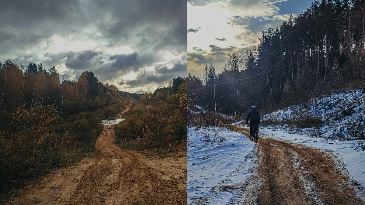
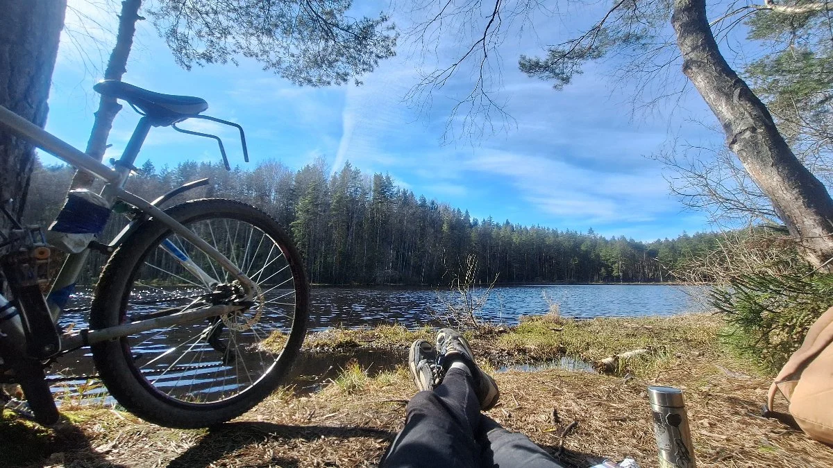
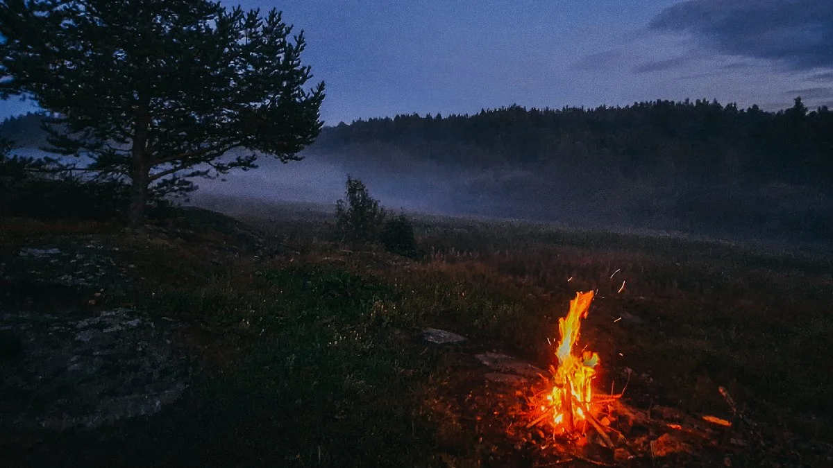
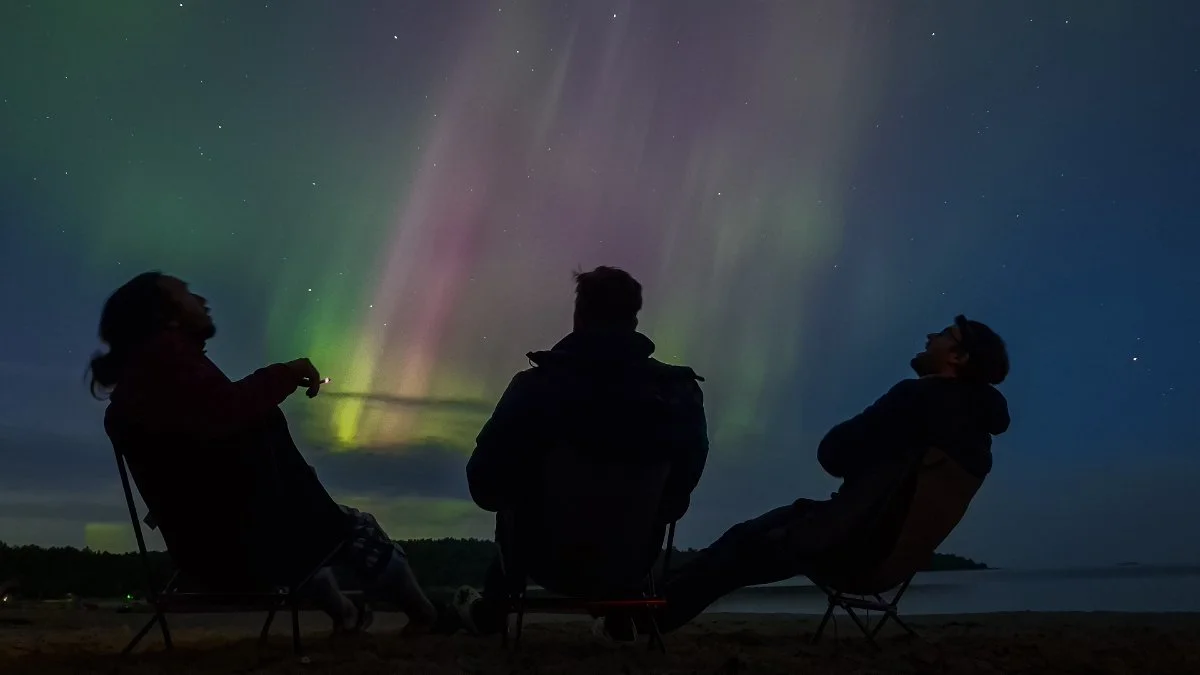
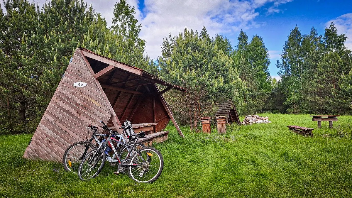
Обсуждение
Комментарии 0
Не удалось загрузить комментарии
Войдите, чтобы оставить комментарий
Можно задать вопрос о маршруте, покрытии или поделиться своим опытом.
Комментариев пока нет
Задайте автору вопрос о маршруте или поделитесь своим опытом.
Ничего не найдено
Попробуйте другой фильтр комментариев.