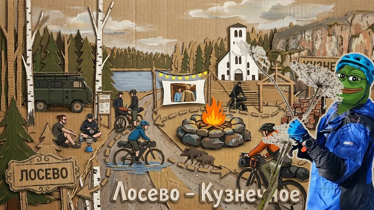
Преимущественно грунтовый маршрут на 180 км. Нитка маршрута: Лосево - Ромашки - р. Вуокса - Карельская тишина - Озёрное - Красный сокол - Карповское озеро - Большое заветное озеро - Севастьяново - Кузнечное.
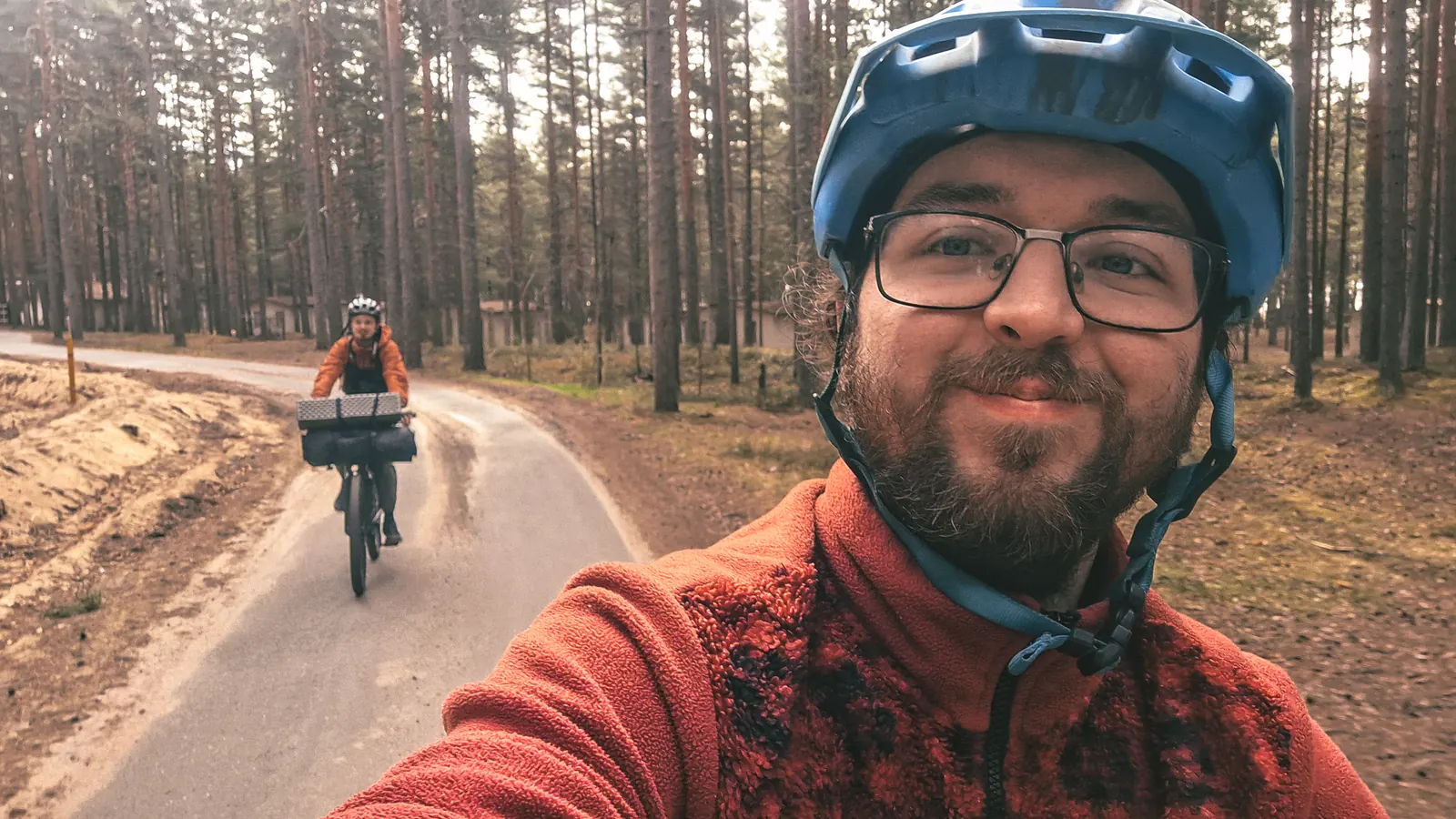
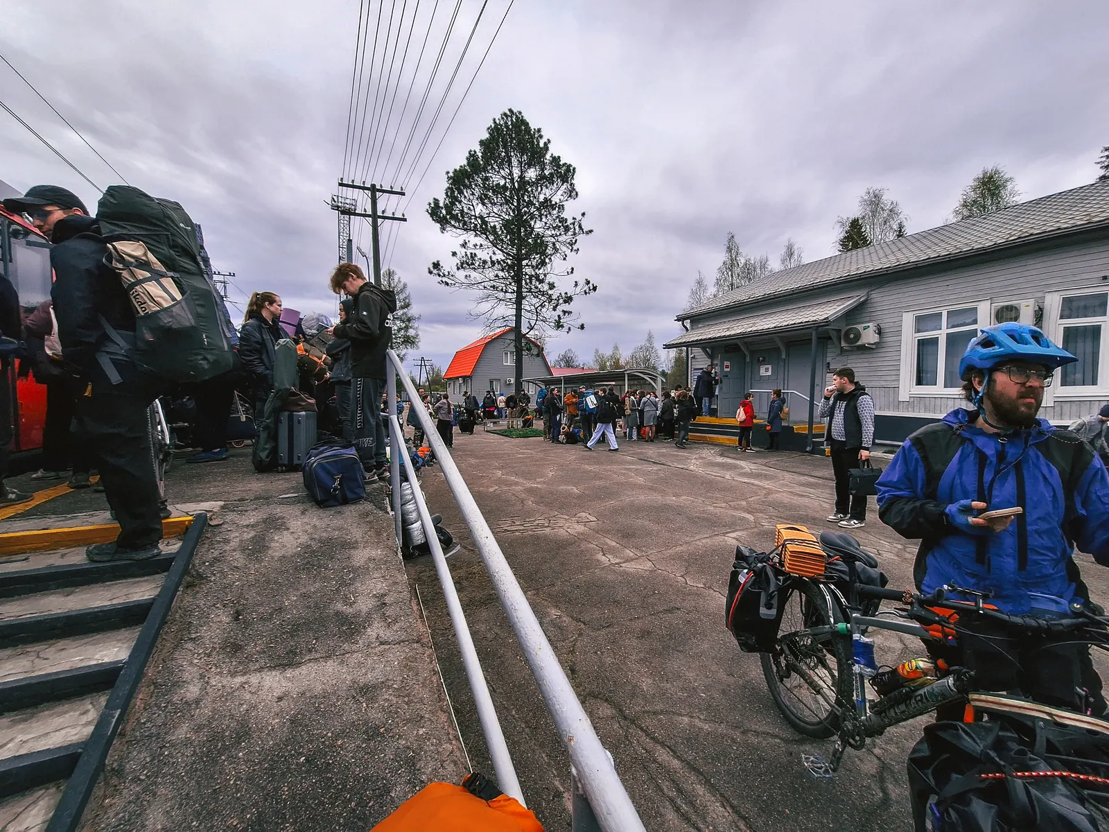
С чего начинается любой поход? Правильно, со страданий на утренней электричке, но в этот раз повезло! Получилось даже присесть, и никто не орал.
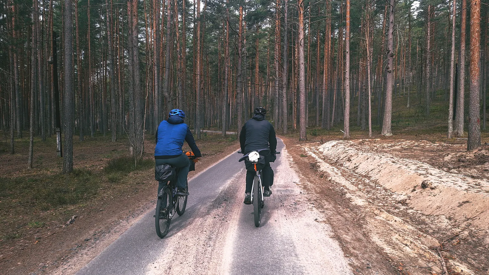
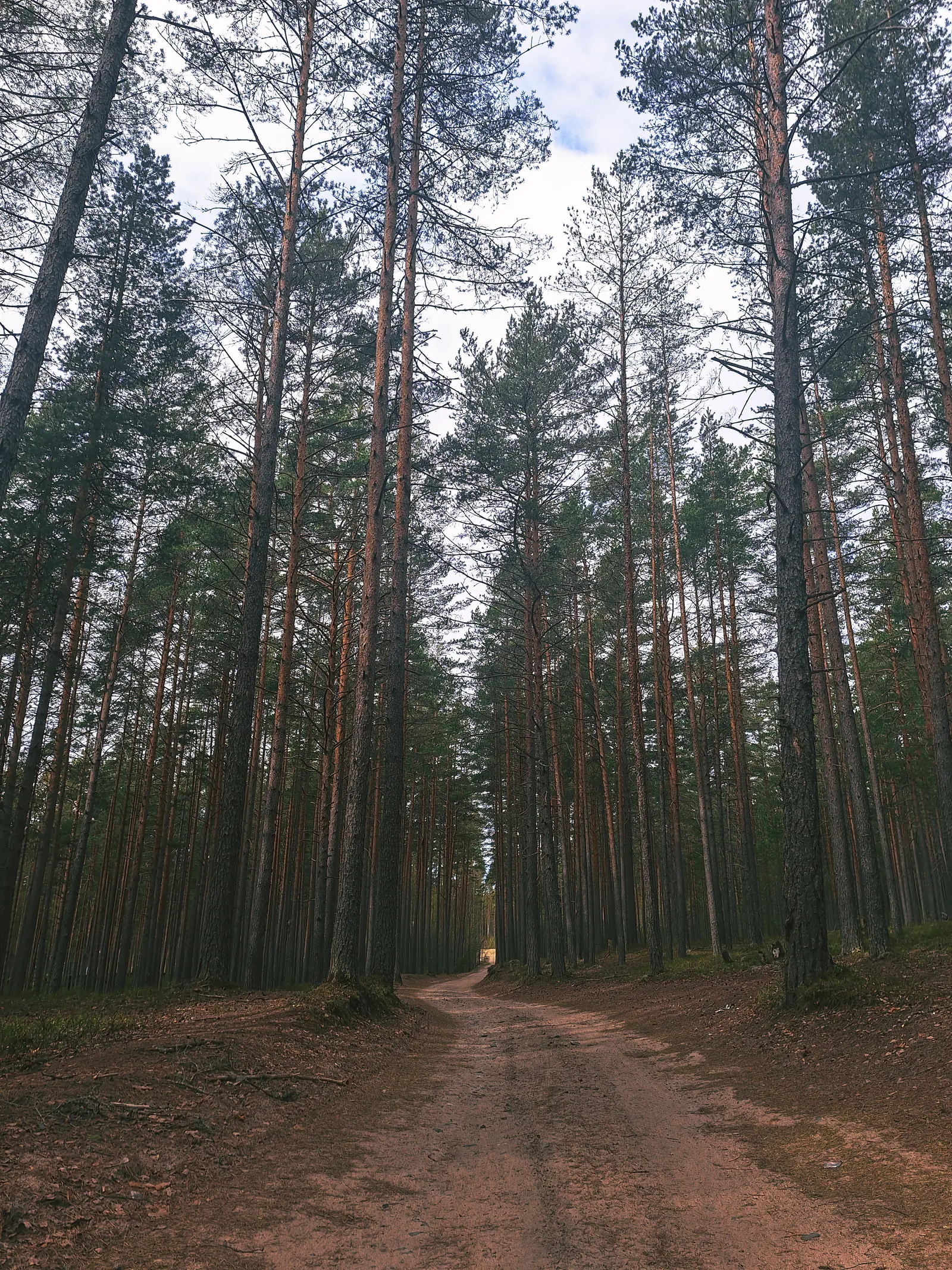
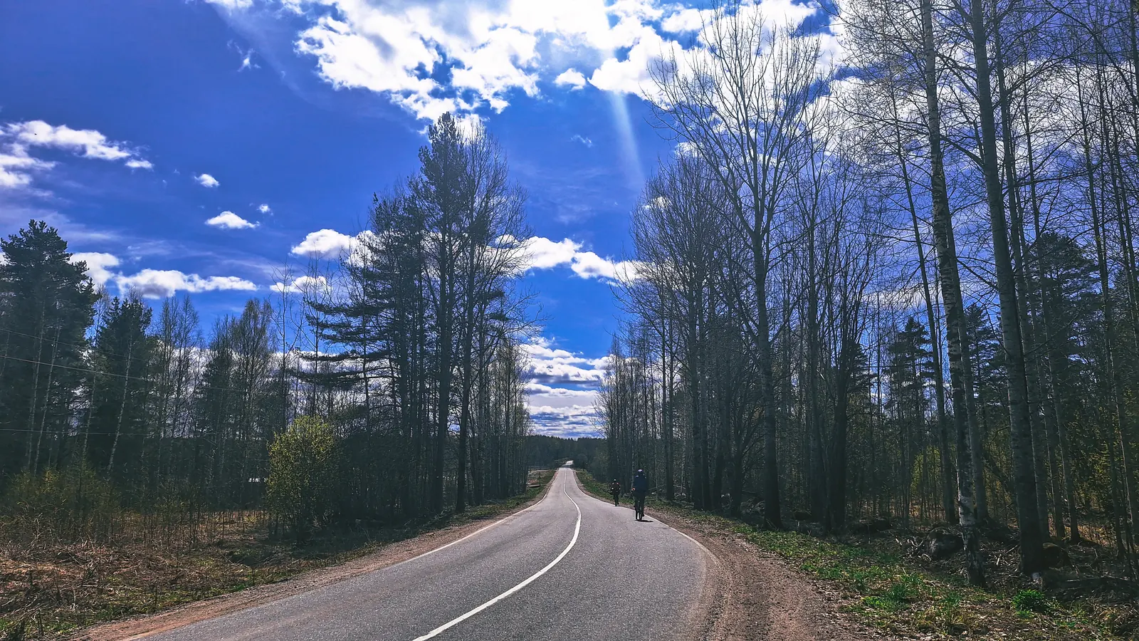
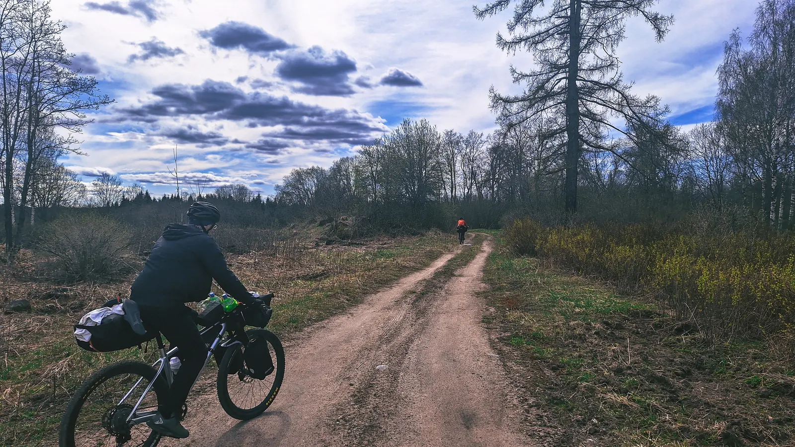
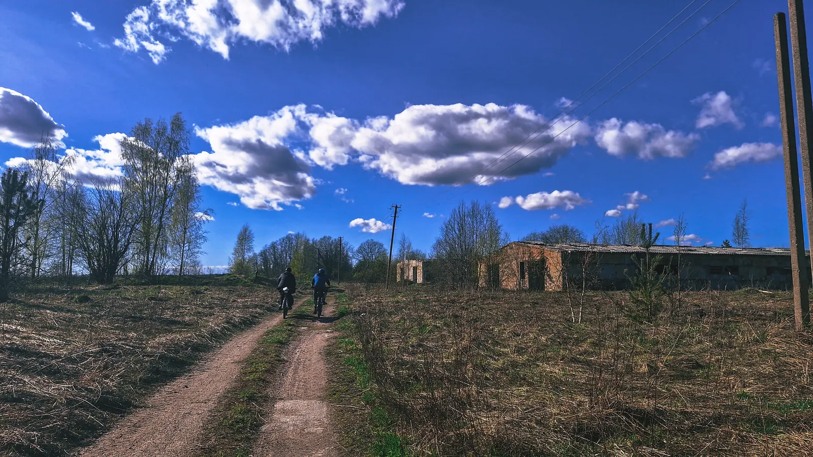
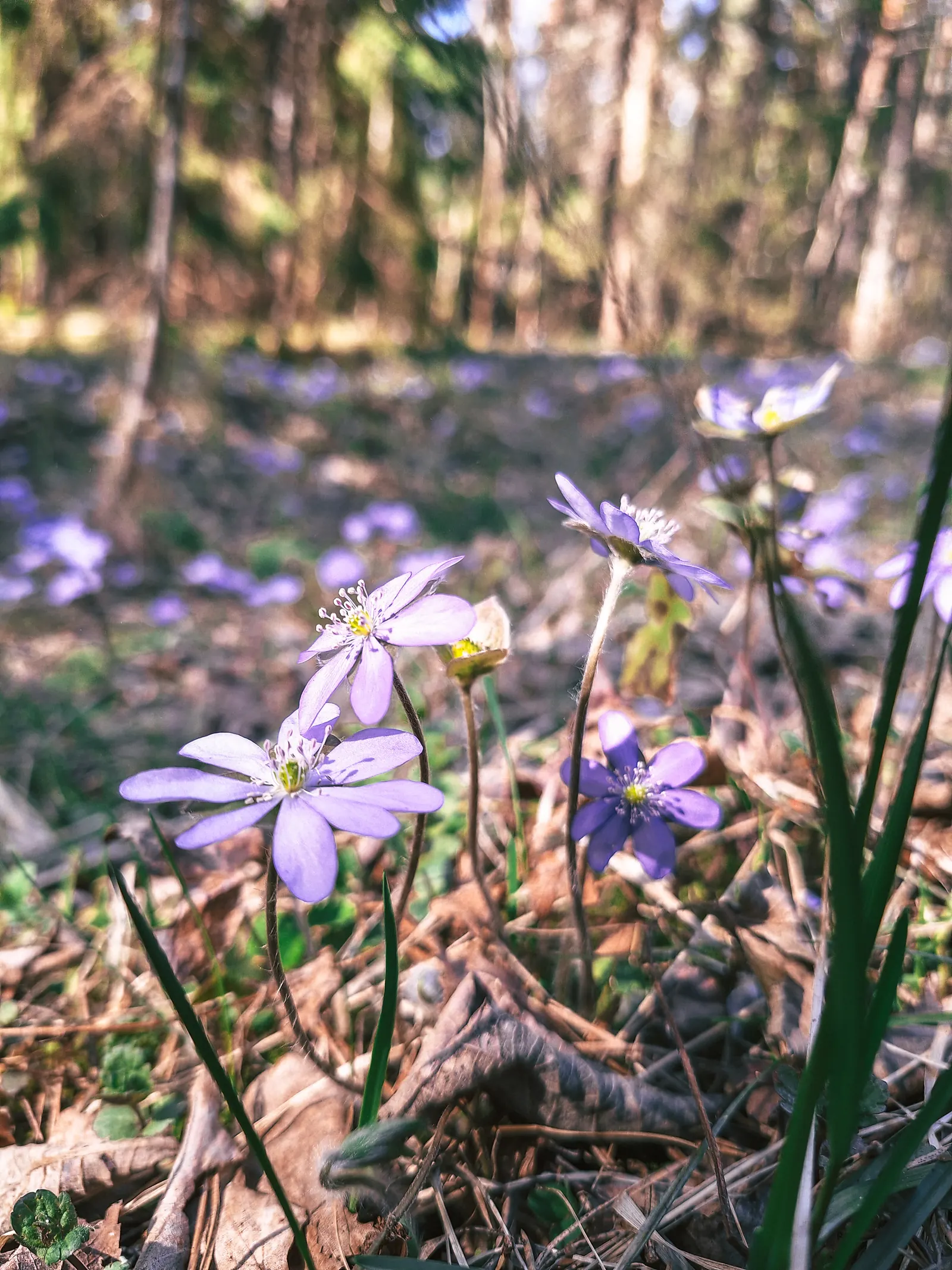
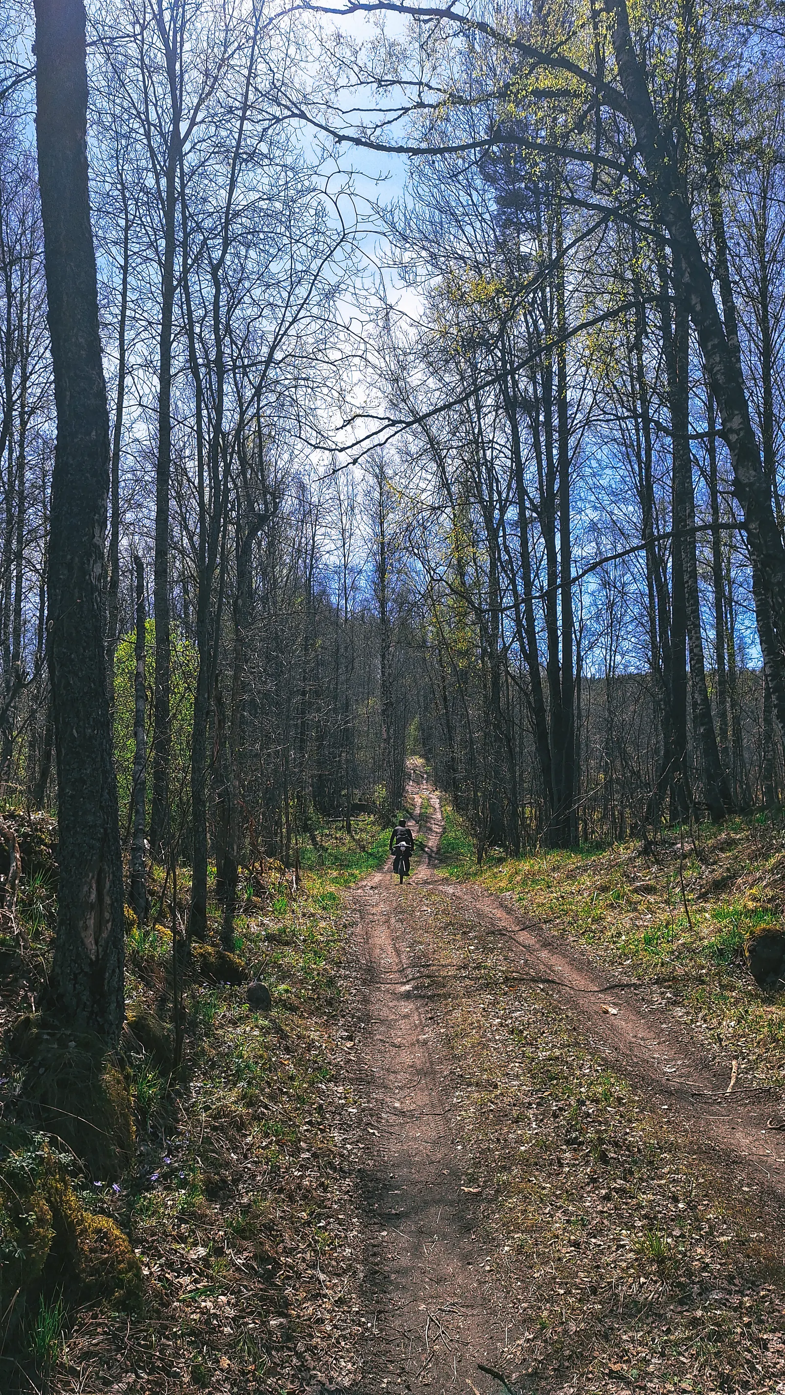
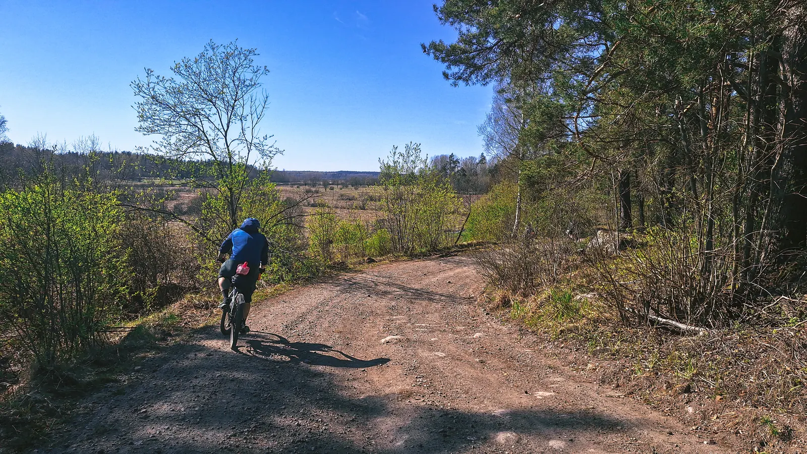
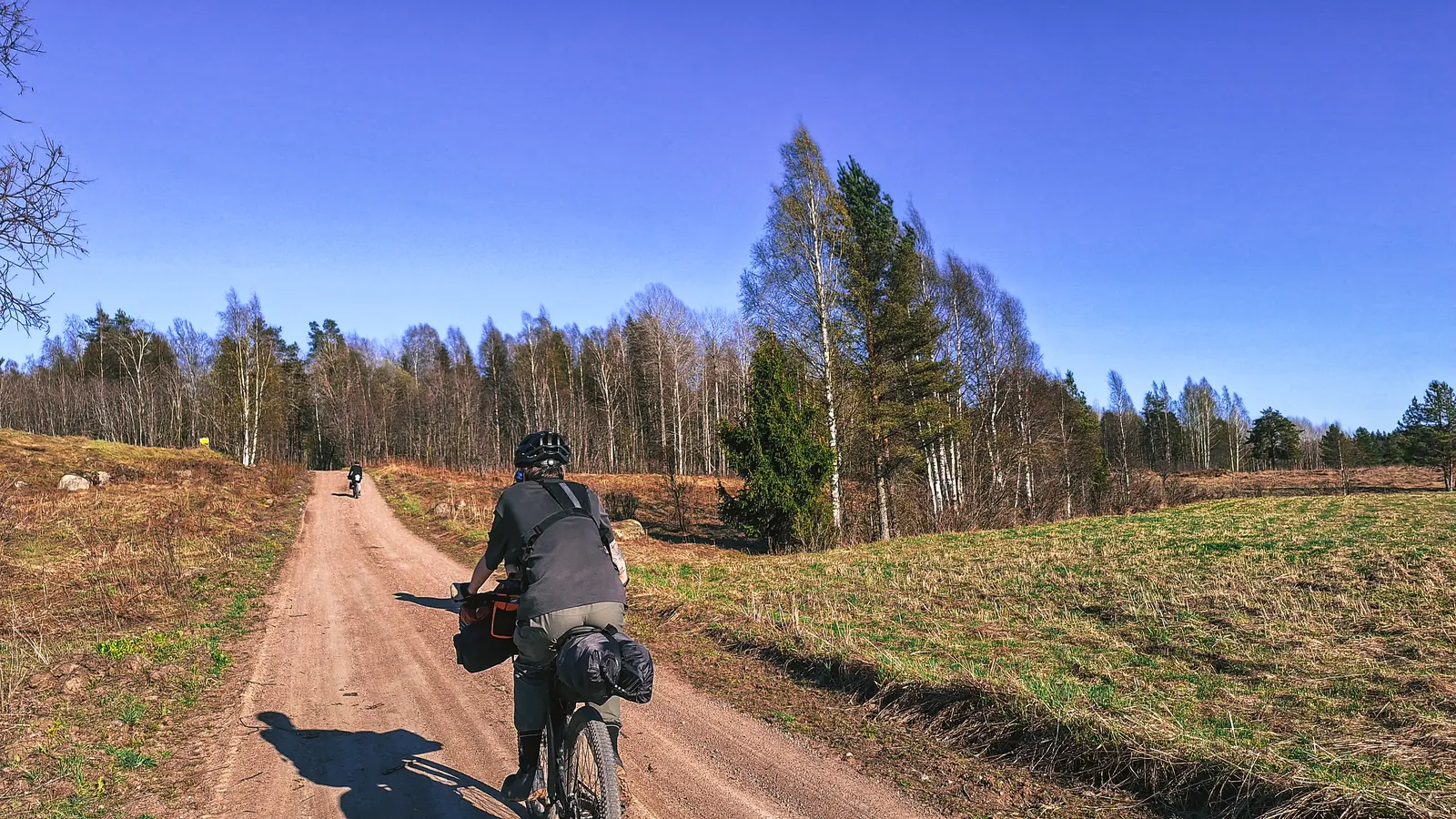
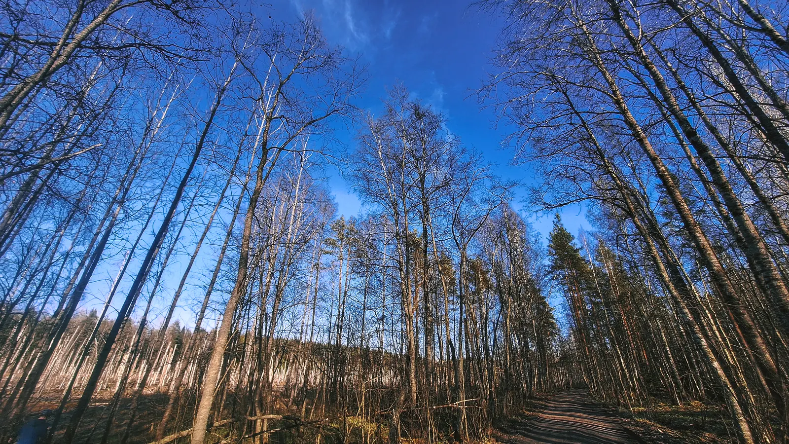
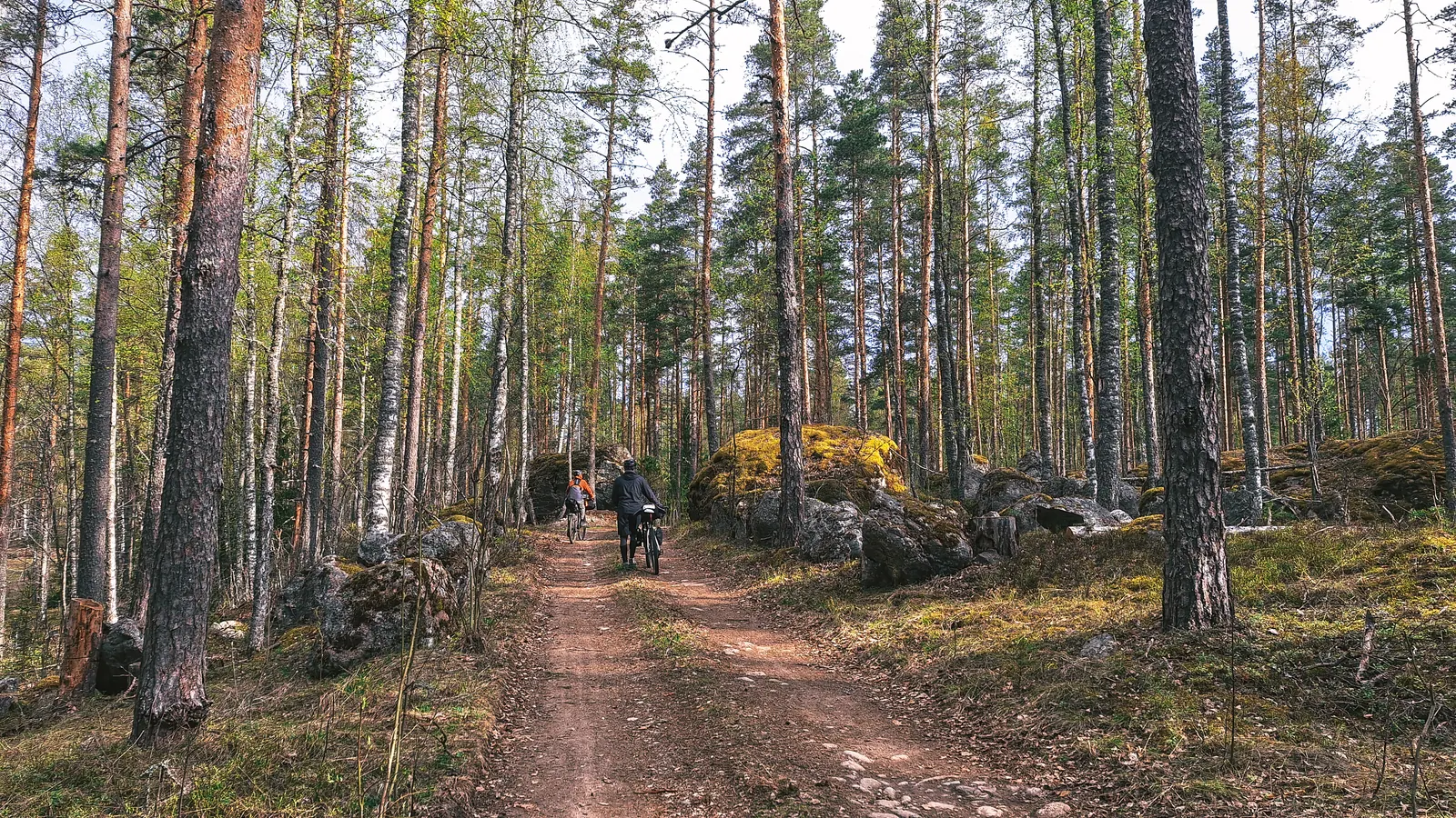
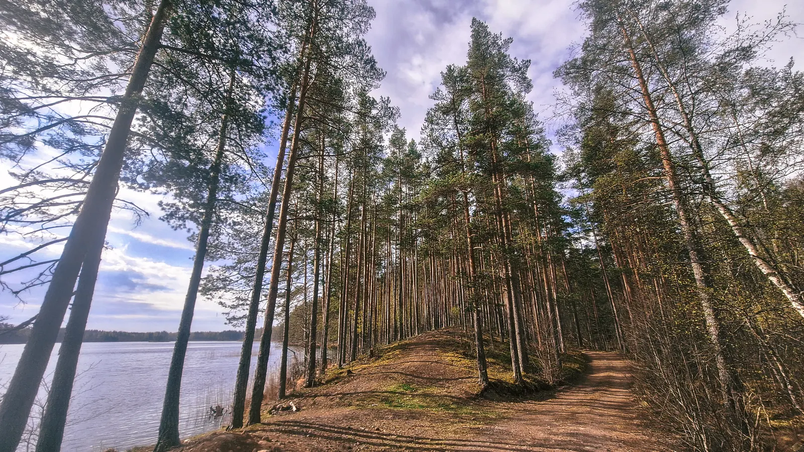
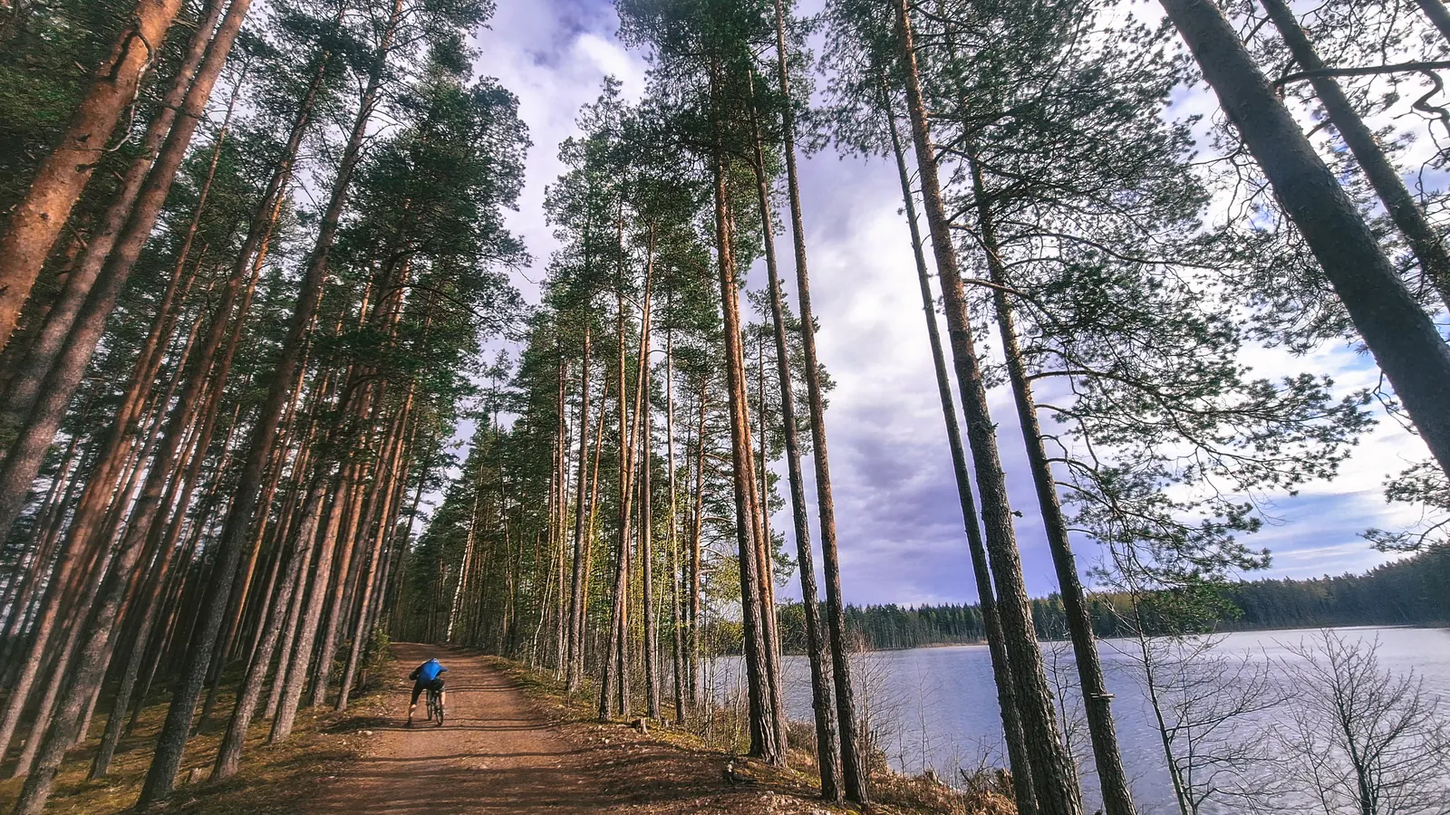
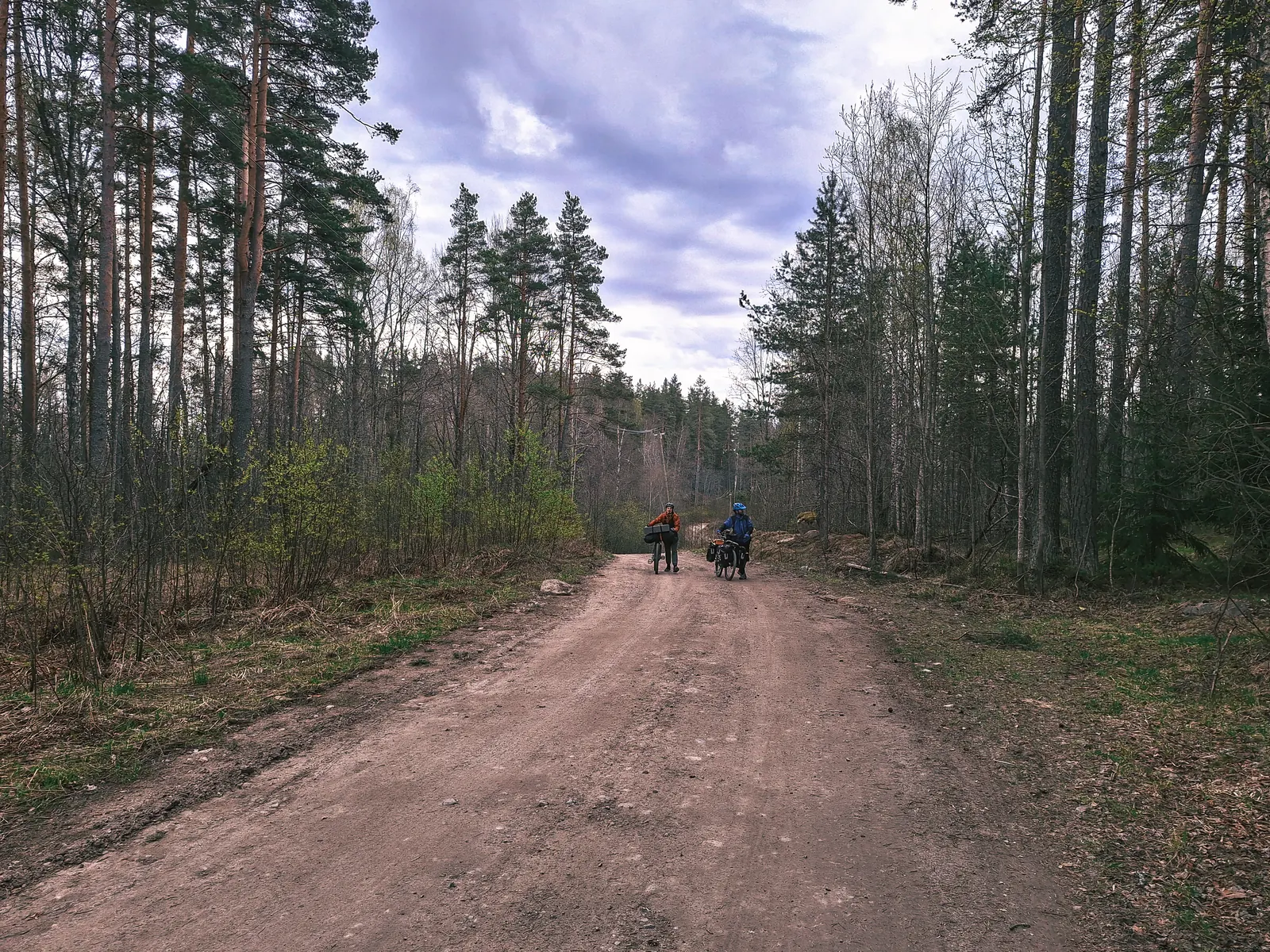
Позавтракав в Хлебнике, двинулись вдоль Вуоксы по маршруту. Пошли грунты и первые подъёмы. Лес в мае великолепен! Ни комаров, не слепней, зелень уже по-тихоньку взрывается, да ещё и с погодой повезло, настоящее лето.
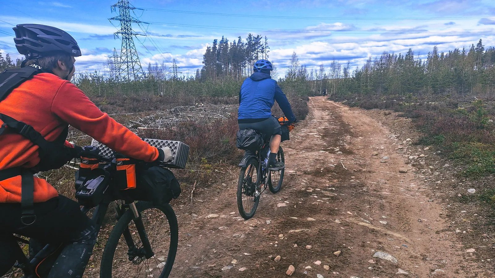
Дальше выехали на унылый асфальт, но хоть пустой! Закупились в пятёрке и двинулись в сторону обеденного привала.
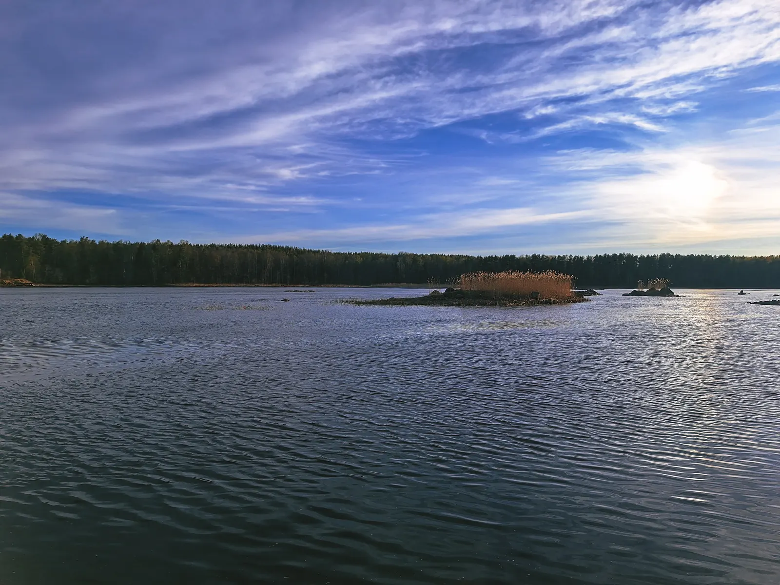
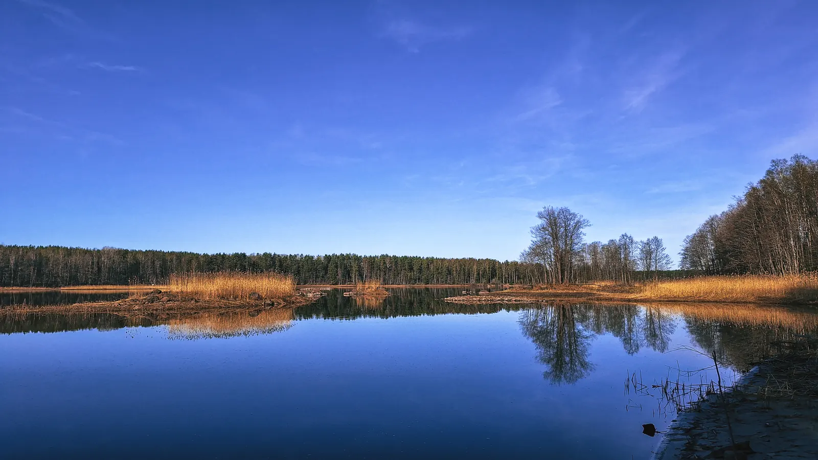
Пообедав на мысу с видом на Вуоксу (народу там было много), поехали дальше, по полям, в сторону ночлега.
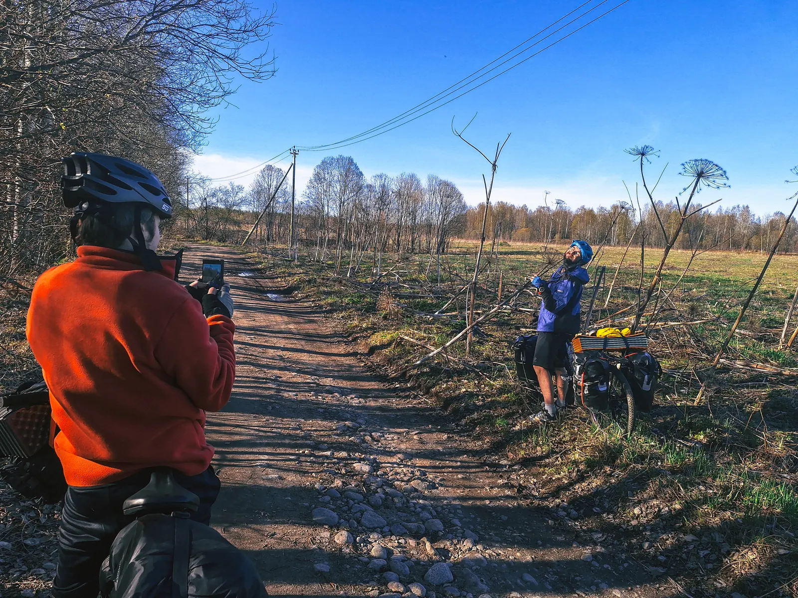
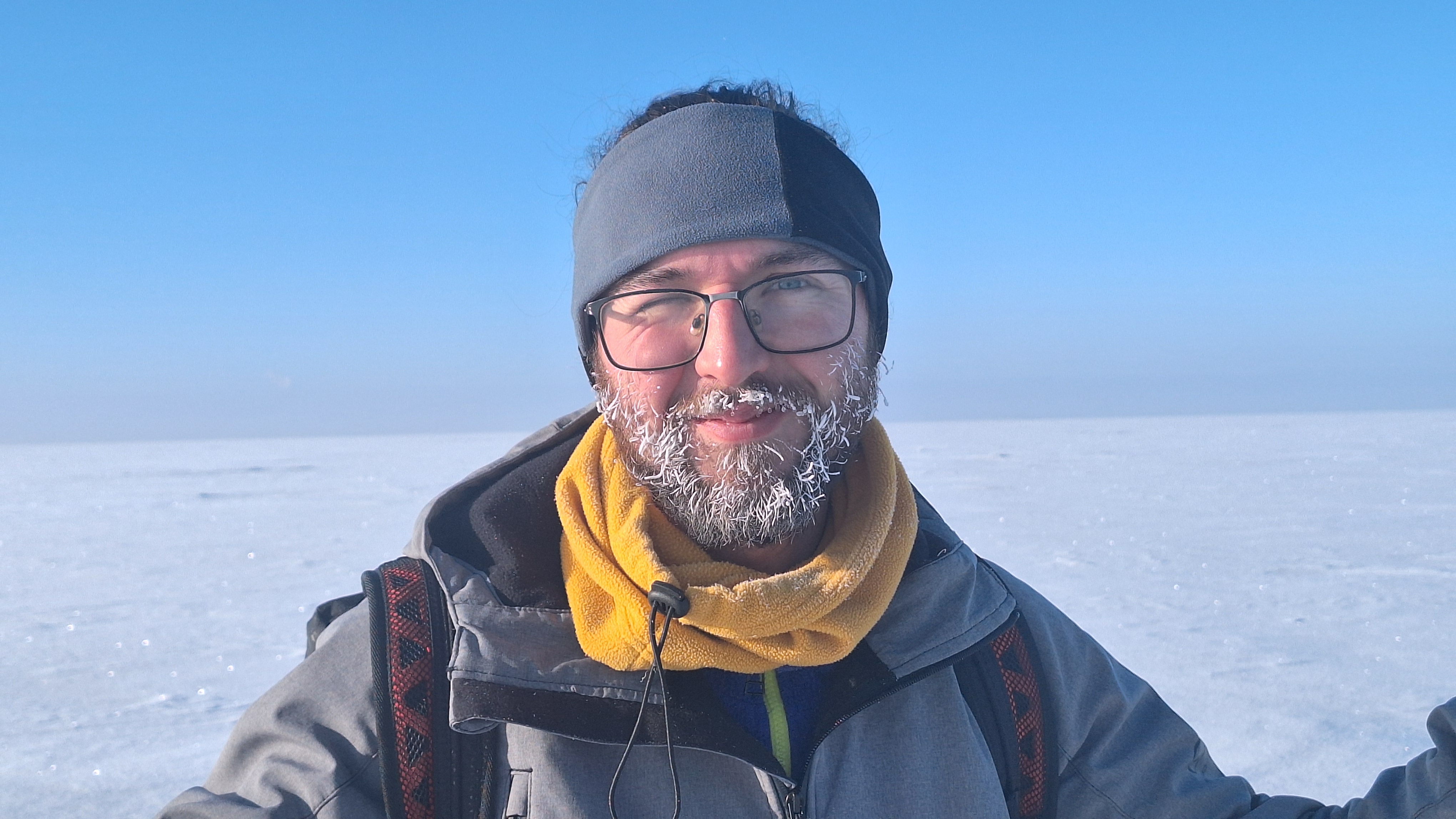
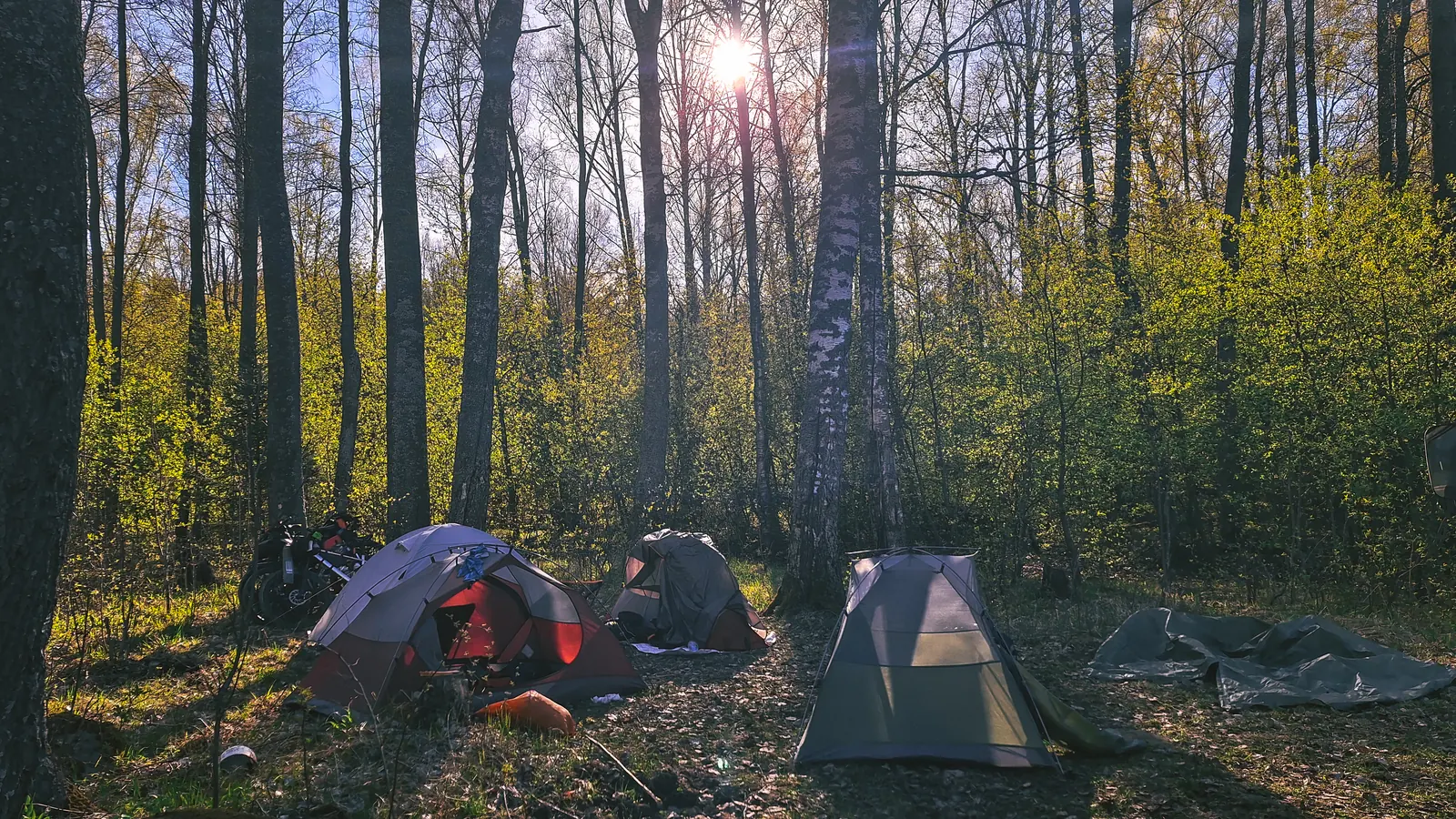
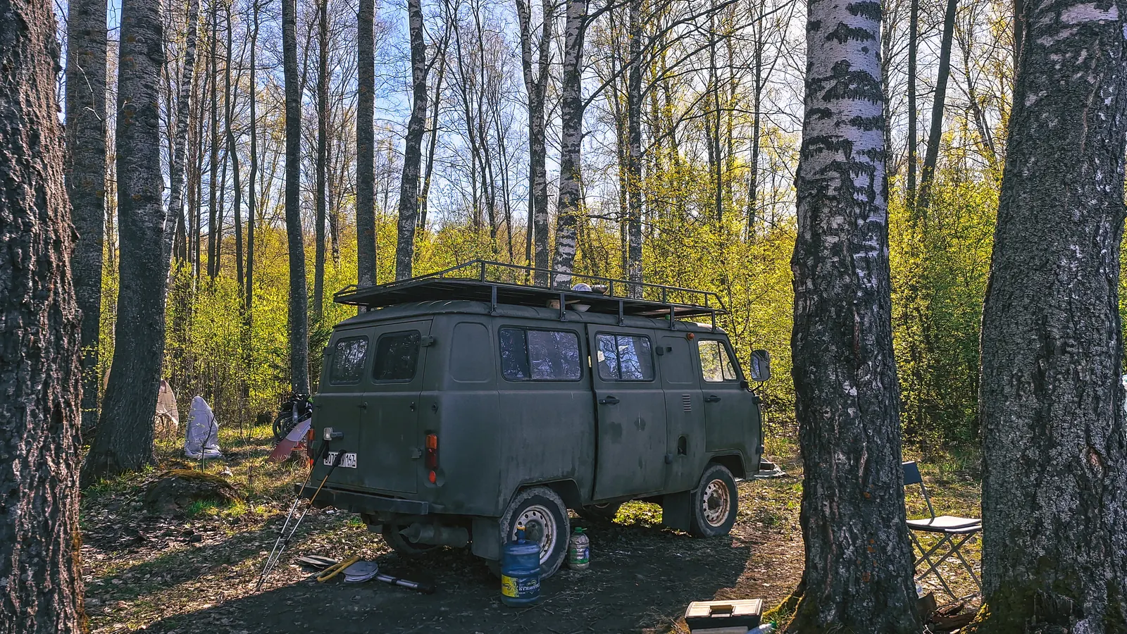
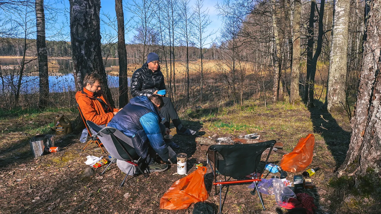
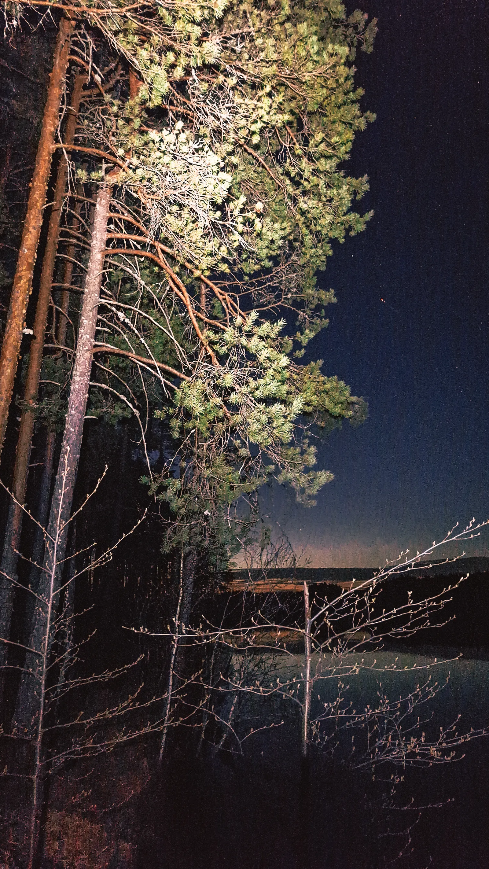
Устроив бой на борщевиках, начали искать ночлег. 1 мая, хорошая погода... Естественно вся Вуокса была усыпана палатками. Но нам повезло, прямо на самой дальней стоянке (которая и была по плану), стоял лагерем добродушный рыбак - Олег, вместе со своей чудесной буханкой-домом на колёсах. Пригласил встать лагерем рядом с ним. Ну а дальше - душевные разговоры, ужин и костерок.
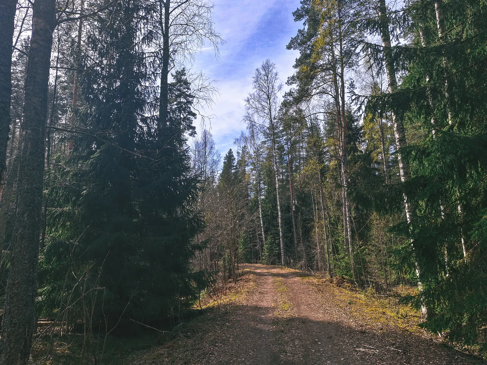
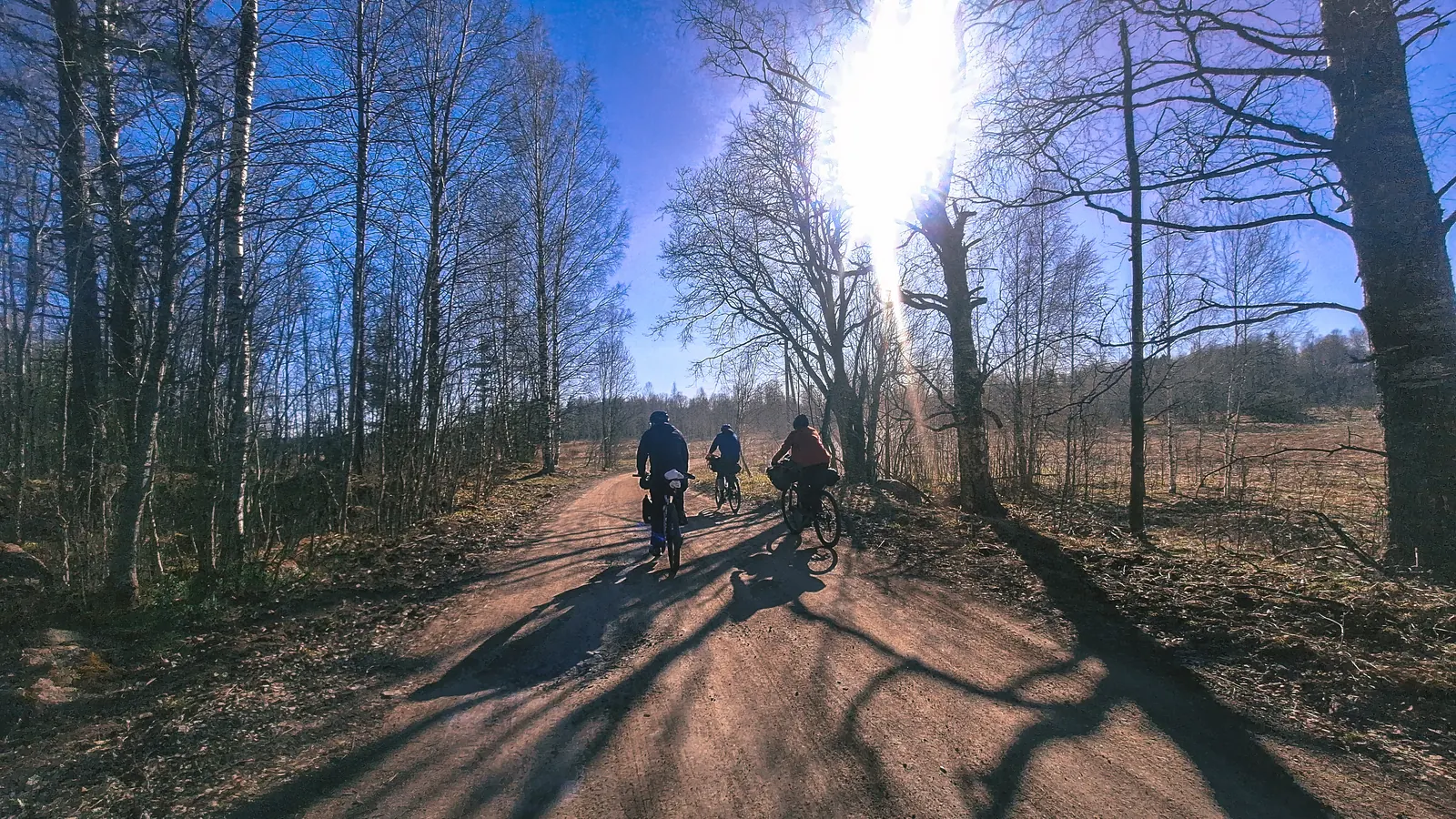
Новый день обещал быть более насыщенным на достопримечательности и рельеф.
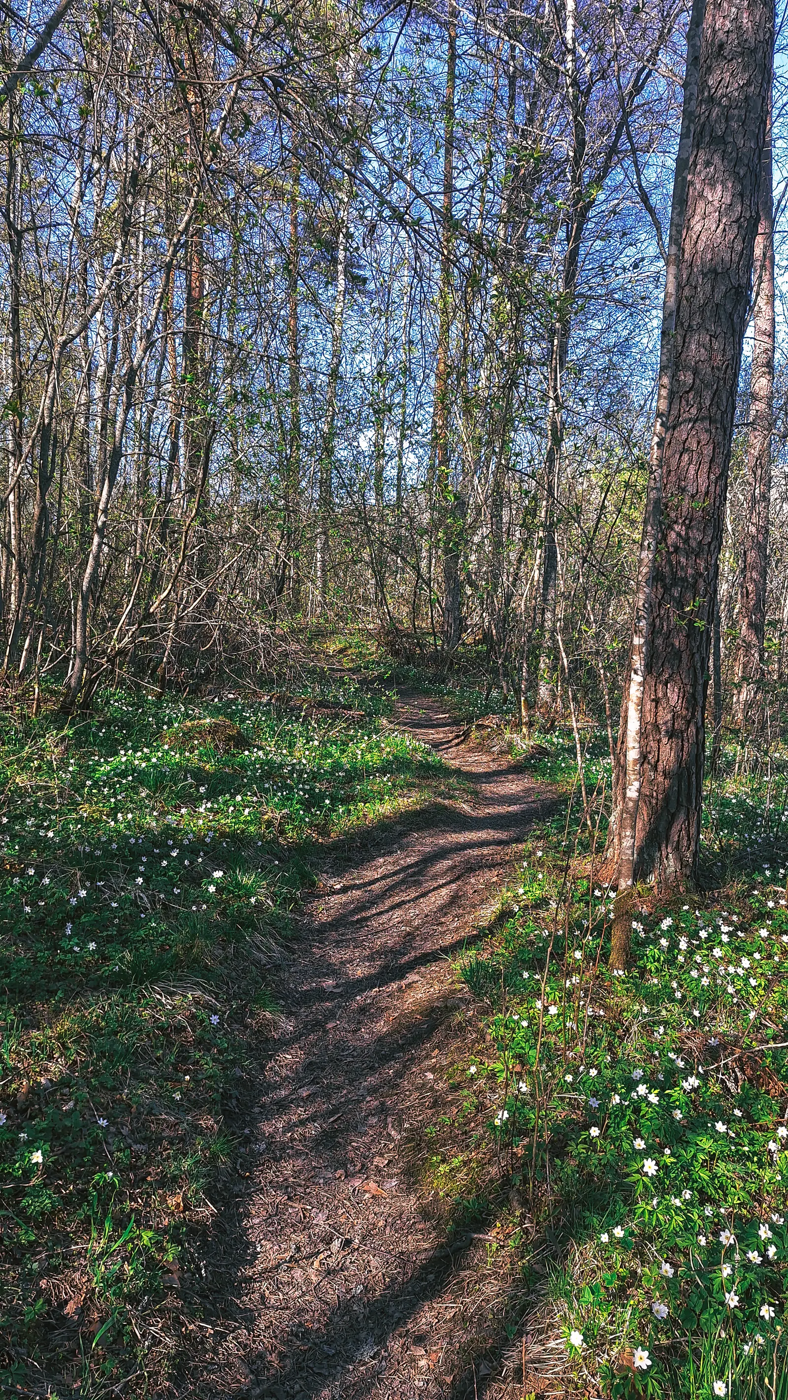
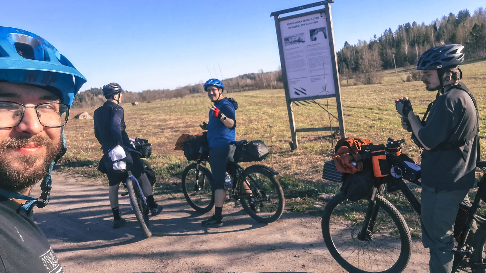
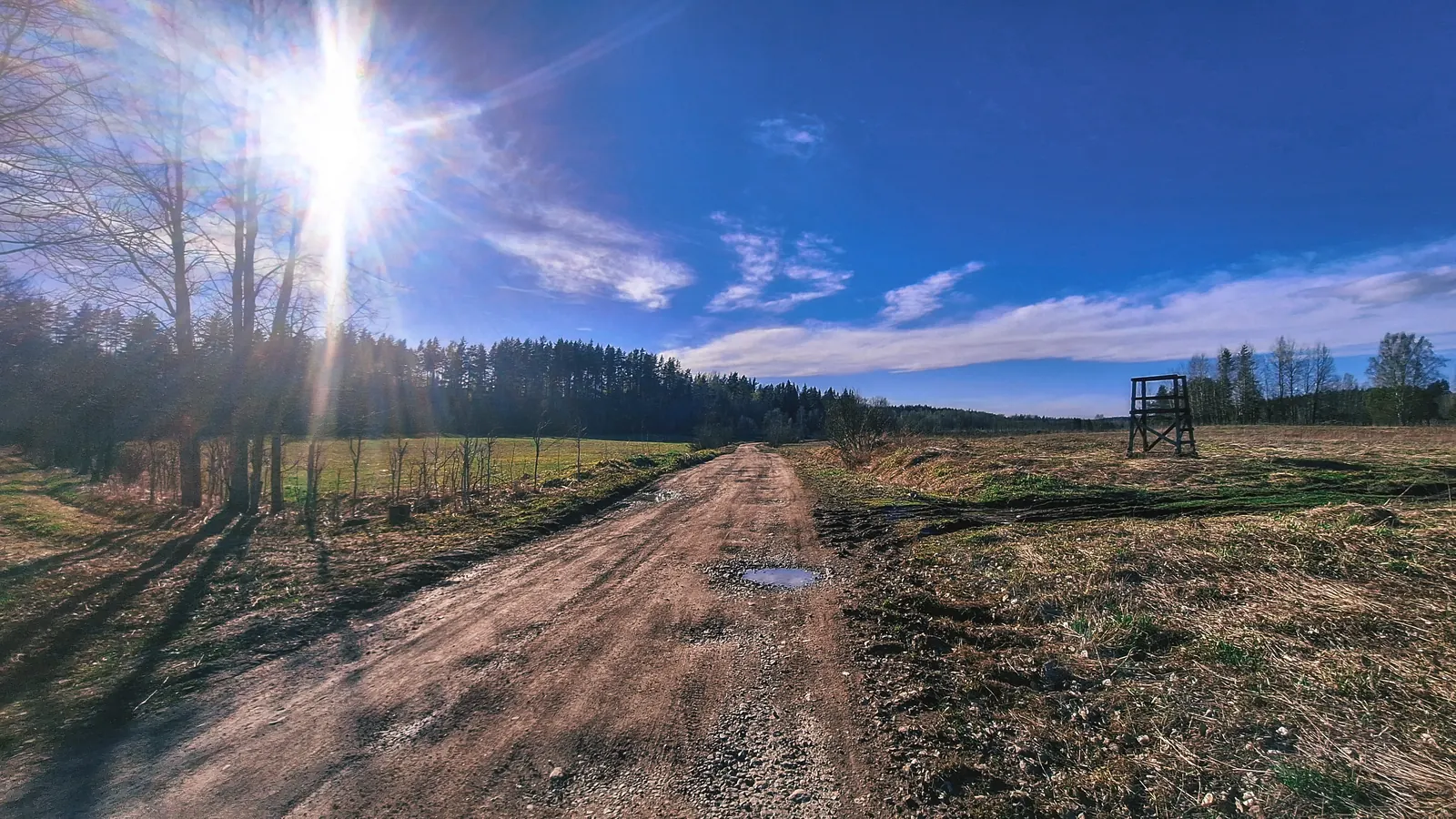
Позавтракали и двинулись в сторону маркированного маршрута Карельская тишина.
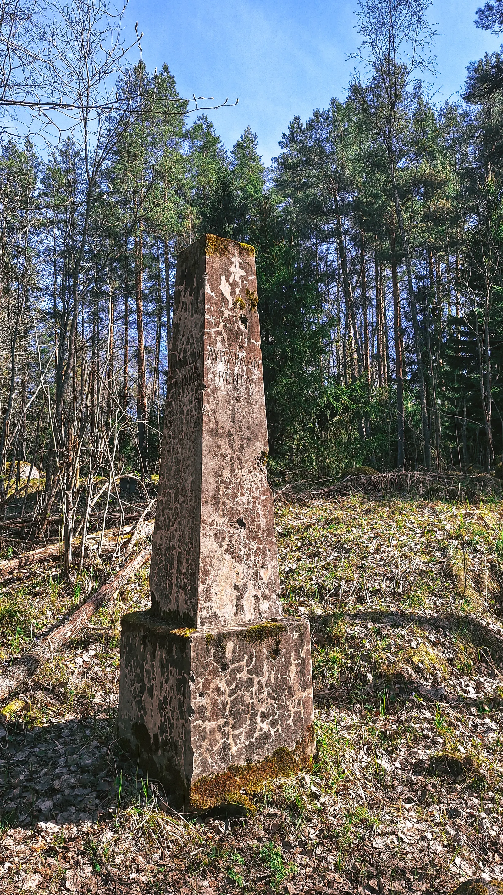
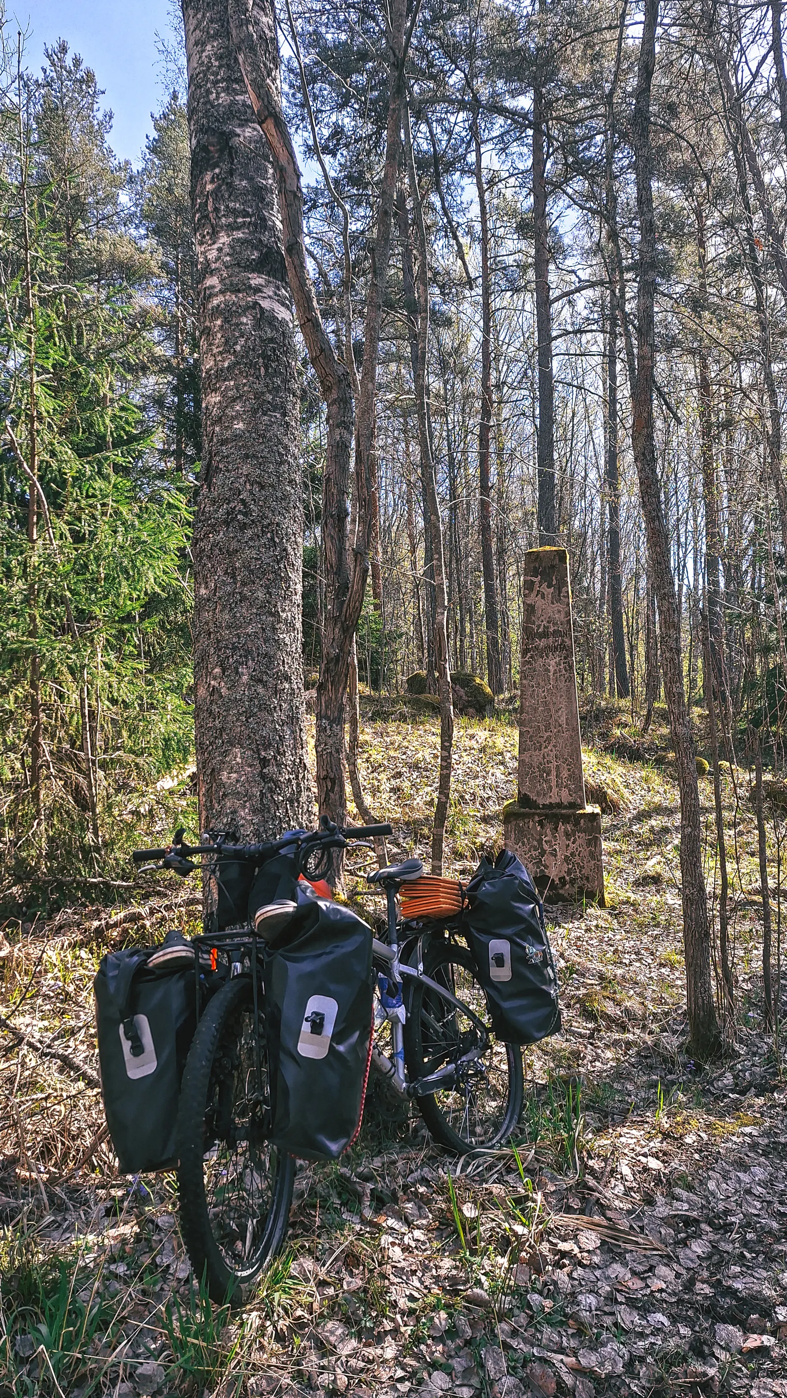

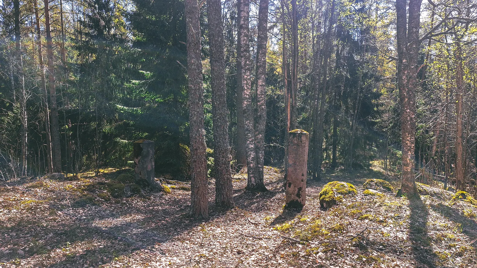
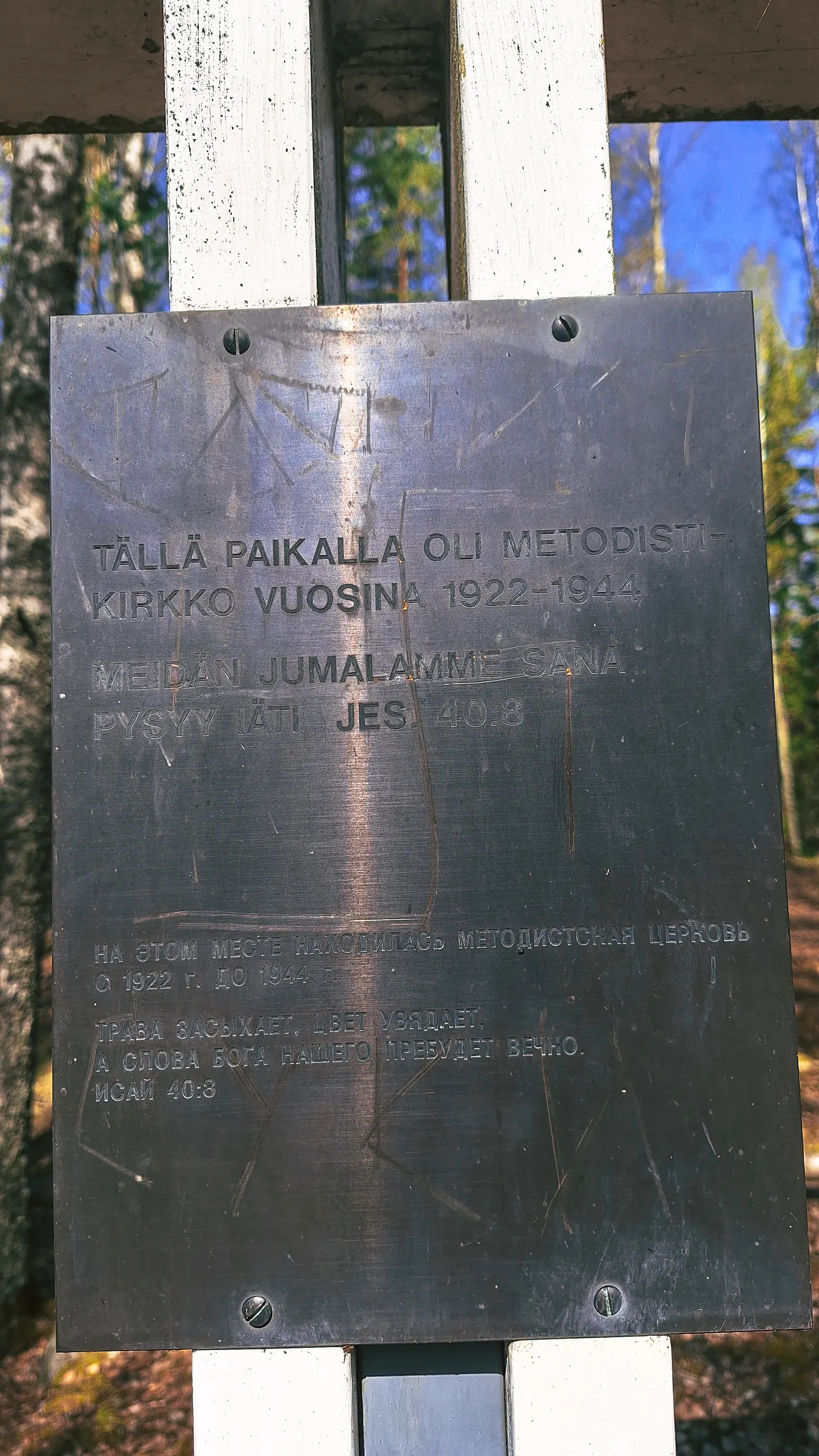
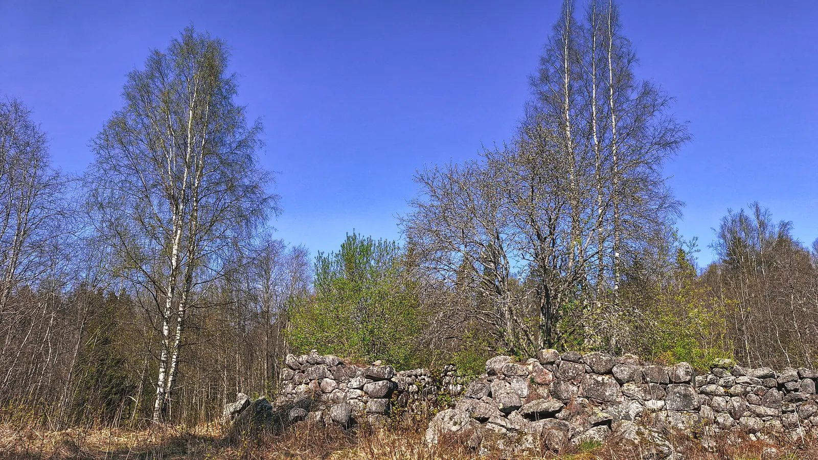
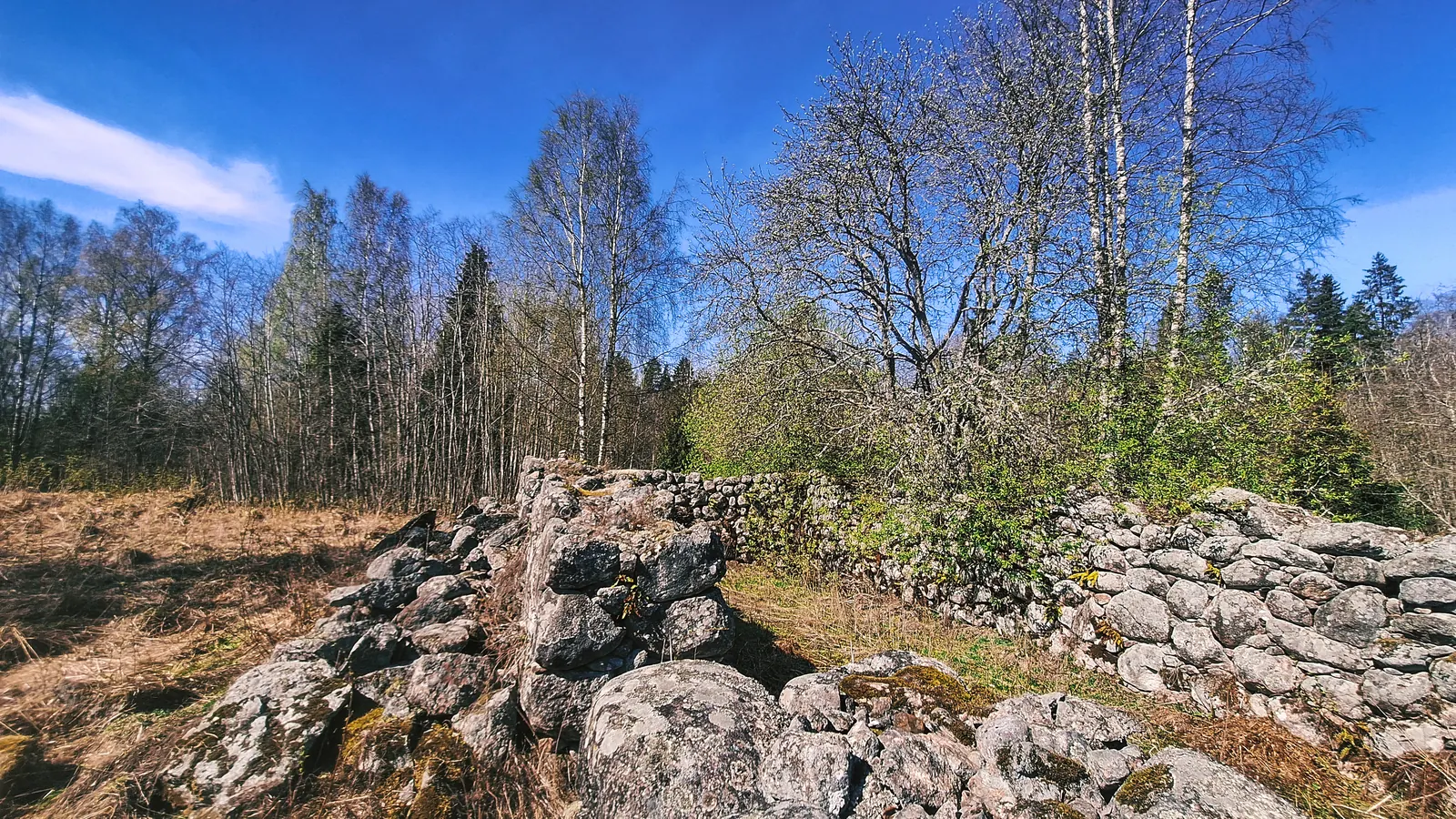
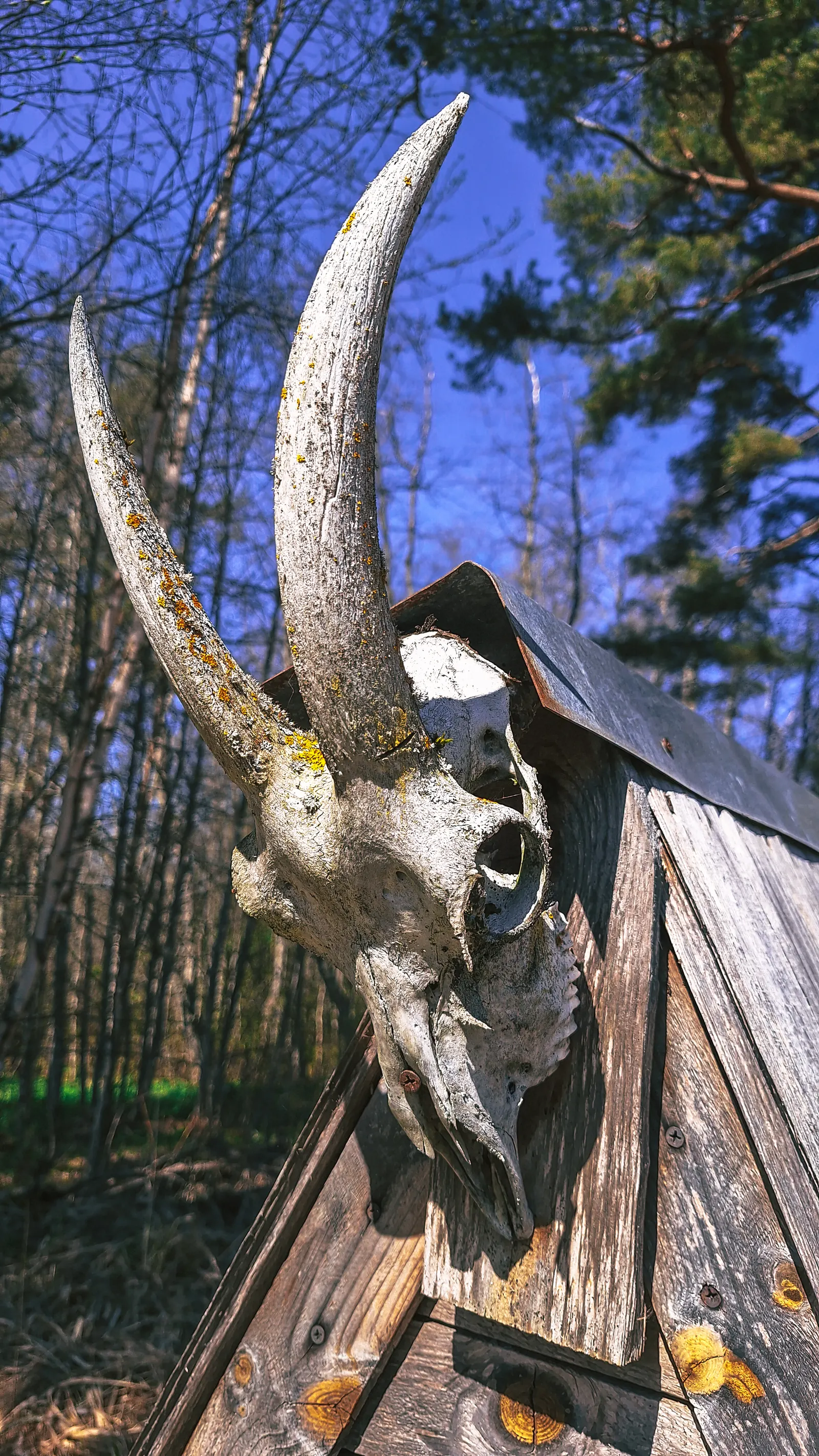
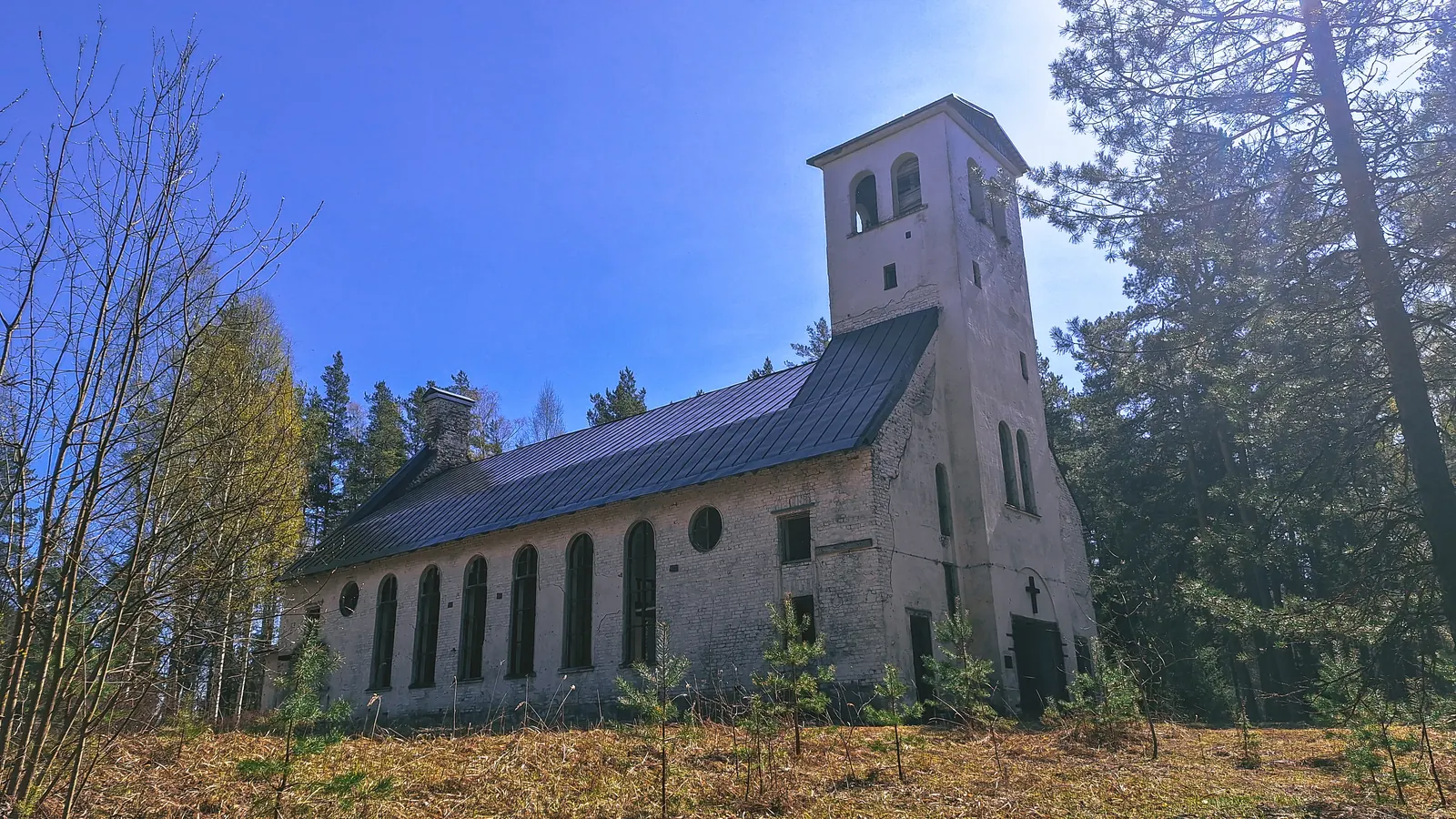
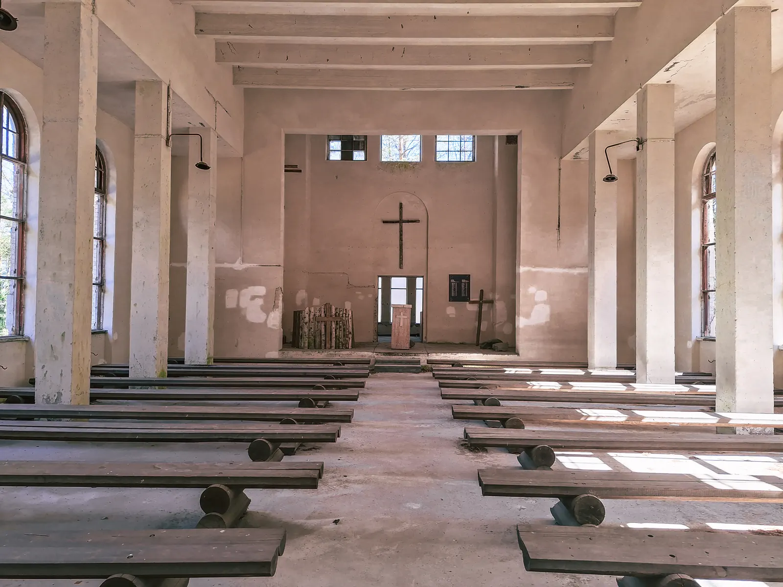
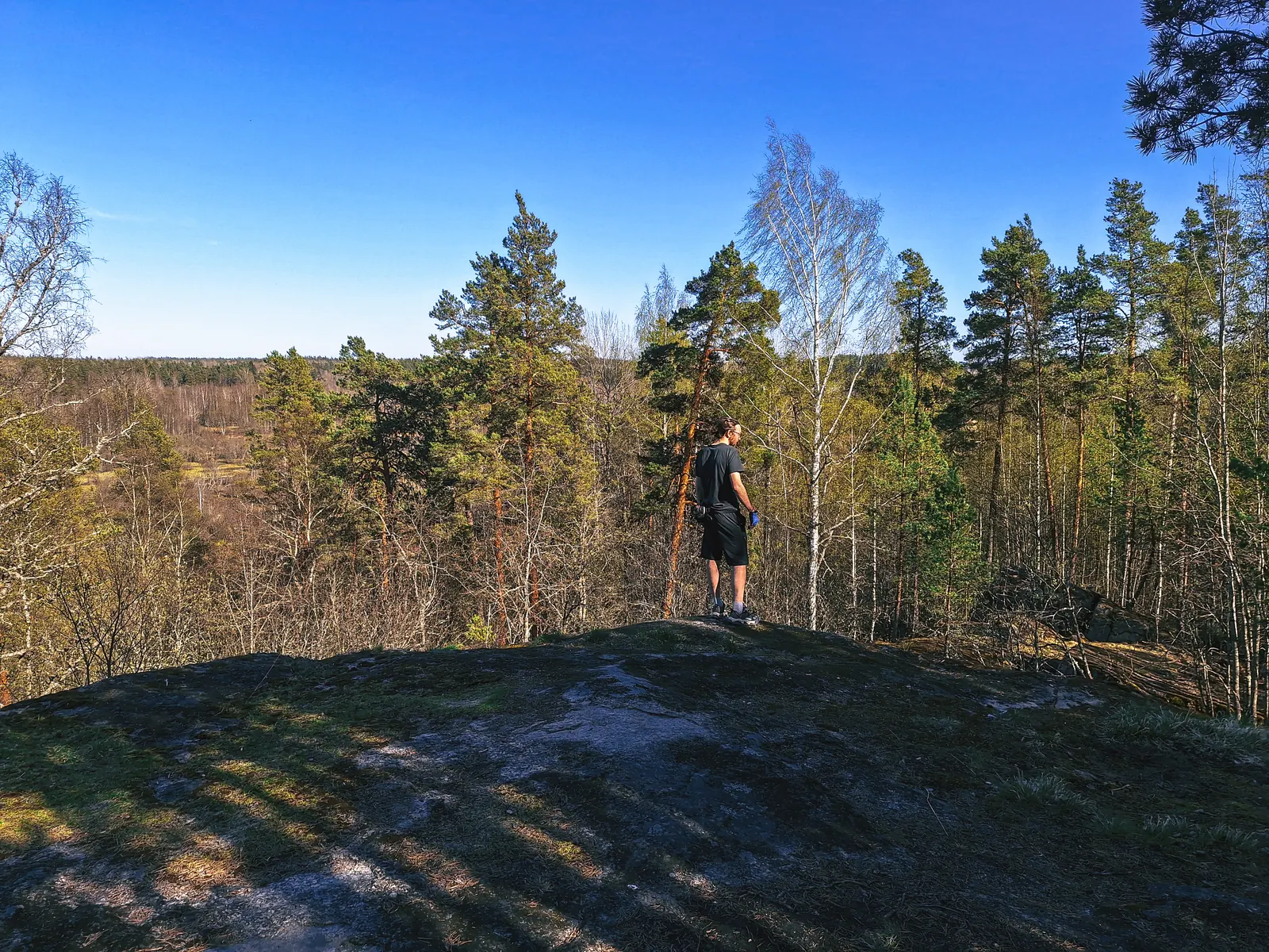
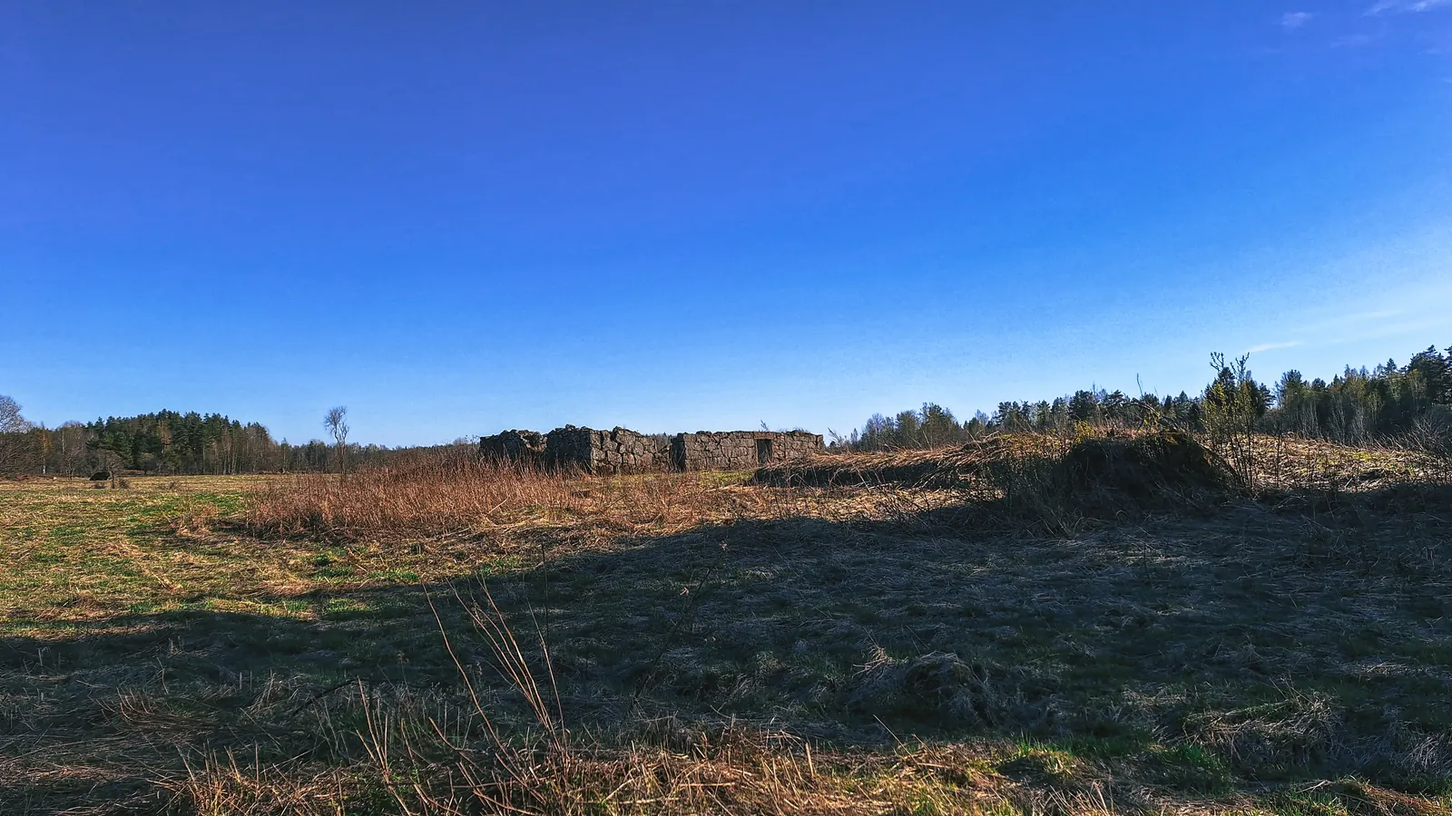
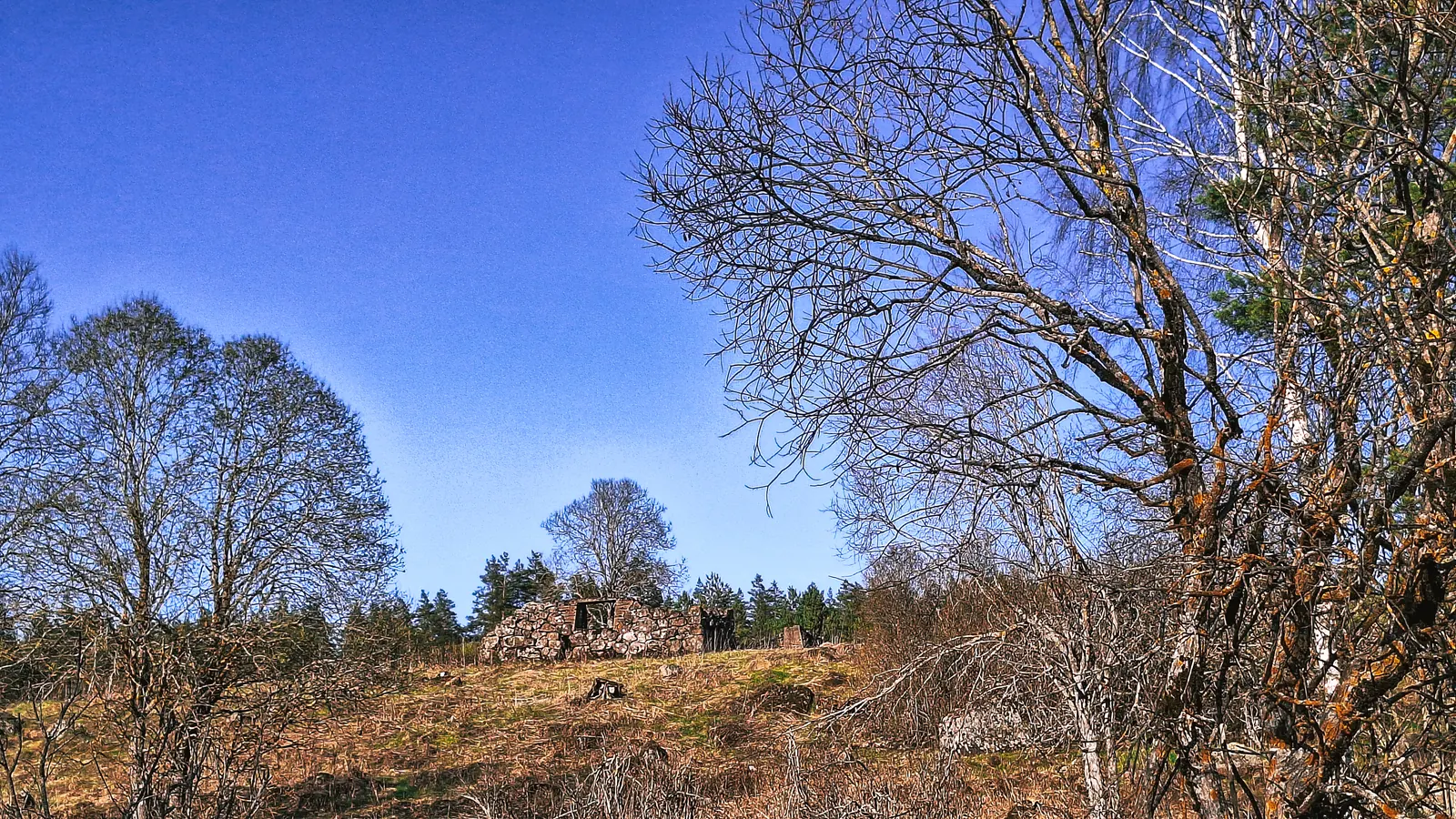
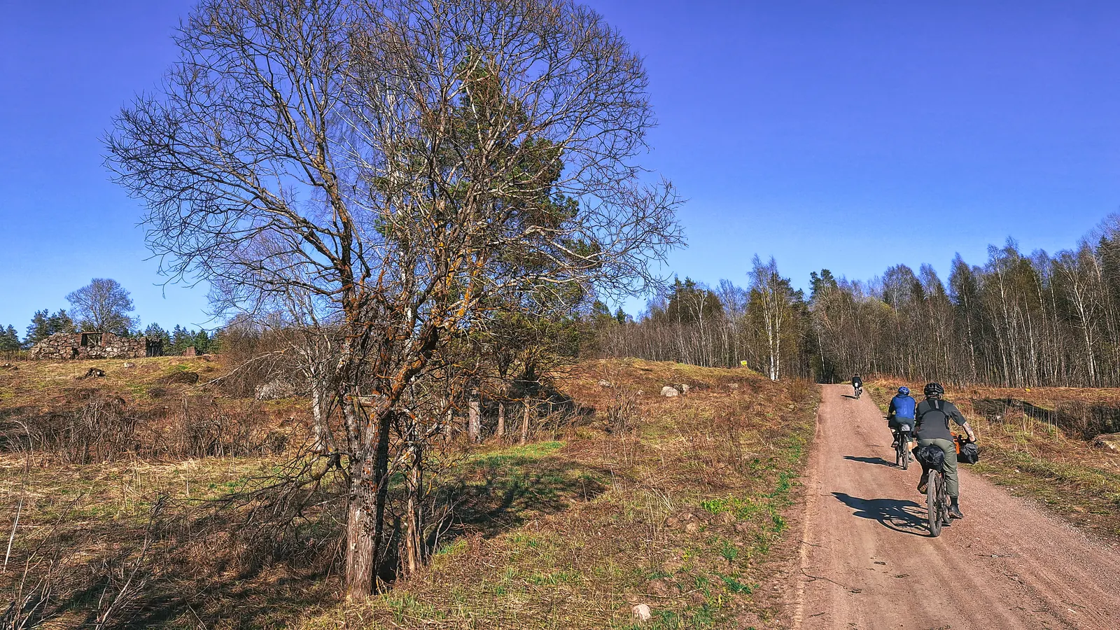
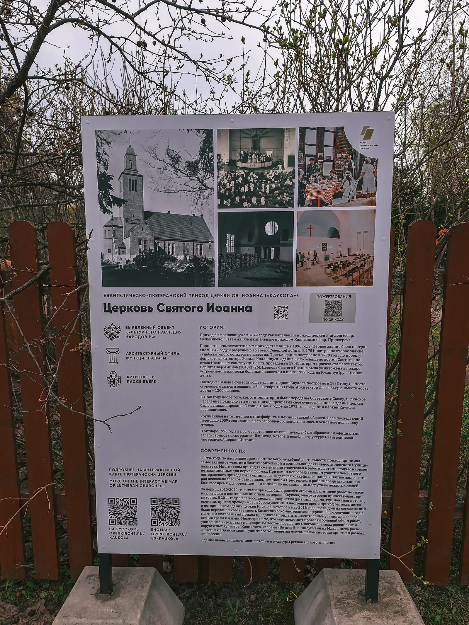
Маршрут шикарный, очень красивые виды, множество руин финских хуторов, кирх, старое финское кладбище. Затем мы попадаем в посёлок Озёрное, где стоит заброшенная, но в очень хорошем состоянии, финская кирха.
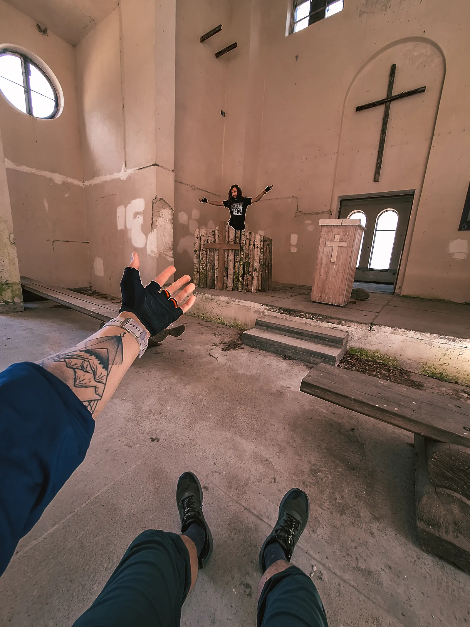
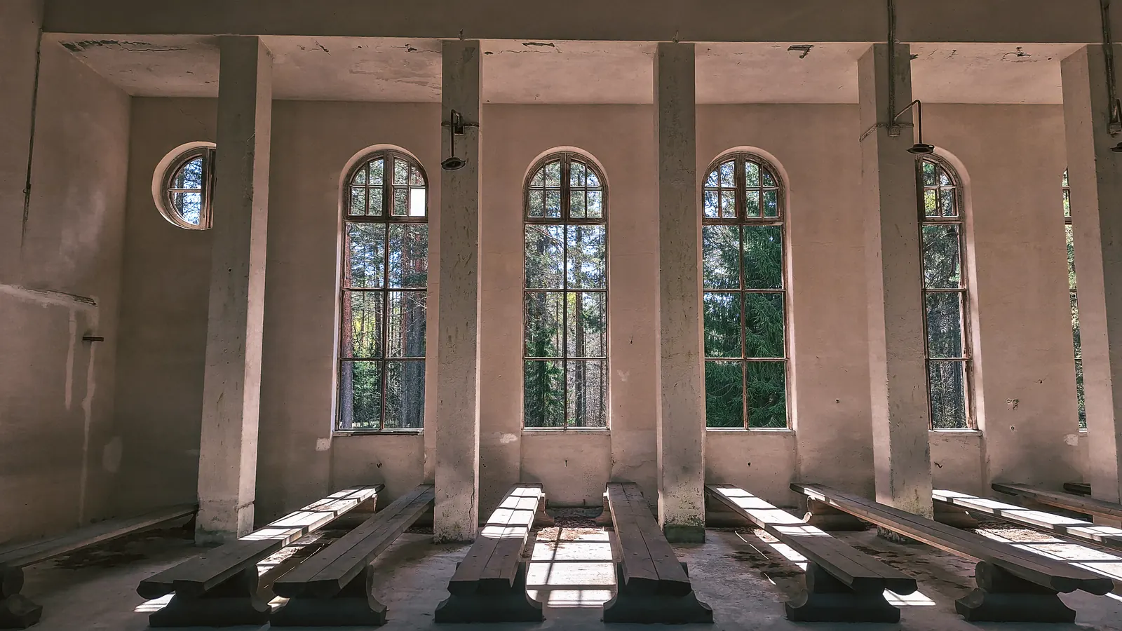
На полянке у кирхи устроили привал, по времени выбились из графика, и было решено сократить маршрут, пропустив заезд к двум озёрам - Владимирская и Водолога.
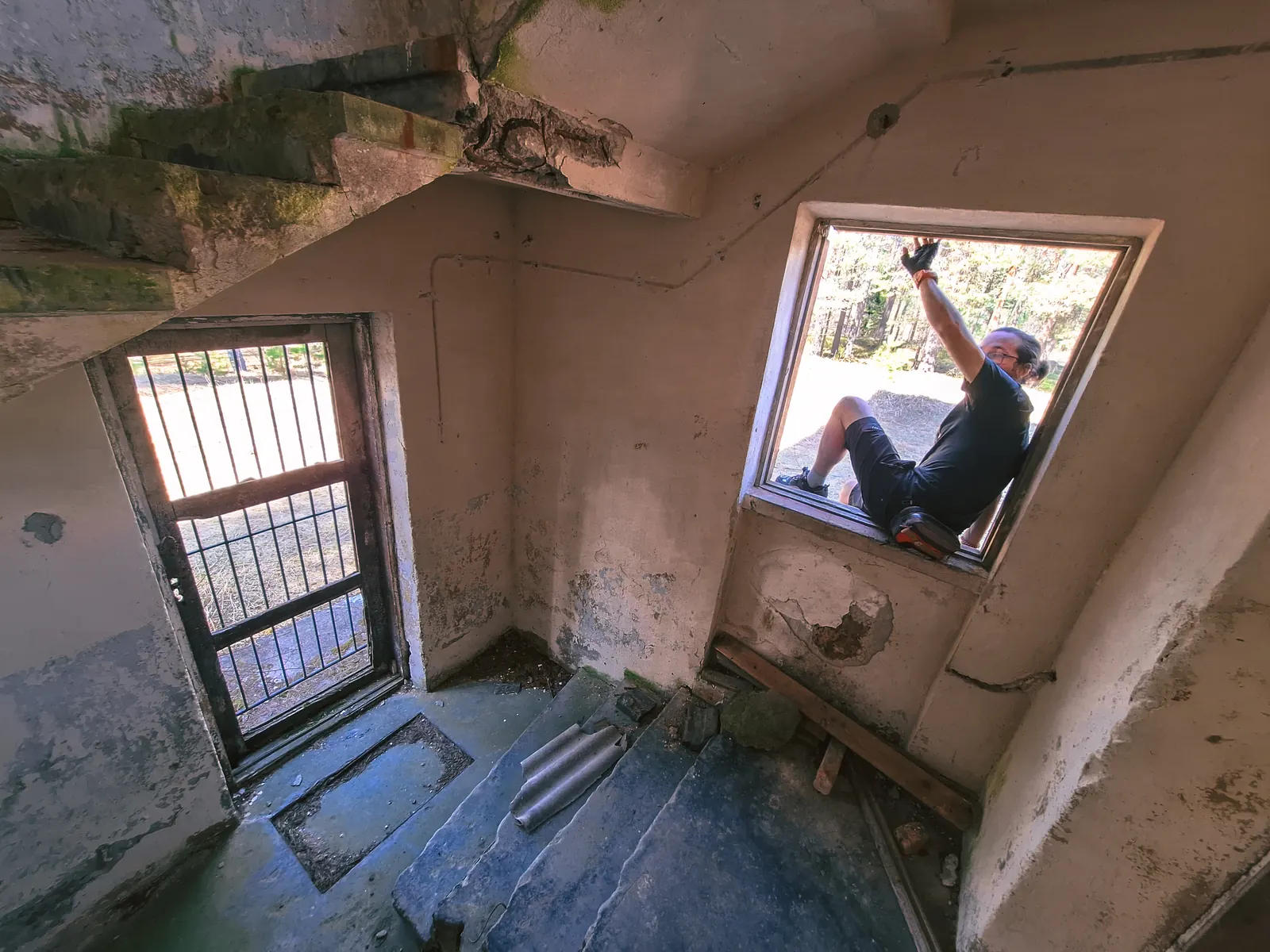
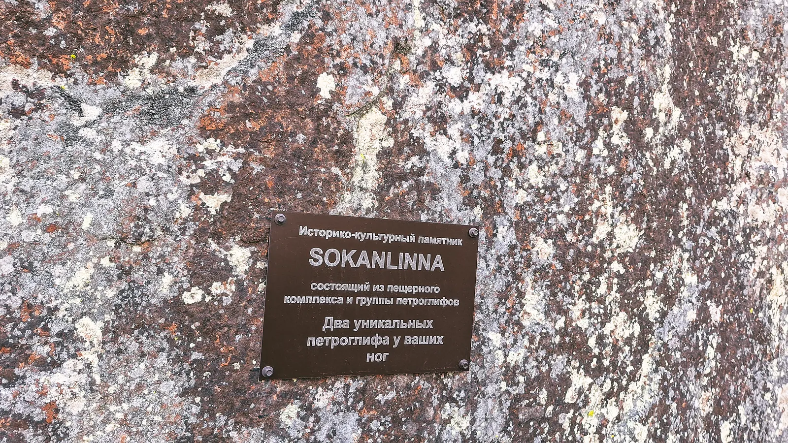
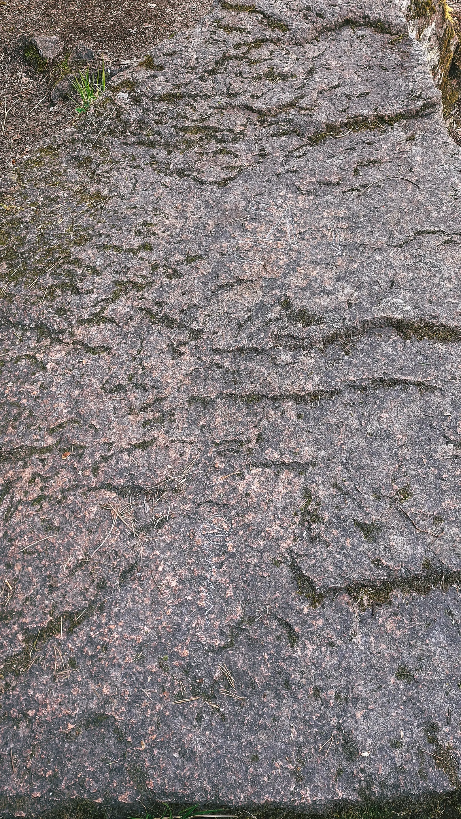
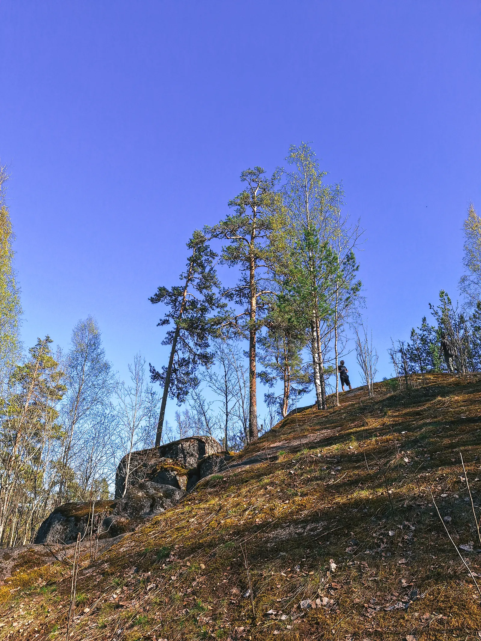
Двинулись к посёлку Красный сокол для закупа в магазине и осмотра местных пещер.
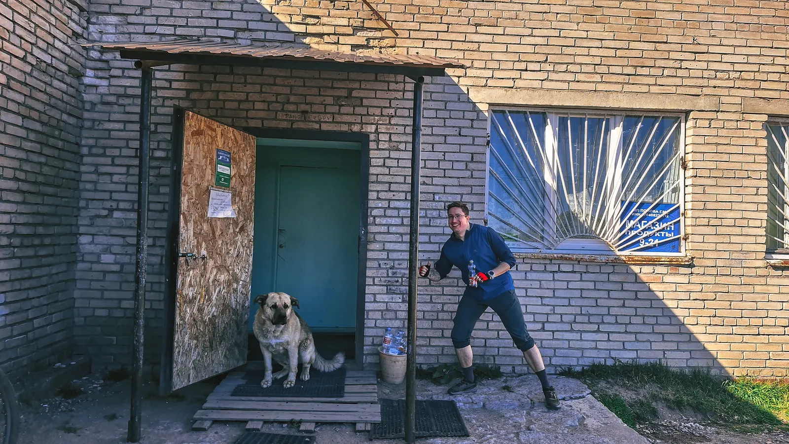
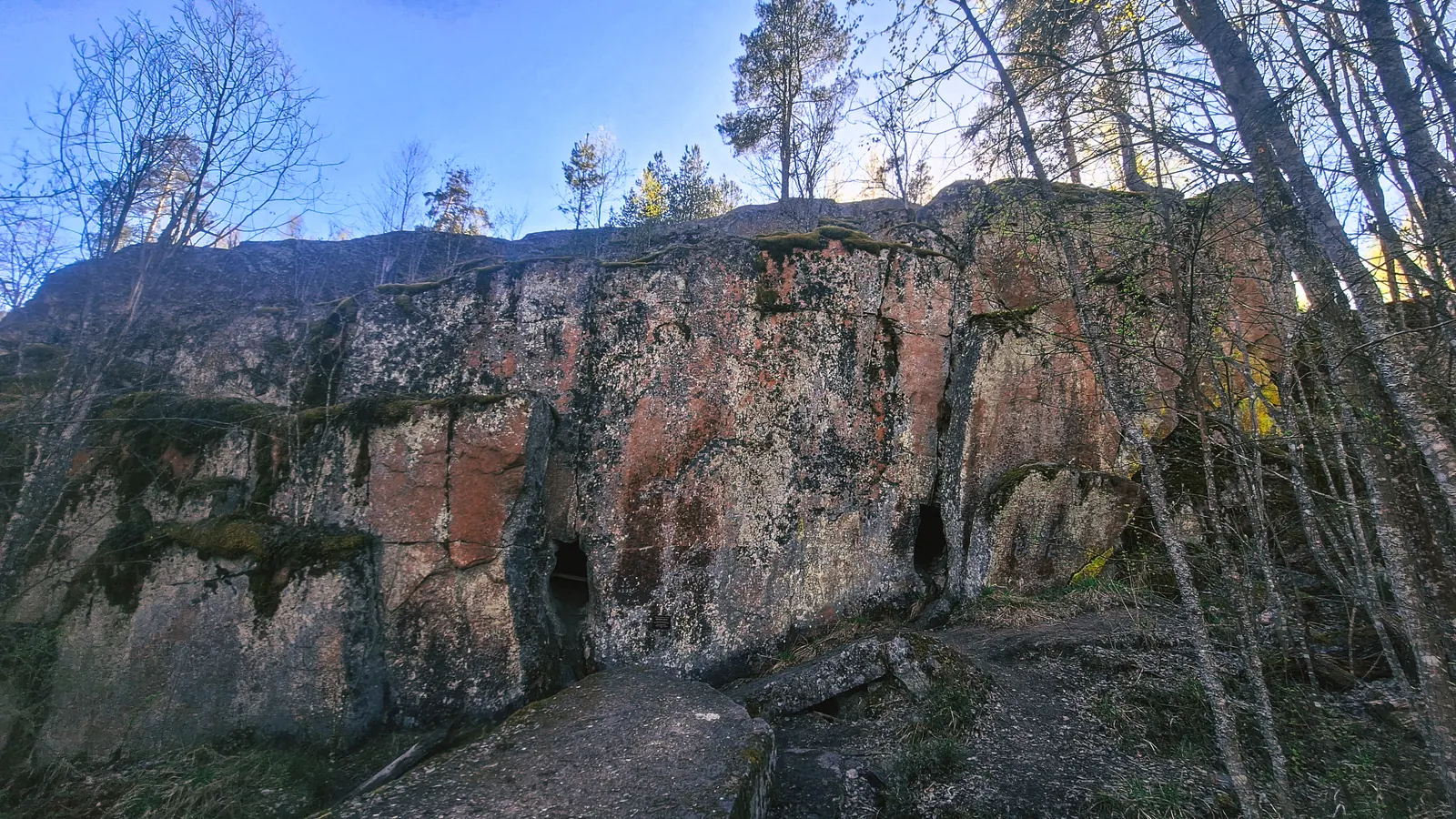
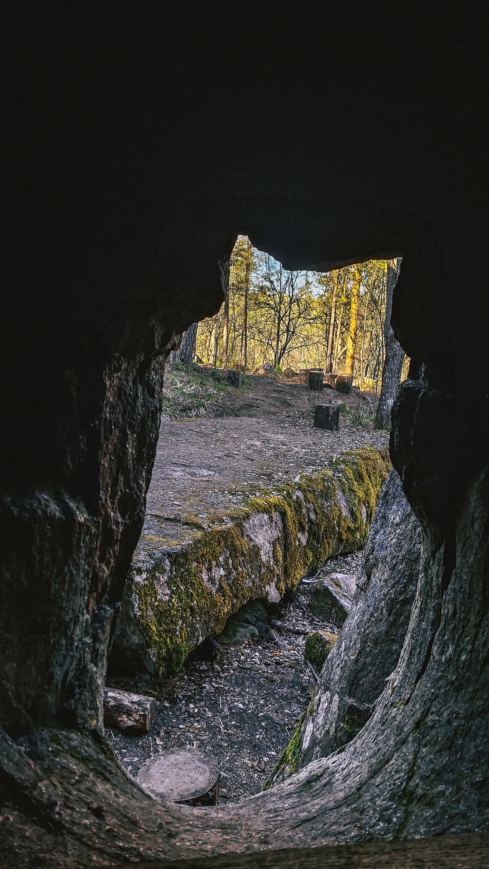
Посёлок произвёл немного грустное впечатление, а вот скалы и пещеры супер, очень красиво.
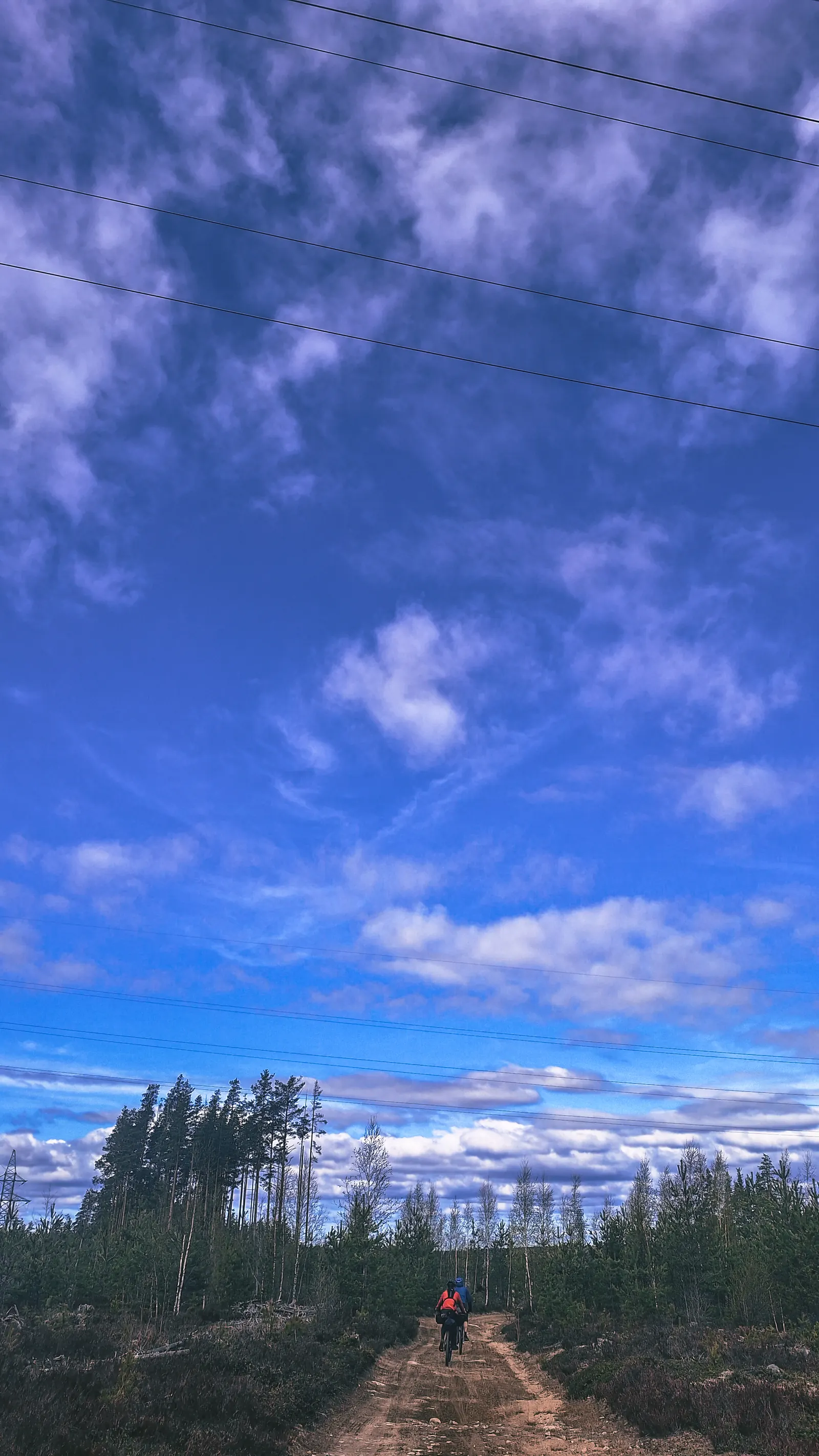
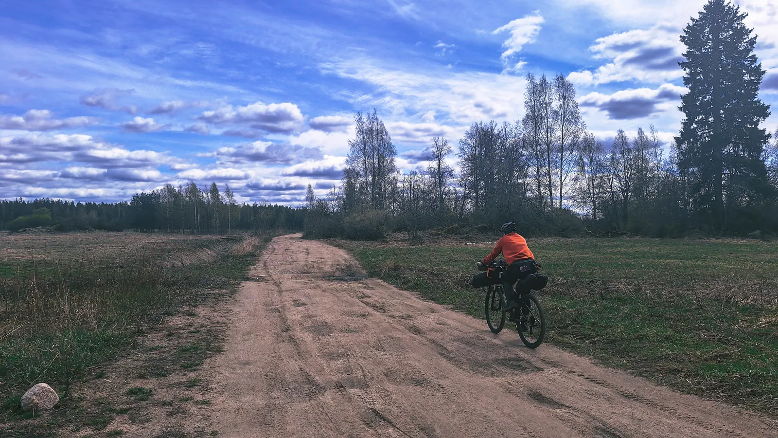
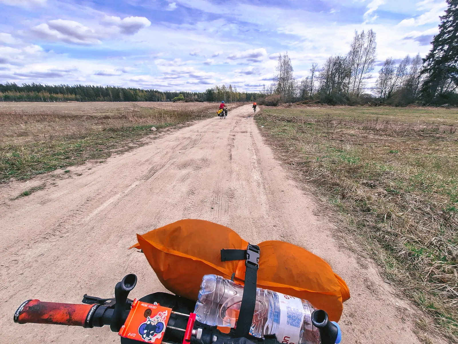
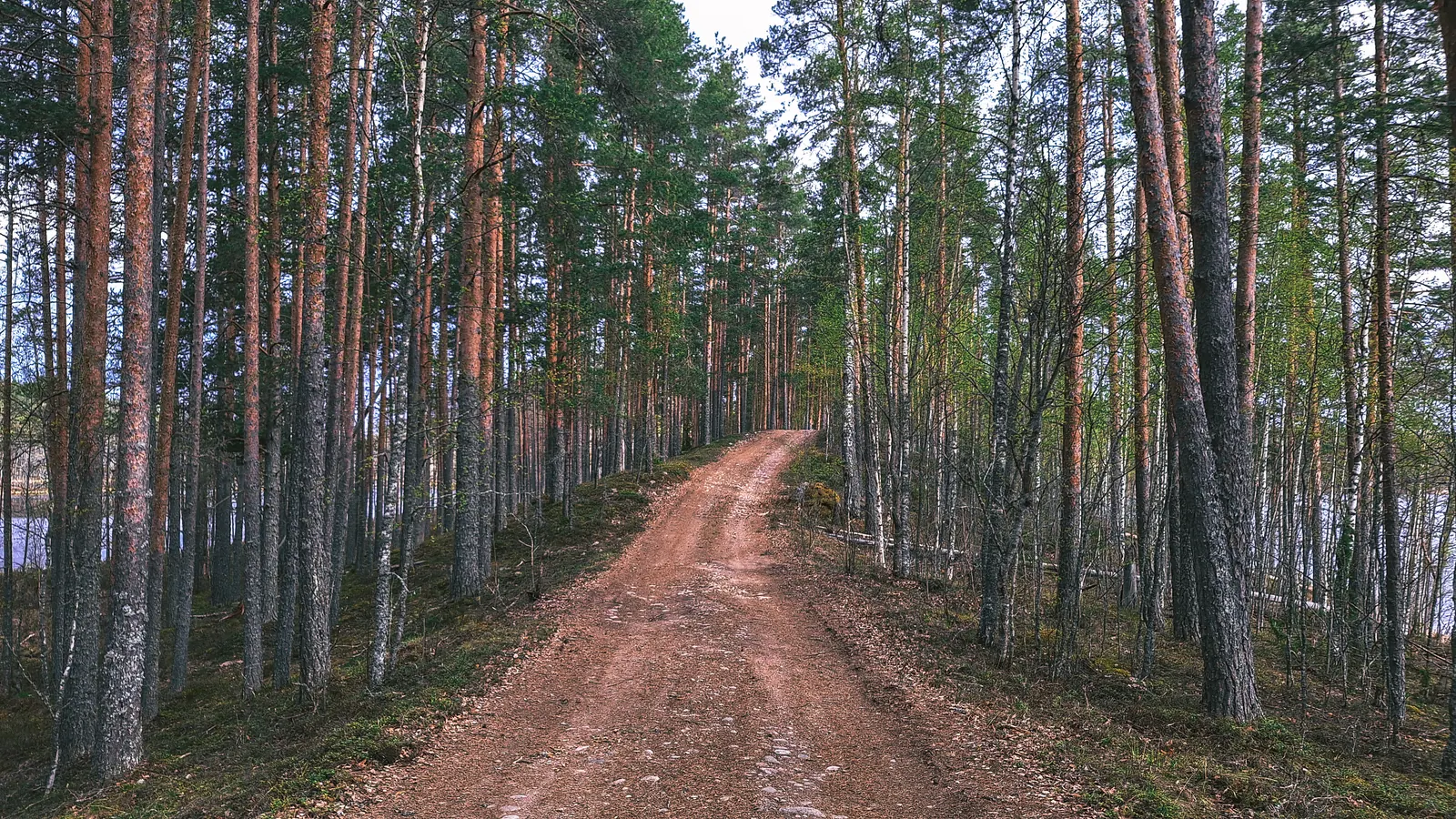
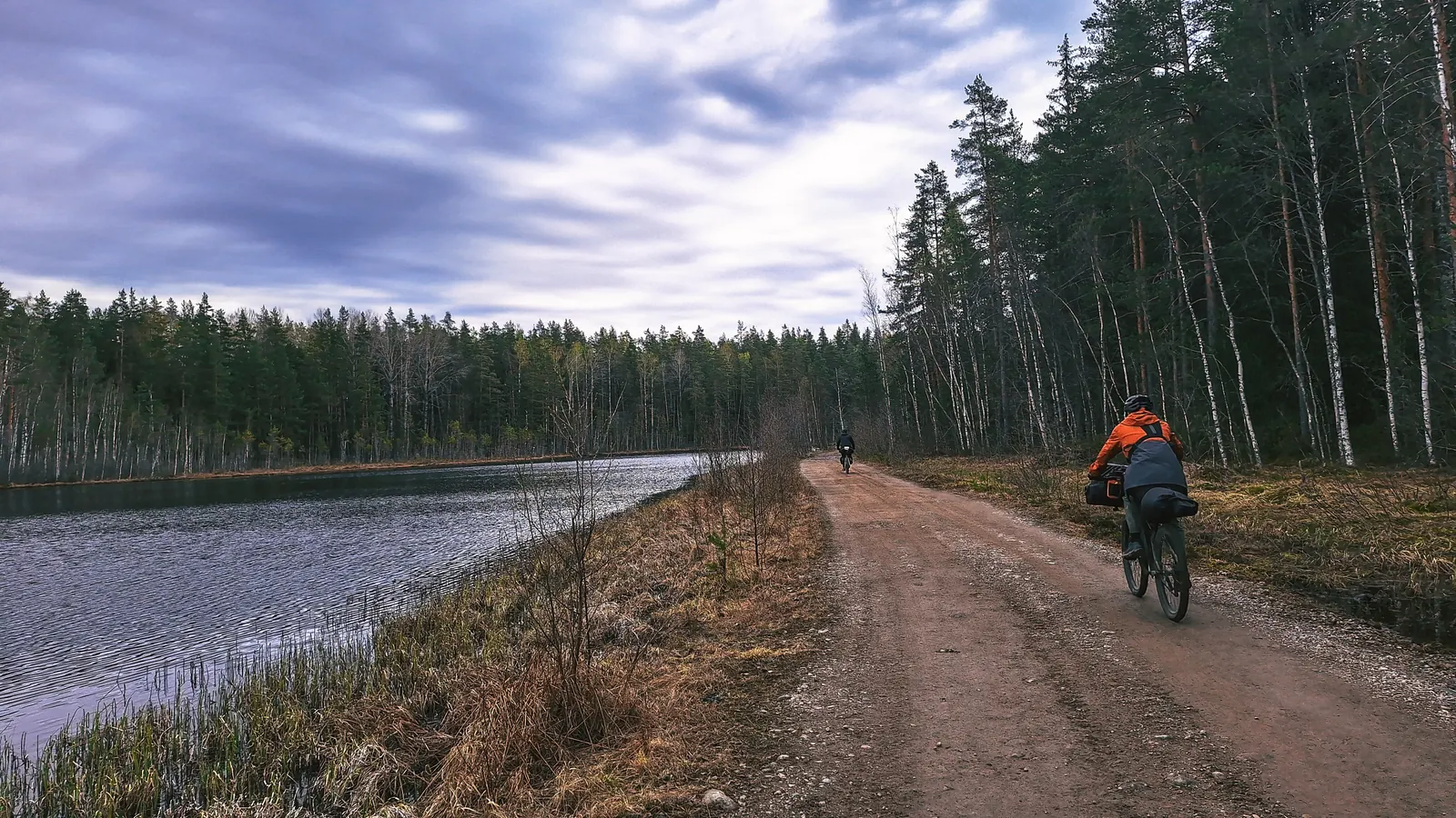
Дальше был скучный прогон по пыльной дороге. Но повезло что был хороший накат, без ям и грейдера. И каким то чудом нас не окатывали пылью камазы каждые 10 минут с ближайших карьеров.
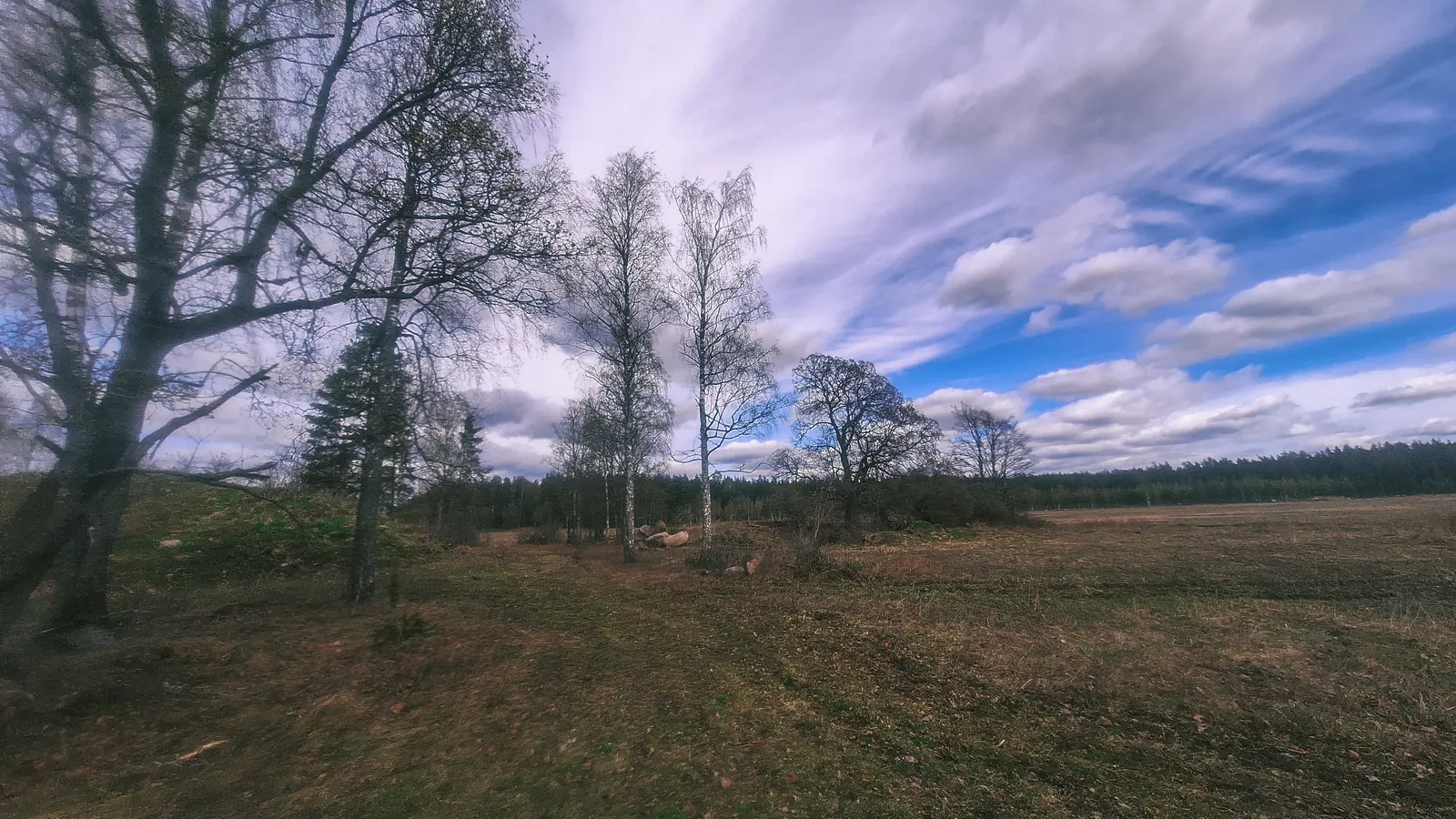
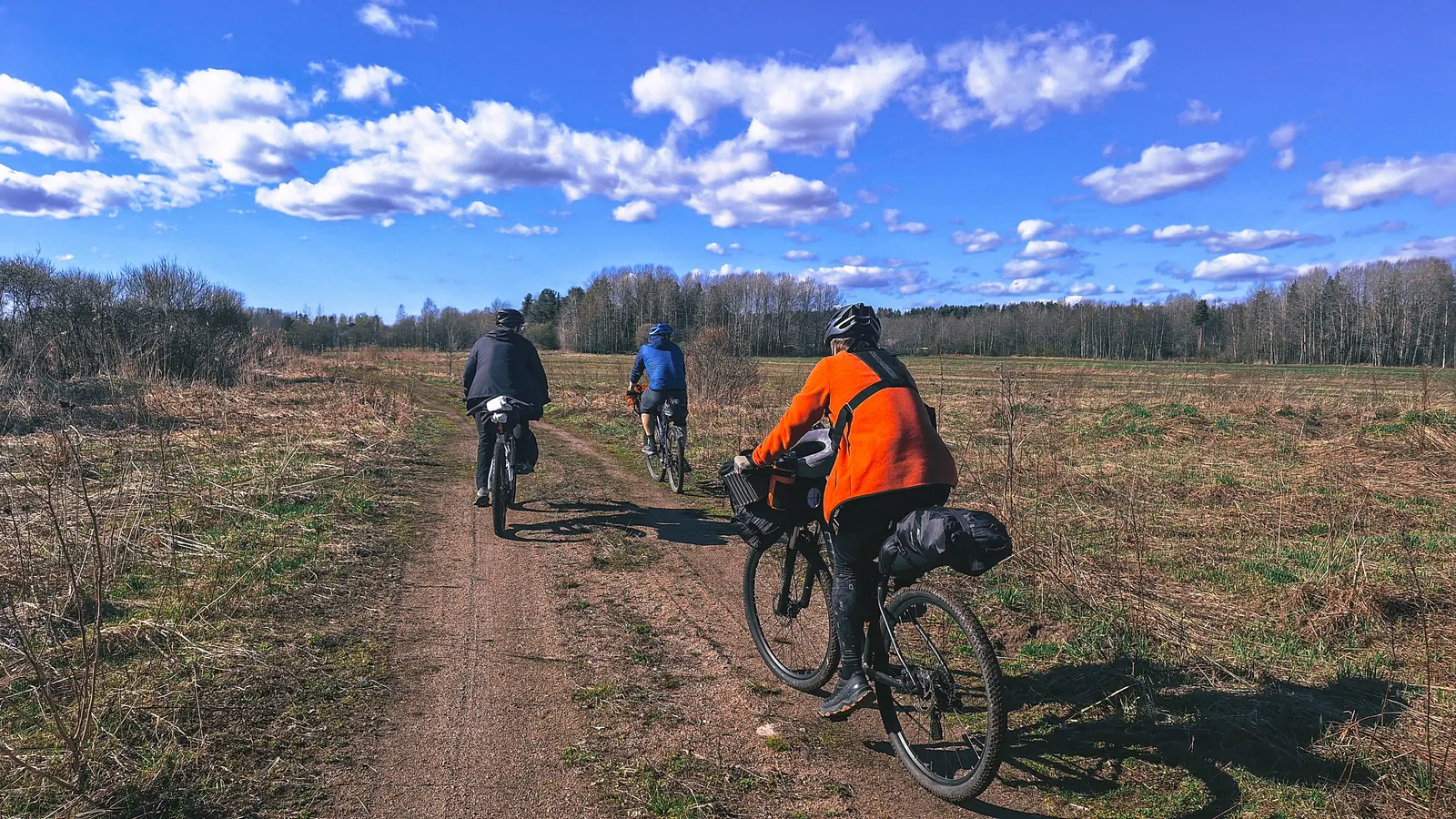
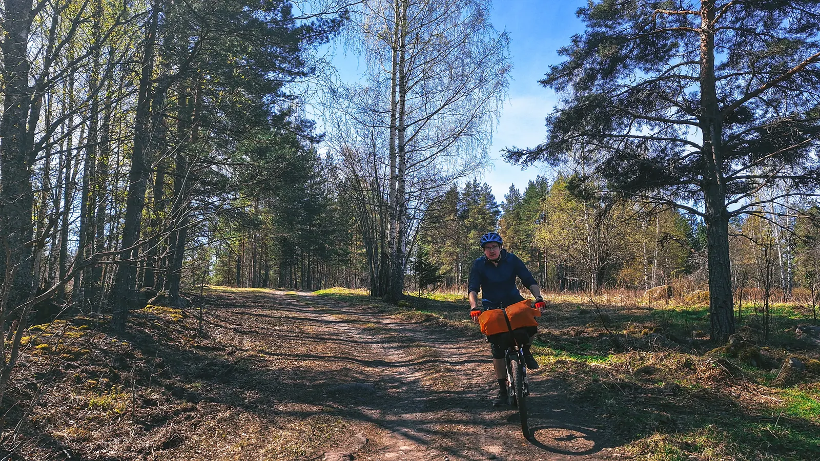
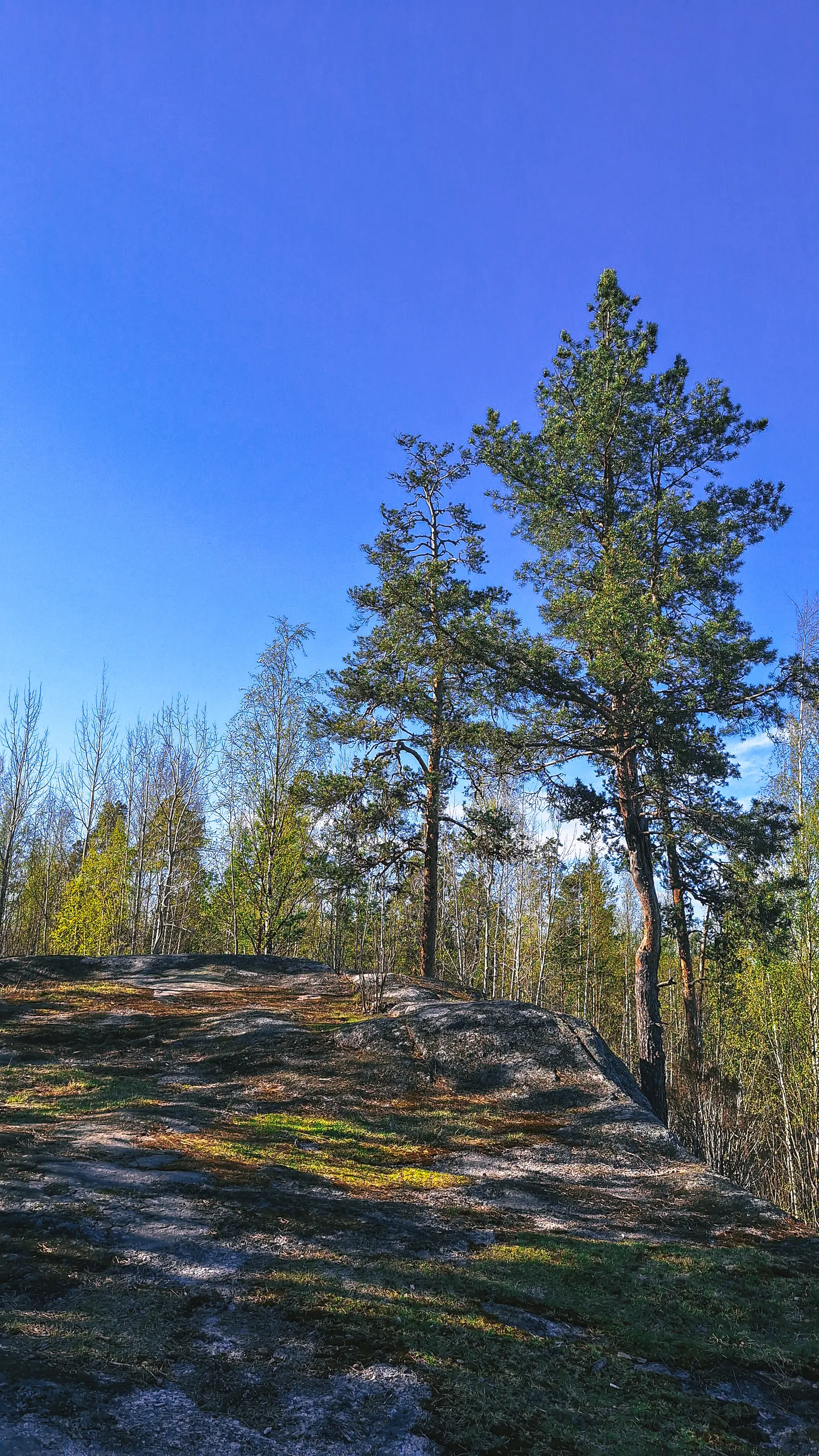
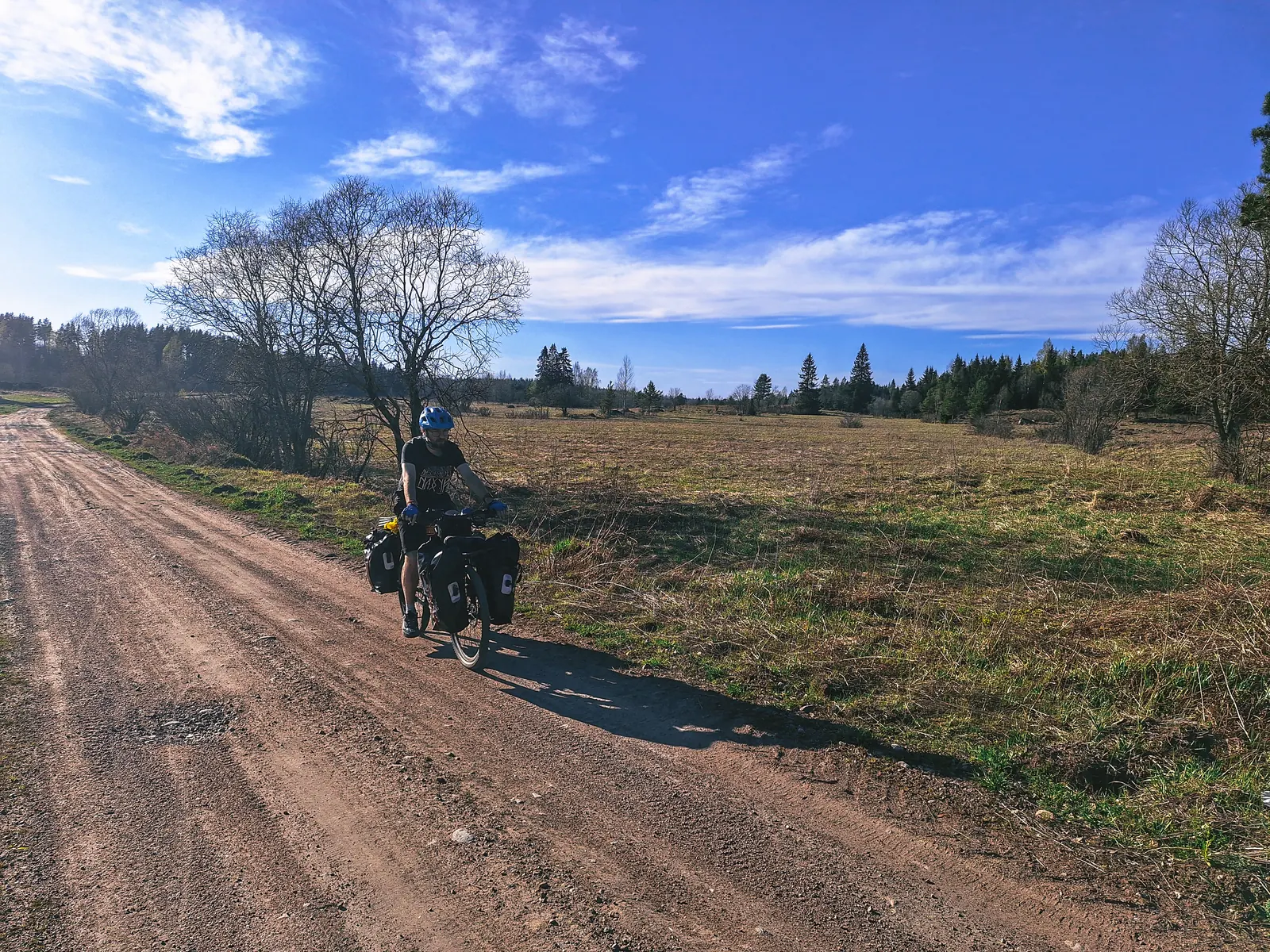
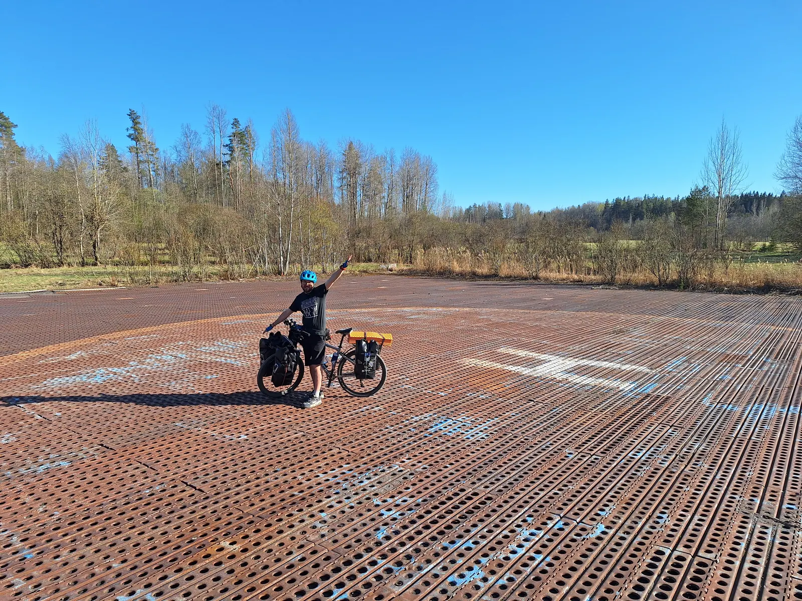
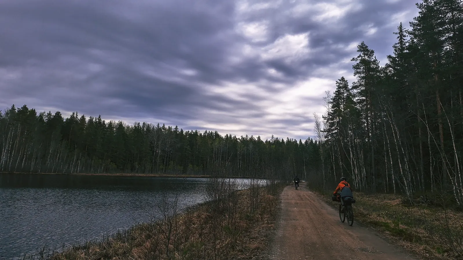
Затем пылюга кончилась и началась снова отличная грунтовка по полям. Виды на хутора, руины и даже вертолётная площадка!
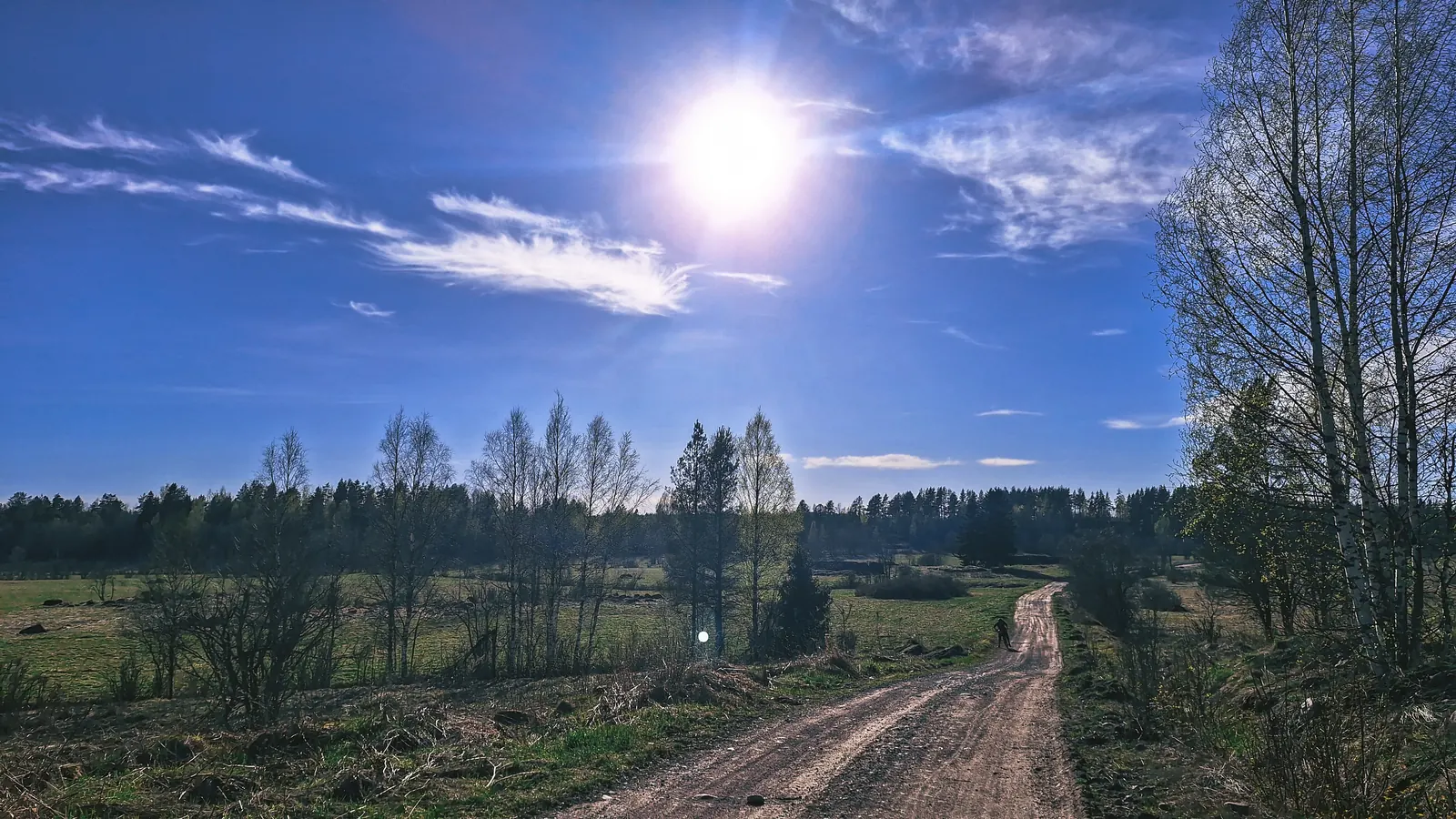
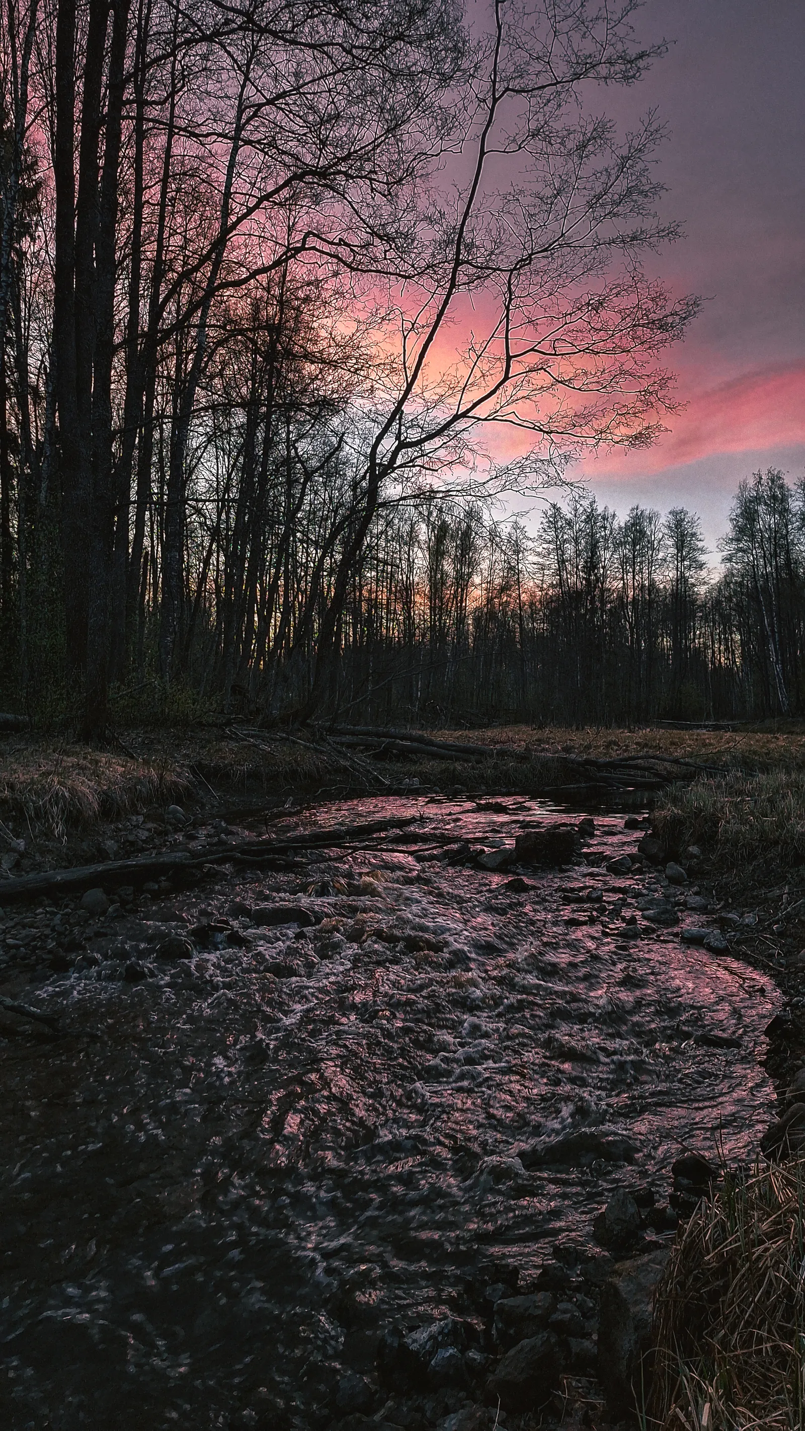
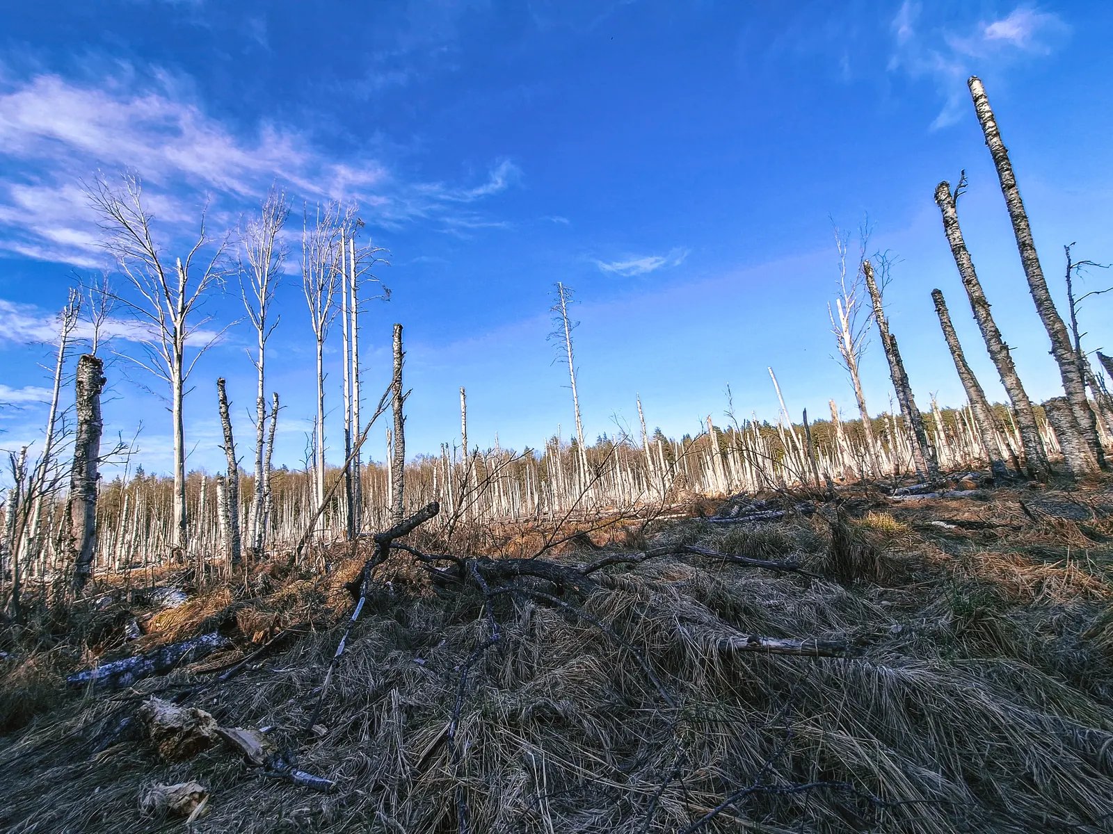
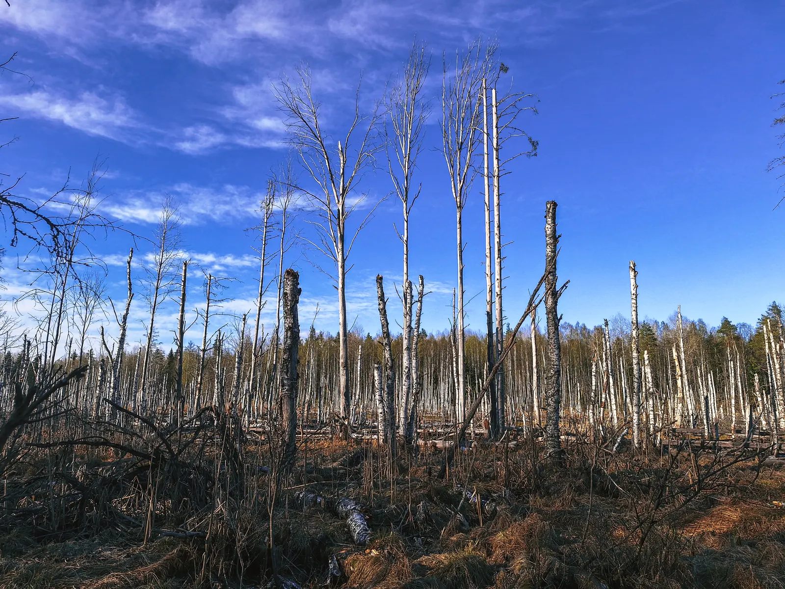
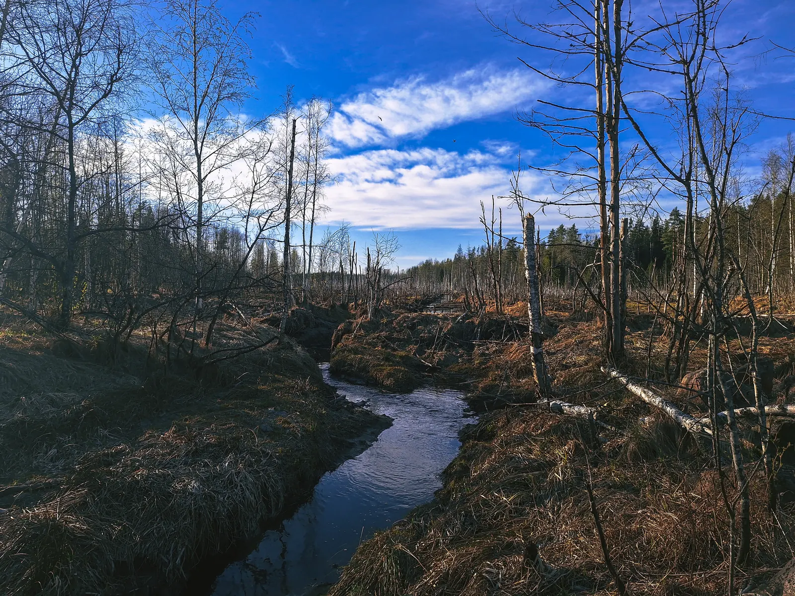
Затем начался участок с красивыми болотами.
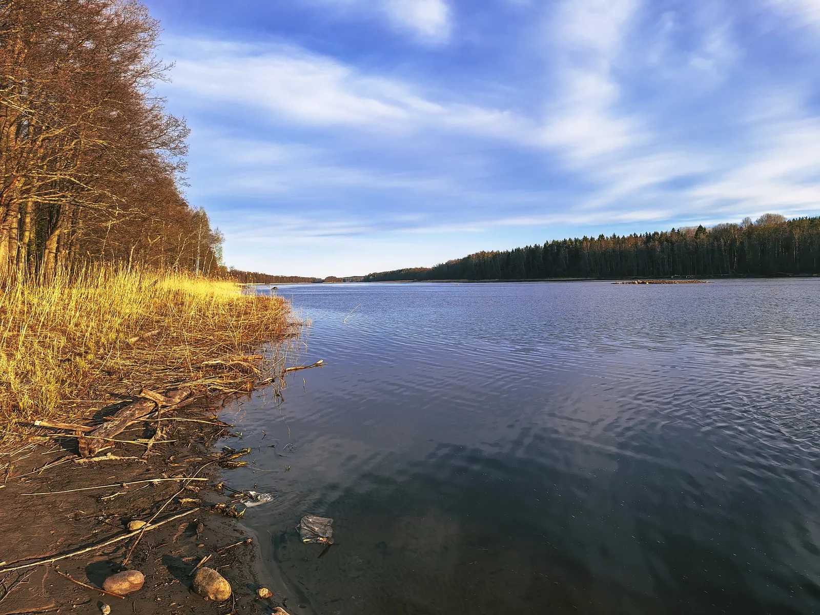
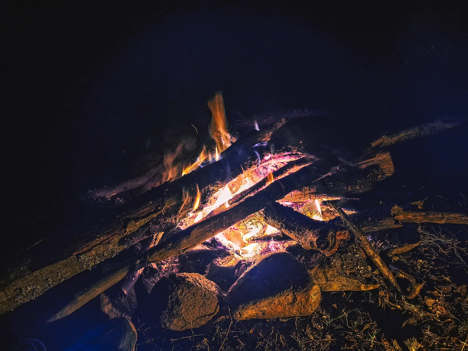
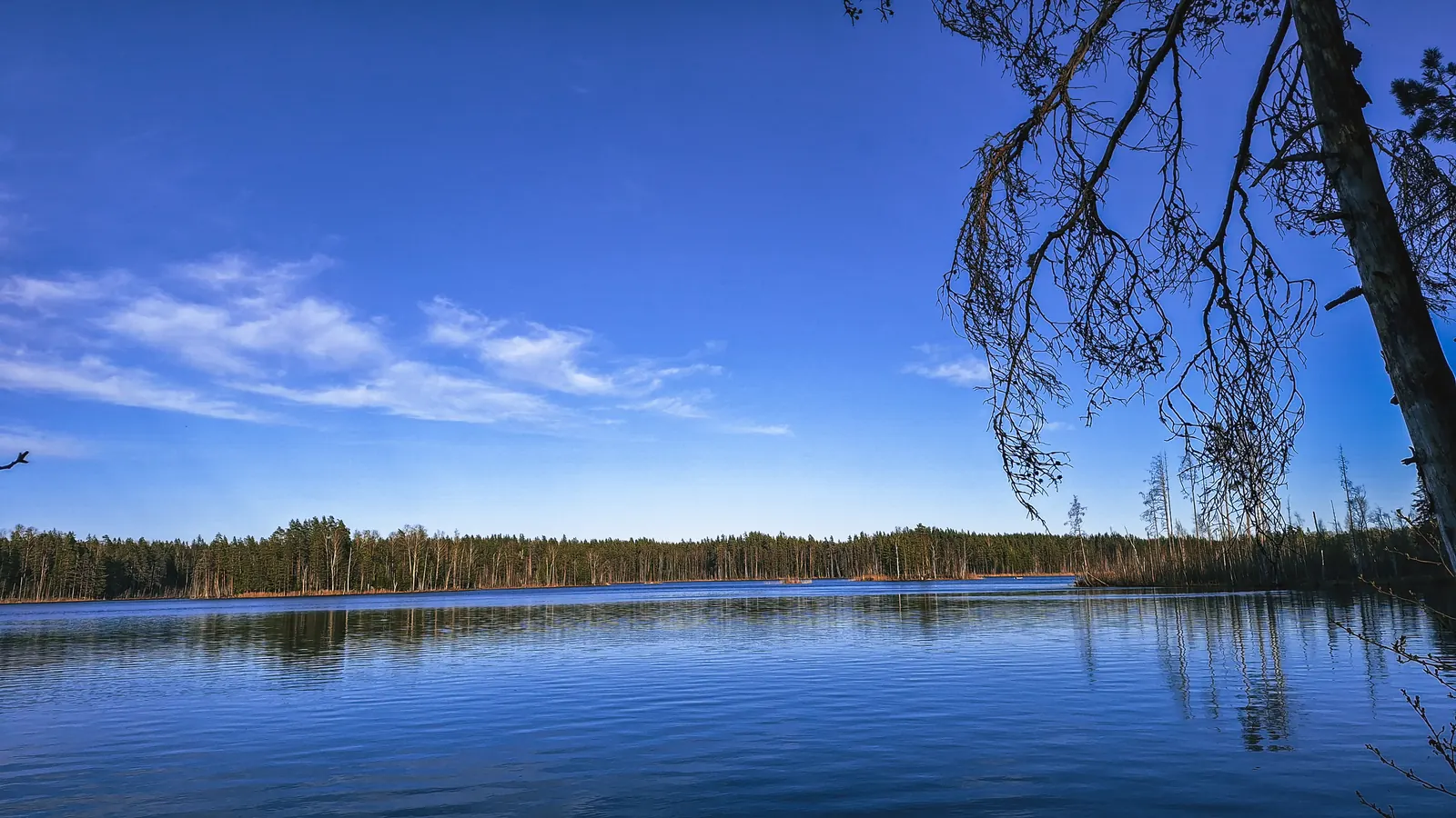
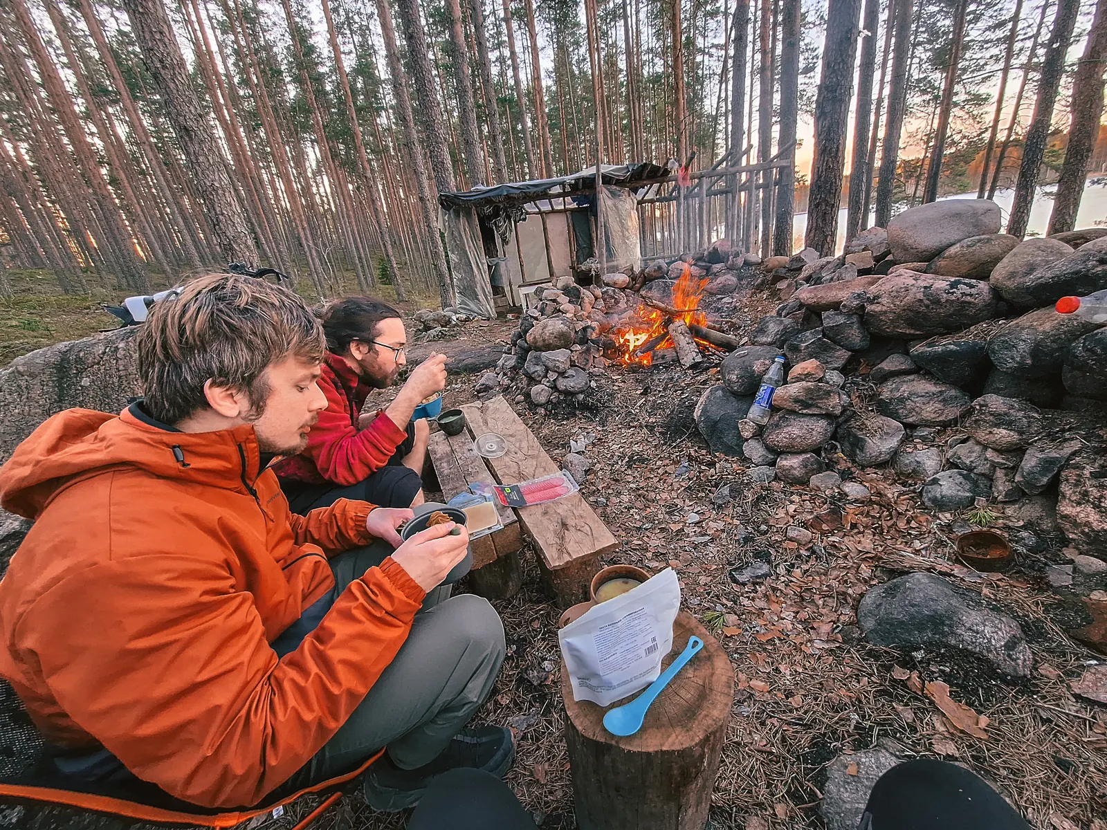
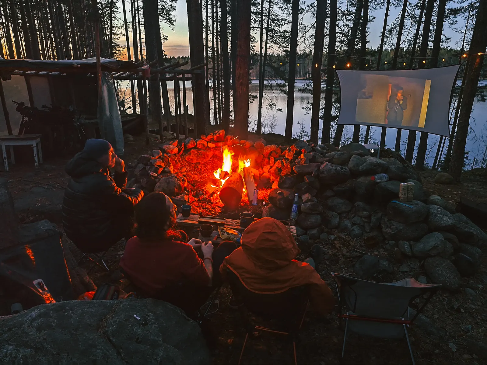
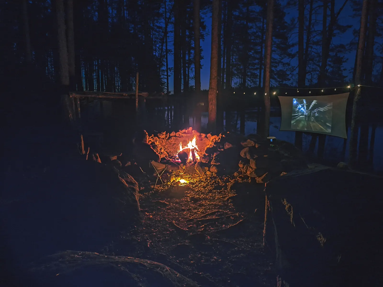
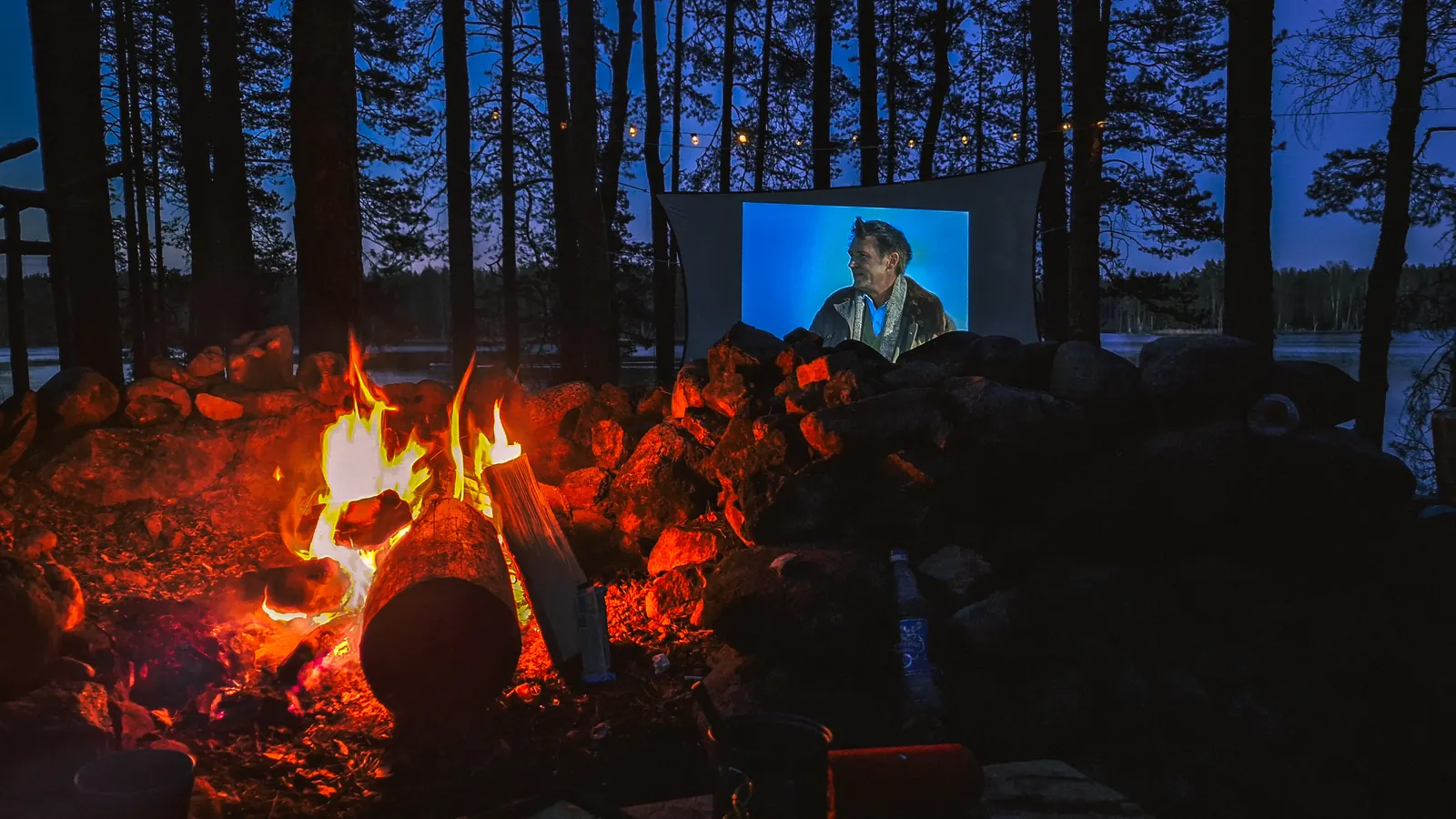
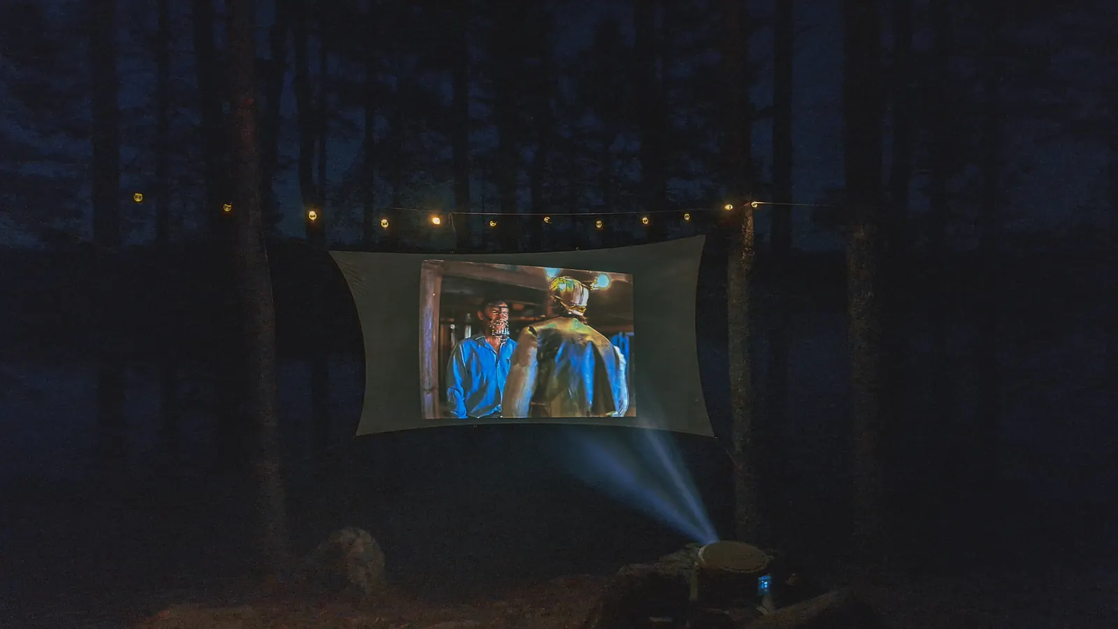
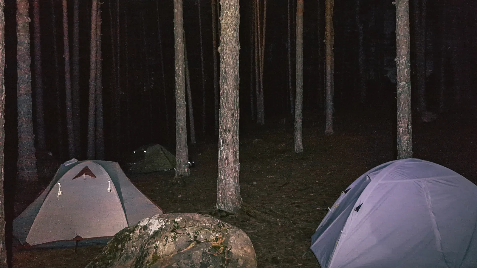
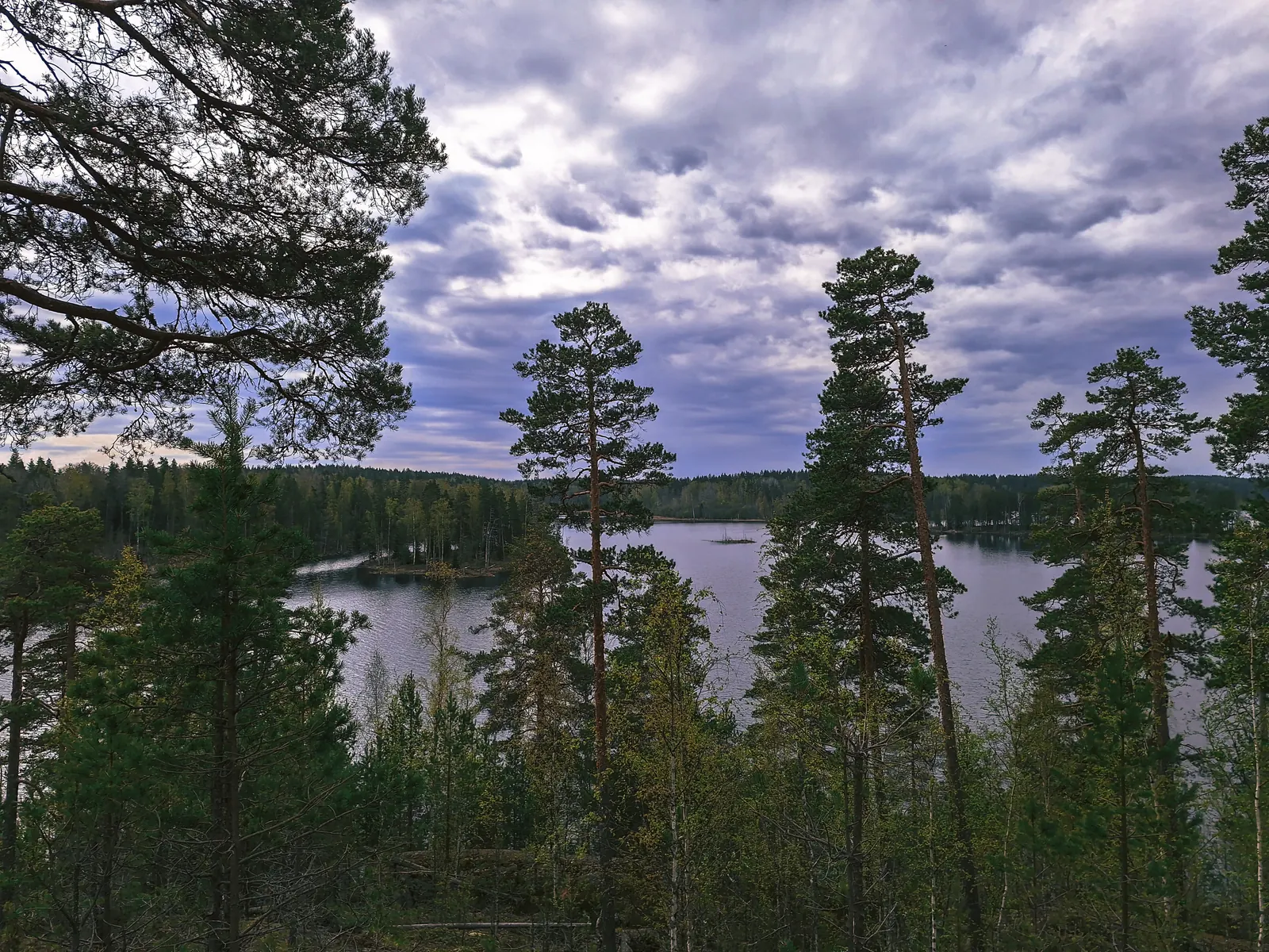
Доехав до озёр, без проблем нашли шикарную стоянку с дровами. Разбились, поужинали и изюминка этого похода... Киносеанс под звёздами! Асфальт не нужен, дорогой!
Решили встать пораньше, и даже удалось оперативно собраться, всего лишь за каких-то шустрых 2 часа)
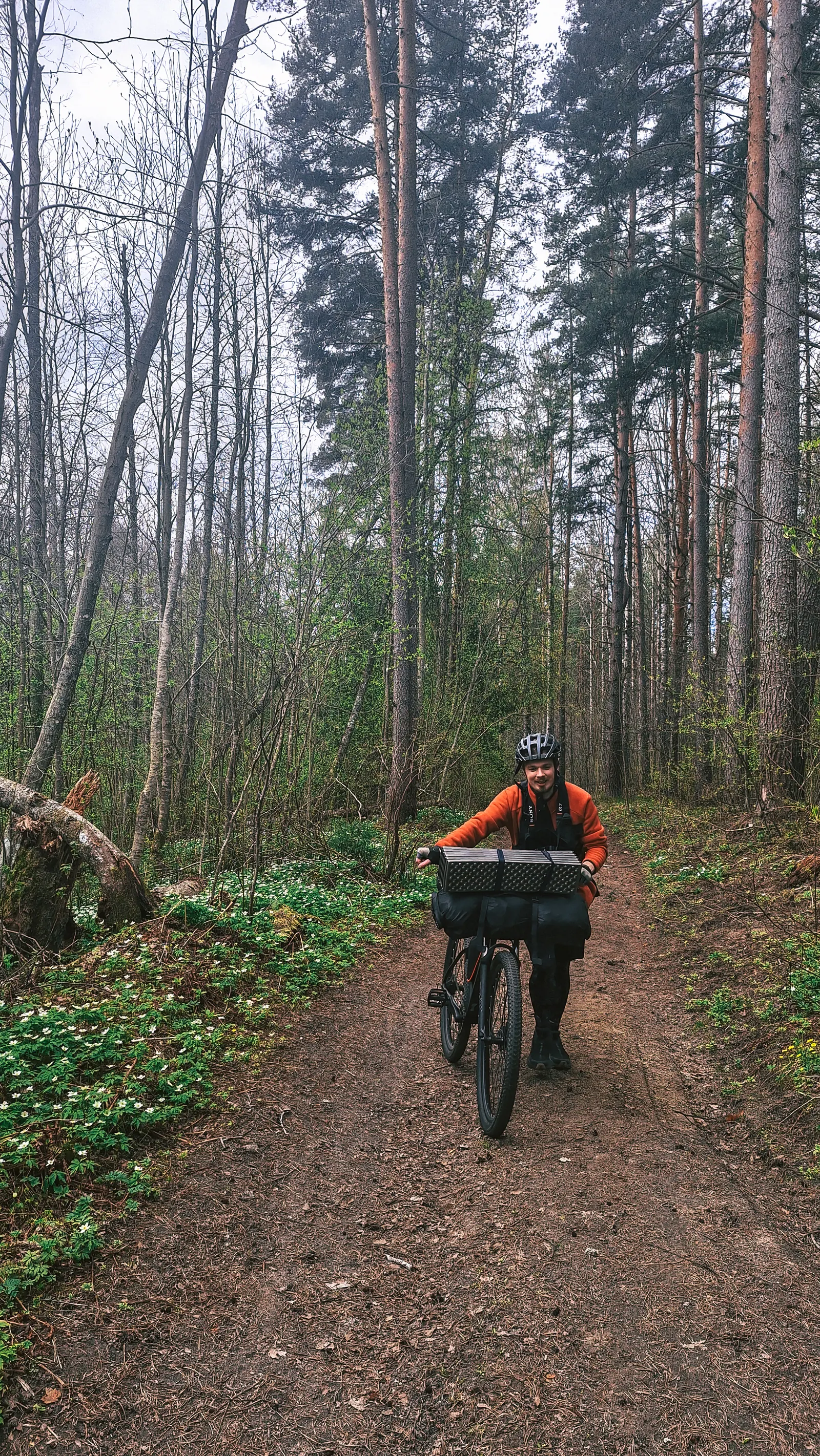
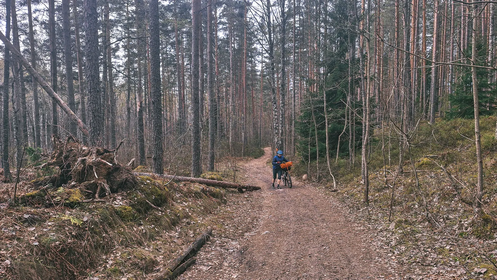
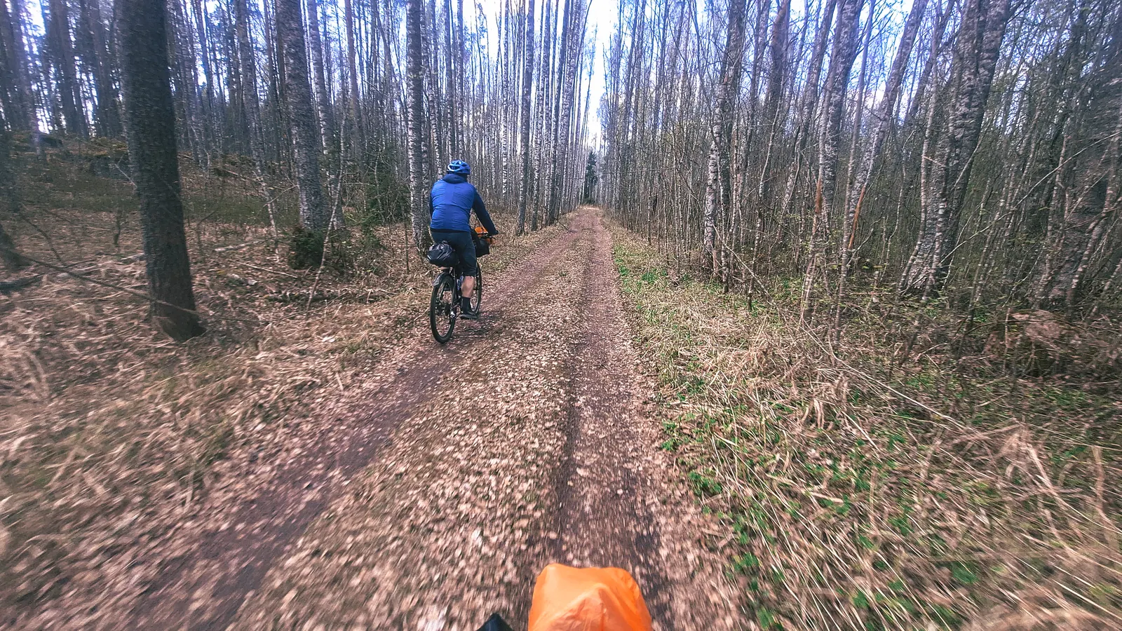
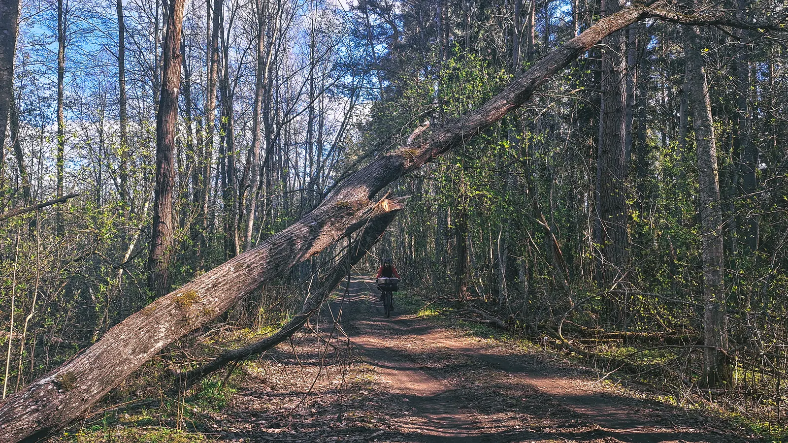
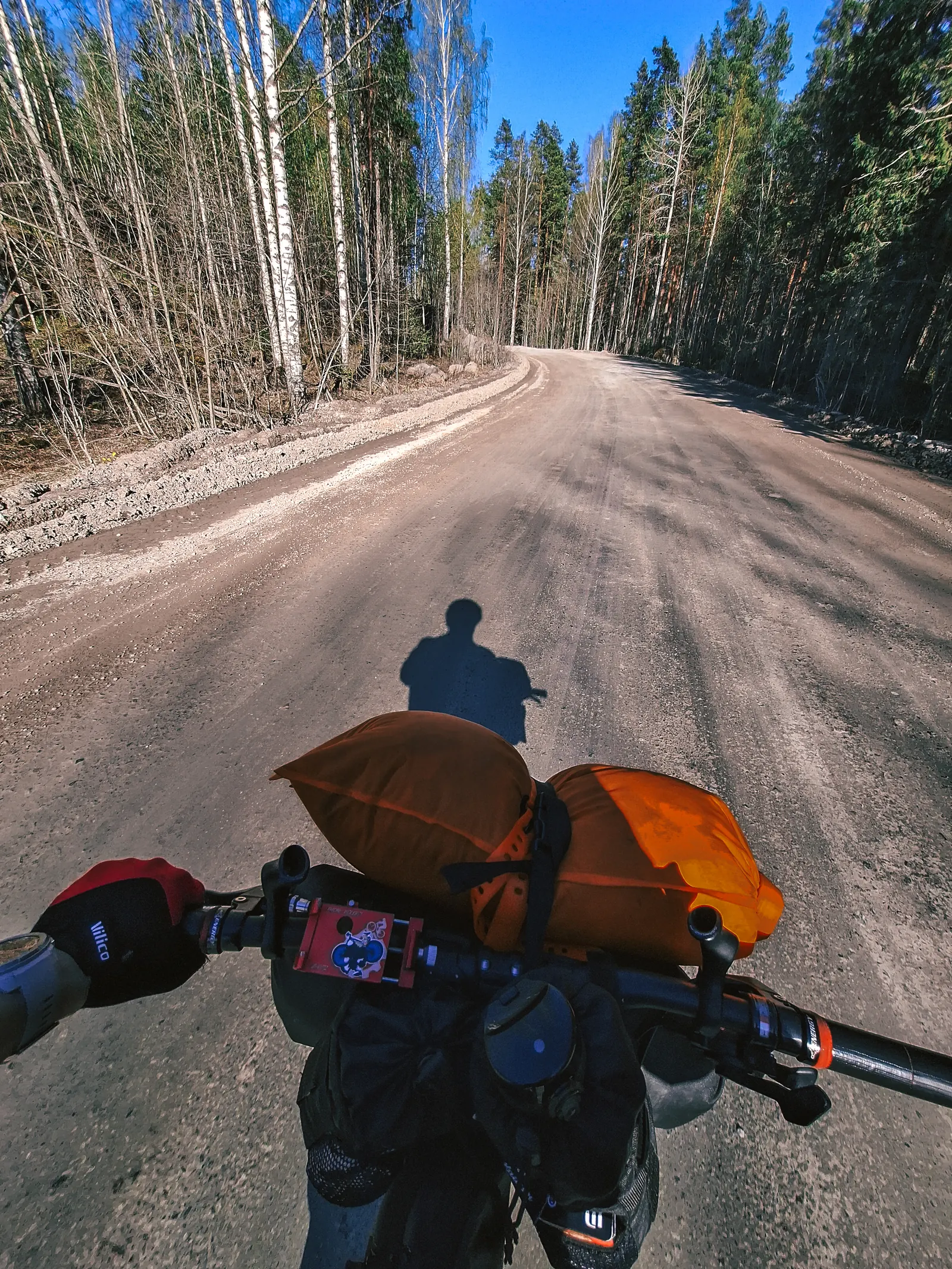
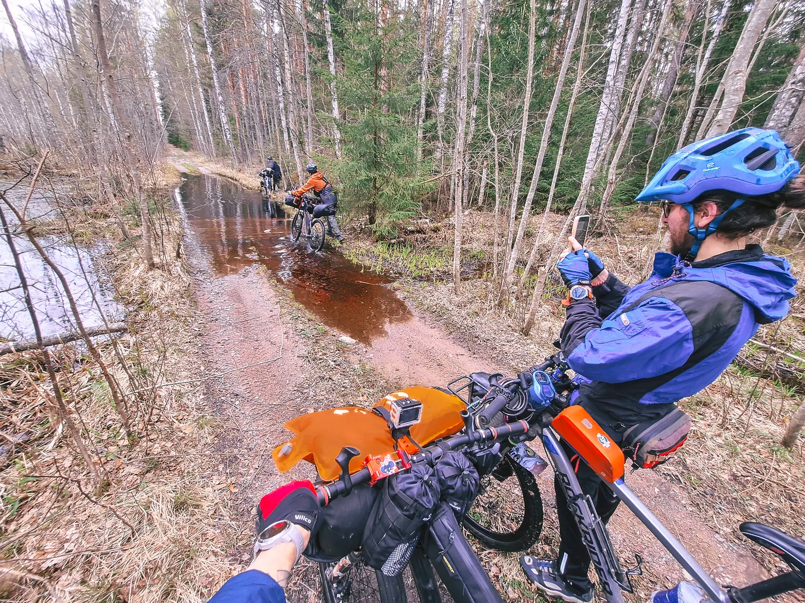
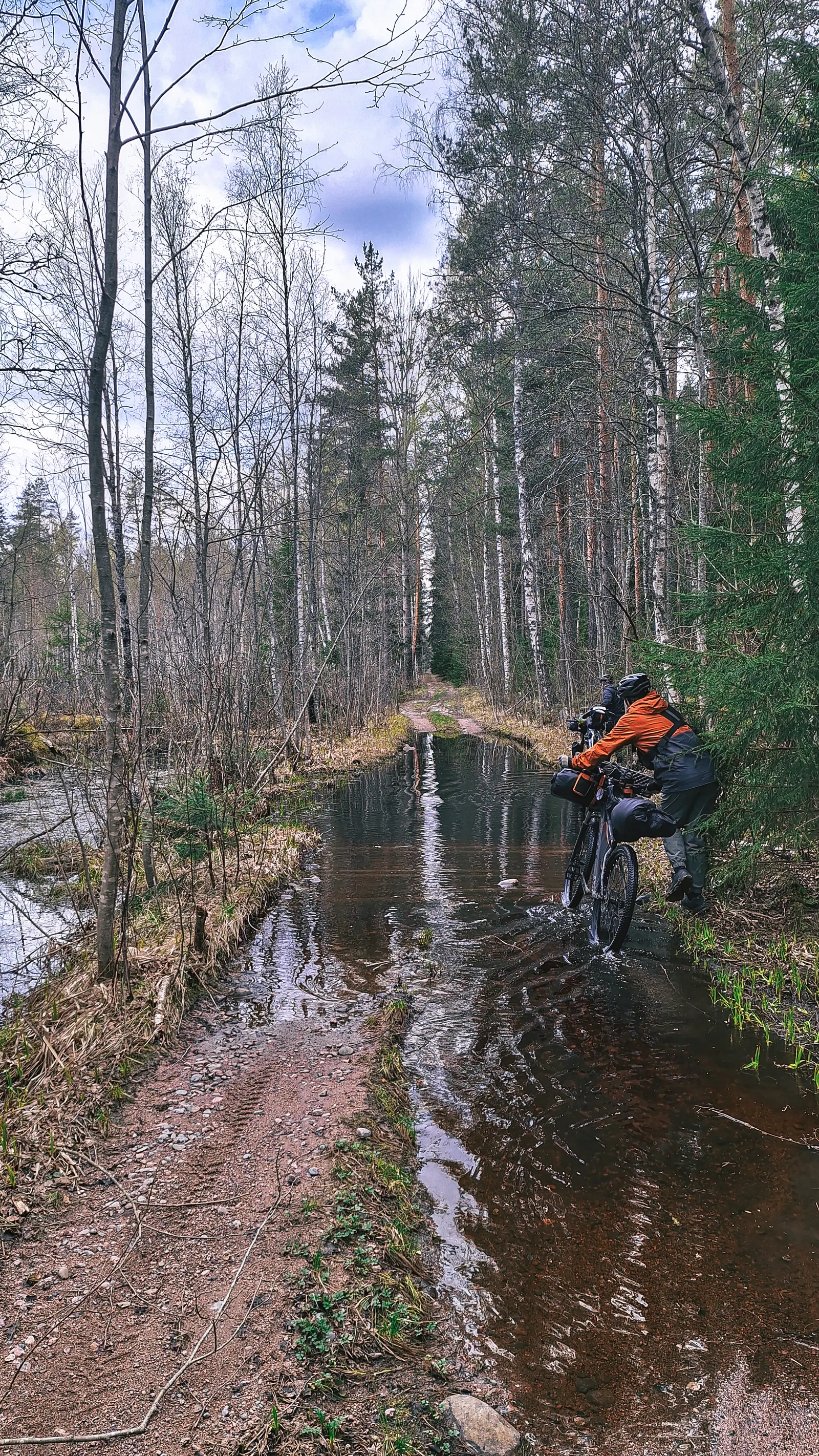
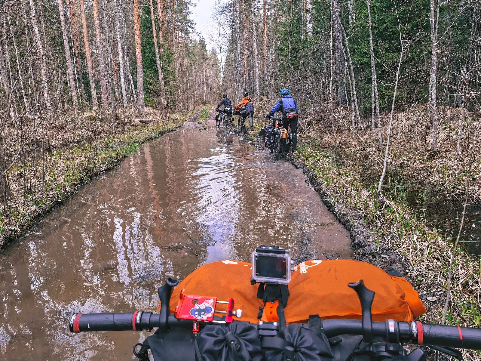
А затем пошло огребалово в видео часа пробирания по лужам) По карте от этих озёр шла ещё одна дорога, тропинка на лево с выходом на "белую" грунтовку, возможно лучше было двигать по ней... Комаров конечно не хватало!
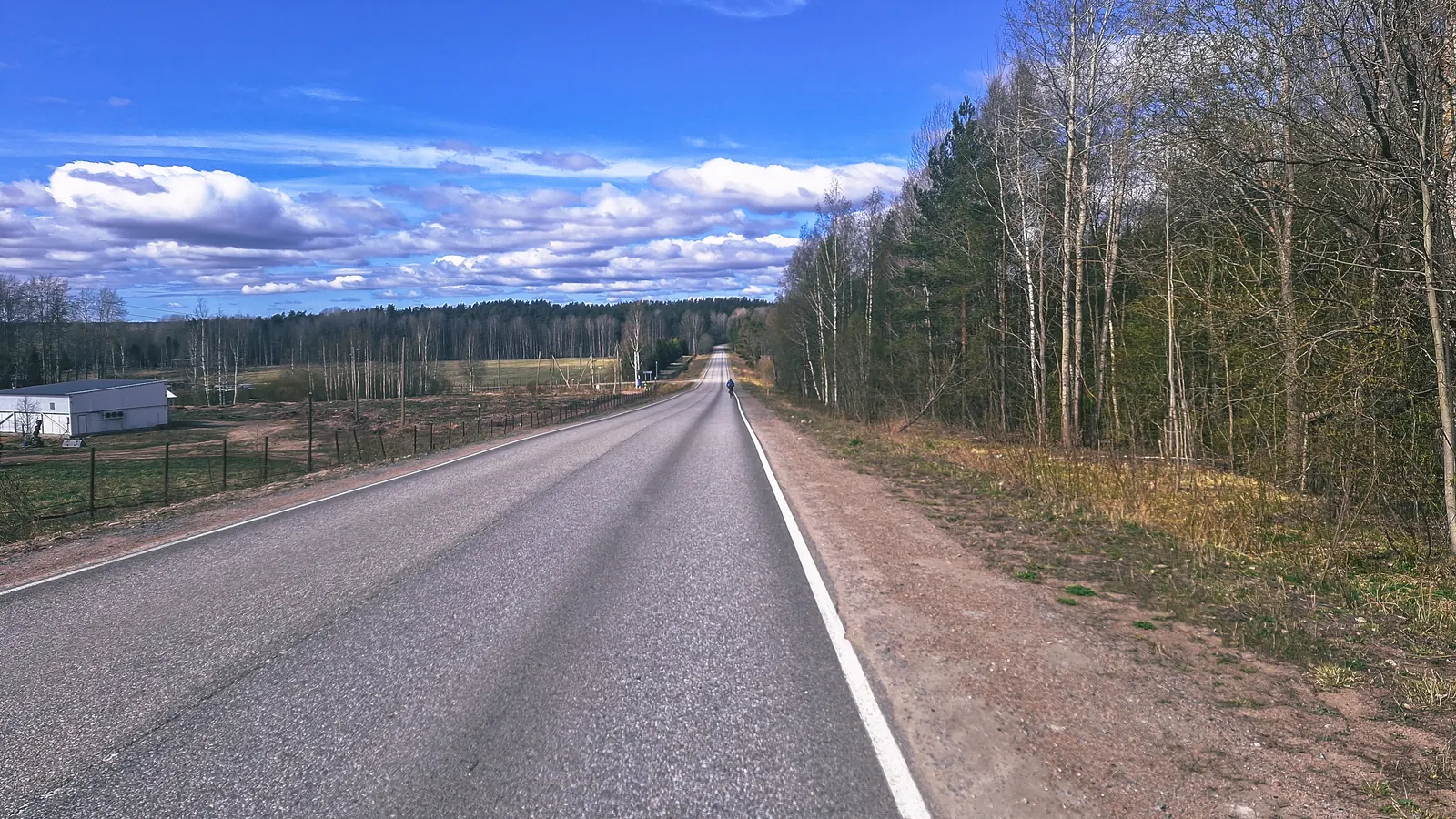
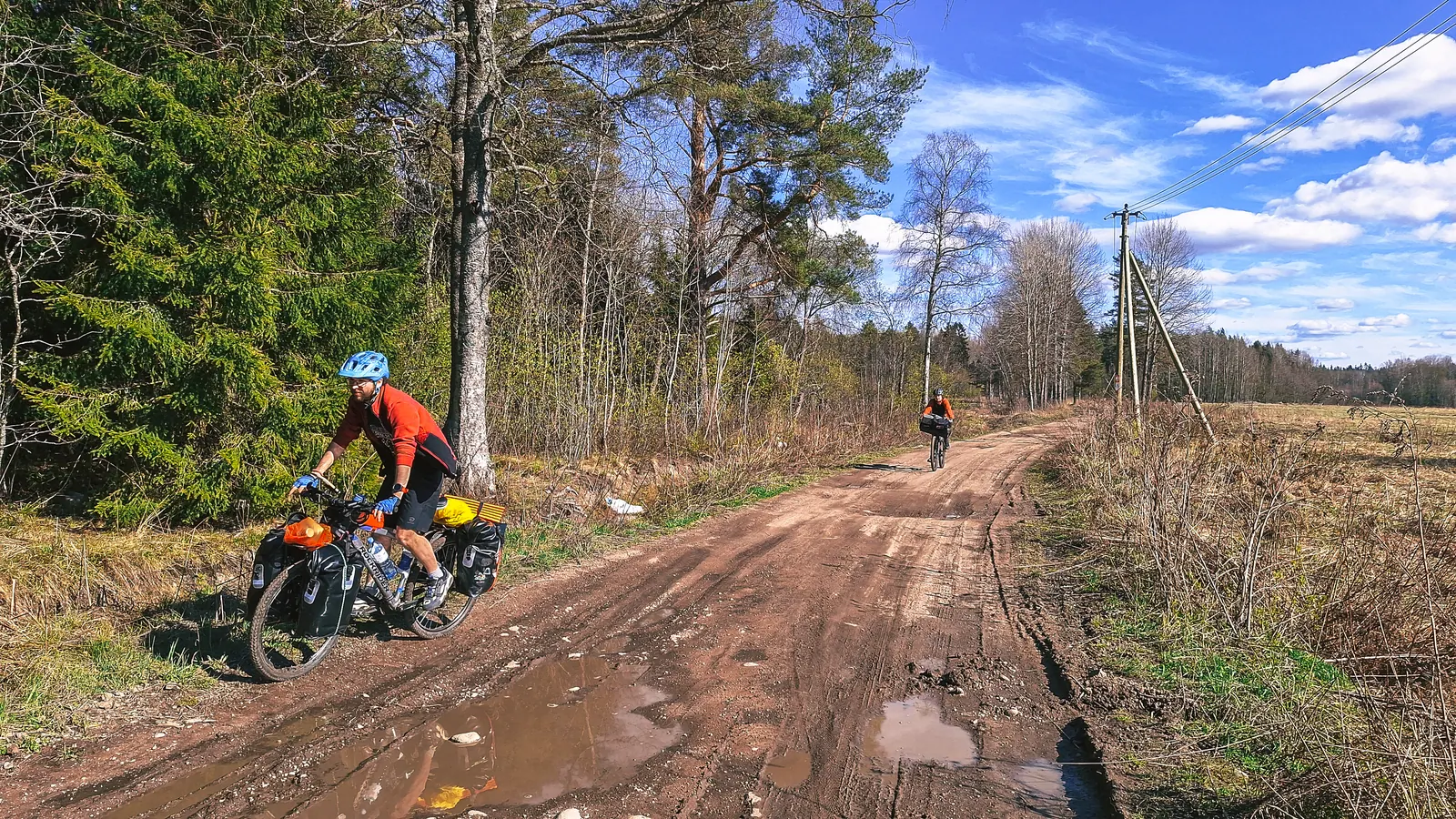
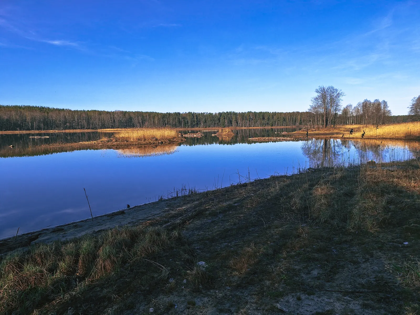
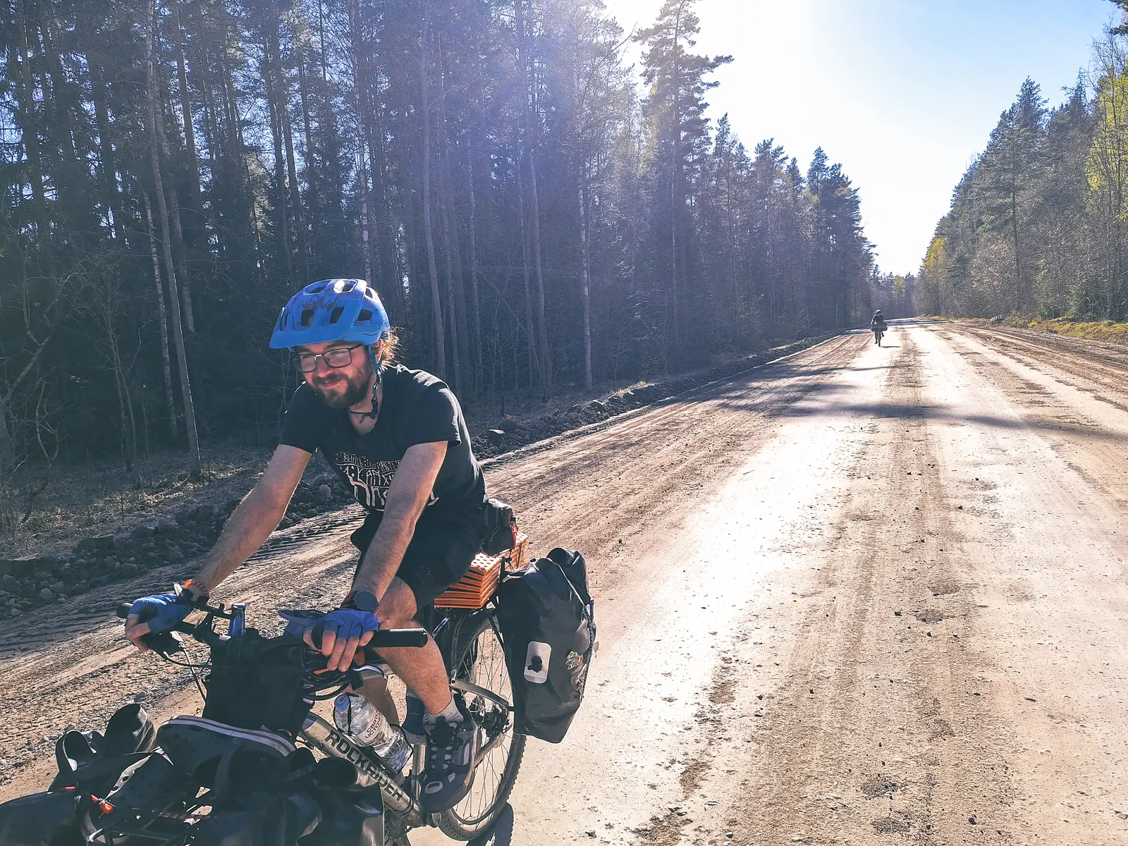
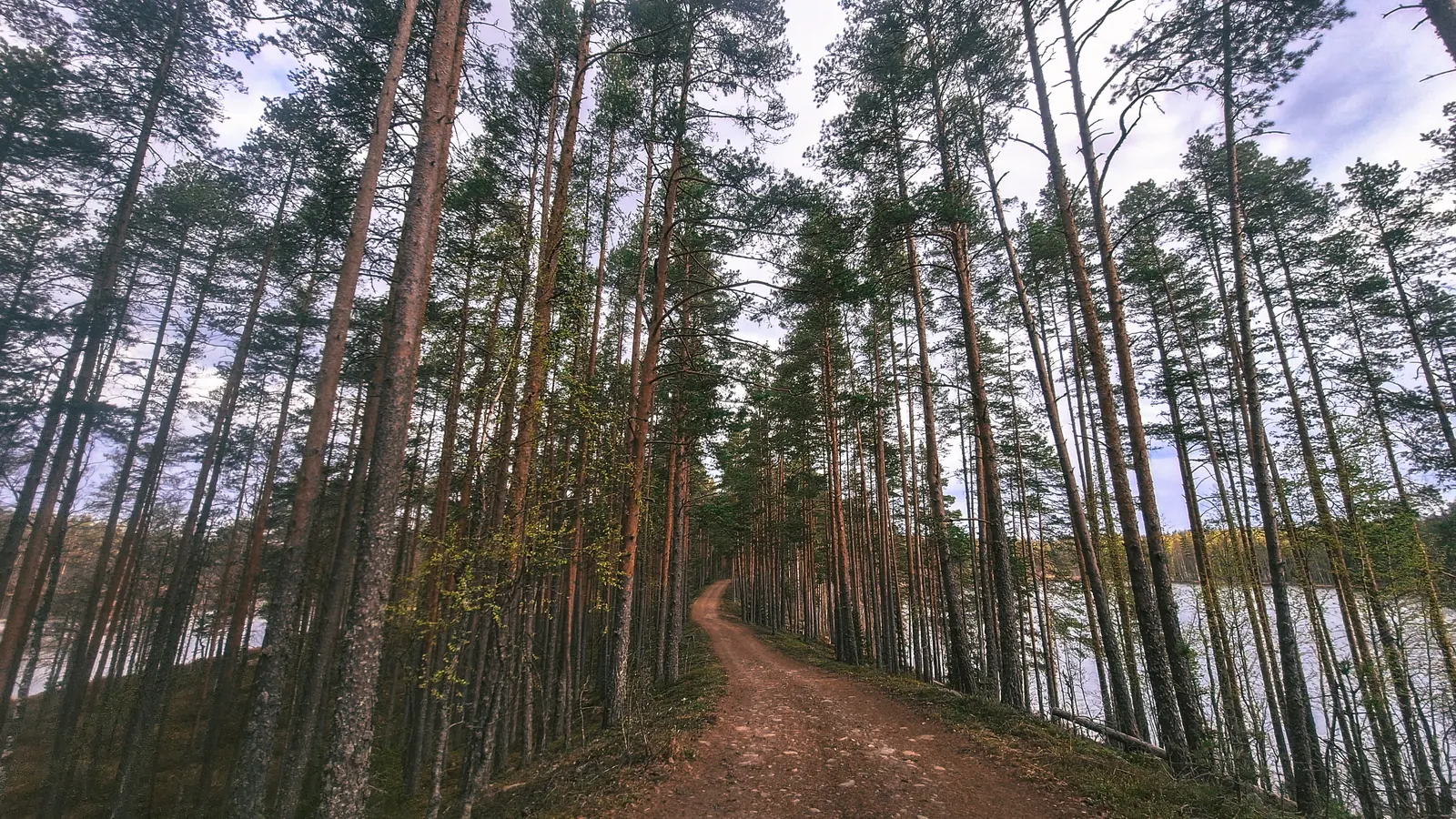
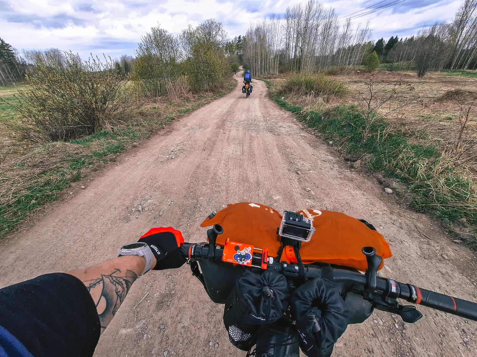
Выбравшись из этих болот пошли отличные грунтовки и асфальтовые прогоны без приключений.
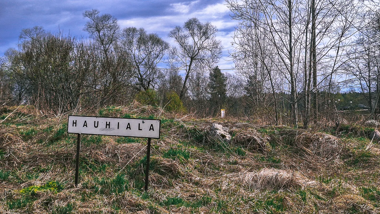
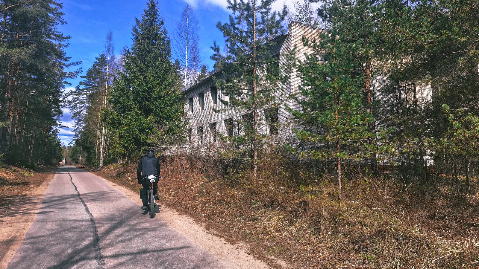
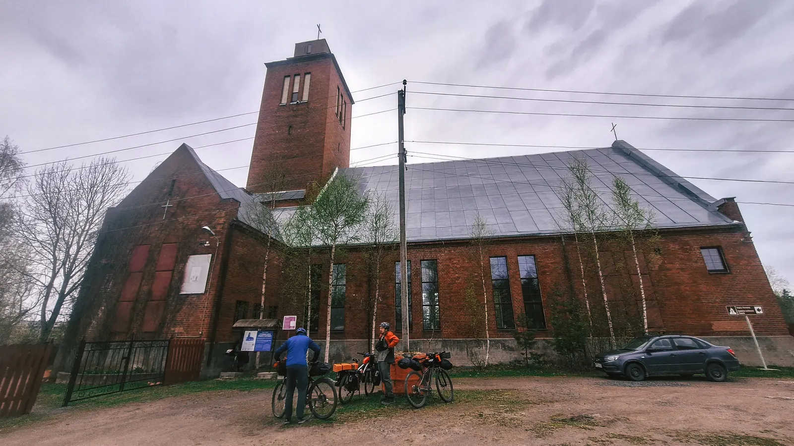
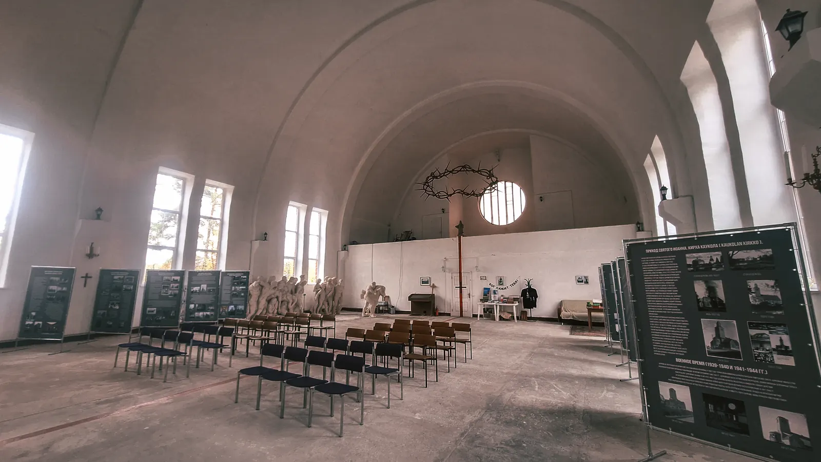
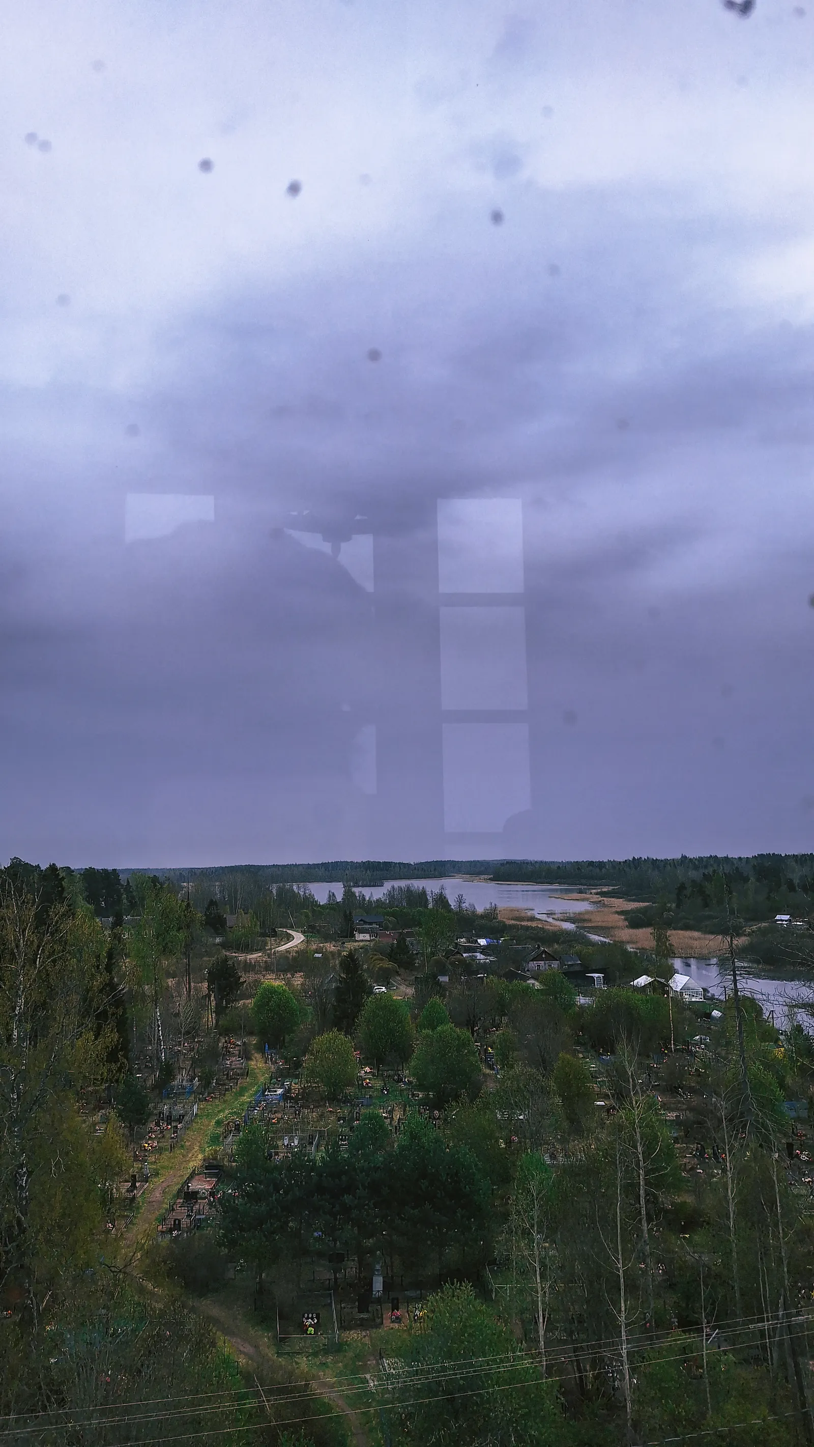
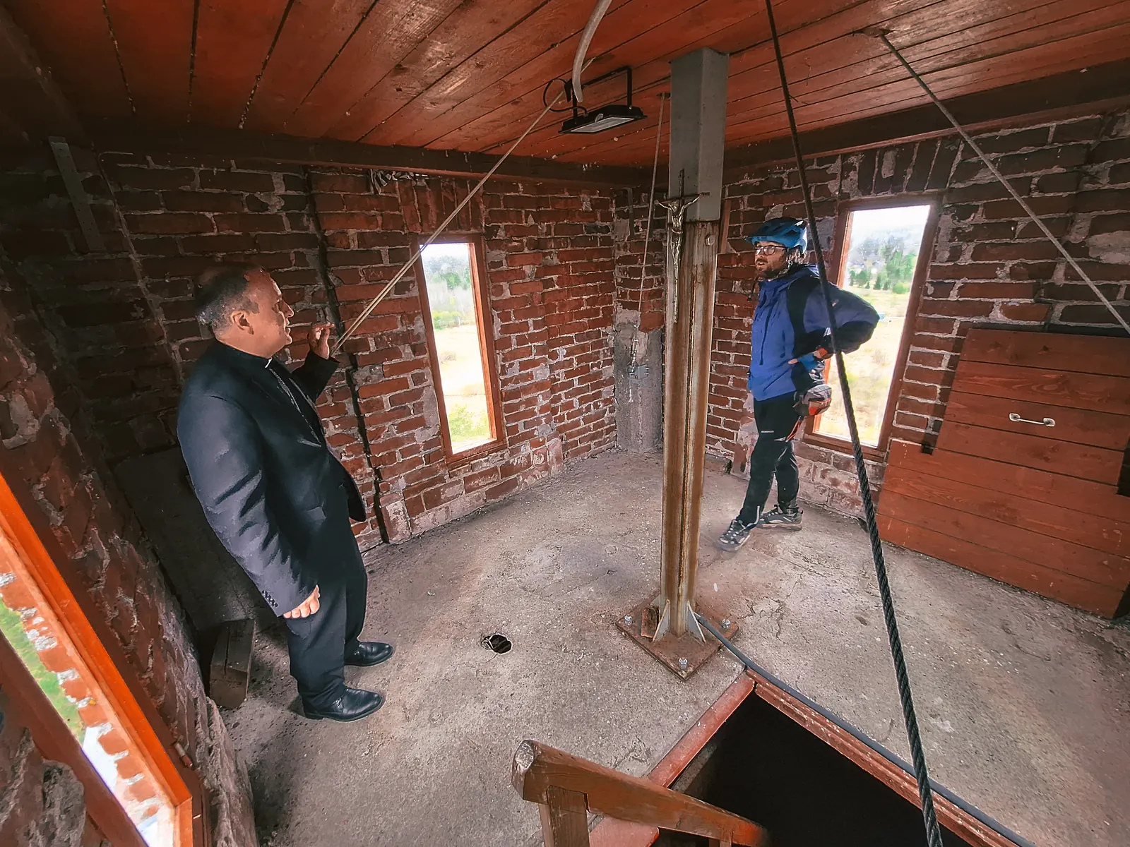
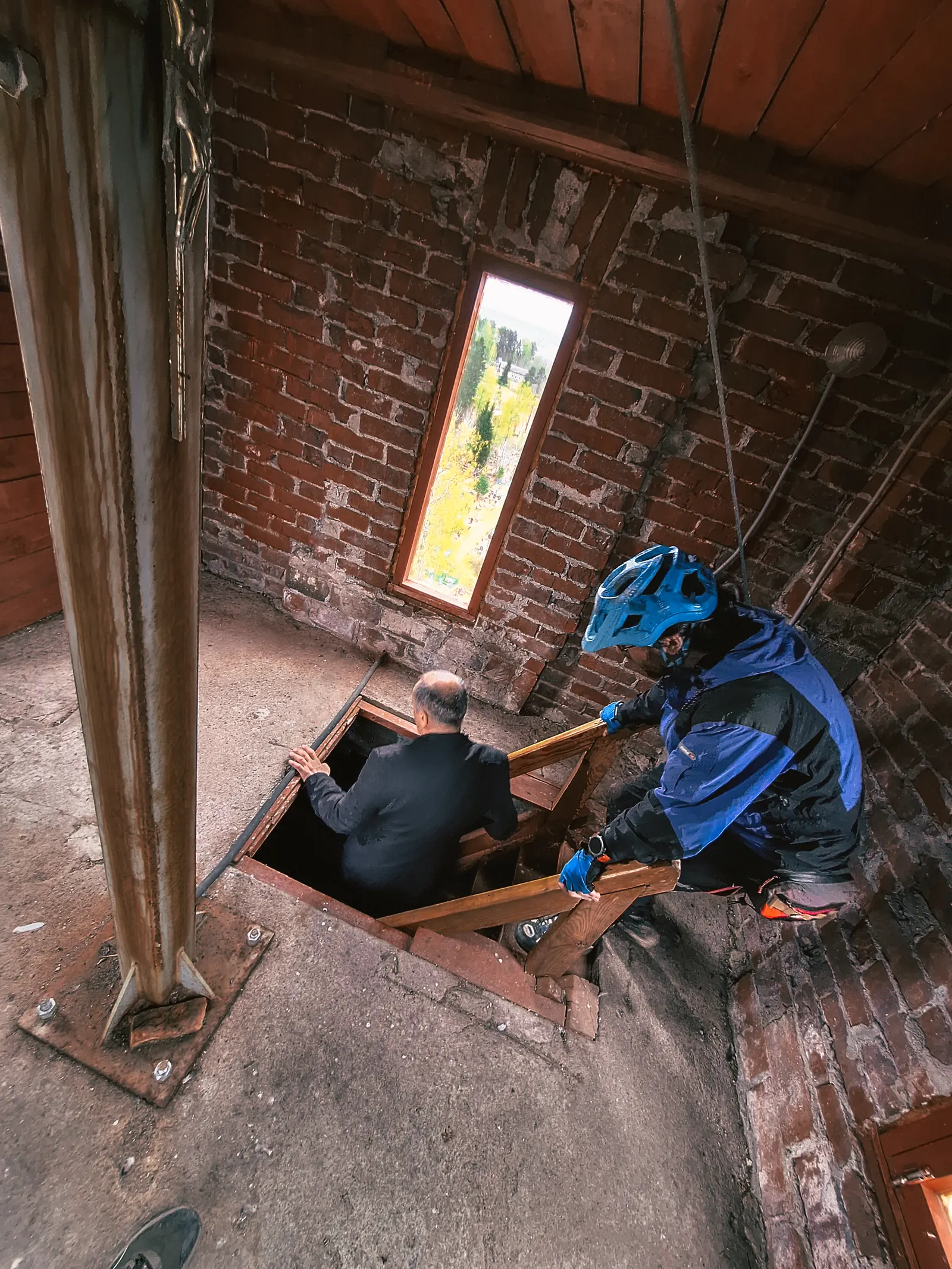
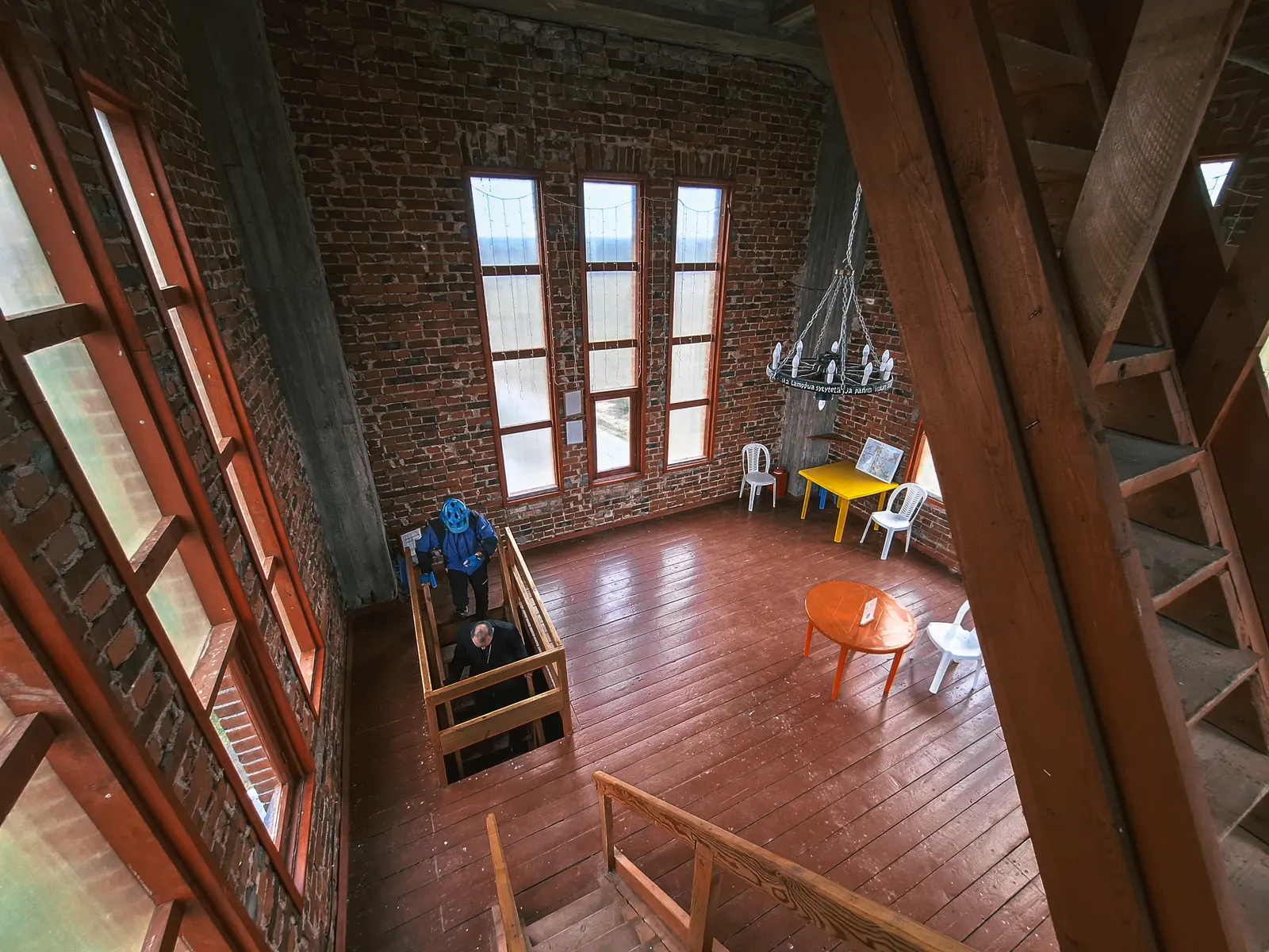
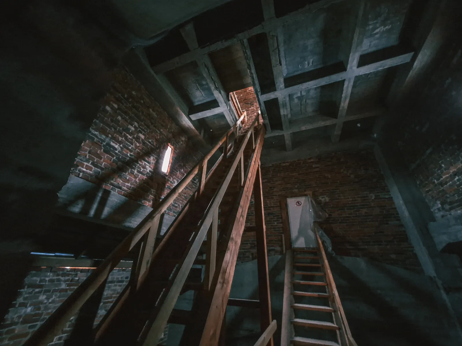
Тихие посёлки, множество озёр, красота! Затем добрались до кирхи в Севастьяново. Она действующая, есть небольшой приход. Также за пожертвование вам проведёт экскурсию настоятель. Можно подняться на колокольню.
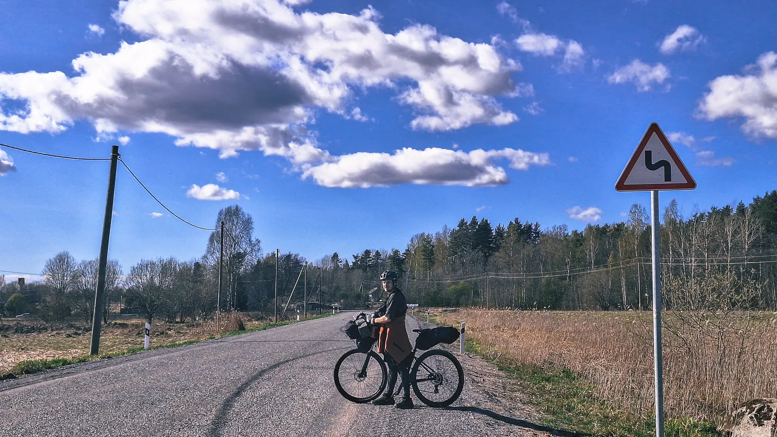
Посмотрев на время поняли, что успеваем на дневную ласточку и забили на грунтовую петлю, просто втопив по асфальту до Кузнечного.
Народу в ласточке было много, двери в Кузнечном открываются не все, только те где есть перрон. Благо к туристам привыкли и привычного ора на велосепедистов не встретили. Пока едете до Приозерска - постарайтесь максимально компактно разместить велики у дверей тамбура. Я снял все сумки и поставил его боком. И заранее сгоняйте в туалет. Народу в Приозерске заходит тьма и дальше все стоят плотняком до Девяткино.
И небольшой видосик)
Видео с маршрута
ЛОСЕВО - КУЗНЕЧНОЕ
Загрузка видео...
Не удалось загрузить видео
0:00 / 0:00
{"type": "FeatureCollection", "features": [{"type": "Feature", "properties": {"color": "#FF5722", "lineStyle": "solid", "segmentId": 0, "isActive": false, "isOffgrid": false, "isFallback": false, "isManual": false, "isImported": false, "isSelected": false, "source": "graphhopper", "buildStatus": "ready", "reused": true, "routeFeatureId": "chunk_0", "pointIds": "[\"pt_1776862901311\",\"pt_1776862907807\"]", "warnings": "[]", "surfaceId": "200", "dominantSurface": "200"}, "geometry": {"type": "LineString", "coordinates": [[30.004157, 60.685304, 0], [30.004979, 60.684807, 0], [30.004947, 60.684795, 0]]}}, {"type": "Feature", "properties": {"color": "#FF5722", "lineStyle": "solid", "segmentId": 0, "isActive": false, "isOffgrid": false, "isFallback": false, "isManual": false, "isImported": false, "isSelected": false, "source": "graphhopper", "buildStatus": "ready", "reused": true, "routeFeatureId": "chunk_0", "pointIds": "[\"pt_1776862901311\",\"pt_1776862907807\"]", "warnings": "[]", "surfaceId": "2", "dominantSurface": "2"}, "geometry": {"type": "LineString", "coordinates": [[30.004947, 60.684795, 0], [30.004892, 60.684736, 0]]}}, {"type": "Feature", "properties": {"color": "#FF5722", "lineStyle": "solid", "segmentId": 0, "isActive": false, "isOffgrid": false, "isFallback": false, "isManual": false, "isImported": false, "isSelected": false, "source": "graphhopper", "buildStatus": "ready", "reused": true, "routeFeatureId": "chunk_0", "pointIds": "[\"pt_1776862901311\",\"pt_1776862907807\"]", "warnings": "[]", "surfaceId": "200", "dominantSurface": "200"}, "geometry": {"type": "LineString", "coordinates": [[30.004892, 60.684736, 0], [30.004971, 60.684674, 0], [30.00482, 60.684619, 0]]}}, {"type": "Feature", "properties": {"color": "#FF5722", "lineStyle": "solid", "segmentId": 0, "isActive": false, "isOffgrid": false, "isFallback": false, "isManual": false, "isImported": false, "isSelected": false, "source": "graphhopper", "buildStatus": "ready", "reused": true, "routeFeatureId": "chunk_0", "pointIds": "[\"pt_1776862901311\",\"pt_1776862907807\"]", "warnings": "[]", "surfaceId": "5", "dominantSurface": "5"}, "geometry": {"type": "LineString", "coordinates": [[30.00482, 60.684619, 0], [30.005429, 60.684219, 0], [30.005434, 60.684198, 0], [30.005416, 60.684178, 0], [30.00478, 60.683945, 0], [30.004728, 60.683942, 0], [30.004689, 60.683951, 0], [30.004626, 60.683926, 0]]}}, {"type": "Feature", "properties": {"color": "#FF5722", "lineStyle": "solid", "segmentId": 0, "isActive": false, "isOffgrid": false, "isFallback": false, "isManual": false, "isImported": false, "isSelected": false, "source": "graphhopper", "buildStatus": "ready", "reused": true, "routeFeatureId": "chunk_0", "pointIds": "[\"pt_1776862901311\",\"pt_1776862907807\"]", "warnings": "[]", "surfaceId": "3", "dominantSurface": "3"}, "geometry": {"type": "LineString", "coordinates": [[30.004626, 60.683926, 0], [30.005993, 60.683039, 0], [30.006114, 60.682918, 0], [30.006181, 60.682784, 0], [30.006186, 60.68266, 0], [30.006141, 60.682544, 0], [30.006052, 60.682443, 0], [30.005918, 60.682363, 0], [30.005658, 60.68225, 0], [30.004679, 60.681957, 0], [30.003962, 60.681633, 0], [30.003676, 60.681458, 0], [30.003296, 60.681176, 0], [30.003346, 60.68116, 0]]}}, {"type": "Feature", "properties": {"color": "#FF5722", "lineStyle": "solid", "segmentId": 0, "isActive": false, "isOffgrid": false, "isFallback": false, "isManual": false, "isImported": false, "isSelected": false, "source": "graphhopper", "buildStatus": "ready", "reused": true, "routeFeatureId": "chunk_0", "pointIds": "[\"pt_1776862901311\",\"pt_1776862907807\"]", "warnings": "[]", "surfaceId": "200", "dominantSurface": "200"}, "geometry": {"type": "LineString", "coordinates": [[30.003346, 60.68116, 0], [30.003388, 60.681146, 0], [30.003416, 60.68109, 0], [30.003484, 60.681049, 0], [30.003559, 60.681021, 0]]}}, {"type": "Feature", "properties": {"color": "#FF5722", "lineStyle": "solid", "segmentId": 0, "isActive": false, "isOffgrid": false, "isFallback": false, "isManual": false, "isImported": false, "isSelected": false, "source": "graphhopper", "buildStatus": "ready", "reused": true, "routeFeatureId": "chunk_0", "pointIds": "[\"pt_1776862901311\",\"pt_1776862907807\"]", "warnings": "[]", "surfaceId": "3", "dominantSurface": "3"}, "geometry": {"type": "LineString", "coordinates": [[30.003559, 60.681021, 0], [30.003323, 60.680864, 0], [30.00323, 60.680891, 0], [30.003152, 60.680901, 0]]}}, {"type": "Feature", "properties": {"color": "#FF5722", "lineStyle": "solid", "segmentId": 0, "isActive": false, "isOffgrid": false, "isFallback": false, "isManual": false, "isImported": false, "isSelected": false, "source": "graphhopper", "buildStatus": "ready", "reused": true, "routeFeatureId": "chunk_0", "pointIds": "[\"pt_1776862901311\",\"pt_1776862907807\"]", "warnings": "[]", "surfaceId": "200", "dominantSurface": "200"}, "geometry": {"type": "LineString", "coordinates": [[30.003152, 60.680901, 0], [30.003108, 60.680889, 0], [30.003074, 60.680867, 0]]}}, {"type": "Feature", "properties": {"color": "#FF5722", "lineStyle": "solid", "segmentId": 0, "isActive": false, "isOffgrid": false, "isFallback": false, "isManual": false, "isImported": false, "isSelected": false, "source": "graphhopper", "buildStatus": "ready", "reused": true, "routeFeatureId": "chunk_0", "pointIds": "[\"pt_1776862901311\",\"pt_1776862907807\"]", "warnings": "[]", "surfaceId": "3", "dominantSurface": "3"}, "geometry": {"type": "LineString", "coordinates": [[30.003074, 60.680867, 0], [30.003003, 60.680886, 0], [30.002503, 60.680505, 0], [30.001836, 60.68002, 0], [30.000767, 60.679192, 0]]}}, {"type": "Feature", "properties": {"color": "#FF5722", "lineStyle": "solid", "segmentId": 0, "isActive": false, "isOffgrid": false, "isFallback": false, "isManual": false, "isImported": false, "isSelected": false, "source": "graphhopper", "buildStatus": "ready", "reused": true, "routeFeatureId": "chunk_0", "pointIds": "[\"pt_1776862901311\",\"pt_1776862907807\"]", "warnings": "[]", "surfaceId": "10", "dominantSurface": "10"}, "geometry": {"type": "LineString", "coordinates": [[30.000767, 60.679192, 0], [30.00055, 60.679214, 0], [30.000317, 60.679191, 0], [29.999706, 60.679074, 0], [29.999355, 60.679065, 0], [29.998494, 60.679246, 0], [29.998359, 60.679262, 0], [29.998134, 60.679264, 0], [29.997581, 60.679204, 0], [29.996228, 60.678956, 0]]}}, {"type": "Feature", "properties": {"color": "#FF5722", "lineStyle": "solid", "segmentId": 0, "isActive": false, "isOffgrid": false, "isFallback": false, "isManual": false, "isImported": false, "isSelected": false, "source": "graphhopper", "buildStatus": "ready", "reused": true, "routeFeatureId": "chunk_1", "pointIds": "[\"pt_1776862907807\",\"pt_1776862927192\"]", "warnings": "[]", "surfaceId": "10", "dominantSurface": "10"}, "geometry": {"type": "LineString", "coordinates": [[29.996228, 60.678956, 25], [29.995559, 60.678834, 25], [29.995311, 60.678695, 25], [29.995129, 60.678476, 25], [29.994706, 60.67749, 23]]}}, {"type": "Feature", "properties": {"color": "#FF5722", "lineStyle": "solid", "segmentId": 0, "isActive": false, "isOffgrid": false, "isFallback": false, "isManual": false, "isImported": false, "isSelected": false, "source": "graphhopper", "buildStatus": "ready", "reused": true, "routeFeatureId": "chunk_1", "pointIds": "[\"pt_1776862907807\",\"pt_1776862927192\"]", "warnings": "[]", "surfaceId": "3", "dominantSurface": "3"}, "geometry": {"type": "LineString", "coordinates": [[29.994706, 60.67749, 23], [29.993141, 60.677111, 23], [29.99297, 60.677059, 23], [29.992129, 60.67688, 23], [29.991683, 60.67681, 23], [29.991413, 60.676794, 28], [29.991299, 60.676585, 28], [29.991123, 60.676354, 28], [29.99106, 60.676225, 28], [29.990838, 60.676185, 28], [29.988203, 60.67614, 27], [29.987228, 60.676115, 27], [29.984698, 60.676113, 30], [29.983772, 60.676193, 30], [29.983122, 60.676175, 29], [29.982339, 60.676193, 29], [29.979864, 60.675888, 37]]}}, {"type": "Feature", "properties": {"color": "#FF5722", "lineStyle": "solid", "segmentId": 0, "isActive": false, "isOffgrid": false, "isFallback": false, "isManual": false, "isImported": false, "isSelected": false, "source": "graphhopper", "buildStatus": "ready", "reused": true, "routeFeatureId": "chunk_2", "pointIds": "[\"pt_1776862927192\",\"pt_1776862934753\"]", "warnings": "[]", "surfaceId": "3", "dominantSurface": "3"}, "geometry": {"type": "LineString", "coordinates": [[29.979864, 60.675888, 37], [29.978032, 60.675469, 38], [29.973421, 60.674761, 38], [29.972997, 60.674732, 43], [29.970585, 60.674349, 50], [29.968111, 60.674347, 59], [29.967647, 60.67433, 59], [29.966943, 60.674416, 59], [29.966255, 60.674363, 58], [29.965861, 60.674308, 58], [29.965321, 60.674262, 58], [29.964981, 60.674201, 57], [29.963654, 60.674048, 33], [29.962918, 60.674027, 34], [29.962063, 60.673937, 34], [29.96123, 60.674003, 38], [29.96053, 60.67393, 38], [29.959844, 60.673908, 40], [29.959252, 60.673851, 40], [29.957855, 60.6738, 40], [29.957464, 60.673802, 40], [29.956936, 60.673841, 40], [29.956434, 60.673922, 40], [29.954719, 60.673876, 39], [29.953999, 60.673836, 39]]}}, {"type": "Feature", "properties": {"color": "#FF5722", "lineStyle": "solid", "segmentId": 0, "isActive": false, "isOffgrid": false, "isFallback": false, "isManual": false, "isImported": false, "isSelected": false, "source": "graphhopper", "buildStatus": "ready", "reused": true, "routeFeatureId": "chunk_2", "pointIds": "[\"pt_1776862927192\",\"pt_1776862934753\"]", "warnings": "[]", "surfaceId": "200", "dominantSurface": "200"}, "geometry": {"type": "LineString", "coordinates": [[29.953999, 60.673836, 39], [29.953896, 60.673874, 39], [29.953821, 60.673921, 39], [29.953778, 60.673994, 39], [29.953698, 60.674063, 39], [29.953381, 60.674177, 54], [29.953188, 60.674214, 54], [29.953014, 60.674232, 54], [29.952791, 60.674227, 54], [29.950833, 60.674025, 41], [29.949385, 60.673998, 42], [29.948312, 60.673901, 39], [29.947864, 60.673921, 39], [29.947376, 60.673969, 39], [29.946531, 60.674153, 35], [29.945485, 60.67447, 48], [29.944847, 60.674939, 47], [29.944672, 60.67521, 53], [29.942401, 60.675186, 49], [29.941009, 60.675096, 47], [29.940219, 60.674995, 47], [29.940021, 60.674976, 38], [29.939694, 60.674986, 47], [29.939429, 60.675015, 47], [29.938699, 60.675124, 47], [29.936745, 60.675391, 44], [29.935613, 60.675492, 40], [29.935319, 60.675517, 40], [29.932929, 60.675592, 36], [29.930433, 60.675602, 41], [29.928688, 60.675801, 43], [29.9256, 60.676364, 42], [29.923178, 60.676943, 26], [29.92144, 60.677317, 25], [29.920587, 60.677478, 25]]}}, {"type": "Feature", "properties": {"color": "#FF5722", "lineStyle": "solid", "segmentId": 0, "isActive": false, "isOffgrid": false, "isFallback": false, "isManual": false, "isImported": false, "isSelected": false, "source": "graphhopper", "buildStatus": "ready", "reused": true, "routeFeatureId": "chunk_3", "pointIds": "[\"pt_1776862934753\",\"pt_1776862939425\"]", "warnings": "[]", "surfaceId": "200", "dominantSurface": "200"}, "geometry": {"type": "LineString", "coordinates": [[29.920587, 60.677478, 25], [29.920506, 60.677493, 25], [29.919288, 60.677328, 27], [29.918268, 60.677259, 23], [29.917461, 60.677474, 23], [29.916539, 60.677749, 18], [29.915909, 60.677963, 18], [29.914913, 60.678351, 23], [29.912877, 60.679108, 18], [29.912003, 60.679398, 21], [29.911298, 60.679537, 23], [29.910915, 60.679598, 23], [29.909355, 60.679694, 24], [29.908418, 60.679739, 24], [29.907764, 60.679867, 20], [29.907365, 60.680224, 19], [29.906781, 60.680789, 19], [29.905592, 60.681245, 23], [29.905439, 60.681499, 23], [29.905573, 60.681695, 30], [29.905314, 60.682045, 30], [29.904861, 60.682358, 20], [29.905154, 60.682586, 37], [29.905956, 60.68277, 37], [29.90683, 60.682933, 40], [29.908448, 60.683744, 55], [29.909002, 60.684354, 65], [29.909967, 60.684863, 65], [29.9109, 60.685549, 62], [29.912395, 60.686422, 68], [29.913109, 60.687304, 76], [29.914197, 60.688195, 87], [29.915377, 60.689214, 98], [29.916195, 60.689544, 98], [29.917107, 60.689775, 96], [29.91705, 60.69039, 90], [29.917091, 60.690664, 90], [29.91656, 60.690912, 93], [29.912355, 60.692638, 93], [29.908592, 60.69431, 92], [29.907941, 60.695084, 93], [29.907664, 60.695742, 93], [29.906951, 60.696659, 90], [29.904668, 60.698266, 85], [29.901537, 60.700325, 81], [29.898521, 60.701233, 80], [29.897913, 60.701599, 78], [29.89643, 60.702493, 63], [29.893696, 60.703276, 67], [29.892594, 60.703783, 59], [29.89217, 60.703939, 59], [29.891465, 60.704035, 56], [29.89081, 60.704026, 56], [29.888522, 60.703865, 53], [29.885659, 60.703769, 51], [29.883619, 60.703543, 50], [29.883546, 60.703554, 50], [29.883437, 60.70367, 50]]}}, {"type": "Feature", "properties": {"color": "#FF5722", "lineStyle": "solid", "segmentId": 0, "isActive": false, "isOffgrid": false, "isFallback": false, "isManual": false, "isImported": false, "isSelected": false, "source": "graphhopper", "buildStatus": "ready", "reused": true, "routeFeatureId": "chunk_3", "pointIds": "[\"pt_1776862934753\",\"pt_1776862939425\"]", "warnings": "[]", "surfaceId": "3", "dominantSurface": "3"}, "geometry": {"type": "LineString", "coordinates": [[29.883437, 60.70367, 50], [29.881447, 60.70328, 52], [29.878158, 60.702593, 47], [29.876048, 60.702167, 39], [29.874969, 60.701997, 40], [29.874363, 60.701931, 40], [29.873691, 60.701871, 40], [29.872341, 60.701778, 43], [29.871165, 60.701724, 40], [29.870418, 60.701708, 40], [29.869861, 60.70171, 35], [29.8689, 60.701757, 35], [29.868184, 60.701807, 29], [29.863931, 60.702151, 22], [29.853934, 60.70293, 24], [29.852842, 60.701679, 39], [29.852113, 60.700876, 39]]}}, {"type": "Feature", "properties": {"color": "#FF5722", "lineStyle": "solid", "segmentId": 0, "isActive": false, "isOffgrid": false, "isFallback": false, "isManual": false, "isImported": false, "isSelected": false, "source": "graphhopper", "buildStatus": "ready", "reused": true, "routeFeatureId": "chunk_4", "pointIds": "[\"pt_1776862939425\",\"pt_1776862947827\"]", "warnings": "[]", "surfaceId": "3", "dominantSurface": "3"}, "geometry": {"type": "LineString", "coordinates": [[29.852113, 60.700876, 39], [29.851795, 60.700527, 30], [29.851318, 60.700122, 27], [29.849052, 60.701111, 23]]}}, {"type": "Feature", "properties": {"color": "#FF5722", "lineStyle": "solid", "segmentId": 0, "isActive": false, "isOffgrid": false, "isFallback": false, "isManual": false, "isImported": false, "isSelected": false, "source": "graphhopper", "buildStatus": "ready", "reused": true, "routeFeatureId": "chunk_5", "pointIds": "[\"pt_1776862947827\",\"pt_1776862953901\"]", "warnings": "[]", "surfaceId": "3", "dominantSurface": "3"}, "geometry": {"type": "LineString", "coordinates": [[29.849052, 60.701111, 23], [29.848234, 60.701469, 20], [29.848094, 60.701616, 20], [29.847597, 60.701894, 21], [29.847064, 60.702033, 21], [29.846646, 60.702007, 20]]}}, {"type": "Feature", "properties": {"color": "#FF5722", "lineStyle": "solid", "segmentId": 0, "isActive": false, "isOffgrid": false, "isFallback": false, "isManual": false, "isImported": false, "isSelected": false, "source": "graphhopper", "buildStatus": "ready", "reused": true, "routeFeatureId": "chunk_5", "pointIds": "[\"pt_1776862947827\",\"pt_1776862953901\"]", "warnings": "[]", "surfaceId": "200", "dominantSurface": "200"}, "geometry": {"type": "LineString", "coordinates": [[29.846646, 60.702007, 20], [29.846408, 60.70214, 20], [29.845267, 60.702908, 19], [29.844586, 60.70335, 21], [29.844387, 60.703511, 21], [29.844411, 60.703603, 21], [29.844197, 60.703759, 21], [29.844183, 60.703879, 21], [29.843873, 60.704116, 21], [29.843647, 60.704425, 30], [29.843684, 60.70458, 30], [29.843573, 60.705024, 24], [29.843261, 60.705574, 25], [29.843426, 60.705652, 24], [29.843688, 60.705732, 24], [29.84419, 60.70564, 24], [29.844417, 60.705799, 24]]}}, {"type": "Feature", "properties": {"color": "#FF5722", "lineStyle": "solid", "segmentId": 0, "isActive": false, "isOffgrid": false, "isFallback": false, "isManual": false, "isImported": false, "isSelected": false, "source": "graphhopper", "buildStatus": "ready", "reused": true, "routeFeatureId": "chunk_5", "pointIds": "[\"pt_1776862947827\",\"pt_1776862953901\"]", "warnings": "[]", "surfaceId": "3", "dominantSurface": "3"}, "geometry": {"type": "LineString", "coordinates": [[29.844417, 60.705799, 24], [29.839624, 60.707458, 18], [29.838854, 60.707756, 21], [29.838331, 60.707975, 21], [29.837838, 60.708196, 19], [29.836663, 60.708796, 20], [29.835828, 60.709249, 20], [29.835563, 60.709378, 20], [29.83506, 60.709593, 20], [29.834159, 60.709929, 20], [29.833738, 60.710076, 20]]}}, {"type": "Feature", "properties": {"color": "#FF5722", "lineStyle": "solid", "segmentId": 0, "isActive": false, "isOffgrid": false, "isFallback": false, "isManual": false, "isImported": false, "isSelected": false, "source": "graphhopper", "buildStatus": "ready", "reused": true, "routeFeatureId": "chunk_6", "pointIds": "[\"pt_1776862953901\",\"pt_1776863096814\"]", "warnings": "[]", "surfaceId": "3", "dominantSurface": "3"}, "geometry": {"type": "LineString", "coordinates": [[29.833738, 60.710076, 20], [29.833279, 60.710236, 20], [29.83111, 60.71095, 21], [29.829939, 60.711348, 21], [29.829116, 60.711749, 23], [29.828769, 60.711934, 23], [29.827511, 60.71274, 23], [29.826495, 60.713418, 23], [29.825872, 60.713788, 23], [29.825565, 60.713948, 23], [29.825152, 60.714134, 23], [29.824563, 60.714355, 24], [29.823853, 60.714586, 24], [29.822839, 60.714897, 23], [29.820897, 60.715419, 23], [29.81822, 60.716112, 23], [29.817611, 60.716286, 23], [29.817039, 60.716477, 23], [29.816605, 60.716643, 23], [29.816188, 60.716829, 24], [29.815539, 60.717075, 24], [29.814967, 60.717247, 25], [29.813566, 60.717622, 24], [29.812128, 60.717976, 24], [29.81152, 60.718093, 27], [29.810305, 60.718276, 27], [29.809928, 60.718322, 30], [29.809632, 60.71834, 28], [29.809478, 60.718322, 30]]}}, {"type": "Feature", "properties": {"color": "#FF5722", "lineStyle": "solid", "segmentId": 0, "isActive": false, "isOffgrid": false, "isFallback": false, "isManual": false, "isImported": false, "isSelected": false, "source": "graphhopper", "buildStatus": "ready", "reused": true, "routeFeatureId": "chunk_6", "pointIds": "[\"pt_1776862953901\",\"pt_1776863096814\"]", "warnings": "[]", "surfaceId": "200", "dominantSurface": "200"}, "geometry": {"type": "LineString", "coordinates": [[29.809478, 60.718322, 30], [29.809067, 60.718523, 28], [29.808876, 60.718627, 28], [29.808862, 60.719128, 28], [29.808665, 60.720036, 25], [29.808723, 60.720805, 25]]}}, {"type": "Feature", "properties": {"color": "#FF5722", "lineStyle": "solid", "segmentId": 0, "isActive": false, "isOffgrid": false, "isFallback": false, "isManual": false, "isImported": false, "isSelected": false, "source": "graphhopper", "buildStatus": "ready", "reused": true, "routeFeatureId": "chunk_7", "pointIds": "[\"pt_1776863096814\",\"pt_1776863114127\"]", "warnings": "[]", "surfaceId": "200", "dominantSurface": "200"}, "geometry": {"type": "LineString", "coordinates": [[29.808723, 60.720805, 25], [29.808747, 60.72113, 25], [29.808831, 60.721824, 25], [29.808923, 60.722206, 25], [29.809009, 60.722332, 25], [29.808655, 60.722712, 24], [29.808008, 60.72329, 24], [29.807053, 60.723771, 24], [29.805603, 60.724115, 24], [29.805054, 60.724122, 24], [29.803597, 60.724087, 22], [29.803114, 60.724087, 22], [29.800005, 60.72403, 21], [29.798656, 60.723985, 19], [29.797233, 60.723834, 17], [29.795634, 60.723635, 15]]}}, {"type": "Feature", "properties": {"color": "#FF5722", "lineStyle": "solid", "segmentId": 0, "isActive": false, "isOffgrid": false, "isFallback": false, "isManual": false, "isImported": false, "isSelected": false, "source": "graphhopper", "buildStatus": "ready", "reused": true, "routeFeatureId": "chunk_7", "pointIds": "[\"pt_1776863096814\",\"pt_1776863114127\"]", "warnings": "[]", "surfaceId": "3", "dominantSurface": "3"}, "geometry": {"type": "LineString", "coordinates": [[29.795634, 60.723635, 15], [29.795194, 60.724267, 16], [29.794774, 60.72493, 14], [29.794125, 60.725816, 14], [29.793731, 60.726286, 15], [29.793451, 60.726573, 15], [29.792096, 60.727852, 15], [29.791786, 60.72817, 15], [29.791223, 60.728792, 14], [29.790641, 60.729348, 15], [29.789459, 60.730274, 15], [29.788927, 60.73071, 15], [29.786625, 60.732381, 14], [29.786199, 60.732719, 14], [29.785801, 60.733061, 14], [29.785272, 60.733685, 14], [29.783186, 60.736721, 13], [29.783037, 60.736989, 13], [29.782879, 60.737429, 13], [29.782726, 60.738063, 13]]}}, {"type": "Feature", "properties": {"color": "#FF5722", "lineStyle": "solid", "segmentId": 0, "isActive": false, "isOffgrid": false, "isFallback": false, "isManual": false, "isImported": false, "isSelected": false, "source": "graphhopper", "buildStatus": "ready", "reused": true, "routeFeatureId": "chunk_8", "pointIds": "[\"pt_1776863114127\",\"pt_1776863122126\"]", "warnings": "[]", "surfaceId": "3", "dominantSurface": "3"}, "geometry": {"type": "LineString", "coordinates": [[29.782726, 60.738063, 13], [29.782702, 60.738591, 14], [29.782797, 60.739795, 13], [29.782909, 60.740265, 13], [29.782971, 60.740391, 13], [29.783706, 60.741612, 14], [29.784473, 60.742817, 12], [29.784547, 60.742959, 12], [29.784761, 60.74326, 12], [29.785219, 60.743845, 18], [29.785596, 60.744191, 12], [29.786244, 60.744696, 12], [29.786979, 60.745171, 14], [29.787246, 60.745305, 14], [29.788335, 60.745961, 8], [29.789426, 60.746708, 8], [29.789908, 60.747065, 8], [29.790179, 60.747345, 12], [29.790513, 60.747828, 11], [29.790572, 60.74825, 11], [29.790528, 60.74848, 15], [29.790439, 60.748739, 15], [29.790351, 60.748922, 15], [29.790136, 60.74925, 11], [29.789926, 60.74951, 13], [29.789687, 60.749736, 13], [29.789415, 60.749916, 13], [29.789083, 60.750097, 11], [29.788183, 60.750498, 15], [29.78508, 60.751803, 15], [29.782958, 60.752738, 18], [29.781235, 60.753455, 19], [29.780441, 60.753767, 19], [29.778434, 60.754426, 18], [29.778062, 60.754557, 21], [29.775521, 60.755405, 15], [29.775106, 60.755615, 15], [29.774729, 60.755824, 16], [29.7746, 60.755976, 18], [29.774458, 60.756221, 18], [29.774245, 60.756785, 11], [29.773942, 60.757714, 8], [29.773811, 60.758168, 8], [29.773665, 60.758524, 11], [29.773448, 60.758914, 11], [29.773269, 60.759176, 22], [29.773057, 60.759399, 22], [29.77286, 60.759579, 22], [29.772556, 60.75976, 22], [29.772215, 60.759908, 22], [29.771808, 60.760038, 16], [29.771097, 60.7602, 18], [29.770017, 60.760384, 18], [29.769585, 60.760418, 21], [29.769145, 60.760432, 21], [29.768782, 60.760388, 21], [29.768427, 60.760333, 21], [29.768215, 60.760292, 40], [29.76788, 60.760121, 40], [29.767428, 60.75987, 24], [29.766479, 60.759317, 28], [29.765998, 60.759091, 33], [29.765215, 60.758742, 33], [29.764718, 60.758545, 41], [29.76424, 60.758371, 41], [29.762684, 60.757763, 39], [29.762244, 60.75757, 39], [29.761853, 60.757337, 31], [29.76151, 60.757054, 36], [29.760724, 60.756331, 34], [29.760434, 60.756122, 34], [29.760149, 60.755957, 34], [29.757429, 60.754599, 28], [29.75582, 60.753746, 23], [29.755593, 60.753667, 23], [29.755396, 60.753623, 23], [29.755086, 60.753595, 23], [29.753588, 60.753549, 23], [29.75325, 60.753528, 24], [29.752949, 60.753499, 24], [29.752601, 60.753448, 24], [29.752305, 60.75339, 24], [29.751824, 60.753271, 23], [29.751335, 60.753117, 22], [29.750418, 60.752801, 22], [29.7498, 60.7526, 26], [29.749533, 60.752534, 26], [29.749282, 60.752486, 26], [29.749017, 60.752449, 26], [29.748511, 60.752392, 26], [29.744827, 60.752054, 35], [29.743537, 60.751946, 35], [29.741443, 60.751803, 31], [29.740832, 60.751735, 31], [29.740596, 60.751697, 31], [29.740231, 60.75161, 25], [29.739172, 60.751298, 28], [29.738874, 60.751207, 28], [29.738664, 60.751094, 28], [29.73853, 60.750942, 28], [29.73837, 60.750654, 23], [29.738286, 60.747939, 15], [29.738135, 60.745577, 13], [29.737864, 60.742247, 13], [29.737394, 60.741033, 16], [29.736607, 60.739912, 15]]}}, {"type": "Feature", "properties": {"color": "#FF5722", "lineStyle": "solid", "segmentId": 0, "isActive": false, "isOffgrid": false, "isFallback": false, "isManual": false, "isImported": false, "isSelected": false, "source": "graphhopper", "buildStatus": "ready", "reused": true, "routeFeatureId": "chunk_9", "pointIds": "[\"pt_1776863122126\",\"pt_1776863126179\"]", "warnings": "[]", "surfaceId": "3", "dominantSurface": "3"}, "geometry": {"type": "LineString", "coordinates": [[29.736607, 60.739912, 0], [29.736503, 60.739764, 0], [29.735635, 60.738321, 0], [29.735587, 60.73811, 0], [29.735652, 60.737895, 0], [29.735961, 60.737496, 0], [29.736826, 60.736695, 0], [29.737522, 60.736297, 0], [29.73866, 60.735974, 0], [29.740408, 60.735672, 0], [29.741494, 60.735394, 0], [29.742509, 60.734705, 0], [29.743637, 60.734223, 0], [29.744042, 60.733989, 0], [29.744949, 60.733222, 0], [29.745459, 60.732604, 0], [29.745586, 60.73237, 0], [29.745602, 60.732117, 0], [29.745481, 60.73164, 0], [29.745146, 60.73124, 0], [29.744687, 60.730798, 0], [29.74392, 60.730192, 0], [29.743002, 60.72953, 0], [29.741875, 60.728587, 0], [29.739216, 60.726692, 0], [29.737667, 60.725807, 0], [29.734725, 60.72445, 0], [29.734424, 60.724123, 0], [29.734265, 60.723622, 0], [29.734032, 60.722203, 0], [29.734163, 60.721669, 0], [29.734656, 60.721392, 0], [29.735952, 60.721055, 0], [29.737077, 60.720642, 0], [29.738631, 60.719952, 0], [29.738899, 60.719771, 0], [29.739043, 60.71959, 0], [29.739053, 60.719262, 0], [29.738868, 60.718381, 0], [29.738735, 60.718091, 0], [29.737821, 60.717154, 0], [29.733968, 60.712807, 0], [29.729938, 60.707527, 0], [29.728568, 60.705651, 0], [29.728252, 60.705352, 0]]}}, {"type": "Feature", "properties": {"color": "#FF5722", "lineStyle": "solid", "segmentId": 0, "isActive": false, "isOffgrid": false, "isFallback": false, "isManual": false, "isImported": false, "isSelected": false, "source": "graphhopper", "buildStatus": "ready", "reused": true, "routeFeatureId": "chunk_9", "pointIds": "[\"pt_1776863122126\",\"pt_1776863126179\"]", "warnings": "[]", "surfaceId": "8", "dominantSurface": "8"}, "geometry": {"type": "LineString", "coordinates": [[29.728252, 60.705352, 0], [29.728072, 60.704988, 0], [29.72906, 60.704889, 0], [29.730026, 60.704543, 0], [29.730997, 60.704466, 0], [29.732515, 60.704572, 0], [29.733769, 60.704536, 0], [29.733994, 60.704489, 0], [29.734744, 60.704426, 0], [29.739769, 60.704794, 0], [29.741295, 60.704786, 0], [29.743727, 60.704724, 0], [29.745582, 60.704578, 0], [29.74671, 60.704296, 0], [29.746986, 60.704239, 0], [29.748268, 60.704192, 0], [29.748856, 60.704101, 0], [29.750403, 60.703497, 0], [29.751397, 60.703162, 0], [29.752638, 60.702965, 0], [29.753179, 60.702804, 0], [29.754748, 60.702297, 0], [29.755193, 60.702077, 0]]}}, {"type": "Feature", "properties": {"color": "#FF5722", "lineStyle": "solid", "segmentId": 0, "isActive": false, "isOffgrid": false, "isFallback": false, "isManual": false, "isImported": false, "isSelected": false, "source": "graphhopper", "buildStatus": "ready", "reused": true, "routeFeatureId": "chunk_10", "pointIds": "[\"pt_1776863126179\",\"pt_1776863130679\"]", "warnings": "[]", "surfaceId": "8", "dominantSurface": "8"}, "geometry": {"type": "LineString", "coordinates": [[29.755193, 60.702077, 0], [29.75585, 60.701752, 0], [29.756279, 60.70149, 0]]}}, {"type": "Feature", "properties": {"color": "#FF5722", "lineStyle": "solid", "segmentId": 0, "isActive": false, "isOffgrid": false, "isFallback": false, "isManual": false, "isImported": false, "isSelected": false, "source": "graphhopper", "buildStatus": "ready", "reused": true, "routeFeatureId": "chunk_10", "pointIds": "[\"pt_1776863126179\",\"pt_1776863130679\"]", "warnings": "[]", "surfaceId": "11", "dominantSurface": "11"}, "geometry": {"type": "LineString", "coordinates": [[29.756279, 60.70149, 0], [29.755435, 60.701043, 0], [29.755302, 60.700865, 0], [29.755276, 60.700572, 0], [29.755456, 60.69948, 0], [29.755472, 60.69886, 0], [29.755318, 60.69858, 0], [29.755371, 60.697981, 0], [29.755853, 60.696459, 0], [29.756124, 60.696049, 0], [29.756378, 60.695813, 0], [29.757888, 60.694976, 0], [29.758089, 60.694841, 0], [29.758375, 60.694325, 0], [29.758423, 60.693368, 0], [29.758513, 60.692766, 0], [29.758768, 60.692175, 0], [29.758826, 60.691845, 0], [29.75846, 60.690753, 0], [29.758413, 60.690164, 0], [29.758556, 60.689755, 0], [29.758534, 60.689091, 0], [29.757348, 60.687685, 0], [29.756876, 60.687301, 0], [29.756426, 60.687091, 0], [29.755806, 60.686657, 0], [29.755414, 60.686354, 0], [29.754762, 60.686012, 0], [29.754476, 60.685936, 0], [29.753745, 60.685597, 0], [29.75277, 60.684951, 0], [29.752155, 60.684717, 0], [29.751143, 60.684471, 0], [29.750836, 60.684312, 0], [29.750089, 60.683679, 0], [29.749972, 60.6835, 0], [29.749659, 60.683314, 0], [29.748987, 60.682751, 0], [29.748579, 60.682504, 0], [29.747715, 60.682151, 0], [29.747296, 60.681562, 0], [29.747233, 60.681215, 0], [29.747651, 60.680351, 0], [29.748255, 60.679663, 0], [29.748891, 60.6793, 0], [29.749691, 60.678698, 0], [29.750126, 60.678005, 0], [29.749951, 60.677146, 0], [29.750052, 60.676822, 0], [29.750248, 60.676562, 0], [29.750221, 60.67642, 0], [29.749993, 60.676243, 0], [29.749792, 60.676212, 0], [29.747673, 60.676171, 0], [29.74728, 60.676114, 0], [29.746719, 60.675916, 0], [29.745998, 60.67574, 0], [29.745246, 60.675441, 0], [29.7447, 60.675273, 0], [29.744138, 60.675039, 0], [29.743672, 60.674832, 0], [29.743503, 60.674645, 0], [29.743656, 60.674113, 0], [29.743503, 60.67383, 0], [29.743036, 60.673516, 0], [29.742703, 60.673217, 0], [29.742475, 60.672756, 0], [29.741659, 60.671471, 0], [29.741548, 60.671178, 0], [29.741361, 60.669341, 0], [29.740223, 60.668498, 0], [29.740119, 60.668163, 0], [29.740184, 60.667618, 0], [29.740131, 60.667177, 0], [29.740421, 60.666524, 0], [29.740413, 60.666171, 0], [29.740288, 60.665774, 0], [29.740404, 60.665368, 0], [29.740727, 60.66489, 0], [29.742292, 60.664436, 0], [29.743178, 60.6639, 0], [29.744055, 60.663008, 0], [29.744532, 60.662876, 0]]}}, {"type": "Feature", "properties": {"color": "#FF5722", "lineStyle": "solid", "segmentId": 0, "isActive": false, "isOffgrid": false, "isFallback": false, "isManual": false, "isImported": false, "isSelected": false, "source": "graphhopper", "buildStatus": "ready", "reused": true, "routeFeatureId": "chunk_11", "pointIds": "[\"pt_1776863130679\",\"pt_1776863134661\"]", "warnings": "[]", "surfaceId": "11", "dominantSurface": "11"}, "geometry": {"type": "LineString", "coordinates": [[29.744532, 60.662876, 0], [29.744055, 60.663008, 0], [29.743178, 60.6639, 0], [29.742292, 60.664436, 0], [29.740727, 60.66489, 0], [29.740404, 60.665368, 0], [29.740288, 60.665774, 0], [29.740413, 60.666171, 0], [29.740421, 60.666524, 0], [29.740131, 60.667177, 0], [29.740184, 60.667618, 0], [29.740119, 60.668163, 0], [29.740223, 60.668498, 0], [29.741361, 60.669341, 0], [29.741548, 60.671178, 0], [29.741659, 60.671471, 0], [29.742475, 60.672756, 0], [29.742703, 60.673217, 0], [29.743036, 60.673516, 0], [29.743503, 60.67383, 0], [29.743656, 60.674113, 0], [29.743503, 60.674645, 0], [29.743426, 60.674871, 0], [29.743638, 60.675927, 0], [29.74358, 60.676278, 0], [29.743235, 60.676589, 0], [29.742557, 60.677131, 0], [29.741942, 60.677381, 0], [29.740459, 60.677954, 0], [29.739468, 60.678372, 0], [29.739049, 60.678587, 0], [29.738668, 60.678717, 0], [29.738302, 60.679072, 0], [29.737974, 60.679254, 0], [29.737534, 60.679366, 0], [29.736739, 60.67941, 0], [29.736204, 60.679379, 0], [29.735505, 60.679295, 0], [29.734933, 60.679319, 0], [29.73418, 60.679586, 0], [29.732352, 60.680035, 0], [29.731806, 60.68024, 0], [29.731033, 60.680419, 0], [29.730694, 60.68045, 0], [29.730217, 60.680603, 0], [29.729968, 60.680772, 0], [29.729838, 60.680913, 0]]}}, {"type": "Feature", "properties": {"color": "#FF5722", "lineStyle": "solid", "segmentId": 0, "isActive": false, "isOffgrid": false, "isFallback": false, "isManual": false, "isImported": false, "isSelected": false, "source": "graphhopper", "buildStatus": "ready", "reused": true, "routeFeatureId": "chunk_12", "pointIds": "[\"pt_1776863134661\",\"pt_1776863137378\"]", "warnings": "[]", "surfaceId": "11", "dominantSurface": "11"}, "geometry": {"type": "LineString", "coordinates": [[29.729838, 60.680913, 0], [29.729247, 60.681558, 0], [29.728882, 60.681732, 0], [29.728664, 60.681778, 0], [29.728341, 60.682129, 0], [29.727573, 60.682894, 0], [29.726794, 60.683242, 0], [29.726365, 60.683423, 0], [29.726042, 60.683854, 0], [29.725681, 60.684458, 0], [29.725485, 60.68464, 0], [29.725443, 60.684855, 0], [29.725178, 60.685286, 0], [29.72494, 60.685501, 0], [29.724781, 60.685582, 0], [29.724304, 60.686163, 0], [29.723467, 60.686583, 0], [29.72299, 60.686697, 0], [29.72219, 60.686959, 0], [29.721104, 60.687224, 0], [29.719842, 60.687637, 0], [29.718677, 60.688111, 0], [29.71751, 60.688951, 0], [29.716566, 60.689454, 0], [29.71599, 60.689646, 0], [29.71553, 60.689898, 0], [29.712806, 60.691135, 0], [29.712525, 60.69134, 0], [29.710978, 60.692238, 0], [29.709924, 60.692637, 0], [29.708321, 60.693289, 0], [29.706368, 60.693914, 0], [29.706331, 60.694022, 0]]}}, {"type": "Feature", "properties": {"color": "#FF5722", "lineStyle": "solid", "segmentId": 0, "isActive": false, "isOffgrid": false, "isFallback": false, "isManual": false, "isImported": false, "isSelected": false, "source": "graphhopper", "buildStatus": "ready", "reused": true, "routeFeatureId": "chunk_12", "pointIds": "[\"pt_1776863134661\",\"pt_1776863137378\"]", "warnings": "[]", "surfaceId": "200", "dominantSurface": "200"}, "geometry": {"type": "LineString", "coordinates": [[29.706331, 60.694022, 0], [29.703927, 60.694927, 0], [29.703517, 60.695293, 0], [29.702516, 60.695689, 0], [29.701231, 60.696058, 0], [29.700574, 60.696484, 0], [29.700139, 60.696731, 0], [29.699107, 60.69711, 0], [29.698768, 60.697353, 0], [29.698217, 60.69813, 0], [29.69646, 60.699573, 0], [29.696774, 60.699951, 0], [29.697285, 60.700323, 0], [29.698023, 60.700685, 0], [29.698237, 60.700872, 0], [29.699126, 60.701406, 0], [29.69967, 60.701836, 0], [29.700112, 60.702165, 0]]}}, {"type": "Feature", "properties": {"color": "#FF5722", "lineStyle": "solid", "segmentId": 0, "isActive": false, "isOffgrid": false, "isFallback": false, "isManual": false, "isImported": false, "isSelected": false, "source": "graphhopper", "buildStatus": "ready", "reused": true, "routeFeatureId": "chunk_12", "pointIds": "[\"pt_1776863134661\",\"pt_1776863137378\"]", "warnings": "[]", "surfaceId": "3", "dominantSurface": "3"}, "geometry": {"type": "LineString", "coordinates": [[29.700112, 60.702165, 0], [29.697712, 60.703244, 0], [29.697021, 60.703466, 0], [29.696313, 60.703555, 0], [29.693907, 60.703457, 0], [29.69325, 60.703398, 0]]}}, {"type": "Feature", "properties": {"color": "#FF5722", "lineStyle": "solid", "segmentId": 0, "isActive": false, "isOffgrid": false, "isFallback": false, "isManual": false, "isImported": false, "isSelected": false, "source": "graphhopper", "buildStatus": "ready", "reused": true, "routeFeatureId": "chunk_12", "pointIds": "[\"pt_1776863134661\",\"pt_1776863137378\"]", "warnings": "[]", "surfaceId": "4", "dominantSurface": "4"}, "geometry": {"type": "LineString", "coordinates": [[29.69325, 60.703398, 0], [29.692558, 60.703499, 0], [29.691749, 60.703728, 0]]}}, {"type": "Feature", "properties": {"color": "#FF5722", "lineStyle": "solid", "segmentId": 0, "isActive": false, "isOffgrid": false, "isFallback": false, "isManual": false, "isImported": false, "isSelected": false, "source": "graphhopper", "buildStatus": "ready", "reused": true, "routeFeatureId": "chunk_13", "pointIds": "[\"pt_1776863137378\",\"pt_1776863143660\"]", "warnings": "[]", "surfaceId": "4", "dominantSurface": "4"}, "geometry": {"type": "LineString", "coordinates": [[29.691749, 60.703728, 0], [29.690971, 60.703948, 0], [29.686023, 60.705107, 0], [29.684674, 60.705482, 0], [29.684174, 60.705703, 0], [29.683638, 60.705888, 0], [29.683412, 60.706078, 0], [29.683132, 60.706256, 0], [29.682495, 60.706569, 0], [29.68213, 60.706737, 0], [29.68163, 60.707049, 0]]}}, {"type": "Feature", "properties": {"color": "#FF5722", "lineStyle": "solid", "segmentId": 0, "isActive": false, "isOffgrid": false, "isFallback": false, "isManual": false, "isImported": false, "isSelected": false, "source": "graphhopper", "buildStatus": "ready", "reused": true, "routeFeatureId": "chunk_13", "pointIds": "[\"pt_1776863137378\",\"pt_1776863143660\"]", "warnings": "[]", "surfaceId": "12", "dominantSurface": "12"}, "geometry": {"type": "LineString", "coordinates": [[29.68163, 60.707049, 0], [29.681286, 60.70718, 0], [29.681018, 60.707465, 0], [29.680876, 60.707858, 0], [29.680239, 60.708044, 0]]}}, {"type": "Feature", "properties": {"color": "#FF5722", "lineStyle": "solid", "segmentId": 0, "isActive": false, "isOffgrid": false, "isFallback": false, "isManual": false, "isImported": false, "isSelected": false, "source": "graphhopper", "buildStatus": "ready", "reused": true, "routeFeatureId": "chunk_13", "pointIds": "[\"pt_1776863137378\",\"pt_1776863143660\"]", "warnings": "[]", "surfaceId": "4", "dominantSurface": "4"}, "geometry": {"type": "LineString", "coordinates": [[29.680239, 60.708044, 0], [29.679799, 60.708133, 0], [29.67813, 60.708645, 0], [29.677725, 60.708704, 0], [29.677214, 60.708853, 0], [29.675333, 60.709466, 0]]}}, {"type": "Feature", "properties": {"color": "#FF5722", "lineStyle": "solid", "segmentId": 0, "isActive": false, "isOffgrid": false, "isFallback": false, "isManual": false, "isImported": false, "isSelected": false, "source": "graphhopper", "buildStatus": "ready", "reused": true, "routeFeatureId": "chunk_13", "pointIds": "[\"pt_1776863137378\",\"pt_1776863143660\"]", "warnings": "[]", "surfaceId": "200", "dominantSurface": "200"}, "geometry": {"type": "LineString", "coordinates": [[29.675333, 60.709466, 0], [29.675136, 60.709162, 0], [29.674716, 60.708957, 0], [29.67435, 60.708905, 0]]}}, {"type": "Feature", "properties": {"color": "#FF5722", "lineStyle": "solid", "segmentId": 0, "isActive": false, "isOffgrid": false, "isFallback": false, "isManual": false, "isImported": false, "isSelected": false, "source": "graphhopper", "buildStatus": "ready", "reused": true, "routeFeatureId": "chunk_13", "pointIds": "[\"pt_1776863137378\",\"pt_1776863143660\"]", "warnings": "[]", "surfaceId": "3", "dominantSurface": "3"}, "geometry": {"type": "LineString", "coordinates": [[29.67435, 60.708905, 0], [29.673554, 60.709728, 0]]}}, {"type": "Feature", "properties": {"color": "#FF5722", "lineStyle": "solid", "segmentId": 0, "isActive": false, "isOffgrid": false, "isFallback": false, "isManual": false, "isImported": false, "isSelected": false, "source": "graphhopper", "buildStatus": "ready", "reused": true, "routeFeatureId": "chunk_13", "pointIds": "[\"pt_1776863137378\",\"pt_1776863143660\"]", "warnings": "[]", "surfaceId": "8", "dominantSurface": "8"}, "geometry": {"type": "LineString", "coordinates": [[29.673554, 60.709728, 0], [29.673063, 60.7101, 0], [29.672504, 60.710768, 0], [29.671829, 60.711186, 0], [29.671086, 60.711348, 0], [29.669441, 60.7115, 0], [29.669135, 60.711601, 0], [29.668591, 60.711878, 0], [29.667058, 60.712799, 0], [29.66626, 60.713706, 0], [29.6652, 60.714231, 0], [29.664097, 60.71468, 0], [29.663081, 60.715655, 0], [29.662075, 60.716157, 0]]}}, {"type": "Feature", "properties": {"color": "#FF5722", "lineStyle": "solid", "segmentId": 0, "isActive": false, "isOffgrid": false, "isFallback": false, "isManual": false, "isImported": false, "isSelected": false, "source": "graphhopper", "buildStatus": "ready", "reused": true, "routeFeatureId": "chunk_14", "pointIds": "[\"pt_1776863143660\",\"pt_1776863161616\"]", "warnings": "[]", "surfaceId": "8", "dominantSurface": "8"}, "geometry": {"type": "LineString", "coordinates": [[29.662075, 60.716157, 0], [29.661098, 60.716644, 0], [29.65917, 60.717297, 0], [29.658832, 60.71749, 0], [29.658178, 60.717919, 0], [29.657152, 60.718808, 0], [29.655924, 60.720069, 0], [29.655718, 60.720569, 0], [29.655454, 60.720774, 0], [29.654639, 60.721181, 0], [29.652802, 60.721717, 0], [29.652316, 60.72208, 0], [29.652241, 60.722305, 0], [29.652291, 60.72252, 0], [29.652887, 60.723346, 0], [29.652904, 60.723718, 0], [29.652695, 60.72407, 0], [29.651758, 60.724853, 0], [29.65107, 60.725737, 0], [29.650536, 60.726173, 0], [29.650017, 60.726491, 0], [29.648732, 60.726962, 0], [29.644451, 60.728932, 0], [29.641735, 60.730052, 0], [29.640353, 60.730431, 0], [29.637635, 60.730741, 0], [29.636408, 60.730923, 0], [29.635773, 60.731079, 0], [29.635221, 60.731293, 0], [29.633804, 60.732164, 0], [29.631887, 60.733996, 0], [29.630632, 60.734811, 0], [29.630023, 60.735048, 0], [29.629333, 60.735401, 0], [29.628431, 60.735724, 0], [29.627273, 60.736015, 0], [29.626443, 60.736304, 0], [29.62383, 60.737555, 0], [29.619391, 60.739805, 0], [29.618489, 60.740183, 0], [29.617861, 60.740334, 0], [29.616862, 60.74048, 0], [29.610396, 60.741302, 0], [29.608751, 60.741574, 0], [29.6074, 60.74098, 0], [29.606565, 60.740633, 0], [29.604991, 60.740563, 0], [29.604469, 60.740451, 0], [29.604143, 60.740215, 0], [29.603032, 60.739886, 0], [29.60212, 60.739768, 0], [29.601538, 60.7396, 0], [29.601006, 60.739092, 0], [29.600587, 60.73829, 0], [29.599953, 60.737612, 0], [29.599843, 60.737279, 0], [29.599899, 60.736878, 0], [29.599472, 60.736439, 0], [29.598715, 60.736091, 0], [29.597185, 60.735551, 0], [29.596531, 60.735141, 0], [29.596072, 60.734587, 0], [29.59574, 60.73438, 0], [29.593604, 60.733507, 0], [29.592955, 60.733393, 0], [29.592366, 60.733388, 0], [29.59178, 60.733427, 0], [29.591164, 60.733303, 0], [29.590131, 60.732907, 0], [29.589581, 60.732837, 0], [29.587863, 60.733017, 0], [29.584724, 60.733199, 0], [29.583619, 60.733094, 0], [29.581857, 60.732561, 0], [29.580655, 60.732175, 0], [29.579486, 60.731881, 0], [29.578961, 60.73168, 0], [29.576635, 60.730209, 0], [29.5758, 60.729495, 0], [29.575427, 60.729096, 0], [29.574321, 60.727412, 0], [29.57332, 60.726157, 0], [29.572837, 60.725729, 0], [29.572318, 60.725502, 0], [29.572041, 60.72527, 0], [29.571889, 60.725073, 0], [29.571561, 60.724306, 0], [29.571293, 60.724028, 0], [29.570361, 60.72375, 0], [29.568923, 60.723624, 0], [29.56827, 60.723478, 0], [29.567618, 60.723287, 0], [29.567262, 60.72328, 0], [29.566427, 60.723389, 0], [29.564941, 60.7236, 0], [29.564232, 60.723532, 0], [29.563249, 60.723221, 0], [29.560805, 60.722315, 0], [29.560573, 60.72222, 0]]}}, {"type": "Feature", "properties": {"color": "#FF5722", "lineStyle": "solid", "segmentId": 0, "isActive": false, "isOffgrid": false, "isFallback": false, "isManual": false, "isImported": false, "isSelected": false, "source": "graphhopper", "buildStatus": "ready", "reused": true, "routeFeatureId": "chunk_14", "pointIds": "[\"pt_1776863143660\",\"pt_1776863161616\"]", "warnings": "[]", "surfaceId": "12", "dominantSurface": "12"}, "geometry": {"type": "LineString", "coordinates": [[29.560573, 60.72222, 0], [29.560342, 60.722374, 0], [29.559072, 60.724267, 0], [29.557731, 60.725238, 0], [29.556719, 60.725743, 0], [29.553946, 60.727077, 0], [29.553611, 60.727117, 0]]}}, {"type": "Feature", "properties": {"color": "#FF5722", "lineStyle": "solid", "segmentId": 0, "isActive": false, "isOffgrid": false, "isFallback": false, "isManual": false, "isImported": false, "isSelected": false, "source": "graphhopper", "buildStatus": "ready", "reused": true, "routeFeatureId": "chunk_15", "pointIds": "[\"pt_1776863161616\",\"pt_1776863165165\"]", "warnings": "[]", "surfaceId": "12", "dominantSurface": "12"}, "geometry": {"type": "LineString", "coordinates": [[29.553611, 60.727117, 0], [29.552469, 60.727254, 0], [29.55051, 60.728235, 0], [29.548744, 60.729192, 0], [29.544884, 60.730409, 0], [29.54243, 60.730573, 0], [29.540726, 60.731101, 0], [29.539441, 60.732038, 0], [29.535524, 60.734801, 0], [29.534814, 60.735195, 0], [29.534042, 60.735467, 0], [29.53155, 60.73608, 0], [29.530573, 60.736164, 0], [29.5298, 60.736298, 0], [29.528605, 60.736692, 0], [29.52782, 60.73705, 0], [29.527054, 60.737605, 0], [29.525823, 60.738753, 0], [29.524668, 60.740344, 0], [29.523232, 60.742028, 0], [29.521249, 60.743117, 0], [29.520237, 60.743915, 0], [29.520187, 60.744155, 0], [29.51921, 60.745373, 0], [29.518925, 60.745772, 0], [29.518071, 60.746589, 0], [29.517994, 60.74681, 0], [29.517561, 60.747087, 0], [29.516817, 60.747953, 0], [29.515453, 60.749499, 0], [29.514904, 60.749831, 0], [29.51387, 60.750163, 0], [29.512499, 60.750955, 0], [29.511985, 60.751534, 0], [29.510295, 60.75239, 0], [29.508729, 60.753018, 0], [29.507251, 60.753276, 0], [29.506157, 60.753822, 0], [29.502658, 60.755757, 0], [29.501073, 60.756439, 0], [29.499707, 60.757209, 0], [29.498523, 60.757817, 0], [29.497385, 60.758636, 0], [29.497165, 60.758905, 0]]}}, {"type": "Feature", "properties": {"color": "#FF5722", "lineStyle": "solid", "segmentId": 0, "isActive": false, "isOffgrid": false, "isFallback": false, "isManual": false, "isImported": false, "isSelected": false, "source": "graphhopper", "buildStatus": "ready", "reused": true, "routeFeatureId": "chunk_16", "pointIds": "[\"pt_1776863165165\",\"pt_1776863171721\"]", "warnings": "[]", "surfaceId": "12", "dominantSurface": "12"}, "geometry": {"type": "LineString", "coordinates": [[29.497165, 60.758905, 0], [29.496746, 60.759417, 0], [29.495713, 60.759741, 0], [29.495317, 60.76001, 0], [29.494921, 60.760864, 0]]}}, {"type": "Feature", "properties": {"color": "#FF5722", "lineStyle": "solid", "segmentId": 0, "isActive": false, "isOffgrid": false, "isFallback": false, "isManual": false, "isImported": false, "isSelected": false, "source": "graphhopper", "buildStatus": "ready", "reused": true, "routeFeatureId": "chunk_16", "pointIds": "[\"pt_1776863165165\",\"pt_1776863171721\"]", "warnings": "[]", "surfaceId": "200", "dominantSurface": "200"}, "geometry": {"type": "LineString", "coordinates": [[29.494921, 60.760864, 0], [29.492639, 60.759941, 0]]}}, {"type": "Feature", "properties": {"color": "#4CAF50", "lineStyle": "solid", "segmentId": 2, "isActive": false, "isOffgrid": false, "isFallback": false, "isManual": false, "isImported": false, "isSelected": false, "source": "graphhopper", "buildStatus": "ready", "reused": true, "routeFeatureId": "chunk_17", "pointIds": "[\"pt_1776863171721\",\"pt_1776863198344\"]", "warnings": "[]", "surfaceId": "200", "dominantSurface": "200"}, "geometry": {"type": "LineString", "coordinates": [[29.492639, 60.759941, 0], [29.492859, 60.76003, 0]]}}, {"type": "Feature", "properties": {"color": "#4CAF50", "lineStyle": "solid", "segmentId": 2, "isActive": false, "isOffgrid": false, "isFallback": false, "isManual": false, "isImported": false, "isSelected": false, "source": "graphhopper", "buildStatus": "ready", "reused": true, "routeFeatureId": "chunk_18", "pointIds": "[\"pt_1776863198344\",\"pt_1776863200812\"]", "warnings": "[]", "surfaceId": "200", "dominantSurface": "200"}, "geometry": {"type": "LineString", "coordinates": [[29.492859, 60.76003, 0], [29.494921, 60.760864, 0]]}}, {"type": "Feature", "properties": {"color": "#4CAF50", "lineStyle": "solid", "segmentId": 2, "isActive": false, "isOffgrid": false, "isFallback": false, "isManual": false, "isImported": false, "isSelected": false, "source": "graphhopper", "buildStatus": "ready", "reused": true, "routeFeatureId": "chunk_18", "pointIds": "[\"pt_1776863198344\",\"pt_1776863200812\"]", "warnings": "[]", "surfaceId": "12", "dominantSurface": "12"}, "geometry": {"type": "LineString", "coordinates": [[29.494921, 60.760864, 0], [29.494902, 60.760906, 0], [29.495052, 60.762399, 0], [29.494726, 60.763302, 0], [29.493748, 60.764208, 0], [29.49232, 60.765911, 0], [29.491631, 60.766612, 0], [29.490535, 60.767459, 0], [29.490718, 60.768676, 0], [29.490598, 60.76906, 0], [29.489355, 60.770259, 0], [29.488089, 60.7734, 0], [29.486774, 60.774523, 0], [29.48677, 60.77525, 0], [29.487339, 60.775806, 0], [29.488895, 60.776806, 0], [29.490784, 60.7783, 0], [29.491824, 60.778777, 0], [29.492477, 60.779795, 0]]}}, {"type": "Feature", "properties": {"color": "#4CAF50", "lineStyle": "solid", "segmentId": 2, "isActive": false, "isOffgrid": false, "isFallback": false, "isManual": false, "isImported": false, "isSelected": false, "source": "graphhopper", "buildStatus": "ready", "reused": true, "routeFeatureId": "chunk_19", "pointIds": "[\"pt_1776863200812\",\"pt_1776863205206\"]", "warnings": "[]", "surfaceId": "12", "dominantSurface": "12"}, "geometry": {"type": "LineString", "coordinates": [[29.492477, 60.779795, 0], [29.492713, 60.780163, 0], [29.492178, 60.781164, 0], [29.491469, 60.781791, 0], [29.489967, 60.785363, 0], [29.490051, 60.785825, 0], [29.490202, 60.787054, 0]]}}, {"type": "Feature", "properties": {"color": "#4CAF50", "lineStyle": "solid", "segmentId": 2, "isActive": false, "isOffgrid": false, "isFallback": false, "isManual": false, "isImported": false, "isSelected": false, "source": "graphhopper", "buildStatus": "ready", "reused": true, "routeFeatureId": "chunk_19", "pointIds": "[\"pt_1776863200812\",\"pt_1776863205206\"]", "warnings": "[]", "surfaceId": "8", "dominantSurface": "8"}, "geometry": {"type": "LineString", "coordinates": [[29.490202, 60.787054, 0], [29.490932, 60.787823, 0], [29.491128, 60.788987, 0], [29.49167, 60.789373, 0], [29.493337, 60.790127, 0], [29.495072, 60.79104, 0], [29.496814, 60.792203, 0], [29.497634, 60.793267, 0], [29.498256, 60.794048, 0], [29.498458, 60.794512, 0], [29.498652, 60.794623, 0], [29.498926, 60.794692, 0], [29.500808, 60.794878, 0], [29.502361, 60.794884, 0], [29.50287, 60.794961, 0], [29.503155, 60.795041, 0], [29.503415, 60.795177, 0], [29.50353, 60.79531, 0], [29.503611, 60.795462, 0], [29.503833, 60.79557, 0], [29.504214, 60.795604, 0], [29.504643, 60.795758, 0], [29.504982, 60.795941, 0], [29.505682, 60.796556, 0], [29.506029, 60.796758, 0], [29.506556, 60.79699, 0], [29.506822, 60.797215, 0], [29.507863, 60.797497, 0], [29.508367, 60.797939, 0], [29.508432, 60.798315, 0], [29.508667, 60.798662, 0], [29.508827, 60.799297, 0], [29.509476, 60.79979, 0], [29.510325, 60.800467, 0], [29.510679, 60.800591, 0]]}}, {"type": "Feature", "properties": {"color": "#4CAF50", "lineStyle": "solid", "segmentId": 2, "isActive": false, "isOffgrid": false, "isFallback": false, "isManual": false, "isImported": false, "isSelected": false, "source": "graphhopper", "buildStatus": "ready", "reused": true, "routeFeatureId": "chunk_20", "pointIds": "[\"pt_1776863205206\",\"pt_1776863213413\"]", "warnings": "[]", "surfaceId": "8", "dominantSurface": "8"}, "geometry": {"type": "LineString", "coordinates": [[29.510679, 60.800591, 0], [29.510806, 60.800636, 0], [29.511375, 60.801041, 0], [29.512923, 60.802575, 0], [29.513038, 60.802871, 0], [29.512968, 60.803156, 0], [29.512655, 60.803447, 0], [29.512637, 60.803501, 0]]}}, {"type": "Feature", "properties": {"color": "#4CAF50", "lineStyle": "solid", "segmentId": 2, "isActive": false, "isOffgrid": false, "isFallback": false, "isManual": false, "isImported": false, "isSelected": false, "source": "graphhopper", "buildStatus": "ready", "reused": true, "routeFeatureId": "chunk_20", "pointIds": "[\"pt_1776863205206\",\"pt_1776863213413\"]", "warnings": "[]", "surfaceId": "200", "dominantSurface": "200"}, "geometry": {"type": "LineString", "coordinates": [[29.512637, 60.803501, 0], [29.511248, 60.803386, 0], [29.509709, 60.803167, 0], [29.507707, 60.802921, 0], [29.506514, 60.802812, 0]]}}, {"type": "Feature", "properties": {"color": "#4CAF50", "lineStyle": "solid", "segmentId": 2, "isActive": false, "isOffgrid": false, "isFallback": false, "isManual": false, "isImported": false, "isSelected": false, "source": "graphhopper", "buildStatus": "ready", "reused": true, "routeFeatureId": "chunk_21", "pointIds": "[\"pt_1776863213413\",\"pt_1776863215353\"]", "warnings": "[]", "surfaceId": "200", "dominantSurface": "200"}, "geometry": {"type": "LineString", "coordinates": [[29.506514, 60.802812, 0], [29.507707, 60.802921, 0], [29.509709, 60.803167, 0], [29.511248, 60.803386, 0], [29.512637, 60.803501, 0]]}}, {"type": "Feature", "properties": {"color": "#4CAF50", "lineStyle": "solid", "segmentId": 2, "isActive": false, "isOffgrid": false, "isFallback": false, "isManual": false, "isImported": false, "isSelected": false, "source": "graphhopper", "buildStatus": "ready", "reused": true, "routeFeatureId": "chunk_21", "pointIds": "[\"pt_1776863213413\",\"pt_1776863215353\"]", "warnings": "[]", "surfaceId": "8", "dominantSurface": "8"}, "geometry": {"type": "LineString", "coordinates": [[29.512637, 60.803501, 0], [29.512382, 60.804252, 0], [29.512478, 60.804643, 0], [29.512696, 60.805, 0], [29.514135, 60.805698, 0], [29.515684, 60.806365, 0], [29.516704, 60.805739, 0], [29.517897, 60.805087, 0], [29.519449, 60.804455, 0]]}}, {"type": "Feature", "properties": {"color": "#4CAF50", "lineStyle": "solid", "segmentId": 2, "isActive": false, "isOffgrid": false, "isFallback": false, "isManual": false, "isImported": false, "isSelected": false, "source": "graphhopper", "buildStatus": "ready", "reused": true, "routeFeatureId": "chunk_22", "pointIds": "[\"pt_1776863215353\",\"pt_1776863219062\"]", "warnings": "[]", "surfaceId": "8", "dominantSurface": "8"}, "geometry": {"type": "LineString", "coordinates": [[29.519449, 60.804455, 0], [29.517897, 60.805087, 0], [29.516704, 60.805739, 0], [29.515684, 60.806365, 0], [29.515933, 60.806475, 0], [29.516026, 60.80663, 0], [29.51607, 60.80711, 0], [29.515981, 60.807494, 0], [29.51589, 60.808291, 0], [29.51316, 60.811848, 0], [29.512739, 60.812146, 0], [29.511792, 60.813036, 0]]}}, {"type": "Feature", "properties": {"color": "#4CAF50", "lineStyle": "solid", "segmentId": 2, "isActive": false, "isOffgrid": false, "isFallback": false, "isManual": false, "isImported": false, "isSelected": false, "source": "graphhopper", "buildStatus": "ready", "reused": true, "routeFeatureId": "chunk_23", "pointIds": "[\"pt_1776863219062\",\"pt_1776863223001\"]", "warnings": "[]", "surfaceId": "8", "dominantSurface": "8"}, "geometry": {"type": "LineString", "coordinates": [[29.511792, 60.813036, 0], [29.511304, 60.813495, 0], [29.511131, 60.813834, 0], [29.511218, 60.814148, 0], [29.511802, 60.814751, 0], [29.512416, 60.815113, 0], [29.512705, 60.81541, 0], [29.512942, 60.816409, 0], [29.513461, 60.817095, 0], [29.51391, 60.817753, 0], [29.513766, 60.818452, 0], [29.513522, 60.818928, 0], [29.512924, 60.81967, 0], [29.51284, 60.819986, 0], [29.513097, 60.820405, 0], [29.513668, 60.820905, 0], [29.514196, 60.821674, 0], [29.514271, 60.822404, 0], [29.51421, 60.822799, 0], [29.513644, 60.823478, 0], [29.512654, 60.824381, 0], [29.511649, 60.825712, 0], [29.511367, 60.826797, 0], [29.511136, 60.828137, 0], [29.509786, 60.82994, 0], [29.507451, 60.831741, 0], [29.504377, 60.832742, 0], [29.500701, 60.834954, 0], [29.499538, 60.83569, 0], [29.499236, 60.836049, 0], [29.499037, 60.836424, 0], [29.499008, 60.837674, 0], [29.498715, 60.838845, 0], [29.49744, 60.839711, 0], [29.495768, 60.841096, 0], [29.494932, 60.842308, 0], [29.493249, 60.843315, 0], [29.492612, 60.843929, 0], [29.492459, 60.844627, 0]]}}, {"type": "Feature", "properties": {"color": "#4CAF50", "lineStyle": "solid", "segmentId": 2, "isActive": false, "isOffgrid": false, "isFallback": false, "isManual": false, "isImported": false, "isSelected": false, "source": "graphhopper", "buildStatus": "ready", "reused": true, "routeFeatureId": "chunk_24", "pointIds": "[\"pt_1776863223001\",\"pt_1776863226725\"]", "warnings": "[]", "surfaceId": "8", "dominantSurface": "8"}, "geometry": {"type": "LineString", "coordinates": [[29.492459, 60.844627, 26], [29.492445, 60.844693, 26], [29.492194, 60.845202, 32], [29.491673, 60.846911, 31]]}}, {"type": "Feature", "properties": {"color": "#4CAF50", "lineStyle": "solid", "segmentId": 2, "isActive": false, "isOffgrid": false, "isFallback": false, "isManual": false, "isImported": false, "isSelected": false, "source": "graphhopper", "buildStatus": "ready", "reused": true, "routeFeatureId": "chunk_24", "pointIds": "[\"pt_1776863223001\",\"pt_1776863226725\"]", "warnings": "[]", "surfaceId": "10", "dominantSurface": "10"}, "geometry": {"type": "LineString", "coordinates": [[29.491673, 60.846911, 31], [29.492764, 60.846931, 31], [29.493512, 60.847125, 33], [29.494561, 60.847429, 33], [29.495234, 60.847563, 35], [29.495958, 60.84783, 35], [29.496831, 60.84811, 37], [29.497331, 60.848292, 37], [29.49748, 60.848632, 37], [29.497256, 60.849009, 37], [29.496707, 60.849435, 35], [29.496258, 60.849872, 35], [29.495908, 60.850164, 36], [29.495758, 60.850626, 36], [29.495659, 60.851173, 31], [29.495833, 60.851562, 31], [29.496083, 60.852182, 26], [29.498017, 60.852912, 25]]}}, {"type": "Feature", "properties": {"color": "#4CAF50", "lineStyle": "solid", "segmentId": 2, "isActive": false, "isOffgrid": false, "isFallback": false, "isManual": false, "isImported": false, "isSelected": false, "source": "graphhopper", "buildStatus": "ready", "reused": true, "routeFeatureId": "chunk_24", "pointIds": "[\"pt_1776863223001\",\"pt_1776863226725\"]", "warnings": "[]", "surfaceId": "9", "dominantSurface": "9"}, "geometry": {"type": "LineString", "coordinates": [[29.498017, 60.852912, 25], [29.493226, 60.856731, 27], [29.492357, 60.857901, 26], [29.491121, 60.860275, 20], [29.490189, 60.860798, 20], [29.489393, 60.860987, 19], [29.487612, 60.861488, 25], [29.486907, 60.861866, 22], [29.486531, 60.862238, 36], [29.486473, 60.862724, 27], [29.486538, 60.863156, 27], [29.486638, 60.864591, 35], [29.48318, 60.867959, 29], [29.479007, 60.870418, 18], [29.474549, 60.872449, 27]]}}, {"type": "Feature", "properties": {"color": "#4CAF50", "lineStyle": "solid", "segmentId": 2, "isActive": false, "isOffgrid": false, "isFallback": false, "isManual": false, "isImported": false, "isSelected": false, "source": "graphhopper", "buildStatus": "ready", "reused": true, "routeFeatureId": "chunk_24", "pointIds": "[\"pt_1776863223001\",\"pt_1776863226725\"]", "warnings": "[]", "surfaceId": "200", "dominantSurface": "200"}, "geometry": {"type": "LineString", "coordinates": [[29.474549, 60.872449, 27], [29.474123, 60.872744, 21], [29.4737, 60.872881, 21], [29.472857, 60.873029, 35], [29.471505, 60.872749, 37], [29.471081, 60.872538, 37], [29.469967, 60.872089, 29], [29.469662, 60.872033, 29]]}}, {"type": "Feature", "properties": {"color": "#4CAF50", "lineStyle": "solid", "segmentId": 2, "isActive": false, "isOffgrid": false, "isFallback": false, "isManual": false, "isImported": false, "isSelected": false, "source": "graphhopper", "buildStatus": "ready", "reused": true, "routeFeatureId": "chunk_24", "pointIds": "[\"pt_1776863223001\",\"pt_1776863226725\"]", "warnings": "[]", "surfaceId": "8", "dominantSurface": "8"}, "geometry": {"type": "LineString", "coordinates": [[29.469662, 60.872033, 29], [29.467038, 60.872814, 22], [29.465229, 60.873653, 26], [29.46293, 60.874684, 21], [29.456966, 60.877437, 29]]}}, {"type": "Feature", "properties": {"color": "#4CAF50", "lineStyle": "solid", "segmentId": 2, "isActive": false, "isOffgrid": false, "isFallback": false, "isManual": false, "isImported": false, "isSelected": false, "source": "graphhopper", "buildStatus": "ready", "reused": true, "routeFeatureId": "chunk_24", "pointIds": "[\"pt_1776863223001\",\"pt_1776863226725\"]", "warnings": "[]", "surfaceId": "200", "dominantSurface": "200"}, "geometry": {"type": "LineString", "coordinates": [[29.456966, 60.877437, 29], [29.455266, 60.87689, 30], [29.454782, 60.876654, 29], [29.454201, 60.875978, 29], [29.454201, 60.87584, 29], [29.454497, 60.875388, 39], [29.454406, 60.875056, 39], [29.454463, 60.87495, 35], [29.455625, 60.874025, 33], [29.455909, 60.873557, 33], [29.455921, 60.873379, 33], [29.455738, 60.873202, 40], [29.45567, 60.873039, 40], [29.456091, 60.872432, 34], [29.456171, 60.872199, 34], [29.456103, 60.872074, 34], [29.455955, 60.871939, 34], [29.455454, 60.87172, 34], [29.451843, 60.870861, 12], [29.451549, 60.870791, 29], [29.450501, 60.870462, 29], [29.448964, 60.870096, 24], [29.448611, 60.869988, 24], [29.448441, 60.869777, 17], [29.448293, 60.868763, 39], [29.448073, 60.867977, 37], [29.44763, 60.867306, 29], [29.447075, 60.866771, 29], [29.446805, 60.866585, 21], [29.445382, 60.865922, 25], [29.444858, 60.865582, 27], [29.444263, 60.865272, 27], [29.442748, 60.863921, 30], [29.442049, 60.863145, 22], [29.441252, 60.862591, 15], [29.440651, 60.862115, 16], [29.439642, 60.860991, 31], [29.438618, 60.860651, 27], [29.438685, 60.859695, 31], [29.436453, 60.857574, 38], [29.436067, 60.856372, 20], [29.43553, 60.855797, 13], [29.433127, 60.852234, 29], [29.432333, 60.852035, 29], [29.433277, 60.849861, 45], [29.43229, 60.847875, 43], [29.431694, 60.846836, 45], [29.428605, 60.845711, 29], [29.426247, 60.844412, 41], [29.425059, 60.844245, 41], [29.422799, 60.843414, 22], [29.418912, 60.842978, 23], [29.418099, 60.842788, 37], [29.417628, 60.842693, 37], [29.417042, 60.842399, 40], [29.4134, 60.841195, 41], [29.41327, 60.840672, 43], [29.4134, 60.839927, 46], [29.413676, 60.839381, 46], [29.414278, 60.838683, 38], [29.413822, 60.838263, 39], [29.412993, 60.837582, 35], [29.41327, 60.836591, 27], [29.412667, 60.836284, 27]]}}, {"type": "Feature", "properties": {"color": "#4CAF50", "lineStyle": "solid", "segmentId": 2, "isActive": false, "isOffgrid": false, "isFallback": false, "isManual": false, "isImported": false, "isSelected": false, "source": "graphhopper", "buildStatus": "ready", "reused": true, "routeFeatureId": "chunk_25", "pointIds": "[\"pt_1776863226725\",\"pt_1776863231849\"]", "warnings": "[]", "surfaceId": "200", "dominantSurface": "200"}, "geometry": {"type": "LineString", "coordinates": [[29.412667, 60.836284, 27], [29.410749, 60.835308, 24], [29.408911, 60.834071, 28], [29.407269, 60.833881, 20], [29.403334, 60.833065, 35], [29.40039, 60.832668, 43], [29.399236, 60.832795, 39], [29.397252, 60.832359, 35], [29.395251, 60.830861, 43], [29.394243, 60.830211, 44], [29.393398, 60.829982, 46], [29.391231, 60.82997, 34]]}}, {"type": "Feature", "properties": {"color": "#4CAF50", "lineStyle": "solid", "segmentId": 2, "isActive": false, "isOffgrid": false, "isFallback": false, "isManual": false, "isImported": false, "isSelected": false, "source": "graphhopper", "buildStatus": "ready", "reused": true, "routeFeatureId": "chunk_25", "pointIds": "[\"pt_1776863226725\",\"pt_1776863231849\"]", "warnings": "[]", "surfaceId": "8", "dominantSurface": "8"}, "geometry": {"type": "LineString", "coordinates": [[29.391231, 60.82997, 34], [29.391035, 60.830055, 37], [29.390724, 60.830207, 37], [29.390134, 60.830453, 37], [29.389629, 60.830583, 32], [29.389109, 60.830858, 34], [29.388449, 60.831321, 34], [29.387913, 60.831896, 36], [29.387618, 60.832489, 36], [29.387521, 60.832772, 31], [29.387553, 60.833007, 31], [29.387505, 60.833125, 31], [29.38751, 60.833663, 30], [29.387564, 60.833815, 30], [29.387591, 60.834032, 30], [29.387543, 60.834319, 29], [29.387435, 60.834706, 29], [29.387301, 60.835305, 32], [29.38706, 60.835697, 32], [29.386652, 60.836128, 41], [29.38648, 60.836361, 41], [29.386202, 60.836588, 41], [29.38529, 60.837239, 36], [29.384724, 60.837534, 35], [29.384072, 60.837895, 35], [29.383514, 60.83817, 35], [29.383031, 60.838387, 39], [29.382634, 60.838531, 39], [29.381886, 60.838633, 39], [29.381298, 60.838729, 41], [29.377951, 60.839098, 41], [29.377463, 60.839244, 39], [29.376867, 60.839401, 39], [29.376331, 60.839464, 34], [29.375542, 60.839498, 34], [29.374797, 60.8396, 34], [29.373965, 60.839725, 34], [29.373424, 60.839861, 34], [29.372748, 60.840049, 38], [29.372029, 60.840264, 38], [29.371353, 60.840454, 34], [29.371026, 60.840598, 34], [29.370666, 60.840807, 34], [29.370275, 60.841066, 33], [29.369593, 60.841581, 34], [29.369314, 60.841774, 39], [29.368917, 60.841968, 39], [29.3677, 60.842436, 39], [29.367625, 60.842569, 38], [29.366868, 60.843052, 38], [29.366466, 60.843246, 38], [29.366171, 60.843478, 34], [29.365886, 60.843672, 34], [29.365699, 60.843816, 34], [29.364021, 60.844473, 26], [29.363644, 60.844589, 26], [29.363312, 60.844681, 31], [29.362083, 60.844775, 31], [29.361708, 60.844887, 31], [29.360586, 60.845188, 38], [29.360297, 60.845347, 38], [29.360018, 60.84553, 38], [29.35961, 60.845708, 43], [29.359074, 60.845862, 38], [29.358634, 60.845927, 38], [29.358076, 60.845998, 39], [29.357657, 60.846021, 39], [29.356456, 60.845948, 43], [29.355544, 60.845925, 43], [29.354873, 60.845872, 47], [29.35357, 60.845687, 41], [29.352717, 60.845522, 39], [29.352239, 60.845486, 39], [29.351617, 60.845496, 32], [29.35115, 60.845538, 32], [29.350711, 60.845653, 32], [29.35041, 60.845778, 32], [29.350078, 60.845898, 35], [29.349756, 60.846142, 28], [29.349681, 60.846319, 28], [29.349648, 60.846463, 28], [29.349021, 60.846894, 24], [29.348726, 60.847169, 24], [29.348581, 60.847385, 24], [29.34842, 60.84754, 19], [29.34813, 60.84779, 21], [29.348087, 60.847992, 21], [29.348087, 60.848141, 21], [29.347921, 60.84836, 20], [29.347631, 60.848595, 0], [29.347251, 60.848844, 0], [29.346371, 60.849303, 0], [29.345925, 60.849518, 0], [29.345405, 60.849732, 0], [29.344944, 60.849847, 0], [29.344466, 60.849981, 0], [29.343941, 60.850048, 0], [29.343733, 60.850045, 0]]}}, {"type": "Feature", "properties": {"color": "#4CAF50", "lineStyle": "solid", "segmentId": 2, "isActive": false, "isOffgrid": false, "isFallback": false, "isManual": false, "isImported": false, "isSelected": false, "source": "graphhopper", "buildStatus": "ready", "reused": true, "routeFeatureId": "chunk_26", "pointIds": "[\"pt_1776863231849\",\"pt_1776863236104\"]", "warnings": "[]", "surfaceId": "8", "dominantSurface": "8"}, "geometry": {"type": "LineString", "coordinates": [[29.343733, 60.850045, 0], [29.342718, 60.850001, 0], [29.342288, 60.850019, 0], [29.341924, 60.850074, 0], [29.341237, 60.850323, 0], [29.340647, 60.850628, 0], [29.340572, 60.850709, 0], [29.340373, 60.850887, 0], [29.340287, 60.851088, 0], [29.339998, 60.851274, 0], [29.339606, 60.851438, 0], [29.338946, 60.851694, 0], [29.338566, 60.851812, 0], [29.338051, 60.852005, 0], [29.337739, 60.852183, 0], [29.337702, 60.852397, 0], [29.33766, 60.852818, 0], [29.337165, 60.853591, 0], [29.336208, 60.854361, 0], [29.335368, 60.855248, 0], [29.335181, 60.85548, 0], [29.33459, 60.856107, 0], [29.334177, 60.856512, 0], [29.333931, 60.856792, 0], [29.333839, 60.856925, 0], [29.333688, 60.857021, 0]]}}, {"type": "Feature", "properties": {"color": "#4CAF50", "lineStyle": "solid", "segmentId": 2, "isActive": false, "isOffgrid": false, "isFallback": false, "isManual": false, "isImported": false, "isSelected": false, "source": "graphhopper", "buildStatus": "ready", "reused": true, "routeFeatureId": "chunk_27", "pointIds": "[\"pt_1776863236104\",\"pt_1776863248180\"]", "warnings": "[]", "surfaceId": "8", "dominantSurface": "8"}, "geometry": {"type": "LineString", "coordinates": [[29.333688, 60.857021, 0], [29.333067, 60.857338, 0], [29.331951, 60.857468, 0], [29.331415, 60.857541, 0], [29.331147, 60.857693, 0], [29.331007, 60.857876, 0], [29.330921, 60.858027, 0], [29.33076, 60.858174, 0], [29.330117, 60.858592, 0], [29.329881, 60.858764, 0], [29.329762, 60.858915, 0], [29.329741, 60.859114, 0], [29.329666, 60.85926, 0], [29.329451, 60.859501, 0], [29.329441, 60.859762, 0], [29.329452, 60.860063, 0], [29.329355, 60.860289, 0], [29.329011, 60.860472, 0], [29.328239, 60.860848, 0], [29.327939, 60.861094, 0], [29.327745, 60.861225, 0], [29.327316, 60.861449, 0], [29.326576, 60.861606, 0], [29.3259, 60.861721, 0], [29.325492, 60.861799, 0], [29.32413, 60.861961, 0], [29.323443, 60.862128, 0], [29.323218, 60.862337, 0], [29.323062, 60.862526, 0], [29.322864, 60.86287, 0], [29.322853, 60.863408, 0], [29.322868, 60.863838, 0], [29.322483, 60.864741, 0], [29.322499, 60.864991, 0], [29.322703, 60.865341, 0], [29.322698, 60.865619, 0], [29.322521, 60.865832, 0], [29.322038, 60.866077, 0], [29.321646, 60.866235, 0], [29.32104, 60.866422, 0], [29.3203, 60.86661, 0], [29.319871, 60.86696, 0], [29.319581, 60.867383, 0], [29.319195, 60.867749, 0], [29.318926, 60.868088, 0], [29.318959, 60.868245, 0], [29.31928, 60.868496, 0], [29.320187, 60.869243, 0], [29.320922, 60.869546, 0], [29.321723, 60.869911, 0], [29.322295, 60.870125, 0], [29.32296, 60.870219, 0], [29.323368, 60.870407, 0], [29.323626, 60.870632, 0], [29.323776, 60.870945, 0], [29.323679, 60.871191, 0], [29.323475, 60.871384, 0], [29.323379, 60.871619, 0], [29.323319, 60.872028, 0], [29.323121, 60.872173, 0], [29.322563, 60.872423, 0], [29.321834, 60.872679, 0], [29.320911, 60.873019, 0], [29.320375, 60.873259, 0], [29.31972, 60.873577, 0], [29.319452, 60.873818, 0], [29.319098, 60.874, 0], [29.318622, 60.874165, 0], [29.31839, 60.874319, 0], [29.318293, 60.874486, 0], [29.318411, 60.874951, 0], [29.318765, 60.875165, 0], [29.319034, 60.875389, 0], [29.319175, 60.875529, 0], [29.319044, 60.875755, 0], [29.318894, 60.875979, 0], [29.318765, 60.876324, 0], [29.318594, 60.876669, 0], [29.318068, 60.877019, 0], [29.317596, 60.877254, 0], [29.317006, 60.877462, 0], [29.316341, 60.877676, 0], [29.315815, 60.877802, 0], [29.315053, 60.877885, 0], [29.314377, 60.877938, 0], [29.31294, 60.878178, 0], [29.312328, 60.87834, 0], [29.312232, 60.878528, 0], [29.312296, 60.878851, 0], [29.312339, 60.879165, 0], [29.312854, 60.880329, 0], [29.312822, 60.880454, 0], [29.312575, 60.880653, 0], [29.312199, 60.880794, 0], [29.311641, 60.881096, 0], [29.311116, 60.881451, 0], [29.310737, 60.88164, 0], [29.310043, 60.881817, 0], [29.309281, 60.881958, 0], [29.308788, 60.882193, 0], [29.30838, 60.88249, 0], [29.308176, 60.882715, 0], [29.308187, 60.883007, 0], [29.307908, 60.883174, 0], [29.307221, 60.883294, 0], [29.306438, 60.88356, 0], [29.30614, 60.883745, 0], [29.305966, 60.884088, 0], [29.30579, 60.884296, 0], [29.30544, 60.884422, 0], [29.304796, 60.884542, 0], [29.304303, 60.88462, 0], [29.303874, 60.88484, 0], [29.303294, 60.885205, 0], [29.302254, 60.885758, 0], [29.302028, 60.88579, 0], [29.301739, 60.885797, 0], [29.301513, 60.885829, 0], [29.301213, 60.885983, 0], [29.30088, 60.886254, 0], [29.300569, 60.88698, 0], [29.300516, 60.887314, 0], [29.300449, 60.887457, 0], [29.300353, 60.887557, 0], [29.300207, 60.887604, 0], [29.299743, 60.887711, 0], [29.299228, 60.887914, 0], [29.299132, 60.888068, 0], [29.298806, 60.888401, 0], [29.298064, 60.888614, 0], [29.29685, 60.888723, 0], [29.295513, 60.888965, 0], [29.295205, 60.889083, 0], [29.293506, 60.890151, 0], [29.293407, 60.890235, 0], [29.293356, 60.890331, 0], [29.293373, 60.890629, 0], [29.293468, 60.89093, 0], [29.293372, 60.891093, 0], [29.292579, 60.891381, 0], [29.291686, 60.891829, 0], [29.290916, 60.892094, 0], [29.290621, 60.892167, 0], [29.290431, 60.892189, 0], [29.289151, 60.892151, 0], [29.288178, 60.892238, 0], [29.285682, 60.892181, 0], [29.284679, 60.892337, 0], [29.283682, 60.892656, 0], [29.283143, 60.892898, 0], [29.282267, 60.893356, 0], [29.281925, 60.893611, 0], [29.281233, 60.894083, 0], [29.280346, 60.894499, 0], [29.277866, 60.895595, 0], [29.277331, 60.895859, 0], [29.276781, 60.896473, 0], [29.276581, 60.896917, 0], [29.276435, 60.897379, 0], [29.276459, 60.897607, 0], [29.276199, 60.897926, 0], [29.275241, 60.898556, 0]]}}, {"type": "Feature", "properties": {"color": "#4CAF50", "lineStyle": "solid", "segmentId": 2, "isActive": false, "isOffgrid": false, "isFallback": false, "isManual": false, "isImported": false, "isSelected": false, "source": "graphhopper", "buildStatus": "ready", "reused": true, "routeFeatureId": "chunk_27", "pointIds": "[\"pt_1776863236104\",\"pt_1776863248180\"]", "warnings": "[]", "surfaceId": "3", "dominantSurface": "3"}, "geometry": {"type": "LineString", "coordinates": [[29.275241, 60.898556, 0], [29.272105, 60.898786, 0], [29.269724, 60.898942, 0]]}}, {"type": "Feature", "properties": {"color": "#4CAF50", "lineStyle": "solid", "segmentId": 2, "isActive": false, "isOffgrid": false, "isFallback": false, "isManual": false, "isImported": false, "isSelected": false, "source": "graphhopper", "buildStatus": "ready", "reused": true, "routeFeatureId": "chunk_27", "pointIds": "[\"pt_1776863236104\",\"pt_1776863248180\"]", "warnings": "[]", "surfaceId": "2", "dominantSurface": "2"}, "geometry": {"type": "LineString", "coordinates": [[29.269724, 60.898942, 0], [29.269657, 60.899035, 0], [29.269499, 60.899144, 0], [29.269295, 60.899201, 0], [29.268718, 60.899298, 0], [29.26845, 60.899364, 0], [29.267562, 60.89969, 0], [29.267326, 60.899746, 0], [29.266704, 60.899847, 0], [29.265491, 60.900005, 0], [29.265304, 60.900009, 0], [29.265105, 60.899996, 0], [29.264535, 60.899937, 0]]}}, {"type": "Feature", "properties": {"color": "#4CAF50", "lineStyle": "solid", "segmentId": 2, "isActive": false, "isOffgrid": false, "isFallback": false, "isManual": false, "isImported": false, "isSelected": false, "source": "graphhopper", "buildStatus": "ready", "reused": true, "routeFeatureId": "chunk_27", "pointIds": "[\"pt_1776863236104\",\"pt_1776863248180\"]", "warnings": "[]", "surfaceId": "8", "dominantSurface": "8"}, "geometry": {"type": "LineString", "coordinates": [[29.264535, 60.899937, 0], [29.263946, 60.899876, 0], [29.263885, 60.899818, 0], [29.263853, 60.899753, 0], [29.263839, 60.899645, 0]]}}, {"type": "Feature", "properties": {"color": "#4CAF50", "lineStyle": "solid", "segmentId": 2, "isActive": false, "isOffgrid": false, "isFallback": false, "isManual": false, "isImported": false, "isSelected": false, "source": "graphhopper", "buildStatus": "ready", "reused": true, "routeFeatureId": "chunk_27", "pointIds": "[\"pt_1776863236104\",\"pt_1776863248180\"]", "warnings": "[]", "surfaceId": "3", "dominantSurface": "3"}, "geometry": {"type": "LineString", "coordinates": [[29.263839, 60.899645, 0], [29.263842, 60.899499, 0], [29.261123, 60.899929, 0], [29.257731, 60.900427, 0], [29.257354, 60.900499, 0], [29.256904, 60.90062, 0], [29.256365, 60.900828, 0], [29.256168, 60.900939, 0], [29.256012, 60.901085, 0], [29.255253, 60.902107, 0], [29.254894, 60.902517, 0], [29.254465, 60.902916, 0], [29.253505, 60.903594, 0], [29.252832, 60.904014, 0], [29.252317, 60.90427, 0]]}}, {"type": "Feature", "properties": {"color": "#4CAF50", "lineStyle": "solid", "segmentId": 2, "isActive": false, "isOffgrid": false, "isFallback": false, "isManual": false, "isImported": false, "isSelected": false, "source": "graphhopper", "buildStatus": "ready", "reused": true, "routeFeatureId": "chunk_27", "pointIds": "[\"pt_1776863236104\",\"pt_1776863248180\"]", "warnings": "[]", "surfaceId": "200", "dominantSurface": "200"}, "geometry": {"type": "LineString", "coordinates": [[29.252317, 60.90427, 0], [29.252746, 60.904729, 0], [29.253025, 60.905501, 0], [29.251633, 60.905928, 0]]}}, {"type": "Feature", "properties": {"color": "#4CAF50", "lineStyle": "solid", "segmentId": 2, "isActive": false, "isOffgrid": false, "isFallback": false, "isManual": false, "isImported": false, "isSelected": false, "source": "graphhopper", "buildStatus": "ready", "reused": true, "routeFeatureId": "chunk_28", "pointIds": "[\"pt_1776863248180\",\"pt_1776863250602\"]", "warnings": "[]", "surfaceId": "200", "dominantSurface": "200"}, "geometry": {"type": "LineString", "coordinates": [[29.251633, 60.905928, 0], [29.251335, 60.906089, 0], [29.25126, 60.906144, 0], [29.251083, 60.906155, 0], [29.250997, 60.906136, 0], [29.251024, 60.906078, 0], [29.251062, 60.906042, 0]]}}, {"type": "Feature", "properties": {"color": "#4CAF50", "lineStyle": "solid", "segmentId": 2, "isActive": false, "isOffgrid": false, "isFallback": false, "isManual": false, "isImported": false, "isSelected": false, "source": "graphhopper", "buildStatus": "ready", "reused": true, "routeFeatureId": "chunk_29", "pointIds": "[\"pt_1776863250602\",\"pt_1776863253599\"]", "warnings": "[]", "surfaceId": "200", "dominantSurface": "200"}, "geometry": {"type": "LineString", "coordinates": [[29.251062, 60.906042, 0], [29.251093, 60.906014, 0], [29.251227, 60.905937, 0], [29.251147, 60.905859, 0], [29.251501, 60.905705, 0]]}}, {"type": "Feature", "properties": {"color": "#4CAF50", "lineStyle": "solid", "segmentId": 2, "isActive": false, "isOffgrid": false, "isFallback": false, "isManual": false, "isImported": false, "isSelected": false, "source": "graphhopper", "buildStatus": "ready", "reused": true, "routeFeatureId": "chunk_30", "pointIds": "[\"pt_1776863253599\",\"pt_1776863270161\"]", "warnings": "[]", "surfaceId": "200", "dominantSurface": "200"}, "geometry": {"type": "LineString", "coordinates": [[29.251501, 60.905705, 0], [29.251754, 60.905646, 0], [29.251807, 60.905771, 0], [29.25163, 60.905929, 0], [29.253025, 60.905501, 0], [29.252746, 60.904729, 0], [29.252317, 60.90427, 0]]}}, {"type": "Feature", "properties": {"color": "#4CAF50", "lineStyle": "solid", "segmentId": 2, "isActive": false, "isOffgrid": false, "isFallback": false, "isManual": false, "isImported": false, "isSelected": false, "source": "graphhopper", "buildStatus": "ready", "reused": true, "routeFeatureId": "chunk_30", "pointIds": "[\"pt_1776863253599\",\"pt_1776863270161\"]", "warnings": "[]", "surfaceId": "3", "dominantSurface": "3"}, "geometry": {"type": "LineString", "coordinates": [[29.252317, 60.90427, 0], [29.252832, 60.904014, 0], [29.253505, 60.903594, 0], [29.254465, 60.902916, 0], [29.254894, 60.902517, 0], [29.255253, 60.902107, 0], [29.256012, 60.901085, 0], [29.256168, 60.900939, 0], [29.256365, 60.900828, 0], [29.256904, 60.90062, 0], [29.257354, 60.900499, 0], [29.257731, 60.900427, 0], [29.261081, 60.899935, 0]]}}, {"type": "Feature", "properties": {"color": "#4CAF50", "lineStyle": "solid", "segmentId": 2, "isActive": false, "isOffgrid": false, "isFallback": false, "isManual": false, "isImported": false, "isSelected": false, "source": "graphhopper", "buildStatus": "ready", "reused": true, "routeFeatureId": "chunk_31", "pointIds": "[\"pt_1776863270161\",\"pt_1776863279850\"]", "warnings": "[]", "surfaceId": "3", "dominantSurface": "3"}, "geometry": {"type": "LineString", "coordinates": [[29.261081, 60.899935, 0], [29.263842, 60.899499, 0], [29.26649, 60.899207, 0], [29.267005, 60.899158, 0]]}}, {"type": "Feature", "properties": {"color": "#4CAF50", "lineStyle": "solid", "segmentId": 2, "isActive": false, "isOffgrid": false, "isFallback": false, "isManual": false, "isImported": false, "isSelected": false, "source": "graphhopper", "buildStatus": "ready", "reused": true, "routeFeatureId": "chunk_32", "pointIds": "[\"pt_1776863279850\",\"pt_1776863285953\"]", "warnings": "[]", "surfaceId": "3", "dominantSurface": "3"}, "geometry": {"type": "LineString", "coordinates": [[29.267005, 60.899158, 0], [29.268854, 60.898997, 0], [29.272105, 60.898786, 0], [29.275241, 60.898556, 0], [29.282038, 60.898172, 0], [29.283191, 60.89818, 0], [29.28843, 60.898763, 0], [29.290068, 60.89878, 0]]}}, {"type": "Feature", "properties": {"color": "#4CAF50", "lineStyle": "solid", "segmentId": 2, "isActive": false, "isOffgrid": false, "isFallback": false, "isManual": false, "isImported": false, "isSelected": false, "source": "graphhopper", "buildStatus": "ready", "reused": true, "routeFeatureId": "chunk_33", "pointIds": "[\"pt_1776863285953\",\"pt_1776863295793\"]", "warnings": "[]", "surfaceId": "3", "dominantSurface": "3"}, "geometry": {"type": "LineString", "coordinates": [[29.290068, 60.89878, 0], [29.302455, 60.898798, 0], [29.303048, 60.898916, 0], [29.304244, 60.899437, 0], [29.305632, 60.899953, 0], [29.305905, 60.90003, 0], [29.307847, 60.90035, 0], [29.30977, 60.90049, 0], [29.311571, 60.900464, 0], [29.313801, 60.900301, 0], [29.319078, 60.90009, 0], [29.332253, 60.900453, 0], [29.333245, 60.900527, 0], [29.336124, 60.900944, 0], [29.342571, 60.901863, 0], [29.343552, 60.901905, 0], [29.347749, 60.902173, 0], [29.353016, 60.90244, 0], [29.357342, 60.902094, 0], [29.358942, 60.902123, 0], [29.36037, 60.90226, 0], [29.360859, 60.90233, 0], [29.361302, 60.902474, 0], [29.363742, 60.903593, 0], [29.365094, 60.90418, 0], [29.365856, 60.904358, 0], [29.368421, 60.90498, 0], [29.372593, 60.905968, 0], [29.37608, 60.906285, 0], [29.380598, 60.90682, 0], [29.381852, 60.907098, 0], [29.38338, 60.907624, 0], [29.384264, 60.908095, 0], [29.387067, 60.909009, 0], [29.388786, 60.909601, 0]]}}, {"type": "Feature", "properties": {"color": "#4CAF50", "lineStyle": "solid", "segmentId": 2, "isActive": false, "isOffgrid": false, "isFallback": false, "isManual": false, "isImported": false, "isSelected": false, "source": "graphhopper", "buildStatus": "ready", "reused": true, "routeFeatureId": "chunk_34", "pointIds": "[\"pt_1776863295793\",\"pt_1776863304892\"]", "warnings": "[]", "surfaceId": "3", "dominantSurface": "3"}, "geometry": {"type": "LineString", "coordinates": [[29.388786, 60.909601, 0], [29.392296, 60.91081, 0], [29.393469, 60.911107, 0], [29.394479, 60.911174, 0], [29.395696, 60.910998, 0], [29.396393, 60.910594, 0], [29.396803, 60.910215, 0], [29.39733, 60.909705, 0], [29.397898, 60.909249, 0], [29.398498, 60.908712, 0], [29.399826, 60.907619, 0], [29.401568, 60.906723, 0], [29.404333, 60.905995, 0], [29.40612, 60.905803, 0], [29.406645, 60.905776, 0], [29.407314, 60.905771, 0], [29.408452, 60.905792, 0], [29.412475, 60.906, 0], [29.41406, 60.906008, 0], [29.415883, 60.906094, 0], [29.418238, 60.906245, 0], [29.420445, 60.906303, 0], [29.421527, 60.906144, 0], [29.422801, 60.905727, 0], [29.425068, 60.905237, 0], [29.426438, 60.905129, 0], [29.427624, 60.90534, 0]]}}, {"type": "Feature", "properties": {"color": "#4CAF50", "lineStyle": "solid", "segmentId": 2, "isActive": false, "isOffgrid": false, "isFallback": false, "isManual": false, "isImported": false, "isSelected": false, "source": "graphhopper", "buildStatus": "ready", "reused": true, "routeFeatureId": "chunk_34", "pointIds": "[\"pt_1776863295793\",\"pt_1776863304892\"]", "warnings": "[]", "surfaceId": "8", "dominantSurface": "8"}, "geometry": {"type": "LineString", "coordinates": [[29.427624, 60.90534, 0], [29.430605, 60.905849, 0], [29.432167, 60.906387, 0], [29.4351, 60.9071, 0], [29.436931, 60.90751, 0], [29.43747, 60.908044, 0], [29.438662, 60.908047, 0], [29.43988, 60.9077, 0], [29.443164, 60.906816, 0]]}}, {"type": "Feature", "properties": {"color": "#4CAF50", "lineStyle": "solid", "segmentId": 2, "isActive": false, "isOffgrid": false, "isFallback": false, "isManual": false, "isImported": false, "isSelected": false, "source": "graphhopper", "buildStatus": "ready", "reused": true, "routeFeatureId": "chunk_34", "pointIds": "[\"pt_1776863295793\",\"pt_1776863304892\"]", "warnings": "[]", "surfaceId": "200", "dominantSurface": "200"}, "geometry": {"type": "LineString", "coordinates": [[29.443164, 60.906816, 0], [29.444282, 60.906505, 0], [29.44589, 60.906265, 0], [29.446369, 60.906112, 0], [29.448551, 60.904991, 0], [29.450318, 60.904066, 0], [29.452482, 60.903534, 0], [29.455454, 60.90262, 0], [29.457094, 60.902301, 0], [29.461662, 60.901961, 0], [29.463061, 60.901844, 0], [29.467564, 60.90077, 0], [29.469728, 60.900366, 0], [29.473728, 60.899059, 0], [29.483414, 60.896806, 0], [29.486822, 60.895912, 0]]}}, {"type": "Feature", "properties": {"color": "#4CAF50", "lineStyle": "solid", "segmentId": 2, "isActive": false, "isOffgrid": false, "isFallback": false, "isManual": false, "isImported": false, "isSelected": false, "source": "graphhopper", "buildStatus": "ready", "reused": true, "routeFeatureId": "chunk_34", "pointIds": "[\"pt_1776863295793\",\"pt_1776863304892\"]", "warnings": "[]", "surfaceId": "3", "dominantSurface": "3"}, "geometry": {"type": "LineString", "coordinates": [[29.486822, 60.895912, 0], [29.48868, 60.895253, 0], [29.489139, 60.894721, 0], [29.489904, 60.894179, 0], [29.491893, 60.893307, 0], [29.493161, 60.891372, 0], [29.495261, 60.889804, 0], [29.496271, 60.889276, 0], [29.497206, 60.888871, 0], [29.498385, 60.888479, 0], [29.500942, 60.888299, 0], [29.502363, 60.88799, 0], [29.504243, 60.887341, 0], [29.505926, 60.887054, 0], [29.508659, 60.886565, 0], [29.513249, 60.886235, 0], [29.514713, 60.885863, 0], [29.515499, 60.885499, 0], [29.517414, 60.88396, 0], [29.518403, 60.88352, 0], [29.519522, 60.883373, 0], [29.522319, 60.883405, 0], [29.523019, 60.883367, 0]]}}, {"type": "Feature", "properties": {"color": "#4CAF50", "lineStyle": "solid", "segmentId": 2, "isActive": false, "isOffgrid": false, "isFallback": false, "isManual": false, "isImported": false, "isSelected": false, "source": "graphhopper", "buildStatus": "ready", "reused": true, "routeFeatureId": "chunk_35", "pointIds": "[\"pt_1776863304892\",\"pt_1776863312461\"]", "warnings": "[]", "surfaceId": "3", "dominantSurface": "3"}, "geometry": {"type": "LineString", "coordinates": [[29.523019, 60.883367, 0], [29.527419, 60.883133, 0], [29.529592, 60.882745, 0], [29.53138, 60.881945, 0], [29.532453, 60.881525, 0], [29.534789, 60.879717, 0], [29.535327, 60.879574, 0], [29.537095, 60.879319, 0], [29.538559, 60.878728, 0], [29.539686, 60.878368, 0]]}}, {"type": "Feature", "properties": {"color": "#4CAF50", "lineStyle": "solid", "segmentId": 2, "isActive": false, "isOffgrid": false, "isFallback": false, "isManual": false, "isImported": false, "isSelected": false, "source": "graphhopper", "buildStatus": "ready", "reused": true, "routeFeatureId": "chunk_35", "pointIds": "[\"pt_1776863304892\",\"pt_1776863312461\"]", "warnings": "[]", "surfaceId": "8", "dominantSurface": "8"}, "geometry": {"type": "LineString", "coordinates": [[29.539686, 60.878368, 0], [29.54005, 60.878479, 0], [29.543301, 60.879184, 0], [29.546114, 60.879438, 0], [29.549187, 60.879869, 0], [29.55227, 60.879965, 0], [29.554375, 60.880558, 0], [29.555208, 60.880664, 0], [29.556552, 60.880705, 0], [29.56073, 60.88176, 0], [29.562511, 60.882606, 0], [29.564459, 60.883351, 0], [29.565699, 60.884127, 0], [29.567803, 60.884847, 0], [29.569532, 60.885571, 0], [29.57048, 60.886144, 0], [29.571027, 60.886753, 0], [29.571123, 60.887069, 0], [29.57141, 60.887301, 0], [29.57152, 60.887456, 0], [29.571522, 60.887796, 0], [29.571871, 60.888025, 0], [29.572933, 60.888375, 0], [29.573669, 60.888743, 0], [29.573797, 60.888943, 0], [29.573761, 60.889353, 0], [29.573532, 60.890093, 0], [29.573559, 60.89028, 0], [29.573962, 60.890757, 0], [29.574051, 60.891122, 0]]}}, {"type": "Feature", "properties": {"color": "#4CAF50", "lineStyle": "solid", "segmentId": 2, "isActive": false, "isOffgrid": false, "isFallback": false, "isManual": false, "isImported": false, "isSelected": false, "source": "graphhopper", "buildStatus": "ready", "reused": true, "routeFeatureId": "chunk_35", "pointIds": "[\"pt_1776863304892\",\"pt_1776863312461\"]", "warnings": "[]", "surfaceId": "200", "dominantSurface": "200"}, "geometry": {"type": "LineString", "coordinates": [[29.574051, 60.891122, 0], [29.573983, 60.891139, 0]]}}, {"type": "Feature", "properties": {"color": "#4CAF50", "lineStyle": "solid", "segmentId": 2, "isActive": false, "isOffgrid": false, "isFallback": false, "isManual": false, "isImported": false, "isSelected": false, "source": "graphhopper", "buildStatus": "ready", "reused": true, "routeFeatureId": "chunk_36", "pointIds": "[\"pt_1776863312461\",\"pt_1776863320008\"]", "warnings": "[]", "surfaceId": "200", "dominantSurface": "200"}, "geometry": {"type": "LineString", "coordinates": [[29.573983, 60.891139, 0], [29.574051, 60.891122, 0]]}}, {"type": "Feature", "properties": {"color": "#4CAF50", "lineStyle": "solid", "segmentId": 2, "isActive": false, "isOffgrid": false, "isFallback": false, "isManual": false, "isImported": false, "isSelected": false, "source": "graphhopper", "buildStatus": "ready", "reused": true, "routeFeatureId": "chunk_36", "pointIds": "[\"pt_1776863312461\",\"pt_1776863320008\"]", "warnings": "[]", "surfaceId": "8", "dominantSurface": "8"}, "geometry": {"type": "LineString", "coordinates": [[29.574051, 60.891122, 0], [29.573816, 60.892156, 0], [29.573422, 60.893186, 0], [29.573394, 60.893559, 0]]}}, {"type": "Feature", "properties": {"color": "#4CAF50", "lineStyle": "solid", "segmentId": 2, "isActive": false, "isOffgrid": false, "isFallback": false, "isManual": false, "isImported": false, "isSelected": false, "source": "graphhopper", "buildStatus": "ready", "reused": true, "routeFeatureId": "chunk_36", "pointIds": "[\"pt_1776863312461\",\"pt_1776863320008\"]", "warnings": "[]", "surfaceId": "200", "dominantSurface": "200"}, "geometry": {"type": "LineString", "coordinates": [[29.573394, 60.893559, 0], [29.574305, 60.893665, 0], [29.574772, 60.894365, 0], [29.57542, 60.89475, 0], [29.57603, 60.894949, 0], [29.576125, 60.895278, 0], [29.57603, 60.89557, 0], [29.575544, 60.895936, 0], [29.575067, 60.896048, 0], [29.574629, 60.896349, 0], [29.574381, 60.896715, 0], [29.574192, 60.897266, 0], [29.574597, 60.89725, 0], [29.574917, 60.897199, 0], [29.575244, 60.8971, 0], [29.575261, 60.8971, 0]]}}, {"type": "Feature", "properties": {"color": "#9C27B0", "lineStyle": "solid", "segmentId": 3, "isActive": true, "isOffgrid": false, "isFallback": false, "isManual": false, "isImported": false, "isSelected": false, "source": "graphhopper", "buildStatus": "ready", "reused": true, "routeFeatureId": "chunk_37", "pointIds": "[\"pt_1776863320008\",\"pt_1776863341655\"]", "warnings": "[]", "surfaceId": "200", "dominantSurface": "200"}, "geometry": {"type": "LineString", "coordinates": [[29.575261, 60.8971, 0], [29.575244, 60.8971, 0], [29.575083, 60.897149, 0]]}}, {"type": "Feature", "properties": {"color": "#9C27B0", "lineStyle": "solid", "segmentId": 3, "isActive": true, "isOffgrid": false, "isFallback": false, "isManual": false, "isImported": false, "isSelected": false, "source": "graphhopper", "buildStatus": "ready", "reused": true, "routeFeatureId": "chunk_38", "pointIds": "[\"pt_1776863341655\",\"pt_1776863346179\"]", "warnings": "[]", "surfaceId": "200", "dominantSurface": "200"}, "geometry": {"type": "LineString", "coordinates": [[29.575083, 60.897149, 0], [29.574917, 60.897199, 0], [29.574597, 60.89725, 0], [29.574192, 60.897266, 0], [29.573661, 60.897692, 0], [29.572667, 60.898109, 0], [29.571903, 60.898288, 0], [29.5714, 60.898551, 0]]}}, {"type": "Feature", "properties": {"color": "#9C27B0", "lineStyle": "solid", "segmentId": 3, "isActive": true, "isOffgrid": false, "isFallback": false, "isManual": false, "isImported": false, "isSelected": false, "source": "graphhopper", "buildStatus": "ready", "reused": true, "routeFeatureId": "chunk_38", "pointIds": "[\"pt_1776863341655\",\"pt_1776863346179\"]", "warnings": "[]", "surfaceId": "8", "dominantSurface": "8"}, "geometry": {"type": "LineString", "coordinates": [[29.5714, 60.898551, 0], [29.571269, 60.898856, 0], [29.571858, 60.900321, 0], [29.571711, 60.900945, 0], [29.572502, 60.902123, 0], [29.572829, 60.902355, 0], [29.5728, 60.902724, 0], [29.572631, 60.903019, 0], [29.571742, 60.904738, 0], [29.571721, 60.905747, 0], [29.572082, 60.906072, 0]]}}, {"type": "Feature", "properties": {"color": "#9C27B0", "lineStyle": "solid", "segmentId": 3, "isActive": true, "isOffgrid": false, "isFallback": false, "isManual": false, "isImported": false, "isSelected": false, "source": "graphhopper", "buildStatus": "ready", "reused": true, "routeFeatureId": "chunk_38", "pointIds": "[\"pt_1776863341655\",\"pt_1776863346179\"]", "warnings": "[]", "surfaceId": "200", "dominantSurface": "200"}, "geometry": {"type": "LineString", "coordinates": [[29.572082, 60.906072, 0], [29.572383, 60.90648, 0]]}}, {"type": "Feature", "properties": {"color": "#9C27B0", "lineStyle": "solid", "segmentId": 3, "isActive": true, "isOffgrid": false, "isFallback": false, "isManual": false, "isImported": false, "isSelected": false, "source": "graphhopper", "buildStatus": "ready", "reused": true, "routeFeatureId": "chunk_39", "pointIds": "[\"pt_1776863346179\",\"pt_1776863346975\"]", "warnings": "[]", "surfaceId": "200", "dominantSurface": "200"}, "geometry": {"type": "LineString", "coordinates": [[29.572383, 60.90648, 0], [29.572082, 60.906072, 0]]}}, {"type": "Feature", "properties": {"color": "#9C27B0", "lineStyle": "solid", "segmentId": 3, "isActive": true, "isOffgrid": false, "isFallback": false, "isManual": false, "isImported": false, "isSelected": false, "source": "graphhopper", "buildStatus": "ready", "reused": true, "routeFeatureId": "chunk_39", "pointIds": "[\"pt_1776863346179\",\"pt_1776863346975\"]", "warnings": "[]", "surfaceId": "8", "dominantSurface": "8"}, "geometry": {"type": "LineString", "coordinates": [[29.572082, 60.906072, 0], [29.571721, 60.905747, 0], [29.571733, 60.905173, 0]]}}, {"type": "Feature", "properties": {"color": "#9C27B0", "lineStyle": "solid", "segmentId": 3, "isActive": true, "isOffgrid": false, "isFallback": false, "isManual": false, "isImported": false, "isSelected": false, "source": "graphhopper", "buildStatus": "ready", "reused": true, "routeFeatureId": "chunk_40", "pointIds": "[\"pt_1776863346975\",\"pt_1776863352051\"]", "warnings": "[]", "surfaceId": "8", "dominantSurface": "8"}, "geometry": {"type": "LineString", "coordinates": [[29.571733, 60.905173, 0], [29.571721, 60.905747, 0], [29.572082, 60.906072, 0]]}}, {"type": "Feature", "properties": {"color": "#9C27B0", "lineStyle": "solid", "segmentId": 3, "isActive": true, "isOffgrid": false, "isFallback": false, "isManual": false, "isImported": false, "isSelected": false, "source": "graphhopper", "buildStatus": "ready", "reused": true, "routeFeatureId": "chunk_40", "pointIds": "[\"pt_1776863346975\",\"pt_1776863352051\"]", "warnings": "[]", "surfaceId": "200", "dominantSurface": "200"}, "geometry": {"type": "LineString", "coordinates": [[29.572082, 60.906072, 0], [29.57233, 60.906419, 0], [29.572758, 60.906911, 0]]}}, {"type": "Feature", "properties": {"color": "#9C27B0", "lineStyle": "solid", "segmentId": 3, "isActive": true, "isOffgrid": false, "isFallback": false, "isManual": false, "isImported": false, "isSelected": false, "source": "graphhopper", "buildStatus": "ready", "reused": true, "routeFeatureId": "chunk_40", "pointIds": "[\"pt_1776863346975\",\"pt_1776863352051\"]", "warnings": "[]", "surfaceId": "12", "dominantSurface": "12"}, "geometry": {"type": "LineString", "coordinates": [[29.572758, 60.906911, 0], [29.572611, 60.907359, 0], [29.573781, 60.908453, 0], [29.576073, 60.909321, 0], [29.578485, 60.910421, 0], [29.579408, 60.911652, 0], [29.579497, 60.913215, 0], [29.579166, 60.914363, 0], [29.579144, 60.914382, 0], [29.578187, 60.917398, 0], [29.577304, 60.918363, 0]]}}, {"type": "Feature", "properties": {"color": "#9C27B0", "lineStyle": "solid", "segmentId": 3, "isActive": true, "isOffgrid": false, "isFallback": false, "isManual": false, "isImported": false, "isSelected": false, "source": "graphhopper", "buildStatus": "ready", "reused": true, "routeFeatureId": "chunk_41", "pointIds": "[\"pt_1776863352051\",\"pt_1776863357177\"]", "warnings": "[]", "surfaceId": "12", "dominantSurface": "12"}, "geometry": {"type": "LineString", "coordinates": [[29.577304, 60.918363, 0], [29.574585, 60.921334, 0], [29.573764, 60.921689, 0], [29.571812, 60.922864, 0], [29.571469, 60.923248, 0], [29.57135, 60.92361, 0], [29.571886, 60.925238, 0], [29.572467, 60.926019, 0], [29.575276, 60.927835, 0], [29.576169, 60.928681, 0], [29.576675, 60.929564, 0], [29.576849, 60.930171, 0], [29.578313, 60.93172, 0]]}}, {"type": "Feature", "properties": {"color": "#9C27B0", "lineStyle": "solid", "segmentId": 3, "isActive": true, "isOffgrid": false, "isFallback": false, "isManual": false, "isImported": false, "isSelected": false, "source": "graphhopper", "buildStatus": "ready", "reused": true, "routeFeatureId": "chunk_41", "pointIds": "[\"pt_1776863352051\",\"pt_1776863357177\"]", "warnings": "[]", "surfaceId": "200", "dominantSurface": "200"}, "geometry": {"type": "LineString", "coordinates": [[29.578313, 60.93172, 0], [29.579167, 60.932948, 0], [29.579051, 60.934716, 0], [29.578266, 60.935701, 0], [29.57542, 60.937467, 0], [29.568186, 60.941775, 0], [29.566399, 60.942615, 0], [29.565024, 60.943615, 0]]}}, {"type": "Feature", "properties": {"color": "#9C27B0", "lineStyle": "solid", "segmentId": 3, "isActive": true, "isOffgrid": false, "isFallback": false, "isManual": false, "isImported": false, "isSelected": false, "source": "graphhopper", "buildStatus": "ready", "reused": true, "routeFeatureId": "chunk_42", "pointIds": "[\"pt_1776863357177\",\"pt_1776863361862\"]", "warnings": "[]", "surfaceId": "200", "dominantSurface": "200"}, "geometry": {"type": "LineString", "coordinates": [[29.565024, 60.943615, 0], [29.564719, 60.943837, 0], [29.563097, 60.945346, 0], [29.560083, 60.947676, 0], [29.558728, 60.948188, 0], [29.557171, 60.949267, 0], [29.555539, 60.950156, 0], [29.554576, 60.951514, 0], [29.553994, 60.952097, 0]]}}, {"type": "Feature", "properties": {"color": "#9C27B0", "lineStyle": "solid", "segmentId": 3, "isActive": true, "isOffgrid": false, "isFallback": false, "isManual": false, "isImported": false, "isSelected": false, "source": "graphhopper", "buildStatus": "ready", "reused": true, "routeFeatureId": "chunk_42", "pointIds": "[\"pt_1776863357177\",\"pt_1776863361862\"]", "warnings": "[]", "surfaceId": "12", "dominantSurface": "12"}, "geometry": {"type": "LineString", "coordinates": [[29.553994, 60.952097, 0], [29.550587, 60.955506, 0], [29.55004, 60.955721, 0]]}}, {"type": "Feature", "properties": {"color": "#9C27B0", "lineStyle": "solid", "segmentId": 3, "isActive": true, "isOffgrid": false, "isFallback": false, "isManual": false, "isImported": false, "isSelected": false, "source": "graphhopper", "buildStatus": "ready", "reused": true, "routeFeatureId": "chunk_42", "pointIds": "[\"pt_1776863357177\",\"pt_1776863361862\"]", "warnings": "[]", "surfaceId": "200", "dominantSurface": "200"}, "geometry": {"type": "LineString", "coordinates": [[29.55004, 60.955721, 0], [29.548521, 60.956027, 0], [29.54594, 60.956196, 0], [29.543739, 60.956064, 0], [29.542926, 60.956179, 0], [29.541775, 60.956607, 0], [29.541365, 60.957361, 0], [29.54106, 60.958413, 0], [29.539854, 60.958724, 0], [29.539768, 60.958851, 0], [29.539823, 60.959079, 0], [29.539806, 60.959204, 0], [29.539366, 60.959621, 0], [29.539275, 60.959845, 0], [29.539334, 60.960109, 0], [29.538926, 60.960541, 0], [29.538936, 60.960722, 0], [29.538673, 60.96096, 0], [29.538201, 60.9611, 0], [29.53765, 60.961175, 0], [29.537278, 60.961258, 0], [29.53703, 60.961428, 0], [29.536452, 60.961766, 0], [29.536208, 60.961811, 0], [29.535779, 60.961715, 0], [29.53505, 60.961676, 0], [29.534635, 60.961577, 0], [29.534469, 60.96156, 0], [29.5342, 60.961572, 0], [29.534049, 60.96157, 0], [29.533474, 60.961449, 0], [29.533188, 60.961434, 0], [29.532871, 60.961474, 0], [29.532472, 60.961615, 0], [29.532303, 60.961625, 0], [29.532131, 60.961598, 0], [29.531993, 60.961518, 0], [29.531855, 60.961287, 0], [29.531535, 60.961078, 0], [29.531098, 60.960926, 0], [29.530374, 60.960892, 0]]}}, {"type": "Feature", "properties": {"color": "#9C27B0", "lineStyle": "solid", "segmentId": 3, "isActive": true, "isOffgrid": false, "isFallback": false, "isManual": false, "isImported": false, "isSelected": false, "source": "graphhopper", "buildStatus": "ready", "reused": true, "routeFeatureId": "chunk_42", "pointIds": "[\"pt_1776863357177\",\"pt_1776863361862\"]", "warnings": "[]", "surfaceId": "12", "dominantSurface": "12"}, "geometry": {"type": "LineString", "coordinates": [[29.530374, 60.960892, 0], [29.53031, 60.961116, 0], [29.530174, 60.962135, 0], [29.529234, 60.963186, 0], [29.528848, 60.963513, 0], [29.52859, 60.963659, 0], [29.527836, 60.963871, 0], [29.526754, 60.964095, 0], [29.526255, 60.964236, 0], [29.52611, 60.964378, 0], [29.526066, 60.964471, 0], [29.526111, 60.964584, 0], [29.526193, 60.964692, 0], [29.526348, 60.964804, 0], [29.527063, 60.965133, 0], [29.527721, 60.965359, 0], [29.528537, 60.965545, 0], [29.529869, 60.965909, 0], [29.53037, 60.966077, 0], [29.530442, 60.966183, 0], [29.530421, 60.966312, 0], [29.528864, 60.967848, 0], [29.528794, 60.96813, 0], [29.529481, 60.969658, 0], [29.529406, 60.969959, 0], [29.529427, 60.970149, 0], [29.529564, 60.970261, 0]]}}, {"type": "Feature", "properties": {"color": "#9C27B0", "lineStyle": "solid", "segmentId": 3, "isActive": true, "isOffgrid": false, "isFallback": false, "isManual": false, "isImported": false, "isSelected": false, "source": "graphhopper", "buildStatus": "ready", "reused": true, "routeFeatureId": "chunk_43", "pointIds": "[\"pt_1776863361862\",\"pt_1776863369194\"]", "warnings": "[]", "surfaceId": "12", "dominantSurface": "12"}, "geometry": {"type": "LineString", "coordinates": [[29.529564, 60.970261, 0], [29.529765, 60.970425, 0], [29.529851, 60.970607, 0], [29.529824, 60.970773, 0], [29.529379, 60.97121, 0], [29.529315, 60.971397, 0], [29.528891, 60.971793, 0], [29.528811, 60.972029, 0], [29.528902, 60.972268, 0], [29.529334, 60.973132, 0], [29.52969, 60.973465, 0], [29.529894, 60.973816, 0], [29.529617, 60.97596, 0], [29.528681, 60.97788, 0], [29.528787, 60.978874, 0], [29.530104, 60.980047, 0]]}}, {"type": "Feature", "properties": {"color": "#9C27B0", "lineStyle": "solid", "segmentId": 3, "isActive": true, "isOffgrid": false, "isFallback": false, "isManual": false, "isImported": false, "isSelected": false, "source": "graphhopper", "buildStatus": "ready", "reused": true, "routeFeatureId": "chunk_43", "pointIds": "[\"pt_1776863361862\",\"pt_1776863369194\"]", "warnings": "[]", "surfaceId": "3", "dominantSurface": "3"}, "geometry": {"type": "LineString", "coordinates": [[29.530104, 60.980047, 0], [29.52991, 60.980128, 0], [29.530024, 60.980257, 0], [29.530991, 60.981679, 0], [29.53194, 60.98312, 0], [29.532641, 60.984147, 0], [29.533361, 60.984921, 0], [29.533775, 60.985318, 0], [29.533948, 60.985531, 0], [29.534152, 60.985947, 0], [29.534251, 60.986295, 0], [29.53397, 60.98733, 0], [29.534075, 60.987446, 0], [29.534256, 60.987496, 0], [29.537363, 60.988535, 0], [29.537559, 60.98867, 0]]}}, {"type": "Feature", "properties": {"color": "#9C27B0", "lineStyle": "solid", "segmentId": 3, "isActive": true, "isOffgrid": false, "isFallback": false, "isManual": false, "isImported": false, "isSelected": false, "source": "graphhopper", "buildStatus": "ready", "reused": true, "routeFeatureId": "chunk_43", "pointIds": "[\"pt_1776863361862\",\"pt_1776863369194\"]", "warnings": "[]", "surfaceId": "10", "dominantSurface": "10"}, "geometry": {"type": "LineString", "coordinates": [[29.537559, 60.98867, 0], [29.537448, 60.989316, 0], [29.537159, 60.990367, 0], [29.536985, 60.99063, 0], [29.536832, 60.990764, 0], [29.536644, 60.991095, 0], [29.536577, 60.99129, 0], [29.536619, 60.991474, 0], [29.536791, 60.991631, 0], [29.536914, 60.9917, 0], [29.537749, 60.991972, 0], [29.538203, 60.992221, 0]]}}, {"type": "Feature", "properties": {"color": "#9C27B0", "lineStyle": "solid", "segmentId": 3, "isActive": true, "isOffgrid": false, "isFallback": false, "isManual": false, "isImported": false, "isSelected": false, "source": "graphhopper", "buildStatus": "ready", "reused": true, "routeFeatureId": "chunk_43", "pointIds": "[\"pt_1776863361862\",\"pt_1776863369194\"]", "warnings": "[]", "surfaceId": "2", "dominantSurface": "2"}, "geometry": {"type": "LineString", "coordinates": [[29.538203, 60.992221, 0], [29.538597, 60.992465, 0]]}}, {"type": "Feature", "properties": {"color": "#9C27B0", "lineStyle": "solid", "segmentId": 3, "isActive": true, "isOffgrid": false, "isFallback": false, "isManual": false, "isImported": false, "isSelected": false, "source": "graphhopper", "buildStatus": "ready", "reused": true, "routeFeatureId": "chunk_43", "pointIds": "[\"pt_1776863361862\",\"pt_1776863369194\"]", "warnings": "[]", "surfaceId": "10", "dominantSurface": "10"}, "geometry": {"type": "LineString", "coordinates": [[29.538597, 60.992465, 0], [29.538804, 60.992583, 0], [29.538748, 60.993019, 0], [29.538817, 60.993232, 0], [29.539615, 60.993638, 0], [29.540302, 60.9939, 0], [29.540577, 60.994119, 0], [29.541115, 60.994797, 0], [29.541318, 60.994932, 0], [29.541876, 60.995121, 0]]}}, {"type": "Feature", "properties": {"color": "#9C27B0", "lineStyle": "solid", "segmentId": 3, "isActive": true, "isOffgrid": false, "isFallback": false, "isManual": false, "isImported": false, "isSelected": false, "source": "graphhopper", "buildStatus": "ready", "reused": true, "routeFeatureId": "chunk_43", "pointIds": "[\"pt_1776863361862\",\"pt_1776863369194\"]", "warnings": "[]", "surfaceId": "200", "dominantSurface": "200"}, "geometry": {"type": "LineString", "coordinates": [[29.541876, 60.995121, 0], [29.54288, 60.995217, 0], [29.543395, 60.995235, 0], [29.543594, 60.99543, 0], [29.543631, 60.99581, 0], [29.543937, 60.99615, 0]]}}, {"type": "Feature", "properties": {"color": "#9C27B0", "lineStyle": "solid", "segmentId": 3, "isActive": true, "isOffgrid": false, "isFallback": false, "isManual": false, "isImported": false, "isSelected": false, "source": "graphhopper", "buildStatus": "ready", "reused": true, "routeFeatureId": "chunk_43", "pointIds": "[\"pt_1776863361862\",\"pt_1776863369194\"]", "warnings": "[]", "surfaceId": "12", "dominantSurface": "12"}, "geometry": {"type": "LineString", "coordinates": [[29.543937, 60.99615, 0], [29.545233, 60.996126, 0], [29.545756, 60.99613, 0], [29.547502, 60.996346, 0], [29.551547, 60.996665, 0], [29.552968, 60.996768, 0], [29.553601, 60.996787, 0], [29.554303, 60.996763, 0], [29.554812, 60.996653, 0], [29.555418, 60.996492, 0], [29.556164, 60.996102, 0], [29.556705, 60.995917, 0], [29.557349, 60.995748, 0], [29.558613, 60.995574, 0], [29.559166, 60.995531, 0], [29.559709, 60.995586, 0], [29.56009, 60.99569, 0], [29.561975, 60.996347, 0], [29.562481, 60.996445, 0], [29.563701, 60.996532, 0], [29.564227, 60.996624, 0], [29.564591, 60.996762, 0], [29.564788, 60.996879, 0], [29.564893, 60.99708, 0], [29.564998, 60.997439, 0], [29.565119, 60.997565, 0], [29.565488, 60.997775, 0], [29.565787, 60.997888, 0], [29.566186, 60.997942, 0], [29.566934, 60.997872, 0], [29.567333, 60.997928, 0], [29.568592, 60.998379, 0], [29.569486, 60.998535, 0], [29.5709, 60.998659, 0], [29.571933, 60.99868, 0], [29.572335, 60.998795, 0], [29.572676, 60.998854, 0], [29.573527, 60.998759, 0], [29.573925, 60.998773, 0]]}}, {"type": "Feature", "properties": {"color": "#9C27B0", "lineStyle": "solid", "segmentId": 3, "isActive": true, "isOffgrid": false, "isFallback": false, "isManual": false, "isImported": false, "isSelected": false, "source": "graphhopper", "buildStatus": "ready", "reused": true, "routeFeatureId": "chunk_44", "pointIds": "[\"pt_1776863369194\",\"pt_1776863374794\"]", "warnings": "[]", "surfaceId": "12", "dominantSurface": "12"}, "geometry": {"type": "LineString", "coordinates": [[29.573925, 60.998773, 48], [29.574081, 60.998779, 48], [29.575547, 60.998721, 48], [29.577443, 60.998901, 44], [29.578035, 60.998832, 44], [29.578891, 60.998545, 37], [29.580623, 60.998219, 34], [29.581523, 60.998112, 34], [29.583582, 60.998317, 26], [29.584015, 60.99842, 22], [29.584331, 60.998476, 22], [29.585007, 60.99866, 18], [29.585465, 60.998719, 18], [29.585989, 60.998772, 18], [29.586527, 60.998814, 18], [29.587171, 60.998829, 20], [29.587456, 60.998819, 20], [29.587999, 60.998744, 20], [29.588663, 60.998578, 28], [29.589583, 60.998362, 28], [29.590855, 60.998225, 19], [29.591883, 60.998078, 23], [29.592762, 60.998012, 23], [29.594354, 60.99799, 22], [29.594975, 60.99797, 22], [29.595471, 60.99805, 24], [29.596239, 60.99827, 24], [29.596717, 60.998336, 32], [29.597224, 60.998321, 23], [29.597611, 60.998336, 32], [29.597896, 60.998389, 32], [29.598152, 60.998531, 32], [29.598853, 60.999162, 32], [29.599133, 60.999358, 32], [29.599416, 60.99948, 32], [29.599975, 60.999573, 32], [29.600177, 60.999728, 28], [29.600596, 61.000212, 31], [29.601032, 61.000596, 31], [29.60141, 61.00099, 34], [29.601808, 61.001184, 35], [29.602862, 61.001361, 35], [29.603337, 61.001568, 29], [29.604598, 61.00263, 50], [29.605075, 61.002899, 36], [29.605934, 61.003128, 36], [29.607112, 61.003359, 24], [29.607804, 61.00368, 24], [29.608322, 61.003765, 24], [29.608963, 61.003809, 24], [29.609488, 61.003906, 24], [29.610353, 61.004182, 41], [29.611058, 61.004492, 41], [29.611643, 61.004631, 41], [29.614151, 61.004831, 29], [29.614758, 61.004844, 29], [29.61534, 61.004895, 33], [29.61586, 61.005016, 50], [29.61685, 61.00527, 36], [29.617305, 61.005407, 36], [29.617551, 61.005643, 36], [29.61787, 61.005806, 36], [29.61811, 61.005871, 30], [29.619279, 61.005949, 23], [29.619823, 61.006065, 23], [29.620279, 61.006231, 20], [29.620901, 61.006606, 20], [29.621423, 61.006843, 26], [29.621808, 61.00698, 35], [29.622681, 61.007341, 35], [29.623601, 61.007694, 44], [29.623971, 61.007765, 44], [29.624308, 61.007797, 44], [29.625015, 61.007788, 25], [29.625639, 61.007718, 25], [29.626473, 61.007668, 25], [29.627025, 61.007613, 22], [29.627507, 61.007481, 18], [29.628102, 61.007187, 18], [29.628582, 61.006974, 23], [29.628911, 61.006886, 23], [29.629191, 61.006877, 23], [29.629386, 61.006901, 23], [29.629612, 61.006984, 23], [29.629876, 61.007044, 23]]}}, {"type": "Feature", "properties": {"color": "#9C27B0", "lineStyle": "solid", "segmentId": 3, "isActive": true, "isOffgrid": false, "isFallback": false, "isManual": false, "isImported": false, "isSelected": false, "source": "graphhopper", "buildStatus": "ready", "reused": true, "routeFeatureId": "chunk_45", "pointIds": "[\"pt_1776863374794\",\"pt_1780054975374\"]", "warnings": "[]", "surfaceId": "12", "dominantSurface": "12"}, "geometry": {"type": "LineString", "coordinates": [[29.629876, 61.007044, 23], [29.63025, 61.007086, 29], [29.630932, 61.007059, 29], [29.631383, 61.007114, 29], [29.631892, 61.007283, 28], [29.632993, 61.007524, 42], [29.633604, 61.007599, 42], [29.633922, 61.007658, 42], [29.634136, 61.007723, 42], [29.634453, 61.007859, 42], [29.635339, 61.008353, 39], [29.635738, 61.0085, 39], [29.636295, 61.008515, 39], [29.6369, 61.00848, 38], [29.637813, 61.008472, 38], [29.638335, 61.008516, 33], [29.638619, 61.008612, 33], [29.638861, 61.008804, 33], [29.639232, 61.009264, 40], [29.639526, 61.009542, 40], [29.639784, 61.009722, 40], [29.63998, 61.009825, 40], [29.640496, 61.009994, 25], [29.641092, 61.010121, 25], [29.641629, 61.01014, 25], [29.642402, 61.010125, 36], [29.643157, 61.010204, 36], [29.644148, 61.010194, 46], [29.645491, 61.010293, 39], [29.647691, 61.010441, 44], [29.64813, 61.010497, 44], [29.649245, 61.010598, 42]]}}, {"type": "Feature", "properties": {"color": "#9C27B0", "lineStyle": "solid", "segmentId": 3, "isActive": true, "isOffgrid": false, "isFallback": false, "isManual": false, "isImported": false, "isSelected": false, "source": "graphhopper", "buildStatus": "ready", "reused": true, "routeFeatureId": "chunk_46", "pointIds": "[\"pt_1780054975374\",\"pt_1776863378488\"]", "warnings": "[]", "surfaceId": "12", "dominantSurface": "12"}, "geometry": {"type": "LineString", "coordinates": [[29.649245, 61.010598, 42], [29.65029, 61.010692, 42], [29.653254, 61.010914, 51], [29.653446, 61.010974, 41], [29.653604, 61.011007, 41], [29.654386, 61.011412, 41], [29.654552, 61.011536, 41], [29.654723, 61.011698, 40], [29.654949, 61.012042, 40], [29.655073, 61.012182, 27], [29.655809, 61.012845, 37], [29.656577, 61.013637, 47], [29.657796, 61.014418, 33], [29.658276, 61.01465, 33], [29.659528, 61.015214, 40], [29.659774, 61.015353, 40], [29.660035, 61.015505, 32], [29.660734, 61.015997, 38], [29.660994, 61.016156, 38], [29.661228, 61.016232, 38], [29.662196, 61.016475, 34], [29.662914, 61.016751, 46], [29.663273, 61.01685, 46], [29.66399, 61.017014, 36], [29.66433, 61.017126, 36], [29.66493, 61.017393, 36], [29.665174, 61.017476, 25], [29.665359, 61.017513, 28], [29.665843, 61.017559, 28], [29.666148, 61.017607, 28], [29.666552, 61.017644, 28], [29.66678, 61.017638, 28], [29.667, 61.017621, 28], [29.667431, 61.017552, 28], [29.667631, 61.01751, 28], [29.667958, 61.017409, 22], [29.668146, 61.01732, 22], [29.668333, 61.017199, 26], [29.669101, 61.01649, 23], [29.669335, 61.016331, 23], [29.669655, 61.016207, 23], [29.669856, 61.016158, 23], [29.670129, 61.016124, 26], [29.671196, 61.016193, 26], [29.671887, 61.016275, 34], [29.672727, 61.016523, 34], [29.673283, 61.01681, 45], [29.674165, 61.017093, 42], [29.675717, 61.017652, 40], [29.676676, 61.01811, 29], [29.677101, 61.018442, 36], [29.677633, 61.018924, 36], [29.677752, 61.019338, 35], [29.678238, 61.0197, 35], [29.678557, 61.01979, 21], [29.679247, 61.019927, 21], [29.679663, 61.020033, 23], [29.680061, 61.020286, 27], [29.680553, 61.020747, 27], [29.680689, 61.021054, 32], [29.680899, 61.021418, 32], [29.681245, 61.021727, 38], [29.681613, 61.021945, 38], [29.681981, 61.02206, 37], [29.682608, 61.02218, 37], [29.682948, 61.022211, 37], [29.683255, 61.022202, 37]]}}, {"type": "Feature", "properties": {"color": "#9C27B0", "lineStyle": "solid", "segmentId": 3, "isActive": true, "isOffgrid": false, "isFallback": false, "isManual": false, "isImported": false, "isSelected": false, "source": "graphhopper", "buildStatus": "ready", "reused": true, "routeFeatureId": "chunk_46", "pointIds": "[\"pt_1780054975374\",\"pt_1776863378488\"]", "warnings": "[]", "surfaceId": "10", "dominantSurface": "10"}, "geometry": {"type": "LineString", "coordinates": [[29.683255, 61.022202, 37], [29.684837, 61.021992, 34], [29.68536, 61.021938, 32], [29.685777, 61.021858, 32], [29.686561, 61.021444, 26], [29.687406, 61.021229, 29], [29.688443, 61.021201, 39], [29.689224, 61.021325, 39], [29.690055, 61.021351, 40], [29.690786, 61.021289, 40], [29.691529, 61.021319, 40], [29.693516, 61.021299, 39], [29.694051, 61.021163, 39], [29.694475, 61.021142, 39], [29.694778, 61.021164, 39]]}}, {"type": "Feature", "properties": {"color": "#9C27B0", "lineStyle": "solid", "segmentId": 3, "isActive": true, "isOffgrid": false, "isFallback": false, "isManual": false, "isImported": false, "isSelected": false, "source": "graphhopper", "buildStatus": "ready", "reused": true, "routeFeatureId": "chunk_47", "pointIds": "[\"pt_1776863378488\",\"pt_1776863384348\"]", "warnings": "[]", "surfaceId": "10", "dominantSurface": "10"}, "geometry": {"type": "LineString", "coordinates": [[29.694778, 61.021164, 39], [29.69832, 61.021551, 36], [29.699437, 61.021817, 36], [29.700235, 61.021858, 38], [29.701321, 61.021868, 38], [29.702093, 61.022045, 37], [29.702699, 61.022311, 37], [29.703175, 61.022427, 37], [29.703493, 61.022589, 41], [29.703716, 61.022759, 41], [29.70423, 61.022873, 41], [29.705007, 61.023067, 39], [29.705549, 61.023135, 39], [29.70621, 61.023194, 39], [29.706642, 61.023338, 47], [29.707895, 61.023594, 44], [29.708523, 61.023654, 37], [29.709094, 61.023735, 37], [29.710213, 61.023944, 28], [29.710793, 61.023942, 28], [29.711249, 61.023998, 28], [29.712041, 61.024019, 29], [29.71248, 61.024065, 29], [29.712686, 61.024123, 29], [29.71293, 61.024369, 32], [29.712972, 61.024457, 32], [29.713119, 61.02466, 32], [29.713249, 61.02478, 32], [29.713501, 61.024887, 29], [29.71397, 61.02502, 38], [29.714447, 61.025048, 38], [29.714863, 61.025092, 38], [29.715204, 61.0252, 36], [29.715563, 61.025262, 36], [29.716005, 61.025322, 36], [29.716451, 61.025248, 36], [29.716804, 61.025275, 28], [29.717776, 61.025421, 28], [29.718888, 61.025716, 22], [29.719972, 61.025944, 30], [29.720752, 61.026077, 30], [29.72096, 61.026142, 30], [29.721853, 61.026452, 21], [29.722113, 61.026584, 21], [29.722368, 61.026735, 25], [29.722792, 61.027223, 25], [29.722999, 61.02731, 25], [29.723193, 61.027337, 25], [29.723298, 61.027472, 25], [29.723327, 61.027774, 30], [29.723538, 61.027923, 30], [29.724039, 61.028041, 30], [29.724471, 61.028183, 30], [29.724967, 61.028377, 34], [29.725247, 61.028656, 26], [29.725419, 61.028864, 26], [29.725689, 61.029028, 26], [29.725774, 61.029226, 26], [29.726014, 61.029415, 26], [29.727452, 61.029941, 22], [29.727846, 61.030134, 21], [29.728244, 61.030564, 21], [29.728309, 61.030671, 21], [29.728754, 61.030889, 25], [29.728924, 61.031039, 25], [29.729121, 61.031173, 25], [29.729444, 61.031334, 25], [29.730095, 61.031567, 22], [29.730638, 61.031683, 32], [29.730948, 61.031675, 32], [29.731435, 61.031758, 32], [29.731693, 61.031856, 22], [29.73181, 61.031926, 22], [29.731984, 61.032137, 22], [29.731938, 61.032317, 22], [29.731724, 61.032699, 22], [29.731661, 61.033144, 35], [29.731722, 61.033365, 21], [29.731792, 61.033466, 21], [29.731783, 61.03392, 21], [29.731887, 61.034137, 21], [29.731863, 61.034561, 21], [29.731786, 61.034787, 21], [29.731889, 61.035505, 23], [29.732022, 61.035846, 25]]}}, {"type": "Feature", "properties": {"color": "#9C27B0", "lineStyle": "solid", "segmentId": 3, "isActive": true, "isOffgrid": false, "isFallback": false, "isManual": false, "isImported": false, "isSelected": false, "source": "graphhopper", "buildStatus": "ready", "reused": true, "routeFeatureId": "chunk_48", "pointIds": "[\"pt_1776863384348\",\"pt_1776863392828\"]", "warnings": "[]", "surfaceId": "10", "dominantSurface": "10"}, "geometry": {"type": "LineString", "coordinates": [[29.732022, 61.035846, 0], [29.732069, 61.035967, 0], [29.731985, 61.036634, 0], [29.732072, 61.036943, 0], [29.732023, 61.037133, 0], [29.731248, 61.037542, 0], [29.730995, 61.037709, 0], [29.730935, 61.038022, 0], [29.73094, 61.038158, 0], [29.731113, 61.038397, 0], [29.732304, 61.039206, 0]]}}, {"type": "Feature", "properties": {"color": "#9C27B0", "lineStyle": "solid", "segmentId": 3, "isActive": true, "isOffgrid": false, "isFallback": false, "isManual": false, "isImported": false, "isSelected": false, "source": "graphhopper", "buildStatus": "ready", "reused": true, "routeFeatureId": "chunk_48", "pointIds": "[\"pt_1776863384348\",\"pt_1776863392828\"]", "warnings": "[]", "surfaceId": "8", "dominantSurface": "8"}, "geometry": {"type": "LineString", "coordinates": [[29.732304, 61.039206, 0], [29.732697, 61.039988, 0], [29.732953, 61.040312, 0], [29.732789, 61.040825, 0], [29.732791, 61.040942, 0], [29.732837, 61.041068, 0], [29.732929, 61.041192, 0], [29.733142, 61.041562, 0], [29.733541, 61.042193, 0], [29.734074, 61.042625, 0], [29.734689, 61.043027, 0], [29.736504, 61.043772, 0]]}}, {"type": "Feature", "properties": {"color": "#9C27B0", "lineStyle": "solid", "segmentId": 3, "isActive": true, "isOffgrid": false, "isFallback": false, "isManual": false, "isImported": false, "isSelected": false, "source": "graphhopper", "buildStatus": "ready", "reused": true, "routeFeatureId": "chunk_48", "pointIds": "[\"pt_1776863384348\",\"pt_1776863392828\"]", "warnings": "[]", "surfaceId": "10", "dominantSurface": "10"}, "geometry": {"type": "LineString", "coordinates": [[29.736504, 61.043772, 0], [29.737578, 61.04414, 0], [29.737667, 61.044178, 0], [29.737818, 61.044291, 0], [29.738103, 61.044439, 0], [29.738679, 61.044639, 0], [29.738891, 61.044689, 0], [29.739098, 61.044706, 0], [29.739399, 61.044713, 0], [29.740095, 61.044761, 0], [29.741311, 61.044872, 0], [29.741684, 61.044936, 0], [29.742064, 61.045069, 0], [29.742621, 61.045249, 0], [29.742812, 61.045327, 0], [29.742961, 61.045408, 0], [29.743451, 61.045758, 0], [29.743836, 61.046127, 0], [29.744211, 61.046295, 0], [29.744576, 61.046423, 0], [29.744769, 61.04651, 0], [29.74516, 61.046818, 0], [29.745689, 61.047145, 0], [29.745769, 61.047285, 0], [29.745831, 61.047584, 0], [29.745997, 61.047782, 0], [29.746057, 61.047814, 0], [29.746638, 61.048044, 0], [29.74715, 61.048327, 0], [29.747312, 61.048379, 0], [29.747598, 61.048451, 0], [29.747904, 61.048551, 0], [29.748284, 61.048707, 0], [29.748477, 61.048747, 0], [29.748697, 61.048756, 0], [29.749006, 61.048755, 0], [29.749319, 61.048768, 0], [29.74959, 61.048809, 0], [29.749816, 61.048872, 0], [29.750298, 61.049065, 0], [29.750611, 61.049163, 0], [29.751397, 61.049355, 0], [29.751903, 61.049509, 0], [29.752241, 61.049651, 0], [29.752342, 61.049709, 0], [29.753001, 61.049959, 0], [29.753866, 61.050151, 0], [29.754404, 61.05023, 0], [29.755381, 61.050342, 0], [29.755751, 61.050373, 0], [29.756143, 61.050387, 0], [29.757981, 61.050328, 0], [29.758221, 61.050297, 0], [29.75847, 61.050223, 0], [29.758672, 61.050126, 0], [29.759221, 61.04972, 0], [29.759684, 61.049401, 0], [29.759898, 61.049294, 0], [29.760151, 61.049198, 0], [29.760505, 61.04913, 0], [29.761497, 61.049015, 0], [29.762322, 61.048974, 0], [29.762735, 61.049, 0], [29.763108, 61.049034, 0], [29.76356, 61.04904, 0], [29.764078, 61.049016, 0], [29.764425, 61.049018, 0], [29.764804, 61.049037, 0], [29.76518, 61.049109, 0], [29.765486, 61.049215, 0], [29.765953, 61.049488, 0], [29.76624, 61.049671, 0], [29.766461, 61.049768, 0], [29.766726, 61.049825, 0], [29.767033, 61.049853, 0], [29.767373, 61.04986, 0], [29.767722, 61.049852, 0], [29.768045, 61.04982, 0], [29.768296, 61.049751, 0], [29.768488, 61.049667, 0], [29.768818, 61.049346, 0], [29.768988, 61.049257, 0], [29.769202, 61.049224, 0], [29.769454, 61.049211, 0], [29.76967, 61.049233, 0], [29.769816, 61.049279, 0], [29.770263, 61.049599, 0], [29.77071, 61.049851, 0], [29.771431, 61.050138, 0], [29.771819, 61.050211, 0], [29.77223, 61.050205, 0], [29.772699, 61.050135, 0], [29.773268, 61.050015, 0], [29.773588, 61.04993, 0], [29.77384, 61.049831, 0], [29.774298, 61.04959, 0], [29.774548, 61.049494, 0], [29.774856, 61.049426, 0], [29.775169, 61.049385, 0], [29.776396, 61.049394, 0], [29.776625, 61.049379, 0]]}}, {"type": "Feature", "properties": {"color": "#9C27B0", "lineStyle": "solid", "segmentId": 3, "isActive": true, "isOffgrid": false, "isFallback": false, "isManual": false, "isImported": false, "isSelected": false, "source": "graphhopper", "buildStatus": "ready", "reused": true, "routeFeatureId": "chunk_48", "pointIds": "[\"pt_1776863384348\",\"pt_1776863392828\"]", "warnings": "[]", "surfaceId": "3", "dominantSurface": "3"}, "geometry": {"type": "LineString", "coordinates": [[29.776625, 61.049379, 0], [29.781527, 61.050695, 0], [29.785031, 61.051737, 0], [29.787787, 61.052572, 0], [29.790107, 61.053378, 0], [29.793966, 61.054694, 0], [29.793854, 61.054804, 0], [29.793622, 61.055138, 0], [29.7935, 61.055264, 0], [29.793388, 61.055338, 0], [29.79325, 61.055478, 0], [29.793263, 61.055536, 0]]}}, {"type": "Feature", "properties": {"color": "#9C27B0", "lineStyle": "solid", "segmentId": 3, "isActive": true, "isOffgrid": false, "isFallback": false, "isManual": false, "isImported": false, "isSelected": false, "source": "graphhopper", "buildStatus": "ready", "reused": true, "routeFeatureId": "chunk_48", "pointIds": "[\"pt_1776863384348\",\"pt_1776863392828\"]", "warnings": "[]", "surfaceId": "8", "dominantSurface": "8"}, "geometry": {"type": "LineString", "coordinates": [[29.793263, 61.055536, 0], [29.793181, 61.05565, 0], [29.792838, 61.055887, 0], [29.792811, 61.055931, 0]]}}, {"type": "Feature", "properties": {"color": "#9C27B0", "lineStyle": "solid", "segmentId": 3, "isActive": true, "isOffgrid": false, "isFallback": false, "isManual": false, "isImported": false, "isSelected": false, "source": "graphhopper", "buildStatus": "ready", "reused": true, "routeFeatureId": "chunk_48", "pointIds": "[\"pt_1776863384348\",\"pt_1776863392828\"]", "warnings": "[]", "surfaceId": "200", "dominantSurface": "200"}, "geometry": {"type": "LineString", "coordinates": [[29.792811, 61.055931, 0], [29.792672, 61.055902, 0]]}}, {"type": "Feature", "properties": {"color": "#9C27B0", "lineStyle": "solid", "segmentId": 3, "isActive": true, "isOffgrid": false, "isFallback": false, "isManual": false, "isImported": false, "isSelected": false, "source": "graphhopper", "buildStatus": "ready", "reused": true, "routeFeatureId": "chunk_49", "pointIds": "[\"pt_1776863392828\",\"pt_1776863397548\"]", "warnings": "[]", "surfaceId": "200", "dominantSurface": "200"}, "geometry": {"type": "LineString", "coordinates": [[29.792672, 61.055902, 0], [29.792811, 61.055931, 0]]}}, {"type": "Feature", "properties": {"color": "#9C27B0", "lineStyle": "solid", "segmentId": 3, "isActive": true, "isOffgrid": false, "isFallback": false, "isManual": false, "isImported": false, "isSelected": false, "source": "graphhopper", "buildStatus": "ready", "reused": true, "routeFeatureId": "chunk_49", "pointIds": "[\"pt_1776863392828\",\"pt_1776863397548\"]", "warnings": "[]", "surfaceId": "8", "dominantSurface": "8"}, "geometry": {"type": "LineString", "coordinates": [[29.792811, 61.055931, 0], [29.792838, 61.055887, 0], [29.793181, 61.05565, 0], [29.793263, 61.055536, 0]]}}, {"type": "Feature", "properties": {"color": "#9C27B0", "lineStyle": "solid", "segmentId": 3, "isActive": true, "isOffgrid": false, "isFallback": false, "isManual": false, "isImported": false, "isSelected": false, "source": "graphhopper", "buildStatus": "ready", "reused": true, "routeFeatureId": "chunk_49", "pointIds": "[\"pt_1776863392828\",\"pt_1776863397548\"]", "warnings": "[]", "surfaceId": "3", "dominantSurface": "3"}, "geometry": {"type": "LineString", "coordinates": [[29.793263, 61.055536, 0], [29.79325, 61.055478, 0], [29.793388, 61.055338, 0], [29.7935, 61.055264, 0], [29.793657, 61.055087, 0]]}}, {"type": "Feature", "properties": {"color": "#9C27B0", "lineStyle": "solid", "segmentId": 3, "isActive": true, "isOffgrid": false, "isFallback": false, "isManual": false, "isImported": false, "isSelected": false, "source": "graphhopper", "buildStatus": "ready", "reused": true, "routeFeatureId": "chunk_50", "pointIds": "[\"pt_1776863397548\",\"pt_1776863406550\"]", "warnings": "[]", "surfaceId": "3", "dominantSurface": "3"}, "geometry": {"type": "LineString", "coordinates": [[29.793657, 61.055087, 18], [29.793622, 61.055138, 18]]}}, {"type": "Feature", "properties": {"color": "#9C27B0", "lineStyle": "solid", "segmentId": 3, "isActive": true, "isOffgrid": false, "isFallback": false, "isManual": false, "isImported": false, "isSelected": false, "source": "graphhopper", "buildStatus": "ready", "reused": true, "routeFeatureId": "chunk_50", "pointIds": "[\"pt_1776863397548\",\"pt_1776863406550\"]", "warnings": "[]", "surfaceId": "2", "dominantSurface": "2"}, "geometry": {"type": "LineString", "coordinates": [[29.793622, 61.055138, 18], [29.794077, 61.055231, 18], [29.794195, 61.055223, 18], [29.794262, 61.055195, 18]]}}, {"type": "Feature", "properties": {"color": "#9C27B0", "lineStyle": "solid", "segmentId": 3, "isActive": true, "isOffgrid": false, "isFallback": false, "isManual": false, "isImported": false, "isSelected": false, "source": "graphhopper", "buildStatus": "ready", "reused": true, "routeFeatureId": "chunk_50", "pointIds": "[\"pt_1776863397548\",\"pt_1776863406550\"]", "warnings": "[]", "surfaceId": "8", "dominantSurface": "8"}, "geometry": {"type": "LineString", "coordinates": [[29.794262, 61.055195, 18], [29.795297, 61.055565, 16]]}}, {"type": "Feature", "properties": {"color": "#9C27B0", "lineStyle": "solid", "segmentId": 3, "isActive": true, "isOffgrid": false, "isFallback": false, "isManual": false, "isImported": false, "isSelected": false, "source": "graphhopper", "buildStatus": "ready", "reused": true, "routeFeatureId": "chunk_50", "pointIds": "[\"pt_1776863397548\",\"pt_1776863406550\"]", "warnings": "[]", "surfaceId": "2", "dominantSurface": "2"}, "geometry": {"type": "LineString", "coordinates": [[29.795297, 61.055565, 16], [29.795429, 61.05554, 16], [29.795643, 61.05554, 16], [29.795917, 61.055584, 16]]}}, {"type": "Feature", "properties": {"color": "#9C27B0", "lineStyle": "solid", "segmentId": 3, "isActive": true, "isOffgrid": false, "isFallback": false, "isManual": false, "isImported": false, "isSelected": false, "source": "graphhopper", "buildStatus": "ready", "reused": true, "routeFeatureId": "chunk_50", "pointIds": "[\"pt_1776863397548\",\"pt_1776863406550\"]", "warnings": "[]", "surfaceId": "3", "dominantSurface": "3"}, "geometry": {"type": "LineString", "coordinates": [[29.795917, 61.055584, 16], [29.795839, 61.055664, 16]]}}, {"type": "Feature", "properties": {"color": "#9C27B0", "lineStyle": "solid", "segmentId": 3, "isActive": true, "isOffgrid": false, "isFallback": false, "isManual": false, "isImported": false, "isSelected": false, "source": "graphhopper", "buildStatus": "ready", "reused": true, "routeFeatureId": "chunk_50", "pointIds": "[\"pt_1776863397548\",\"pt_1776863406550\"]", "warnings": "[]", "surfaceId": "2", "dominantSurface": "2"}, "geometry": {"type": "LineString", "coordinates": [[29.795839, 61.055664, 16], [29.796008, 61.05578, 16], [29.796185, 61.05584, 13], [29.79644, 61.055876, 13], [29.796759, 61.055897, 10], [29.796899, 61.055883, 10], [29.797137, 61.055806, 15], [29.797435, 61.055745, 15], [29.797736, 61.055717, 15]]}}, {"type": "Feature", "properties": {"color": "#9C27B0", "lineStyle": "solid", "segmentId": 3, "isActive": true, "isOffgrid": false, "isFallback": false, "isManual": false, "isImported": false, "isSelected": false, "source": "graphhopper", "buildStatus": "ready", "reused": true, "routeFeatureId": "chunk_50", "pointIds": "[\"pt_1776863397548\",\"pt_1776863406550\"]", "warnings": "[]", "surfaceId": "3", "dominantSurface": "3"}, "geometry": {"type": "LineString", "coordinates": [[29.797736, 61.055717, 15], [29.79795, 61.055743, 15], [29.799071, 61.055841, 10], [29.799421, 61.055901, 10], [29.799765, 61.055996, 10], [29.80026, 61.056198, 13], [29.800777, 61.056435, 13], [29.801109, 61.056614, 13]]}}, {"type": "Feature", "properties": {"color": "#9C27B0", "lineStyle": "solid", "segmentId": 3, "isActive": true, "isOffgrid": false, "isFallback": false, "isManual": false, "isImported": false, "isSelected": false, "source": "graphhopper", "buildStatus": "ready", "reused": true, "routeFeatureId": "chunk_50", "pointIds": "[\"pt_1776863397548\",\"pt_1776863406550\"]", "warnings": "[]", "surfaceId": "2", "dominantSurface": "2"}, "geometry": {"type": "LineString", "coordinates": [[29.801109, 61.056614, 13], [29.801054, 61.05664, 13]]}}, {"type": "Feature", "properties": {"color": "#9C27B0", "lineStyle": "solid", "segmentId": 3, "isActive": true, "isOffgrid": false, "isFallback": false, "isManual": false, "isImported": false, "isSelected": false, "source": "graphhopper", "buildStatus": "ready", "reused": true, "routeFeatureId": "chunk_51", "pointIds": "[\"pt_1776863406550\",\"pt_1776863448613\"]", "warnings": "[]", "surfaceId": "2", "dominantSurface": "2"}, "geometry": {"type": "LineString", "coordinates": [[29.801054, 61.05664, 13], [29.801109, 61.056614, 13]]}}, {"type": "Feature", "properties": {"color": "#9C27B0", "lineStyle": "solid", "segmentId": 3, "isActive": true, "isOffgrid": false, "isFallback": false, "isManual": false, "isImported": false, "isSelected": false, "source": "graphhopper", "buildStatus": "ready", "reused": true, "routeFeatureId": "chunk_51", "pointIds": "[\"pt_1776863406550\",\"pt_1776863448613\"]", "warnings": "[]", "surfaceId": "3", "dominantSurface": "3"}, "geometry": {"type": "LineString", "coordinates": [[29.801109, 61.056614, 13], [29.801736, 61.056967, 13], [29.802491, 61.057537, 14], [29.803932, 61.05881, 20], [29.804446, 61.059348, 20], [29.804617, 61.05951, 20], [29.804811, 61.059666, 20], [29.805337, 61.060042, 18], [29.806795, 61.060939, 19], [29.807166, 61.061181, 19], [29.807596, 61.061564, 19], [29.807931, 61.061984, 18], [29.809103, 61.063725, 16], [29.809226, 61.064036, 16], [29.809272, 61.064215, 21], [29.809304, 61.064542, 21], [29.809282, 61.06474, 21]]}}, {"type": "Feature", "properties": {"color": "#9C27B0", "lineStyle": "solid", "segmentId": 3, "isActive": true, "isOffgrid": false, "isFallback": false, "isManual": false, "isImported": false, "isSelected": false, "source": "graphhopper", "buildStatus": "ready", "reused": true, "routeFeatureId": "chunk_51", "pointIds": "[\"pt_1776863406550\",\"pt_1776863448613\"]", "warnings": "[]", "surfaceId": "200", "dominantSurface": "200"}, "geometry": {"type": "LineString", "coordinates": [[29.809282, 61.06474, 21], [29.80848, 61.065449, 23], [29.807752, 61.065924, 26], [29.807752, 61.066371, 26], [29.808006, 61.066829, 30], [29.808466, 61.067253, 27]]}}, {"type": "Feature", "properties": {"color": "#9C27B0", "lineStyle": "solid", "segmentId": 3, "isActive": true, "isOffgrid": false, "isFallback": false, "isManual": false, "isImported": false, "isSelected": false, "source": "graphhopper", "buildStatus": "ready", "reused": true, "routeFeatureId": "chunk_51", "pointIds": "[\"pt_1776863406550\",\"pt_1776863448613\"]", "warnings": "[]", "surfaceId": "3", "dominantSurface": "3"}, "geometry": {"type": "LineString", "coordinates": [[29.808466, 61.067253, 27], [29.808245, 61.068013, 32], [29.808265, 61.068227, 32], [29.808315, 61.068502, 29], [29.80897, 61.069743, 30], [29.809215, 61.070305, 32], [29.809313, 61.070433, 32], [29.809431, 61.070553, 32], [29.809755, 61.071139, 29], [29.810464, 61.072273, 26], [29.810707, 61.072568, 20], [29.811282, 61.073017, 20], [29.812137, 61.073551, 20], [29.812693, 61.073972, 20], [29.813065, 61.074343, 28], [29.813386, 61.074592, 29], [29.813705, 61.074779, 29], [29.814128, 61.074961, 29], [29.814738, 61.075243, 42], [29.815385, 61.075505, 36], [29.815942, 61.075668, 36], [29.816609, 61.07583, 32], [29.81884, 61.07633, 21], [29.819529, 61.076499, 21], [29.820448, 61.076768, 20], [29.820905, 61.076992, 20], [29.821349, 61.077308, 20], [29.821761, 61.077584, 21], [29.822124, 61.077793, 21], [29.822968, 61.078124, 21], [29.823486, 61.078394, 28], [29.823683, 61.078678, 28], [29.823796, 61.078911, 28], [29.823868, 61.079163, 24], [29.82394, 61.07988, 24], [29.824069, 61.080376, 20], [29.824365, 61.081135, 18], [29.824515, 61.08145, 18], [29.824707, 61.081759, 23], [29.824882, 61.081938, 23], [29.825073, 61.082104, 21], [29.825385, 61.082288, 21], [29.825693, 61.082404, 21], [29.826439, 61.082633, 19], [29.82753, 61.082999, 20]]}}, {"type": "Feature", "properties": {"color": "#9C27B0", "lineStyle": "solid", "segmentId": 3, "isActive": true, "isOffgrid": false, "isFallback": false, "isManual": false, "isImported": false, "isSelected": false, "source": "graphhopper", "buildStatus": "ready", "reused": true, "routeFeatureId": "chunk_51", "pointIds": "[\"pt_1776863406550\",\"pt_1776863448613\"]", "warnings": "[]", "surfaceId": "200", "dominantSurface": "200"}, "geometry": {"type": "LineString", "coordinates": [[29.82753, 61.082999, 20], [29.827296, 61.083203, 20], [29.827402, 61.083256, 20], [29.827466, 61.083258, 20], [29.827556, 61.083236, 20], [29.827698, 61.083237, 20], [29.828173, 61.083537, 19], [29.828577, 61.083716, 24], [29.828703, 61.083735, 24], [29.829098, 61.083725, 24]]}}, {"type": "Feature", "properties": {"color": "#9C27B0", "lineStyle": "solid", "segmentId": 3, "isActive": true, "isOffgrid": false, "isFallback": false, "isManual": false, "isImported": false, "isSelected": false, "source": "graphhopper", "buildStatus": "ready", "reused": true, "routeFeatureId": "chunk_52", "pointIds": "[\"pt_1776863448613\",\"pt_1776863452486\"]", "warnings": "[]", "surfaceId": "200", "dominantSurface": "200"}, "geometry": {"type": "LineString", "coordinates": [[29.829098, 61.083725, 0], [29.828703, 61.083735, 0], [29.828577, 61.083716, 0], [29.828173, 61.083537, 0], [29.827698, 61.083237, 0], [29.827556, 61.083236, 0], [29.827466, 61.083258, 0], [29.827402, 61.083256, 0], [29.827296, 61.083203, 0], [29.82753, 61.082999, 0]]}}, {"type": "Feature", "properties": {"color": "#9C27B0", "lineStyle": "solid", "segmentId": 3, "isActive": true, "isOffgrid": false, "isFallback": false, "isManual": false, "isImported": false, "isSelected": false, "source": "graphhopper", "buildStatus": "ready", "reused": true, "routeFeatureId": "chunk_52", "pointIds": "[\"pt_1776863448613\",\"pt_1776863452486\"]", "warnings": "[]", "surfaceId": "3", "dominantSurface": "3"}, "geometry": {"type": "LineString", "coordinates": [[29.82753, 61.082999, 0], [29.829214, 61.083543, 0], [29.829865, 61.08376, 0], [29.830645, 61.084045, 0], [29.831188, 61.084271, 0], [29.831471, 61.084419, 0], [29.831649, 61.084548, 0], [29.832066, 61.084976, 0], [29.83217, 61.085128, 0], [29.83225, 61.085314, 0], [29.832296, 61.085564, 0], [29.832337, 61.085688, 0], [29.832399, 61.085805, 0], [29.832851, 61.086311, 0], [29.833184, 61.086716, 0], [29.833324, 61.086955, 0], [29.83349, 61.087188, 0], [29.83359, 61.087429, 0], [29.833608, 61.087705, 0], [29.833599, 61.087982, 0], [29.833859, 61.088723, 0], [29.834055, 61.089095, 0], [29.834121, 61.089194, 0]]}}, {"type": "Feature", "properties": {"color": "#9C27B0", "lineStyle": "solid", "segmentId": 3, "isActive": true, "isOffgrid": false, "isFallback": false, "isManual": false, "isImported": false, "isSelected": false, "source": "graphhopper", "buildStatus": "ready", "reused": true, "routeFeatureId": "chunk_53", "pointIds": "[\"pt_1776863452486\",\"pt_1780055033430\"]", "warnings": "[]", "surfaceId": "3", "dominantSurface": "3"}, "geometry": {"type": "LineString", "coordinates": [[29.834121, 61.089194, 0], [29.834686, 61.089922, 0], [29.834809, 61.090184, 0], [29.834806, 61.090333, 0], [29.834768, 61.090488, 0], [29.834629, 61.090848, 0], [29.834576, 61.091028, 0], [29.834549, 61.0912, 0], [29.834585, 61.091354, 0], [29.835705, 61.09432, 0], [29.835796, 61.09468, 0], [29.835758, 61.095096, 0], [29.835695, 61.09551, 0], [29.835642, 61.095727, 0], [29.835557, 61.096299, 0], [29.835549, 61.09692, 0], [29.835605, 61.097026, 0], [29.83572, 61.097137, 0], [29.835848, 61.097212, 0], [29.83598, 61.09727, 0], [29.836162, 61.097335, 0], [29.836371, 61.097385, 0], [29.836653, 61.097426, 0], [29.836961, 61.097437, 0], [29.837532, 61.09742, 0], [29.837881, 61.097419, 0], [29.838132, 61.097433, 0], [29.838561, 61.097504, 0], [29.841094, 61.098058, 0], [29.842242, 61.098292, 0], [29.842892, 61.0984, 0], [29.843198, 61.09843, 0], [29.843511, 61.098436, 0], [29.843873, 61.09843, 0], [29.84436, 61.098404, 0], [29.844897, 61.098353, 0], [29.845317, 61.098291, 0], [29.845454, 61.098261, 0]]}}, {"type": "Feature", "properties": {"color": "#9C27B0", "lineStyle": "solid", "segmentId": 3, "isActive": true, "isOffgrid": false, "isFallback": false, "isManual": false, "isImported": false, "isSelected": false, "source": "graphhopper", "buildStatus": "ready", "reused": true, "routeFeatureId": "chunk_54", "pointIds": "[\"pt_1780055033430\",\"pt_1780055026268\"]", "warnings": "[]", "surfaceId": "3", "dominantSurface": "3"}, "geometry": {"type": "LineString", "coordinates": [[29.845454, 61.098261, 0], [29.845921, 61.098163, 0], [29.846532, 61.098019, 0], [29.84734, 61.09777, 0], [29.847688, 61.097675, 0], [29.848091, 61.097578, 0], [29.848949, 61.097468, 0], [29.849846, 61.097398, 0], [29.853574, 61.097264, 0], [29.854796, 61.097257, 0], [29.855285, 61.097271, 0], [29.856403, 61.097366, 0], [29.856987, 61.097393, 0], [29.858745, 61.097429, 0], [29.859339, 61.097457, 0], [29.860084, 61.097519, 0], [29.860557, 61.097593, 0], [29.860995, 61.09769, 0], [29.861354, 61.097788, 0], [29.861741, 61.097907, 0], [29.862574, 61.098179, 0], [29.863165, 61.098432, 0], [29.863896, 61.098804, 0], [29.864445, 61.099142, 0], [29.865277, 61.099703, 0], [29.865654, 61.100043, 0], [29.865808, 61.100222, 0], [29.865973, 61.10047, 0], [29.866077, 61.100706, 0], [29.866133, 61.100871, 0], [29.866163, 61.101033, 0], [29.866269, 61.102081, 0], [29.866449, 61.102666, 0]]}}, {"type": "Feature", "properties": {"color": "#9C27B0", "lineStyle": "solid", "segmentId": 3, "isActive": true, "isOffgrid": false, "isFallback": false, "isManual": false, "isImported": false, "isSelected": false, "source": "graphhopper", "buildStatus": "ready", "reused": true, "routeFeatureId": "chunk_55", "pointIds": "[\"pt_1780055026268\",\"pt_1780055041702\"]", "warnings": "[]", "surfaceId": "3", "dominantSurface": "3"}, "geometry": {"type": "LineString", "coordinates": [[29.866449, 61.102666, 0], [29.866483, 61.102776, 0], [29.866901, 61.103659, 0], [29.867588, 61.105192, 0], [29.867907, 61.106231, 0], [29.868139, 61.107421, 0], [29.868156, 61.10769, 0], [29.868105, 61.108037, 0], [29.867951, 61.108834, 0], [29.867826, 61.109297, 0], [29.867736, 61.109525, 0], [29.867624, 61.109753, 0], [29.867321, 61.110182, 0], [29.866996, 61.110514, 0], [29.86624, 61.111208, 0], [29.865964, 61.111512, 0], [29.865749, 61.111837, 0], [29.865649, 61.112036, 0], [29.865635, 61.112108, 0]]}}, {"type": "Feature", "properties": {"color": "#9C27B0", "lineStyle": "solid", "segmentId": 3, "isActive": true, "isOffgrid": false, "isFallback": false, "isManual": false, "isImported": false, "isSelected": false, "source": "graphhopper", "buildStatus": "ready", "reused": true, "routeFeatureId": "chunk_56", "pointIds": "[\"pt_1780055041702\",\"pt_1776863473137\"]", "warnings": "[]", "surfaceId": "3", "dominantSurface": "3"}, "geometry": {"type": "LineString", "coordinates": [[29.865635, 61.112108, 0], [29.865601, 61.112293, 0], [29.865556, 61.112802, 0], [29.865596, 61.113445, 0], [29.86586, 61.1139, 0], [29.866429, 61.114238, 0], [29.866903, 61.114471, 0], [29.867425, 61.114682, 0], [29.867977, 61.114847, 0], [29.870708, 61.11553, 0], [29.872213, 61.115916, 0], [29.873028, 61.115359, 0], [29.874564, 61.114283, 0], [29.875451, 61.113683, 0], [29.875218, 61.113599, 0], [29.875103, 61.113473, 0], [29.875114, 61.113372, 0], [29.875366, 61.113199, 0], [29.875276, 61.113168, 0]]}}]}
--°C
Определяем погоду
Прогноз на 7 дней
Маршрутная карта
Дистанция
160,34 км
Время
1 д 9 м
Сложность
Сложно
{"type": "FeatureCollection", "features": [{"type": "Feature", "properties": {"color": "#FF5722", "lineStyle": "solid", "segmentId": 0, "isActive": false, "isOffgrid": false, "isFallback": false, "isManual": false, "isImported": false, "isSelected": false, "source": "graphhopper", "buildStatus": "ready", "reused": true, "routeFeatureId": "chunk_0", "pointIds": "[\"pt_1776862901311\",\"pt_1776862907807\"]", "warnings": "[]", "surfaceId": "200", "dominantSurface": "200"}, "geometry": {"type": "LineString", "coordinates": [[30.004157, 60.685304, 0], [30.004979, 60.684807, 0], [30.004947, 60.684795, 0]]}}, {"type": "Feature", "properties": {"color": "#FF5722", "lineStyle": "solid", "segmentId": 0, "isActive": false, "isOffgrid": false, "isFallback": false, "isManual": false, "isImported": false, "isSelected": false, "source": "graphhopper", "buildStatus": "ready", "reused": true, "routeFeatureId": "chunk_0", "pointIds": "[\"pt_1776862901311\",\"pt_1776862907807\"]", "warnings": "[]", "surfaceId": "2", "dominantSurface": "2"}, "geometry": {"type": "LineString", "coordinates": [[30.004947, 60.684795, 0], [30.004892, 60.684736, 0]]}}, {"type": "Feature", "properties": {"color": "#FF5722", "lineStyle": "solid", "segmentId": 0, "isActive": false, "isOffgrid": false, "isFallback": false, "isManual": false, "isImported": false, "isSelected": false, "source": "graphhopper", "buildStatus": "ready", "reused": true, "routeFeatureId": "chunk_0", "pointIds": "[\"pt_1776862901311\",\"pt_1776862907807\"]", "warnings": "[]", "surfaceId": "200", "dominantSurface": "200"}, "geometry": {"type": "LineString", "coordinates": [[30.004892, 60.684736, 0], [30.004971, 60.684674, 0], [30.00482, 60.684619, 0]]}}, {"type": "Feature", "properties": {"color": "#FF5722", "lineStyle": "solid", "segmentId": 0, "isActive": false, "isOffgrid": false, "isFallback": false, "isManual": false, "isImported": false, "isSelected": false, "source": "graphhopper", "buildStatus": "ready", "reused": true, "routeFeatureId": "chunk_0", "pointIds": "[\"pt_1776862901311\",\"pt_1776862907807\"]", "warnings": "[]", "surfaceId": "5", "dominantSurface": "5"}, "geometry": {"type": "LineString", "coordinates": [[30.00482, 60.684619, 0], [30.005429, 60.684219, 0], [30.005434, 60.684198, 0], [30.005416, 60.684178, 0], [30.00478, 60.683945, 0], [30.004728, 60.683942, 0], [30.004689, 60.683951, 0], [30.004626, 60.683926, 0]]}}, {"type": "Feature", "properties": {"color": "#FF5722", "lineStyle": "solid", "segmentId": 0, "isActive": false, "isOffgrid": false, "isFallback": false, "isManual": false, "isImported": false, "isSelected": false, "source": "graphhopper", "buildStatus": "ready", "reused": true, "routeFeatureId": "chunk_0", "pointIds": "[\"pt_1776862901311\",\"pt_1776862907807\"]", "warnings": "[]", "surfaceId": "3", "dominantSurface": "3"}, "geometry": {"type": "LineString", "coordinates": [[30.004626, 60.683926, 0], [30.005993, 60.683039, 0], [30.006114, 60.682918, 0], [30.006181, 60.682784, 0], [30.006186, 60.68266, 0], [30.006141, 60.682544, 0], [30.006052, 60.682443, 0], [30.005918, 60.682363, 0], [30.005658, 60.68225, 0], [30.004679, 60.681957, 0], [30.003962, 60.681633, 0], [30.003676, 60.681458, 0], [30.003296, 60.681176, 0], [30.003346, 60.68116, 0]]}}, {"type": "Feature", "properties": {"color": "#FF5722", "lineStyle": "solid", "segmentId": 0, "isActive": false, "isOffgrid": false, "isFallback": false, "isManual": false, "isImported": false, "isSelected": false, "source": "graphhopper", "buildStatus": "ready", "reused": true, "routeFeatureId": "chunk_0", "pointIds": "[\"pt_1776862901311\",\"pt_1776862907807\"]", "warnings": "[]", "surfaceId": "200", "dominantSurface": "200"}, "geometry": {"type": "LineString", "coordinates": [[30.003346, 60.68116, 0], [30.003388, 60.681146, 0], [30.003416, 60.68109, 0], [30.003484, 60.681049, 0], [30.003559, 60.681021, 0]]}}, {"type": "Feature", "properties": {"color": "#FF5722", "lineStyle": "solid", "segmentId": 0, "isActive": false, "isOffgrid": false, "isFallback": false, "isManual": false, "isImported": false, "isSelected": false, "source": "graphhopper", "buildStatus": "ready", "reused": true, "routeFeatureId": "chunk_0", "pointIds": "[\"pt_1776862901311\",\"pt_1776862907807\"]", "warnings": "[]", "surfaceId": "3", "dominantSurface": "3"}, "geometry": {"type": "LineString", "coordinates": [[30.003559, 60.681021, 0], [30.003323, 60.680864, 0], [30.00323, 60.680891, 0], [30.003152, 60.680901, 0]]}}, {"type": "Feature", "properties": {"color": "#FF5722", "lineStyle": "solid", "segmentId": 0, "isActive": false, "isOffgrid": false, "isFallback": false, "isManual": false, "isImported": false, "isSelected": false, "source": "graphhopper", "buildStatus": "ready", "reused": true, "routeFeatureId": "chunk_0", "pointIds": "[\"pt_1776862901311\",\"pt_1776862907807\"]", "warnings": "[]", "surfaceId": "200", "dominantSurface": "200"}, "geometry": {"type": "LineString", "coordinates": [[30.003152, 60.680901, 0], [30.003108, 60.680889, 0], [30.003074, 60.680867, 0]]}}, {"type": "Feature", "properties": {"color": "#FF5722", "lineStyle": "solid", "segmentId": 0, "isActive": false, "isOffgrid": false, "isFallback": false, "isManual": false, "isImported": false, "isSelected": false, "source": "graphhopper", "buildStatus": "ready", "reused": true, "routeFeatureId": "chunk_0", "pointIds": "[\"pt_1776862901311\",\"pt_1776862907807\"]", "warnings": "[]", "surfaceId": "3", "dominantSurface": "3"}, "geometry": {"type": "LineString", "coordinates": [[30.003074, 60.680867, 0], [30.003003, 60.680886, 0], [30.002503, 60.680505, 0], [30.001836, 60.68002, 0], [30.000767, 60.679192, 0]]}}, {"type": "Feature", "properties": {"color": "#FF5722", "lineStyle": "solid", "segmentId": 0, "isActive": false, "isOffgrid": false, "isFallback": false, "isManual": false, "isImported": false, "isSelected": false, "source": "graphhopper", "buildStatus": "ready", "reused": true, "routeFeatureId": "chunk_0", "pointIds": "[\"pt_1776862901311\",\"pt_1776862907807\"]", "warnings": "[]", "surfaceId": "10", "dominantSurface": "10"}, "geometry": {"type": "LineString", "coordinates": [[30.000767, 60.679192, 0], [30.00055, 60.679214, 0], [30.000317, 60.679191, 0], [29.999706, 60.679074, 0], [29.999355, 60.679065, 0], [29.998494, 60.679246, 0], [29.998359, 60.679262, 0], [29.998134, 60.679264, 0], [29.997581, 60.679204, 0], [29.996228, 60.678956, 0]]}}, {"type": "Feature", "properties": {"color": "#FF5722", "lineStyle": "solid", "segmentId": 0, "isActive": false, "isOffgrid": false, "isFallback": false, "isManual": false, "isImported": false, "isSelected": false, "source": "graphhopper", "buildStatus": "ready", "reused": true, "routeFeatureId": "chunk_1", "pointIds": "[\"pt_1776862907807\",\"pt_1776862927192\"]", "warnings": "[]", "surfaceId": "10", "dominantSurface": "10"}, "geometry": {"type": "LineString", "coordinates": [[29.996228, 60.678956, 25], [29.995559, 60.678834, 25], [29.995311, 60.678695, 25], [29.995129, 60.678476, 25], [29.994706, 60.67749, 23]]}}, {"type": "Feature", "properties": {"color": "#FF5722", "lineStyle": "solid", "segmentId": 0, "isActive": false, "isOffgrid": false, "isFallback": false, "isManual": false, "isImported": false, "isSelected": false, "source": "graphhopper", "buildStatus": "ready", "reused": true, "routeFeatureId": "chunk_1", "pointIds": "[\"pt_1776862907807\",\"pt_1776862927192\"]", "warnings": "[]", "surfaceId": "3", "dominantSurface": "3"}, "geometry": {"type": "LineString", "coordinates": [[29.994706, 60.67749, 23], [29.993141, 60.677111, 23], [29.99297, 60.677059, 23], [29.992129, 60.67688, 23], [29.991683, 60.67681, 23], [29.991413, 60.676794, 28], [29.991299, 60.676585, 28], [29.991123, 60.676354, 28], [29.99106, 60.676225, 28], [29.990838, 60.676185, 28], [29.988203, 60.67614, 27], [29.987228, 60.676115, 27], [29.984698, 60.676113, 30], [29.983772, 60.676193, 30], [29.983122, 60.676175, 29], [29.982339, 60.676193, 29], [29.979864, 60.675888, 37]]}}, {"type": "Feature", "properties": {"color": "#FF5722", "lineStyle": "solid", "segmentId": 0, "isActive": false, "isOffgrid": false, "isFallback": false, "isManual": false, "isImported": false, "isSelected": false, "source": "graphhopper", "buildStatus": "ready", "reused": true, "routeFeatureId": "chunk_2", "pointIds": "[\"pt_1776862927192\",\"pt_1776862934753\"]", "warnings": "[]", "surfaceId": "3", "dominantSurface": "3"}, "geometry": {"type": "LineString", "coordinates": [[29.979864, 60.675888, 37], [29.978032, 60.675469, 38], [29.973421, 60.674761, 38], [29.972997, 60.674732, 43], [29.970585, 60.674349, 50], [29.968111, 60.674347, 59], [29.967647, 60.67433, 59], [29.966943, 60.674416, 59], [29.966255, 60.674363, 58], [29.965861, 60.674308, 58], [29.965321, 60.674262, 58], [29.964981, 60.674201, 57], [29.963654, 60.674048, 33], [29.962918, 60.674027, 34], [29.962063, 60.673937, 34], [29.96123, 60.674003, 38], [29.96053, 60.67393, 38], [29.959844, 60.673908, 40], [29.959252, 60.673851, 40], [29.957855, 60.6738, 40], [29.957464, 60.673802, 40], [29.956936, 60.673841, 40], [29.956434, 60.673922, 40], [29.954719, 60.673876, 39], [29.953999, 60.673836, 39]]}}, {"type": "Feature", "properties": {"color": "#FF5722", "lineStyle": "solid", "segmentId": 0, "isActive": false, "isOffgrid": false, "isFallback": false, "isManual": false, "isImported": false, "isSelected": false, "source": "graphhopper", "buildStatus": "ready", "reused": true, "routeFeatureId": "chunk_2", "pointIds": "[\"pt_1776862927192\",\"pt_1776862934753\"]", "warnings": "[]", "surfaceId": "200", "dominantSurface": "200"}, "geometry": {"type": "LineString", "coordinates": [[29.953999, 60.673836, 39], [29.953896, 60.673874, 39], [29.953821, 60.673921, 39], [29.953778, 60.673994, 39], [29.953698, 60.674063, 39], [29.953381, 60.674177, 54], [29.953188, 60.674214, 54], [29.953014, 60.674232, 54], [29.952791, 60.674227, 54], [29.950833, 60.674025, 41], [29.949385, 60.673998, 42], [29.948312, 60.673901, 39], [29.947864, 60.673921, 39], [29.947376, 60.673969, 39], [29.946531, 60.674153, 35], [29.945485, 60.67447, 48], [29.944847, 60.674939, 47], [29.944672, 60.67521, 53], [29.942401, 60.675186, 49], [29.941009, 60.675096, 47], [29.940219, 60.674995, 47], [29.940021, 60.674976, 38], [29.939694, 60.674986, 47], [29.939429, 60.675015, 47], [29.938699, 60.675124, 47], [29.936745, 60.675391, 44], [29.935613, 60.675492, 40], [29.935319, 60.675517, 40], [29.932929, 60.675592, 36], [29.930433, 60.675602, 41], [29.928688, 60.675801, 43], [29.9256, 60.676364, 42], [29.923178, 60.676943, 26], [29.92144, 60.677317, 25], [29.920587, 60.677478, 25]]}}, {"type": "Feature", "properties": {"color": "#FF5722", "lineStyle": "solid", "segmentId": 0, "isActive": false, "isOffgrid": false, "isFallback": false, "isManual": false, "isImported": false, "isSelected": false, "source": "graphhopper", "buildStatus": "ready", "reused": true, "routeFeatureId": "chunk_3", "pointIds": "[\"pt_1776862934753\",\"pt_1776862939425\"]", "warnings": "[]", "surfaceId": "200", "dominantSurface": "200"}, "geometry": {"type": "LineString", "coordinates": [[29.920587, 60.677478, 25], [29.920506, 60.677493, 25], [29.919288, 60.677328, 27], [29.918268, 60.677259, 23], [29.917461, 60.677474, 23], [29.916539, 60.677749, 18], [29.915909, 60.677963, 18], [29.914913, 60.678351, 23], [29.912877, 60.679108, 18], [29.912003, 60.679398, 21], [29.911298, 60.679537, 23], [29.910915, 60.679598, 23], [29.909355, 60.679694, 24], [29.908418, 60.679739, 24], [29.907764, 60.679867, 20], [29.907365, 60.680224, 19], [29.906781, 60.680789, 19], [29.905592, 60.681245, 23], [29.905439, 60.681499, 23], [29.905573, 60.681695, 30], [29.905314, 60.682045, 30], [29.904861, 60.682358, 20], [29.905154, 60.682586, 37], [29.905956, 60.68277, 37], [29.90683, 60.682933, 40], [29.908448, 60.683744, 55], [29.909002, 60.684354, 65], [29.909967, 60.684863, 65], [29.9109, 60.685549, 62], [29.912395, 60.686422, 68], [29.913109, 60.687304, 76], [29.914197, 60.688195, 87], [29.915377, 60.689214, 98], [29.916195, 60.689544, 98], [29.917107, 60.689775, 96], [29.91705, 60.69039, 90], [29.917091, 60.690664, 90], [29.91656, 60.690912, 93], [29.912355, 60.692638, 93], [29.908592, 60.69431, 92], [29.907941, 60.695084, 93], [29.907664, 60.695742, 93], [29.906951, 60.696659, 90], [29.904668, 60.698266, 85], [29.901537, 60.700325, 81], [29.898521, 60.701233, 80], [29.897913, 60.701599, 78], [29.89643, 60.702493, 63], [29.893696, 60.703276, 67], [29.892594, 60.703783, 59], [29.89217, 60.703939, 59], [29.891465, 60.704035, 56], [29.89081, 60.704026, 56], [29.888522, 60.703865, 53], [29.885659, 60.703769, 51], [29.883619, 60.703543, 50], [29.883546, 60.703554, 50], [29.883437, 60.70367, 50]]}}, {"type": "Feature", "properties": {"color": "#FF5722", "lineStyle": "solid", "segmentId": 0, "isActive": false, "isOffgrid": false, "isFallback": false, "isManual": false, "isImported": false, "isSelected": false, "source": "graphhopper", "buildStatus": "ready", "reused": true, "routeFeatureId": "chunk_3", "pointIds": "[\"pt_1776862934753\",\"pt_1776862939425\"]", "warnings": "[]", "surfaceId": "3", "dominantSurface": "3"}, "geometry": {"type": "LineString", "coordinates": [[29.883437, 60.70367, 50], [29.881447, 60.70328, 52], [29.878158, 60.702593, 47], [29.876048, 60.702167, 39], [29.874969, 60.701997, 40], [29.874363, 60.701931, 40], [29.873691, 60.701871, 40], [29.872341, 60.701778, 43], [29.871165, 60.701724, 40], [29.870418, 60.701708, 40], [29.869861, 60.70171, 35], [29.8689, 60.701757, 35], [29.868184, 60.701807, 29], [29.863931, 60.702151, 22], [29.853934, 60.70293, 24], [29.852842, 60.701679, 39], [29.852113, 60.700876, 39]]}}, {"type": "Feature", "properties": {"color": "#FF5722", "lineStyle": "solid", "segmentId": 0, "isActive": false, "isOffgrid": false, "isFallback": false, "isManual": false, "isImported": false, "isSelected": false, "source": "graphhopper", "buildStatus": "ready", "reused": true, "routeFeatureId": "chunk_4", "pointIds": "[\"pt_1776862939425\",\"pt_1776862947827\"]", "warnings": "[]", "surfaceId": "3", "dominantSurface": "3"}, "geometry": {"type": "LineString", "coordinates": [[29.852113, 60.700876, 39], [29.851795, 60.700527, 30], [29.851318, 60.700122, 27], [29.849052, 60.701111, 23]]}}, {"type": "Feature", "properties": {"color": "#FF5722", "lineStyle": "solid", "segmentId": 0, "isActive": false, "isOffgrid": false, "isFallback": false, "isManual": false, "isImported": false, "isSelected": false, "source": "graphhopper", "buildStatus": "ready", "reused": true, "routeFeatureId": "chunk_5", "pointIds": "[\"pt_1776862947827\",\"pt_1776862953901\"]", "warnings": "[]", "surfaceId": "3", "dominantSurface": "3"}, "geometry": {"type": "LineString", "coordinates": [[29.849052, 60.701111, 23], [29.848234, 60.701469, 20], [29.848094, 60.701616, 20], [29.847597, 60.701894, 21], [29.847064, 60.702033, 21], [29.846646, 60.702007, 20]]}}, {"type": "Feature", "properties": {"color": "#FF5722", "lineStyle": "solid", "segmentId": 0, "isActive": false, "isOffgrid": false, "isFallback": false, "isManual": false, "isImported": false, "isSelected": false, "source": "graphhopper", "buildStatus": "ready", "reused": true, "routeFeatureId": "chunk_5", "pointIds": "[\"pt_1776862947827\",\"pt_1776862953901\"]", "warnings": "[]", "surfaceId": "200", "dominantSurface": "200"}, "geometry": {"type": "LineString", "coordinates": [[29.846646, 60.702007, 20], [29.846408, 60.70214, 20], [29.845267, 60.702908, 19], [29.844586, 60.70335, 21], [29.844387, 60.703511, 21], [29.844411, 60.703603, 21], [29.844197, 60.703759, 21], [29.844183, 60.703879, 21], [29.843873, 60.704116, 21], [29.843647, 60.704425, 30], [29.843684, 60.70458, 30], [29.843573, 60.705024, 24], [29.843261, 60.705574, 25], [29.843426, 60.705652, 24], [29.843688, 60.705732, 24], [29.84419, 60.70564, 24], [29.844417, 60.705799, 24]]}}, {"type": "Feature", "properties": {"color": "#FF5722", "lineStyle": "solid", "segmentId": 0, "isActive": false, "isOffgrid": false, "isFallback": false, "isManual": false, "isImported": false, "isSelected": false, "source": "graphhopper", "buildStatus": "ready", "reused": true, "routeFeatureId": "chunk_5", "pointIds": "[\"pt_1776862947827\",\"pt_1776862953901\"]", "warnings": "[]", "surfaceId": "3", "dominantSurface": "3"}, "geometry": {"type": "LineString", "coordinates": [[29.844417, 60.705799, 24], [29.839624, 60.707458, 18], [29.838854, 60.707756, 21], [29.838331, 60.707975, 21], [29.837838, 60.708196, 19], [29.836663, 60.708796, 20], [29.835828, 60.709249, 20], [29.835563, 60.709378, 20], [29.83506, 60.709593, 20], [29.834159, 60.709929, 20], [29.833738, 60.710076, 20]]}}, {"type": "Feature", "properties": {"color": "#FF5722", "lineStyle": "solid", "segmentId": 0, "isActive": false, "isOffgrid": false, "isFallback": false, "isManual": false, "isImported": false, "isSelected": false, "source": "graphhopper", "buildStatus": "ready", "reused": true, "routeFeatureId": "chunk_6", "pointIds": "[\"pt_1776862953901\",\"pt_1776863096814\"]", "warnings": "[]", "surfaceId": "3", "dominantSurface": "3"}, "geometry": {"type": "LineString", "coordinates": [[29.833738, 60.710076, 20], [29.833279, 60.710236, 20], [29.83111, 60.71095, 21], [29.829939, 60.711348, 21], [29.829116, 60.711749, 23], [29.828769, 60.711934, 23], [29.827511, 60.71274, 23], [29.826495, 60.713418, 23], [29.825872, 60.713788, 23], [29.825565, 60.713948, 23], [29.825152, 60.714134, 23], [29.824563, 60.714355, 24], [29.823853, 60.714586, 24], [29.822839, 60.714897, 23], [29.820897, 60.715419, 23], [29.81822, 60.716112, 23], [29.817611, 60.716286, 23], [29.817039, 60.716477, 23], [29.816605, 60.716643, 23], [29.816188, 60.716829, 24], [29.815539, 60.717075, 24], [29.814967, 60.717247, 25], [29.813566, 60.717622, 24], [29.812128, 60.717976, 24], [29.81152, 60.718093, 27], [29.810305, 60.718276, 27], [29.809928, 60.718322, 30], [29.809632, 60.71834, 28], [29.809478, 60.718322, 30]]}}, {"type": "Feature", "properties": {"color": "#FF5722", "lineStyle": "solid", "segmentId": 0, "isActive": false, "isOffgrid": false, "isFallback": false, "isManual": false, "isImported": false, "isSelected": false, "source": "graphhopper", "buildStatus": "ready", "reused": true, "routeFeatureId": "chunk_6", "pointIds": "[\"pt_1776862953901\",\"pt_1776863096814\"]", "warnings": "[]", "surfaceId": "200", "dominantSurface": "200"}, "geometry": {"type": "LineString", "coordinates": [[29.809478, 60.718322, 30], [29.809067, 60.718523, 28], [29.808876, 60.718627, 28], [29.808862, 60.719128, 28], [29.808665, 60.720036, 25], [29.808723, 60.720805, 25]]}}, {"type": "Feature", "properties": {"color": "#FF5722", "lineStyle": "solid", "segmentId": 0, "isActive": false, "isOffgrid": false, "isFallback": false, "isManual": false, "isImported": false, "isSelected": false, "source": "graphhopper", "buildStatus": "ready", "reused": true, "routeFeatureId": "chunk_7", "pointIds": "[\"pt_1776863096814\",\"pt_1776863114127\"]", "warnings": "[]", "surfaceId": "200", "dominantSurface": "200"}, "geometry": {"type": "LineString", "coordinates": [[29.808723, 60.720805, 25], [29.808747, 60.72113, 25], [29.808831, 60.721824, 25], [29.808923, 60.722206, 25], [29.809009, 60.722332, 25], [29.808655, 60.722712, 24], [29.808008, 60.72329, 24], [29.807053, 60.723771, 24], [29.805603, 60.724115, 24], [29.805054, 60.724122, 24], [29.803597, 60.724087, 22], [29.803114, 60.724087, 22], [29.800005, 60.72403, 21], [29.798656, 60.723985, 19], [29.797233, 60.723834, 17], [29.795634, 60.723635, 15]]}}, {"type": "Feature", "properties": {"color": "#FF5722", "lineStyle": "solid", "segmentId": 0, "isActive": false, "isOffgrid": false, "isFallback": false, "isManual": false, "isImported": false, "isSelected": false, "source": "graphhopper", "buildStatus": "ready", "reused": true, "routeFeatureId": "chunk_7", "pointIds": "[\"pt_1776863096814\",\"pt_1776863114127\"]", "warnings": "[]", "surfaceId": "3", "dominantSurface": "3"}, "geometry": {"type": "LineString", "coordinates": [[29.795634, 60.723635, 15], [29.795194, 60.724267, 16], [29.794774, 60.72493, 14], [29.794125, 60.725816, 14], [29.793731, 60.726286, 15], [29.793451, 60.726573, 15], [29.792096, 60.727852, 15], [29.791786, 60.72817, 15], [29.791223, 60.728792, 14], [29.790641, 60.729348, 15], [29.789459, 60.730274, 15], [29.788927, 60.73071, 15], [29.786625, 60.732381, 14], [29.786199, 60.732719, 14], [29.785801, 60.733061, 14], [29.785272, 60.733685, 14], [29.783186, 60.736721, 13], [29.783037, 60.736989, 13], [29.782879, 60.737429, 13], [29.782726, 60.738063, 13]]}}, {"type": "Feature", "properties": {"color": "#FF5722", "lineStyle": "solid", "segmentId": 0, "isActive": false, "isOffgrid": false, "isFallback": false, "isManual": false, "isImported": false, "isSelected": false, "source": "graphhopper", "buildStatus": "ready", "reused": true, "routeFeatureId": "chunk_8", "pointIds": "[\"pt_1776863114127\",\"pt_1776863122126\"]", "warnings": "[]", "surfaceId": "3", "dominantSurface": "3"}, "geometry": {"type": "LineString", "coordinates": [[29.782726, 60.738063, 13], [29.782702, 60.738591, 14], [29.782797, 60.739795, 13], [29.782909, 60.740265, 13], [29.782971, 60.740391, 13], [29.783706, 60.741612, 14], [29.784473, 60.742817, 12], [29.784547, 60.742959, 12], [29.784761, 60.74326, 12], [29.785219, 60.743845, 18], [29.785596, 60.744191, 12], [29.786244, 60.744696, 12], [29.786979, 60.745171, 14], [29.787246, 60.745305, 14], [29.788335, 60.745961, 8], [29.789426, 60.746708, 8], [29.789908, 60.747065, 8], [29.790179, 60.747345, 12], [29.790513, 60.747828, 11], [29.790572, 60.74825, 11], [29.790528, 60.74848, 15], [29.790439, 60.748739, 15], [29.790351, 60.748922, 15], [29.790136, 60.74925, 11], [29.789926, 60.74951, 13], [29.789687, 60.749736, 13], [29.789415, 60.749916, 13], [29.789083, 60.750097, 11], [29.788183, 60.750498, 15], [29.78508, 60.751803, 15], [29.782958, 60.752738, 18], [29.781235, 60.753455, 19], [29.780441, 60.753767, 19], [29.778434, 60.754426, 18], [29.778062, 60.754557, 21], [29.775521, 60.755405, 15], [29.775106, 60.755615, 15], [29.774729, 60.755824, 16], [29.7746, 60.755976, 18], [29.774458, 60.756221, 18], [29.774245, 60.756785, 11], [29.773942, 60.757714, 8], [29.773811, 60.758168, 8], [29.773665, 60.758524, 11], [29.773448, 60.758914, 11], [29.773269, 60.759176, 22], [29.773057, 60.759399, 22], [29.77286, 60.759579, 22], [29.772556, 60.75976, 22], [29.772215, 60.759908, 22], [29.771808, 60.760038, 16], [29.771097, 60.7602, 18], [29.770017, 60.760384, 18], [29.769585, 60.760418, 21], [29.769145, 60.760432, 21], [29.768782, 60.760388, 21], [29.768427, 60.760333, 21], [29.768215, 60.760292, 40], [29.76788, 60.760121, 40], [29.767428, 60.75987, 24], [29.766479, 60.759317, 28], [29.765998, 60.759091, 33], [29.765215, 60.758742, 33], [29.764718, 60.758545, 41], [29.76424, 60.758371, 41], [29.762684, 60.757763, 39], [29.762244, 60.75757, 39], [29.761853, 60.757337, 31], [29.76151, 60.757054, 36], [29.760724, 60.756331, 34], [29.760434, 60.756122, 34], [29.760149, 60.755957, 34], [29.757429, 60.754599, 28], [29.75582, 60.753746, 23], [29.755593, 60.753667, 23], [29.755396, 60.753623, 23], [29.755086, 60.753595, 23], [29.753588, 60.753549, 23], [29.75325, 60.753528, 24], [29.752949, 60.753499, 24], [29.752601, 60.753448, 24], [29.752305, 60.75339, 24], [29.751824, 60.753271, 23], [29.751335, 60.753117, 22], [29.750418, 60.752801, 22], [29.7498, 60.7526, 26], [29.749533, 60.752534, 26], [29.749282, 60.752486, 26], [29.749017, 60.752449, 26], [29.748511, 60.752392, 26], [29.744827, 60.752054, 35], [29.743537, 60.751946, 35], [29.741443, 60.751803, 31], [29.740832, 60.751735, 31], [29.740596, 60.751697, 31], [29.740231, 60.75161, 25], [29.739172, 60.751298, 28], [29.738874, 60.751207, 28], [29.738664, 60.751094, 28], [29.73853, 60.750942, 28], [29.73837, 60.750654, 23], [29.738286, 60.747939, 15], [29.738135, 60.745577, 13], [29.737864, 60.742247, 13], [29.737394, 60.741033, 16], [29.736607, 60.739912, 15]]}}, {"type": "Feature", "properties": {"color": "#FF5722", "lineStyle": "solid", "segmentId": 0, "isActive": false, "isOffgrid": false, "isFallback": false, "isManual": false, "isImported": false, "isSelected": false, "source": "graphhopper", "buildStatus": "ready", "reused": true, "routeFeatureId": "chunk_9", "pointIds": "[\"pt_1776863122126\",\"pt_1776863126179\"]", "warnings": "[]", "surfaceId": "3", "dominantSurface": "3"}, "geometry": {"type": "LineString", "coordinates": [[29.736607, 60.739912, 0], [29.736503, 60.739764, 0], [29.735635, 60.738321, 0], [29.735587, 60.73811, 0], [29.735652, 60.737895, 0], [29.735961, 60.737496, 0], [29.736826, 60.736695, 0], [29.737522, 60.736297, 0], [29.73866, 60.735974, 0], [29.740408, 60.735672, 0], [29.741494, 60.735394, 0], [29.742509, 60.734705, 0], [29.743637, 60.734223, 0], [29.744042, 60.733989, 0], [29.744949, 60.733222, 0], [29.745459, 60.732604, 0], [29.745586, 60.73237, 0], [29.745602, 60.732117, 0], [29.745481, 60.73164, 0], [29.745146, 60.73124, 0], [29.744687, 60.730798, 0], [29.74392, 60.730192, 0], [29.743002, 60.72953, 0], [29.741875, 60.728587, 0], [29.739216, 60.726692, 0], [29.737667, 60.725807, 0], [29.734725, 60.72445, 0], [29.734424, 60.724123, 0], [29.734265, 60.723622, 0], [29.734032, 60.722203, 0], [29.734163, 60.721669, 0], [29.734656, 60.721392, 0], [29.735952, 60.721055, 0], [29.737077, 60.720642, 0], [29.738631, 60.719952, 0], [29.738899, 60.719771, 0], [29.739043, 60.71959, 0], [29.739053, 60.719262, 0], [29.738868, 60.718381, 0], [29.738735, 60.718091, 0], [29.737821, 60.717154, 0], [29.733968, 60.712807, 0], [29.729938, 60.707527, 0], [29.728568, 60.705651, 0], [29.728252, 60.705352, 0]]}}, {"type": "Feature", "properties": {"color": "#FF5722", "lineStyle": "solid", "segmentId": 0, "isActive": false, "isOffgrid": false, "isFallback": false, "isManual": false, "isImported": false, "isSelected": false, "source": "graphhopper", "buildStatus": "ready", "reused": true, "routeFeatureId": "chunk_9", "pointIds": "[\"pt_1776863122126\",\"pt_1776863126179\"]", "warnings": "[]", "surfaceId": "8", "dominantSurface": "8"}, "geometry": {"type": "LineString", "coordinates": [[29.728252, 60.705352, 0], [29.728072, 60.704988, 0], [29.72906, 60.704889, 0], [29.730026, 60.704543, 0], [29.730997, 60.704466, 0], [29.732515, 60.704572, 0], [29.733769, 60.704536, 0], [29.733994, 60.704489, 0], [29.734744, 60.704426, 0], [29.739769, 60.704794, 0], [29.741295, 60.704786, 0], [29.743727, 60.704724, 0], [29.745582, 60.704578, 0], [29.74671, 60.704296, 0], [29.746986, 60.704239, 0], [29.748268, 60.704192, 0], [29.748856, 60.704101, 0], [29.750403, 60.703497, 0], [29.751397, 60.703162, 0], [29.752638, 60.702965, 0], [29.753179, 60.702804, 0], [29.754748, 60.702297, 0], [29.755193, 60.702077, 0]]}}, {"type": "Feature", "properties": {"color": "#FF5722", "lineStyle": "solid", "segmentId": 0, "isActive": false, "isOffgrid": false, "isFallback": false, "isManual": false, "isImported": false, "isSelected": false, "source": "graphhopper", "buildStatus": "ready", "reused": true, "routeFeatureId": "chunk_10", "pointIds": "[\"pt_1776863126179\",\"pt_1776863130679\"]", "warnings": "[]", "surfaceId": "8", "dominantSurface": "8"}, "geometry": {"type": "LineString", "coordinates": [[29.755193, 60.702077, 0], [29.75585, 60.701752, 0], [29.756279, 60.70149, 0]]}}, {"type": "Feature", "properties": {"color": "#FF5722", "lineStyle": "solid", "segmentId": 0, "isActive": false, "isOffgrid": false, "isFallback": false, "isManual": false, "isImported": false, "isSelected": false, "source": "graphhopper", "buildStatus": "ready", "reused": true, "routeFeatureId": "chunk_10", "pointIds": "[\"pt_1776863126179\",\"pt_1776863130679\"]", "warnings": "[]", "surfaceId": "11", "dominantSurface": "11"}, "geometry": {"type": "LineString", "coordinates": [[29.756279, 60.70149, 0], [29.755435, 60.701043, 0], [29.755302, 60.700865, 0], [29.755276, 60.700572, 0], [29.755456, 60.69948, 0], [29.755472, 60.69886, 0], [29.755318, 60.69858, 0], [29.755371, 60.697981, 0], [29.755853, 60.696459, 0], [29.756124, 60.696049, 0], [29.756378, 60.695813, 0], [29.757888, 60.694976, 0], [29.758089, 60.694841, 0], [29.758375, 60.694325, 0], [29.758423, 60.693368, 0], [29.758513, 60.692766, 0], [29.758768, 60.692175, 0], [29.758826, 60.691845, 0], [29.75846, 60.690753, 0], [29.758413, 60.690164, 0], [29.758556, 60.689755, 0], [29.758534, 60.689091, 0], [29.757348, 60.687685, 0], [29.756876, 60.687301, 0], [29.756426, 60.687091, 0], [29.755806, 60.686657, 0], [29.755414, 60.686354, 0], [29.754762, 60.686012, 0], [29.754476, 60.685936, 0], [29.753745, 60.685597, 0], [29.75277, 60.684951, 0], [29.752155, 60.684717, 0], [29.751143, 60.684471, 0], [29.750836, 60.684312, 0], [29.750089, 60.683679, 0], [29.749972, 60.6835, 0], [29.749659, 60.683314, 0], [29.748987, 60.682751, 0], [29.748579, 60.682504, 0], [29.747715, 60.682151, 0], [29.747296, 60.681562, 0], [29.747233, 60.681215, 0], [29.747651, 60.680351, 0], [29.748255, 60.679663, 0], [29.748891, 60.6793, 0], [29.749691, 60.678698, 0], [29.750126, 60.678005, 0], [29.749951, 60.677146, 0], [29.750052, 60.676822, 0], [29.750248, 60.676562, 0], [29.750221, 60.67642, 0], [29.749993, 60.676243, 0], [29.749792, 60.676212, 0], [29.747673, 60.676171, 0], [29.74728, 60.676114, 0], [29.746719, 60.675916, 0], [29.745998, 60.67574, 0], [29.745246, 60.675441, 0], [29.7447, 60.675273, 0], [29.744138, 60.675039, 0], [29.743672, 60.674832, 0], [29.743503, 60.674645, 0], [29.743656, 60.674113, 0], [29.743503, 60.67383, 0], [29.743036, 60.673516, 0], [29.742703, 60.673217, 0], [29.742475, 60.672756, 0], [29.741659, 60.671471, 0], [29.741548, 60.671178, 0], [29.741361, 60.669341, 0], [29.740223, 60.668498, 0], [29.740119, 60.668163, 0], [29.740184, 60.667618, 0], [29.740131, 60.667177, 0], [29.740421, 60.666524, 0], [29.740413, 60.666171, 0], [29.740288, 60.665774, 0], [29.740404, 60.665368, 0], [29.740727, 60.66489, 0], [29.742292, 60.664436, 0], [29.743178, 60.6639, 0], [29.744055, 60.663008, 0], [29.744532, 60.662876, 0]]}}, {"type": "Feature", "properties": {"color": "#FF5722", "lineStyle": "solid", "segmentId": 0, "isActive": false, "isOffgrid": false, "isFallback": false, "isManual": false, "isImported": false, "isSelected": false, "source": "graphhopper", "buildStatus": "ready", "reused": true, "routeFeatureId": "chunk_11", "pointIds": "[\"pt_1776863130679\",\"pt_1776863134661\"]", "warnings": "[]", "surfaceId": "11", "dominantSurface": "11"}, "geometry": {"type": "LineString", "coordinates": [[29.744532, 60.662876, 0], [29.744055, 60.663008, 0], [29.743178, 60.6639, 0], [29.742292, 60.664436, 0], [29.740727, 60.66489, 0], [29.740404, 60.665368, 0], [29.740288, 60.665774, 0], [29.740413, 60.666171, 0], [29.740421, 60.666524, 0], [29.740131, 60.667177, 0], [29.740184, 60.667618, 0], [29.740119, 60.668163, 0], [29.740223, 60.668498, 0], [29.741361, 60.669341, 0], [29.741548, 60.671178, 0], [29.741659, 60.671471, 0], [29.742475, 60.672756, 0], [29.742703, 60.673217, 0], [29.743036, 60.673516, 0], [29.743503, 60.67383, 0], [29.743656, 60.674113, 0], [29.743503, 60.674645, 0], [29.743426, 60.674871, 0], [29.743638, 60.675927, 0], [29.74358, 60.676278, 0], [29.743235, 60.676589, 0], [29.742557, 60.677131, 0], [29.741942, 60.677381, 0], [29.740459, 60.677954, 0], [29.739468, 60.678372, 0], [29.739049, 60.678587, 0], [29.738668, 60.678717, 0], [29.738302, 60.679072, 0], [29.737974, 60.679254, 0], [29.737534, 60.679366, 0], [29.736739, 60.67941, 0], [29.736204, 60.679379, 0], [29.735505, 60.679295, 0], [29.734933, 60.679319, 0], [29.73418, 60.679586, 0], [29.732352, 60.680035, 0], [29.731806, 60.68024, 0], [29.731033, 60.680419, 0], [29.730694, 60.68045, 0], [29.730217, 60.680603, 0], [29.729968, 60.680772, 0], [29.729838, 60.680913, 0]]}}, {"type": "Feature", "properties": {"color": "#FF5722", "lineStyle": "solid", "segmentId": 0, "isActive": false, "isOffgrid": false, "isFallback": false, "isManual": false, "isImported": false, "isSelected": false, "source": "graphhopper", "buildStatus": "ready", "reused": true, "routeFeatureId": "chunk_12", "pointIds": "[\"pt_1776863134661\",\"pt_1776863137378\"]", "warnings": "[]", "surfaceId": "11", "dominantSurface": "11"}, "geometry": {"type": "LineString", "coordinates": [[29.729838, 60.680913, 0], [29.729247, 60.681558, 0], [29.728882, 60.681732, 0], [29.728664, 60.681778, 0], [29.728341, 60.682129, 0], [29.727573, 60.682894, 0], [29.726794, 60.683242, 0], [29.726365, 60.683423, 0], [29.726042, 60.683854, 0], [29.725681, 60.684458, 0], [29.725485, 60.68464, 0], [29.725443, 60.684855, 0], [29.725178, 60.685286, 0], [29.72494, 60.685501, 0], [29.724781, 60.685582, 0], [29.724304, 60.686163, 0], [29.723467, 60.686583, 0], [29.72299, 60.686697, 0], [29.72219, 60.686959, 0], [29.721104, 60.687224, 0], [29.719842, 60.687637, 0], [29.718677, 60.688111, 0], [29.71751, 60.688951, 0], [29.716566, 60.689454, 0], [29.71599, 60.689646, 0], [29.71553, 60.689898, 0], [29.712806, 60.691135, 0], [29.712525, 60.69134, 0], [29.710978, 60.692238, 0], [29.709924, 60.692637, 0], [29.708321, 60.693289, 0], [29.706368, 60.693914, 0], [29.706331, 60.694022, 0]]}}, {"type": "Feature", "properties": {"color": "#FF5722", "lineStyle": "solid", "segmentId": 0, "isActive": false, "isOffgrid": false, "isFallback": false, "isManual": false, "isImported": false, "isSelected": false, "source": "graphhopper", "buildStatus": "ready", "reused": true, "routeFeatureId": "chunk_12", "pointIds": "[\"pt_1776863134661\",\"pt_1776863137378\"]", "warnings": "[]", "surfaceId": "200", "dominantSurface": "200"}, "geometry": {"type": "LineString", "coordinates": [[29.706331, 60.694022, 0], [29.703927, 60.694927, 0], [29.703517, 60.695293, 0], [29.702516, 60.695689, 0], [29.701231, 60.696058, 0], [29.700574, 60.696484, 0], [29.700139, 60.696731, 0], [29.699107, 60.69711, 0], [29.698768, 60.697353, 0], [29.698217, 60.69813, 0], [29.69646, 60.699573, 0], [29.696774, 60.699951, 0], [29.697285, 60.700323, 0], [29.698023, 60.700685, 0], [29.698237, 60.700872, 0], [29.699126, 60.701406, 0], [29.69967, 60.701836, 0], [29.700112, 60.702165, 0]]}}, {"type": "Feature", "properties": {"color": "#FF5722", "lineStyle": "solid", "segmentId": 0, "isActive": false, "isOffgrid": false, "isFallback": false, "isManual": false, "isImported": false, "isSelected": false, "source": "graphhopper", "buildStatus": "ready", "reused": true, "routeFeatureId": "chunk_12", "pointIds": "[\"pt_1776863134661\",\"pt_1776863137378\"]", "warnings": "[]", "surfaceId": "3", "dominantSurface": "3"}, "geometry": {"type": "LineString", "coordinates": [[29.700112, 60.702165, 0], [29.697712, 60.703244, 0], [29.697021, 60.703466, 0], [29.696313, 60.703555, 0], [29.693907, 60.703457, 0], [29.69325, 60.703398, 0]]}}, {"type": "Feature", "properties": {"color": "#FF5722", "lineStyle": "solid", "segmentId": 0, "isActive": false, "isOffgrid": false, "isFallback": false, "isManual": false, "isImported": false, "isSelected": false, "source": "graphhopper", "buildStatus": "ready", "reused": true, "routeFeatureId": "chunk_12", "pointIds": "[\"pt_1776863134661\",\"pt_1776863137378\"]", "warnings": "[]", "surfaceId": "4", "dominantSurface": "4"}, "geometry": {"type": "LineString", "coordinates": [[29.69325, 60.703398, 0], [29.692558, 60.703499, 0], [29.691749, 60.703728, 0]]}}, {"type": "Feature", "properties": {"color": "#FF5722", "lineStyle": "solid", "segmentId": 0, "isActive": false, "isOffgrid": false, "isFallback": false, "isManual": false, "isImported": false, "isSelected": false, "source": "graphhopper", "buildStatus": "ready", "reused": true, "routeFeatureId": "chunk_13", "pointIds": "[\"pt_1776863137378\",\"pt_1776863143660\"]", "warnings": "[]", "surfaceId": "4", "dominantSurface": "4"}, "geometry": {"type": "LineString", "coordinates": [[29.691749, 60.703728, 0], [29.690971, 60.703948, 0], [29.686023, 60.705107, 0], [29.684674, 60.705482, 0], [29.684174, 60.705703, 0], [29.683638, 60.705888, 0], [29.683412, 60.706078, 0], [29.683132, 60.706256, 0], [29.682495, 60.706569, 0], [29.68213, 60.706737, 0], [29.68163, 60.707049, 0]]}}, {"type": "Feature", "properties": {"color": "#FF5722", "lineStyle": "solid", "segmentId": 0, "isActive": false, "isOffgrid": false, "isFallback": false, "isManual": false, "isImported": false, "isSelected": false, "source": "graphhopper", "buildStatus": "ready", "reused": true, "routeFeatureId": "chunk_13", "pointIds": "[\"pt_1776863137378\",\"pt_1776863143660\"]", "warnings": "[]", "surfaceId": "12", "dominantSurface": "12"}, "geometry": {"type": "LineString", "coordinates": [[29.68163, 60.707049, 0], [29.681286, 60.70718, 0], [29.681018, 60.707465, 0], [29.680876, 60.707858, 0], [29.680239, 60.708044, 0]]}}, {"type": "Feature", "properties": {"color": "#FF5722", "lineStyle": "solid", "segmentId": 0, "isActive": false, "isOffgrid": false, "isFallback": false, "isManual": false, "isImported": false, "isSelected": false, "source": "graphhopper", "buildStatus": "ready", "reused": true, "routeFeatureId": "chunk_13", "pointIds": "[\"pt_1776863137378\",\"pt_1776863143660\"]", "warnings": "[]", "surfaceId": "4", "dominantSurface": "4"}, "geometry": {"type": "LineString", "coordinates": [[29.680239, 60.708044, 0], [29.679799, 60.708133, 0], [29.67813, 60.708645, 0], [29.677725, 60.708704, 0], [29.677214, 60.708853, 0], [29.675333, 60.709466, 0]]}}, {"type": "Feature", "properties": {"color": "#FF5722", "lineStyle": "solid", "segmentId": 0, "isActive": false, "isOffgrid": false, "isFallback": false, "isManual": false, "isImported": false, "isSelected": false, "source": "graphhopper", "buildStatus": "ready", "reused": true, "routeFeatureId": "chunk_13", "pointIds": "[\"pt_1776863137378\",\"pt_1776863143660\"]", "warnings": "[]", "surfaceId": "200", "dominantSurface": "200"}, "geometry": {"type": "LineString", "coordinates": [[29.675333, 60.709466, 0], [29.675136, 60.709162, 0], [29.674716, 60.708957, 0], [29.67435, 60.708905, 0]]}}, {"type": "Feature", "properties": {"color": "#FF5722", "lineStyle": "solid", "segmentId": 0, "isActive": false, "isOffgrid": false, "isFallback": false, "isManual": false, "isImported": false, "isSelected": false, "source": "graphhopper", "buildStatus": "ready", "reused": true, "routeFeatureId": "chunk_13", "pointIds": "[\"pt_1776863137378\",\"pt_1776863143660\"]", "warnings": "[]", "surfaceId": "3", "dominantSurface": "3"}, "geometry": {"type": "LineString", "coordinates": [[29.67435, 60.708905, 0], [29.673554, 60.709728, 0]]}}, {"type": "Feature", "properties": {"color": "#FF5722", "lineStyle": "solid", "segmentId": 0, "isActive": false, "isOffgrid": false, "isFallback": false, "isManual": false, "isImported": false, "isSelected": false, "source": "graphhopper", "buildStatus": "ready", "reused": true, "routeFeatureId": "chunk_13", "pointIds": "[\"pt_1776863137378\",\"pt_1776863143660\"]", "warnings": "[]", "surfaceId": "8", "dominantSurface": "8"}, "geometry": {"type": "LineString", "coordinates": [[29.673554, 60.709728, 0], [29.673063, 60.7101, 0], [29.672504, 60.710768, 0], [29.671829, 60.711186, 0], [29.671086, 60.711348, 0], [29.669441, 60.7115, 0], [29.669135, 60.711601, 0], [29.668591, 60.711878, 0], [29.667058, 60.712799, 0], [29.66626, 60.713706, 0], [29.6652, 60.714231, 0], [29.664097, 60.71468, 0], [29.663081, 60.715655, 0], [29.662075, 60.716157, 0]]}}, {"type": "Feature", "properties": {"color": "#FF5722", "lineStyle": "solid", "segmentId": 0, "isActive": false, "isOffgrid": false, "isFallback": false, "isManual": false, "isImported": false, "isSelected": false, "source": "graphhopper", "buildStatus": "ready", "reused": true, "routeFeatureId": "chunk_14", "pointIds": "[\"pt_1776863143660\",\"pt_1776863161616\"]", "warnings": "[]", "surfaceId": "8", "dominantSurface": "8"}, "geometry": {"type": "LineString", "coordinates": [[29.662075, 60.716157, 0], [29.661098, 60.716644, 0], [29.65917, 60.717297, 0], [29.658832, 60.71749, 0], [29.658178, 60.717919, 0], [29.657152, 60.718808, 0], [29.655924, 60.720069, 0], [29.655718, 60.720569, 0], [29.655454, 60.720774, 0], [29.654639, 60.721181, 0], [29.652802, 60.721717, 0], [29.652316, 60.72208, 0], [29.652241, 60.722305, 0], [29.652291, 60.72252, 0], [29.652887, 60.723346, 0], [29.652904, 60.723718, 0], [29.652695, 60.72407, 0], [29.651758, 60.724853, 0], [29.65107, 60.725737, 0], [29.650536, 60.726173, 0], [29.650017, 60.726491, 0], [29.648732, 60.726962, 0], [29.644451, 60.728932, 0], [29.641735, 60.730052, 0], [29.640353, 60.730431, 0], [29.637635, 60.730741, 0], [29.636408, 60.730923, 0], [29.635773, 60.731079, 0], [29.635221, 60.731293, 0], [29.633804, 60.732164, 0], [29.631887, 60.733996, 0], [29.630632, 60.734811, 0], [29.630023, 60.735048, 0], [29.629333, 60.735401, 0], [29.628431, 60.735724, 0], [29.627273, 60.736015, 0], [29.626443, 60.736304, 0], [29.62383, 60.737555, 0], [29.619391, 60.739805, 0], [29.618489, 60.740183, 0], [29.617861, 60.740334, 0], [29.616862, 60.74048, 0], [29.610396, 60.741302, 0], [29.608751, 60.741574, 0], [29.6074, 60.74098, 0], [29.606565, 60.740633, 0], [29.604991, 60.740563, 0], [29.604469, 60.740451, 0], [29.604143, 60.740215, 0], [29.603032, 60.739886, 0], [29.60212, 60.739768, 0], [29.601538, 60.7396, 0], [29.601006, 60.739092, 0], [29.600587, 60.73829, 0], [29.599953, 60.737612, 0], [29.599843, 60.737279, 0], [29.599899, 60.736878, 0], [29.599472, 60.736439, 0], [29.598715, 60.736091, 0], [29.597185, 60.735551, 0], [29.596531, 60.735141, 0], [29.596072, 60.734587, 0], [29.59574, 60.73438, 0], [29.593604, 60.733507, 0], [29.592955, 60.733393, 0], [29.592366, 60.733388, 0], [29.59178, 60.733427, 0], [29.591164, 60.733303, 0], [29.590131, 60.732907, 0], [29.589581, 60.732837, 0], [29.587863, 60.733017, 0], [29.584724, 60.733199, 0], [29.583619, 60.733094, 0], [29.581857, 60.732561, 0], [29.580655, 60.732175, 0], [29.579486, 60.731881, 0], [29.578961, 60.73168, 0], [29.576635, 60.730209, 0], [29.5758, 60.729495, 0], [29.575427, 60.729096, 0], [29.574321, 60.727412, 0], [29.57332, 60.726157, 0], [29.572837, 60.725729, 0], [29.572318, 60.725502, 0], [29.572041, 60.72527, 0], [29.571889, 60.725073, 0], [29.571561, 60.724306, 0], [29.571293, 60.724028, 0], [29.570361, 60.72375, 0], [29.568923, 60.723624, 0], [29.56827, 60.723478, 0], [29.567618, 60.723287, 0], [29.567262, 60.72328, 0], [29.566427, 60.723389, 0], [29.564941, 60.7236, 0], [29.564232, 60.723532, 0], [29.563249, 60.723221, 0], [29.560805, 60.722315, 0], [29.560573, 60.72222, 0]]}}, {"type": "Feature", "properties": {"color": "#FF5722", "lineStyle": "solid", "segmentId": 0, "isActive": false, "isOffgrid": false, "isFallback": false, "isManual": false, "isImported": false, "isSelected": false, "source": "graphhopper", "buildStatus": "ready", "reused": true, "routeFeatureId": "chunk_14", "pointIds": "[\"pt_1776863143660\",\"pt_1776863161616\"]", "warnings": "[]", "surfaceId": "12", "dominantSurface": "12"}, "geometry": {"type": "LineString", "coordinates": [[29.560573, 60.72222, 0], [29.560342, 60.722374, 0], [29.559072, 60.724267, 0], [29.557731, 60.725238, 0], [29.556719, 60.725743, 0], [29.553946, 60.727077, 0], [29.553611, 60.727117, 0]]}}, {"type": "Feature", "properties": {"color": "#FF5722", "lineStyle": "solid", "segmentId": 0, "isActive": false, "isOffgrid": false, "isFallback": false, "isManual": false, "isImported": false, "isSelected": false, "source": "graphhopper", "buildStatus": "ready", "reused": true, "routeFeatureId": "chunk_15", "pointIds": "[\"pt_1776863161616\",\"pt_1776863165165\"]", "warnings": "[]", "surfaceId": "12", "dominantSurface": "12"}, "geometry": {"type": "LineString", "coordinates": [[29.553611, 60.727117, 0], [29.552469, 60.727254, 0], [29.55051, 60.728235, 0], [29.548744, 60.729192, 0], [29.544884, 60.730409, 0], [29.54243, 60.730573, 0], [29.540726, 60.731101, 0], [29.539441, 60.732038, 0], [29.535524, 60.734801, 0], [29.534814, 60.735195, 0], [29.534042, 60.735467, 0], [29.53155, 60.73608, 0], [29.530573, 60.736164, 0], [29.5298, 60.736298, 0], [29.528605, 60.736692, 0], [29.52782, 60.73705, 0], [29.527054, 60.737605, 0], [29.525823, 60.738753, 0], [29.524668, 60.740344, 0], [29.523232, 60.742028, 0], [29.521249, 60.743117, 0], [29.520237, 60.743915, 0], [29.520187, 60.744155, 0], [29.51921, 60.745373, 0], [29.518925, 60.745772, 0], [29.518071, 60.746589, 0], [29.517994, 60.74681, 0], [29.517561, 60.747087, 0], [29.516817, 60.747953, 0], [29.515453, 60.749499, 0], [29.514904, 60.749831, 0], [29.51387, 60.750163, 0], [29.512499, 60.750955, 0], [29.511985, 60.751534, 0], [29.510295, 60.75239, 0], [29.508729, 60.753018, 0], [29.507251, 60.753276, 0], [29.506157, 60.753822, 0], [29.502658, 60.755757, 0], [29.501073, 60.756439, 0], [29.499707, 60.757209, 0], [29.498523, 60.757817, 0], [29.497385, 60.758636, 0], [29.497165, 60.758905, 0]]}}, {"type": "Feature", "properties": {"color": "#FF5722", "lineStyle": "solid", "segmentId": 0, "isActive": false, "isOffgrid": false, "isFallback": false, "isManual": false, "isImported": false, "isSelected": false, "source": "graphhopper", "buildStatus": "ready", "reused": true, "routeFeatureId": "chunk_16", "pointIds": "[\"pt_1776863165165\",\"pt_1776863171721\"]", "warnings": "[]", "surfaceId": "12", "dominantSurface": "12"}, "geometry": {"type": "LineString", "coordinates": [[29.497165, 60.758905, 0], [29.496746, 60.759417, 0], [29.495713, 60.759741, 0], [29.495317, 60.76001, 0], [29.494921, 60.760864, 0]]}}, {"type": "Feature", "properties": {"color": "#FF5722", "lineStyle": "solid", "segmentId": 0, "isActive": false, "isOffgrid": false, "isFallback": false, "isManual": false, "isImported": false, "isSelected": false, "source": "graphhopper", "buildStatus": "ready", "reused": true, "routeFeatureId": "chunk_16", "pointIds": "[\"pt_1776863165165\",\"pt_1776863171721\"]", "warnings": "[]", "surfaceId": "200", "dominantSurface": "200"}, "geometry": {"type": "LineString", "coordinates": [[29.494921, 60.760864, 0], [29.492639, 60.759941, 0]]}}, {"type": "Feature", "properties": {"color": "#4CAF50", "lineStyle": "solid", "segmentId": 2, "isActive": false, "isOffgrid": false, "isFallback": false, "isManual": false, "isImported": false, "isSelected": false, "source": "graphhopper", "buildStatus": "ready", "reused": true, "routeFeatureId": "chunk_17", "pointIds": "[\"pt_1776863171721\",\"pt_1776863198344\"]", "warnings": "[]", "surfaceId": "200", "dominantSurface": "200"}, "geometry": {"type": "LineString", "coordinates": [[29.492639, 60.759941, 0], [29.492859, 60.76003, 0]]}}, {"type": "Feature", "properties": {"color": "#4CAF50", "lineStyle": "solid", "segmentId": 2, "isActive": false, "isOffgrid": false, "isFallback": false, "isManual": false, "isImported": false, "isSelected": false, "source": "graphhopper", "buildStatus": "ready", "reused": true, "routeFeatureId": "chunk_18", "pointIds": "[\"pt_1776863198344\",\"pt_1776863200812\"]", "warnings": "[]", "surfaceId": "200", "dominantSurface": "200"}, "geometry": {"type": "LineString", "coordinates": [[29.492859, 60.76003, 0], [29.494921, 60.760864, 0]]}}, {"type": "Feature", "properties": {"color": "#4CAF50", "lineStyle": "solid", "segmentId": 2, "isActive": false, "isOffgrid": false, "isFallback": false, "isManual": false, "isImported": false, "isSelected": false, "source": "graphhopper", "buildStatus": "ready", "reused": true, "routeFeatureId": "chunk_18", "pointIds": "[\"pt_1776863198344\",\"pt_1776863200812\"]", "warnings": "[]", "surfaceId": "12", "dominantSurface": "12"}, "geometry": {"type": "LineString", "coordinates": [[29.494921, 60.760864, 0], [29.494902, 60.760906, 0], [29.495052, 60.762399, 0], [29.494726, 60.763302, 0], [29.493748, 60.764208, 0], [29.49232, 60.765911, 0], [29.491631, 60.766612, 0], [29.490535, 60.767459, 0], [29.490718, 60.768676, 0], [29.490598, 60.76906, 0], [29.489355, 60.770259, 0], [29.488089, 60.7734, 0], [29.486774, 60.774523, 0], [29.48677, 60.77525, 0], [29.487339, 60.775806, 0], [29.488895, 60.776806, 0], [29.490784, 60.7783, 0], [29.491824, 60.778777, 0], [29.492477, 60.779795, 0]]}}, {"type": "Feature", "properties": {"color": "#4CAF50", "lineStyle": "solid", "segmentId": 2, "isActive": false, "isOffgrid": false, "isFallback": false, "isManual": false, "isImported": false, "isSelected": false, "source": "graphhopper", "buildStatus": "ready", "reused": true, "routeFeatureId": "chunk_19", "pointIds": "[\"pt_1776863200812\",\"pt_1776863205206\"]", "warnings": "[]", "surfaceId": "12", "dominantSurface": "12"}, "geometry": {"type": "LineString", "coordinates": [[29.492477, 60.779795, 0], [29.492713, 60.780163, 0], [29.492178, 60.781164, 0], [29.491469, 60.781791, 0], [29.489967, 60.785363, 0], [29.490051, 60.785825, 0], [29.490202, 60.787054, 0]]}}, {"type": "Feature", "properties": {"color": "#4CAF50", "lineStyle": "solid", "segmentId": 2, "isActive": false, "isOffgrid": false, "isFallback": false, "isManual": false, "isImported": false, "isSelected": false, "source": "graphhopper", "buildStatus": "ready", "reused": true, "routeFeatureId": "chunk_19", "pointIds": "[\"pt_1776863200812\",\"pt_1776863205206\"]", "warnings": "[]", "surfaceId": "8", "dominantSurface": "8"}, "geometry": {"type": "LineString", "coordinates": [[29.490202, 60.787054, 0], [29.490932, 60.787823, 0], [29.491128, 60.788987, 0], [29.49167, 60.789373, 0], [29.493337, 60.790127, 0], [29.495072, 60.79104, 0], [29.496814, 60.792203, 0], [29.497634, 60.793267, 0], [29.498256, 60.794048, 0], [29.498458, 60.794512, 0], [29.498652, 60.794623, 0], [29.498926, 60.794692, 0], [29.500808, 60.794878, 0], [29.502361, 60.794884, 0], [29.50287, 60.794961, 0], [29.503155, 60.795041, 0], [29.503415, 60.795177, 0], [29.50353, 60.79531, 0], [29.503611, 60.795462, 0], [29.503833, 60.79557, 0], [29.504214, 60.795604, 0], [29.504643, 60.795758, 0], [29.504982, 60.795941, 0], [29.505682, 60.796556, 0], [29.506029, 60.796758, 0], [29.506556, 60.79699, 0], [29.506822, 60.797215, 0], [29.507863, 60.797497, 0], [29.508367, 60.797939, 0], [29.508432, 60.798315, 0], [29.508667, 60.798662, 0], [29.508827, 60.799297, 0], [29.509476, 60.79979, 0], [29.510325, 60.800467, 0], [29.510679, 60.800591, 0]]}}, {"type": "Feature", "properties": {"color": "#4CAF50", "lineStyle": "solid", "segmentId": 2, "isActive": false, "isOffgrid": false, "isFallback": false, "isManual": false, "isImported": false, "isSelected": false, "source": "graphhopper", "buildStatus": "ready", "reused": true, "routeFeatureId": "chunk_20", "pointIds": "[\"pt_1776863205206\",\"pt_1776863213413\"]", "warnings": "[]", "surfaceId": "8", "dominantSurface": "8"}, "geometry": {"type": "LineString", "coordinates": [[29.510679, 60.800591, 0], [29.510806, 60.800636, 0], [29.511375, 60.801041, 0], [29.512923, 60.802575, 0], [29.513038, 60.802871, 0], [29.512968, 60.803156, 0], [29.512655, 60.803447, 0], [29.512637, 60.803501, 0]]}}, {"type": "Feature", "properties": {"color": "#4CAF50", "lineStyle": "solid", "segmentId": 2, "isActive": false, "isOffgrid": false, "isFallback": false, "isManual": false, "isImported": false, "isSelected": false, "source": "graphhopper", "buildStatus": "ready", "reused": true, "routeFeatureId": "chunk_20", "pointIds": "[\"pt_1776863205206\",\"pt_1776863213413\"]", "warnings": "[]", "surfaceId": "200", "dominantSurface": "200"}, "geometry": {"type": "LineString", "coordinates": [[29.512637, 60.803501, 0], [29.511248, 60.803386, 0], [29.509709, 60.803167, 0], [29.507707, 60.802921, 0], [29.506514, 60.802812, 0]]}}, {"type": "Feature", "properties": {"color": "#4CAF50", "lineStyle": "solid", "segmentId": 2, "isActive": false, "isOffgrid": false, "isFallback": false, "isManual": false, "isImported": false, "isSelected": false, "source": "graphhopper", "buildStatus": "ready", "reused": true, "routeFeatureId": "chunk_21", "pointIds": "[\"pt_1776863213413\",\"pt_1776863215353\"]", "warnings": "[]", "surfaceId": "200", "dominantSurface": "200"}, "geometry": {"type": "LineString", "coordinates": [[29.506514, 60.802812, 0], [29.507707, 60.802921, 0], [29.509709, 60.803167, 0], [29.511248, 60.803386, 0], [29.512637, 60.803501, 0]]}}, {"type": "Feature", "properties": {"color": "#4CAF50", "lineStyle": "solid", "segmentId": 2, "isActive": false, "isOffgrid": false, "isFallback": false, "isManual": false, "isImported": false, "isSelected": false, "source": "graphhopper", "buildStatus": "ready", "reused": true, "routeFeatureId": "chunk_21", "pointIds": "[\"pt_1776863213413\",\"pt_1776863215353\"]", "warnings": "[]", "surfaceId": "8", "dominantSurface": "8"}, "geometry": {"type": "LineString", "coordinates": [[29.512637, 60.803501, 0], [29.512382, 60.804252, 0], [29.512478, 60.804643, 0], [29.512696, 60.805, 0], [29.514135, 60.805698, 0], [29.515684, 60.806365, 0], [29.516704, 60.805739, 0], [29.517897, 60.805087, 0], [29.519449, 60.804455, 0]]}}, {"type": "Feature", "properties": {"color": "#4CAF50", "lineStyle": "solid", "segmentId": 2, "isActive": false, "isOffgrid": false, "isFallback": false, "isManual": false, "isImported": false, "isSelected": false, "source": "graphhopper", "buildStatus": "ready", "reused": true, "routeFeatureId": "chunk_22", "pointIds": "[\"pt_1776863215353\",\"pt_1776863219062\"]", "warnings": "[]", "surfaceId": "8", "dominantSurface": "8"}, "geometry": {"type": "LineString", "coordinates": [[29.519449, 60.804455, 0], [29.517897, 60.805087, 0], [29.516704, 60.805739, 0], [29.515684, 60.806365, 0], [29.515933, 60.806475, 0], [29.516026, 60.80663, 0], [29.51607, 60.80711, 0], [29.515981, 60.807494, 0], [29.51589, 60.808291, 0], [29.51316, 60.811848, 0], [29.512739, 60.812146, 0], [29.511792, 60.813036, 0]]}}, {"type": "Feature", "properties": {"color": "#4CAF50", "lineStyle": "solid", "segmentId": 2, "isActive": false, "isOffgrid": false, "isFallback": false, "isManual": false, "isImported": false, "isSelected": false, "source": "graphhopper", "buildStatus": "ready", "reused": true, "routeFeatureId": "chunk_23", "pointIds": "[\"pt_1776863219062\",\"pt_1776863223001\"]", "warnings": "[]", "surfaceId": "8", "dominantSurface": "8"}, "geometry": {"type": "LineString", "coordinates": [[29.511792, 60.813036, 0], [29.511304, 60.813495, 0], [29.511131, 60.813834, 0], [29.511218, 60.814148, 0], [29.511802, 60.814751, 0], [29.512416, 60.815113, 0], [29.512705, 60.81541, 0], [29.512942, 60.816409, 0], [29.513461, 60.817095, 0], [29.51391, 60.817753, 0], [29.513766, 60.818452, 0], [29.513522, 60.818928, 0], [29.512924, 60.81967, 0], [29.51284, 60.819986, 0], [29.513097, 60.820405, 0], [29.513668, 60.820905, 0], [29.514196, 60.821674, 0], [29.514271, 60.822404, 0], [29.51421, 60.822799, 0], [29.513644, 60.823478, 0], [29.512654, 60.824381, 0], [29.511649, 60.825712, 0], [29.511367, 60.826797, 0], [29.511136, 60.828137, 0], [29.509786, 60.82994, 0], [29.507451, 60.831741, 0], [29.504377, 60.832742, 0], [29.500701, 60.834954, 0], [29.499538, 60.83569, 0], [29.499236, 60.836049, 0], [29.499037, 60.836424, 0], [29.499008, 60.837674, 0], [29.498715, 60.838845, 0], [29.49744, 60.839711, 0], [29.495768, 60.841096, 0], [29.494932, 60.842308, 0], [29.493249, 60.843315, 0], [29.492612, 60.843929, 0], [29.492459, 60.844627, 0]]}}, {"type": "Feature", "properties": {"color": "#4CAF50", "lineStyle": "solid", "segmentId": 2, "isActive": false, "isOffgrid": false, "isFallback": false, "isManual": false, "isImported": false, "isSelected": false, "source": "graphhopper", "buildStatus": "ready", "reused": true, "routeFeatureId": "chunk_24", "pointIds": "[\"pt_1776863223001\",\"pt_1776863226725\"]", "warnings": "[]", "surfaceId": "8", "dominantSurface": "8"}, "geometry": {"type": "LineString", "coordinates": [[29.492459, 60.844627, 26], [29.492445, 60.844693, 26], [29.492194, 60.845202, 32], [29.491673, 60.846911, 31]]}}, {"type": "Feature", "properties": {"color": "#4CAF50", "lineStyle": "solid", "segmentId": 2, "isActive": false, "isOffgrid": false, "isFallback": false, "isManual": false, "isImported": false, "isSelected": false, "source": "graphhopper", "buildStatus": "ready", "reused": true, "routeFeatureId": "chunk_24", "pointIds": "[\"pt_1776863223001\",\"pt_1776863226725\"]", "warnings": "[]", "surfaceId": "10", "dominantSurface": "10"}, "geometry": {"type": "LineString", "coordinates": [[29.491673, 60.846911, 31], [29.492764, 60.846931, 31], [29.493512, 60.847125, 33], [29.494561, 60.847429, 33], [29.495234, 60.847563, 35], [29.495958, 60.84783, 35], [29.496831, 60.84811, 37], [29.497331, 60.848292, 37], [29.49748, 60.848632, 37], [29.497256, 60.849009, 37], [29.496707, 60.849435, 35], [29.496258, 60.849872, 35], [29.495908, 60.850164, 36], [29.495758, 60.850626, 36], [29.495659, 60.851173, 31], [29.495833, 60.851562, 31], [29.496083, 60.852182, 26], [29.498017, 60.852912, 25]]}}, {"type": "Feature", "properties": {"color": "#4CAF50", "lineStyle": "solid", "segmentId": 2, "isActive": false, "isOffgrid": false, "isFallback": false, "isManual": false, "isImported": false, "isSelected": false, "source": "graphhopper", "buildStatus": "ready", "reused": true, "routeFeatureId": "chunk_24", "pointIds": "[\"pt_1776863223001\",\"pt_1776863226725\"]", "warnings": "[]", "surfaceId": "9", "dominantSurface": "9"}, "geometry": {"type": "LineString", "coordinates": [[29.498017, 60.852912, 25], [29.493226, 60.856731, 27], [29.492357, 60.857901, 26], [29.491121, 60.860275, 20], [29.490189, 60.860798, 20], [29.489393, 60.860987, 19], [29.487612, 60.861488, 25], [29.486907, 60.861866, 22], [29.486531, 60.862238, 36], [29.486473, 60.862724, 27], [29.486538, 60.863156, 27], [29.486638, 60.864591, 35], [29.48318, 60.867959, 29], [29.479007, 60.870418, 18], [29.474549, 60.872449, 27]]}}, {"type": "Feature", "properties": {"color": "#4CAF50", "lineStyle": "solid", "segmentId": 2, "isActive": false, "isOffgrid": false, "isFallback": false, "isManual": false, "isImported": false, "isSelected": false, "source": "graphhopper", "buildStatus": "ready", "reused": true, "routeFeatureId": "chunk_24", "pointIds": "[\"pt_1776863223001\",\"pt_1776863226725\"]", "warnings": "[]", "surfaceId": "200", "dominantSurface": "200"}, "geometry": {"type": "LineString", "coordinates": [[29.474549, 60.872449, 27], [29.474123, 60.872744, 21], [29.4737, 60.872881, 21], [29.472857, 60.873029, 35], [29.471505, 60.872749, 37], [29.471081, 60.872538, 37], [29.469967, 60.872089, 29], [29.469662, 60.872033, 29]]}}, {"type": "Feature", "properties": {"color": "#4CAF50", "lineStyle": "solid", "segmentId": 2, "isActive": false, "isOffgrid": false, "isFallback": false, "isManual": false, "isImported": false, "isSelected": false, "source": "graphhopper", "buildStatus": "ready", "reused": true, "routeFeatureId": "chunk_24", "pointIds": "[\"pt_1776863223001\",\"pt_1776863226725\"]", "warnings": "[]", "surfaceId": "8", "dominantSurface": "8"}, "geometry": {"type": "LineString", "coordinates": [[29.469662, 60.872033, 29], [29.467038, 60.872814, 22], [29.465229, 60.873653, 26], [29.46293, 60.874684, 21], [29.456966, 60.877437, 29]]}}, {"type": "Feature", "properties": {"color": "#4CAF50", "lineStyle": "solid", "segmentId": 2, "isActive": false, "isOffgrid": false, "isFallback": false, "isManual": false, "isImported": false, "isSelected": false, "source": "graphhopper", "buildStatus": "ready", "reused": true, "routeFeatureId": "chunk_24", "pointIds": "[\"pt_1776863223001\",\"pt_1776863226725\"]", "warnings": "[]", "surfaceId": "200", "dominantSurface": "200"}, "geometry": {"type": "LineString", "coordinates": [[29.456966, 60.877437, 29], [29.455266, 60.87689, 30], [29.454782, 60.876654, 29], [29.454201, 60.875978, 29], [29.454201, 60.87584, 29], [29.454497, 60.875388, 39], [29.454406, 60.875056, 39], [29.454463, 60.87495, 35], [29.455625, 60.874025, 33], [29.455909, 60.873557, 33], [29.455921, 60.873379, 33], [29.455738, 60.873202, 40], [29.45567, 60.873039, 40], [29.456091, 60.872432, 34], [29.456171, 60.872199, 34], [29.456103, 60.872074, 34], [29.455955, 60.871939, 34], [29.455454, 60.87172, 34], [29.451843, 60.870861, 12], [29.451549, 60.870791, 29], [29.450501, 60.870462, 29], [29.448964, 60.870096, 24], [29.448611, 60.869988, 24], [29.448441, 60.869777, 17], [29.448293, 60.868763, 39], [29.448073, 60.867977, 37], [29.44763, 60.867306, 29], [29.447075, 60.866771, 29], [29.446805, 60.866585, 21], [29.445382, 60.865922, 25], [29.444858, 60.865582, 27], [29.444263, 60.865272, 27], [29.442748, 60.863921, 30], [29.442049, 60.863145, 22], [29.441252, 60.862591, 15], [29.440651, 60.862115, 16], [29.439642, 60.860991, 31], [29.438618, 60.860651, 27], [29.438685, 60.859695, 31], [29.436453, 60.857574, 38], [29.436067, 60.856372, 20], [29.43553, 60.855797, 13], [29.433127, 60.852234, 29], [29.432333, 60.852035, 29], [29.433277, 60.849861, 45], [29.43229, 60.847875, 43], [29.431694, 60.846836, 45], [29.428605, 60.845711, 29], [29.426247, 60.844412, 41], [29.425059, 60.844245, 41], [29.422799, 60.843414, 22], [29.418912, 60.842978, 23], [29.418099, 60.842788, 37], [29.417628, 60.842693, 37], [29.417042, 60.842399, 40], [29.4134, 60.841195, 41], [29.41327, 60.840672, 43], [29.4134, 60.839927, 46], [29.413676, 60.839381, 46], [29.414278, 60.838683, 38], [29.413822, 60.838263, 39], [29.412993, 60.837582, 35], [29.41327, 60.836591, 27], [29.412667, 60.836284, 27]]}}, {"type": "Feature", "properties": {"color": "#4CAF50", "lineStyle": "solid", "segmentId": 2, "isActive": false, "isOffgrid": false, "isFallback": false, "isManual": false, "isImported": false, "isSelected": false, "source": "graphhopper", "buildStatus": "ready", "reused": true, "routeFeatureId": "chunk_25", "pointIds": "[\"pt_1776863226725\",\"pt_1776863231849\"]", "warnings": "[]", "surfaceId": "200", "dominantSurface": "200"}, "geometry": {"type": "LineString", "coordinates": [[29.412667, 60.836284, 27], [29.410749, 60.835308, 24], [29.408911, 60.834071, 28], [29.407269, 60.833881, 20], [29.403334, 60.833065, 35], [29.40039, 60.832668, 43], [29.399236, 60.832795, 39], [29.397252, 60.832359, 35], [29.395251, 60.830861, 43], [29.394243, 60.830211, 44], [29.393398, 60.829982, 46], [29.391231, 60.82997, 34]]}}, {"type": "Feature", "properties": {"color": "#4CAF50", "lineStyle": "solid", "segmentId": 2, "isActive": false, "isOffgrid": false, "isFallback": false, "isManual": false, "isImported": false, "isSelected": false, "source": "graphhopper", "buildStatus": "ready", "reused": true, "routeFeatureId": "chunk_25", "pointIds": "[\"pt_1776863226725\",\"pt_1776863231849\"]", "warnings": "[]", "surfaceId": "8", "dominantSurface": "8"}, "geometry": {"type": "LineString", "coordinates": [[29.391231, 60.82997, 34], [29.391035, 60.830055, 37], [29.390724, 60.830207, 37], [29.390134, 60.830453, 37], [29.389629, 60.830583, 32], [29.389109, 60.830858, 34], [29.388449, 60.831321, 34], [29.387913, 60.831896, 36], [29.387618, 60.832489, 36], [29.387521, 60.832772, 31], [29.387553, 60.833007, 31], [29.387505, 60.833125, 31], [29.38751, 60.833663, 30], [29.387564, 60.833815, 30], [29.387591, 60.834032, 30], [29.387543, 60.834319, 29], [29.387435, 60.834706, 29], [29.387301, 60.835305, 32], [29.38706, 60.835697, 32], [29.386652, 60.836128, 41], [29.38648, 60.836361, 41], [29.386202, 60.836588, 41], [29.38529, 60.837239, 36], [29.384724, 60.837534, 35], [29.384072, 60.837895, 35], [29.383514, 60.83817, 35], [29.383031, 60.838387, 39], [29.382634, 60.838531, 39], [29.381886, 60.838633, 39], [29.381298, 60.838729, 41], [29.377951, 60.839098, 41], [29.377463, 60.839244, 39], [29.376867, 60.839401, 39], [29.376331, 60.839464, 34], [29.375542, 60.839498, 34], [29.374797, 60.8396, 34], [29.373965, 60.839725, 34], [29.373424, 60.839861, 34], [29.372748, 60.840049, 38], [29.372029, 60.840264, 38], [29.371353, 60.840454, 34], [29.371026, 60.840598, 34], [29.370666, 60.840807, 34], [29.370275, 60.841066, 33], [29.369593, 60.841581, 34], [29.369314, 60.841774, 39], [29.368917, 60.841968, 39], [29.3677, 60.842436, 39], [29.367625, 60.842569, 38], [29.366868, 60.843052, 38], [29.366466, 60.843246, 38], [29.366171, 60.843478, 34], [29.365886, 60.843672, 34], [29.365699, 60.843816, 34], [29.364021, 60.844473, 26], [29.363644, 60.844589, 26], [29.363312, 60.844681, 31], [29.362083, 60.844775, 31], [29.361708, 60.844887, 31], [29.360586, 60.845188, 38], [29.360297, 60.845347, 38], [29.360018, 60.84553, 38], [29.35961, 60.845708, 43], [29.359074, 60.845862, 38], [29.358634, 60.845927, 38], [29.358076, 60.845998, 39], [29.357657, 60.846021, 39], [29.356456, 60.845948, 43], [29.355544, 60.845925, 43], [29.354873, 60.845872, 47], [29.35357, 60.845687, 41], [29.352717, 60.845522, 39], [29.352239, 60.845486, 39], [29.351617, 60.845496, 32], [29.35115, 60.845538, 32], [29.350711, 60.845653, 32], [29.35041, 60.845778, 32], [29.350078, 60.845898, 35], [29.349756, 60.846142, 28], [29.349681, 60.846319, 28], [29.349648, 60.846463, 28], [29.349021, 60.846894, 24], [29.348726, 60.847169, 24], [29.348581, 60.847385, 24], [29.34842, 60.84754, 19], [29.34813, 60.84779, 21], [29.348087, 60.847992, 21], [29.348087, 60.848141, 21], [29.347921, 60.84836, 20], [29.347631, 60.848595, 0], [29.347251, 60.848844, 0], [29.346371, 60.849303, 0], [29.345925, 60.849518, 0], [29.345405, 60.849732, 0], [29.344944, 60.849847, 0], [29.344466, 60.849981, 0], [29.343941, 60.850048, 0], [29.343733, 60.850045, 0]]}}, {"type": "Feature", "properties": {"color": "#4CAF50", "lineStyle": "solid", "segmentId": 2, "isActive": false, "isOffgrid": false, "isFallback": false, "isManual": false, "isImported": false, "isSelected": false, "source": "graphhopper", "buildStatus": "ready", "reused": true, "routeFeatureId": "chunk_26", "pointIds": "[\"pt_1776863231849\",\"pt_1776863236104\"]", "warnings": "[]", "surfaceId": "8", "dominantSurface": "8"}, "geometry": {"type": "LineString", "coordinates": [[29.343733, 60.850045, 0], [29.342718, 60.850001, 0], [29.342288, 60.850019, 0], [29.341924, 60.850074, 0], [29.341237, 60.850323, 0], [29.340647, 60.850628, 0], [29.340572, 60.850709, 0], [29.340373, 60.850887, 0], [29.340287, 60.851088, 0], [29.339998, 60.851274, 0], [29.339606, 60.851438, 0], [29.338946, 60.851694, 0], [29.338566, 60.851812, 0], [29.338051, 60.852005, 0], [29.337739, 60.852183, 0], [29.337702, 60.852397, 0], [29.33766, 60.852818, 0], [29.337165, 60.853591, 0], [29.336208, 60.854361, 0], [29.335368, 60.855248, 0], [29.335181, 60.85548, 0], [29.33459, 60.856107, 0], [29.334177, 60.856512, 0], [29.333931, 60.856792, 0], [29.333839, 60.856925, 0], [29.333688, 60.857021, 0]]}}, {"type": "Feature", "properties": {"color": "#4CAF50", "lineStyle": "solid", "segmentId": 2, "isActive": false, "isOffgrid": false, "isFallback": false, "isManual": false, "isImported": false, "isSelected": false, "source": "graphhopper", "buildStatus": "ready", "reused": true, "routeFeatureId": "chunk_27", "pointIds": "[\"pt_1776863236104\",\"pt_1776863248180\"]", "warnings": "[]", "surfaceId": "8", "dominantSurface": "8"}, "geometry": {"type": "LineString", "coordinates": [[29.333688, 60.857021, 0], [29.333067, 60.857338, 0], [29.331951, 60.857468, 0], [29.331415, 60.857541, 0], [29.331147, 60.857693, 0], [29.331007, 60.857876, 0], [29.330921, 60.858027, 0], [29.33076, 60.858174, 0], [29.330117, 60.858592, 0], [29.329881, 60.858764, 0], [29.329762, 60.858915, 0], [29.329741, 60.859114, 0], [29.329666, 60.85926, 0], [29.329451, 60.859501, 0], [29.329441, 60.859762, 0], [29.329452, 60.860063, 0], [29.329355, 60.860289, 0], [29.329011, 60.860472, 0], [29.328239, 60.860848, 0], [29.327939, 60.861094, 0], [29.327745, 60.861225, 0], [29.327316, 60.861449, 0], [29.326576, 60.861606, 0], [29.3259, 60.861721, 0], [29.325492, 60.861799, 0], [29.32413, 60.861961, 0], [29.323443, 60.862128, 0], [29.323218, 60.862337, 0], [29.323062, 60.862526, 0], [29.322864, 60.86287, 0], [29.322853, 60.863408, 0], [29.322868, 60.863838, 0], [29.322483, 60.864741, 0], [29.322499, 60.864991, 0], [29.322703, 60.865341, 0], [29.322698, 60.865619, 0], [29.322521, 60.865832, 0], [29.322038, 60.866077, 0], [29.321646, 60.866235, 0], [29.32104, 60.866422, 0], [29.3203, 60.86661, 0], [29.319871, 60.86696, 0], [29.319581, 60.867383, 0], [29.319195, 60.867749, 0], [29.318926, 60.868088, 0], [29.318959, 60.868245, 0], [29.31928, 60.868496, 0], [29.320187, 60.869243, 0], [29.320922, 60.869546, 0], [29.321723, 60.869911, 0], [29.322295, 60.870125, 0], [29.32296, 60.870219, 0], [29.323368, 60.870407, 0], [29.323626, 60.870632, 0], [29.323776, 60.870945, 0], [29.323679, 60.871191, 0], [29.323475, 60.871384, 0], [29.323379, 60.871619, 0], [29.323319, 60.872028, 0], [29.323121, 60.872173, 0], [29.322563, 60.872423, 0], [29.321834, 60.872679, 0], [29.320911, 60.873019, 0], [29.320375, 60.873259, 0], [29.31972, 60.873577, 0], [29.319452, 60.873818, 0], [29.319098, 60.874, 0], [29.318622, 60.874165, 0], [29.31839, 60.874319, 0], [29.318293, 60.874486, 0], [29.318411, 60.874951, 0], [29.318765, 60.875165, 0], [29.319034, 60.875389, 0], [29.319175, 60.875529, 0], [29.319044, 60.875755, 0], [29.318894, 60.875979, 0], [29.318765, 60.876324, 0], [29.318594, 60.876669, 0], [29.318068, 60.877019, 0], [29.317596, 60.877254, 0], [29.317006, 60.877462, 0], [29.316341, 60.877676, 0], [29.315815, 60.877802, 0], [29.315053, 60.877885, 0], [29.314377, 60.877938, 0], [29.31294, 60.878178, 0], [29.312328, 60.87834, 0], [29.312232, 60.878528, 0], [29.312296, 60.878851, 0], [29.312339, 60.879165, 0], [29.312854, 60.880329, 0], [29.312822, 60.880454, 0], [29.312575, 60.880653, 0], [29.312199, 60.880794, 0], [29.311641, 60.881096, 0], [29.311116, 60.881451, 0], [29.310737, 60.88164, 0], [29.310043, 60.881817, 0], [29.309281, 60.881958, 0], [29.308788, 60.882193, 0], [29.30838, 60.88249, 0], [29.308176, 60.882715, 0], [29.308187, 60.883007, 0], [29.307908, 60.883174, 0], [29.307221, 60.883294, 0], [29.306438, 60.88356, 0], [29.30614, 60.883745, 0], [29.305966, 60.884088, 0], [29.30579, 60.884296, 0], [29.30544, 60.884422, 0], [29.304796, 60.884542, 0], [29.304303, 60.88462, 0], [29.303874, 60.88484, 0], [29.303294, 60.885205, 0], [29.302254, 60.885758, 0], [29.302028, 60.88579, 0], [29.301739, 60.885797, 0], [29.301513, 60.885829, 0], [29.301213, 60.885983, 0], [29.30088, 60.886254, 0], [29.300569, 60.88698, 0], [29.300516, 60.887314, 0], [29.300449, 60.887457, 0], [29.300353, 60.887557, 0], [29.300207, 60.887604, 0], [29.299743, 60.887711, 0], [29.299228, 60.887914, 0], [29.299132, 60.888068, 0], [29.298806, 60.888401, 0], [29.298064, 60.888614, 0], [29.29685, 60.888723, 0], [29.295513, 60.888965, 0], [29.295205, 60.889083, 0], [29.293506, 60.890151, 0], [29.293407, 60.890235, 0], [29.293356, 60.890331, 0], [29.293373, 60.890629, 0], [29.293468, 60.89093, 0], [29.293372, 60.891093, 0], [29.292579, 60.891381, 0], [29.291686, 60.891829, 0], [29.290916, 60.892094, 0], [29.290621, 60.892167, 0], [29.290431, 60.892189, 0], [29.289151, 60.892151, 0], [29.288178, 60.892238, 0], [29.285682, 60.892181, 0], [29.284679, 60.892337, 0], [29.283682, 60.892656, 0], [29.283143, 60.892898, 0], [29.282267, 60.893356, 0], [29.281925, 60.893611, 0], [29.281233, 60.894083, 0], [29.280346, 60.894499, 0], [29.277866, 60.895595, 0], [29.277331, 60.895859, 0], [29.276781, 60.896473, 0], [29.276581, 60.896917, 0], [29.276435, 60.897379, 0], [29.276459, 60.897607, 0], [29.276199, 60.897926, 0], [29.275241, 60.898556, 0]]}}, {"type": "Feature", "properties": {"color": "#4CAF50", "lineStyle": "solid", "segmentId": 2, "isActive": false, "isOffgrid": false, "isFallback": false, "isManual": false, "isImported": false, "isSelected": false, "source": "graphhopper", "buildStatus": "ready", "reused": true, "routeFeatureId": "chunk_27", "pointIds": "[\"pt_1776863236104\",\"pt_1776863248180\"]", "warnings": "[]", "surfaceId": "3", "dominantSurface": "3"}, "geometry": {"type": "LineString", "coordinates": [[29.275241, 60.898556, 0], [29.272105, 60.898786, 0], [29.269724, 60.898942, 0]]}}, {"type": "Feature", "properties": {"color": "#4CAF50", "lineStyle": "solid", "segmentId": 2, "isActive": false, "isOffgrid": false, "isFallback": false, "isManual": false, "isImported": false, "isSelected": false, "source": "graphhopper", "buildStatus": "ready", "reused": true, "routeFeatureId": "chunk_27", "pointIds": "[\"pt_1776863236104\",\"pt_1776863248180\"]", "warnings": "[]", "surfaceId": "2", "dominantSurface": "2"}, "geometry": {"type": "LineString", "coordinates": [[29.269724, 60.898942, 0], [29.269657, 60.899035, 0], [29.269499, 60.899144, 0], [29.269295, 60.899201, 0], [29.268718, 60.899298, 0], [29.26845, 60.899364, 0], [29.267562, 60.89969, 0], [29.267326, 60.899746, 0], [29.266704, 60.899847, 0], [29.265491, 60.900005, 0], [29.265304, 60.900009, 0], [29.265105, 60.899996, 0], [29.264535, 60.899937, 0]]}}, {"type": "Feature", "properties": {"color": "#4CAF50", "lineStyle": "solid", "segmentId": 2, "isActive": false, "isOffgrid": false, "isFallback": false, "isManual": false, "isImported": false, "isSelected": false, "source": "graphhopper", "buildStatus": "ready", "reused": true, "routeFeatureId": "chunk_27", "pointIds": "[\"pt_1776863236104\",\"pt_1776863248180\"]", "warnings": "[]", "surfaceId": "8", "dominantSurface": "8"}, "geometry": {"type": "LineString", "coordinates": [[29.264535, 60.899937, 0], [29.263946, 60.899876, 0], [29.263885, 60.899818, 0], [29.263853, 60.899753, 0], [29.263839, 60.899645, 0]]}}, {"type": "Feature", "properties": {"color": "#4CAF50", "lineStyle": "solid", "segmentId": 2, "isActive": false, "isOffgrid": false, "isFallback": false, "isManual": false, "isImported": false, "isSelected": false, "source": "graphhopper", "buildStatus": "ready", "reused": true, "routeFeatureId": "chunk_27", "pointIds": "[\"pt_1776863236104\",\"pt_1776863248180\"]", "warnings": "[]", "surfaceId": "3", "dominantSurface": "3"}, "geometry": {"type": "LineString", "coordinates": [[29.263839, 60.899645, 0], [29.263842, 60.899499, 0], [29.261123, 60.899929, 0], [29.257731, 60.900427, 0], [29.257354, 60.900499, 0], [29.256904, 60.90062, 0], [29.256365, 60.900828, 0], [29.256168, 60.900939, 0], [29.256012, 60.901085, 0], [29.255253, 60.902107, 0], [29.254894, 60.902517, 0], [29.254465, 60.902916, 0], [29.253505, 60.903594, 0], [29.252832, 60.904014, 0], [29.252317, 60.90427, 0]]}}, {"type": "Feature", "properties": {"color": "#4CAF50", "lineStyle": "solid", "segmentId": 2, "isActive": false, "isOffgrid": false, "isFallback": false, "isManual": false, "isImported": false, "isSelected": false, "source": "graphhopper", "buildStatus": "ready", "reused": true, "routeFeatureId": "chunk_27", "pointIds": "[\"pt_1776863236104\",\"pt_1776863248180\"]", "warnings": "[]", "surfaceId": "200", "dominantSurface": "200"}, "geometry": {"type": "LineString", "coordinates": [[29.252317, 60.90427, 0], [29.252746, 60.904729, 0], [29.253025, 60.905501, 0], [29.251633, 60.905928, 0]]}}, {"type": "Feature", "properties": {"color": "#4CAF50", "lineStyle": "solid", "segmentId": 2, "isActive": false, "isOffgrid": false, "isFallback": false, "isManual": false, "isImported": false, "isSelected": false, "source": "graphhopper", "buildStatus": "ready", "reused": true, "routeFeatureId": "chunk_28", "pointIds": "[\"pt_1776863248180\",\"pt_1776863250602\"]", "warnings": "[]", "surfaceId": "200", "dominantSurface": "200"}, "geometry": {"type": "LineString", "coordinates": [[29.251633, 60.905928, 0], [29.251335, 60.906089, 0], [29.25126, 60.906144, 0], [29.251083, 60.906155, 0], [29.250997, 60.906136, 0], [29.251024, 60.906078, 0], [29.251062, 60.906042, 0]]}}, {"type": "Feature", "properties": {"color": "#4CAF50", "lineStyle": "solid", "segmentId": 2, "isActive": false, "isOffgrid": false, "isFallback": false, "isManual": false, "isImported": false, "isSelected": false, "source": "graphhopper", "buildStatus": "ready", "reused": true, "routeFeatureId": "chunk_29", "pointIds": "[\"pt_1776863250602\",\"pt_1776863253599\"]", "warnings": "[]", "surfaceId": "200", "dominantSurface": "200"}, "geometry": {"type": "LineString", "coordinates": [[29.251062, 60.906042, 0], [29.251093, 60.906014, 0], [29.251227, 60.905937, 0], [29.251147, 60.905859, 0], [29.251501, 60.905705, 0]]}}, {"type": "Feature", "properties": {"color": "#4CAF50", "lineStyle": "solid", "segmentId": 2, "isActive": false, "isOffgrid": false, "isFallback": false, "isManual": false, "isImported": false, "isSelected": false, "source": "graphhopper", "buildStatus": "ready", "reused": true, "routeFeatureId": "chunk_30", "pointIds": "[\"pt_1776863253599\",\"pt_1776863270161\"]", "warnings": "[]", "surfaceId": "200", "dominantSurface": "200"}, "geometry": {"type": "LineString", "coordinates": [[29.251501, 60.905705, 0], [29.251754, 60.905646, 0], [29.251807, 60.905771, 0], [29.25163, 60.905929, 0], [29.253025, 60.905501, 0], [29.252746, 60.904729, 0], [29.252317, 60.90427, 0]]}}, {"type": "Feature", "properties": {"color": "#4CAF50", "lineStyle": "solid", "segmentId": 2, "isActive": false, "isOffgrid": false, "isFallback": false, "isManual": false, "isImported": false, "isSelected": false, "source": "graphhopper", "buildStatus": "ready", "reused": true, "routeFeatureId": "chunk_30", "pointIds": "[\"pt_1776863253599\",\"pt_1776863270161\"]", "warnings": "[]", "surfaceId": "3", "dominantSurface": "3"}, "geometry": {"type": "LineString", "coordinates": [[29.252317, 60.90427, 0], [29.252832, 60.904014, 0], [29.253505, 60.903594, 0], [29.254465, 60.902916, 0], [29.254894, 60.902517, 0], [29.255253, 60.902107, 0], [29.256012, 60.901085, 0], [29.256168, 60.900939, 0], [29.256365, 60.900828, 0], [29.256904, 60.90062, 0], [29.257354, 60.900499, 0], [29.257731, 60.900427, 0], [29.261081, 60.899935, 0]]}}, {"type": "Feature", "properties": {"color": "#4CAF50", "lineStyle": "solid", "segmentId": 2, "isActive": false, "isOffgrid": false, "isFallback": false, "isManual": false, "isImported": false, "isSelected": false, "source": "graphhopper", "buildStatus": "ready", "reused": true, "routeFeatureId": "chunk_31", "pointIds": "[\"pt_1776863270161\",\"pt_1776863279850\"]", "warnings": "[]", "surfaceId": "3", "dominantSurface": "3"}, "geometry": {"type": "LineString", "coordinates": [[29.261081, 60.899935, 0], [29.263842, 60.899499, 0], [29.26649, 60.899207, 0], [29.267005, 60.899158, 0]]}}, {"type": "Feature", "properties": {"color": "#4CAF50", "lineStyle": "solid", "segmentId": 2, "isActive": false, "isOffgrid": false, "isFallback": false, "isManual": false, "isImported": false, "isSelected": false, "source": "graphhopper", "buildStatus": "ready", "reused": true, "routeFeatureId": "chunk_32", "pointIds": "[\"pt_1776863279850\",\"pt_1776863285953\"]", "warnings": "[]", "surfaceId": "3", "dominantSurface": "3"}, "geometry": {"type": "LineString", "coordinates": [[29.267005, 60.899158, 0], [29.268854, 60.898997, 0], [29.272105, 60.898786, 0], [29.275241, 60.898556, 0], [29.282038, 60.898172, 0], [29.283191, 60.89818, 0], [29.28843, 60.898763, 0], [29.290068, 60.89878, 0]]}}, {"type": "Feature", "properties": {"color": "#4CAF50", "lineStyle": "solid", "segmentId": 2, "isActive": false, "isOffgrid": false, "isFallback": false, "isManual": false, "isImported": false, "isSelected": false, "source": "graphhopper", "buildStatus": "ready", "reused": true, "routeFeatureId": "chunk_33", "pointIds": "[\"pt_1776863285953\",\"pt_1776863295793\"]", "warnings": "[]", "surfaceId": "3", "dominantSurface": "3"}, "geometry": {"type": "LineString", "coordinates": [[29.290068, 60.89878, 0], [29.302455, 60.898798, 0], [29.303048, 60.898916, 0], [29.304244, 60.899437, 0], [29.305632, 60.899953, 0], [29.305905, 60.90003, 0], [29.307847, 60.90035, 0], [29.30977, 60.90049, 0], [29.311571, 60.900464, 0], [29.313801, 60.900301, 0], [29.319078, 60.90009, 0], [29.332253, 60.900453, 0], [29.333245, 60.900527, 0], [29.336124, 60.900944, 0], [29.342571, 60.901863, 0], [29.343552, 60.901905, 0], [29.347749, 60.902173, 0], [29.353016, 60.90244, 0], [29.357342, 60.902094, 0], [29.358942, 60.902123, 0], [29.36037, 60.90226, 0], [29.360859, 60.90233, 0], [29.361302, 60.902474, 0], [29.363742, 60.903593, 0], [29.365094, 60.90418, 0], [29.365856, 60.904358, 0], [29.368421, 60.90498, 0], [29.372593, 60.905968, 0], [29.37608, 60.906285, 0], [29.380598, 60.90682, 0], [29.381852, 60.907098, 0], [29.38338, 60.907624, 0], [29.384264, 60.908095, 0], [29.387067, 60.909009, 0], [29.388786, 60.909601, 0]]}}, {"type": "Feature", "properties": {"color": "#4CAF50", "lineStyle": "solid", "segmentId": 2, "isActive": false, "isOffgrid": false, "isFallback": false, "isManual": false, "isImported": false, "isSelected": false, "source": "graphhopper", "buildStatus": "ready", "reused": true, "routeFeatureId": "chunk_34", "pointIds": "[\"pt_1776863295793\",\"pt_1776863304892\"]", "warnings": "[]", "surfaceId": "3", "dominantSurface": "3"}, "geometry": {"type": "LineString", "coordinates": [[29.388786, 60.909601, 0], [29.392296, 60.91081, 0], [29.393469, 60.911107, 0], [29.394479, 60.911174, 0], [29.395696, 60.910998, 0], [29.396393, 60.910594, 0], [29.396803, 60.910215, 0], [29.39733, 60.909705, 0], [29.397898, 60.909249, 0], [29.398498, 60.908712, 0], [29.399826, 60.907619, 0], [29.401568, 60.906723, 0], [29.404333, 60.905995, 0], [29.40612, 60.905803, 0], [29.406645, 60.905776, 0], [29.407314, 60.905771, 0], [29.408452, 60.905792, 0], [29.412475, 60.906, 0], [29.41406, 60.906008, 0], [29.415883, 60.906094, 0], [29.418238, 60.906245, 0], [29.420445, 60.906303, 0], [29.421527, 60.906144, 0], [29.422801, 60.905727, 0], [29.425068, 60.905237, 0], [29.426438, 60.905129, 0], [29.427624, 60.90534, 0]]}}, {"type": "Feature", "properties": {"color": "#4CAF50", "lineStyle": "solid", "segmentId": 2, "isActive": false, "isOffgrid": false, "isFallback": false, "isManual": false, "isImported": false, "isSelected": false, "source": "graphhopper", "buildStatus": "ready", "reused": true, "routeFeatureId": "chunk_34", "pointIds": "[\"pt_1776863295793\",\"pt_1776863304892\"]", "warnings": "[]", "surfaceId": "8", "dominantSurface": "8"}, "geometry": {"type": "LineString", "coordinates": [[29.427624, 60.90534, 0], [29.430605, 60.905849, 0], [29.432167, 60.906387, 0], [29.4351, 60.9071, 0], [29.436931, 60.90751, 0], [29.43747, 60.908044, 0], [29.438662, 60.908047, 0], [29.43988, 60.9077, 0], [29.443164, 60.906816, 0]]}}, {"type": "Feature", "properties": {"color": "#4CAF50", "lineStyle": "solid", "segmentId": 2, "isActive": false, "isOffgrid": false, "isFallback": false, "isManual": false, "isImported": false, "isSelected": false, "source": "graphhopper", "buildStatus": "ready", "reused": true, "routeFeatureId": "chunk_34", "pointIds": "[\"pt_1776863295793\",\"pt_1776863304892\"]", "warnings": "[]", "surfaceId": "200", "dominantSurface": "200"}, "geometry": {"type": "LineString", "coordinates": [[29.443164, 60.906816, 0], [29.444282, 60.906505, 0], [29.44589, 60.906265, 0], [29.446369, 60.906112, 0], [29.448551, 60.904991, 0], [29.450318, 60.904066, 0], [29.452482, 60.903534, 0], [29.455454, 60.90262, 0], [29.457094, 60.902301, 0], [29.461662, 60.901961, 0], [29.463061, 60.901844, 0], [29.467564, 60.90077, 0], [29.469728, 60.900366, 0], [29.473728, 60.899059, 0], [29.483414, 60.896806, 0], [29.486822, 60.895912, 0]]}}, {"type": "Feature", "properties": {"color": "#4CAF50", "lineStyle": "solid", "segmentId": 2, "isActive": false, "isOffgrid": false, "isFallback": false, "isManual": false, "isImported": false, "isSelected": false, "source": "graphhopper", "buildStatus": "ready", "reused": true, "routeFeatureId": "chunk_34", "pointIds": "[\"pt_1776863295793\",\"pt_1776863304892\"]", "warnings": "[]", "surfaceId": "3", "dominantSurface": "3"}, "geometry": {"type": "LineString", "coordinates": [[29.486822, 60.895912, 0], [29.48868, 60.895253, 0], [29.489139, 60.894721, 0], [29.489904, 60.894179, 0], [29.491893, 60.893307, 0], [29.493161, 60.891372, 0], [29.495261, 60.889804, 0], [29.496271, 60.889276, 0], [29.497206, 60.888871, 0], [29.498385, 60.888479, 0], [29.500942, 60.888299, 0], [29.502363, 60.88799, 0], [29.504243, 60.887341, 0], [29.505926, 60.887054, 0], [29.508659, 60.886565, 0], [29.513249, 60.886235, 0], [29.514713, 60.885863, 0], [29.515499, 60.885499, 0], [29.517414, 60.88396, 0], [29.518403, 60.88352, 0], [29.519522, 60.883373, 0], [29.522319, 60.883405, 0], [29.523019, 60.883367, 0]]}}, {"type": "Feature", "properties": {"color": "#4CAF50", "lineStyle": "solid", "segmentId": 2, "isActive": false, "isOffgrid": false, "isFallback": false, "isManual": false, "isImported": false, "isSelected": false, "source": "graphhopper", "buildStatus": "ready", "reused": true, "routeFeatureId": "chunk_35", "pointIds": "[\"pt_1776863304892\",\"pt_1776863312461\"]", "warnings": "[]", "surfaceId": "3", "dominantSurface": "3"}, "geometry": {"type": "LineString", "coordinates": [[29.523019, 60.883367, 0], [29.527419, 60.883133, 0], [29.529592, 60.882745, 0], [29.53138, 60.881945, 0], [29.532453, 60.881525, 0], [29.534789, 60.879717, 0], [29.535327, 60.879574, 0], [29.537095, 60.879319, 0], [29.538559, 60.878728, 0], [29.539686, 60.878368, 0]]}}, {"type": "Feature", "properties": {"color": "#4CAF50", "lineStyle": "solid", "segmentId": 2, "isActive": false, "isOffgrid": false, "isFallback": false, "isManual": false, "isImported": false, "isSelected": false, "source": "graphhopper", "buildStatus": "ready", "reused": true, "routeFeatureId": "chunk_35", "pointIds": "[\"pt_1776863304892\",\"pt_1776863312461\"]", "warnings": "[]", "surfaceId": "8", "dominantSurface": "8"}, "geometry": {"type": "LineString", "coordinates": [[29.539686, 60.878368, 0], [29.54005, 60.878479, 0], [29.543301, 60.879184, 0], [29.546114, 60.879438, 0], [29.549187, 60.879869, 0], [29.55227, 60.879965, 0], [29.554375, 60.880558, 0], [29.555208, 60.880664, 0], [29.556552, 60.880705, 0], [29.56073, 60.88176, 0], [29.562511, 60.882606, 0], [29.564459, 60.883351, 0], [29.565699, 60.884127, 0], [29.567803, 60.884847, 0], [29.569532, 60.885571, 0], [29.57048, 60.886144, 0], [29.571027, 60.886753, 0], [29.571123, 60.887069, 0], [29.57141, 60.887301, 0], [29.57152, 60.887456, 0], [29.571522, 60.887796, 0], [29.571871, 60.888025, 0], [29.572933, 60.888375, 0], [29.573669, 60.888743, 0], [29.573797, 60.888943, 0], [29.573761, 60.889353, 0], [29.573532, 60.890093, 0], [29.573559, 60.89028, 0], [29.573962, 60.890757, 0], [29.574051, 60.891122, 0]]}}, {"type": "Feature", "properties": {"color": "#4CAF50", "lineStyle": "solid", "segmentId": 2, "isActive": false, "isOffgrid": false, "isFallback": false, "isManual": false, "isImported": false, "isSelected": false, "source": "graphhopper", "buildStatus": "ready", "reused": true, "routeFeatureId": "chunk_35", "pointIds": "[\"pt_1776863304892\",\"pt_1776863312461\"]", "warnings": "[]", "surfaceId": "200", "dominantSurface": "200"}, "geometry": {"type": "LineString", "coordinates": [[29.574051, 60.891122, 0], [29.573983, 60.891139, 0]]}}, {"type": "Feature", "properties": {"color": "#4CAF50", "lineStyle": "solid", "segmentId": 2, "isActive": false, "isOffgrid": false, "isFallback": false, "isManual": false, "isImported": false, "isSelected": false, "source": "graphhopper", "buildStatus": "ready", "reused": true, "routeFeatureId": "chunk_36", "pointIds": "[\"pt_1776863312461\",\"pt_1776863320008\"]", "warnings": "[]", "surfaceId": "200", "dominantSurface": "200"}, "geometry": {"type": "LineString", "coordinates": [[29.573983, 60.891139, 0], [29.574051, 60.891122, 0]]}}, {"type": "Feature", "properties": {"color": "#4CAF50", "lineStyle": "solid", "segmentId": 2, "isActive": false, "isOffgrid": false, "isFallback": false, "isManual": false, "isImported": false, "isSelected": false, "source": "graphhopper", "buildStatus": "ready", "reused": true, "routeFeatureId": "chunk_36", "pointIds": "[\"pt_1776863312461\",\"pt_1776863320008\"]", "warnings": "[]", "surfaceId": "8", "dominantSurface": "8"}, "geometry": {"type": "LineString", "coordinates": [[29.574051, 60.891122, 0], [29.573816, 60.892156, 0], [29.573422, 60.893186, 0], [29.573394, 60.893559, 0]]}}, {"type": "Feature", "properties": {"color": "#4CAF50", "lineStyle": "solid", "segmentId": 2, "isActive": false, "isOffgrid": false, "isFallback": false, "isManual": false, "isImported": false, "isSelected": false, "source": "graphhopper", "buildStatus": "ready", "reused": true, "routeFeatureId": "chunk_36", "pointIds": "[\"pt_1776863312461\",\"pt_1776863320008\"]", "warnings": "[]", "surfaceId": "200", "dominantSurface": "200"}, "geometry": {"type": "LineString", "coordinates": [[29.573394, 60.893559, 0], [29.574305, 60.893665, 0], [29.574772, 60.894365, 0], [29.57542, 60.89475, 0], [29.57603, 60.894949, 0], [29.576125, 60.895278, 0], [29.57603, 60.89557, 0], [29.575544, 60.895936, 0], [29.575067, 60.896048, 0], [29.574629, 60.896349, 0], [29.574381, 60.896715, 0], [29.574192, 60.897266, 0], [29.574597, 60.89725, 0], [29.574917, 60.897199, 0], [29.575244, 60.8971, 0], [29.575261, 60.8971, 0]]}}, {"type": "Feature", "properties": {"color": "#9C27B0", "lineStyle": "solid", "segmentId": 3, "isActive": true, "isOffgrid": false, "isFallback": false, "isManual": false, "isImported": false, "isSelected": false, "source": "graphhopper", "buildStatus": "ready", "reused": true, "routeFeatureId": "chunk_37", "pointIds": "[\"pt_1776863320008\",\"pt_1776863341655\"]", "warnings": "[]", "surfaceId": "200", "dominantSurface": "200"}, "geometry": {"type": "LineString", "coordinates": [[29.575261, 60.8971, 0], [29.575244, 60.8971, 0], [29.575083, 60.897149, 0]]}}, {"type": "Feature", "properties": {"color": "#9C27B0", "lineStyle": "solid", "segmentId": 3, "isActive": true, "isOffgrid": false, "isFallback": false, "isManual": false, "isImported": false, "isSelected": false, "source": "graphhopper", "buildStatus": "ready", "reused": true, "routeFeatureId": "chunk_38", "pointIds": "[\"pt_1776863341655\",\"pt_1776863346179\"]", "warnings": "[]", "surfaceId": "200", "dominantSurface": "200"}, "geometry": {"type": "LineString", "coordinates": [[29.575083, 60.897149, 0], [29.574917, 60.897199, 0], [29.574597, 60.89725, 0], [29.574192, 60.897266, 0], [29.573661, 60.897692, 0], [29.572667, 60.898109, 0], [29.571903, 60.898288, 0], [29.5714, 60.898551, 0]]}}, {"type": "Feature", "properties": {"color": "#9C27B0", "lineStyle": "solid", "segmentId": 3, "isActive": true, "isOffgrid": false, "isFallback": false, "isManual": false, "isImported": false, "isSelected": false, "source": "graphhopper", "buildStatus": "ready", "reused": true, "routeFeatureId": "chunk_38", "pointIds": "[\"pt_1776863341655\",\"pt_1776863346179\"]", "warnings": "[]", "surfaceId": "8", "dominantSurface": "8"}, "geometry": {"type": "LineString", "coordinates": [[29.5714, 60.898551, 0], [29.571269, 60.898856, 0], [29.571858, 60.900321, 0], [29.571711, 60.900945, 0], [29.572502, 60.902123, 0], [29.572829, 60.902355, 0], [29.5728, 60.902724, 0], [29.572631, 60.903019, 0], [29.571742, 60.904738, 0], [29.571721, 60.905747, 0], [29.572082, 60.906072, 0]]}}, {"type": "Feature", "properties": {"color": "#9C27B0", "lineStyle": "solid", "segmentId": 3, "isActive": true, "isOffgrid": false, "isFallback": false, "isManual": false, "isImported": false, "isSelected": false, "source": "graphhopper", "buildStatus": "ready", "reused": true, "routeFeatureId": "chunk_38", "pointIds": "[\"pt_1776863341655\",\"pt_1776863346179\"]", "warnings": "[]", "surfaceId": "200", "dominantSurface": "200"}, "geometry": {"type": "LineString", "coordinates": [[29.572082, 60.906072, 0], [29.572383, 60.90648, 0]]}}, {"type": "Feature", "properties": {"color": "#9C27B0", "lineStyle": "solid", "segmentId": 3, "isActive": true, "isOffgrid": false, "isFallback": false, "isManual": false, "isImported": false, "isSelected": false, "source": "graphhopper", "buildStatus": "ready", "reused": true, "routeFeatureId": "chunk_39", "pointIds": "[\"pt_1776863346179\",\"pt_1776863346975\"]", "warnings": "[]", "surfaceId": "200", "dominantSurface": "200"}, "geometry": {"type": "LineString", "coordinates": [[29.572383, 60.90648, 0], [29.572082, 60.906072, 0]]}}, {"type": "Feature", "properties": {"color": "#9C27B0", "lineStyle": "solid", "segmentId": 3, "isActive": true, "isOffgrid": false, "isFallback": false, "isManual": false, "isImported": false, "isSelected": false, "source": "graphhopper", "buildStatus": "ready", "reused": true, "routeFeatureId": "chunk_39", "pointIds": "[\"pt_1776863346179\",\"pt_1776863346975\"]", "warnings": "[]", "surfaceId": "8", "dominantSurface": "8"}, "geometry": {"type": "LineString", "coordinates": [[29.572082, 60.906072, 0], [29.571721, 60.905747, 0], [29.571733, 60.905173, 0]]}}, {"type": "Feature", "properties": {"color": "#9C27B0", "lineStyle": "solid", "segmentId": 3, "isActive": true, "isOffgrid": false, "isFallback": false, "isManual": false, "isImported": false, "isSelected": false, "source": "graphhopper", "buildStatus": "ready", "reused": true, "routeFeatureId": "chunk_40", "pointIds": "[\"pt_1776863346975\",\"pt_1776863352051\"]", "warnings": "[]", "surfaceId": "8", "dominantSurface": "8"}, "geometry": {"type": "LineString", "coordinates": [[29.571733, 60.905173, 0], [29.571721, 60.905747, 0], [29.572082, 60.906072, 0]]}}, {"type": "Feature", "properties": {"color": "#9C27B0", "lineStyle": "solid", "segmentId": 3, "isActive": true, "isOffgrid": false, "isFallback": false, "isManual": false, "isImported": false, "isSelected": false, "source": "graphhopper", "buildStatus": "ready", "reused": true, "routeFeatureId": "chunk_40", "pointIds": "[\"pt_1776863346975\",\"pt_1776863352051\"]", "warnings": "[]", "surfaceId": "200", "dominantSurface": "200"}, "geometry": {"type": "LineString", "coordinates": [[29.572082, 60.906072, 0], [29.57233, 60.906419, 0], [29.572758, 60.906911, 0]]}}, {"type": "Feature", "properties": {"color": "#9C27B0", "lineStyle": "solid", "segmentId": 3, "isActive": true, "isOffgrid": false, "isFallback": false, "isManual": false, "isImported": false, "isSelected": false, "source": "graphhopper", "buildStatus": "ready", "reused": true, "routeFeatureId": "chunk_40", "pointIds": "[\"pt_1776863346975\",\"pt_1776863352051\"]", "warnings": "[]", "surfaceId": "12", "dominantSurface": "12"}, "geometry": {"type": "LineString", "coordinates": [[29.572758, 60.906911, 0], [29.572611, 60.907359, 0], [29.573781, 60.908453, 0], [29.576073, 60.909321, 0], [29.578485, 60.910421, 0], [29.579408, 60.911652, 0], [29.579497, 60.913215, 0], [29.579166, 60.914363, 0], [29.579144, 60.914382, 0], [29.578187, 60.917398, 0], [29.577304, 60.918363, 0]]}}, {"type": "Feature", "properties": {"color": "#9C27B0", "lineStyle": "solid", "segmentId": 3, "isActive": true, "isOffgrid": false, "isFallback": false, "isManual": false, "isImported": false, "isSelected": false, "source": "graphhopper", "buildStatus": "ready", "reused": true, "routeFeatureId": "chunk_41", "pointIds": "[\"pt_1776863352051\",\"pt_1776863357177\"]", "warnings": "[]", "surfaceId": "12", "dominantSurface": "12"}, "geometry": {"type": "LineString", "coordinates": [[29.577304, 60.918363, 0], [29.574585, 60.921334, 0], [29.573764, 60.921689, 0], [29.571812, 60.922864, 0], [29.571469, 60.923248, 0], [29.57135, 60.92361, 0], [29.571886, 60.925238, 0], [29.572467, 60.926019, 0], [29.575276, 60.927835, 0], [29.576169, 60.928681, 0], [29.576675, 60.929564, 0], [29.576849, 60.930171, 0], [29.578313, 60.93172, 0]]}}, {"type": "Feature", "properties": {"color": "#9C27B0", "lineStyle": "solid", "segmentId": 3, "isActive": true, "isOffgrid": false, "isFallback": false, "isManual": false, "isImported": false, "isSelected": false, "source": "graphhopper", "buildStatus": "ready", "reused": true, "routeFeatureId": "chunk_41", "pointIds": "[\"pt_1776863352051\",\"pt_1776863357177\"]", "warnings": "[]", "surfaceId": "200", "dominantSurface": "200"}, "geometry": {"type": "LineString", "coordinates": [[29.578313, 60.93172, 0], [29.579167, 60.932948, 0], [29.579051, 60.934716, 0], [29.578266, 60.935701, 0], [29.57542, 60.937467, 0], [29.568186, 60.941775, 0], [29.566399, 60.942615, 0], [29.565024, 60.943615, 0]]}}, {"type": "Feature", "properties": {"color": "#9C27B0", "lineStyle": "solid", "segmentId": 3, "isActive": true, "isOffgrid": false, "isFallback": false, "isManual": false, "isImported": false, "isSelected": false, "source": "graphhopper", "buildStatus": "ready", "reused": true, "routeFeatureId": "chunk_42", "pointIds": "[\"pt_1776863357177\",\"pt_1776863361862\"]", "warnings": "[]", "surfaceId": "200", "dominantSurface": "200"}, "geometry": {"type": "LineString", "coordinates": [[29.565024, 60.943615, 0], [29.564719, 60.943837, 0], [29.563097, 60.945346, 0], [29.560083, 60.947676, 0], [29.558728, 60.948188, 0], [29.557171, 60.949267, 0], [29.555539, 60.950156, 0], [29.554576, 60.951514, 0], [29.553994, 60.952097, 0]]}}, {"type": "Feature", "properties": {"color": "#9C27B0", "lineStyle": "solid", "segmentId": 3, "isActive": true, "isOffgrid": false, "isFallback": false, "isManual": false, "isImported": false, "isSelected": false, "source": "graphhopper", "buildStatus": "ready", "reused": true, "routeFeatureId": "chunk_42", "pointIds": "[\"pt_1776863357177\",\"pt_1776863361862\"]", "warnings": "[]", "surfaceId": "12", "dominantSurface": "12"}, "geometry": {"type": "LineString", "coordinates": [[29.553994, 60.952097, 0], [29.550587, 60.955506, 0], [29.55004, 60.955721, 0]]}}, {"type": "Feature", "properties": {"color": "#9C27B0", "lineStyle": "solid", "segmentId": 3, "isActive": true, "isOffgrid": false, "isFallback": false, "isManual": false, "isImported": false, "isSelected": false, "source": "graphhopper", "buildStatus": "ready", "reused": true, "routeFeatureId": "chunk_42", "pointIds": "[\"pt_1776863357177\",\"pt_1776863361862\"]", "warnings": "[]", "surfaceId": "200", "dominantSurface": "200"}, "geometry": {"type": "LineString", "coordinates": [[29.55004, 60.955721, 0], [29.548521, 60.956027, 0], [29.54594, 60.956196, 0], [29.543739, 60.956064, 0], [29.542926, 60.956179, 0], [29.541775, 60.956607, 0], [29.541365, 60.957361, 0], [29.54106, 60.958413, 0], [29.539854, 60.958724, 0], [29.539768, 60.958851, 0], [29.539823, 60.959079, 0], [29.539806, 60.959204, 0], [29.539366, 60.959621, 0], [29.539275, 60.959845, 0], [29.539334, 60.960109, 0], [29.538926, 60.960541, 0], [29.538936, 60.960722, 0], [29.538673, 60.96096, 0], [29.538201, 60.9611, 0], [29.53765, 60.961175, 0], [29.537278, 60.961258, 0], [29.53703, 60.961428, 0], [29.536452, 60.961766, 0], [29.536208, 60.961811, 0], [29.535779, 60.961715, 0], [29.53505, 60.961676, 0], [29.534635, 60.961577, 0], [29.534469, 60.96156, 0], [29.5342, 60.961572, 0], [29.534049, 60.96157, 0], [29.533474, 60.961449, 0], [29.533188, 60.961434, 0], [29.532871, 60.961474, 0], [29.532472, 60.961615, 0], [29.532303, 60.961625, 0], [29.532131, 60.961598, 0], [29.531993, 60.961518, 0], [29.531855, 60.961287, 0], [29.531535, 60.961078, 0], [29.531098, 60.960926, 0], [29.530374, 60.960892, 0]]}}, {"type": "Feature", "properties": {"color": "#9C27B0", "lineStyle": "solid", "segmentId": 3, "isActive": true, "isOffgrid": false, "isFallback": false, "isManual": false, "isImported": false, "isSelected": false, "source": "graphhopper", "buildStatus": "ready", "reused": true, "routeFeatureId": "chunk_42", "pointIds": "[\"pt_1776863357177\",\"pt_1776863361862\"]", "warnings": "[]", "surfaceId": "12", "dominantSurface": "12"}, "geometry": {"type": "LineString", "coordinates": [[29.530374, 60.960892, 0], [29.53031, 60.961116, 0], [29.530174, 60.962135, 0], [29.529234, 60.963186, 0], [29.528848, 60.963513, 0], [29.52859, 60.963659, 0], [29.527836, 60.963871, 0], [29.526754, 60.964095, 0], [29.526255, 60.964236, 0], [29.52611, 60.964378, 0], [29.526066, 60.964471, 0], [29.526111, 60.964584, 0], [29.526193, 60.964692, 0], [29.526348, 60.964804, 0], [29.527063, 60.965133, 0], [29.527721, 60.965359, 0], [29.528537, 60.965545, 0], [29.529869, 60.965909, 0], [29.53037, 60.966077, 0], [29.530442, 60.966183, 0], [29.530421, 60.966312, 0], [29.528864, 60.967848, 0], [29.528794, 60.96813, 0], [29.529481, 60.969658, 0], [29.529406, 60.969959, 0], [29.529427, 60.970149, 0], [29.529564, 60.970261, 0]]}}, {"type": "Feature", "properties": {"color": "#9C27B0", "lineStyle": "solid", "segmentId": 3, "isActive": true, "isOffgrid": false, "isFallback": false, "isManual": false, "isImported": false, "isSelected": false, "source": "graphhopper", "buildStatus": "ready", "reused": true, "routeFeatureId": "chunk_43", "pointIds": "[\"pt_1776863361862\",\"pt_1776863369194\"]", "warnings": "[]", "surfaceId": "12", "dominantSurface": "12"}, "geometry": {"type": "LineString", "coordinates": [[29.529564, 60.970261, 0], [29.529765, 60.970425, 0], [29.529851, 60.970607, 0], [29.529824, 60.970773, 0], [29.529379, 60.97121, 0], [29.529315, 60.971397, 0], [29.528891, 60.971793, 0], [29.528811, 60.972029, 0], [29.528902, 60.972268, 0], [29.529334, 60.973132, 0], [29.52969, 60.973465, 0], [29.529894, 60.973816, 0], [29.529617, 60.97596, 0], [29.528681, 60.97788, 0], [29.528787, 60.978874, 0], [29.530104, 60.980047, 0]]}}, {"type": "Feature", "properties": {"color": "#9C27B0", "lineStyle": "solid", "segmentId": 3, "isActive": true, "isOffgrid": false, "isFallback": false, "isManual": false, "isImported": false, "isSelected": false, "source": "graphhopper", "buildStatus": "ready", "reused": true, "routeFeatureId": "chunk_43", "pointIds": "[\"pt_1776863361862\",\"pt_1776863369194\"]", "warnings": "[]", "surfaceId": "3", "dominantSurface": "3"}, "geometry": {"type": "LineString", "coordinates": [[29.530104, 60.980047, 0], [29.52991, 60.980128, 0], [29.530024, 60.980257, 0], [29.530991, 60.981679, 0], [29.53194, 60.98312, 0], [29.532641, 60.984147, 0], [29.533361, 60.984921, 0], [29.533775, 60.985318, 0], [29.533948, 60.985531, 0], [29.534152, 60.985947, 0], [29.534251, 60.986295, 0], [29.53397, 60.98733, 0], [29.534075, 60.987446, 0], [29.534256, 60.987496, 0], [29.537363, 60.988535, 0], [29.537559, 60.98867, 0]]}}, {"type": "Feature", "properties": {"color": "#9C27B0", "lineStyle": "solid", "segmentId": 3, "isActive": true, "isOffgrid": false, "isFallback": false, "isManual": false, "isImported": false, "isSelected": false, "source": "graphhopper", "buildStatus": "ready", "reused": true, "routeFeatureId": "chunk_43", "pointIds": "[\"pt_1776863361862\",\"pt_1776863369194\"]", "warnings": "[]", "surfaceId": "10", "dominantSurface": "10"}, "geometry": {"type": "LineString", "coordinates": [[29.537559, 60.98867, 0], [29.537448, 60.989316, 0], [29.537159, 60.990367, 0], [29.536985, 60.99063, 0], [29.536832, 60.990764, 0], [29.536644, 60.991095, 0], [29.536577, 60.99129, 0], [29.536619, 60.991474, 0], [29.536791, 60.991631, 0], [29.536914, 60.9917, 0], [29.537749, 60.991972, 0], [29.538203, 60.992221, 0]]}}, {"type": "Feature", "properties": {"color": "#9C27B0", "lineStyle": "solid", "segmentId": 3, "isActive": true, "isOffgrid": false, "isFallback": false, "isManual": false, "isImported": false, "isSelected": false, "source": "graphhopper", "buildStatus": "ready", "reused": true, "routeFeatureId": "chunk_43", "pointIds": "[\"pt_1776863361862\",\"pt_1776863369194\"]", "warnings": "[]", "surfaceId": "2", "dominantSurface": "2"}, "geometry": {"type": "LineString", "coordinates": [[29.538203, 60.992221, 0], [29.538597, 60.992465, 0]]}}, {"type": "Feature", "properties": {"color": "#9C27B0", "lineStyle": "solid", "segmentId": 3, "isActive": true, "isOffgrid": false, "isFallback": false, "isManual": false, "isImported": false, "isSelected": false, "source": "graphhopper", "buildStatus": "ready", "reused": true, "routeFeatureId": "chunk_43", "pointIds": "[\"pt_1776863361862\",\"pt_1776863369194\"]", "warnings": "[]", "surfaceId": "10", "dominantSurface": "10"}, "geometry": {"type": "LineString", "coordinates": [[29.538597, 60.992465, 0], [29.538804, 60.992583, 0], [29.538748, 60.993019, 0], [29.538817, 60.993232, 0], [29.539615, 60.993638, 0], [29.540302, 60.9939, 0], [29.540577, 60.994119, 0], [29.541115, 60.994797, 0], [29.541318, 60.994932, 0], [29.541876, 60.995121, 0]]}}, {"type": "Feature", "properties": {"color": "#9C27B0", "lineStyle": "solid", "segmentId": 3, "isActive": true, "isOffgrid": false, "isFallback": false, "isManual": false, "isImported": false, "isSelected": false, "source": "graphhopper", "buildStatus": "ready", "reused": true, "routeFeatureId": "chunk_43", "pointIds": "[\"pt_1776863361862\",\"pt_1776863369194\"]", "warnings": "[]", "surfaceId": "200", "dominantSurface": "200"}, "geometry": {"type": "LineString", "coordinates": [[29.541876, 60.995121, 0], [29.54288, 60.995217, 0], [29.543395, 60.995235, 0], [29.543594, 60.99543, 0], [29.543631, 60.99581, 0], [29.543937, 60.99615, 0]]}}, {"type": "Feature", "properties": {"color": "#9C27B0", "lineStyle": "solid", "segmentId": 3, "isActive": true, "isOffgrid": false, "isFallback": false, "isManual": false, "isImported": false, "isSelected": false, "source": "graphhopper", "buildStatus": "ready", "reused": true, "routeFeatureId": "chunk_43", "pointIds": "[\"pt_1776863361862\",\"pt_1776863369194\"]", "warnings": "[]", "surfaceId": "12", "dominantSurface": "12"}, "geometry": {"type": "LineString", "coordinates": [[29.543937, 60.99615, 0], [29.545233, 60.996126, 0], [29.545756, 60.99613, 0], [29.547502, 60.996346, 0], [29.551547, 60.996665, 0], [29.552968, 60.996768, 0], [29.553601, 60.996787, 0], [29.554303, 60.996763, 0], [29.554812, 60.996653, 0], [29.555418, 60.996492, 0], [29.556164, 60.996102, 0], [29.556705, 60.995917, 0], [29.557349, 60.995748, 0], [29.558613, 60.995574, 0], [29.559166, 60.995531, 0], [29.559709, 60.995586, 0], [29.56009, 60.99569, 0], [29.561975, 60.996347, 0], [29.562481, 60.996445, 0], [29.563701, 60.996532, 0], [29.564227, 60.996624, 0], [29.564591, 60.996762, 0], [29.564788, 60.996879, 0], [29.564893, 60.99708, 0], [29.564998, 60.997439, 0], [29.565119, 60.997565, 0], [29.565488, 60.997775, 0], [29.565787, 60.997888, 0], [29.566186, 60.997942, 0], [29.566934, 60.997872, 0], [29.567333, 60.997928, 0], [29.568592, 60.998379, 0], [29.569486, 60.998535, 0], [29.5709, 60.998659, 0], [29.571933, 60.99868, 0], [29.572335, 60.998795, 0], [29.572676, 60.998854, 0], [29.573527, 60.998759, 0], [29.573925, 60.998773, 0]]}}, {"type": "Feature", "properties": {"color": "#9C27B0", "lineStyle": "solid", "segmentId": 3, "isActive": true, "isOffgrid": false, "isFallback": false, "isManual": false, "isImported": false, "isSelected": false, "source": "graphhopper", "buildStatus": "ready", "reused": true, "routeFeatureId": "chunk_44", "pointIds": "[\"pt_1776863369194\",\"pt_1776863374794\"]", "warnings": "[]", "surfaceId": "12", "dominantSurface": "12"}, "geometry": {"type": "LineString", "coordinates": [[29.573925, 60.998773, 48], [29.574081, 60.998779, 48], [29.575547, 60.998721, 48], [29.577443, 60.998901, 44], [29.578035, 60.998832, 44], [29.578891, 60.998545, 37], [29.580623, 60.998219, 34], [29.581523, 60.998112, 34], [29.583582, 60.998317, 26], [29.584015, 60.99842, 22], [29.584331, 60.998476, 22], [29.585007, 60.99866, 18], [29.585465, 60.998719, 18], [29.585989, 60.998772, 18], [29.586527, 60.998814, 18], [29.587171, 60.998829, 20], [29.587456, 60.998819, 20], [29.587999, 60.998744, 20], [29.588663, 60.998578, 28], [29.589583, 60.998362, 28], [29.590855, 60.998225, 19], [29.591883, 60.998078, 23], [29.592762, 60.998012, 23], [29.594354, 60.99799, 22], [29.594975, 60.99797, 22], [29.595471, 60.99805, 24], [29.596239, 60.99827, 24], [29.596717, 60.998336, 32], [29.597224, 60.998321, 23], [29.597611, 60.998336, 32], [29.597896, 60.998389, 32], [29.598152, 60.998531, 32], [29.598853, 60.999162, 32], [29.599133, 60.999358, 32], [29.599416, 60.99948, 32], [29.599975, 60.999573, 32], [29.600177, 60.999728, 28], [29.600596, 61.000212, 31], [29.601032, 61.000596, 31], [29.60141, 61.00099, 34], [29.601808, 61.001184, 35], [29.602862, 61.001361, 35], [29.603337, 61.001568, 29], [29.604598, 61.00263, 50], [29.605075, 61.002899, 36], [29.605934, 61.003128, 36], [29.607112, 61.003359, 24], [29.607804, 61.00368, 24], [29.608322, 61.003765, 24], [29.608963, 61.003809, 24], [29.609488, 61.003906, 24], [29.610353, 61.004182, 41], [29.611058, 61.004492, 41], [29.611643, 61.004631, 41], [29.614151, 61.004831, 29], [29.614758, 61.004844, 29], [29.61534, 61.004895, 33], [29.61586, 61.005016, 50], [29.61685, 61.00527, 36], [29.617305, 61.005407, 36], [29.617551, 61.005643, 36], [29.61787, 61.005806, 36], [29.61811, 61.005871, 30], [29.619279, 61.005949, 23], [29.619823, 61.006065, 23], [29.620279, 61.006231, 20], [29.620901, 61.006606, 20], [29.621423, 61.006843, 26], [29.621808, 61.00698, 35], [29.622681, 61.007341, 35], [29.623601, 61.007694, 44], [29.623971, 61.007765, 44], [29.624308, 61.007797, 44], [29.625015, 61.007788, 25], [29.625639, 61.007718, 25], [29.626473, 61.007668, 25], [29.627025, 61.007613, 22], [29.627507, 61.007481, 18], [29.628102, 61.007187, 18], [29.628582, 61.006974, 23], [29.628911, 61.006886, 23], [29.629191, 61.006877, 23], [29.629386, 61.006901, 23], [29.629612, 61.006984, 23], [29.629876, 61.007044, 23]]}}, {"type": "Feature", "properties": {"color": "#9C27B0", "lineStyle": "solid", "segmentId": 3, "isActive": true, "isOffgrid": false, "isFallback": false, "isManual": false, "isImported": false, "isSelected": false, "source": "graphhopper", "buildStatus": "ready", "reused": true, "routeFeatureId": "chunk_45", "pointIds": "[\"pt_1776863374794\",\"pt_1780054975374\"]", "warnings": "[]", "surfaceId": "12", "dominantSurface": "12"}, "geometry": {"type": "LineString", "coordinates": [[29.629876, 61.007044, 23], [29.63025, 61.007086, 29], [29.630932, 61.007059, 29], [29.631383, 61.007114, 29], [29.631892, 61.007283, 28], [29.632993, 61.007524, 42], [29.633604, 61.007599, 42], [29.633922, 61.007658, 42], [29.634136, 61.007723, 42], [29.634453, 61.007859, 42], [29.635339, 61.008353, 39], [29.635738, 61.0085, 39], [29.636295, 61.008515, 39], [29.6369, 61.00848, 38], [29.637813, 61.008472, 38], [29.638335, 61.008516, 33], [29.638619, 61.008612, 33], [29.638861, 61.008804, 33], [29.639232, 61.009264, 40], [29.639526, 61.009542, 40], [29.639784, 61.009722, 40], [29.63998, 61.009825, 40], [29.640496, 61.009994, 25], [29.641092, 61.010121, 25], [29.641629, 61.01014, 25], [29.642402, 61.010125, 36], [29.643157, 61.010204, 36], [29.644148, 61.010194, 46], [29.645491, 61.010293, 39], [29.647691, 61.010441, 44], [29.64813, 61.010497, 44], [29.649245, 61.010598, 42]]}}, {"type": "Feature", "properties": {"color": "#9C27B0", "lineStyle": "solid", "segmentId": 3, "isActive": true, "isOffgrid": false, "isFallback": false, "isManual": false, "isImported": false, "isSelected": false, "source": "graphhopper", "buildStatus": "ready", "reused": true, "routeFeatureId": "chunk_46", "pointIds": "[\"pt_1780054975374\",\"pt_1776863378488\"]", "warnings": "[]", "surfaceId": "12", "dominantSurface": "12"}, "geometry": {"type": "LineString", "coordinates": [[29.649245, 61.010598, 42], [29.65029, 61.010692, 42], [29.653254, 61.010914, 51], [29.653446, 61.010974, 41], [29.653604, 61.011007, 41], [29.654386, 61.011412, 41], [29.654552, 61.011536, 41], [29.654723, 61.011698, 40], [29.654949, 61.012042, 40], [29.655073, 61.012182, 27], [29.655809, 61.012845, 37], [29.656577, 61.013637, 47], [29.657796, 61.014418, 33], [29.658276, 61.01465, 33], [29.659528, 61.015214, 40], [29.659774, 61.015353, 40], [29.660035, 61.015505, 32], [29.660734, 61.015997, 38], [29.660994, 61.016156, 38], [29.661228, 61.016232, 38], [29.662196, 61.016475, 34], [29.662914, 61.016751, 46], [29.663273, 61.01685, 46], [29.66399, 61.017014, 36], [29.66433, 61.017126, 36], [29.66493, 61.017393, 36], [29.665174, 61.017476, 25], [29.665359, 61.017513, 28], [29.665843, 61.017559, 28], [29.666148, 61.017607, 28], [29.666552, 61.017644, 28], [29.66678, 61.017638, 28], [29.667, 61.017621, 28], [29.667431, 61.017552, 28], [29.667631, 61.01751, 28], [29.667958, 61.017409, 22], [29.668146, 61.01732, 22], [29.668333, 61.017199, 26], [29.669101, 61.01649, 23], [29.669335, 61.016331, 23], [29.669655, 61.016207, 23], [29.669856, 61.016158, 23], [29.670129, 61.016124, 26], [29.671196, 61.016193, 26], [29.671887, 61.016275, 34], [29.672727, 61.016523, 34], [29.673283, 61.01681, 45], [29.674165, 61.017093, 42], [29.675717, 61.017652, 40], [29.676676, 61.01811, 29], [29.677101, 61.018442, 36], [29.677633, 61.018924, 36], [29.677752, 61.019338, 35], [29.678238, 61.0197, 35], [29.678557, 61.01979, 21], [29.679247, 61.019927, 21], [29.679663, 61.020033, 23], [29.680061, 61.020286, 27], [29.680553, 61.020747, 27], [29.680689, 61.021054, 32], [29.680899, 61.021418, 32], [29.681245, 61.021727, 38], [29.681613, 61.021945, 38], [29.681981, 61.02206, 37], [29.682608, 61.02218, 37], [29.682948, 61.022211, 37], [29.683255, 61.022202, 37]]}}, {"type": "Feature", "properties": {"color": "#9C27B0", "lineStyle": "solid", "segmentId": 3, "isActive": true, "isOffgrid": false, "isFallback": false, "isManual": false, "isImported": false, "isSelected": false, "source": "graphhopper", "buildStatus": "ready", "reused": true, "routeFeatureId": "chunk_46", "pointIds": "[\"pt_1780054975374\",\"pt_1776863378488\"]", "warnings": "[]", "surfaceId": "10", "dominantSurface": "10"}, "geometry": {"type": "LineString", "coordinates": [[29.683255, 61.022202, 37], [29.684837, 61.021992, 34], [29.68536, 61.021938, 32], [29.685777, 61.021858, 32], [29.686561, 61.021444, 26], [29.687406, 61.021229, 29], [29.688443, 61.021201, 39], [29.689224, 61.021325, 39], [29.690055, 61.021351, 40], [29.690786, 61.021289, 40], [29.691529, 61.021319, 40], [29.693516, 61.021299, 39], [29.694051, 61.021163, 39], [29.694475, 61.021142, 39], [29.694778, 61.021164, 39]]}}, {"type": "Feature", "properties": {"color": "#9C27B0", "lineStyle": "solid", "segmentId": 3, "isActive": true, "isOffgrid": false, "isFallback": false, "isManual": false, "isImported": false, "isSelected": false, "source": "graphhopper", "buildStatus": "ready", "reused": true, "routeFeatureId": "chunk_47", "pointIds": "[\"pt_1776863378488\",\"pt_1776863384348\"]", "warnings": "[]", "surfaceId": "10", "dominantSurface": "10"}, "geometry": {"type": "LineString", "coordinates": [[29.694778, 61.021164, 39], [29.69832, 61.021551, 36], [29.699437, 61.021817, 36], [29.700235, 61.021858, 38], [29.701321, 61.021868, 38], [29.702093, 61.022045, 37], [29.702699, 61.022311, 37], [29.703175, 61.022427, 37], [29.703493, 61.022589, 41], [29.703716, 61.022759, 41], [29.70423, 61.022873, 41], [29.705007, 61.023067, 39], [29.705549, 61.023135, 39], [29.70621, 61.023194, 39], [29.706642, 61.023338, 47], [29.707895, 61.023594, 44], [29.708523, 61.023654, 37], [29.709094, 61.023735, 37], [29.710213, 61.023944, 28], [29.710793, 61.023942, 28], [29.711249, 61.023998, 28], [29.712041, 61.024019, 29], [29.71248, 61.024065, 29], [29.712686, 61.024123, 29], [29.71293, 61.024369, 32], [29.712972, 61.024457, 32], [29.713119, 61.02466, 32], [29.713249, 61.02478, 32], [29.713501, 61.024887, 29], [29.71397, 61.02502, 38], [29.714447, 61.025048, 38], [29.714863, 61.025092, 38], [29.715204, 61.0252, 36], [29.715563, 61.025262, 36], [29.716005, 61.025322, 36], [29.716451, 61.025248, 36], [29.716804, 61.025275, 28], [29.717776, 61.025421, 28], [29.718888, 61.025716, 22], [29.719972, 61.025944, 30], [29.720752, 61.026077, 30], [29.72096, 61.026142, 30], [29.721853, 61.026452, 21], [29.722113, 61.026584, 21], [29.722368, 61.026735, 25], [29.722792, 61.027223, 25], [29.722999, 61.02731, 25], [29.723193, 61.027337, 25], [29.723298, 61.027472, 25], [29.723327, 61.027774, 30], [29.723538, 61.027923, 30], [29.724039, 61.028041, 30], [29.724471, 61.028183, 30], [29.724967, 61.028377, 34], [29.725247, 61.028656, 26], [29.725419, 61.028864, 26], [29.725689, 61.029028, 26], [29.725774, 61.029226, 26], [29.726014, 61.029415, 26], [29.727452, 61.029941, 22], [29.727846, 61.030134, 21], [29.728244, 61.030564, 21], [29.728309, 61.030671, 21], [29.728754, 61.030889, 25], [29.728924, 61.031039, 25], [29.729121, 61.031173, 25], [29.729444, 61.031334, 25], [29.730095, 61.031567, 22], [29.730638, 61.031683, 32], [29.730948, 61.031675, 32], [29.731435, 61.031758, 32], [29.731693, 61.031856, 22], [29.73181, 61.031926, 22], [29.731984, 61.032137, 22], [29.731938, 61.032317, 22], [29.731724, 61.032699, 22], [29.731661, 61.033144, 35], [29.731722, 61.033365, 21], [29.731792, 61.033466, 21], [29.731783, 61.03392, 21], [29.731887, 61.034137, 21], [29.731863, 61.034561, 21], [29.731786, 61.034787, 21], [29.731889, 61.035505, 23], [29.732022, 61.035846, 25]]}}, {"type": "Feature", "properties": {"color": "#9C27B0", "lineStyle": "solid", "segmentId": 3, "isActive": true, "isOffgrid": false, "isFallback": false, "isManual": false, "isImported": false, "isSelected": false, "source": "graphhopper", "buildStatus": "ready", "reused": true, "routeFeatureId": "chunk_48", "pointIds": "[\"pt_1776863384348\",\"pt_1776863392828\"]", "warnings": "[]", "surfaceId": "10", "dominantSurface": "10"}, "geometry": {"type": "LineString", "coordinates": [[29.732022, 61.035846, 0], [29.732069, 61.035967, 0], [29.731985, 61.036634, 0], [29.732072, 61.036943, 0], [29.732023, 61.037133, 0], [29.731248, 61.037542, 0], [29.730995, 61.037709, 0], [29.730935, 61.038022, 0], [29.73094, 61.038158, 0], [29.731113, 61.038397, 0], [29.732304, 61.039206, 0]]}}, {"type": "Feature", "properties": {"color": "#9C27B0", "lineStyle": "solid", "segmentId": 3, "isActive": true, "isOffgrid": false, "isFallback": false, "isManual": false, "isImported": false, "isSelected": false, "source": "graphhopper", "buildStatus": "ready", "reused": true, "routeFeatureId": "chunk_48", "pointIds": "[\"pt_1776863384348\",\"pt_1776863392828\"]", "warnings": "[]", "surfaceId": "8", "dominantSurface": "8"}, "geometry": {"type": "LineString", "coordinates": [[29.732304, 61.039206, 0], [29.732697, 61.039988, 0], [29.732953, 61.040312, 0], [29.732789, 61.040825, 0], [29.732791, 61.040942, 0], [29.732837, 61.041068, 0], [29.732929, 61.041192, 0], [29.733142, 61.041562, 0], [29.733541, 61.042193, 0], [29.734074, 61.042625, 0], [29.734689, 61.043027, 0], [29.736504, 61.043772, 0]]}}, {"type": "Feature", "properties": {"color": "#9C27B0", "lineStyle": "solid", "segmentId": 3, "isActive": true, "isOffgrid": false, "isFallback": false, "isManual": false, "isImported": false, "isSelected": false, "source": "graphhopper", "buildStatus": "ready", "reused": true, "routeFeatureId": "chunk_48", "pointIds": "[\"pt_1776863384348\",\"pt_1776863392828\"]", "warnings": "[]", "surfaceId": "10", "dominantSurface": "10"}, "geometry": {"type": "LineString", "coordinates": [[29.736504, 61.043772, 0], [29.737578, 61.04414, 0], [29.737667, 61.044178, 0], [29.737818, 61.044291, 0], [29.738103, 61.044439, 0], [29.738679, 61.044639, 0], [29.738891, 61.044689, 0], [29.739098, 61.044706, 0], [29.739399, 61.044713, 0], [29.740095, 61.044761, 0], [29.741311, 61.044872, 0], [29.741684, 61.044936, 0], [29.742064, 61.045069, 0], [29.742621, 61.045249, 0], [29.742812, 61.045327, 0], [29.742961, 61.045408, 0], [29.743451, 61.045758, 0], [29.743836, 61.046127, 0], [29.744211, 61.046295, 0], [29.744576, 61.046423, 0], [29.744769, 61.04651, 0], [29.74516, 61.046818, 0], [29.745689, 61.047145, 0], [29.745769, 61.047285, 0], [29.745831, 61.047584, 0], [29.745997, 61.047782, 0], [29.746057, 61.047814, 0], [29.746638, 61.048044, 0], [29.74715, 61.048327, 0], [29.747312, 61.048379, 0], [29.747598, 61.048451, 0], [29.747904, 61.048551, 0], [29.748284, 61.048707, 0], [29.748477, 61.048747, 0], [29.748697, 61.048756, 0], [29.749006, 61.048755, 0], [29.749319, 61.048768, 0], [29.74959, 61.048809, 0], [29.749816, 61.048872, 0], [29.750298, 61.049065, 0], [29.750611, 61.049163, 0], [29.751397, 61.049355, 0], [29.751903, 61.049509, 0], [29.752241, 61.049651, 0], [29.752342, 61.049709, 0], [29.753001, 61.049959, 0], [29.753866, 61.050151, 0], [29.754404, 61.05023, 0], [29.755381, 61.050342, 0], [29.755751, 61.050373, 0], [29.756143, 61.050387, 0], [29.757981, 61.050328, 0], [29.758221, 61.050297, 0], [29.75847, 61.050223, 0], [29.758672, 61.050126, 0], [29.759221, 61.04972, 0], [29.759684, 61.049401, 0], [29.759898, 61.049294, 0], [29.760151, 61.049198, 0], [29.760505, 61.04913, 0], [29.761497, 61.049015, 0], [29.762322, 61.048974, 0], [29.762735, 61.049, 0], [29.763108, 61.049034, 0], [29.76356, 61.04904, 0], [29.764078, 61.049016, 0], [29.764425, 61.049018, 0], [29.764804, 61.049037, 0], [29.76518, 61.049109, 0], [29.765486, 61.049215, 0], [29.765953, 61.049488, 0], [29.76624, 61.049671, 0], [29.766461, 61.049768, 0], [29.766726, 61.049825, 0], [29.767033, 61.049853, 0], [29.767373, 61.04986, 0], [29.767722, 61.049852, 0], [29.768045, 61.04982, 0], [29.768296, 61.049751, 0], [29.768488, 61.049667, 0], [29.768818, 61.049346, 0], [29.768988, 61.049257, 0], [29.769202, 61.049224, 0], [29.769454, 61.049211, 0], [29.76967, 61.049233, 0], [29.769816, 61.049279, 0], [29.770263, 61.049599, 0], [29.77071, 61.049851, 0], [29.771431, 61.050138, 0], [29.771819, 61.050211, 0], [29.77223, 61.050205, 0], [29.772699, 61.050135, 0], [29.773268, 61.050015, 0], [29.773588, 61.04993, 0], [29.77384, 61.049831, 0], [29.774298, 61.04959, 0], [29.774548, 61.049494, 0], [29.774856, 61.049426, 0], [29.775169, 61.049385, 0], [29.776396, 61.049394, 0], [29.776625, 61.049379, 0]]}}, {"type": "Feature", "properties": {"color": "#9C27B0", "lineStyle": "solid", "segmentId": 3, "isActive": true, "isOffgrid": false, "isFallback": false, "isManual": false, "isImported": false, "isSelected": false, "source": "graphhopper", "buildStatus": "ready", "reused": true, "routeFeatureId": "chunk_48", "pointIds": "[\"pt_1776863384348\",\"pt_1776863392828\"]", "warnings": "[]", "surfaceId": "3", "dominantSurface": "3"}, "geometry": {"type": "LineString", "coordinates": [[29.776625, 61.049379, 0], [29.781527, 61.050695, 0], [29.785031, 61.051737, 0], [29.787787, 61.052572, 0], [29.790107, 61.053378, 0], [29.793966, 61.054694, 0], [29.793854, 61.054804, 0], [29.793622, 61.055138, 0], [29.7935, 61.055264, 0], [29.793388, 61.055338, 0], [29.79325, 61.055478, 0], [29.793263, 61.055536, 0]]}}, {"type": "Feature", "properties": {"color": "#9C27B0", "lineStyle": "solid", "segmentId": 3, "isActive": true, "isOffgrid": false, "isFallback": false, "isManual": false, "isImported": false, "isSelected": false, "source": "graphhopper", "buildStatus": "ready", "reused": true, "routeFeatureId": "chunk_48", "pointIds": "[\"pt_1776863384348\",\"pt_1776863392828\"]", "warnings": "[]", "surfaceId": "8", "dominantSurface": "8"}, "geometry": {"type": "LineString", "coordinates": [[29.793263, 61.055536, 0], [29.793181, 61.05565, 0], [29.792838, 61.055887, 0], [29.792811, 61.055931, 0]]}}, {"type": "Feature", "properties": {"color": "#9C27B0", "lineStyle": "solid", "segmentId": 3, "isActive": true, "isOffgrid": false, "isFallback": false, "isManual": false, "isImported": false, "isSelected": false, "source": "graphhopper", "buildStatus": "ready", "reused": true, "routeFeatureId": "chunk_48", "pointIds": "[\"pt_1776863384348\",\"pt_1776863392828\"]", "warnings": "[]", "surfaceId": "200", "dominantSurface": "200"}, "geometry": {"type": "LineString", "coordinates": [[29.792811, 61.055931, 0], [29.792672, 61.055902, 0]]}}, {"type": "Feature", "properties": {"color": "#9C27B0", "lineStyle": "solid", "segmentId": 3, "isActive": true, "isOffgrid": false, "isFallback": false, "isManual": false, "isImported": false, "isSelected": false, "source": "graphhopper", "buildStatus": "ready", "reused": true, "routeFeatureId": "chunk_49", "pointIds": "[\"pt_1776863392828\",\"pt_1776863397548\"]", "warnings": "[]", "surfaceId": "200", "dominantSurface": "200"}, "geometry": {"type": "LineString", "coordinates": [[29.792672, 61.055902, 0], [29.792811, 61.055931, 0]]}}, {"type": "Feature", "properties": {"color": "#9C27B0", "lineStyle": "solid", "segmentId": 3, "isActive": true, "isOffgrid": false, "isFallback": false, "isManual": false, "isImported": false, "isSelected": false, "source": "graphhopper", "buildStatus": "ready", "reused": true, "routeFeatureId": "chunk_49", "pointIds": "[\"pt_1776863392828\",\"pt_1776863397548\"]", "warnings": "[]", "surfaceId": "8", "dominantSurface": "8"}, "geometry": {"type": "LineString", "coordinates": [[29.792811, 61.055931, 0], [29.792838, 61.055887, 0], [29.793181, 61.05565, 0], [29.793263, 61.055536, 0]]}}, {"type": "Feature", "properties": {"color": "#9C27B0", "lineStyle": "solid", "segmentId": 3, "isActive": true, "isOffgrid": false, "isFallback": false, "isManual": false, "isImported": false, "isSelected": false, "source": "graphhopper", "buildStatus": "ready", "reused": true, "routeFeatureId": "chunk_49", "pointIds": "[\"pt_1776863392828\",\"pt_1776863397548\"]", "warnings": "[]", "surfaceId": "3", "dominantSurface": "3"}, "geometry": {"type": "LineString", "coordinates": [[29.793263, 61.055536, 0], [29.79325, 61.055478, 0], [29.793388, 61.055338, 0], [29.7935, 61.055264, 0], [29.793657, 61.055087, 0]]}}, {"type": "Feature", "properties": {"color": "#9C27B0", "lineStyle": "solid", "segmentId": 3, "isActive": true, "isOffgrid": false, "isFallback": false, "isManual": false, "isImported": false, "isSelected": false, "source": "graphhopper", "buildStatus": "ready", "reused": true, "routeFeatureId": "chunk_50", "pointIds": "[\"pt_1776863397548\",\"pt_1776863406550\"]", "warnings": "[]", "surfaceId": "3", "dominantSurface": "3"}, "geometry": {"type": "LineString", "coordinates": [[29.793657, 61.055087, 18], [29.793622, 61.055138, 18]]}}, {"type": "Feature", "properties": {"color": "#9C27B0", "lineStyle": "solid", "segmentId": 3, "isActive": true, "isOffgrid": false, "isFallback": false, "isManual": false, "isImported": false, "isSelected": false, "source": "graphhopper", "buildStatus": "ready", "reused": true, "routeFeatureId": "chunk_50", "pointIds": "[\"pt_1776863397548\",\"pt_1776863406550\"]", "warnings": "[]", "surfaceId": "2", "dominantSurface": "2"}, "geometry": {"type": "LineString", "coordinates": [[29.793622, 61.055138, 18], [29.794077, 61.055231, 18], [29.794195, 61.055223, 18], [29.794262, 61.055195, 18]]}}, {"type": "Feature", "properties": {"color": "#9C27B0", "lineStyle": "solid", "segmentId": 3, "isActive": true, "isOffgrid": false, "isFallback": false, "isManual": false, "isImported": false, "isSelected": false, "source": "graphhopper", "buildStatus": "ready", "reused": true, "routeFeatureId": "chunk_50", "pointIds": "[\"pt_1776863397548\",\"pt_1776863406550\"]", "warnings": "[]", "surfaceId": "8", "dominantSurface": "8"}, "geometry": {"type": "LineString", "coordinates": [[29.794262, 61.055195, 18], [29.795297, 61.055565, 16]]}}, {"type": "Feature", "properties": {"color": "#9C27B0", "lineStyle": "solid", "segmentId": 3, "isActive": true, "isOffgrid": false, "isFallback": false, "isManual": false, "isImported": false, "isSelected": false, "source": "graphhopper", "buildStatus": "ready", "reused": true, "routeFeatureId": "chunk_50", "pointIds": "[\"pt_1776863397548\",\"pt_1776863406550\"]", "warnings": "[]", "surfaceId": "2", "dominantSurface": "2"}, "geometry": {"type": "LineString", "coordinates": [[29.795297, 61.055565, 16], [29.795429, 61.05554, 16], [29.795643, 61.05554, 16], [29.795917, 61.055584, 16]]}}, {"type": "Feature", "properties": {"color": "#9C27B0", "lineStyle": "solid", "segmentId": 3, "isActive": true, "isOffgrid": false, "isFallback": false, "isManual": false, "isImported": false, "isSelected": false, "source": "graphhopper", "buildStatus": "ready", "reused": true, "routeFeatureId": "chunk_50", "pointIds": "[\"pt_1776863397548\",\"pt_1776863406550\"]", "warnings": "[]", "surfaceId": "3", "dominantSurface": "3"}, "geometry": {"type": "LineString", "coordinates": [[29.795917, 61.055584, 16], [29.795839, 61.055664, 16]]}}, {"type": "Feature", "properties": {"color": "#9C27B0", "lineStyle": "solid", "segmentId": 3, "isActive": true, "isOffgrid": false, "isFallback": false, "isManual": false, "isImported": false, "isSelected": false, "source": "graphhopper", "buildStatus": "ready", "reused": true, "routeFeatureId": "chunk_50", "pointIds": "[\"pt_1776863397548\",\"pt_1776863406550\"]", "warnings": "[]", "surfaceId": "2", "dominantSurface": "2"}, "geometry": {"type": "LineString", "coordinates": [[29.795839, 61.055664, 16], [29.796008, 61.05578, 16], [29.796185, 61.05584, 13], [29.79644, 61.055876, 13], [29.796759, 61.055897, 10], [29.796899, 61.055883, 10], [29.797137, 61.055806, 15], [29.797435, 61.055745, 15], [29.797736, 61.055717, 15]]}}, {"type": "Feature", "properties": {"color": "#9C27B0", "lineStyle": "solid", "segmentId": 3, "isActive": true, "isOffgrid": false, "isFallback": false, "isManual": false, "isImported": false, "isSelected": false, "source": "graphhopper", "buildStatus": "ready", "reused": true, "routeFeatureId": "chunk_50", "pointIds": "[\"pt_1776863397548\",\"pt_1776863406550\"]", "warnings": "[]", "surfaceId": "3", "dominantSurface": "3"}, "geometry": {"type": "LineString", "coordinates": [[29.797736, 61.055717, 15], [29.79795, 61.055743, 15], [29.799071, 61.055841, 10], [29.799421, 61.055901, 10], [29.799765, 61.055996, 10], [29.80026, 61.056198, 13], [29.800777, 61.056435, 13], [29.801109, 61.056614, 13]]}}, {"type": "Feature", "properties": {"color": "#9C27B0", "lineStyle": "solid", "segmentId": 3, "isActive": true, "isOffgrid": false, "isFallback": false, "isManual": false, "isImported": false, "isSelected": false, "source": "graphhopper", "buildStatus": "ready", "reused": true, "routeFeatureId": "chunk_50", "pointIds": "[\"pt_1776863397548\",\"pt_1776863406550\"]", "warnings": "[]", "surfaceId": "2", "dominantSurface": "2"}, "geometry": {"type": "LineString", "coordinates": [[29.801109, 61.056614, 13], [29.801054, 61.05664, 13]]}}, {"type": "Feature", "properties": {"color": "#9C27B0", "lineStyle": "solid", "segmentId": 3, "isActive": true, "isOffgrid": false, "isFallback": false, "isManual": false, "isImported": false, "isSelected": false, "source": "graphhopper", "buildStatus": "ready", "reused": true, "routeFeatureId": "chunk_51", "pointIds": "[\"pt_1776863406550\",\"pt_1776863448613\"]", "warnings": "[]", "surfaceId": "2", "dominantSurface": "2"}, "geometry": {"type": "LineString", "coordinates": [[29.801054, 61.05664, 13], [29.801109, 61.056614, 13]]}}, {"type": "Feature", "properties": {"color": "#9C27B0", "lineStyle": "solid", "segmentId": 3, "isActive": true, "isOffgrid": false, "isFallback": false, "isManual": false, "isImported": false, "isSelected": false, "source": "graphhopper", "buildStatus": "ready", "reused": true, "routeFeatureId": "chunk_51", "pointIds": "[\"pt_1776863406550\",\"pt_1776863448613\"]", "warnings": "[]", "surfaceId": "3", "dominantSurface": "3"}, "geometry": {"type": "LineString", "coordinates": [[29.801109, 61.056614, 13], [29.801736, 61.056967, 13], [29.802491, 61.057537, 14], [29.803932, 61.05881, 20], [29.804446, 61.059348, 20], [29.804617, 61.05951, 20], [29.804811, 61.059666, 20], [29.805337, 61.060042, 18], [29.806795, 61.060939, 19], [29.807166, 61.061181, 19], [29.807596, 61.061564, 19], [29.807931, 61.061984, 18], [29.809103, 61.063725, 16], [29.809226, 61.064036, 16], [29.809272, 61.064215, 21], [29.809304, 61.064542, 21], [29.809282, 61.06474, 21]]}}, {"type": "Feature", "properties": {"color": "#9C27B0", "lineStyle": "solid", "segmentId": 3, "isActive": true, "isOffgrid": false, "isFallback": false, "isManual": false, "isImported": false, "isSelected": false, "source": "graphhopper", "buildStatus": "ready", "reused": true, "routeFeatureId": "chunk_51", "pointIds": "[\"pt_1776863406550\",\"pt_1776863448613\"]", "warnings": "[]", "surfaceId": "200", "dominantSurface": "200"}, "geometry": {"type": "LineString", "coordinates": [[29.809282, 61.06474, 21], [29.80848, 61.065449, 23], [29.807752, 61.065924, 26], [29.807752, 61.066371, 26], [29.808006, 61.066829, 30], [29.808466, 61.067253, 27]]}}, {"type": "Feature", "properties": {"color": "#9C27B0", "lineStyle": "solid", "segmentId": 3, "isActive": true, "isOffgrid": false, "isFallback": false, "isManual": false, "isImported": false, "isSelected": false, "source": "graphhopper", "buildStatus": "ready", "reused": true, "routeFeatureId": "chunk_51", "pointIds": "[\"pt_1776863406550\",\"pt_1776863448613\"]", "warnings": "[]", "surfaceId": "3", "dominantSurface": "3"}, "geometry": {"type": "LineString", "coordinates": [[29.808466, 61.067253, 27], [29.808245, 61.068013, 32], [29.808265, 61.068227, 32], [29.808315, 61.068502, 29], [29.80897, 61.069743, 30], [29.809215, 61.070305, 32], [29.809313, 61.070433, 32], [29.809431, 61.070553, 32], [29.809755, 61.071139, 29], [29.810464, 61.072273, 26], [29.810707, 61.072568, 20], [29.811282, 61.073017, 20], [29.812137, 61.073551, 20], [29.812693, 61.073972, 20], [29.813065, 61.074343, 28], [29.813386, 61.074592, 29], [29.813705, 61.074779, 29], [29.814128, 61.074961, 29], [29.814738, 61.075243, 42], [29.815385, 61.075505, 36], [29.815942, 61.075668, 36], [29.816609, 61.07583, 32], [29.81884, 61.07633, 21], [29.819529, 61.076499, 21], [29.820448, 61.076768, 20], [29.820905, 61.076992, 20], [29.821349, 61.077308, 20], [29.821761, 61.077584, 21], [29.822124, 61.077793, 21], [29.822968, 61.078124, 21], [29.823486, 61.078394, 28], [29.823683, 61.078678, 28], [29.823796, 61.078911, 28], [29.823868, 61.079163, 24], [29.82394, 61.07988, 24], [29.824069, 61.080376, 20], [29.824365, 61.081135, 18], [29.824515, 61.08145, 18], [29.824707, 61.081759, 23], [29.824882, 61.081938, 23], [29.825073, 61.082104, 21], [29.825385, 61.082288, 21], [29.825693, 61.082404, 21], [29.826439, 61.082633, 19], [29.82753, 61.082999, 20]]}}, {"type": "Feature", "properties": {"color": "#9C27B0", "lineStyle": "solid", "segmentId": 3, "isActive": true, "isOffgrid": false, "isFallback": false, "isManual": false, "isImported": false, "isSelected": false, "source": "graphhopper", "buildStatus": "ready", "reused": true, "routeFeatureId": "chunk_51", "pointIds": "[\"pt_1776863406550\",\"pt_1776863448613\"]", "warnings": "[]", "surfaceId": "200", "dominantSurface": "200"}, "geometry": {"type": "LineString", "coordinates": [[29.82753, 61.082999, 20], [29.827296, 61.083203, 20], [29.827402, 61.083256, 20], [29.827466, 61.083258, 20], [29.827556, 61.083236, 20], [29.827698, 61.083237, 20], [29.828173, 61.083537, 19], [29.828577, 61.083716, 24], [29.828703, 61.083735, 24], [29.829098, 61.083725, 24]]}}, {"type": "Feature", "properties": {"color": "#9C27B0", "lineStyle": "solid", "segmentId": 3, "isActive": true, "isOffgrid": false, "isFallback": false, "isManual": false, "isImported": false, "isSelected": false, "source": "graphhopper", "buildStatus": "ready", "reused": true, "routeFeatureId": "chunk_52", "pointIds": "[\"pt_1776863448613\",\"pt_1776863452486\"]", "warnings": "[]", "surfaceId": "200", "dominantSurface": "200"}, "geometry": {"type": "LineString", "coordinates": [[29.829098, 61.083725, 0], [29.828703, 61.083735, 0], [29.828577, 61.083716, 0], [29.828173, 61.083537, 0], [29.827698, 61.083237, 0], [29.827556, 61.083236, 0], [29.827466, 61.083258, 0], [29.827402, 61.083256, 0], [29.827296, 61.083203, 0], [29.82753, 61.082999, 0]]}}, {"type": "Feature", "properties": {"color": "#9C27B0", "lineStyle": "solid", "segmentId": 3, "isActive": true, "isOffgrid": false, "isFallback": false, "isManual": false, "isImported": false, "isSelected": false, "source": "graphhopper", "buildStatus": "ready", "reused": true, "routeFeatureId": "chunk_52", "pointIds": "[\"pt_1776863448613\",\"pt_1776863452486\"]", "warnings": "[]", "surfaceId": "3", "dominantSurface": "3"}, "geometry": {"type": "LineString", "coordinates": [[29.82753, 61.082999, 0], [29.829214, 61.083543, 0], [29.829865, 61.08376, 0], [29.830645, 61.084045, 0], [29.831188, 61.084271, 0], [29.831471, 61.084419, 0], [29.831649, 61.084548, 0], [29.832066, 61.084976, 0], [29.83217, 61.085128, 0], [29.83225, 61.085314, 0], [29.832296, 61.085564, 0], [29.832337, 61.085688, 0], [29.832399, 61.085805, 0], [29.832851, 61.086311, 0], [29.833184, 61.086716, 0], [29.833324, 61.086955, 0], [29.83349, 61.087188, 0], [29.83359, 61.087429, 0], [29.833608, 61.087705, 0], [29.833599, 61.087982, 0], [29.833859, 61.088723, 0], [29.834055, 61.089095, 0], [29.834121, 61.089194, 0]]}}, {"type": "Feature", "properties": {"color": "#9C27B0", "lineStyle": "solid", "segmentId": 3, "isActive": true, "isOffgrid": false, "isFallback": false, "isManual": false, "isImported": false, "isSelected": false, "source": "graphhopper", "buildStatus": "ready", "reused": true, "routeFeatureId": "chunk_53", "pointIds": "[\"pt_1776863452486\",\"pt_1780055033430\"]", "warnings": "[]", "surfaceId": "3", "dominantSurface": "3"}, "geometry": {"type": "LineString", "coordinates": [[29.834121, 61.089194, 0], [29.834686, 61.089922, 0], [29.834809, 61.090184, 0], [29.834806, 61.090333, 0], [29.834768, 61.090488, 0], [29.834629, 61.090848, 0], [29.834576, 61.091028, 0], [29.834549, 61.0912, 0], [29.834585, 61.091354, 0], [29.835705, 61.09432, 0], [29.835796, 61.09468, 0], [29.835758, 61.095096, 0], [29.835695, 61.09551, 0], [29.835642, 61.095727, 0], [29.835557, 61.096299, 0], [29.835549, 61.09692, 0], [29.835605, 61.097026, 0], [29.83572, 61.097137, 0], [29.835848, 61.097212, 0], [29.83598, 61.09727, 0], [29.836162, 61.097335, 0], [29.836371, 61.097385, 0], [29.836653, 61.097426, 0], [29.836961, 61.097437, 0], [29.837532, 61.09742, 0], [29.837881, 61.097419, 0], [29.838132, 61.097433, 0], [29.838561, 61.097504, 0], [29.841094, 61.098058, 0], [29.842242, 61.098292, 0], [29.842892, 61.0984, 0], [29.843198, 61.09843, 0], [29.843511, 61.098436, 0], [29.843873, 61.09843, 0], [29.84436, 61.098404, 0], [29.844897, 61.098353, 0], [29.845317, 61.098291, 0], [29.845454, 61.098261, 0]]}}, {"type": "Feature", "properties": {"color": "#9C27B0", "lineStyle": "solid", "segmentId": 3, "isActive": true, "isOffgrid": false, "isFallback": false, "isManual": false, "isImported": false, "isSelected": false, "source": "graphhopper", "buildStatus": "ready", "reused": true, "routeFeatureId": "chunk_54", "pointIds": "[\"pt_1780055033430\",\"pt_1780055026268\"]", "warnings": "[]", "surfaceId": "3", "dominantSurface": "3"}, "geometry": {"type": "LineString", "coordinates": [[29.845454, 61.098261, 0], [29.845921, 61.098163, 0], [29.846532, 61.098019, 0], [29.84734, 61.09777, 0], [29.847688, 61.097675, 0], [29.848091, 61.097578, 0], [29.848949, 61.097468, 0], [29.849846, 61.097398, 0], [29.853574, 61.097264, 0], [29.854796, 61.097257, 0], [29.855285, 61.097271, 0], [29.856403, 61.097366, 0], [29.856987, 61.097393, 0], [29.858745, 61.097429, 0], [29.859339, 61.097457, 0], [29.860084, 61.097519, 0], [29.860557, 61.097593, 0], [29.860995, 61.09769, 0], [29.861354, 61.097788, 0], [29.861741, 61.097907, 0], [29.862574, 61.098179, 0], [29.863165, 61.098432, 0], [29.863896, 61.098804, 0], [29.864445, 61.099142, 0], [29.865277, 61.099703, 0], [29.865654, 61.100043, 0], [29.865808, 61.100222, 0], [29.865973, 61.10047, 0], [29.866077, 61.100706, 0], [29.866133, 61.100871, 0], [29.866163, 61.101033, 0], [29.866269, 61.102081, 0], [29.866449, 61.102666, 0]]}}, {"type": "Feature", "properties": {"color": "#9C27B0", "lineStyle": "solid", "segmentId": 3, "isActive": true, "isOffgrid": false, "isFallback": false, "isManual": false, "isImported": false, "isSelected": false, "source": "graphhopper", "buildStatus": "ready", "reused": true, "routeFeatureId": "chunk_55", "pointIds": "[\"pt_1780055026268\",\"pt_1780055041702\"]", "warnings": "[]", "surfaceId": "3", "dominantSurface": "3"}, "geometry": {"type": "LineString", "coordinates": [[29.866449, 61.102666, 0], [29.866483, 61.102776, 0], [29.866901, 61.103659, 0], [29.867588, 61.105192, 0], [29.867907, 61.106231, 0], [29.868139, 61.107421, 0], [29.868156, 61.10769, 0], [29.868105, 61.108037, 0], [29.867951, 61.108834, 0], [29.867826, 61.109297, 0], [29.867736, 61.109525, 0], [29.867624, 61.109753, 0], [29.867321, 61.110182, 0], [29.866996, 61.110514, 0], [29.86624, 61.111208, 0], [29.865964, 61.111512, 0], [29.865749, 61.111837, 0], [29.865649, 61.112036, 0], [29.865635, 61.112108, 0]]}}, {"type": "Feature", "properties": {"color": "#9C27B0", "lineStyle": "solid", "segmentId": 3, "isActive": true, "isOffgrid": false, "isFallback": false, "isManual": false, "isImported": false, "isSelected": false, "source": "graphhopper", "buildStatus": "ready", "reused": true, "routeFeatureId": "chunk_56", "pointIds": "[\"pt_1780055041702\",\"pt_1776863473137\"]", "warnings": "[]", "surfaceId": "3", "dominantSurface": "3"}, "geometry": {"type": "LineString", "coordinates": [[29.865635, 61.112108, 0], [29.865601, 61.112293, 0], [29.865556, 61.112802, 0], [29.865596, 61.113445, 0], [29.86586, 61.1139, 0], [29.866429, 61.114238, 0], [29.866903, 61.114471, 0], [29.867425, 61.114682, 0], [29.867977, 61.114847, 0], [29.870708, 61.11553, 0], [29.872213, 61.115916, 0], [29.873028, 61.115359, 0], [29.874564, 61.114283, 0], [29.875451, 61.113683, 0], [29.875218, 61.113599, 0], [29.875103, 61.113473, 0], [29.875114, 61.113372, 0], [29.875366, 61.113199, 0], [29.875276, 61.113168, 0]]}}]}
[{"desc": "Уууу", "name": "Дом с привидениями", "coords": [30.003222227096558, 60.680439995479674], "category": "default", "image_url": null}, {"desc": "", "name": "Баю бай?", "coords": [29.934319655581135, 60.67016273104923], "category": "default", "image_url": null}, {"desc": "Закуп", "name": "Закуп", "coords": [29.80842411518097, 60.718414937429856], "category": "default", "image_url": null}, {"desc": "", "name": "Ночевка раз?", "coords": [29.49245917088001, 60.75982585965451], "category": "default", "image_url": null}, {"desc": "information", "name": "Кирха Вуоксентранта", "coords": [29.480904936790466, 60.86361451406802], "category": "default", "image_url": null}, {"desc": "Достопримечательность", "name": "Здание бывшей аптеки Вуоксенранта", "coords": [29.479392170906067, 60.863063402127295], "category": "default", "image_url": null}, {"desc": "", "name": "Родник", "coords": [29.37198066139419, 60.867718900126704], "category": "default", "image_url": null}, {"desc": "Достопримечательность", "name": "Пещеры Соканлинны", "coords": [29.25138294696808, 60.905943332218015], "category": "default", "image_url": null}, {"desc": "", "name": "Обед на скалах", "coords": [29.251592039773783, 60.90576801022681], "category": "default", "image_url": null}, {"desc": "shop", "name": "Закуп", "coords": [29.26459014415741, 60.900376477888216], "category": "default", "image_url": null}, {"desc": "Достопримечательность", "name": "Здание бывшей финской школы", "coords": [29.757419228553772, 61.049699409662026], "category": "default", "image_url": null}, {"desc": "Достопримечательность", "name": "Старый дом на финском фундаменте", "coords": [29.798339009284973, 61.05536739129633], "category": "default", "image_url": null}, {"desc": "place_of_worship", "name": "Кирха Святого Иоанна – Каукола", "coords": [29.800726175308228, 61.056816030159354], "category": "default", "image_url": null}, {"desc": "Достопримечательность", "name": "Старый финский мост", "coords": [29.828310012817383, 61.08360131157639], "category": "default", "image_url": null}, {"desc": "castle", "name": "Финский фундамент", "coords": [29.49077546596527, 60.76791575158211], "category": "default", "image_url": null}, {"desc": "Достопримечательность", "name": "Финский межевой столб (граница волостей Äyräpään и Vuoksenranta)", "coords": [29.489713311195374, 60.770019305651175], "category": "default", "image_url": null}, {"desc": "castle", "name": "Фундамент финского дома", "coords": [29.787057638168335, 60.687807463223976], "category": "default", "image_url": null}, {"desc": "castle", "name": "Заброшенная казарма", "coords": [29.84833538532257, 60.70094127124719], "category": "default", "image_url": null}, {"desc": "castle", "name": "Фундамент финского дома (хутор Kaunola)", "coords": [29.758390188217163, 60.6893884253669], "category": "default", "image_url": null}, {"desc": "castle", "name": "Дот La1 («Илмаринен»)", "coords": [29.739587903022766, 60.668178155897124], "category": "default", "image_url": null}, {"desc": "Достопримечательность", "name": "Пулемётный ДОТ La-3 линии Энкеля", "coords": [29.750896096229553, 60.66989146841834], "category": "default", "image_url": null}, {"desc": "castle", "name": "Дот La2", "coords": [29.7437185049057, 60.66232014567461], "category": "default", "image_url": null}, {"desc": "castle", "name": "Фундамент финского дома", "coords": [29.70626950263977, 60.693897154684834], "category": "default", "image_url": null}, {"desc": "campsite", "name": "Бараньи лбы", "coords": [29.530359506607056, 60.73551460062998], "category": "default", "image_url": null}, {"desc": "castle", "name": "Фундамент финской школы", "coords": [29.5292866230011, 60.73679428281042], "category": "default", "image_url": null}, {"desc": "Достопримечательность", "name": "хутор Каскиселька", "coords": [29.499594569206238, 60.787355925386976], "category": "default", "image_url": null}, {"desc": "castle", "name": "Погреб финского дома(хутор Vanhatalo)", "coords": [29.49403166770935, 60.79067814292827], "category": "default", "image_url": null}, {"desc": "cemetery", "name": "Церковное кладбище Лейпонен", "coords": [29.518595337867737, 60.804172908280975], "category": "default", "image_url": null}, {"desc": "information", "name": "Церковь Нойнмяки, кладбище Лейпонен", "coords": [29.5157790184021, 60.8062322180798], "category": "default", "image_url": null}, {"desc": "castle", "name": "Остатки нарродной школы Каскиселька", "coords": [29.50581192970276, 60.802848809399876], "category": "default", "image_url": null}, {"desc": "Достопримечательность", "name": "Противотанковые надолбы", "coords": [29.514137506484985, 60.82153290033747], "category": "default", "image_url": null}, {"desc": "castle", "name": "Остатки коровника совхоза Лазурное", "coords": [29.500629901885986, 60.8368288826633], "category": "default", "image_url": null}, {"desc": "castle", "name": "Развалины финского дома(хутор Симола)", "coords": [29.499224424362183, 60.838794604850364], "category": "default", "image_url": null}, {"desc": "Достопримечательность", "name": "Сад камней", "coords": [29.378820061683655, 60.86037561567667], "category": "default", "image_url": null}, {"desc": "Достопримечательность", "name": "Расколотый камень", "coords": [29.377833008766174, 60.86102080953597], "category": "default", "image_url": null}, {"desc": "", "name": "Ночёвка 2", "coords": [29.575450107054223, 60.896972905989685], "category": "default", "image_url": null}, {"desc": "campsite", "name": "Привал", "coords": [29.744796752929688, 60.662811639260326], "category": "default", "image_url": null}, {"desc": "Достопримечательность", "name": "Противотанковые надолбы линии VKT (1944г.)", "coords": [29.57498610019684, 60.888686573737345], "category": "default", "image_url": null}, {"desc": "Достопримечательность", "name": "Противотанковые надолбы линии VKT (1944г.)", "coords": [29.56967532634735, 60.89867544570723], "category": "default", "image_url": null}, {"desc": "Достопримечательность", "name": "Пограничный камень на границе 1323-1595 годов", "coords": [29.572266340255737, 60.998709560796925], "category": "default", "image_url": null}, {"desc": "castle", "name": "Руины хутора Jorikka", "coords": [29.58167552947998, 60.99829342572872], "category": "default", "image_url": null}, {"desc": "Достопримечательность", "name": "Вид на озеро Большое Заветное", "coords": [29.690229892730713, 61.02106360172061], "category": "default", "image_url": null}, {"desc": "Достопримечательность", "name": "Вид на озеро Большое Заветное", "coords": [29.70055103302002, 61.02173153677583], "category": "default", "image_url": null}, {"desc": "Место для пикника", "name": "Обед?", "coords": [29.707921743392944, 61.023293462314], "category": "default", "image_url": null}, {"desc": "Питьевая вода", "name": "Точка на карте", "coords": [29.74699079990387, 61.04840625122634], "category": "default", "image_url": null}, {"desc": "shop", "name": "Точка на карте", "coords": [29.79263663291931, 61.05593335486407], "category": "default", "image_url": null}, {"desc": "castle", "name": "Развалины финского дома (хутор Minajöki)", "coords": [29.845701456069946, 61.03091486768835], "category": "default", "image_url": null}, {"desc": "castle", "name": "Развалины финского дома", "coords": [29.846956729888916, 61.03231266286022], "category": "default", "image_url": null}, {"desc": "Достопримечательность", "name": "Финский мост", "coords": [29.846736788749695, 61.03147347352032], "category": "default", "image_url": null}, {"desc": "castle", "name": "Развалины финского дома", "coords": [29.847450256347656, 61.03863574713759], "category": "default", "image_url": null}, {"desc": "", "name": "Пороги", "coords": [29.866740395405287, 61.07365962006671], "category": "default", "image_url": null}, {"desc": "", "name": "Пещера", "coords": [29.880161455099113, 61.11641165823394], "category": "default", "image_url": null}, {"desc": "", "name": "Родник", "coords": [29.569840282201767, 60.89045468576467], "category": "default", "image_url": null}, {"desc": "", "name": "Лучше здесь?", "coords": [29.553670650802303, 60.91575646983199], "category": "default", "image_url": null}, {"desc": "", "name": "Сплошные болота", "coords": [29.575582005315397, 60.920200904739204], "category": "default", "image_url": null}]
[]
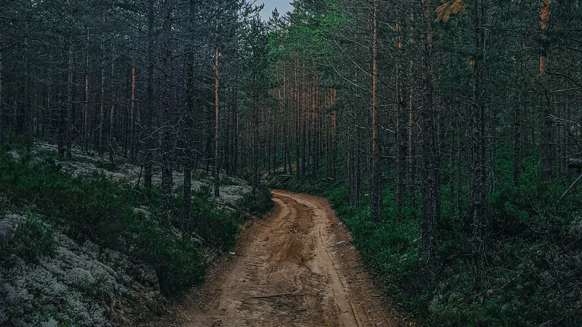
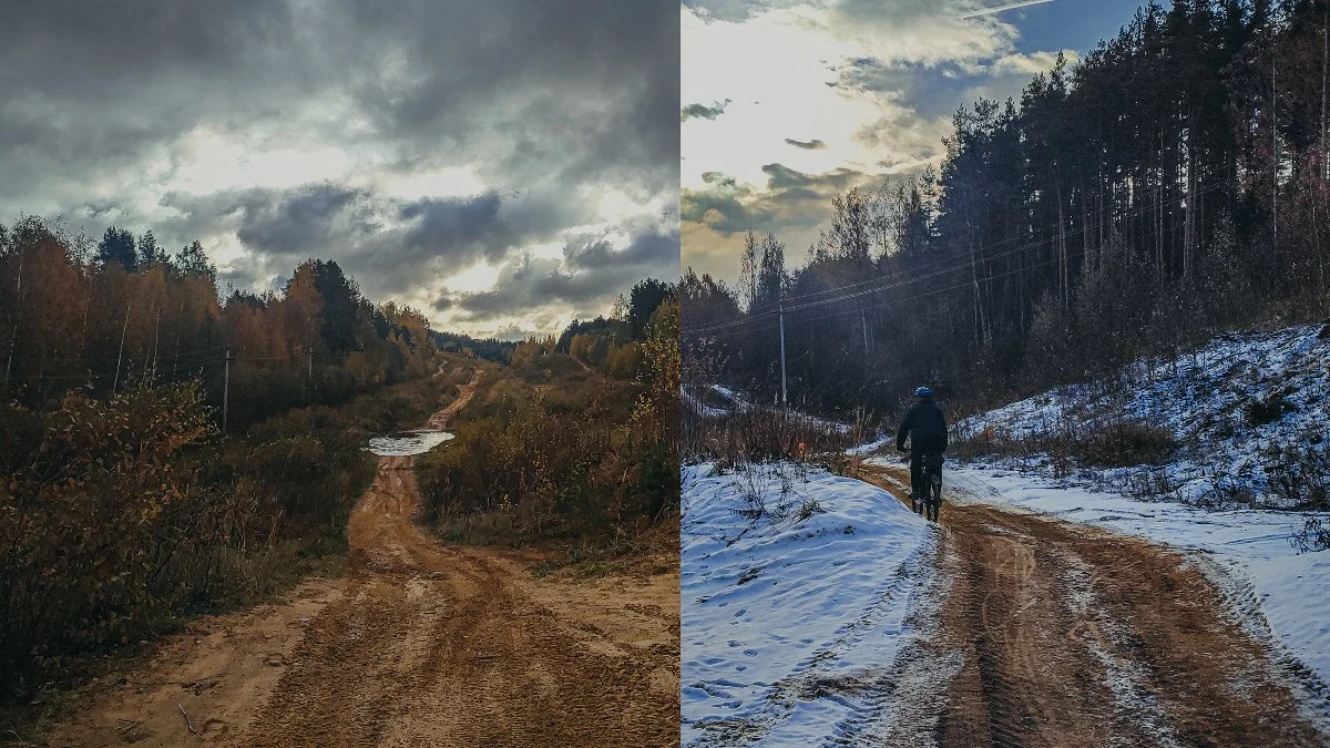
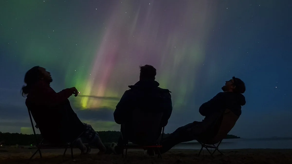
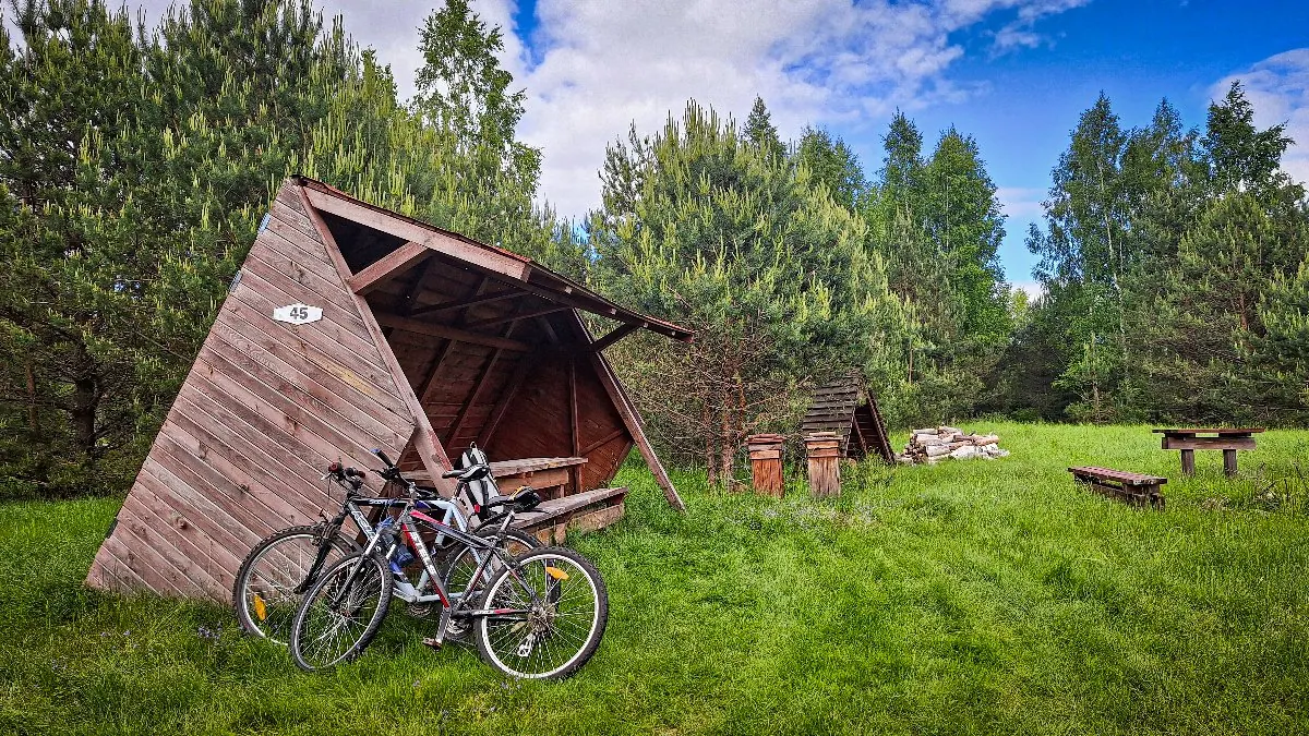
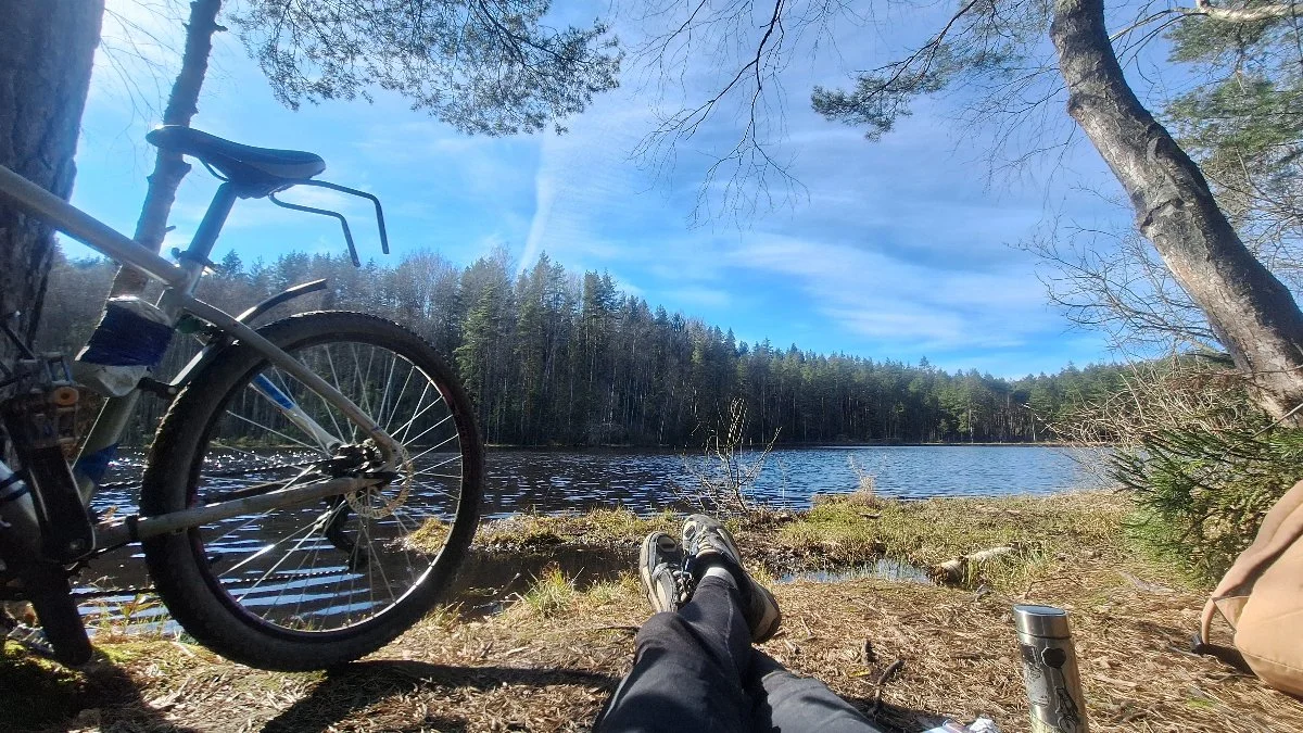
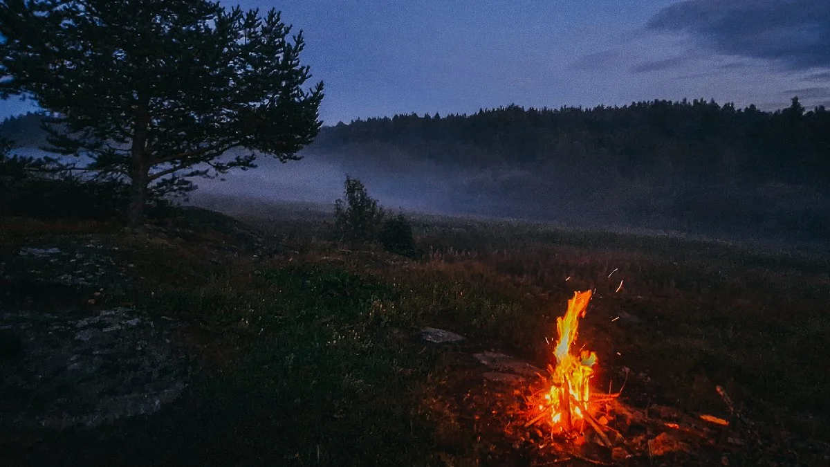
Обсуждение
Комментарии 0
Не удалось загрузить комментарии
Войдите, чтобы оставить комментарий
Можно задать вопрос о маршруте, покрытии или поделиться своим опытом.
Комментариев пока нет
Задайте автору вопрос о маршруте или поделитесь своим опытом.
Ничего не найдено
Попробуйте другой фильтр комментариев.