TrailTrack routes

Маршруты с подготовленным описанием, сложностью, покрытием и планированием визита.

Найдено 859 routes
Choose a route from the list or view routes on the map.
Arshan to the Suburga
TrailTrack

Arshan to the Suburga

Hiking · One-day

The multi-section hiking route “Arshan to the Suburga” is approximately 5.8 km long, with about 60 m of ascent from the GPX. The route focuses on the historical, cultural or memorial site named in the title and provides a ready-made approach track. The file contains several lines or stages; select the intended sequence before departure. The GPX represents a user or archive trip; roads, bridges and fords may have changed. Compare the GPX with a current map, forecast and local access rules before setting out.

5.8 km 5 +126 m Easy
Peak of Love
TrailTrack

Peak of Love

Старт · Hiking · One-day

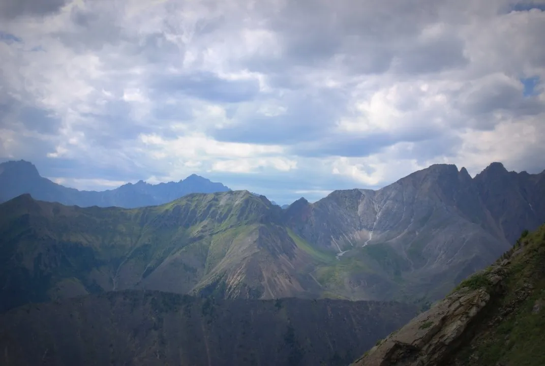
The point-to-point hiking route “Peak of Love” is approximately 4.1 km long, with about 1180 m of ascent from the GPX. The route crosses mountain or strongly broken terrain, so distance alone does not represent the full physical or technical effort. The start and finish are in different places, so return travel must be planned in advance. The track is based on a published trail description; surface conditions and access should be checked before departure. Compare the GPX with a current map, forecast and local access rules before setting out.

4.1 km 5 +1197 m Hard
Summer Route to Munku-Sardyk
TrailTrack

Summer Route to Munku-Sardyk

Hiking · One-day

The multi-section hiking route “Summer Route to Munku-Sardyk” is approximately 12.8 km long. The summer route to Munku-Sardyk reaches high terrain near the Russian–Mongolian border. The file contains several lines or stages; select the intended sequence before departure. The line comes from an OpenStreetMap route relation and is not evidence of a recent field check. Compare the GPX with a current map, forecast and local access rules before setting out.

12.8 km 5 +0 m Moderate
Ski Track
TrailTrack

Ski Track

Hiking · One-day

The loop hiking route “Ski Track” is approximately 4.9 km long. The route provides a ready-made line for exploring the area and the places named in the title. It returns to the starting point. The line comes from an OpenStreetMap route relation and is not evidence of a recent field check. Compare the GPX with a current map, forecast and local access rules before setting out.

4.9 km 5 +0 m Easy
Great Ob Trail
TrailTrack

Great Ob Trail

Hiking · One-day

The point-to-point hiking route “Great Ob Trail” is approximately 5.7 km long. The route provides a ready-made line for exploring the area and the places named in the title. The start and finish are in different places, so return travel must be planned in advance. The line comes from an OpenStreetMap route relation and is not evidence of a recent field check. Compare the GPX with a current map, forecast and local access rules before setting out.

5.7 km 5 +0 m Easy
Great Ob Trail
TrailTrack

Great Ob Trail

Hiking · One-day

The point-to-point hiking route “Great Ob Trail” is approximately 9.4 km long. The route provides a ready-made line for exploring the area and the places named in the title. The start and finish are in different places, so return travel must be planned in advance. The line comes from an OpenStreetMap route relation and is not evidence of a recent field check. Compare the GPX with a current map, forecast and local access rules before setting out.

9.4 km 5 +0 m Easy
Yellow Route: Kashtak Trail
TrailTrack

Yellow Route: Kashtak Trail

Hiking · One-day

The point-to-point hiking route “Yellow Route: Kashtak Trail” is approximately 6.0 km long. The route provides a ready-made line for exploring the area and the places named in the title. The start and finish are in different places, so return travel must be planned in advance. The line comes from an OpenStreetMap route relation and is not evidence of a recent field check. Compare the GPX with a current map, forecast and local access rules before setting out.

6.0 km 5 +0 m Easy
Lingonberry Trail
TrailTrack

Lingonberry Trail

Hiking · One-day

The loop hiking route “Lingonberry Trail” is approximately 16.1 km long. The route provides a ready-made line for exploring the area and the places named in the title. It returns to the starting point. The line comes from an OpenStreetMap route relation and is not evidence of a recent field check. Compare the GPX with a current map, forecast and local access rules before setting out.

16.1 km 5 +0 m Moderate
Vachkazhets Mountain Massif
TrailTrack

Vachkazhets Mountain Massif

Hiking · One-day

The loop hiking route “Vachkazhets Mountain Massif” is approximately 12.2 km long, with about 520 m of ascent from the GPX. The track crosses the Vachkazhets mountain massif, with volcanic terrain and exposed sections. It returns to the starting point. The track is based on a regional tourism source; seasonal status and access rules may change. Compare the GPX with a current map, forecast and local access rules before setting out.

12.2 km 5 +1093 m Hard
Ganalskiye Vostryaki
TrailTrack

Ganalskiye Vostryaki

Hiking · One-day

The point-to-point hiking route “Ganalskiye Vostryaki” is approximately 15.5 km long. The route provides a ready-made line for exploring the area and the places named in the title. The start and finish are in different places, so return travel must be planned in advance. The track is based on a regional tourism source; seasonal status and access rules may change. Compare the GPX with a current map, forecast and local access rules before setting out.

15.5 km 5 +0 m Moderate
Orlyonok to Starukha and the Shakhtan Rocks
TrailTrack

Orlyonok to Starukha and the Shakhtan Rocks

Горнолыжка · Hiking · One-day

The point-to-point hiking route “Orlyonok to Starukha and the Shakhtan Rocks” is approximately 17.1 km long, with about 1050 m of ascent from the GPX. The route provides a ready-made line for exploring the area and the places named in the title. The start and finish are in different places, so return travel must be planned in advance. The GPX represents a user or archive trip; roads, bridges and fords may have changed. Compare the GPX with a current map, forecast and local access rules before setting out.

17.1 km 5 +1589 m Hard
Vorota Tract and Return to Glubokaya
TrailTrack

Vorota Tract and Return to Glubokaya

Hiking · One-day

The multi-section hiking route “Vorota Tract and Return to Glubokaya” is approximately 8.9 km long, with about 320 m of ascent from the GPX. The route provides a ready-made line for exploring the area and the places named in the title. The file contains several lines or stages; select the intended sequence before departure. The GPX represents a user or archive trip; roads, bridges and fords may have changed. Compare the GPX with a current map, forecast and local access rules before setting out.

8.9 km 5 +522 m Moderate
To Mount Hidden Stones
TrailTrack

To Mount Hidden Stones

Hiking · Multi-day

The point-to-point hiking route “To Mount Hidden Stones” is approximately 26.6 km long, with about 840 m of ascent from the GPX. The route provides a ready-made line for exploring the area and the places named in the title. The start and finish are in different places, so return travel must be planned in advance. The GPX represents a user or archive trip; roads, bridges and fords may have changed. Compare the GPX with a current map, forecast and local access rules before setting out.

26.6 km 5 +1442 m Hard
Sinichka Bay to Cormorant Rock
TrailTrack

Sinichka Bay to Cormorant Rock

Hiking · One-day

The point-to-point hiking route “Sinichka Bay to Cormorant Rock” is approximately 2.3 km long, with about 50 m of ascent from the GPX. The line follows a shore, bay or cape section; exposed ground may bring wind, surf and limited exit options. The start and finish are in different places, so return travel must be planned in advance. The GPX represents a user or archive trip; roads, bridges and fords may have changed. Compare the GPX with a current map, forecast and local access rules before setting out.

2.4 km 5 +87 m Easy
Routes to Bolshaya Osinovka around the Settling Ponds
TrailTrack

Routes to Bolshaya Osinovka around the Settling Ponds

Hiking · One-day

The multi-section hiking route “Routes to Bolshaya Osinovka around the Settling Ponds” is approximately 1.8 km long, with about 60 m of ascent from the GPX. The route provides a ready-made line for exploring the area and the places named in the title. The file contains several lines or stages; select the intended sequence before departure. The GPX represents a user or archive trip; roads, bridges and fords may have changed. Compare the GPX with a current map, forecast and local access rules before setting out.

1.8 km 5 +66 m Easy
Nature and Heritage Trail in the V. P. Sukachyov Estate Memorial Park
TrailTrack

Nature and Heritage Trail in the V. P. Sukachyov Estate Memorial Park

Hiking · One-day

The multi-section hiking route “Nature and Heritage Trail in the V. P. Sukachyov Estate Memorial Park” is approximately 0.4 km long. The route focuses on the historical, cultural or memorial site named in the title and provides a ready-made approach track. The file contains several lines or stages; select the intended sequence before departure. The line comes from an OpenStreetMap route relation and is not evidence of a recent field check. Compare the GPX with a current map, forecast and local access rules before setting out.

0.4 km 5 +0 m Easy
Orlyonok–Dabat–Kurma–Irkutsk Ski Route
TrailTrack

Orlyonok–Dabat–Kurma–Irkutsk Ski Route

Skiing · Multi-day

The point-to-point cross-country ski route “Orlyonok–Dabat–Kurma–Irkutsk Ski Route” is approximately 64.2 km long. The line is intended for skiing once a stable snow cover has formed; the actual track may depend on the season and recent snowfall. The start and finish are in different places, so return travel must be planned in advance. The GPX represents a user or archive trip; roads, bridges and fords may have changed. Compare the GPX with a current map, forecast and local access rules before setting out.

64.2 km 5 +0 m Hard
Listvyanka to MRS
TrailTrack

Listvyanka to MRS

Skiing · Multi-day

The point-to-point cross-country ski route “Listvyanka to MRS” is approximately 208.9 km long, with about 110 m of ascent from the GPX. The line is intended for skiing once a stable snow cover has formed; the actual track may depend on the season and recent snowfall. The start and finish are in different places, so return travel must be planned in advance. The GPX represents a user or archive trip; roads, bridges and fords may have changed. Compare the GPX with a current map, forecast and local access rules before setting out.

208.9 km 5 +2303 m Hard
Volchya Nature Trail
TrailTrack

Volchya Nature Trail

Hiking · One-day

The point-to-point hiking route “Volchya Nature Trail” is approximately 16.9 km long. The route provides a ready-made line for exploring the area and the places named in the title. The start and finish are in different places, so return travel must be planned in advance. The line comes from an OpenStreetMap route relation and is not evidence of a recent field check. Compare the GPX with a current map, forecast and local access rules before setting out.

16.9 km 5 +0 m Moderate
First Microdistrict Nature Trail
TrailTrack

First Microdistrict Nature Trail

Moscow region · Hiking · One-day

The point-to-point hiking route “First Microdistrict Nature Trail” is approximately 1.5 km long. The route provides a ready-made line for exploring the area and the places named in the title. The start and finish are in different places, so return travel must be planned in advance. The line comes from an OpenStreetMap route relation and is not evidence of a recent field check. Compare the GPX with a current map, forecast and local access rules before setting out.

1.5 km 5 +0 m Easy
Voynovo — Zapolitsy
TrailTrack

Voynovo — Zapolitsy

Moscow region · Hiking · Multi-day

The multi-section hiking route “Voynovo — Zapolitsy” is approximately 56.8 km long. The route provides a ready-made line for exploring the area and the places named in the title. The file contains several lines or stages; select the intended sequence before departure. The line comes from an OpenStreetMap route relation and is not evidence of a recent field check. Compare the GPX with a current map, forecast and local access rules before setting out.

56.8 km 5 +0 m Hard
Moscow Green Ring
TrailTrack

Moscow Green Ring

Moscow region · Hiking · Multi-day

The multi-section hiking route “Moscow Green Ring” is approximately 165.1 km long. The route provides a ready-made line for exploring the area and the places named in the title. The file contains several lines or stages; select the intended sequence before departure. The line comes from an OpenStreetMap route relation and is not evidence of a recent field check. Compare the GPX with a current map, forecast and local access rules before setting out.

165.1 km 5 +0 m Hard
Nerskaya River
TrailTrack

Nerskaya River

Moscow region · Hiking · One-day

The multi-section hiking route “Nerskaya River” is approximately 23.2 km long, with about 80 m of ascent from the GPX. The route provides a ready-made line for exploring the area and the places named in the title. The file contains several lines or stages; select the intended sequence before departure. The track is based on a published trail description; surface conditions and access should be checked before departure. Compare the GPX with a current map, forecast and local access rules before setting out.

23.2 km 5 +139 m Moderate
Alleya — Snegiri
TrailTrack

Alleya — Snegiri

Moscow region · Skiing · One-day

The point-to-point cross-country ski route “Alleya — Snegiri” is approximately 0.7 km long. The line is intended for skiing once a stable snow cover has formed; the actual track may depend on the season and recent snowfall. The start and finish are in different places, so return travel must be planned in advance. The line comes from an OpenStreetMap route relation and is not evidence of a recent field check. Compare the GPX with a current map, forecast and local access rules before setting out.

0.7 km 5 +0 m Easy
Back Page 33 of 36 Next
Home Map Routes Regions Profile