TrailTrack routes

Маршруты с подготовленным описанием, сложностью, покрытием и планированием визита.

Found 22 routes
Choose a route from the list or view routes on the map.
Hiking route — Almaty Region, 1.3 km
✓ TrailTrack

Hiking route — Almaty Region, 1.3 km

Hiking route · Hiking · One-day

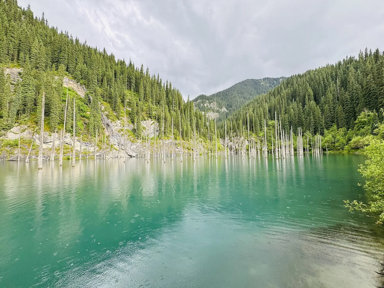
The route covers about 1.3 km as a point-to-point hiking route, with Saty as the most useful starting reference. Use Saty as the starting reference and Saty as the finishing reference; plan the return in advance. Features worth noticing include Trail to frozen lake (visitor information, about 0.3 km away). There is no reliable elevation profile, so climbs and descents should be checked on a detailed map. Original material: OpenStreetMap — https://www.openstreetmap.org/relation/21223164.

1.3 km 2 +7 m Easy
Kairak waterfall
✓ TrailTrack

Kairak waterfall

Hiking · One-day

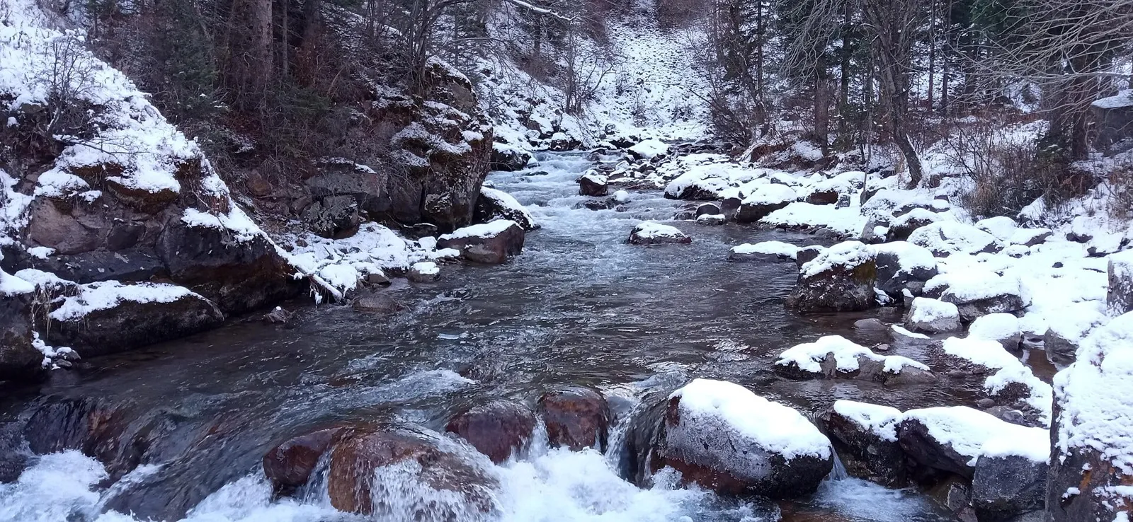
This is a point-to-point hiking route of about 7.8 km. The clearest starting reference is Bartugul. Use Bartugul as the starting reference and Nazar Mountains as the finishing reference; plan the return in advance. Features worth noticing include the nearest waterfall (attraction, directly beside the route); Кұрбатан бастауы (spring, about 0.9 km away); Batan Visit Center (visitor information, directly beside the route). There is no reliable elevation profile, so climbs and descents should be checked on a detailed map. Original material: OpenStreetMap — https://www.openstreetmap.org/relation/19609245.

7.9 km 2 +51 m Easy
Vodopad Bolshoy Shymbulak
✓ TrailTrack

Vodopad Bolshoy Shymbulak

Hiking · One-day

The route covers about 7.1 km as a point-to-point hiking route, with Кайнар as the most useful starting reference. Use Кайнар as the starting reference and Кайнар as the finishing reference; plan the return in advance. Features worth noticing include Наскальные рисунки (attraction, directly beside the route); Ulken Shymbulak (attraction, directly beside the route). There is no reliable elevation profile, so climbs and descents should be checked on a detailed map. Original material: OpenStreetMap — https://www.openstreetmap.org/relation/17990993.

7.1 km 2 +301 m Easy
Kargaly-Aksai-Kaskelen
✓ TrailTrack

Kargaly-Aksai-Kaskelen

Hiking · Multi-day

This is a point-to-point hiking route of about 45.4 km. The clearest starting reference is Буйражар. Use Буйражар as the starting reference and Кызылкунгей as the finishing reference; plan the return in advance. Features worth noticing include Dorozhnyy (mountain pass, 2780 m, directly beside the route); Low Qargaly (mountain pass, 3735 m, directly beside the route); Somnitel'nykh romashek (mountain pass, 3708 m, directly beside the route); Вагончик КазСелезащиты (wilderness hut, directly beside the route); Perevalny (peak, 3738 m, directly beside the route). The route itself has no recorded elevations, but nearby named features rise to about 3805 m. This matters for weather and acclimatisation. Original material: OpenStreetMap — https://www.openstreetmap.org/relation/17975553.

45.5 km 2 +3026 m Hard
Kazachi ozera
✓ TrailTrack

Kazachi ozera

Hiking · One-day

Expect roughly 13.2 km of high-mountain travel. The format is point-to-point, and Кызылкунгей is the starting reference. Use Кызылкунгей as the starting reference and Zhai as the finishing reference; plan the return in advance. Features worth noticing include Aidarys (mountain pass, 2800 m, about 0.3 km away); Mezhduozernyy (mountain pass, 3703 m, about 0.8 km away); Perevalny (peak, 3738 m, about 0.8 km away); Somnitel'nykh romashek (mountain pass, 3708 m, about 0.8 km away); Somnitel'nykh udovolstviy (mountain pass, 3728 m, about 0.8 km away). The route itself has no recorded elevations, but nearby named features rise to about 3918 m. This matters for weather and acclimatisation. Original material: OpenStreetMap — https://www.openstreetmap.org/relation/17975445.

13.2 km 2 +1575 m Moderate
Yukon
✓ TrailTrack

Yukon

Hiking · One-day

The route covers about 14.4 km as a point-to-point hiking route, with Visyachaya valley as the most useful starting reference. Use Visyachaya valley as the starting reference and Буйражар as the finishing reference; plan the return in advance. Features worth noticing include Dorozhnyy (mountain pass, 2780 m, directly beside the route); the nearest landmark (peak, 3540 m, directly beside the route); Ykylas (peak, 2232 m, about 0.1 km away); Aqjar (peak, 2901 m, about 0.2 km away); Kaspansay (mountain pass, 2518 m, about 0.8 km away). The route itself has no recorded elevations, but nearby named features rise to about 3640 m. This matters for weather and acclimatisation. Original material: OpenStreetMap — https://www.openstreetmap.org/relation/17867220.

14.4 km 2 +59 m Moderate
Polyana Terra
✓ TrailTrack

Polyana Terra

Hiking · One-day

Expect roughly 8.3 km of high-mountain travel. The format is multi-part, and Visyachaya valley is the starting reference. The route contains 4 separate parts; establish how they connect before travelling. Features worth noticing include Алма-Арасан (hot spring, directly beside the route); Hut Terra Glade (wilderness hut, about 0.2 km away); Volchonok (peak, 1935 m, about 0.8 km away); Vechernyaya (peak, 3333 m, about 1.4 km away); Utrennyaya (peak, 3210 m, about 1.6 km away). The route itself has no recorded elevations, but nearby named features rise to about 3680 m. This matters for weather and acclimatisation. Original material: OpenStreetMap — https://www.openstreetmap.org/relation/17055101.

8.3 km 2 +1311 m Easy
Volchya tropa
✓ TrailTrack

Volchya tropa

Hiking · One-day

The route covers about 10.2 km as a point-to-point hiking route, with Leshoz as the most useful starting reference. Use Leshoz as the starting reference and Leshoz as the finishing reference; plan the return in advance. Features worth noticing include Volchij (mountain pass, 2142 m, directly beside the route); Volchonok (peak, 1935 m, directly beside the route); Volch'ya (peak, 2305 m, directly beside the route); Qasqabas (mountain pass, 2584 m, about 1.1 km away); Алма-Арасан (hot spring, about 1.8 km away). The route itself has no recorded elevations, but nearby named features rise to about 2584 m. This matters for weather and acclimatisation. Original material: OpenStreetMap — https://www.openstreetmap.org/relation/17055038.

10.2 km 2 +854 m Moderate
Small Alamaty circle trail
✓ TrailTrack

Small Alamaty circle trail

Hiking · One-day

The route covers about 18.5 km as a multi-part hiking route, with Glaciological station T-1 (Tuyuksu) as the most useful starting reference. The route contains 3 separate parts; establish how they connect before travelling. Features worth noticing include Butakovskiy (mountain pass, 2880 m, directly beside the route); Small Talgar (mountain pass, 2760 m, directly beside the route); Talgar (mountain pass, 3200 m, directly beside the route); Furmanov (peak, 3053.4 m, about 0.4 km away); Panorama hut (wilderness hut, 3060 m, about 0.6 km away). The route itself has no recorded elevations, but nearby named features rise to about 3573 m. This matters for weather and acclimatisation. Original material: OpenStreetMap — https://www.openstreetmap.org/relation/17024665.

18.6 km 2 +2065 m Moderate
Ulken Alamaty circle trail
✓ TrailTrack

Ulken Alamaty circle trail

Hiking · Multi-day

This is a multi-part hiking route of about 37.6 km. The clearest starting reference is Озёрный. The route contains 3 separate parts; establish how they connect before travelling. Features worth noticing include Small Talgar (mountain pass, 2760 m, directly beside the route); Talgar (mountain pass, 3200 m, directly beside the route); Turistov (mountain pass, 3981 m, directly beside the route); Hut BAG (wilderness hut, 3092 m, about 0.1 km away); Хижина Левый Талгар (wilderness hut, 2965 m, about 0.1 km away). The route itself has no recorded elevations, but nearby named features rise to about 4176 m. This matters for weather and acclimatisation. Original material: OpenStreetMap — https://www.openstreetmap.org/relation/17024304.

37.7 km 2 +2158 m Hard
Kurti - Qonaev
✓ TrailTrack

Kurti - Qonaev

Kurti · Bicycle · One-day

This multi-part route is about 92.5 km long. Use Qonaev to locate the starting area. The route contains 16 separate parts; establish how they connect before travelling. Features worth noticing include Kapchagay bus station (bus station, about 1.5 km away); улица Сидранского (public transport stop, about 1.4 km away); По требованию (public transport stop, about 1.8 km away). There is no reliable elevation profile, so climbs and descents should be checked on a detailed map. Original material: OpenStreetMap — https://www.openstreetmap.org/relation/14431257. It states: published distance: 250 км от развязки ул. Саина и пр. Раимбека до развязки Северное кольцо и ул. Джансугурова;10-11 часов. В одну сторону: 100 км;5-6 часов..

92.6 km 2 +394 m Hard
AL-36
✓ TrailTrack

AL-36

Bicycle · One-day

This is a multi-part cycling route of about 24.0 km. The clearest starting reference is Bulaqsaz. The route contains 6 separate parts; establish how they connect before travelling. Features worth noticing include Karaarsha (peak, 3300 m, directly beside the route); Oi-Zhailau (mountain pass, 2565 m, directly beside the route); Karaarsha (mountain pass, 3120 m, about 1.0 km away); Assy-Turgen astronomical observatory named after academician T.B. Omarov (attraction, 2750 m, about 1.8 km away). The route itself has no recorded elevations, but nearby named features rise to about 3300 m. This matters for weather and acclimatisation. Original material: OpenStreetMap — https://www.openstreetmap.org/relation/14429387.

24.1 km 2 +1049 m Moderate
BAK - 4
✓ TrailTrack

BAK - 4

BAK · Bicycle · Multi-day

The route covers about 88.1 km as a multi-part cycling route, with Ушбулак as the most useful starting reference. The route contains 6 separate parts; establish how they connect before travelling. Features worth noticing include Oi-Zhailau (mountain pass, 2565 m, directly beside the route); Шүмек Бастау (spring, directly beside the route); Әулие Бастау (spring, directly beside the route); Кұрбатан бастауы (spring, directly beside the route); Assy-Turgen astronomical observatory named after academician T.B. Omarov (attraction, 2750 m, about 0.1 km away). The route itself has no recorded elevations, but nearby named features rise to about 2750 m. This matters for weather and acclimatisation. Original material: OpenStreetMap — https://www.openstreetmap.org/relation/14429331.

88.2 km 2 +3437 m Hard
Lake Issyk
✓ TrailTrack

Lake Issyk

Bicycle · One-day

Expect roughly 14.9 km of lowland or foothill travel. The format is multi-part, and Кызылжар is the starting reference. The route contains 3 separate parts; establish how they connect before travelling. Features worth noticing include Lake Esik (attraction, about 0.3 km away); the nearest lake (camp site, about 0.6 km away); Археолого-Краеведческий музей (museum, about 2.0 km away); Памятник Керею и Жанибеку 550 лет Казахского ханства (memorial, directly beside the route). There is no reliable elevation profile, so climbs and descents should be checked on a detailed map. Original material: OpenStreetMap — https://www.openstreetmap.org/relation/14428241. It states: published distance: 15; ascent: 838.

14.9 km 2 +703 m Moderate
Tabagan (MAU 9)
✓ TrailTrack

Tabagan (MAU 9)

Bicycle · One-day

This is a multi-part cycling route of about 16.3 km. The clearest starting reference is Besqaynar. The route contains 5 separate parts; establish how they connect before travelling. Features worth noticing include Shybynsay (peak, 2036 m, about 1.3 km away); 1600m lookout (viewpoint, about 0.4 km away). The route itself has no recorded elevations, but nearby named features rise to about 2036 m. This matters for weather and acclimatisation. Original material: OpenStreetMap — https://www.openstreetmap.org/relation/14425012. It states: published distance: 27 км (в одну сторону) от пересечения пр.Достык и ул. Сатпаева;4-5 часов туда. Возвращение по Талгарской трассе – 17 км, 1-1,5 часа;удлиненный вариант – от пересечения пр. Достык и ул. Сатпаева до Развилки – 27 км и 7-8 часов.

16.3 km 2 +727 m Moderate
Alatau Amanaty: Marshrut №2. Ozero Kaindy - ozero Kolsay 1
✓ TrailTrack

Alatau Amanaty: Marshrut №2. Ozero Kaindy - ozero Kolsay 1

Alatau Amanaty: Marshrut №2. Ozero Kaindy · Hiking · One-day

The route covers about 18.1 km as a point-to-point hiking route, with Курменты as the most useful starting reference. Use Курменты as the starting reference and Saty as the finishing reference; plan the return in advance. Features worth noticing include Trail to frozen lake (visitor information, about 0.2 km away). There is no reliable elevation profile, so climbs and descents should be checked on a detailed map. Original material: OpenStreetMap — https://www.openstreetmap.org/relation/19901674. It states: published distance: 19 km.

18.1 km 1 +1495 m Moderate
Alatau Amanaty: Marshrut №1. Poselok Kurmenty - Ushchele Saty- ozero Kaindy
✓ TrailTrack

Alatau Amanaty: Marshrut №1. Poselok Kurmenty - Ushchele Saty- ozero Kaindy

Alatau Amanaty: Marshrut №1. Poselok Kurmenty · Hiking · Multi-day

This multi-part route is about 25.4 km long. Use Saty to locate the starting area. The route contains 2 separate parts; establish how they connect before travelling. Features worth noticing include Лагерь Шитика (camp site, about 1.1 km away); Trail to frozen lake (visitor information, about 0.1 km away). There is no reliable elevation profile, so climbs and descents should be checked on a detailed map. Original material: OpenStreetMap — https://www.openstreetmap.org/relation/19886683. It states: published distance: 27 km; ascent: 1986; descent: 1637.

25.4 km 1 +1591 m Hard
Krugovoy marshrut po Shamalganu i Uzyn Kargaly
✓ TrailTrack

Krugovoy marshrut po Shamalganu i Uzyn Kargaly

Hiking · Multi-day

This is a multi-part hiking route of about 57.2 km. The clearest starting reference is Кызылкунгей. The route contains 2 separate parts; establish how they connect before travelling. Features worth noticing include Gauhar-Zhan-Tas (mountain pass, 3643 m, directly beside the route); Zharkus (mountain pass, 3838 m, directly beside the route); Kyzylsaz (mountain pass, 3174 m, directly beside the route); Meduza (mountain pass, 3983 m, directly beside the route); Molochnyj Kvarc (mountain pass, 3716 m, directly beside the route). The route itself has no recorded elevations, but nearby named features rise to about 3983 m. This matters for weather and acclimatisation. Original material: OpenStreetMap — https://www.openstreetmap.org/relation/19533866.

57.2 km 1 +2901 m Hard
Krugovoy marshrut iz Bolshogo Almatinskogo ushchelya v Prokhodnoe cherez Kosmostantsiyu i pereval Almaty Alagir
✓ TrailTrack

Krugovoy marshrut iz Bolshogo Almatinskogo ushchelya v Prokhodnoe cherez Kosmostantsiyu i pereval Almaty Alagir

Hiking · Multi-day

Expect roughly 27.7 km of high-mountain travel. The format is loop, and Озёрный is the starting reference. The route returns to its starting area, so a separate finish transfer is usually unnecessary. Features worth noticing include Almaty Alagir (mountain pass, 3655 m, directly beside the route); Zhosalykezen (mountain pass, 3337 m, about 0.1 km away); Utrennyaya (peak, 3210 m, about 0.2 km away); Хижина Проходная (wilderness hut, 3072 m, about 0.2 km away); Garysh tau (peak, 3500 m, about 0.7 km away). The route itself has no recorded elevations, but nearby named features rise to about 4050 m. This matters for weather and acclimatisation. Original material: OpenStreetMap — https://www.openstreetmap.org/relation/17168388.

27.7 km 1 +1422 m Hard
Gora Kaskabas i Visyachaya dolina
✓ TrailTrack

Gora Kaskabas i Visyachaya dolina

Hiking · One-day

The route covers about 8.7 km as a point-to-point hiking route, with Visyachaya valley as the most useful starting reference. Use Visyachaya valley as the starting reference and Leshoz as the finishing reference; plan the return in advance. Features worth noticing include Qasqabas (peak, 2932 m, directly beside the route); Qasqabas (mountain pass, 2584 m, directly beside the route); Volchij (mountain pass, 2142 m, about 0.1 km away); Volchonok (peak, 1935 m, about 0.7 km away); Volch'ya (peak, 2305 m, about 1.1 km away). The route itself has no recorded elevations, but nearby named features rise to about 2932 m. This matters for weather and acclimatisation. Original material: OpenStreetMap — https://www.openstreetmap.org/relation/17072851.

8.7 km 1 +51 m Easy
Winter trail to the Bogdanovich glacier and Oktyabrskaya cave
✓ TrailTrack

Winter trail to the Bogdanovich glacier and Oktyabrskaya cave

Hiking · One-day

Expect roughly 2.4 km of high-mountain travel. The format is point-to-point, and Glaciological station T-1 (Tuyuksu) is the starting reference. Use Glaciological station T-1 (Tuyuksu) as the starting reference and Glaciological station T-1 (Tuyuksu) as the finishing reference; plan the return in advance. Features worth noticing include Talgar (mountain pass, 3200 m, directly beside the route); Oktyabrskaya cave (cave entrance, 3300 m, directly beside the route); SHkol'nik (peak, 3713 m, about 0.5 km away); SHkol'nik (mountain pass, 3590 m, about 0.7 km away); Edelweiss (peak, 3573 m, about 0.7 km away). The route itself has no recorded elevations, but nearby named features rise to about 4090 m. This matters for weather and acclimatisation. Original material: OpenStreetMap — https://www.openstreetmap.org/relation/17032222.

2.4 km 1 +214 m Easy
Aq Bulaq
✓ TrailTrack

Aq Bulaq

Bicycle · One-day

This point-to-point route is about 2.9 km long. Use Орман to locate the starting area. Use Орман as the starting reference and Береке as the finishing reference; plan the return in advance. Features worth noticing include Высокогорный курорт "Ак-Булак" (public transport stop, directly beside the route); Солдатское (public transport stop, about 0.7 km away); Орман (public transport stop, about 0.7 km away); По требованию (public transport stop, about 1.7 km away); Всемирная академия бокса (public transport stop, about 1.9 km away). There is no reliable elevation profile, so climbs and descents should be checked on a detailed map. Original material: OpenStreetMap — https://www.openstreetmap.org/relation/19843994.

2.9 km 1 +0 m Easy