TrailTrack routes

Маршруты с подготовленным описанием, сложностью, покрытием и планированием визита.

Найдено 13 routes
Choose a route from the list or view routes on the map.
Kleshnia - proryv Naboko: vulkanicheskii route Tolbachika
TrailTrack

Kleshnia - proryv Naboko: vulkanicheskii route Tolbachika

Клешня-2 · Hiking · One-day

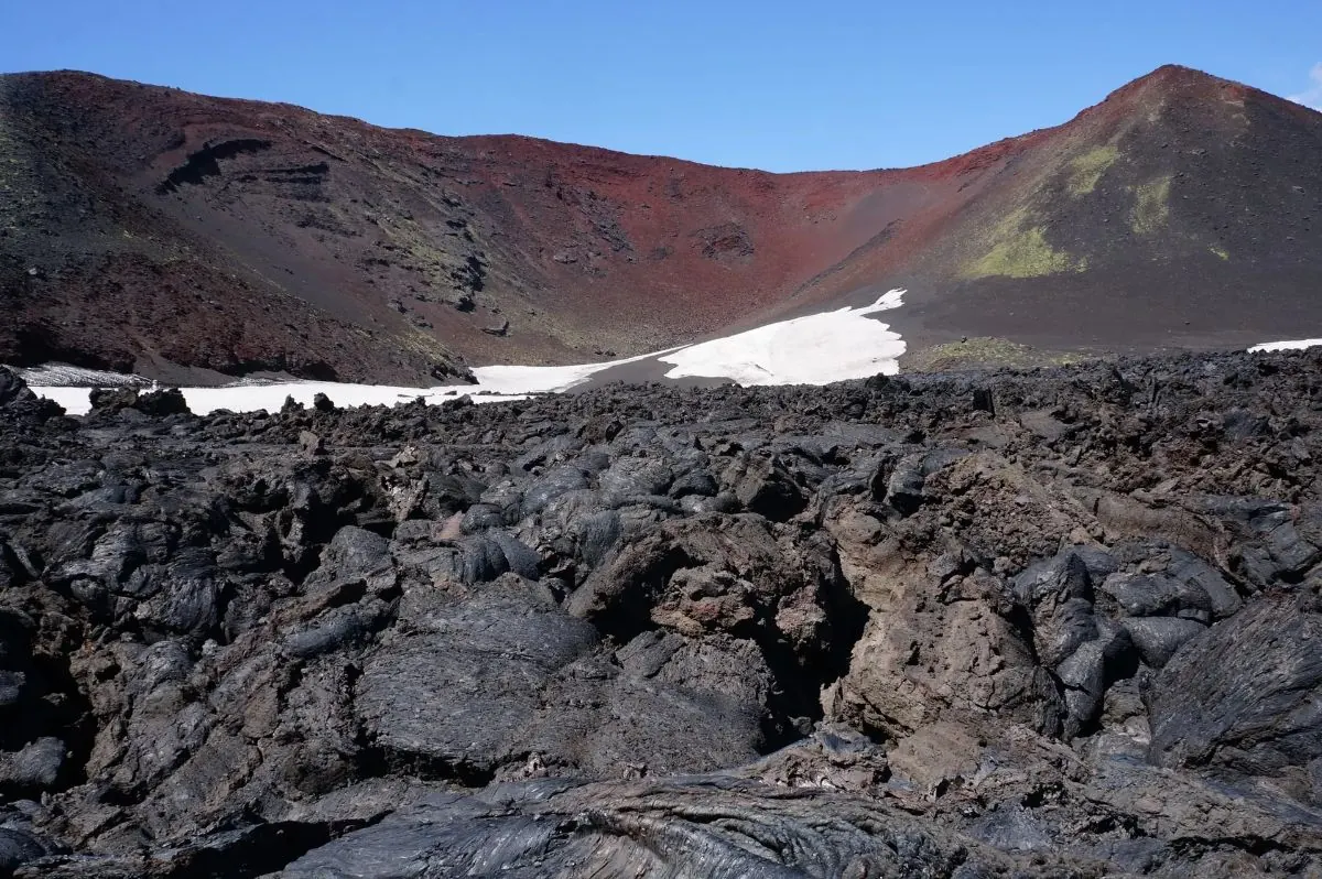
Notable places along the way include Kleshnia, Naboko Breakthrough, and Tolbachik. Vegetation gradually gives way to lava fields, dark rock and open volcanic ground.

8.4 km 197 +520 m Moderate

TrailTrack

Petropavlovsk Lighthouse to Cape Vertikalny

Hiking · One-day

The point-to-point hiking route “Petropavlovsk Lighthouse to Cape Vertikalny” is approximately 1.6 km long. The line follows a shore, bay or cape section; exposed ground may bring wind, surf and limited exit options. The start and finish are in different places, so return travel must be planned in advance. The track is based on a regional tourism source; seasonal status and access rules may change. Compare the GPX with a current map, forecast and local access rules before setting out.

1.6 km 12 +56 m Easy
TrailTrack

Blue Lakes

Hiking · One-day

The point-to-point hiking route “Blue Lakes” is approximately 13.0 km long, with about 530 m of ascent from the GPX. The route leads to the Blue Lakes, a highland lake group near Petropavlovsk-Kamchatsky. The start and finish are in different places, so return travel must be planned in advance. The track is based on a regional tourism source; seasonal status and access rules may change. Compare the GPX with a current map, forecast and local access rules before setting out.

13.0 km 5 +1176 m Hard
TrailTrack

Snow Leopard Waterfall on Spokoyny Stream

Hiking · One-day

The point-to-point hiking route “Snow Leopard Waterfall on Spokoyny Stream” is approximately 3.2 km long. The main objective is the waterfall or cascade named in the route title; conditions beside the water depend on season and rainfall. The start and finish are in different places, so return travel must be planned in advance. The track is based on a regional tourism source; seasonal status and access rules may change. Compare the GPX with a current map, forecast and local access rules before setting out.

3.2 km 4 +0 m Easy
TrailTrack

Waterfall at Babiy Rock

Hiking · One-day

The point-to-point hiking route “Waterfall at Babiy Rock” is approximately 3.3 km long. The main objective is the waterfall or cascade named in the route title; conditions beside the water depend on season and rainfall. The start and finish are in different places, so return travel must be planned in advance. The track is based on a regional tourism source; seasonal status and access rules may change. Compare the GPX with a current map, forecast and local access rules before setting out.

3.3 km 4 +0 m Easy
TrailTrack

Cape Mayachny

Hiking · One-day

The point-to-point hiking route “Cape Mayachny” is approximately 11.2 km long. The line follows a shore, bay or cape section; exposed ground may bring wind, surf and limited exit options. The start and finish are in different places, so return travel must be planned in advance. The track is based on a regional tourism source; seasonal status and access rules may change. Compare the GPX with a current map, forecast and local access rules before setting out.

11.2 km 4 +375 m Moderate
TrailTrack

Kamchatka Stone

Hiking · One-day

The point-to-point hiking route “Kamchatka Stone” is approximately 3.3 km long. The route provides a ready-made line for exploring the area and the places named in the title. The start and finish are in different places, so return travel must be planned in advance. The track is based on a regional tourism source; seasonal status and access rules may change. Compare the GPX with a current map, forecast and local access rules before setting out.

3.3 km 4 +0 m Easy
TrailTrack

Vachkazhets Mountain Massif

Hiking · One-day

The loop hiking route “Vachkazhets Mountain Massif” is approximately 12.2 km long, with about 520 m of ascent from the GPX. The track crosses the Vachkazhets mountain massif, with volcanic terrain and exposed sections. It returns to the starting point. The track is based on a regional tourism source; seasonal status and access rules may change. Compare the GPX with a current map, forecast and local access rules before setting out.

12.2 km 4 +1093 m Hard
TrailTrack

Ganalskiye Vostryaki

Hiking · One-day

The point-to-point hiking route “Ganalskiye Vostryaki” is approximately 15.5 km long. The route provides a ready-made line for exploring the area and the places named in the title. The start and finish are in different places, so return travel must be planned in advance. The track is based on a regional tourism source; seasonal status and access rules may change. Compare the GPX with a current map, forecast and local access rules before setting out.

15.5 km 4 +0 m Moderate
TrailTrack

Pionerskaya Bay

смотровая Приливное · Hiking · One-day

The point-to-point hiking route “Pionerskaya Bay” is approximately 5.3 km long. The route heads to Pionerskaya Bay on Kamchatka’s Pacific coast. The start and finish are in different places, so return travel must be planned in advance. The track is based on a regional tourism source; seasonal status and access rules may change. Compare the GPX with a current map, forecast and local access rules before setting out.

5.3 km 4 +282 m Moderate
TrailTrack

Nalychevo Nature Park Hiking Routes

Волонтерка · Hiking · Multi-day

The multi-section hiking route “Nalychevo Nature Park Hiking Routes” is approximately 109.5 km long. The route provides a ready-made line for exploring the area and the places named in the title. The file contains several lines or stages; select the intended sequence before departure. The track is based on a published trekking programme; independent travel requires separate preparation. Compare the GPX with a current map, forecast and local access rules before setting out.

109.5 km 4 +0 m Hard
TrailTrack

Kamchatka Walking Route — 40.9 km

Kamchatka Walking Route · Hiking · Multi-day

The multi-section hiking route “Kamchatka Walking Route — 40.9 km” is approximately 40.9 km long. The route provides a ready-made line for exploring the area and the places named in the title. The file contains several lines or stages; select the intended sequence before departure. The line comes from an OpenStreetMap route relation and is not evidence of a recent field check. Compare the GPX with a current map, forecast and local access rules before setting out.

40.9 km 4 +0 m Hard
TrailTrack

Dachnye Hot Springs

Hiking · One-day

The point-to-point hiking route “Dachnye Hot Springs” is approximately 1.7 km long. The destination is the Dachnye hot-spring area near the Mutnovsky volcanic massif. The start and finish are in different places, so return travel must be planned in advance. The track is based on a regional tourism source; seasonal status and access rules may change. Compare the GPX with a current map, forecast and local access rules before setting out.

1.7 km 3 +0 m Easy
Home Map Routes Regions Profile
