TrailTrack routes

Маршруты с подготовленным описанием, сложностью, покрытием и планированием визита.

Found 12 routes
Choose a route from the list or view routes on the map.
Alamedin Gorge - Al-Archa trail
✓ TrailTrack

Alamedin Gorge - Al-Archa trail

Alamedin Gorge · Hiking · Multi-day

Expect roughly 59.2 km of high-mountain travel. The format is multi-part, and Звонилка is the starting reference. The route contains 2 separate parts; establish how they connect before travelling. Features worth noticing include Наталии (glacier, directly beside the route); Токтогул (glacier, directly beside the route); Токтогул (mountain pass, 4050 m, directly beside the route); Туюк-Тор Западный (mountain pass, 3970 m, directly beside the route); верхняя Ала-арча (wilderness hut, directly beside the route). The route itself has no recorded elevations, but nearby named features rise to about 4350 m. This matters for weather and acclimatisation. Original material: OpenStreetMap — https://www.openstreetmap.org/relation/9431475.

59.3 km 4 +3734 m Hard
Trail do ozera Kol-Tor
✓ TrailTrack

Trail do ozera Kol-Tor

Hiking · One-day

This point-to-point route is about 7.2 km long. Use Дачи Кегети to locate the starting area. Use Дачи Кегети as the starting reference and Дачи Кегети as the finishing reference; plan the return in advance. Features worth noticing include Коль-Тор (camp site, about 0.2 km away); Ущелье Коль-Тор (visitor information, directly beside the route). There is no reliable elevation profile, so climbs and descents should be checked on a detailed map. Original material: OpenStreetMap — https://www.openstreetmap.org/relation/15630842. It states: published distance: 4200.

7.3 km 4 +901 m Easy
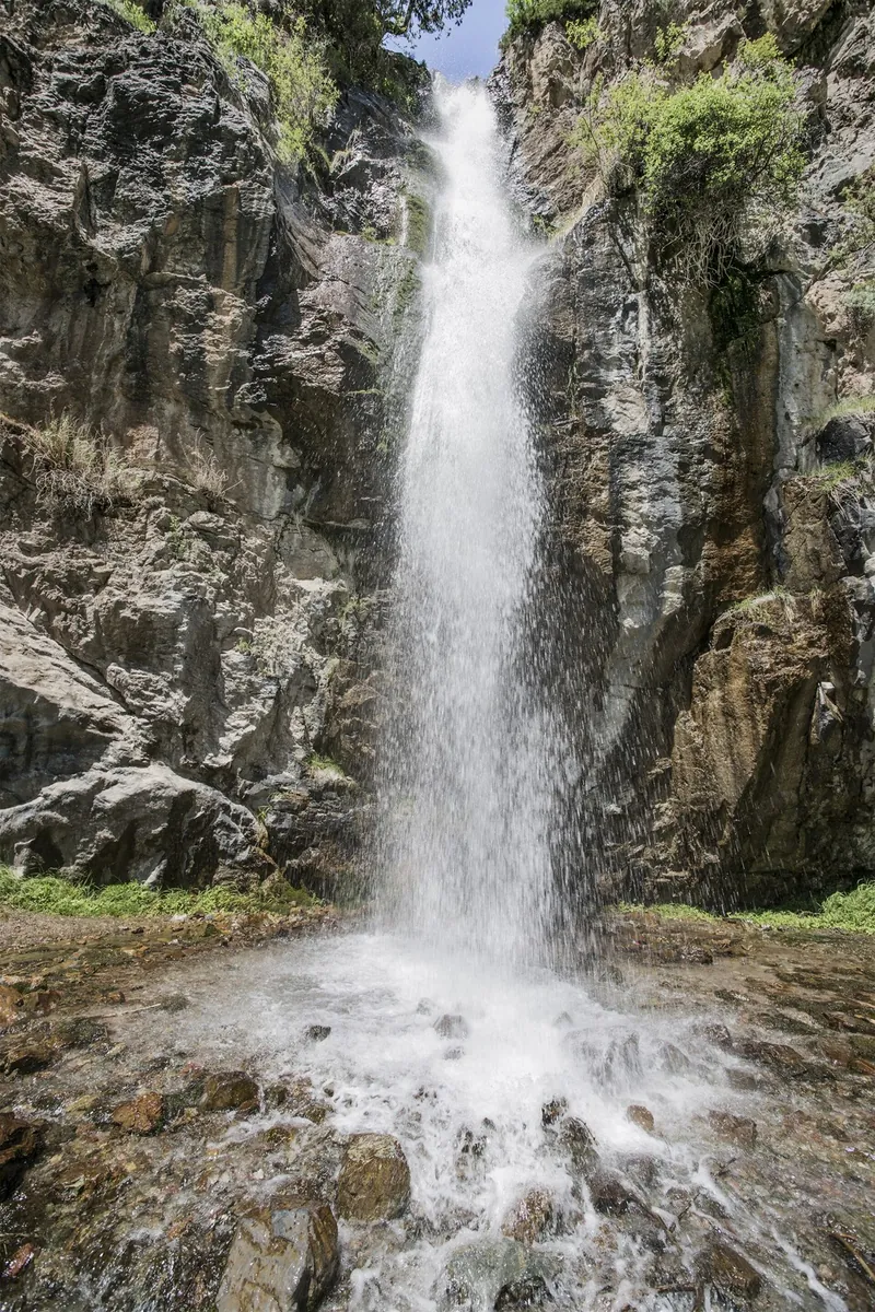
Waterfall Teketor
✓ TrailTrack

Waterfall Teketor

Hiking · One-day

This is a point-to-point hiking route of about 5.6 km. The clearest starting reference is Татыр. Use Татыр as the starting reference and Звонилка as the finishing reference; plan the return in advance. Features worth noticing include березовая роща (camp site, about 0.3 km away); балаган (shelter, about 0.4 km away). There is no reliable elevation profile, so climbs and descents should be checked on a detailed map. Original material: OpenStreetMap — https://www.openstreetmap.org/relation/15631890. It states: published distance: 5.6; ascent: 310.

5.6 km 3 +341 m Easy
Adygene
✓ TrailTrack

Adygene

Hiking · One-day

The route covers about 7.0 km as a multi-part hiking route, with Звонилка as the most useful starting reference. The route contains 2 separate parts; establish how they connect before travelling. Features worth noticing include Шубина (peak, 4040 m, about 1.0 km away); Elektra (peak, 4079 m, about 1.1 km away); Электро (mountain pass, 3900 m, about 1.2 km away); Саватар-Баши (peak, 4050 m, about 1.5 km away); Адыгине (glacier, about 1.5 km away). The route itself has no recorded elevations, but nearby named features rise to about 4300 m. This matters for weather and acclimatisation. Original material: OpenStreetMap — https://www.openstreetmap.org/relation/15630903.

7.0 km 3 +1132 m Easy
Alamedin Teke-Tor Waterfall
✓ TrailTrack

Alamedin Teke-Tor Waterfall

Alamedin Gorge trailhead / parking area · Hiking · One-day

Expect roughly 11.5 km of high-mountain travel. The format is loop, and Татыр is the starting reference. The route returns to its starting area, so a separate finish transfer is usually unnecessary. Features worth noticing include Кек-Керим (mountain pass, 4200 m, about 1.5 km away); балаган (shelter, about 1.6 km away); березовая роща (camp site, about 1.9 km away). The route itself has no recorded elevations, but nearby named features rise to about 4200 m. This matters for weather and acclimatisation. Original material: KG Nomad — https://kgnomad.com/treks/alamedin-teke-tor-waterfall/. It states: published distance: 11.4 km; published duration: 4-5 hours walking; author difficulty: Easy.

11.5 km 3 +594 m Moderate
Ala-Archa Ratsek Hut
✓ TrailTrack

Ala-Archa Ratsek Hut

Hiking · One-day

This point-to-point route is about 4.2 km long. Use Березовая роща Бөйрөк to locate the starting area. Use Березовая роща Бөйрөк as the starting reference and Звонилка as the finishing reference; plan the return in advance. Features worth noticing include Приют Северная звезда (memorial, about 0.6 km away); Climbers' memorial (memorial, 2320 m, about 0.6 km away); Wild animals (visitor information, about 1.5 km away). The route itself has no recorded elevations, but nearby named features rise to about 2320 m. This matters for weather and acclimatisation. Original material: KG Nomad — https://kgnomad.com/treks/ala-archa-ratsek/. It states: published distance: 14 km; published duration: 1 day; author difficulty: Moderate.

4.2 km 3 +825 m Easy
Alamedin Gorge - Issyk Ata Trail
✓ TrailTrack

Alamedin Gorge - Issyk Ata Trail

Alamedin Gorge · Hiking · Multi-day

This is a multi-part hiking route of about 64.1 km. The clearest starting reference is Yssyk-Ata. The route contains 5 separate parts; establish how they connect before travelling. Features worth noticing include Аламедин Восточный (mountain pass, 4037 m, directly beside the route); Issyk Ata (mountain pass, 3930 m, directly beside the route); Лесгафта (mountain pass, 4100 m, about 0.1 km away); Прогонный (glacier, about 0.1 km away); Yssyk-Ata (nature reserve, about 0.1 km away). The route itself has no recorded elevations, but nearby named features rise to about 4603 m. This matters for weather and acclimatisation. Original material: OpenStreetMap — https://www.openstreetmap.org/relation/9431474.

64.2 km 2 +2523 m Hard
Kyzyl-Oy path
✓ TrailTrack

Kyzyl-Oy path

Hiking · Multi-day

This multi-part route is about 37.2 km long. Use Ytch-Chymchyk to locate the starting area. The route contains 2 separate parts; establish how they connect before travelling. Features worth noticing include Colors of Nature (viewpoint, directly beside the route); Кемпинг (picnic site, about 1.6 km away). There is no reliable elevation profile, so climbs and descents should be checked on a detailed map. Original material: OpenStreetMap — https://www.openstreetmap.org/relation/9431330.

37.2 km 2 +1048 m Hard
Konorcheck Canyons
✓ TrailTrack

Konorcheck Canyons

Hiking · One-day

The route covers about 6.3 km as a point-to-point hiking route, with Kök-Moynok Canyon as the most useful starting reference. Use Kök-Moynok Canyon as the starting reference and Kök-Moynok Canyon as the finishing reference; plan the return in advance. Features worth noticing include Spring (spring, about 0.1 km away); Каньоны Конорчек (Конорчок) (rock, about 0.8 km away). There is no reliable elevation profile, so climbs and descents should be checked on a detailed map. Original material: OpenStreetMap — https://www.openstreetmap.org/relation/19628981.

6.3 km 2 +7 m Easy
Kok-Moynok
✓ TrailTrack

Kok-Moynok

Hiking · One-day

This is a multi-part hiking route of about 11.5 km. The clearest starting reference is Yssyk-Ata. The route contains 3 separate parts; establish how they connect before travelling. Features worth noticing include Кок-Мойнок (mountain pass, about 1.5 km away); Красивый вид на речные пороги (viewpoint, directly beside the route); Красивый вид на ущелье (viewpoint, directly beside the route); Привал под елями (camp site, directly beside the route); Привал у озера (camp site, directly beside the route). There is no reliable elevation profile, so climbs and descents should be checked on a detailed map. Original material: OpenStreetMap — https://www.openstreetmap.org/relation/15632103. It states: published distance: 9500; ascent: 1000.

11.5 km 2 +1798 m Moderate
Trail do berezovoy roshchi Boyrok
✓ TrailTrack

Trail do berezovoy roshchi Boyrok

Hiking · One-day

This point-to-point route is about 3.8 km long. Use Березовая роща Бөйрөк to locate the starting area. Use Березовая роща Бөйрөк as the starting reference and Березовая роща Бөйрөк as the finishing reference; plan the return in advance. Features worth noticing include Кемпинг на поляне (camp site, about 0.3 km away); Ала-Арча панорамасы (viewpoint, about 0.9 km away); Ala-Archa Nature Park (visitor information, about 1.1 km away). There is no reliable elevation profile, so climbs and descents should be checked on a detailed map. Original material: OpenStreetMap — https://www.openstreetmap.org/relation/15631925. It states: published distance: 3500; ascent: 330.

3.8 km 2 +19 m Easy
Adygene Loop Trail
✓ TrailTrack

Adygene Loop Trail

Hiking · One-day

This point-to-point route is about 5.4 km long. Use Звонилка to locate the starting area. Use Звонилка as the starting reference and Звонилка as the finishing reference; plan the return in advance. Features worth noticing include Бессмертный Полк (peak, 2700 m, about 1.7 km away); Panoramic view near the "Broken Heart" (viewpoint, 2415 m, about 1.9 km away); "Broken Heart" rock (attraction, about 1.9 km away); Climbers' memorial (memorial, 2320 m, directly beside the route); Приют Северная звезда (memorial, directly beside the route). The route itself has no recorded elevations, but nearby named features rise to about 2700 m. This matters for weather and acclimatisation. Original material: OpenStreetMap — https://www.openstreetmap.org/relation/1019939.

5.5 km 2 +412 m Easy