{"type": "FeatureCollection", "features": [{"type": "Feature", "properties": {"color": "#FF5722", "segmentId": 0, "isActive": true, "isOffgrid": false, "pointIds": "[\"pt_1778925279363\",\"pt_1778925281066\",\"pt_1778925297629\",\"pt_1778925307972\",\"pt_1778925312569\",\"pt_1778925328907\",\"pt_1778925336692\",\"pt_1778925345677\"]", "surfaceId": "3", "dominantSurface": "3"}, "geometry": {"type": "LineString", "coordinates": [[37.592553, 55.736195, 132], [37.592426, 55.736269, 132], [37.592245, 55.73639, 132], [37.592039, 55.736495, 132], [37.590268, 55.737155, 140], [37.590199, 55.737166, 140], [37.590131, 55.737168, 140], [37.590074, 55.737158, 140], [37.589962, 55.737108, 140], [37.589503, 55.737282, 137], [37.587306, 55.738164, 140], [37.586982, 55.738295, 137], [37.586703, 55.73842, 137], [37.586428, 55.738566, 140], [37.586319, 55.738642, 140], [37.586223, 55.738722, 140], [37.586135, 55.738818, 139], [37.586011, 55.738996, 139], [37.585604, 55.739665, 140], [37.585509, 55.739836, 140], [37.585168, 55.740535, 142], [37.58488, 55.741255, 143], [37.584211, 55.743039, 141], [37.583922, 55.743765, 146], [37.583193, 55.745465, 148]]}}, {"type": "Feature", "properties": {"color": "#FF5722", "segmentId": 0, "isActive": true, "isOffgrid": false, "pointIds": "[\"pt_1778925279363\",\"pt_1778925281066\",\"pt_1778925297629\",\"pt_1778925307972\",\"pt_1778925312569\",\"pt_1778925328907\",\"pt_1778925336692\",\"pt_1778925345677\"]", "surfaceId": "3", "dominantSurface": "3"}, "geometry": {"type": "LineString", "coordinates": [[37.583193, 55.745465, 148], [37.582653, 55.746753, 147], [37.582624, 55.746898, 146], [37.582618, 55.747019, 146], [37.582709, 55.747817, 141], [37.582911, 55.749209, 137], [37.582967, 55.749773, 137], [37.583362, 55.751995, 145], [37.583504, 55.752953, 148], [37.583841, 55.754869, 157], [37.58396, 55.755229, 154], [37.584682, 55.758522, 151], [37.584793, 55.758847, 151], [37.584913, 55.759123, 151], [37.585127, 55.759509, 151], [37.585672, 55.76036, 156], [37.586579, 55.76162, 155], [37.587129, 55.76234, 155], [37.587975, 55.763414, 154], [37.588561, 55.764052, 153], [37.58893, 55.764406, 157], [37.589272, 55.764712, 157], [37.59003, 55.765293, 155], [37.590251, 55.765448, 156]]}}, {"type": "Feature", "properties": {"color": "#FF5722", "segmentId": 0, "isActive": true, "isOffgrid": false, "pointIds": "[\"pt_1778925279363\",\"pt_1778925281066\",\"pt_1778925297629\",\"pt_1778925307972\",\"pt_1778925312569\",\"pt_1778925328907\",\"pt_1778925336692\",\"pt_1778925345677\"]", "surfaceId": "3", "dominantSurface": "3"}, "geometry": {"type": "LineString", "coordinates": [[37.590251, 55.765448, 156], [37.592157, 55.766805, 159], [37.593335, 55.767619, 161], [37.593767, 55.767943, 161], [37.594038, 55.768125, 161], [37.594838, 55.768633, 160], [37.595479, 55.769021, 161], [37.595973, 55.769285, 161.65], [37.598074, 55.770317, 165], [37.598679, 55.770582, 165], [37.59961, 55.770938, 167], [37.600537, 55.771245, 163], [37.602395, 55.771774, 164], [37.604485, 55.772383, 160], [37.60521, 55.772541, 158], [37.605745, 55.77263, 158], [37.607002, 55.772814, 157], [37.608294, 55.772983, 156], [37.611088, 55.773258, 156], [37.611748, 55.773307, 158], [37.612362, 55.77334, 160], [37.613435, 55.773379, 158], [37.614082, 55.773413, 155], [37.615162, 55.773458, 156], [37.619121, 55.773592, 154.52], [37.620886, 55.773633, 153.87], [37.622457, 55.773637, 153.28], [37.624212, 55.773599, 152.63], [37.625117, 55.773559, 152.29], [37.625891, 55.773506, 152], [37.627056, 55.773405, 155], [37.628197, 55.773259, 158], [37.630897, 55.77288, 159]]}}, {"type": "Feature", "properties": {"color": "#FF5722", "segmentId": 0, "isActive": true, "isOffgrid": false, "pointIds": "[\"pt_1778925279363\",\"pt_1778925281066\",\"pt_1778925297629\",\"pt_1778925307972\",\"pt_1778925312569\",\"pt_1778925328907\",\"pt_1778925336692\",\"pt_1778925345677\"]", "surfaceId": "3", "dominantSurface": "3"}, "geometry": {"type": "LineString", "coordinates": [[37.630897, 55.77288, 159], [37.63229, 55.772688, 155], [37.633355, 55.772553, 157], [37.635821, 55.772288, 159], [37.636782, 55.772148, 159], [37.637267, 55.772062, 159], [37.637889, 55.771933, 157], [37.638393, 55.771806, 158], [37.638881, 55.771673, 154], [37.641577, 55.770846, 157], [37.643723, 55.770203, 152], [37.644377, 55.769994, 153], [37.64566, 55.769603, 158], [37.646125, 55.769474, 158], [37.647666, 55.769093, 157], [37.64783, 55.769021, 160], [37.648067, 55.768939, 160], [37.648506, 55.768822, 160], [37.649383, 55.768562, 168], [37.64978, 55.768425, 163], [37.649997, 55.768334, 163], [37.650187, 55.768227, 163], [37.650654, 55.767901, 164], [37.651977, 55.766929, 161], [37.652585, 55.766494, 158], [37.65368, 55.765759, 158]]}}, {"type": "Feature", "properties": {"color": "#FF5722", "segmentId": 0, "isActive": true, "isOffgrid": false, "pointIds": "[\"pt_1778925279363\",\"pt_1778925281066\",\"pt_1778925297629\",\"pt_1778925307972\",\"pt_1778925312569\",\"pt_1778925328907\",\"pt_1778925336692\",\"pt_1778925345677\"]", "surfaceId": "3", "dominantSurface": "3"}, "geometry": {"type": "LineString", "coordinates": [[37.65368, 55.765759, 158], [37.655851, 55.76428, 153], [37.656024, 55.76415, 153], [37.656144, 55.76404, 151], [37.656265, 55.763896, 151], [37.6564, 55.763673, 151], [37.656918, 55.762652, 154], [37.657051, 55.762344, 150], [37.65725, 55.761772, 148], [37.657354, 55.761339, 148], [37.65748, 55.760396, 156], [37.657564, 55.759347, 153], [37.65761, 55.758407, 152], [37.657612, 55.757932, 152], [37.657592, 55.757646, 150], [37.657529, 55.757081, 150], [37.657422, 55.75656, 152], [37.657159, 55.755566, 150], [37.656873, 55.754752, 154], [37.655944, 55.752605, 155], [37.655903, 55.752484, 155], [37.655868, 55.752179, 155]]}}, {"type": "Feature", "properties": {"color": "#FF5722", "segmentId": 0, "isActive": true, "isOffgrid": false, "pointIds": "[\"pt_1778925279363\",\"pt_1778925281066\",\"pt_1778925297629\",\"pt_1778925307972\",\"pt_1778925312569\",\"pt_1778925328907\",\"pt_1778925336692\",\"pt_1778925345677\"]", "surfaceId": "3", "dominantSurface": "3"}, "geometry": {"type": "LineString", "coordinates": [[37.655868, 55.752179, 155], [37.655816, 55.75123, 143], [37.655699, 55.749769, 127], [37.655639, 55.749175, 131], [37.655586, 55.748574, 131], [37.655107, 55.744711, 134], [37.655009, 55.744204, 136], [37.654752, 55.743333, 142], [37.654641, 55.743005, 142], [37.654492, 55.742673, 143], [37.654332, 55.742385, 142.81], [37.654131, 55.742097, 142.62], [37.653797, 55.741723, 142.33], [37.65342, 55.741349, 142.04], [37.653036, 55.74103, 141.76], [37.652343, 55.740506, 141.27], [37.650827, 55.739437, 140], [37.649285, 55.738376, 136.04], [37.647165, 55.736944, 131.93]]}}, {"type": "Feature", "properties": {"color": "#FF5722", "segmentId": 0, "isActive": true, "isOffgrid": false, "pointIds": "[\"pt_1778925279363\",\"pt_1778925281066\",\"pt_1778925297629\",\"pt_1778925307972\",\"pt_1778925312569\",\"pt_1778925328907\",\"pt_1778925336692\",\"pt_1778925345677\"]", "surfaceId": "3", "dominantSurface": "3"}, "geometry": {"type": "LineString", "coordinates": [[37.647165, 55.736944, 131.93], [37.645078, 55.735534, 127.83], [37.643641, 55.734534, 125], [37.641598, 55.733453, 123], [37.640461, 55.732832, 125], [37.639978, 55.732551, 124], [37.639443, 55.732204, 127], [37.63907, 55.731972, 127], [37.638897, 55.731878, 121], [37.638545, 55.731716, 123], [37.637542, 55.731354, 124], [37.637107, 55.731242, 124], [37.636468, 55.73111, 127], [37.632972, 55.730719, 132], [37.630297, 55.73043, 134], [37.629116, 55.730274, 135], [37.626065, 55.729953, 134], [37.625367, 55.729895, 134], [37.624797, 55.729861, 134], [37.624168, 55.729834, 134], [37.623152, 55.729813, 134], [37.616114, 55.729703, 137], [37.615164, 55.729702, 139], [37.614539, 55.729725, 139], [37.613705, 55.729781, 136.81], [37.612943, 55.729857, 134.81], [37.612219, 55.729967, 132.9], [37.611505, 55.730104, 131], [37.61122, 55.730168, 131], [37.610588, 55.730336, 134], [37.610206, 55.73045, 130], [37.600834, 55.733451, 122], [37.598982, 55.734054, 122]]}}]}
[]
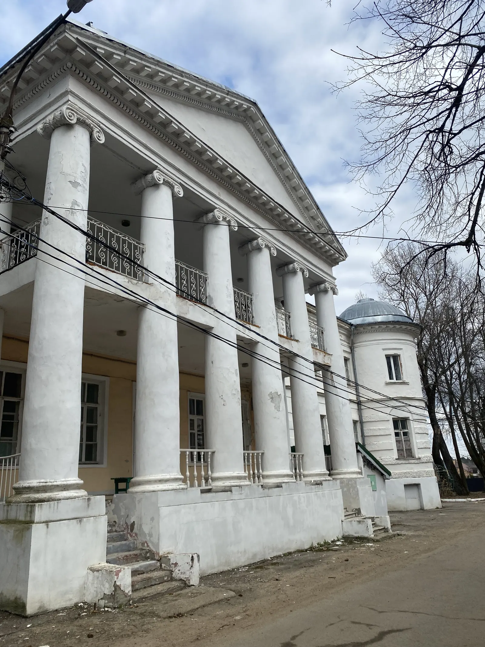
Садовое Кольцо - 15км
 3
Автор
LeChat
3
Автор
LeChat
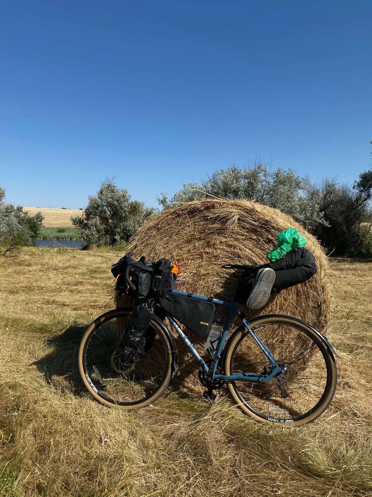
Садовое Кольцо - 15км на TrailTrack: Подмосковье, Шоссейный велосипед, 15.0 км, легко, однодневный, набор +90 м. Карта, GPX/KML, фотографии, описание и параметры
Перед выходом проверьте погоду, воду, снаряжение и состояние тропы.
Маршрут требует подготовки.
Безопасность и ответственность
- Дистанция
- 15.0 км
- Время в пути
- 1 ч 12 м
- Формат
- Однодневный
- Подъём
- +90 м
- Мин/макс высота
- 122-165 м
- Сложность
- Легко
- Основное покрытие
- Асфальт
- Категория
- Шоссейный велосипед
Карта маршрута
Старт, финиш и линия трека перед подробным планированием.
{"type": "FeatureCollection", "features": [{"type": "Feature", "properties": {"color": "#FF5722", "segmentId": 0, "isActive": true, "isOffgrid": false, "pointIds": "[\"pt_1778925279363\",\"pt_1778925281066\",\"pt_1778925297629\",\"pt_1778925307972\",\"pt_1778925312569\",\"pt_1778925328907\",\"pt_1778925336692\",\"pt_1778925345677\"]", "surfaceId": "3", "dominantSurface": "3"}, "geometry": {"type": "LineString", "coordinates": [[37.592553, 55.736195, 132], [37.592426, 55.736269, 132], [37.592245, 55.73639, 132], [37.592039, 55.736495, 132], [37.590268, 55.737155, 140], [37.590199, 55.737166, 140], [37.590131, 55.737168, 140], [37.590074, 55.737158, 140], [37.589962, 55.737108, 140], [37.589503, 55.737282, 137], [37.587306, 55.738164, 140], [37.586982, 55.738295, 137], [37.586703, 55.73842, 137], [37.586428, 55.738566, 140], [37.586319, 55.738642, 140], [37.586223, 55.738722, 140], [37.586135, 55.738818, 139], [37.586011, 55.738996, 139], [37.585604, 55.739665, 140], [37.585509, 55.739836, 140], [37.585168, 55.740535, 142], [37.58488, 55.741255, 143], [37.584211, 55.743039, 141], [37.583922, 55.743765, 146], [37.583193, 55.745465, 148]]}}, {"type": "Feature", "properties": {"color": "#FF5722", "segmentId": 0, "isActive": true, "isOffgrid": false, "pointIds": "[\"pt_1778925279363\",\"pt_1778925281066\",\"pt_1778925297629\",\"pt_1778925307972\",\"pt_1778925312569\",\"pt_1778925328907\",\"pt_1778925336692\",\"pt_1778925345677\"]", "surfaceId": "3", "dominantSurface": "3"}, "geometry": {"type": "LineString", "coordinates": [[37.583193, 55.745465, 148], [37.582653, 55.746753, 147], [37.582624, 55.746898, 146], [37.582618, 55.747019, 146], [37.582709, 55.747817, 141], [37.582911, 55.749209, 137], [37.582967, 55.749773, 137], [37.583362, 55.751995, 145], [37.583504, 55.752953, 148], [37.583841, 55.754869, 157], [37.58396, 55.755229, 154], [37.584682, 55.758522, 151], [37.584793, 55.758847, 151], [37.584913, 55.759123, 151], [37.585127, 55.759509, 151], [37.585672, 55.76036, 156], [37.586579, 55.76162, 155], [37.587129, 55.76234, 155], [37.587975, 55.763414, 154], [37.588561, 55.764052, 153], [37.58893, 55.764406, 157], [37.589272, 55.764712, 157], [37.59003, 55.765293, 155], [37.590251, 55.765448, 156]]}}, {"type": "Feature", "properties": {"color": "#FF5722", "segmentId": 0, "isActive": true, "isOffgrid": false, "pointIds": "[\"pt_1778925279363\",\"pt_1778925281066\",\"pt_1778925297629\",\"pt_1778925307972\",\"pt_1778925312569\",\"pt_1778925328907\",\"pt_1778925336692\",\"pt_1778925345677\"]", "surfaceId": "3", "dominantSurface": "3"}, "geometry": {"type": "LineString", "coordinates": [[37.590251, 55.765448, 156], [37.592157, 55.766805, 159], [37.593335, 55.767619, 161], [37.593767, 55.767943, 161], [37.594038, 55.768125, 161], [37.594838, 55.768633, 160], [37.595479, 55.769021, 161], [37.595973, 55.769285, 161.65], [37.598074, 55.770317, 165], [37.598679, 55.770582, 165], [37.59961, 55.770938, 167], [37.600537, 55.771245, 163], [37.602395, 55.771774, 164], [37.604485, 55.772383, 160], [37.60521, 55.772541, 158], [37.605745, 55.77263, 158], [37.607002, 55.772814, 157], [37.608294, 55.772983, 156], [37.611088, 55.773258, 156], [37.611748, 55.773307, 158], [37.612362, 55.77334, 160], [37.613435, 55.773379, 158], [37.614082, 55.773413, 155], [37.615162, 55.773458, 156], [37.619121, 55.773592, 154.52], [37.620886, 55.773633, 153.87], [37.622457, 55.773637, 153.28], [37.624212, 55.773599, 152.63], [37.625117, 55.773559, 152.29], [37.625891, 55.773506, 152], [37.627056, 55.773405, 155], [37.628197, 55.773259, 158], [37.630897, 55.77288, 159]]}}, {"type": "Feature", "properties": {"color": "#FF5722", "segmentId": 0, "isActive": true, "isOffgrid": false, "pointIds": "[\"pt_1778925279363\",\"pt_1778925281066\",\"pt_1778925297629\",\"pt_1778925307972\",\"pt_1778925312569\",\"pt_1778925328907\",\"pt_1778925336692\",\"pt_1778925345677\"]", "surfaceId": "3", "dominantSurface": "3"}, "geometry": {"type": "LineString", "coordinates": [[37.630897, 55.77288, 159], [37.63229, 55.772688, 155], [37.633355, 55.772553, 157], [37.635821, 55.772288, 159], [37.636782, 55.772148, 159], [37.637267, 55.772062, 159], [37.637889, 55.771933, 157], [37.638393, 55.771806, 158], [37.638881, 55.771673, 154], [37.641577, 55.770846, 157], [37.643723, 55.770203, 152], [37.644377, 55.769994, 153], [37.64566, 55.769603, 158], [37.646125, 55.769474, 158], [37.647666, 55.769093, 157], [37.64783, 55.769021, 160], [37.648067, 55.768939, 160], [37.648506, 55.768822, 160], [37.649383, 55.768562, 168], [37.64978, 55.768425, 163], [37.649997, 55.768334, 163], [37.650187, 55.768227, 163], [37.650654, 55.767901, 164], [37.651977, 55.766929, 161], [37.652585, 55.766494, 158], [37.65368, 55.765759, 158]]}}, {"type": "Feature", "properties": {"color": "#FF5722", "segmentId": 0, "isActive": true, "isOffgrid": false, "pointIds": "[\"pt_1778925279363\",\"pt_1778925281066\",\"pt_1778925297629\",\"pt_1778925307972\",\"pt_1778925312569\",\"pt_1778925328907\",\"pt_1778925336692\",\"pt_1778925345677\"]", "surfaceId": "3", "dominantSurface": "3"}, "geometry": {"type": "LineString", "coordinates": [[37.65368, 55.765759, 158], [37.655851, 55.76428, 153], [37.656024, 55.76415, 153], [37.656144, 55.76404, 151], [37.656265, 55.763896, 151], [37.6564, 55.763673, 151], [37.656918, 55.762652, 154], [37.657051, 55.762344, 150], [37.65725, 55.761772, 148], [37.657354, 55.761339, 148], [37.65748, 55.760396, 156], [37.657564, 55.759347, 153], [37.65761, 55.758407, 152], [37.657612, 55.757932, 152], [37.657592, 55.757646, 150], [37.657529, 55.757081, 150], [37.657422, 55.75656, 152], [37.657159, 55.755566, 150], [37.656873, 55.754752, 154], [37.655944, 55.752605, 155], [37.655903, 55.752484, 155], [37.655868, 55.752179, 155]]}}, {"type": "Feature", "properties": {"color": "#FF5722", "segmentId": 0, "isActive": true, "isOffgrid": false, "pointIds": "[\"pt_1778925279363\",\"pt_1778925281066\",\"pt_1778925297629\",\"pt_1778925307972\",\"pt_1778925312569\",\"pt_1778925328907\",\"pt_1778925336692\",\"pt_1778925345677\"]", "surfaceId": "3", "dominantSurface": "3"}, "geometry": {"type": "LineString", "coordinates": [[37.655868, 55.752179, 155], [37.655816, 55.75123, 143], [37.655699, 55.749769, 127], [37.655639, 55.749175, 131], [37.655586, 55.748574, 131], [37.655107, 55.744711, 134], [37.655009, 55.744204, 136], [37.654752, 55.743333, 142], [37.654641, 55.743005, 142], [37.654492, 55.742673, 143], [37.654332, 55.742385, 142.81], [37.654131, 55.742097, 142.62], [37.653797, 55.741723, 142.33], [37.65342, 55.741349, 142.04], [37.653036, 55.74103, 141.76], [37.652343, 55.740506, 141.27], [37.650827, 55.739437, 140], [37.649285, 55.738376, 136.04], [37.647165, 55.736944, 131.93]]}}, {"type": "Feature", "properties": {"color": "#FF5722", "segmentId": 0, "isActive": true, "isOffgrid": false, "pointIds": "[\"pt_1778925279363\",\"pt_1778925281066\",\"pt_1778925297629\",\"pt_1778925307972\",\"pt_1778925312569\",\"pt_1778925328907\",\"pt_1778925336692\",\"pt_1778925345677\"]", "surfaceId": "3", "dominantSurface": "3"}, "geometry": {"type": "LineString", "coordinates": [[37.647165, 55.736944, 131.93], [37.645078, 55.735534, 127.83], [37.643641, 55.734534, 125], [37.641598, 55.733453, 123], [37.640461, 55.732832, 125], [37.639978, 55.732551, 124], [37.639443, 55.732204, 127], [37.63907, 55.731972, 127], [37.638897, 55.731878, 121], [37.638545, 55.731716, 123], [37.637542, 55.731354, 124], [37.637107, 55.731242, 124], [37.636468, 55.73111, 127], [37.632972, 55.730719, 132], [37.630297, 55.73043, 134], [37.629116, 55.730274, 135], [37.626065, 55.729953, 134], [37.625367, 55.729895, 134], [37.624797, 55.729861, 134], [37.624168, 55.729834, 134], [37.623152, 55.729813, 134], [37.616114, 55.729703, 137], [37.615164, 55.729702, 139], [37.614539, 55.729725, 139], [37.613705, 55.729781, 136.81], [37.612943, 55.729857, 134.81], [37.612219, 55.729967, 132.9], [37.611505, 55.730104, 131], [37.61122, 55.730168, 131], [37.610588, 55.730336, 134], [37.610206, 55.73045, 130], [37.600834, 55.733451, 122], [37.598982, 55.734054, 122]]}}]}
[]
Старт
Точка старта на карте
Финиш
Точка финиша на карте
Тип маршрута
Линейный
Перед выходом
Проверьте воду, связь, прогноз и состояние тропы
{"type": "FeatureCollection", "features": [{"type": "Feature", "properties": {"color": "#FF5722", "segmentId": 0, "isActive": true, "isOffgrid": false, "pointIds": "[\"pt_1778925279363\",\"pt_1778925281066\",\"pt_1778925297629\",\"pt_1778925307972\",\"pt_1778925312569\",\"pt_1778925328907\",\"pt_1778925336692\",\"pt_1778925345677\"]", "surfaceId": "3", "dominantSurface": "3"}, "geometry": {"type": "LineString", "coordinates": [[37.592553, 55.736195, 132], [37.592426, 55.736269, 132], [37.592245, 55.73639, 132], [37.592039, 55.736495, 132], [37.590268, 55.737155, 140], [37.590199, 55.737166, 140], [37.590131, 55.737168, 140], [37.590074, 55.737158, 140], [37.589962, 55.737108, 140], [37.589503, 55.737282, 137], [37.587306, 55.738164, 140], [37.586982, 55.738295, 137], [37.586703, 55.73842, 137], [37.586428, 55.738566, 140], [37.586319, 55.738642, 140], [37.586223, 55.738722, 140], [37.586135, 55.738818, 139], [37.586011, 55.738996, 139], [37.585604, 55.739665, 140], [37.585509, 55.739836, 140], [37.585168, 55.740535, 142], [37.58488, 55.741255, 143], [37.584211, 55.743039, 141], [37.583922, 55.743765, 146], [37.583193, 55.745465, 148]]}}, {"type": "Feature", "properties": {"color": "#FF5722", "segmentId": 0, "isActive": true, "isOffgrid": false, "pointIds": "[\"pt_1778925279363\",\"pt_1778925281066\",\"pt_1778925297629\",\"pt_1778925307972\",\"pt_1778925312569\",\"pt_1778925328907\",\"pt_1778925336692\",\"pt_1778925345677\"]", "surfaceId": "3", "dominantSurface": "3"}, "geometry": {"type": "LineString", "coordinates": [[37.583193, 55.745465, 148], [37.582653, 55.746753, 147], [37.582624, 55.746898, 146], [37.582618, 55.747019, 146], [37.582709, 55.747817, 141], [37.582911, 55.749209, 137], [37.582967, 55.749773, 137], [37.583362, 55.751995, 145], [37.583504, 55.752953, 148], [37.583841, 55.754869, 157], [37.58396, 55.755229, 154], [37.584682, 55.758522, 151], [37.584793, 55.758847, 151], [37.584913, 55.759123, 151], [37.585127, 55.759509, 151], [37.585672, 55.76036, 156], [37.586579, 55.76162, 155], [37.587129, 55.76234, 155], [37.587975, 55.763414, 154], [37.588561, 55.764052, 153], [37.58893, 55.764406, 157], [37.589272, 55.764712, 157], [37.59003, 55.765293, 155], [37.590251, 55.765448, 156]]}}, {"type": "Feature", "properties": {"color": "#FF5722", "segmentId": 0, "isActive": true, "isOffgrid": false, "pointIds": "[\"pt_1778925279363\",\"pt_1778925281066\",\"pt_1778925297629\",\"pt_1778925307972\",\"pt_1778925312569\",\"pt_1778925328907\",\"pt_1778925336692\",\"pt_1778925345677\"]", "surfaceId": "3", "dominantSurface": "3"}, "geometry": {"type": "LineString", "coordinates": [[37.590251, 55.765448, 156], [37.592157, 55.766805, 159], [37.593335, 55.767619, 161], [37.593767, 55.767943, 161], [37.594038, 55.768125, 161], [37.594838, 55.768633, 160], [37.595479, 55.769021, 161], [37.595973, 55.769285, 161.65], [37.598074, 55.770317, 165], [37.598679, 55.770582, 165], [37.59961, 55.770938, 167], [37.600537, 55.771245, 163], [37.602395, 55.771774, 164], [37.604485, 55.772383, 160], [37.60521, 55.772541, 158], [37.605745, 55.77263, 158], [37.607002, 55.772814, 157], [37.608294, 55.772983, 156], [37.611088, 55.773258, 156], [37.611748, 55.773307, 158], [37.612362, 55.77334, 160], [37.613435, 55.773379, 158], [37.614082, 55.773413, 155], [37.615162, 55.773458, 156], [37.619121, 55.773592, 154.52], [37.620886, 55.773633, 153.87], [37.622457, 55.773637, 153.28], [37.624212, 55.773599, 152.63], [37.625117, 55.773559, 152.29], [37.625891, 55.773506, 152], [37.627056, 55.773405, 155], [37.628197, 55.773259, 158], [37.630897, 55.77288, 159]]}}, {"type": "Feature", "properties": {"color": "#FF5722", "segmentId": 0, "isActive": true, "isOffgrid": false, "pointIds": "[\"pt_1778925279363\",\"pt_1778925281066\",\"pt_1778925297629\",\"pt_1778925307972\",\"pt_1778925312569\",\"pt_1778925328907\",\"pt_1778925336692\",\"pt_1778925345677\"]", "surfaceId": "3", "dominantSurface": "3"}, "geometry": {"type": "LineString", "coordinates": [[37.630897, 55.77288, 159], [37.63229, 55.772688, 155], [37.633355, 55.772553, 157], [37.635821, 55.772288, 159], [37.636782, 55.772148, 159], [37.637267, 55.772062, 159], [37.637889, 55.771933, 157], [37.638393, 55.771806, 158], [37.638881, 55.771673, 154], [37.641577, 55.770846, 157], [37.643723, 55.770203, 152], [37.644377, 55.769994, 153], [37.64566, 55.769603, 158], [37.646125, 55.769474, 158], [37.647666, 55.769093, 157], [37.64783, 55.769021, 160], [37.648067, 55.768939, 160], [37.648506, 55.768822, 160], [37.649383, 55.768562, 168], [37.64978, 55.768425, 163], [37.649997, 55.768334, 163], [37.650187, 55.768227, 163], [37.650654, 55.767901, 164], [37.651977, 55.766929, 161], [37.652585, 55.766494, 158], [37.65368, 55.765759, 158]]}}, {"type": "Feature", "properties": {"color": "#FF5722", "segmentId": 0, "isActive": true, "isOffgrid": false, "pointIds": "[\"pt_1778925279363\",\"pt_1778925281066\",\"pt_1778925297629\",\"pt_1778925307972\",\"pt_1778925312569\",\"pt_1778925328907\",\"pt_1778925336692\",\"pt_1778925345677\"]", "surfaceId": "3", "dominantSurface": "3"}, "geometry": {"type": "LineString", "coordinates": [[37.65368, 55.765759, 158], [37.655851, 55.76428, 153], [37.656024, 55.76415, 153], [37.656144, 55.76404, 151], [37.656265, 55.763896, 151], [37.6564, 55.763673, 151], [37.656918, 55.762652, 154], [37.657051, 55.762344, 150], [37.65725, 55.761772, 148], [37.657354, 55.761339, 148], [37.65748, 55.760396, 156], [37.657564, 55.759347, 153], [37.65761, 55.758407, 152], [37.657612, 55.757932, 152], [37.657592, 55.757646, 150], [37.657529, 55.757081, 150], [37.657422, 55.75656, 152], [37.657159, 55.755566, 150], [37.656873, 55.754752, 154], [37.655944, 55.752605, 155], [37.655903, 55.752484, 155], [37.655868, 55.752179, 155]]}}, {"type": "Feature", "properties": {"color": "#FF5722", "segmentId": 0, "isActive": true, "isOffgrid": false, "pointIds": "[\"pt_1778925279363\",\"pt_1778925281066\",\"pt_1778925297629\",\"pt_1778925307972\",\"pt_1778925312569\",\"pt_1778925328907\",\"pt_1778925336692\",\"pt_1778925345677\"]", "surfaceId": "3", "dominantSurface": "3"}, "geometry": {"type": "LineString", "coordinates": [[37.655868, 55.752179, 155], [37.655816, 55.75123, 143], [37.655699, 55.749769, 127], [37.655639, 55.749175, 131], [37.655586, 55.748574, 131], [37.655107, 55.744711, 134], [37.655009, 55.744204, 136], [37.654752, 55.743333, 142], [37.654641, 55.743005, 142], [37.654492, 55.742673, 143], [37.654332, 55.742385, 142.81], [37.654131, 55.742097, 142.62], [37.653797, 55.741723, 142.33], [37.65342, 55.741349, 142.04], [37.653036, 55.74103, 141.76], [37.652343, 55.740506, 141.27], [37.650827, 55.739437, 140], [37.649285, 55.738376, 136.04], [37.647165, 55.736944, 131.93]]}}, {"type": "Feature", "properties": {"color": "#FF5722", "segmentId": 0, "isActive": true, "isOffgrid": false, "pointIds": "[\"pt_1778925279363\",\"pt_1778925281066\",\"pt_1778925297629\",\"pt_1778925307972\",\"pt_1778925312569\",\"pt_1778925328907\",\"pt_1778925336692\",\"pt_1778925345677\"]", "surfaceId": "3", "dominantSurface": "3"}, "geometry": {"type": "LineString", "coordinates": [[37.647165, 55.736944, 131.93], [37.645078, 55.735534, 127.83], [37.643641, 55.734534, 125], [37.641598, 55.733453, 123], [37.640461, 55.732832, 125], [37.639978, 55.732551, 124], [37.639443, 55.732204, 127], [37.63907, 55.731972, 127], [37.638897, 55.731878, 121], [37.638545, 55.731716, 123], [37.637542, 55.731354, 124], [37.637107, 55.731242, 124], [37.636468, 55.73111, 127], [37.632972, 55.730719, 132], [37.630297, 55.73043, 134], [37.629116, 55.730274, 135], [37.626065, 55.729953, 134], [37.625367, 55.729895, 134], [37.624797, 55.729861, 134], [37.624168, 55.729834, 134], [37.623152, 55.729813, 134], [37.616114, 55.729703, 137], [37.615164, 55.729702, 139], [37.614539, 55.729725, 139], [37.613705, 55.729781, 136.81], [37.612943, 55.729857, 134.81], [37.612219, 55.729967, 132.9], [37.611505, 55.730104, 131], [37.61122, 55.730168, 131], [37.610588, 55.730336, 134], [37.610206, 55.73045, 130], [37.600834, 55.733451, 122], [37.598982, 55.734054, 122]]}}]}
[]
{"type": "FeatureCollection", "features": [{"type": "Feature", "properties": {"color": "#FF5722", "segmentId": 0, "isActive": true, "isOffgrid": false, "pointIds": "[\"pt_1778925279363\",\"pt_1778925281066\",\"pt_1778925297629\",\"pt_1778925307972\",\"pt_1778925312569\",\"pt_1778925328907\",\"pt_1778925336692\",\"pt_1778925345677\"]", "surfaceId": "3", "dominantSurface": "3"}, "geometry": {"type": "LineString", "coordinates": [[37.592553, 55.736195, 132], [37.592426, 55.736269, 132], [37.592245, 55.73639, 132], [37.592039, 55.736495, 132], [37.590268, 55.737155, 140], [37.590199, 55.737166, 140], [37.590131, 55.737168, 140], [37.590074, 55.737158, 140], [37.589962, 55.737108, 140], [37.589503, 55.737282, 137], [37.587306, 55.738164, 140], [37.586982, 55.738295, 137], [37.586703, 55.73842, 137], [37.586428, 55.738566, 140], [37.586319, 55.738642, 140], [37.586223, 55.738722, 140], [37.586135, 55.738818, 139], [37.586011, 55.738996, 139], [37.585604, 55.739665, 140], [37.585509, 55.739836, 140], [37.585168, 55.740535, 142], [37.58488, 55.741255, 143], [37.584211, 55.743039, 141], [37.583922, 55.743765, 146], [37.583193, 55.745465, 148]]}}, {"type": "Feature", "properties": {"color": "#FF5722", "segmentId": 0, "isActive": true, "isOffgrid": false, "pointIds": "[\"pt_1778925279363\",\"pt_1778925281066\",\"pt_1778925297629\",\"pt_1778925307972\",\"pt_1778925312569\",\"pt_1778925328907\",\"pt_1778925336692\",\"pt_1778925345677\"]", "surfaceId": "3", "dominantSurface": "3"}, "geometry": {"type": "LineString", "coordinates": [[37.583193, 55.745465, 148], [37.582653, 55.746753, 147], [37.582624, 55.746898, 146], [37.582618, 55.747019, 146], [37.582709, 55.747817, 141], [37.582911, 55.749209, 137], [37.582967, 55.749773, 137], [37.583362, 55.751995, 145], [37.583504, 55.752953, 148], [37.583841, 55.754869, 157], [37.58396, 55.755229, 154], [37.584682, 55.758522, 151], [37.584793, 55.758847, 151], [37.584913, 55.759123, 151], [37.585127, 55.759509, 151], [37.585672, 55.76036, 156], [37.586579, 55.76162, 155], [37.587129, 55.76234, 155], [37.587975, 55.763414, 154], [37.588561, 55.764052, 153], [37.58893, 55.764406, 157], [37.589272, 55.764712, 157], [37.59003, 55.765293, 155], [37.590251, 55.765448, 156]]}}, {"type": "Feature", "properties": {"color": "#FF5722", "segmentId": 0, "isActive": true, "isOffgrid": false, "pointIds": "[\"pt_1778925279363\",\"pt_1778925281066\",\"pt_1778925297629\",\"pt_1778925307972\",\"pt_1778925312569\",\"pt_1778925328907\",\"pt_1778925336692\",\"pt_1778925345677\"]", "surfaceId": "3", "dominantSurface": "3"}, "geometry": {"type": "LineString", "coordinates": [[37.590251, 55.765448, 156], [37.592157, 55.766805, 159], [37.593335, 55.767619, 161], [37.593767, 55.767943, 161], [37.594038, 55.768125, 161], [37.594838, 55.768633, 160], [37.595479, 55.769021, 161], [37.595973, 55.769285, 161.65], [37.598074, 55.770317, 165], [37.598679, 55.770582, 165], [37.59961, 55.770938, 167], [37.600537, 55.771245, 163], [37.602395, 55.771774, 164], [37.604485, 55.772383, 160], [37.60521, 55.772541, 158], [37.605745, 55.77263, 158], [37.607002, 55.772814, 157], [37.608294, 55.772983, 156], [37.611088, 55.773258, 156], [37.611748, 55.773307, 158], [37.612362, 55.77334, 160], [37.613435, 55.773379, 158], [37.614082, 55.773413, 155], [37.615162, 55.773458, 156], [37.619121, 55.773592, 154.52], [37.620886, 55.773633, 153.87], [37.622457, 55.773637, 153.28], [37.624212, 55.773599, 152.63], [37.625117, 55.773559, 152.29], [37.625891, 55.773506, 152], [37.627056, 55.773405, 155], [37.628197, 55.773259, 158], [37.630897, 55.77288, 159]]}}, {"type": "Feature", "properties": {"color": "#FF5722", "segmentId": 0, "isActive": true, "isOffgrid": false, "pointIds": "[\"pt_1778925279363\",\"pt_1778925281066\",\"pt_1778925297629\",\"pt_1778925307972\",\"pt_1778925312569\",\"pt_1778925328907\",\"pt_1778925336692\",\"pt_1778925345677\"]", "surfaceId": "3", "dominantSurface": "3"}, "geometry": {"type": "LineString", "coordinates": [[37.630897, 55.77288, 159], [37.63229, 55.772688, 155], [37.633355, 55.772553, 157], [37.635821, 55.772288, 159], [37.636782, 55.772148, 159], [37.637267, 55.772062, 159], [37.637889, 55.771933, 157], [37.638393, 55.771806, 158], [37.638881, 55.771673, 154], [37.641577, 55.770846, 157], [37.643723, 55.770203, 152], [37.644377, 55.769994, 153], [37.64566, 55.769603, 158], [37.646125, 55.769474, 158], [37.647666, 55.769093, 157], [37.64783, 55.769021, 160], [37.648067, 55.768939, 160], [37.648506, 55.768822, 160], [37.649383, 55.768562, 168], [37.64978, 55.768425, 163], [37.649997, 55.768334, 163], [37.650187, 55.768227, 163], [37.650654, 55.767901, 164], [37.651977, 55.766929, 161], [37.652585, 55.766494, 158], [37.65368, 55.765759, 158]]}}, {"type": "Feature", "properties": {"color": "#FF5722", "segmentId": 0, "isActive": true, "isOffgrid": false, "pointIds": "[\"pt_1778925279363\",\"pt_1778925281066\",\"pt_1778925297629\",\"pt_1778925307972\",\"pt_1778925312569\",\"pt_1778925328907\",\"pt_1778925336692\",\"pt_1778925345677\"]", "surfaceId": "3", "dominantSurface": "3"}, "geometry": {"type": "LineString", "coordinates": [[37.65368, 55.765759, 158], [37.655851, 55.76428, 153], [37.656024, 55.76415, 153], [37.656144, 55.76404, 151], [37.656265, 55.763896, 151], [37.6564, 55.763673, 151], [37.656918, 55.762652, 154], [37.657051, 55.762344, 150], [37.65725, 55.761772, 148], [37.657354, 55.761339, 148], [37.65748, 55.760396, 156], [37.657564, 55.759347, 153], [37.65761, 55.758407, 152], [37.657612, 55.757932, 152], [37.657592, 55.757646, 150], [37.657529, 55.757081, 150], [37.657422, 55.75656, 152], [37.657159, 55.755566, 150], [37.656873, 55.754752, 154], [37.655944, 55.752605, 155], [37.655903, 55.752484, 155], [37.655868, 55.752179, 155]]}}, {"type": "Feature", "properties": {"color": "#FF5722", "segmentId": 0, "isActive": true, "isOffgrid": false, "pointIds": "[\"pt_1778925279363\",\"pt_1778925281066\",\"pt_1778925297629\",\"pt_1778925307972\",\"pt_1778925312569\",\"pt_1778925328907\",\"pt_1778925336692\",\"pt_1778925345677\"]", "surfaceId": "3", "dominantSurface": "3"}, "geometry": {"type": "LineString", "coordinates": [[37.655868, 55.752179, 155], [37.655816, 55.75123, 143], [37.655699, 55.749769, 127], [37.655639, 55.749175, 131], [37.655586, 55.748574, 131], [37.655107, 55.744711, 134], [37.655009, 55.744204, 136], [37.654752, 55.743333, 142], [37.654641, 55.743005, 142], [37.654492, 55.742673, 143], [37.654332, 55.742385, 142.81], [37.654131, 55.742097, 142.62], [37.653797, 55.741723, 142.33], [37.65342, 55.741349, 142.04], [37.653036, 55.74103, 141.76], [37.652343, 55.740506, 141.27], [37.650827, 55.739437, 140], [37.649285, 55.738376, 136.04], [37.647165, 55.736944, 131.93]]}}, {"type": "Feature", "properties": {"color": "#FF5722", "segmentId": 0, "isActive": true, "isOffgrid": false, "pointIds": "[\"pt_1778925279363\",\"pt_1778925281066\",\"pt_1778925297629\",\"pt_1778925307972\",\"pt_1778925312569\",\"pt_1778925328907\",\"pt_1778925336692\",\"pt_1778925345677\"]", "surfaceId": "3", "dominantSurface": "3"}, "geometry": {"type": "LineString", "coordinates": [[37.647165, 55.736944, 131.93], [37.645078, 55.735534, 127.83], [37.643641, 55.734534, 125], [37.641598, 55.733453, 123], [37.640461, 55.732832, 125], [37.639978, 55.732551, 124], [37.639443, 55.732204, 127], [37.63907, 55.731972, 127], [37.638897, 55.731878, 121], [37.638545, 55.731716, 123], [37.637542, 55.731354, 124], [37.637107, 55.731242, 124], [37.636468, 55.73111, 127], [37.632972, 55.730719, 132], [37.630297, 55.73043, 134], [37.629116, 55.730274, 135], [37.626065, 55.729953, 134], [37.625367, 55.729895, 134], [37.624797, 55.729861, 134], [37.624168, 55.729834, 134], [37.623152, 55.729813, 134], [37.616114, 55.729703, 137], [37.615164, 55.729702, 139], [37.614539, 55.729725, 139], [37.613705, 55.729781, 136.81], [37.612943, 55.729857, 134.81], [37.612219, 55.729967, 132.9], [37.611505, 55.730104, 131], [37.61122, 55.730168, 131], [37.610588, 55.730336, 134], [37.610206, 55.73045, 130], [37.600834, 55.733451, 122], [37.598982, 55.734054, 122]]}}]}
Погода на маршруте
--°C
Определяем
Прогноз по стартовой точке маршрута.
Ветер
-- м/с
Профиль высоты
В треке нет данных высоты для графика.
Покрытия и участки
Асфальт 100%
Покрытие определено для 100% маршрута.
Типы путей и покрытий
Асфальт
100% · 15.0 км