TrailTrack routes

Маршруты с подготовленным описанием, сложностью, покрытием и планированием визита.

Найдено 51 routes
Choose a route from the list or view routes on the map.
From Peak Arshan to Trail at Peak Lyubvi: Among the Peaks
TrailTrack

From Peak Arshan to Trail at Peak Lyubvi: Among the Peaks

Hiking · One-day

The lower section offers a gradual start before woodland gives way to more open terrain. Even the connecting sections remain engaging because of wooded lower slopes, mountain meadows and rocky ground. Particular attention should be given to Peak Liubvi, Pika Arshan, Tropy na Peak Liubvi and Pika Arshan do tropy na Peak Liubvi. These are the places that give the route its recognisable character.

3.4 km 13 +112 m Easy
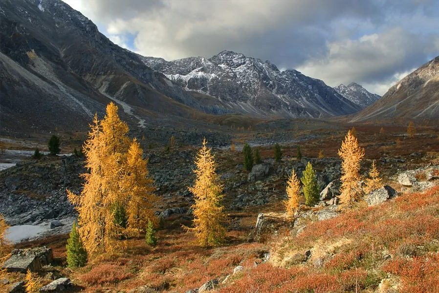
Trail S Barom-Gola at Arkhat: Along the Main Ridge
TrailTrack

Trail S Barom-Gola at Arkhat: Along the Main Ridge

Hiking · One-day

The lower section offers a gradual start before woodland gives way to more open terrain. Along the way, wooded lower slopes, mountain meadows and rocky ground are revealed one section at a time. The route passes Tunka Valley, Barom-Gola, Arkhat and Eastern Sayan. Together they turn the walk into a coherent introduction to the area rather than a simple transfer.

1.3 km 13 +59 m Easy
Road at Chertolen-Gorkhon: Across Ridges and Mountain Meadows
TrailTrack

Road at Chertolen-Gorkhon: Across Ridges and Mountain Meadows

Hiking · One-day

The lower section offers a gradual start before woodland gives way to more open terrain. The setting is shaped by a combination of wooded lower slopes, mountain meadows and rocky ground. The route passes Tunka Valley, Chertolen-Gorkhon and Eastern Sayan. Together they turn the walk into a coherent introduction to the area rather than a simple transfer.

7.6 km 13 +918 m Hard
Trail through Levoy Kyngarge: A Mountain Walk with Character
TrailTrack

Trail through Levoy Kyngarge: A Mountain Walk with Character

Hiking · One-day

The lower section offers a gradual start before woodland gives way to more open terrain. An unhurried pace leaves time to notice wooded lower slopes, mountain meadows and rocky ground rather than focusing only on the finish. Named places along the way include Tunka Valley, Levoi Kyngarge and Eastern Sayan. Together they give the walk a clear sequence and make the area easier to remember.

1.5 km 12 +21 m Easy
Around from Strelki Kyngargi at Peak Obzornaya and Obratno: Along the Main Ridge
TrailTrack

Around from Strelki Kyngargi at Peak Obzornaya and Obratno: Along the Main Ridge

Hiking · One-day

The lower section offers a gradual start before woodland gives way to more open terrain. The combination of wooded lower slopes, mountain meadows and rocky ground gives the journey its variety. Named places along the way include Peak Obzornaia i obratno. Together they give the walk a clear sequence and make the area easier to remember.

10.4 km 12 +1254 m Hard
Trail Lake to Moglayn-Gol: Up to the Skyline
TrailTrack

Trail Lake to Moglayn-Gol: Up to the Skyline

Hiking · One-day

The approach to the water unfolds gradually, moving from sheltered paths to open shoreline. Along the way, woodland paths, open shores and quiet waterside sections are revealed one section at a time. The most distinctive places are Tunka Valley, Moglain-Gol and Eastern Sayan. It is worth allowing time for a brief stop at each one.

7.9 km 12 +102 m Easy
Road through Zangisanskomu Khrebtu: Up to the Skyline
TrailTrack

Road through Zangisanskomu Khrebtu: Up to the Skyline

Hiking · One-day

The lower section offers a gradual start before woodland gives way to more open terrain. Along the way, wooded lower slopes, mountain meadows and rocky ground are revealed one section at a time. The main landmarks are Tunka Valley, Zangisanskomu and Eastern Sayan. Each deserves a short pause for both the details and the wider setting.

7.1 km 12 +618 m Moderate
Radialki V Dolinu Vulkanov and at G. Buda-Khanda: Among Slopes and Clouds
TrailTrack

Radialki V Dolinu Vulkanov and at G. Buda-Khanda: Among Slopes and Clouds

Hiking · Multi-day

The lower section offers a gradual start before woodland gives way to more open terrain. An unhurried pace leaves time to notice wooded lower slopes, mountain meadows and rocky ground rather than focusing only on the finish. The route passes Dolinu Vulkanov, Radialki and Buda-Khanda. Together they turn the walk into a coherent introduction to the area rather than a simple transfer.

80.7 km 12 +5243 m Hard
Khamar-Dabanu: Mamay — R. Snezhnaya
TrailTrack

Khamar-Dabanu: Mamay — R. Snezhnaya

Khamar-Dabanu: Mamay · Hiking · Multi-day

The lower section offers a gradual start before woodland gives way to more open terrain. The character of the area is especially clear in wooded lower slopes, mountain meadows and rocky ground. Particular attention should be given to Peak Meadow, Peak Poliana - per. Obrucheva - r. Barun-Selenginka - oz. Sobol, Mamai and Oz. Sobolinoe. These are the places that give the route its recognisable character.

79.1 km 12 +5265 m Hard
Arshan-Shumak: A Trail to Quiet and Beautiful Places
TrailTrack

Arshan-Shumak: A Trail to Quiet and Beautiful Places

Hiking · Multi-day

The lower section offers a gradual start before woodland gives way to more open terrain. The combination of wooded lower slopes, mountain meadows and rocky ground gives the journey its variety. The most distinctive places are Tunka Valley, Arshan-Shumak and Eastern Sayan. It is worth allowing time for a brief stop at each one.

64.6 km 12 +0 m Hard
Peak Lyubvi: Up to the Skyline
TrailTrack

Peak Lyubvi: Up to the Skyline

Hiking · One-day

The lower section offers a gradual start before woodland gives way to more open terrain. The character of the area is especially clear in wooded lower slopes, mountain meadows and rocky ground. The main line of the experience is formed by Peak Liubvi, Tunka Valley and Eastern Sayan. They are spaced through the journey so that the area reveals itself gradually.

4.0 km 12 +0 m Easy
Lyzhnogo Pokhoda Khubuty — Per. Shumakskiy: Along the Main Ridge
TrailTrack

Lyzhnogo Pokhoda Khubuty — Per. Shumakskiy: Along the Main Ridge

Lyzhnogo Pokhoda Khubuty · Skiing · Multi-day

Woodland offers shelter from the wind, while open sections add space to the winter journey. The combination of snow-covered tracks, sheltered woodland and open clearings gives the journey its variety. The most distinctive places are Kitoy, Per. Obzornyy, Shumak and Lyzhnogo pokhoda Khubuty. It is worth allowing time for a brief stop at each one.

129.0 km 12 +7733 m Hard
Tunki - 2014: To Height and Wide Horizons
TrailTrack

Tunki - 2014: To Height and Wide Horizons

Tunki · Hiking · Multi-day

The lower section offers a gradual start before woodland gives way to more open terrain. Along the way, wooded lower slopes, mountain meadows and rocky ground are revealed one section at a time. The main line of the experience is formed by Tunka Valley, Tunki and Eastern Sayan. They are spaced through the journey so that the area reveals itself gradually.

140.5 km 11 +14151 m Hard
Pokhoda through Khrebtu Great Sayan: Across Ridges and Mountain Meadows
TrailTrack

Pokhoda through Khrebtu Great Sayan: Across Ridges and Mountain Meadows

Hiking · Multi-day

The lower section offers a gradual start before woodland gives way to more open terrain. Along the way, wooded lower slopes, mountain meadows and rocky ground are revealed one section at a time. Named places along the way include Tunka Valley, Pokhoda, Bol'shoi Saian and Eastern Sayan. Together they give the walk a clear sequence and make the area easier to remember.

107.1 km 11 +10050 m Hard
Vykhoda through Bironu: Along the Main Ridge
TrailTrack

Vykhoda through Bironu: Along the Main Ridge

Hiking · One-day

The lower section offers a gradual start before woodland gives way to more open terrain. Along the way, wooded lower slopes, mountain meadows and rocky ground are revealed one section at a time. The most distinctive places are Vykhoda po Bironu. It is worth allowing time for a brief stop at each one.

5.1 km 11 +388 m Moderate
Peshki at Kharamurin Avg. 2007: A Mountain Walk with Character
TrailTrack

Peshki at Kharamurin Avg. 2007: A Mountain Walk with Character

Hiking · Multi-day

The lower section offers a gradual start before woodland gives way to more open terrain. The character of the area is especially clear in wooded lower slopes, mountain meadows and rocky ground. Particular attention should be given to Peshki na Kharamurin avg. These are the places that give the route its recognisable character.

46.4 km 11 +3038 m Hard
Peshey Edinichki "Neudachnaya Popytka Vyyti S Sobolinykh Ozer River at Ara-Burektay and Dalshe"
TrailTrack

Peshey Edinichki "Neudachnaya Popytka Vyyti S Sobolinykh Ozer River at Ara-Burektay and Dalshe"

Hiking · Multi-day

The approach to the water unfolds gradually, moving from sheltered paths to open shoreline. The setting is shaped by a combination of woodland paths, open shores and quiet waterside sections. Named places along the way include Peshei. Together they give the walk a clear sequence and make the area easier to remember.

41.9 km 11 +1552 m Hard
Mamay-p.Meadow-Osinovka-p.Neftyanikov-per. Baykal-Gramotukha-Vydrino: A Trail Above the Valleys
TrailTrack

Mamay-p.Meadow-Osinovka-p.Neftyanikov-per. Baykal-Gramotukha-Vydrino: A Trail Above the Valleys

Hiking · Multi-day

The lower section offers a gradual start before woodland gives way to more open terrain. The setting is shaped by a combination of wooded lower slopes, mountain meadows and rocky ground. The most distinctive places are Chersky Peak and Lake Baikal. It is worth allowing time for a brief stop at each one.

76.4 km 10 +5217 m Hard
Trail at Ulan-Gol: Among the Peaks
TrailTrack

Trail at Ulan-Gol: Among the Peaks

Hiking · One-day

The lower section offers a gradual start before woodland gives way to more open terrain. The combination of wooded lower slopes, mountain meadows and rocky ground gives the journey its variety. Named places along the way include Tunka Valley, Ulan-Gol and Eastern Sayan. Together they give the walk a clear sequence and make the area easier to remember.

10.4 km 10 +64 m Moderate
Uchastka Road and Trail through Ekhe-Bulnayu: Along the Main Ridge
TrailTrack

Uchastka Road and Trail through Ekhe-Bulnayu: Along the Main Ridge

Hiking · One-day

The lower section offers a gradual start before woodland gives way to more open terrain. The character of the area is especially clear in wooded lower slopes, mountain meadows and rocky ground. The main landmarks are Tunka Valley, Uchastka, Ekhe-Bulnaiu and Eastern Sayan. Each deserves a short pause for both the details and the wider setting.

15.9 km 10 +966 m Hard
Peak Lyubvi: A Mountain Walk with Character
TrailTrack

Peak Lyubvi: A Mountain Walk with Character

Старт · Hiking · One-day

The lower section offers a gradual start before woodland gives way to more open terrain. Even the connecting sections remain engaging because of wooded lower slopes, mountain meadows and rocky ground. Named places along the way include Peak Liubvi, Tunka Valley and Eastern Sayan. Together they give the walk a clear sequence and make the area easier to remember.

4.1 km 10 +1197 m Hard
Around Trail at Shumak: A Day Outdoors
TrailTrack

Around Trail at Shumak: A Day Outdoors

Hiking · Multi-day

Maintained sections make it easier to notice the natural features of the area in detail. The combination of maintained paths, natural observation areas and interpretive stops gives the journey its variety. The main landmarks are Tunka Valley, Shumak and Eastern Sayan. Each deserves a short pause for both the details and the wider setting.

40.8 km 10 +0 m Hard
At Arshan through Yuzhnomu Grebnyu: Along the Main Ridge
TrailTrack

At Arshan through Yuzhnomu Grebnyu: Along the Main Ridge

Hiking · One-day

The lower section offers a gradual start before woodland gives way to more open terrain. The combination of wooded lower slopes, mountain meadows and rocky ground gives the journey its variety. The main line of the experience is formed by Tunka Valley, Na Arshan, Eastern Sayan and Na Arshan po iuzhnomu grebniu. They are spaced through the journey so that the area reveals itself gradually.

7.8 km 9 +1753 m Hard
To Bronenostsu through Yuzhnomu Grebnyu: Among the Peaks
TrailTrack

To Bronenostsu through Yuzhnomu Grebnyu: Among the Peaks

Hiking · One-day

The lower section offers a gradual start before woodland gives way to more open terrain. The combination of wooded lower slopes, mountain meadows and rocky ground gives the journey its variety. The most distinctive places are Tunka Valley, To Bronenostsu and Eastern Sayan. It is worth allowing time for a brief stop at each one.

11.5 km 9 +1889 m Hard
Back Page 2 of 3 Next
Home Map Routes Regions Profile