TrailTrack routes

Маршруты с подготовленным описанием, сложностью, покрытием и планированием визита.

Found 1895 routes
Choose a route from the list or view routes on the map.
Across Djukuchak — from the Northern Valley to the Arabel Syrts
✓ TrailTrack

Across Djukuchak — from the Northern Valley to the Arabel Syrts

Across Djukuchak · Hiking · Multi-day

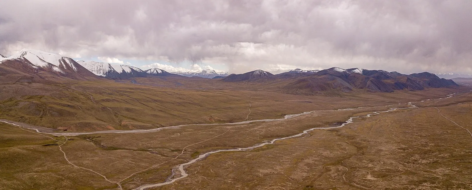
Follow Djukuchak valley towards the glacial Terskey Ala-Too divide and emerge on the southern side near the Arabel syrts. Choose an experienced leader who has checked snow, ice and the high-country exit.

24.8 km 80 +1123 m Moderate
Bus №5 - Kok Zhailau
✓ TrailTrack

Bus №5 - Kok Zhailau

Bus №5 · Hiking · One-day

Expect roughly 5.7 km of high-mountain travel. The format is point-to-point, and Leshoz is the starting reference. Use Leshoz as the starting reference and Kokshoky as the finishing reference; plan the return in advance. Features worth noticing include Батарейка (peak, 2483 m, about 0.9 km away); Землянка (wilderness hut, about 1.0 km away); Dinamo (peak, 1590 m, about 1.1 km away); Kokterek (peak, 2174 m, about 1.3 km away); Suhaya elka (mountain pass, 2745 m, about 1.7 km away). The route itself has no recorded elevations, but nearby named features rise to about 2860 m. This matters for weather and acclimatisation. Original material: OpenStreetMap — https://www.openstreetmap.org/relation/19953303.

5.7 km 80 +871 m Easy
Assy and Karaarshasay: Separate Mountain Cycling Sections
✓ TrailTrack

Assy and Karaarshasay: Separate Mountain Cycling Sections

Bicycle · One-day

See a specific Sarytau section and Karaarshasay Valley on independently organised mountain cycling sections. This terrain differs from an ordinary observatory-side outing and needs checks of each section and its actual access.

43.5 km 80 +1049 m Moderate
Belarusian Fleche across the Minsk Region: via Minsk
✓ TrailTrack

Belarusian Fleche across the Minsk Region: via Minsk

КП1 Слуцк 92км · Hiking · Multi-day

This 364.05 km point-to-point walking route passes through terrain where woodland is one of the route's main features. Gentle terrain: 163 m of total ascent over 364.05 km. Allow at least 16 days and verify overnight and exit options independently.

364.1 km 80 +163 m Hard
Road to Khatyn: Northern route
✓ TrailTrack

Road to Khatyn: Northern route

Bicycle · Multi-day

Expect woodland is one of the route's main features on this 201.24 km circular cycling route. Gentle terrain: 169 m of total ascent over 201.24 km. Surface: asphalt plus compacted ground. Allow at least 3 days and verify overnight and exit options independently.

201.2 km 80 +169 m Hard
Minsk Grand Circuit: Heritage Journey
✓ TrailTrack

Minsk Grand Circuit: Heritage Journey

КП1, Ивье, 129 · Bicycle · Multi-day

The recorded line is a 1003.18 km point-to-point cycling route, with the route includes sites with cultural context. Gentle terrain: 394 m of total ascent over 1003.18 km. Surface: asphalt. Allow at least 14 days and verify overnight and exit options independently.

1003.2 km 80 +394 m Hard
Creative Trail
✓ TrailTrack

Creative Trail

Hiking · One-day

The interest of this 1.16 km circular walking route lies in travelling the distance itself: its gradients, surface and rhythm. Rolling terrain: 10 m of total ascent over 1.16 km. Surface: compacted ground plus improved surface. Estimated moving time is about 0.5 hours; add time for pauses and navigation.

1.2 km 80 +10 m Easy
Legends of Belarusian Flora
✓ TrailTrack

Legends of Belarusian Flora

Hiking · One-day

The route includes sites with cultural context along this 0.43 km circular walking route. Gentle terrain: 1 m of total ascent over 0.43 km. Estimated moving time is about 0.4 hours; add time for pauses and navigation.

0.4 km 80 +1 m Easy
Malyavki: Nature Circuit
✓ TrailTrack

Malyavki: Nature Circuit

Hiking · One-day

The recorded line is a 1.34 km circular walking route, with woodland is one of the route's main features. Rolling terrain: 19 m of total ascent over 1.34 km. Surface: paving stones plus natural ground. Estimated moving time is about 0.6 hours; add time for pauses and navigation.

1.3 km 80 +19 m Easy
Roads of Belarus: Forest variant
✓ TrailTrack

Roads of Belarus: Forest variant

КП10 Озера АЗС · Hiking · Multi-day

This 1201.47 km circular walking route passes through terrain where woodland is one of the route's main features. Gentle terrain: 563 m of total ascent over 1201.47 km. Surface: asphalt. Allow at least 51 days and verify overnight and exit options independently.

1201.5 km 80 +563 m Hard
Trans-Belarus: From Orsha Station to the Start
✓ TrailTrack

Trans-Belarus: From Orsha Station to the Start

Bicycle · One-day

The recorded line is a 8.96 km point-to-point cycling route, with shore or waterside sections are recorded on the route. Gentle terrain: 63 m of total ascent over 8.96 km. Surface: asphalt. Estimated moving time is about 0.9 hours; add time for pauses and navigation.

9.0 km 80 +63 m Easy
Quiet Roads of Polesie
✓ TrailTrack

Quiet Roads of Polesie

КП3 · Hiking · Multi-day

This 54.62 km point-to-point walking route passes through terrain where woodland is one of the route's main features. Gentle terrain: 24 m of total ascent over 54.62 km. Surface: asphalt plus paving stones. Allow at least 3 days and verify overnight and exit options independently.

54.6 km 80 +24 m Hard
Western Belarus by Road: Kobrin, Pinsk and Ruzhany
✓ TrailTrack

Western Belarus by Road: Kobrin, Pinsk and Ruzhany

КП0 Гродно · Bicycle · Multi-day

See western Belarus change beyond Grodno, from Kobrin’s cathedral to Pinsk’s old urban buildings and the palace heritage of Ruzhany. A longer trip connects these places through the experience of travelling between them.

600.9 km 80 +243 m Hard
Indyuk, Semashkho, Dva brata
✓ TrailTrack

Indyuk, Semashkho, Dva brata

Indyuk · Hiking · One-day

Plan this 17.1 km point-to-point walking route from its verified distance, gradients and recorded surface rather than unconfirmed landmarks. Estimated moving time is about 5.0 hours; add time for pauses and navigation.

17.1 km 79 +0 m Moderate
Sun Gate to Mount Mashuk
✓ TrailTrack

Sun Gate to Mount Mashuk

Caucasus · Hiking · One-day

Plan this 3.66 km point-to-point walking route from its verified distance, gradients and recorded surface rather than unconfirmed landmarks. Estimated moving time is about 1.1 hours; add time for pauses and navigation.

3.7 km 79 +0 m Easy
Walking Route in the Caucasus — 6,5 km
✓ TrailTrack

Walking Route in the Caucasus — 6,5 km

Walking Route in the Caucasus · Hiking · One-day

Plan this 6.47 km point-to-point walking route from its verified distance, gradients and recorded surface rather than unconfirmed landmarks. Estimated moving time is about 1.9 hours; add time for pauses and navigation.

6.5 km 79 +0 m Easy
Nalycheva valley to Ostrovnaya in winter: transit through Mokhnaty
✓ TrailTrack

Nalycheva valley to Ostrovnaya in winter: transit through Mokhnaty

Travel · One-day

See the lower Nalycheva valley give way to the Ostrovnaya river side during an agreed winter journey. The appeal lies in travelling through remote country; sightseeing stops and separate lakeside walks are outside the transit.

23.6 km 79 +0 m Moderate
Northern Song-Kol Basin: a West-to-East Horse Plan
✓ TrailTrack

Northern Song-Kol Basin: a West-to-East Horse Plan

Horse riding · Multi-day

Prepare a northern Song-Kol riding journey with a local guide and time beside the lake. Checking the actual way allows an independent outing without borrowing a tour whose beginning and ending differ.

33.5 km 79 +783 m Moderate
Chon-Kyzyl-Suu to Kichi-Kyzyl-Suu — across the Northern Spur
✓ TrailTrack

Chon-Kyzyl-Suu to Kichi-Kyzyl-Suu — across the Northern Spur

Chon-Kyzyl-Suu to Kichi-Kyzyl-Suu · Hiking · One-day

Cross from Chon-Kyzyl-Suu to the small red river of Kichi-Kyzyl-Suu and discover the neighbouring northern valleys of Terskey Ala-Too. This option is especially useful as a walking link within a longer trek.

7.6 km 79 +534 m Easy
Kaindy: from the Isfayram-Say Valley over the Pass to Tengizbay
✓ TrailTrack

Kaindy: from the Isfayram-Say Valley over the Pass to Tengizbay

Hiking · One-day

For the Kaindy valley and its pass into the Tengizbay. Following the tributary towards the divide gives a clear sense of how neighbouring mountain valleys connect.

15.1 km 79 +1863 m Moderate
Tengizbay: the Valley Approach from the Upper Isfayram-Say
✓ TrailTrack

Tengizbay: the Valley Approach from the Upper Isfayram-Say

Hiking · One-day

To enter the Tengizbay from the upper Isfayram-Say and visit the Chatindy junction. The walk introduces the headwater valleys before any later pass crossing.

21.8 km 79 +1229 m Moderate
Aktash: Abshir-Say to Isfayram-Say through the Pum Valley
✓ TrailTrack

Aktash: Abshir-Say to Isfayram-Say through the Pum Valley

Hiking · One-day

To cross Aktash between the Abshir-Say and Isfayram-Say valleys. The journey makes the divide between two river systems tangible, from the saddle down to the streams that gather in the larger gorge.

25.9 km 79 +652 m Hard
Turquoise Route: via Orsha
✓ TrailTrack

Turquoise Route: via Orsha

КП0 Орша ЖДВокзал Фонтанчик · Bicycle · Multi-day

This large cycling circuit from Orsha stretches for almost 600 km and needs expedition-style planning. The refreshed profile remains broadly flat, but the journey still requires realistic stages, verified overnight and resupply options, and possible exits; raw control points are not presented as protected areas.

599.9 km 79 +334 m Hard
May Day Cycling Route
✓ TrailTrack

May Day Cycling Route

Hiking · Multi-day

Treat this 103.6 km circular walking route as a complete outing, paying attention to the terrain and changing surface underfoot. Gentle terrain: 152 m of total ascent over 103.6 km. Allow at least 5 days and verify overnight and exit options independently.

103.6 km 79 +152 m Hard
Back Page 58 of 79 Next