TrailTrack routes

Маршруты с подготовленным описанием, сложностью, покрытием и планированием визита.

Found 1895 routes
Choose a route from the list or view routes on the map.
Secrets of White Lake
✓ TrailTrack

Secrets of White Lake

Bicycle · One-day

The recorded line is a 24.87 km circular cycling route, with shore or waterside sections are recorded on the route. Gentle terrain: 23 m of total ascent over 24.87 km. Surface: asphalt plus improved surface. Estimated moving time is about 2.3 hours; add time for pauses and navigation.

24.9 km 77 +23 m Moderate
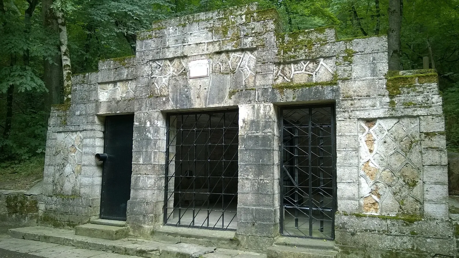
Lermontovskiy Spring => Peshchera vechnoy merzloty => Peshchera pervobytnogo cheloveka
✓ TrailTrack

Lermontovskiy Spring => Peshchera vechnoy merzloty => Peshchera pervobytnogo cheloveka

Caucasus · Off-road cycling · One-day

Plan this 11.84 km circular cycling route from its verified distance, gradients and recorded surface rather than unconfirmed landmarks. Estimated moving time is about 1.7 hours; add time for pauses and navigation.

11.8 km 76 +0 m Moderate
Hiking route: Caucasus, 0.4 km
✓ TrailTrack

Hiking route: Caucasus, 0.4 km

Hiking route: Caucasus · Hiking · One-day

Plan this 0.43 km point-to-point walking route from its verified distance, gradients and recorded surface rather than unconfirmed landmarks. Estimated moving time is about 0.4 hours; add time for pauses and navigation.

0.4 km 76 +0 m Easy
Walking Route in the Caucasus — 3,6 km
✓ TrailTrack

Walking Route in the Caucasus — 3,6 km

Caucasus · Hiking · One-day

Plan this 3.59 km circular walking route from its verified distance, gradients and recorded surface rather than unconfirmed landmarks. Estimated moving time is about 1.1 hours; add time for pauses and navigation.

3.6 km 76 +0 m Easy
Dygeren-Olengende via Nyulki: upper circuit ending beside Alpine Shelter
✓ TrailTrack

Dygeren-Olengende via Nyulki: upper circuit ending beside Alpine Shelter

Hiking · Multi-day

Follow the woodland approach from Esso through Nyulki towards Dygeren’s upper side, then descend to Alpine Shelter. The high circuit offers another perspective on the mountain valley while retaining time for the descent and onward journey.

22.8 km 76 +1527 m Hard
Viktoria: a cycling journey from Pskov to Krypetskoye-2
✓ TrailTrack

Viktoria: a cycling journey from Pskov to Krypetskoye-2

Точка · Bicycle · Multi-day

See Pskov within a large cycling journey, then exchange town architecture for country and woodland roads. Two historical stops provide useful pauses during sustained travel.

170.1 km 76 +0 m Hard
Torpo and Kum-Bel: two Passes towards Kyrgyz-Ata
✓ TrailTrack

Torpo and Kum-Bel: two Passes towards Kyrgyz-Ata

Hiking · Multi-day

To cross Torpo and Kum-Bel in sequence and understand the valleys on both sides of Kichik-Alay. The two passes give this version its own mountain journey through changing river catchments.

24.3 km 76 +1737 m Moderate
Atala-Tektyu through the Mountains to Terek-Suu and the Tar
✓ TrailTrack

Atala-Tektyu through the Mountains to Terek-Suu and the Tar

Hiking · Multi-day

Cross Atala-Tektyu and reach Terek-Suu beside the Tar River. The journey links mountain sides with a recognisable village finish, while accommodation or collection still needs arranging beforehand.

26.8 km 76 +1485 m Hard
Upper Djukuchak to Ashu-Kashka-Suu — the Short Mountain Link
✓ TrailTrack

Upper Djukuchak to Ashu-Kashka-Suu — the Short Mountain Link

Upper Djukuchak to Ashu-Kashka-Suu · Hiking · One-day

Link upper Djukuchak with Ashu-Kashka-Suu on foot across the spur, then choose an onward route through a different valley. It adds variety to a longer journey on the northern side of Terskey Ala-Too.

6.1 km 76 +759 m Easy
Minsk Grand Circuit: Open-country variant
✓ TrailTrack

Minsk Grand Circuit: Open-country variant

КП6, Борисов, 439 · Bicycle · Multi-day

Woodland is one of the route's main features along this 603.55 km circular cycling route. Gentle terrain: 388 m of total ascent over 603.55 km. Surface: asphalt. Allow at least 8 days and verify overnight and exit options independently.

603.6 km 76 +388 m Hard
Road to Khatyn: Reverse route
✓ TrailTrack

Road to Khatyn: Reverse route

Х,106 · Bicycle · Multi-day

This 199.81 km circular cycling route passes through terrain where woodland is one of the route's main features. Gentle terrain: 395 m of total ascent over 199.81 km. Surface: asphalt plus compacted ground. Allow at least 3 days and verify overnight and exit options independently.

199.8 km 76 +395 m Hard
Minsk Grand Circuit: Forest Journey
✓ TrailTrack

Minsk Grand Circuit: Forest Journey

КП10 Ивье, 862 · Bicycle · Multi-day

This 997.58 km point-to-point cycling route passes through terrain where woodland is one of the route's main features. Gentle terrain: 435 m of total ascent over 997.58 km. Surface: asphalt. Allow at least 14 days and verify overnight and exit options independently.

997.6 km 76 +435 m Hard
Zaslavl: Stolbtsy Grand Loop: via Isloch
✓ TrailTrack

Zaslavl: Stolbtsy Grand Loop: via Isloch

КП0 СТАРТ 0 км · Bicycle · Multi-day

Expect woodland is one of the route's main features on this 200.17 km circular cycling route. Gentle terrain: 267 m of total ascent over 200.17 km. Surface: asphalt. Allow at least 3 days and verify overnight and exit options independently.

200.2 km 76 +267 m Hard
Right to Ride: Open-country variant
✓ TrailTrack

Right to Ride: Open-country variant

КП2, Несвиж, 157км · Bicycle · Multi-day

This 305.28 km point-to-point cycling route passes through terrain where woodland is one of the route's main features. Gentle terrain: 238 m of total ascent over 305.28 km. Surface: asphalt plus concrete. Allow at least 5 days and verify overnight and exit options independently.

305.3 km 76 +238 m Hard
Lake Country Route
✓ TrailTrack

Lake Country Route

Хостел · Bicycle · One-day

This 6.47 km point-to-point cycling route passes through terrain where shore or waterside sections are recorded on the route. Gentle terrain: 44 m of total ascent over 6.47 km. Surface: paving stones plus asphalt. Estimated moving time is about 0.7 hours; add time for pauses and navigation.

6.5 km 76 +44 m Easy
Gomel: Road between Towns
✓ TrailTrack

Gomel: Road between Towns

Старт · Hiking · Multi-day

Treat this 203.72 km point-to-point walking route as a complete outing, paying attention to the terrain and changing surface underfoot. Gentle terrain: 90 m of total ascent over 203.72 km. Allow at least 9 days and verify overnight and exit options independently.

203.7 km 76 +90 m Hard
Triangle of the Brave
✓ TrailTrack

Triangle of the Brave

Кп1 · Hiking · Multi-day

The recorded line is a 405.86 km circular walking route, with woodland is one of the route's main features. Gentle terrain: 131 m of total ascent over 405.86 km. Surface: asphalt plus improved surface. Allow at least 18 days and verify overnight and exit options independently.

405.9 km 76 +131 m Hard
Autumn Forest: via Gomel
✓ TrailTrack

Autumn Forest: via Gomel

КП 0 Старт · Hiking · Multi-day

Expect woodland is one of the route's main features on this 200.16 km circular walking route. Gentle terrain: 131 m of total ascent over 200.16 km. Surface: asphalt plus improved surface. Allow at least 9 days and verify overnight and exit options independently.

200.2 km 76 +131 m Hard
Across Six Districts of the Gomel Region
✓ TrailTrack

Across Six Districts of the Gomel Region

КП 1 Агроусадьба ( только вода) · Bicycle · Multi-day

This 403.53 km point-to-point cycling route passes through terrain where woodland is one of the route's main features. Gentle terrain: 219 m of total ascent over 403.53 km. Surface: asphalt. Allow at least 6 days and verify overnight and exit options independently.

403.5 km 76 +219 m Hard
Gorki: Krichev: Gomel: via Cherikov
✓ TrailTrack

Gorki: Krichev: Gomel: via Cherikov

КП0. Гармата · Bicycle · Multi-day

The recorded line is a 403.53 km point-to-point cycling route, with woodland is one of the route's main features. Gentle terrain: 163 m of total ascent over 403.53 km. Surface: asphalt. Allow at least 6 days and verify overnight and exit options independently.

403.5 km 76 +163 m Hard
Meeting Friends: via Shumilino
✓ TrailTrack

Meeting Friends: via Shumilino

КП 0, КП 5 Витебск АЗС · Bicycle · Multi-day

This 201.97 km circular cycling route passes through terrain where shore or waterside sections are recorded on the route. Gentle terrain: 42 m of total ascent over 201.97 km. Surface: asphalt. Allow at least 3 days and verify overnight and exit options independently.

202.0 km 76 +42 m Hard
Breakthrough across the Vitebsk Lake District: Western route
✓ TrailTrack

Breakthrough across the Vitebsk Lake District: Western route

по тротуару · Bicycle · Multi-day

The recorded line is a 299.92 km point-to-point cycling route, with shore or waterside sections are recorded on the route. Gentle terrain: 237 m of total ascent over 299.92 km. Surface: asphalt. Allow at least 4 days and verify overnight and exit options independently.

299.9 km 76 +237 m Hard
Hidden Corners of Polotsk: via Lepel
✓ TrailTrack

Hidden Corners of Polotsk: via Lepel

КП 0/5 Новополоцк АЗС · Bicycle · Multi-day

Expect shore or waterside sections are recorded on the route on this 203.79 km circular cycling route. Gentle terrain: 177 m of total ascent over 203.79 km. Surface: asphalt. Allow at least 3 days and verify overnight and exit options independently.

203.8 km 76 +177 m Hard
Meeting Friends: From Polotsk
✓ TrailTrack

Meeting Friends: From Polotsk

КП 0 Полоцк пл.Скорины · Bicycle · Multi-day

Shore or waterside sections are recorded on the route along this 200.51 km point-to-point cycling route. Gentle terrain: 69 m of total ascent over 200.51 km. Surface: asphalt. Allow at least 3 days and verify overnight and exit options independently.

200.5 km 76 +69 m Hard
Back Page 62 of 79 Next