TrailTrack routes

Маршруты с подготовленным описанием, сложностью, покрытием и планированием визита.

Found 1895 routes
Choose a route from the list or view routes on the map.
Archival Sotnya 2017: three Klubish locations and the eastern Yakhroma loop
✓ TrailTrack

Archival Sotnya 2017: three Klubish locations and the eastern Yakhroma loop

Moscow region · Skiing · One-day

Recognise the 2017 version through three distinct Klubish encounters and the eastern continuation via the Yakhroma. Water locations reveal this old Sotnya’s individual character; build a present trip around a checked accessible section.

103.3 km 126 +1442 m Hard
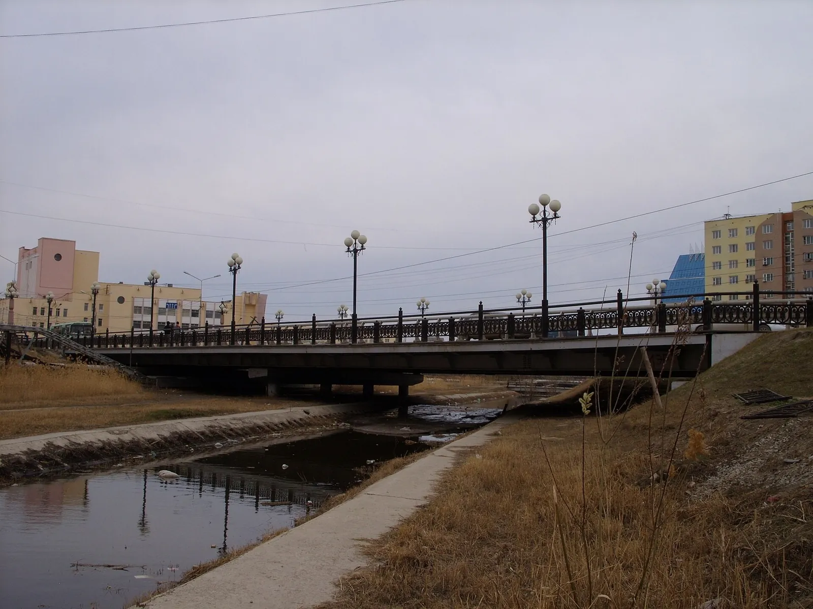
Short walking circuit around Yakutsk Bus Station
✓ TrailTrack

Short walking circuit around Yakutsk Bus Station

Hiking · One-day

Take a short walk around the bus-station area and return to your meeting place. It may be useful alongside a transport errand after checking open pedestrian passages.

0.4 km 125 +0 m Easy
Western walking exit from Olekminsk towards the Bolshaya Cherepanikha
✓ TrailTrack

Western walking exit from Olekminsk towards the Bolshaya Cherepanikha

Hiking · One-day

Follow Olekminsk’s western road exit across the named Malaya Cherepanikha and see the change from urban edge to settlement approaches. Check pedestrian road safety beforehand.

12.7 km 125 +0 m Moderate
From Iogach to Achelman: Horse Trek through the Teletskoye Taiga
✓ TrailTrack

From Iogach to Achelman: Horse Trek through the Teletskoye Taiga

Altai · Horse riding · Multi-day

Follow the horse paths from Iogach through the Pyzha, Bolshiye Chili and Aba river valleys to Achelman. The attraction is an extended journey through the Teletskoye taiga, with a sequence of river stops and the daily rhythm of a trek.

90.9 km 125 +1608 m Hard
Great Ob Trail: Berdsk Woodland and the Separate Polyana Approach
✓ TrailTrack

Great Ob Trail: Berdsk Woodland and the Separate Polyana Approach

Hiking · One-day

Explore Berdsk’s woodland and shoreline in a single outing: begin at Polyana, pause by the Ob Sea and follow the walk through Berdsk Woodland Nature Monument. It suits walkers who enjoy a journey between different parts of a town and can arrange their return in advance.

9.3 km 125 +53 m Easy
Northern Ergaki via NKT and Skazka Passes to Lazurnoe Lake
✓ TrailTrack

Northern Ergaki via NKT and Skazka Passes to Lazurnoe Lake

Hiking · One-day

Follow NKT, Skazka and Lazurnoe in southward order, finishing beside a lake after the pass connection. Three identifiable stops focus the outing on northern Ergaki’s valleys.

5.9 km 125 +425 m Hard
Osinovka Mountain Directions: Above Vysokogornoye towards Charuyushchy
✓ TrailTrack

Osinovka Mountain Directions: Above Vysokogornoye towards Charuyushchy

Hiking · Multi-day

View Vysokogornoye from above and follow Serebryanka towards Charuyushchy, a waterfall completing a long change of mountain and woodland scenery. The Osinovka branch introduces another side of the same massif when selected as a separate outing.

46.0 km 125 +2330 m Hard
Ski Trail Ershi: Kartakoy
✓ TrailTrack

Ski Trail Ershi: Kartakoy

Skiing · One-day

The interest of this 30.73 km circular cross-country skiing route lies in travelling the distance itself: its gradients, surface and rhythm. Noticeable climbing: 640 m of total ascent over 30.73 km. Estimated moving time is about 6.2 hours; add time for pauses and navigation.

30.7 km 125 +640 m Hard
Katuar to Iksha: the southern Klubish crossing and direct woodland turn
✓ TrailTrack

Katuar to Iksha: the southern Klubish crossing and direct woodland turn

Moscow region · Run · One-day

Run from Katuar towards Iksha through the specific southern Klubish crossing. The direct woodland turn beyond the river distinguishes this version from the more westerly archived loop with another river approach.

20.3 km 125 +217 m Moderate
Sivaya Trail
✓ TrailTrack

Sivaya Trail

Hiking · One-day

Treat this 1.59 km point-to-point walking route as a complete outing, paying attention to the terrain and changing surface underfoot. Rolling terrain: 30 m of total ascent over 1.59 km. Surface: natural ground. Estimated moving time is about 0.7 hours; add time for pauses and navigation.

1.6 km 124 +30 m Easy
Vachkazhets: Takhkoloch’s lake circuit through the cirque and two waterfalls
✓ TrailTrack

Vachkazhets: Takhkoloch’s lake circuit through the cirque and two waterfalls

Hiking · One-day

View Takhkoloch from different sides and connect it with two waterfall stops and the Letnyaya Poperechnaya cirque. The upper loop adds open mountain terrain to the wooded beginning.

12.2 km 124 +592 m Moderate
Polovinnaya Forest Ski Passage: via Marituy towards Kolokolny’s Ice Side
✓ TrailTrack

Polovinnaya Forest Ski Passage: via Marituy towards Kolokolny’s Ice Side

Skiing · One-day

With agreed admission and safe ice, travel from wooded headwaters to the lake: experience the actual Marituy valley before changing enclosed taiga surroundings for Baikal’s expanse. The continuation beyond Marituy distinguishes this variant when shore exit and accompaniment are confirmed.

31.9 km 124 +467 m Hard
Gremyachiy Klyuch V2
✓ TrailTrack

Gremyachiy Klyuch V2

Moscow region · Hiking · One-day

The interest of this 3.73 km point-to-point walking route lies in travelling the distance itself: its gradients, surface and rhythm. Rolling terrain: 73 m of total ascent over 3.73 km. Estimated moving time is about 1.3 hours; add time for pauses and navigation.

3.7 km 124 +73 m Easy
The Kalistovo Junction: Muranovo, Radonezh and Abramtsevo on Foot
✓ TrailTrack

The Kalistovo Junction: Muranovo, Radonezh and Abramtsevo on Foot

Moscow region · Hiking · Multi-day

Muranovo’s main house and Abramtsevo’s majolica bench reveal different aspects of estate culture: a poet’s domestic world and artists’ craftwork. Rail access at Kalistovo makes it possible to give each place a separate day.

37.3 km 124 +400 m Moderate
Snegiri: the Southern Ski Loops between Woods and Fields
✓ TrailTrack

Snegiri: the Southern Ski Loops between Woods and Fields

Moscow region · Skiing · One-day

Ski between woods and field margins and get to know Snegiri’s local skiing tradition. The gentler sections favour an unhurried pace, while alternating enclosed and open ground keeps the outing varied. Bring your own equipment and be ready to select the branches available that day.

6.6 km 124 +96 m Easy
From Zvenigorod to Sima: A Long Woodland Run via Belozyorovo
✓ TrailTrack

From Zvenigorod to Sima: A Long Woodland Run via Belozyorovo

Moscow region · Run · One-day

Link Sima, the Setun River near Sharapovo and the Belozyorovo passage in one prolonged run returning towards Zvenigorod’s railway. The interest lies in a sequence of actual woodland waters and watercourses, rather than replacing this journey with Zvenigorod’s town embankment.

32.7 km 124 +576 m Hard
Zelyonka
✓ TrailTrack

Zelyonka

Bicycle · One-day

The interest of this 0.64 km point-to-point cycling route lies in travelling the distance itself: its gradients, surface and rhythm. Surface: natural ground. Estimated moving time is about 0.3 hours; add time for pauses and navigation.

0.6 km 123 +0 m Easy
Sukhoy Stream: Shumak
✓ TrailTrack

Sukhoy Stream: Shumak

Hiking · Multi-day

This 42.48 km point-to-point walking route passes through terrain where mapped viewpoints occur along the way. Strong mountain relief: 1869 m of total ascent over 42.48 km. Allow at least 3 days and verify overnight and exit options independently.

42.5 km 123 +1869 m Hard
Peak of Love from Arshan: Main Park Approach
✓ TrailTrack

Peak of Love from Arshan: Main Park Approach

Hiking · One-day

Combine Arshan’s park landmarks with a sustained mountain ascent. The old larch, a viewpoint on the path and Peak of Love provide distinct places to pause as the village falls away below.

4.0 km 123 +1083 m Moderate
Yellow Trail via Kashtak Trail
✓ TrailTrack

Yellow Trail via Kashtak Trail

Hiking · One-day

The interest of this 6.01 km point-to-point walking route lies in travelling the distance itself: its gradients, surface and rhythm. Noticeable climbing: 150 m of total ascent over 6.01 km. Surface: natural ground. Estimated moving time is about 2.0 hours; add time for pauses and navigation.

6.0 km 123 +150 m Easy
Ski Trail S Sanatornogo to Orlyonka
✓ TrailTrack

Ski Trail S Sanatornogo to Orlyonka

Skiing · One-day

This 25.38 km point-to-point cross-country skiing route is shaped by its terrain, surface and pace rather than a single landmark. Rolling terrain: 394 m of total ascent over 25.38 km. Estimated moving time is about 4.9 hours; add time for pauses and navigation.

25.4 km 123 +394 m Hard
Upper Yauza Wetlands: The Ornithological Pontoon Trail
✓ TrailTrack

Upper Yauza Wetlands: The Ornithological Pontoon Trail

Moscow region · Hiking · One-day

The observation tower and far pontoon platform offer two distinct places to examine the Upper Yauza wetlands. Binoculars allow close observation without approaching birds or leaving the boardwalk.

1.0 km 123 +4 m Easy
Ozyory—Kolomna
✓ TrailTrack

Ozyory—Kolomna

Moscow region · Hiking · Multi-day

Shore or waterside sections are recorded on the route along this 37.02 km point-to-point walking route. Gentle terrain: 275 m of total ascent over 37.02 km. Allow at least 2 days and verify overnight and exit options independently.

37.0 km 123 +275 m Hard
Lopatinskie Quarries: Following the Traces of Old Quarrying
✓ TrailTrack

Lopatinskie Quarries: Following the Traces of Old Quarrying

Moscow region · Hiking · Multi-day

This 37.38 km point-to-point walking route is shaped by its terrain, surface and pace rather than a single landmark. Gentle terrain: 246 m of total ascent over 37.38 km. Surface: sand plus natural ground. Allow at least 2 days and verify overnight and exit options independently.

37.4 km 123 +246 m Hard
Back Page 28 of 79 Next