TrailTrack routes

Маршруты с подготовленным описанием, сложностью, покрытием и планированием визита.

Found 1895 routes
Choose a route from the list or view routes on the map.
Ostrovtsy: Ski Loop: A Trail with Island Character
✓ TrailTrack

Ostrovtsy: Ski Loop: A Trail with Island Character

Moscow region · Skiing · One-day

This 3 km circular cross-country skiing route passes through terrain where shore or waterside sections are recorded on the route. Noticeable climbing: 75 m of total ascent over 3 km. Estimated moving time is about 0.7 hours; add time for pauses and navigation.

3.0 km 123 +75 m Easy
Bruschaty Posyolok: Banka Ski Slopes with the Western Woodland Branch
✓ TrailTrack

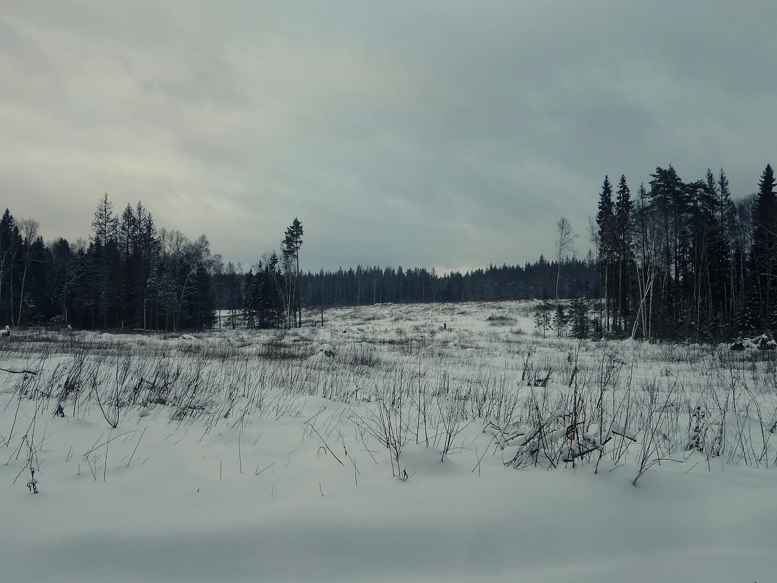
Bruschaty Posyolok: Banka Ski Slopes with the Western Woodland Branch

Moscow region · Skiing · One-day

Discover how the stadium slopes extend into the deeper woodland of the Krasnogorsk skiing area. The added western branch brings another approach towards the Banka valley and more changes of direction and relief. Choose it for an independent ski outing with careful attention to junctions.

5.1 km 123 +91 m Moderate
Ryzhaya Trail
✓ TrailTrack

Ryzhaya Trail

Hiking · One-day

This 0.6 km point-to-point walking route is shaped by its terrain, surface and pace rather than a single landmark. Noticeable climbing: 15 m of total ascent over 0.6 km. Surface: natural ground. Estimated moving time is about 0.4 hours; add time for pauses and navigation.

0.6 km 122 +15 m Easy
Around Bazayskaya Trail
✓ TrailTrack

Around Bazayskaya Trail

Hiking · One-day

The interest of this 7.03 km circular walking route lies in travelling the distance itself: its gradients, surface and rhythm. Noticeable climbing: 251 m of total ascent over 7.03 km. Surface: natural ground plus compacted ground. Estimated moving time is about 2.5 hours; add time for pauses and navigation.

7.0 km 122 +251 m Easy
Dry Bay to Dyrovataya Bay: Coastal Route
✓ TrailTrack

Dry Bay to Dyrovataya Bay: Coastal Route

Hiking · One-day

Expect shore or waterside sections are recorded on the route on this 11.22 km point-to-point walking route. Noticeable climbing: 405 m of total ascent over 11.22 km. Estimated moving time is about 4.0 hours; add time for pauses and navigation.

11.2 km 122 +405 m Moderate
Memorial Alley to Goloustnoye: Baikal via Bolshiye Koty and Kadilnaya
✓ TrailTrack

Memorial Alley to Goloustnoye: Baikal via Bolshiye Koty and Kadilnaya

Hiking · Multi-day

After reopening, travel between two Baikal villages and discover the changing western coast. Specific stopping places include Listvyanka and Bolshiye Koty memorials, water beside stony shores and Malaya Kadilnaya’s open valley.

51.4 km 122 +1063 m Hard
Bolshaya Olkha: Cross-Country Ski Route
✓ TrailTrack

Bolshaya Olkha: Cross-Country Ski Route

Skiing · One-day

The recorded line is a 17.04 km circular cross-country skiing route, with the route includes sites with cultural context. Noticeable climbing: 474 m of total ascent over 17.04 km. Estimated moving time is about 3.6 hours; add time for pauses and navigation.

17.0 km 122 +474 m Moderate
Talyany to Tory: Forest Watershed Cycling Crossing to the Irkut
✓ TrailTrack

Talyany to Tory: Forest Watershed Cycling Crossing to the Irkut

Bicycle · Multi-day

Travel from Talyany’s forest surroundings to the open Tunka valley, noticing Toysuk, Greater Zhidoy and Shardzhelga rivers along the way. Reaching the Irkut gives the journey a clear ending: the forest ascent and southern descent lead to a different village landscape. Changes of valley and independent movement give this bicycle crossing its interest.

85.2 km 122 +2171 m Hard
Biryulyovo Nature Walk: Ponds, Hobbit House and Japanese Pavilion
✓ TrailTrack

Biryulyovo Nature Walk: Ponds, Hobbit House and Japanese Pavilion

Moscow region · Hiking · One-day

Link the ponds, Hobbit House and Japanese Pavilion on a walk through the arboretum’s historical section. Each place offers a reason to pause before continuing to another avenue.

3.4 km 122 +47 m Easy
Gremyachiy Klyuch
✓ TrailTrack

Gremyachiy Klyuch

Moscow region · Hiking · One-day

Expect mapped viewpoints occur along the way on this 25.34 km point-to-point walking route. Rolling terrain: 297 m of total ascent over 25.34 km. Estimated moving time is about 7.9 hours; add time for pauses and navigation.

25.3 km 122 +297 m Hard
Radonezh ski loop: Yakhroma and the western out-and-back
✓ TrailTrack

Radonezh ski loop: Yakhroma and the western out-and-back

Moscow region · Skiing · One-day

Follow a long western ski loop from Radonezh and add this particular western out-and-back. The Yakhroma on the southern side separates the distant section from the return, while one starting and finishing halt helps organise the train journey.

31.4 km 122 +474 m Hard
Povarovka to Katuar: western Lytsenka Sanctuary and the northern arc
✓ TrailTrack

Povarovka to Katuar: western Lytsenka Sanctuary and the northern arc

Moscow region · Run · One-day

Cross the western side of the named Lytsenka Transitional Mire Sanctuary while linking two different railway sides of the Moscow region. The northern arc continues this distinct running outing; Morozovo Lake and its shore belong to another version.

36.5 km 122 +141 m Hard
Chany: A Short Lenina Street Cycle Section from the Komsomolskaya Junction
✓ TrailTrack

Chany: A Short Lenina Street Cycle Section from the Komsomolskaya Junction

Bicycle · One-day

Ride from the Komsomolskaya side towards western Lenina Street and see everyday Chany. The small street section can connect your own plans in the settlement; a museum visit and railway history walk can be arranged separately.

0.5 km 121 +1 m Easy
Around Trail Bolgash
✓ TrailTrack

Around Trail Bolgash

Hiking · One-day

The interest of this 5.75 km circular walking route lies in travelling the distance itself: its gradients, surface and rhythm. Strong mountain relief: 273 m of total ascent over 5.75 km. Surface: natural ground. Estimated moving time is about 2.1 hours; add time for pauses and navigation.

5.8 km 121 +273 m Easy
Rakovaya above Babya Bay: ascending past Kamchatsky Stone
✓ TrailTrack

Rakovaya above Babya Bay: ascending past Kamchatsky Stone

Hiking · One-day

Watch the urban waterfront give way to birch woodland and Rakovaya’s upper rocks. Kamchatsky Stone provides a distinct stop on the ascent towards views of Avacha Bay.

3.3 km 121 +472 m Moderate
Marathon Ski Trail: Cross-Country Ski Route
✓ TrailTrack

Marathon Ski Trail: Cross-Country Ski Route

Skiing · Multi-day

This 43.21 km circular cross-country skiing route is shaped by its terrain, surface and pace rather than a single landmark. Noticeable climbing: 1553 m of total ascent over 43.21 km. Allow at least 2 days and verify overnight and exit options independently.

43.2 km 121 +1553 m Hard
Kozhino: the green ski circuit with a northern extension
✓ TrailTrack

Kozhino: the green ski circuit with a northern extension

Moscow region · Skiing · One-day

Choose Kozhino skiing with its own western entry and additional northern continuation. Long turns connect several sides of the ski network while retaining one return place. This separate green version gives a different movement pattern from the circuit with an eastern arc.

4.8 km 121 +95 m Moderate
Klimovsk Red Ski Circuit: The Northern Woodland Loop beside the Petritsa
✓ TrailTrack

Klimovsk Red Ski Circuit: The Northern Woodland Loop beside the Petritsa

Moscow region · Skiing · One-day

Combine woodland skiing with an actual encounter with the Petritsa on the northern side. This option provides more continuation between the trees than the neighbouring Green Circuit and returns to a familiar woodland area. Choose it for an independent winter outing with a small-river-valley pause.

4.1 km 121 +91 m Easy
Bakovka New Year Run 2023: Two Ponds, Bibigon and Kabanya Glade
✓ TrailTrack

Bakovka New Year Run 2023: Two Ponds, Bibigon and Kabanya Glade

Moscow region · Run · One-day

Spend a substantial running day between Bakovka and Kuntsevo, connecting Big Lazenkovsky and Meshchersky ponds, Malevich’s Cipher, Bibigon and Kabanya Glade. This version has its own historical identity: the course selected for the 2023 New Year run after snowfall.

41.9 km 121 +742 m Hard
Mogilev: Walk through the River Valley
✓ TrailTrack

Mogilev: Walk through the River Valley

Bicycle · One-day

The recorded line is a 1.76 km point-to-point cycling route, with shore or waterside sections are recorded on the route. Rolling terrain: 23 m of total ascent over 1.76 km. Estimated moving time is about 0.4 hours; add time for pauses and navigation.

1.8 km 120 +23 m Easy
Two Oka Mountain Outings: Khoyto-Ula via Sailag and the Open Shitsky Crest
✓ TrailTrack

Two Oka Mountain Outings: Khoyto-Ula via Sailag and the Open Shitsky Crest

Hiking · Multi-day

For two different perspectives on the Oka. Khoyto-Ula provides a mountain objective above Sailag, moving from larch floodplain to stone slopes and a summit. The Shitsky outing reveals the river from another side, first through woodland openings and then from an open crest beside the ridge’s rocky section. Prepare them as separate tasks, omitting the summit or upper crest when conditions are unsuitable.

51.5 km 120 +4107 m Hard
Zmeyovaya Bay Route
✓ TrailTrack

Zmeyovaya Bay Route

Hiking · One-day

This 19.06 km point-to-point walking route passes through terrain where shore or waterside sections are recorded on the route. Noticeable climbing: 389 m of total ascent over 19.06 km. Surface: sand. Estimated moving time is about 6.2 hours; add time for pauses and navigation.

19.1 km 120 +389 m Moderate
From Biysk to the Chemrovka and Chugunayka Rivers by Bike
✓ TrailTrack

From Biysk to the Chemrovka and Chugunayka Rivers by Bike

Bicycle · One-day

Compare urban Biysk beside the Church of the Intercession of the Mother of God with rural sections near the Chugunayka and Chemrovka rivers in one cycling day. This outing rewards a patient exploration of the surroundings.

64.5 km 120 +134 m Hard
Zeleny Bor Winter Forest Trail
✓ TrailTrack

Zeleny Bor Winter Forest Trail

Насыпь узкоколейки, малоиспользуемый участок · Hiking · One-day

This is a 21.59 km circular walking route. Woodland is one of the route's main features. Gentle terrain: 18 m of total ascent over 21.59 km. Surface: improved surface. Estimated moving time is about 6.4 hours; add time for pauses and navigation.

21.6 km 119 +18 m Moderate
Back Page 29 of 79 Next