TrailTrack routes

Маршруты с подготовленным описанием, сложностью, покрытием и планированием визита.

Found 1895 routes
Choose a route from the list or view routes on the map.
Baritovaya from Arkhyz: The Woodland Approach to Baritovy Waterfall
✓ TrailTrack

Baritovaya from Arkhyz: The Woodland Approach to Baritovy Waterfall

Hiking · One-day

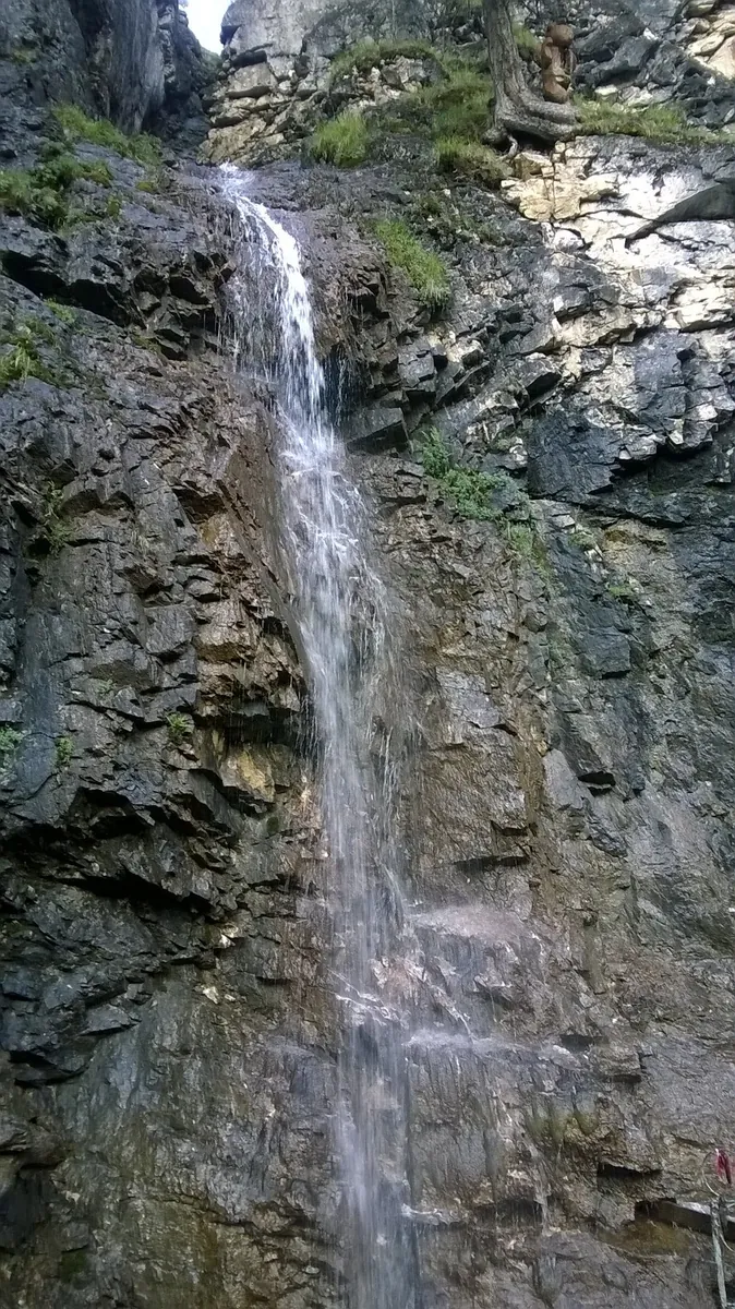
Devote the walk to a single valley, following Baritovaya from Arkhyz towards its waterfall. The wooded approach and steeper upper section make the waterside pause feel earned. For visitors who prefer walking out from their accommodation, it offers a clear destination without a required mountain transfer.

2.4 km 105 +0 m Easy
Walking Route in the Caucasus — 3,5 km
✓ TrailTrack

Walking Route in the Caucasus — 3,5 km

Walking Route in the Caucasus · Hiking · One-day

Plan this 3.54 km point-to-point walking route from its verified distance, gradients and recorded surface rather than unconfirmed landmarks. Estimated moving time is about 1.1 hours; add time for pauses and navigation.

3.5 km 105 +0 m Easy
Minsk: Molodechno
✓ TrailTrack

Minsk: Molodechno

маг1 · Hiking · Multi-day

This 89.7 km point-to-point walking route passes through terrain where woodland is one of the route's main features. Gentle terrain: 30 m of total ascent over 89.7 km. Surface: asphalt plus natural ground. Allow at least 4 days and verify overnight and exit options independently.

89.7 km 105 +30 m Hard
Minsk: Zaslavl: Cycling Circuit across Open High Ground
✓ TrailTrack

Minsk: Zaslavl: Cycling Circuit across Open High Ground

Старт! · Hiking · Multi-day

The interest of this 34.88 km point-to-point walking route lies in travelling the distance itself: its gradients, surface and rhythm. Gentle terrain: 98 m of total ascent over 34.88 km. Surface: asphalt plus natural ground. Allow at least 2 days and verify overnight and exit options independently.

34.9 km 105 +98 m Hard
EuroVelo 2 in Belarus: Navahrudak Castle and Drazdy Shores
✓ TrailTrack

EuroVelo 2 in Belarus: Navahrudak Castle and Drazdy Shores

Bicycle · Multi-day

For travellers already in Belarus who have confirmed access to a selected stage, this offers Navahrudak Castle and Minsk’s Drazdy shores within a wider European cycling idea. International entry and a continuous country crossing cannot currently be assumed as ready parts of the programme.

846.8 km 105 +243 m Hard
Tyzenhauz route: Haradnica, Yubileynoye Lake and the road towards Kuźnica
✓ TrailTrack

Tyzenhauz route: Haradnica, Yubileynoye Lake and the road towards Kuźnica

Tyzenhauz route: Haradnica · Bicycle · One-day

The ride links the Tyzenhauz urban ensemble with Yubileynoye Lake and the old Tatarka watermill. It is a chance to see historic Grodno give way to its suburban landscape, with worthwhile pauses rather than a continuous push towards the border.

29.7 km 105 +102 m Hard
Literary southern version from Novopolotsk through Bychki towards Polotsk
✓ TrailTrack

Literary southern version from Novopolotsk through Bychki towards Polotsk

КП 0 Старт АЗС · Bicycle · Multi-day

Explore the literary and theatrical side of Ushachi district through Bychki and Prozoroki, connecting it with the Ushachi Folk Glory Museum. The stops give the rural road journey a clear subject.

201.0 km 105 +114 m Hard
Large Novopolotsk cycling circuit through Volozhin, Boruny and Halshany
✓ TrailTrack

Large Novopolotsk cycling circuit through Volozhin, Boruny and Halshany

КП 0 и КП 8 Новополоцк АЗС · Bicycle · Multi-day

Compare Volozhin’s columned architecture with the Baroque churches of Boruny and Halshany in one large journey. The northern and western sides reveal more of these settlements’ rural surroundings.

604.2 km 105 +190 m Hard
Great Journey: the Patriarch Oak and Father Frost’s Estate
✓ TrailTrack

Great Journey: the Patriarch Oak and Father Frost’s Estate

Bicycle · One-day

The Patriarch Oak and Queen Pine reveal two different veteran trees, while the estate approach offers a separate storybook visit. The circuit connects natural stops with the history of old forest roads.

27.3 km 105 +65 m Moderate
South Vandan
✓ TrailTrack

South Vandan

Колонка с водой · Hiking · One-day

The track links Vershina. 713 m into one continuous outdoor outing. Strong mountain relief: 864 m of total ascent over 15.67 km. Estimated moving time is about 6.0 hours; add time for pauses and navigation.

15.7 km 105 +864 m Hard
oz.Artemeva: Walking Route
✓ TrailTrack

oz.Artemeva: Walking Route

Hiking · One-day

This 6.64 km point-to-point walking route passes through terrain where mapped viewpoints occur along the way. Strong mountain relief: 381 m of total ascent over 6.64 km. Estimated moving time is about 2.6 hours; add time for pauses and navigation.

6.6 km 105 +381 m Moderate
Great Sayan Ridge Expedition
✓ TrailTrack

Great Sayan Ridge Expedition

Hiking · Multi-day

The recorded line is a 107.06 km point-to-point walking route, with mapped viewpoints occur along the way. Strong mountain relief: 4898 m of total ascent over 107.06 km. Allow at least 6 days and verify overnight and exit options independently.

107.1 km 105 +4898 m Hard
Trail Lake to Moglayn-Gol
✓ TrailTrack

Trail Lake to Moglayn-Gol

Hiking · One-day

Shore or waterside sections are recorded on the route along this 7.89 km point-to-point walking route. Gentle terrain: 3 m of total ascent over 7.89 km. Estimated moving time is about 2.3 hours; add time for pauses and navigation.

7.9 km 105 +3 m Easy
Lower Luzhba Approach to Tremolites and Alguy Falls
✓ TrailTrack

Lower Luzhba Approach to Tremolites and Alguy Falls

Тальковый карьер · Hiking · One-day

Visit the specific Alguy Falls and tremolite rock outcrops after a continuous approach from the Tom River through woodland valleys. The Talc Quarry site adds a defined geological landmark.

12.9 km 105 +483 m Moderate
An Afanasotka Ski Circle: Radonezh Clearings and Khlyby
✓ TrailTrack

An Afanasotka Ski Circle: Radonezh Clearings and Khlyby

Moscow region · Skiing · One-day

A single circle introduces Afanasotka’s woodland geography without repeating its full racing distance. The southern Khlyby bridge gives a specific stop, while the rest of the outing forms a substantial independent winter day.

48.4 km 105 +829 m Hard
Kilpola to Kurkiniemi: The Water Passage to Yesusaret
✓ TrailTrack

Kilpola to Kurkiniemi: The Water Passage to Yesusaret

Часовня · Boat · One-day

Follow Kilpola’s island shores to Kurkiniemi Lighthouse and Yesusaret. This more focused alternative to the extended Ladoga programmes concentrates on one distinctive lighthouse passage.

13.0 km 104 +0 m Moderate
The Sofia Traverse: Irkiz, Sapozhok and the Gammesh-Chat Descent
✓ TrailTrack

The Sofia Traverse: Irkiz, Sapozhok and the Gammesh-Chat Descent

The Sofia Traverse: Irkiz · Hiking · One-day

Choose the traverse for its sequence of lake basins and valleys. A pass separates Great Sofia Lake from Sapozhok, while the Gammesh-Chat descent reveals another side of the mountains. It links familiar photographic destinations into one outing for walkers with experience of long mountain days and a substantial descent.

9.9 km 104 +0 m Easy
Novogrudok Circuit: via Minsk
✓ TrailTrack

Novogrudok Circuit: via Minsk

Д · Bicycle · Multi-day

This is a 404.43 km circular cycling route. Woodland is one of the route's main features. Gentle terrain: 273 m of total ascent over 404.43 km. Surface: asphalt. Allow at least 6 days and verify overnight and exit options independently.

404.4 km 104 +273 m Hard
In Harmony with Nature
✓ TrailTrack

In Harmony with Nature

Hiking · One-day

Expect woodland is one of the route's main features on this 1.98 km point-to-point walking route. Rolling terrain: 16 m of total ascent over 1.98 km. Surface: improved surface plus natural ground. Estimated moving time is about 0.7 hours; add time for pauses and navigation.

2.0 km 104 +16 m Easy
Green Corridor: Pashuki, Forest Guards and the Old Tar Kiln
✓ TrailTrack

Green Corridor: Pashuki, Forest Guards and the Old Tar Kiln

Green Corridor: Pashuki · Bicycle · One-day

The Pashuki church, forest-guard house foundation and old tar kiln give the ride a specific historical story. They introduce the southern forest through former occupations and present village life.

17.8 km 104 +60 m Moderate
Ekspeditsii #BaykalSOS - 2016
✓ TrailTrack

Ekspeditsii #BaykalSOS - 2016

Ekspeditsii #BaykalSOS · Hiking · Multi-day

This 1262.63 km point-to-point walking route is shaped by its terrain, surface and pace rather than a single landmark. Allow at least 53 days and verify overnight and exit options independently.

1262.6 km 104 +0 m Hard
Trail through Srednemu Irkutu
✓ TrailTrack

Trail through Srednemu Irkutu

Hiking · One-day

Expect mapped viewpoints occur along the way on this 7.7 km point-to-point walking route. Strong mountain relief: 492 m of total ascent over 7.7 km. Estimated moving time is about 3.1 hours; add time for pauses and navigation.

7.7 km 104 +492 m Moderate
Mountain approach towards the Khara-Murin via Chertovy Gate, Utulik and Dabaty
✓ TrailTrack

Mountain approach towards the Khara-Murin via Chertovy Gate, Utulik and Dabaty

Mountain approach towards the Khara-Murin via Ch · Hiking · Multi-day

Travel from the Slyudyanka valley through a named pass to the Utulik and Dabaty, experiencing Khamar-Daban’s inner river landscapes. Specific mountain places give the independent approach its purpose.

46.4 km 104 +1925 m Hard
Letniy at Munku-Sardyk
✓ TrailTrack

Letniy at Munku-Sardyk

Hiking · One-day

Treat this 12.82 km point-to-point walking route as a complete outing, paying attention to the terrain and changing surface underfoot. Noticeable climbing: 329 m of total ascent over 12.82 km. Estimated moving time is about 4.3 hours; add time for pauses and navigation.

12.8 km 104 +329 m Moderate
Back Page 37 of 79 Next