TrailTrack routes

Маршруты с подготовленным описанием, сложностью, покрытием и планированием визита.

Found 1895 routes
Choose a route from the list or view routes on the map.
Lindebensteig: The Winding Glanterboden Forest Passage
✓ TrailTrack

Lindebensteig: The Winding Glanterboden Forest Passage

Hiking · One-day

Follow a quiet forest direction with several short repeated approaches. This option suits a woodland walk when connections to lower access have already been arranged independently.

2.9 km 261 +152 m Moderate
Haneburger Cross: the Upper Ascent from Largozalm
✓ TrailTrack

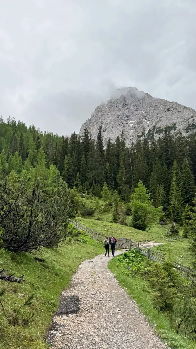
Haneburger Cross: the Upper Ascent from Largozalm

Hiking · One-day

Haneburger Cross is the particular upper destination, with the neighbouring summit kept separate. It reveals the open mountain side above Voldertal once the Largozalm approach and descent are settled.

2.8 km 261 +533 m Moderate
Øye circuit through Eidsbugarden: walking return via Yksendalsbu and Tomashelleren
✓ TrailTrack

Øye circuit through Eidsbugarden: walking return via Yksendalsbu and Tomashelleren

Hiking · Multi-day

Connect Fondsbu beside Bygdin with the remote Yksendalsbu and Tomashelleren cabins, then see Leine’s historical mill site on the lower return. The lakeside road and rocky high country provide contrasting ways to explore southern Jotunheimen.

98.5 km 261 +1278 m Hard
Skogadalsbøen to Fondsbu: walking through Uradalsvatnet towards Bygdin
✓ TrailTrack

Skogadalsbøen to Fondsbu: walking through Uradalsvatnet towards Bygdin

Hiking · Multi-day

Uradalen’s ascent, Uradalsvatnet and arrival beside Bygdin provide a clear mountain story. Skogadalsbøen and Fondsbu form contrasting ends: a remote valley lodge and a lively lakeside house with local food.

44.2 km 261 +0 m Hard
✓ TrailTrack

Baumgartnerhof to Kranjska Gora: Jepca, Kresišče and Sedlič

Baumgartnerhof to Kranjska Gora: Jepca · Hiking · Multi-day

Connect Jepca and Kresišče with the village side of Srednji Vrh and the Kranjska Gora valley. The change from ridge to settled valley creates a distinctive passage between countries.

32.9 km 261 +2244 m Hard
Hohbalmen Circuit: Trift and Alterhaupt
✓ TrailTrack

Hohbalmen Circuit: Trift and Alterhaupt

Hiking · One-day

Two named mountain houses and Hohbalmen give the circuit clear focal points. Moving between the open slope and Trift reveals different heights of the western Zermatt valley.

7.0 km 261 +818 m Hard
São Cristóvão and Ribeira do Porco: the Short Boaventura Royal Road
✓ TrailTrack

São Cristóvão and Ribeira do Porco: the Short Boaventura Royal Road

Hiking · One-day

This passage introduces Boaventura’s valley through a compact walk with identifiable pauses: the named picnic place and the Ribeira do Porco crossing. The royal road gives the outing a place in Madeira’s overland history. A separate São Cristóvão Viewpoint visit can add a north-coast panorama to the day.

1.8 km 261 +491 m Moderate
✓ TrailTrack

Cârțișoara to Bâlea Cascadă: Badea Cârțan Museum and Forest Approaches

Hiking · One-day

Combine Badea Cârțan Museum with the gradual approach from Cârțișoara to the lower Bâlea visitor side. The two named watercourses mark the change from the valley beginning to the wooded finish.

27.3 km 260 +1431 m Moderate
Lakes and Dales via Loweswater: Newton Reigny to Newton Rigg Variant
✓ TrailTrack

Lakes and Dales via Loweswater: Newton Reigny to Newton Rigg Variant

Bicycle · Multi-day

Build a journey in which quiet lakeshores give way to seaside gardens, old bridges and market-town streets. Compare the different faces of Cumbria: wooded Loweswater, the reconstructed Kinniside circle and the carefully laid stone of Devil’s Bridge. Once permitted connections are checked, these stops can shape a rewarding tour with time to explore on foot.

298.7 km 259 +4962 m Hard
Knappental: Woodland Loops and Branches from Ebenwald
✓ TrailTrack

Knappental: Woodland Loops and Branches from Ebenwald

Hiking · One-day

Explore the woodland edge south of the Inn Valley and small clearings beside farms. The transition between quiet valleys and the cultivated landscape suits a walk without a high ridge outing.

7.4 km 259 +344 m Moderate
Nikolaevka: Repeated River Approaches to Iremel’s High Side
✓ TrailTrack

Nikolaevka: Repeated River Approaches to Iremel’s High Side

Hiking · Multi-day

Traverse specific river valleys of the southern approach and reach Bolshoy Iremel’s upper side. Repeated woodland branches create a more involved sequence than a standard Nikolaevka-to-Tyulyuk passage.

63.8 km 258 +2546 m Moderate
Radule from Fer à Cheval: Sheepfolds, the Golo Footbridge and Waterfall
✓ TrailTrack

Radule from Fer à Cheval: Sheepfolds, the Golo Footbridge and Waterfall

Radule from Fer à Cheval: Sheepfolds · Hiking · One-day

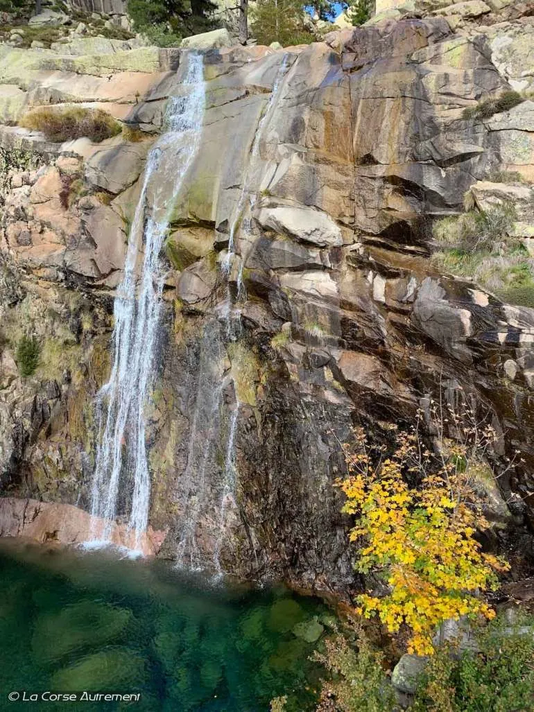
The walk reveals mountain Corsica in one unhurried outing. Radule’s sheepfolds provide a human story, while the river and waterfall show an island landscape beyond its beaches. The change from woodland into the open stony river setting is especially noticeable. Choose it to explore the Vergio area when comfortable with uneven mountain paths.

4.3 km 258 +348 m Moderate
✓ TrailTrack

Bârcaciu to Șaua Scării: Puha Pass and Open Mountain Slopes

Hiking · One-day

Compare Puha with Șaua Scării as the wooded approach gives way to open Făgăraș slopes. Treat Bârcaciu as the beginning of a separate mountain day after the walking approach.

9.4 km 258 +1320 m Moderate
Rihtunjira: Birch Woods to Njullá’s Upper Station
✓ TrailTrack

Rihtunjira: Birch Woods to Njullá’s Upper Station

Hiking · One-day

Follow the sound of Rihtunjira through the birches, then see the surrounding valley from above. The walk suits anyone who enjoys quiet streamside pauses and wants to reach the open mountainside without committing to the summit.

6.9 km 258 +277 m Moderate
✓ TrailTrack

Kerch to the Ilyas-Kaya lookout via Chokrak and western mountain branches

Crimea · Hiking · Multi-day

Experience the change from Chokrak’s salt shore through steppe and limestone plateaus to wooded mountain Crimea within one journey. An upper view of the Grand Canyon and the final Ilyas-Kaya lookout offer different perspectives on the peninsula’s western terrain. This route suits walkers interested in preparing an extended crossing and agreeing every protected section.

615.6 km 257 +20304 m Hard
Path 217: Arzler Scharte Scree Ascent to Pfeishütte
✓ TrailTrack

Path 217: Arzler Scharte Scree Ascent to Pfeishütte

Hiking · One-day

Cross the actual Arzler Scharte from the southern wooded slope into the Pfeis mountain setting. Arzler Alm and Pfeishütte’s exterior provide different stops on opposite sides of the steep scree crossing.

10.4 km 257 +1950 m Hard
✓ TrailTrack

Psenodakh to Fisht-Oshten Pass: towards Fisht Shelter

Hiking · One-day

Psenodakh’s shore and Fisht-Oshten Pass give the crossing two clear natural destinations. Follow the lake side and an actual saddle crossing when the independent approach and onward logistics have been approved beforehand.

7.0 km 257 +392 m Moderate
Dziura: from the cave entrance through the wooded valley towards town
✓ TrailTrack

Dziura: from the cave entrance through the wooded valley towards town

Hiking · One-day

Dziura provides an unusual destination for a short Zakopane outing: a woodland approach ends at a real cave entrance. Appreciate the contrast between the daylight forest and dark chamber while taking care inside.

0.9 km 257 +8 m Moderate
Luhy to the Upper Turkul Side: The Blue Path and Ustia-Brebeneskula Dam
✓ TrailTrack

Luhy to the Upper Turkul Side: The Blue Path and Ustia-Brebeneskula Dam

Hiking · One-day

See White Tisa, Hoverla River and the named timber dam before reaching the upper Turkul side. The blue approach gives the valley and its historic water structure an independent visit without promising the summit.

12.0 km 256 +1647 m Hard
Across the Schwandbach Streams to Schwand: Rear-Valley Pasture Path
✓ TrailTrack

Across the Schwandbach Streams to Schwand: Rear-Valley Pasture Path

Hiking · One-day

Two real mountain streams and an old pasture direction give the ascent a clear story. Observe the hillside structure and imagine how valley residents connected lower settlements with summer grazing ground.

1.2 km 256 +408 m Hard
Climbing Iograf to the cave complex’s surface entrances
✓ TrailTrack

Climbing Iograf to the cave complex’s surface entrances

Crimea · Hiking · One-day

Climb Iograf to the actual entrance areas of its cave complex. The ridge trail and karst openings reveal different aspects of Yalta’s mountain woodland.

3.9 km 255 +919 m Hard
Marelisi: an Extended Mountain Version of the St Andrew Trail
✓ TrailTrack

Marelisi: an Extended Mountain Version of the St Andrew Trail

Hiking · Multi-day

Choose a substantial journey linking Marelisi’s wooded valley, Sakhvlari and named places in the park’s high country. Khergianis Mta and the mountain connections reward visitors who allow time for the necessary returns and prepare the full outing.

101.7 km 255 +7492 m Hard
Zyuratkul to Tyulyuk via Nurgush: Repeated Mountain Passages
✓ TrailTrack

Zyuratkul to Tyulyuk via Nurgush: Repeated Mountain Passages

Hiking · Multi-day

During the authorised season, link the specific high Bolshoy Nurgush side, cold Boiling Spring and the Bolshoy and Maly Berezyak valleys. Passage heads from northern Zyuratkul access towards a separate southern Tyulyuk ending.

149.1 km 254 +3891 m Hard
Iceberg and Kholodnoye Lakes on Aibga
✓ TrailTrack

Iceberg and Kholodnoye Lakes on Aibga

Hiking · One-day

These lakes are visible evidence of snow shaping a mountain slope. The short connection gives them focused attention within a larger mountain day.

0.8 km 254 +1 m Moderate
Back Page 10 of 79 Next