Dachnye Springs: from the Bear thermal field to the Active group
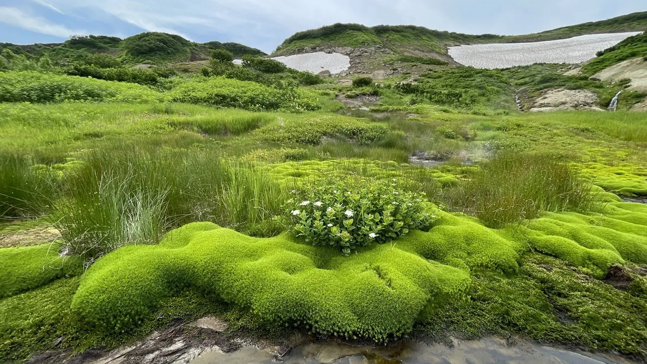
Explore two distinct thermal fields, Bear and Active, along one main approach. Steam, mud pots and hot-water outlets bring Kamchatka’s geothermal landscape beside the established path.
Маршруты с подготовленным описанием, сложностью, покрытием и планированием визита.
Explore two distinct thermal fields, Bear and Active, along one main approach. Steam, mud pots and hot-water outlets bring Kamchatka’s geothermal landscape beside the established path.
Combine a view of Prilivnoye Lake with a woodland approach towards the open ocean shore. This version brings together the city edge, lake outlook and coastal side.
See Kutkhiny Baty from a checked viewpoint, explore the Ozyornaya river valley and encounter the scientific side of its spawning ecosystem. Separate road arrangements let you choose how to reach the most interesting walking section.
For the combination of Malaya Kadilnaya’s narrow valley, the cliff-side passage at Chayachy, Skriper’s viewing point and quieter valleys near Bolshiye Koty. The route offers Baikal both beside stony shoreline and from above. These sights remain worthwhile on a separately permitted stage if the present rocky ending towards Listvyanka cannot be completed.
Compare Maralyi Rozhki and Orlinaya, then explore the wooded sections beside Pryamukha Stream. The Bear Trail reveals Chinetinsky Nature Sanctuary through its alternation of open observation stops and sheltered forest walking.
Follow a sequence of real observation points, from the three numbered lookouts to Maralyi Rozhki. The woodland between them gives the walk its contrast, with sheltered slopes alternating with the open meadows of Chinetinsky Nature Sanctuary.
Discover the Alexander Zavyalov skiing area in Telman settlement and experience Chulkovo’s sporting atmosphere on a small winter outing.
The wooden figures show how carving can turn an ordinary woodland entrance into a place worth examining. The long loop combines this pause with an extended ride rather than ending at the first town exit.
The route gives you good reasons to pause at Ivenetskiy Museum Traditsionnoy Kultury GU, Museum-galereya «Yanushkevichy, Bridge, rather than treating the outing as distance alone. Forest sections: woodland is one of the route's main features. Gentle terrain: 48 m of total ascent over 37.65 km. Surface: natural ground plus asphalt.
This 4.66 km circular walking route passes through terrain where woodland is one of the route's main features. Noticeable climbing: 158 m of total ascent over 4.66 km. Estimated moving time is about 1.6 hours; add time for pauses and navigation.
For a mountain first seen from below that reveals a different perspective on the river valley. Obzornaya’s ascent and cirque return change woodland into an open ridge and mountain hollow. The reward is observing mountain and valley shapes in suitable weather while reserving strength for the return.
Walk from Turochak to Salop and see the valley from its mountain side. The ridge gives the approach its own appeal, while returning the same way lets you revisit a view that caught your attention.
View the Blue Lakes cirque before descending and follow its water system towards the Polovinka valley. This version brings a mountain outing out to Moroznaya’s woodland side.
Mapped viewpoints occur along the way along this 8.94 km point-to-point walking route. Noticeable climbing: 346 m of total ascent over 8.94 km. Estimated moving time is about 3.2 hours; add time for pauses and navigation.
Connect several actual summits and a pass in one ridge journey, finishing through a river valley. Mountain views change with the ridge’s direction and the descent towards Baikal.
Combine Chersky’s upper ridge with an actual visit to Heart Lake’s shore. Travelling between the open mountain and enclosed lake basin provides two distinct natural experiences.
Cross the woods from Esino to Kuzyaevo without returning to the start. The Slogavka and Forest Pond add specific waterside pauses to a long running outing, suited to travellers who enjoy moving between stations instead of repeating park laps.
Spend a substantial independent running day between suburban rail and the Moscow metro. The places follow their own sequence: Ilyinskoye’s Baroque church, Bykov Pond, Lake Generalskoye, woodland streams and Mitino’s historic side. A pause by the lake gives the two halves of the long journey distinct moods.
Expect shore or waterside sections are recorded on the route on this 8.75 km point-to-point walking route. Gentle terrain: 38 m of total ascent over 8.75 km. Surface: natural ground plus asphalt. Estimated moving time is about 2.6 hours; add time for pauses and navigation.
The Pine Family and Queen Pine provide two distinctive natural stops within a larger forest circuit. Secret Paths suits experienced forest cyclists interested in how different ways of tree growth shape the woodland.
Combine Polyana, Obruchev’s summit and Grokhotun in one prepared expedition. Above, the route opens different mountain sides of Khamar-Daban; return changes to river-side taiga. Its variety becomes especially clear beyond Baikal Pass as ridges give way to Gramotukha.
Reach Shumak through successive mountain valleys and see how the Kyngarga, Fedyushkina River and Kitoy shape the journey. This approach suits walkers who value travelling through the mountains as much as time spent at their destination.
Expect mapped viewpoints occur along the way on this 11.38 km point-to-point walking route. Strong mountain relief: 532 m of total ascent over 11.38 km. Estimated moving time is about 4.2 hours; add time for pauses and navigation.
To cross from Olkhon’s western side to open Baikal near Uzury and compare their character. Peschanaya and Nyurganskaya Bay offer sandy shore and changing woodland; on the eastern side, the bay between rocky slopes provides the destination. This is an independent island crossing for walkers arranging their own overnight places and return.
Pick where to start
Share a trip